Hydrology - The scientific study of the waters of the earth, especially with relation to the effects of precipitation and evaporation upon the occurrence and character of water on or below the land surface.
The National Weather Service at Binghamton, New York is responsibile for issuing river flood watches, warnings, advisories, statements and information for 17 counties in New York and 7 counties in Pennsylvania.
Important River Information:
The menu below has selections for various text product including river forecasts, watches, warning, advisories, statements, etc. Please note the times on the products as some are not daily.
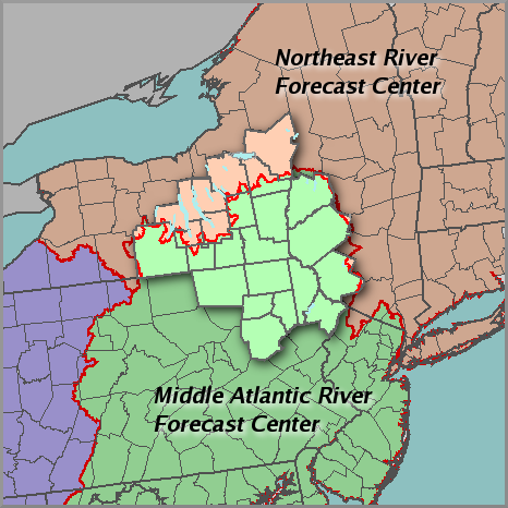
The map below shows river forecast responsibilites across the NWS Binghamton, NY Hydrologic Service Area, or HSA. There are two River Forecast Centers, or RFCs, that have forecast responsiblity for the Binghamton HSA, they are the Middle Atlantic River Forecast Center (shown in light green on the map) and the Northeast River Forecast Center (shown in peach). The Binghamton HSA is shown as a raised area on the map. The red line shows the borders between the RFCs.
The menu below has selections for various text products. Please note the times on the products as some are not daily.
Drought Information
Precipitation Measurement and Streamflow Conditions
Other Hydrologic Information
Safety