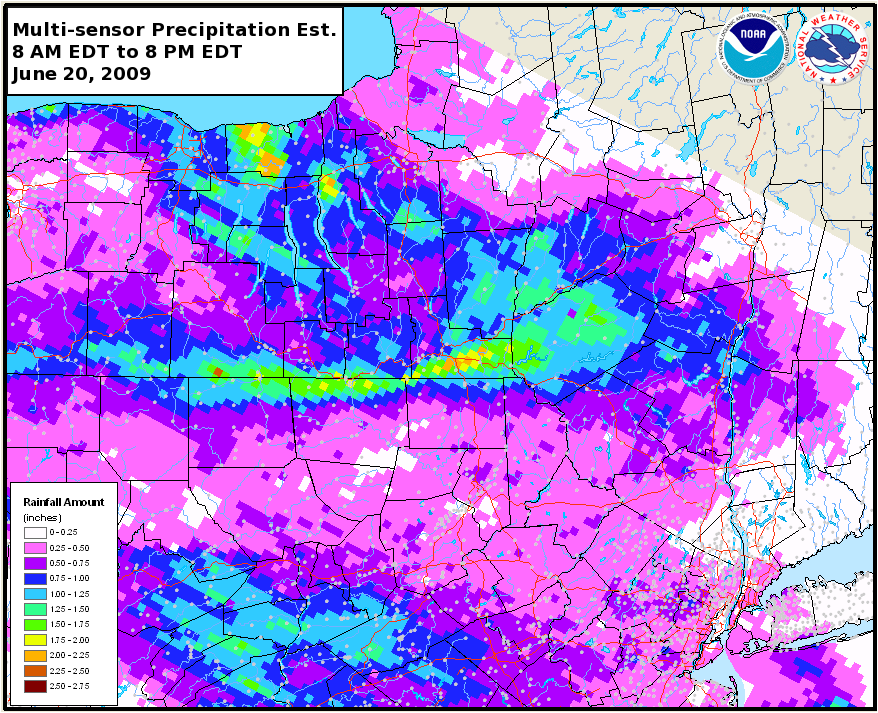
Local heavy rainfall occurred across parts of south central New York, western Catskills and Northeast Pennsylvania.
Definitions
The MPE graphic shown in this section are Multisensor Precipitation Estimates, otherwise known as MPE data. The data used to produce this graphic is a combination of radar and precipitation gages.
When using MPE data, it is important to remember it is vulnerable to the same inaccuracies that can be caused by either radar or precipitation gages. For radar, problems would be: freezing or frozen precipitation, low topped convection, bright banding, the reflectivity/rainfall relationship in use, calibration of the radar, radar location and elevation, range degradation, and the radar's effective coverage. For precipitation gages, problems come from freezing precipitation, windy conditions, gage siting, undermeasurement by tipping bucket gages in high intensity rainfall, and gage maintenance.
Local Storm Reports
..TIME... ...EVENT... ...CITY LOCATION... ...LAT.LON...
..DATE... ....MAG.... ..COUNTY LOCATION..ST.. ...SOURCE....
..REMARKS..
0221 PM FLASH FLOOD 2 SSE LITTLE MEADOWS 41.97N 76.12W
06/20/2009 SUSQUEHANNA PA NWS EMPLOYEE
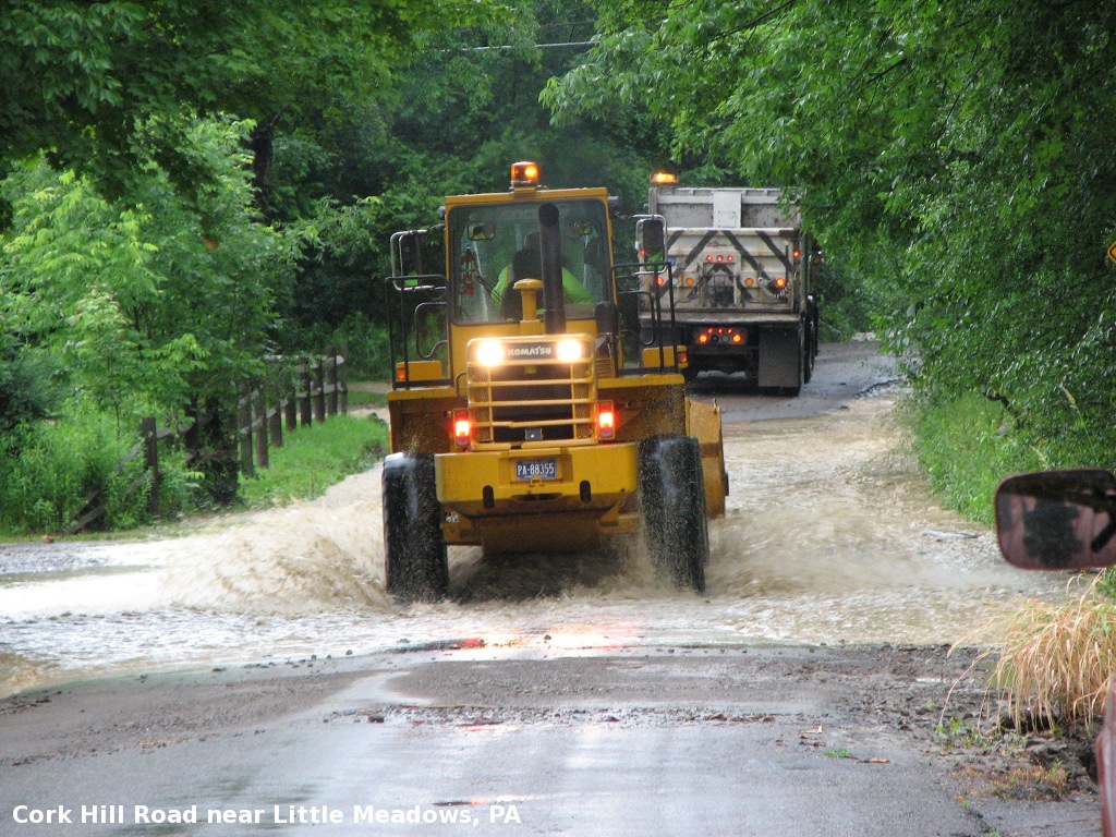
WATER ON ROAD OF LOWER PART OF CORK HILL ROAD. WATER
DRAINED DOWN FROM UPPER PART OF ROAD INTO THIS AREA.
0221 PM FLASH FLOOD LITTLE MEADOWS 41.99N 76.13W
06/20/2009 SUSQUEHANNA PA NWS EMPLOYEE
ONE HALF MILE EAST OF LITTLE MEADOWS DEBRIS BLOCKED
DRAINAGE THROUGH PIPES OF OVERPASS AND WATER THEN COVERED
ROAD AND INTO HOME OWNERS YARD.
0221 PM FLASH FLOOD 2 SE LITTLE MEADOWS 41.97N 76.10W
06/20/2009 SUSQUEHANNA PA NWS EMPLOYEE
HEAVY RAIN CAUSED DEBRIS TO BLOCK THE 3 LARGE DRAINAGE
PIPES, WHICH THEN CAUSED WATER TO FLOW OVER BRIDGE. THE
WATER WASHED AWAY THE TAR ON TOP OF THE BRIDGE/ROAD. THE
WATER ALSO TRAVELED DOWN CORK HILL ROAD TOWARDS BOW
BRIDGE AND CAUSED SOME MINOR ROAD EROSION AND IMPACTED
HOMEOWNERS YARDS.
0221 PM HEAVY RAIN LITTLE MEADOWS 41.99N 76.13W
06/20/2009 E1.50 INCH SUSQUEHANNA PA NWS EMPLOYEE
ONE HALF MILE NORTH OF LITTLE MEADOWS...DUE TO HEAVY
RAIN...THE RUSHING WATER HELPED MOVE THE DEBRIS WHICH
THEN BLOCKED PIPES AND CAUSED WATER TO FLOOD YARDS.
0221 PM HEAVY RAIN LITTLE MEADOWS 41.99N 76.13W
06/20/2009 E1.50 INCH SUSQUEHANNA PA COUNTY OFFICIAL
HEAVY RAIN MOVED DEBRIS TO CLOG CULVERT ON BOLLES RD NEAR
NY/PA BORDER.
This is a 0.5 Base Reflectivity loop from the NWS Binghamton, NY WSR-88D. The loop runs from 8:03 AM EDT to 7:59 PM EDT.
There is no audio with this video.
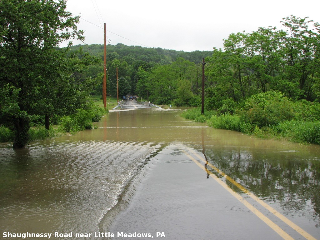 Shaughnessy Road near Little Meadows, PA. Looking east. |
 Cork Hill Road near Bowbridge Road near Little Meadows, PA. Looking northeast. |
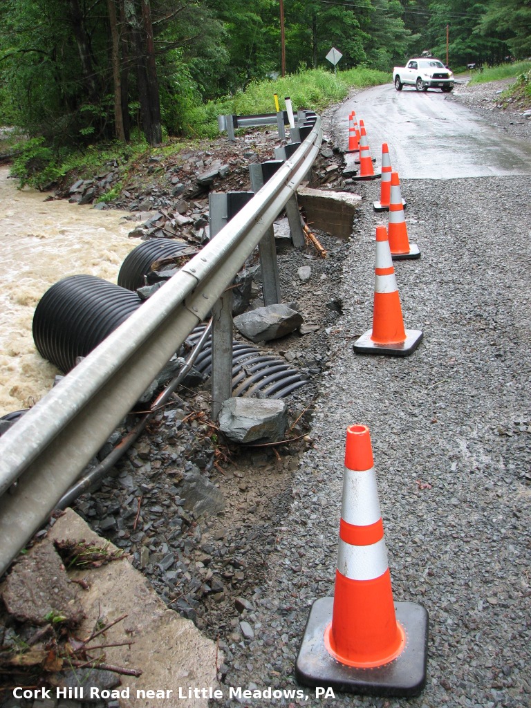
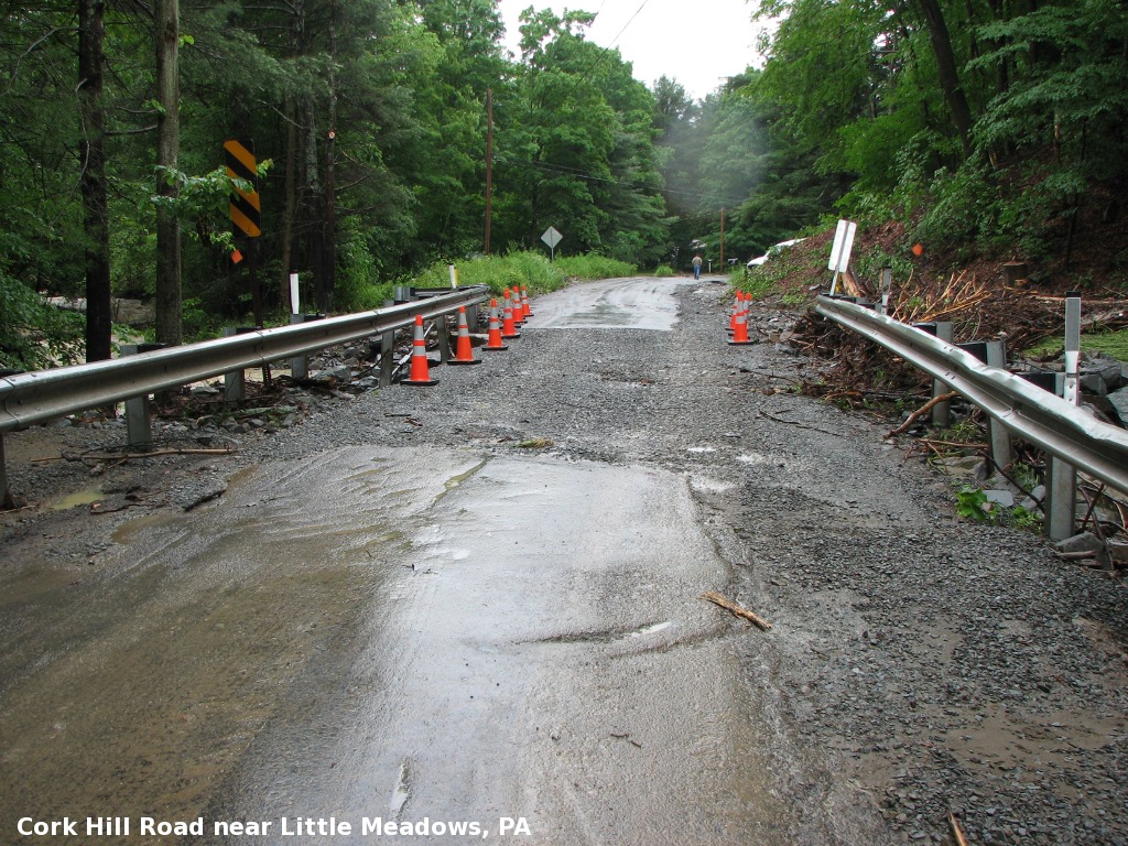 Cork Hill Road near Little Meadows, PA looking southwest. Water is traveling from right to left. Note that the tar has been stripped from the top of the overpass. Also, there is debris along the guard rail on the right. |
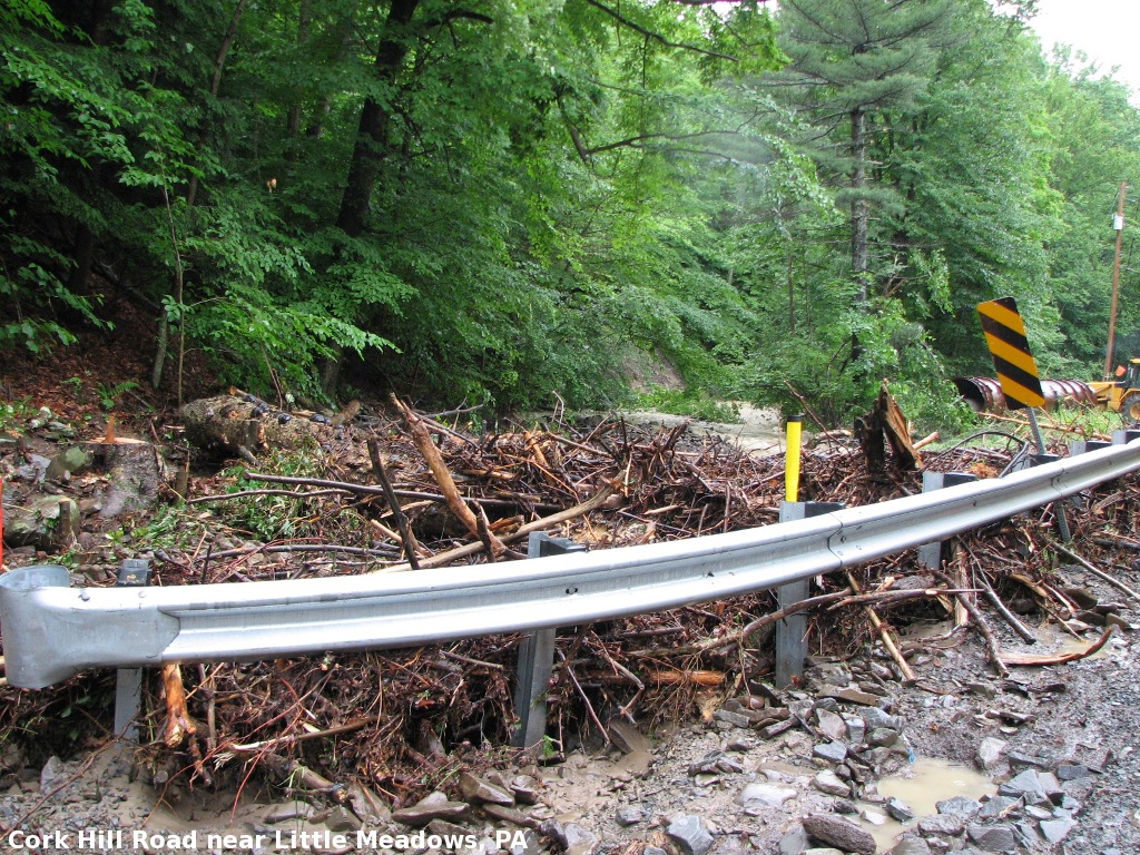
 Another shot of the overpass damage on Cork Hill Road. Note the erosion. |
 Cork Hill Road, showing the debris against the guard rail. |
|||
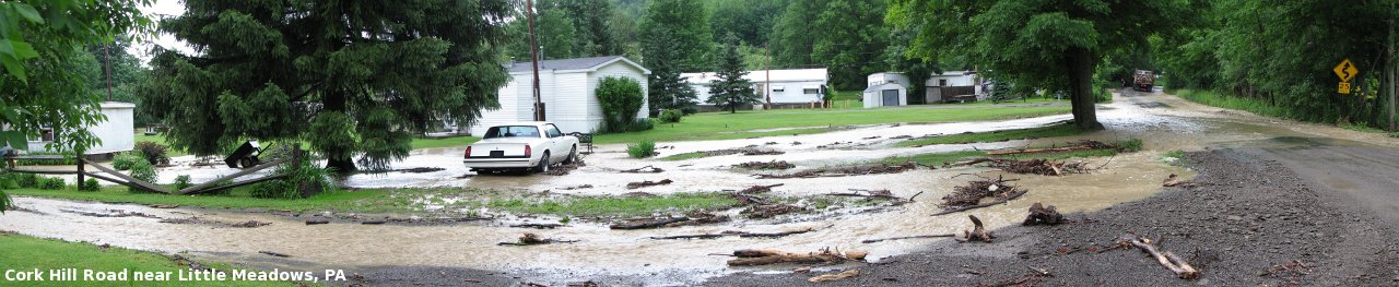 A four image panorama of some of the flooding. This is near the bottom of Cork Hill Road, near Bowbridge Road. |
|||

