Microburst/Straight Line Wind Damage Confirmed near Sidney in Delaware County New York
Summary
The National Weather Service in Binghamton, NY has confirmed a microburst/straight line wind damage near Sidney in Delaware county New York on August 5, 2012.
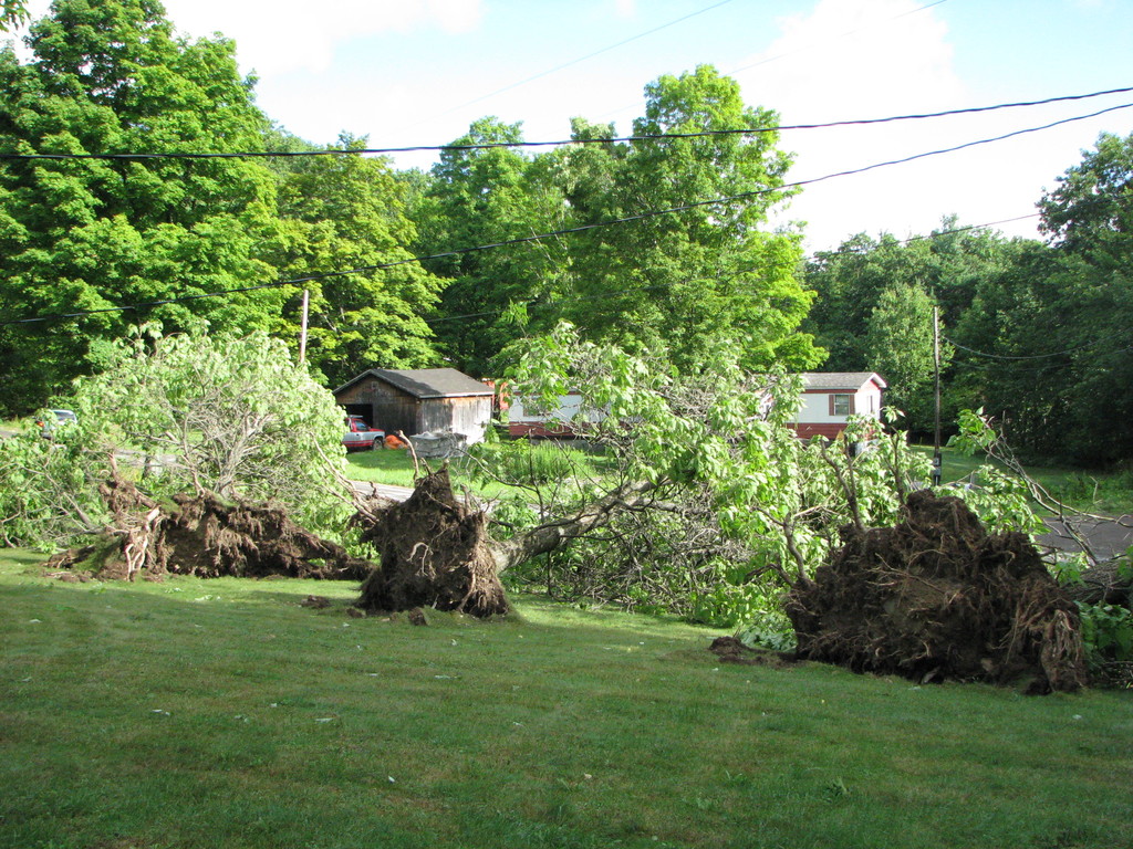
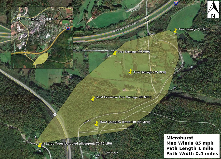
A path of straight line wind damage began west of Route 8 on Thrope Road as three large trees were uprooted. The damage path continued across Thorpe Road through an area of woods just west of county Route 8. The uprooted trees in this area were blown from the south, southwest, and westerly directions or consistent with a divergent pattern (straight-line winds). No damage could be found to either a house or a mobile home at this location so the top wind speeds were estimated to be around 75 mph.
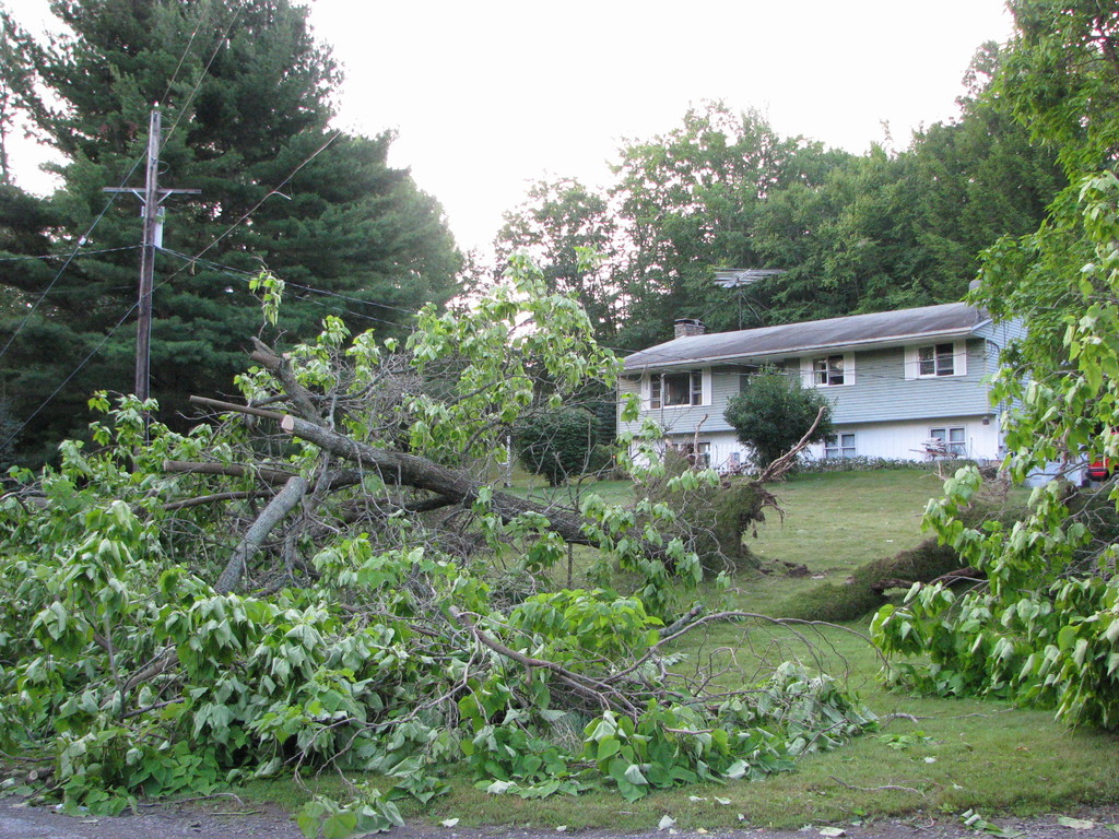
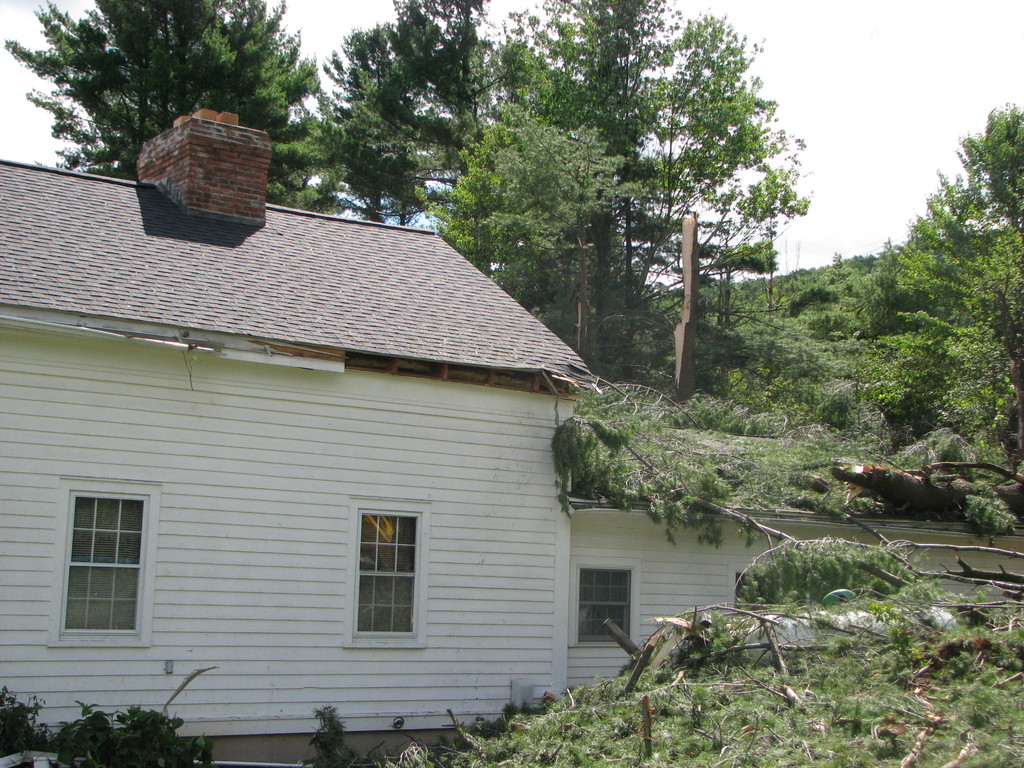
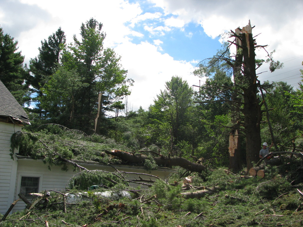
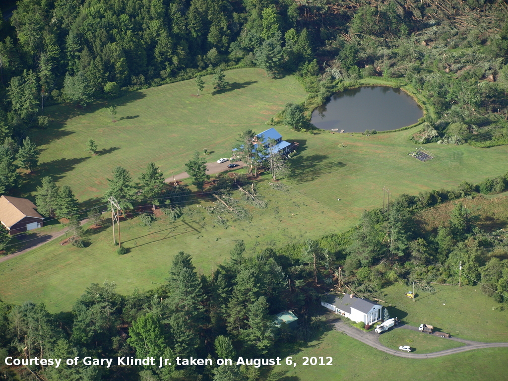
The damage path continued northeast across Route 8 and toward/along County Route 4. It was here the most significant winds occurred. A large swath of trees was blown down along and north of county Route 4, just east of Route 8. This damage area can easily be seen from Interstate 88 near the Sidney or Route 8 exit. In addition to numerous uprooted trees, mainly softwood trees were snapped. Just across the street from this damage was a house that had roof shingle loss at around 15%. The roof shingle loss, combined with the numerous uprooted and snapped trees were enough to estimate the winds at around 85 mph.
The damage continued but became more isolated as the path continued northeast, and downhill, across and near Gifford and Wood road. Most of the property damage in this area was mainly limited to trees falling on a house, with most of the damage occurring to trees. The damage in this area was consistent with winds of around 75 mph. The path continued across county Route 4 before ending in a field east of county Route 4 and south of Interstate 88.
The National Weather Service at Binghamton, NY received numerous pieces of evidence prior to our storm survey including video and still pictures of rotating clouds south of the Sidney area on Sunday August 5 shortly after 6 PM. The combination of the video evidence and eyewitness reports confirm we had a rotating wall cloud with this storm. While wall clouds can be precursors to tornadoes, it should be noted that about 20 percent of them are actually associated with tornadoes. In this case it appears the rear flank downdraft came around the wall cloud and rapidly descended into the area surveyed. The start of the path of damage start at around 1600 feet and descended down the steep north side of Sidney mountain, likely helping to enhance the winds. We want to thank everyone who sent us pictures, and video and provided eyewitness accounts of the event. These pieces are invaluable to our storm survey process.
The image below is the approximate path and width of the straight line winds.
Damage Photos
Click on an image to see a large version
|
|
|
|
|
|
|
|
For reference:
A microburst is a convective downdraft with an affected outflow area of less than 2 1/2 miles wide and peak winds lasting less than 5 minutes. Microbursts may induce dangerous horizontal/vertical wind shears, which can adversely affect aircraft performance and cause property damage. Straight-line winds are generally any wind that is not associated with rotation, used mainly to differentiate them from tornadic winds.
The information in this statement is preliminary and subject to change pending final review of the event(s) and publication in National Weather Service Storm Data.