Summary
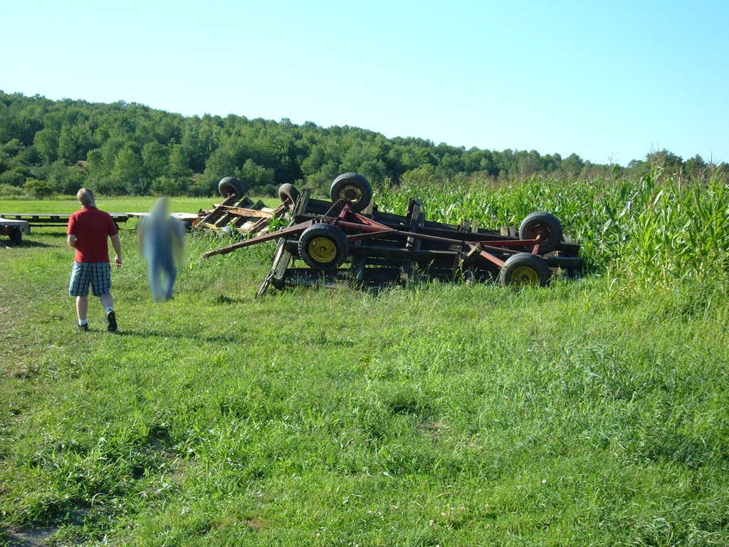
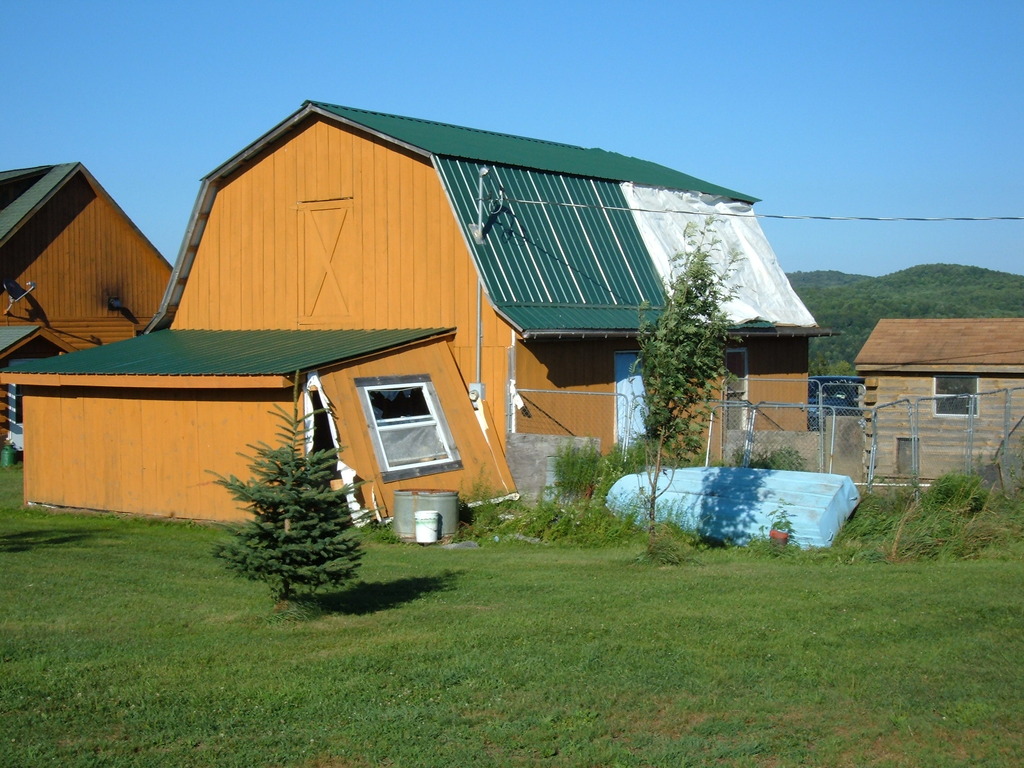
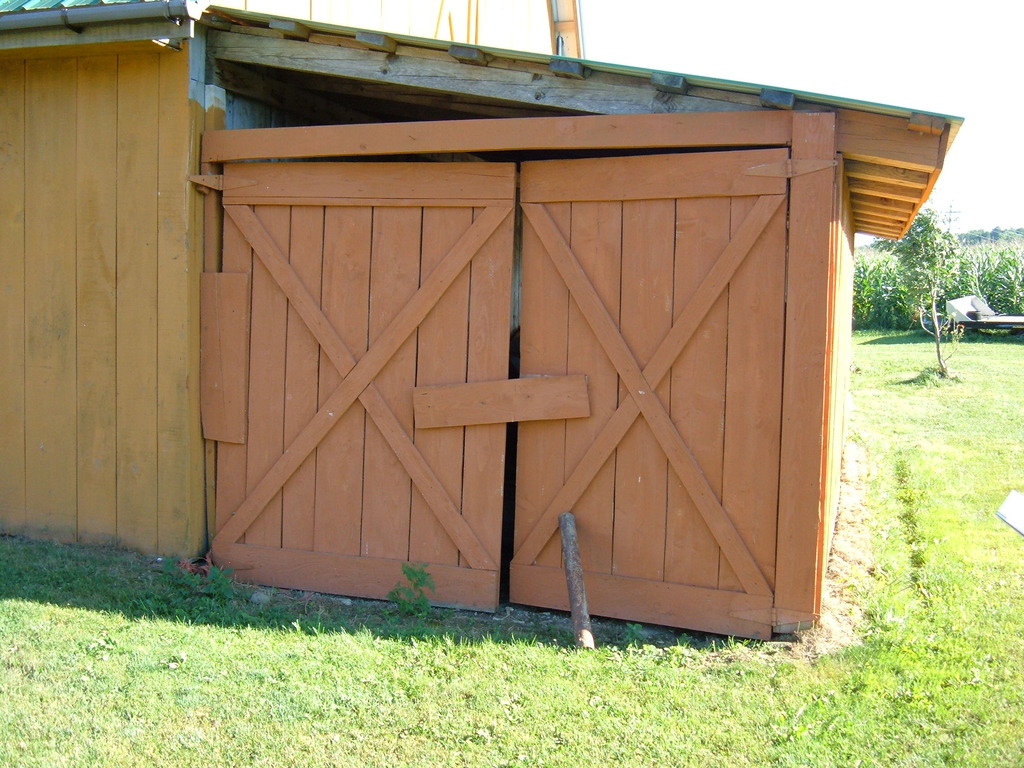
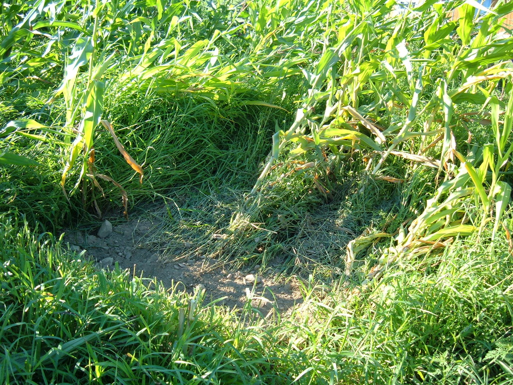
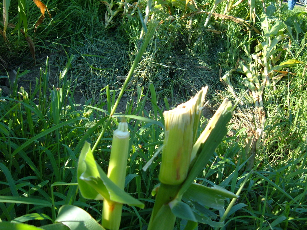
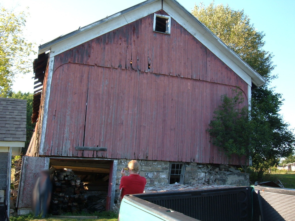
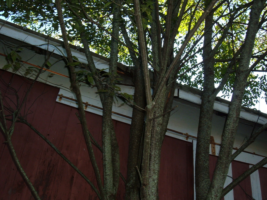
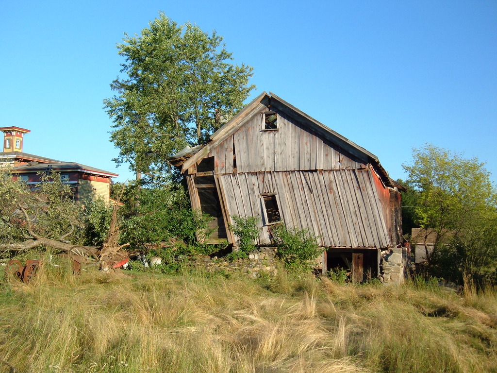
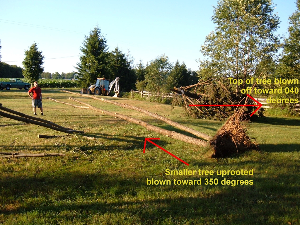
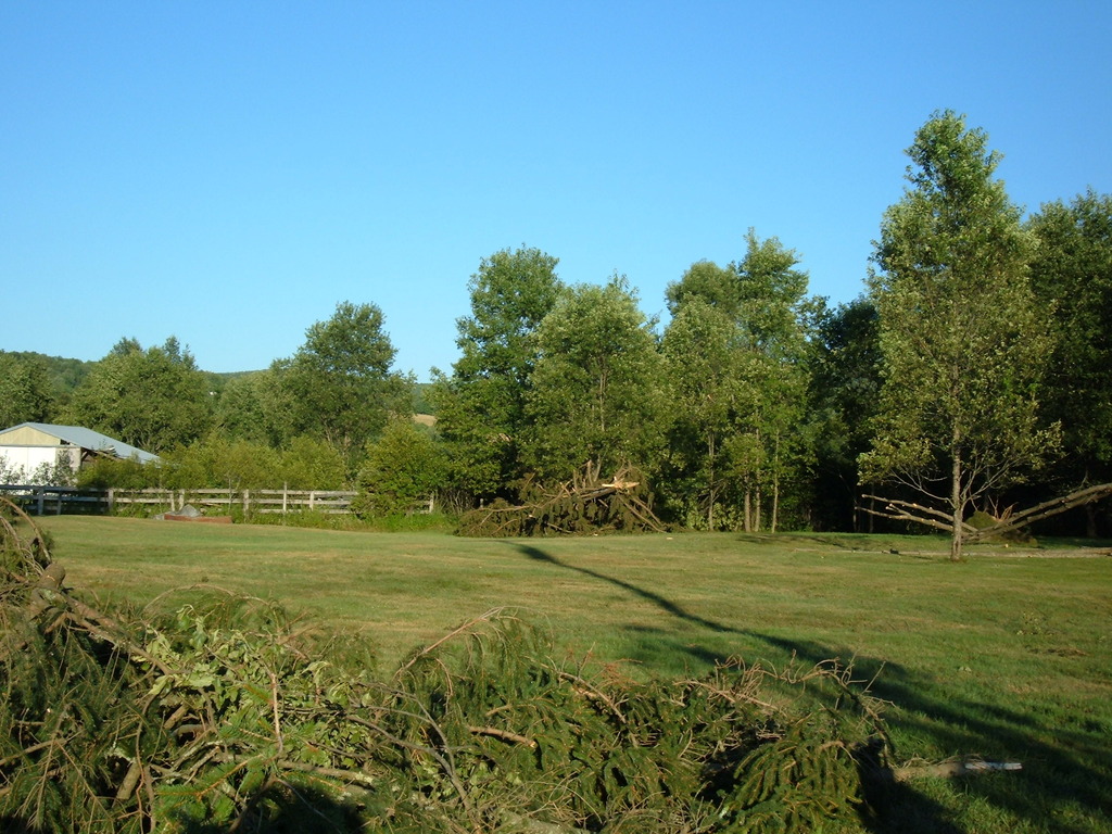
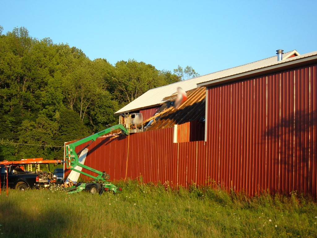
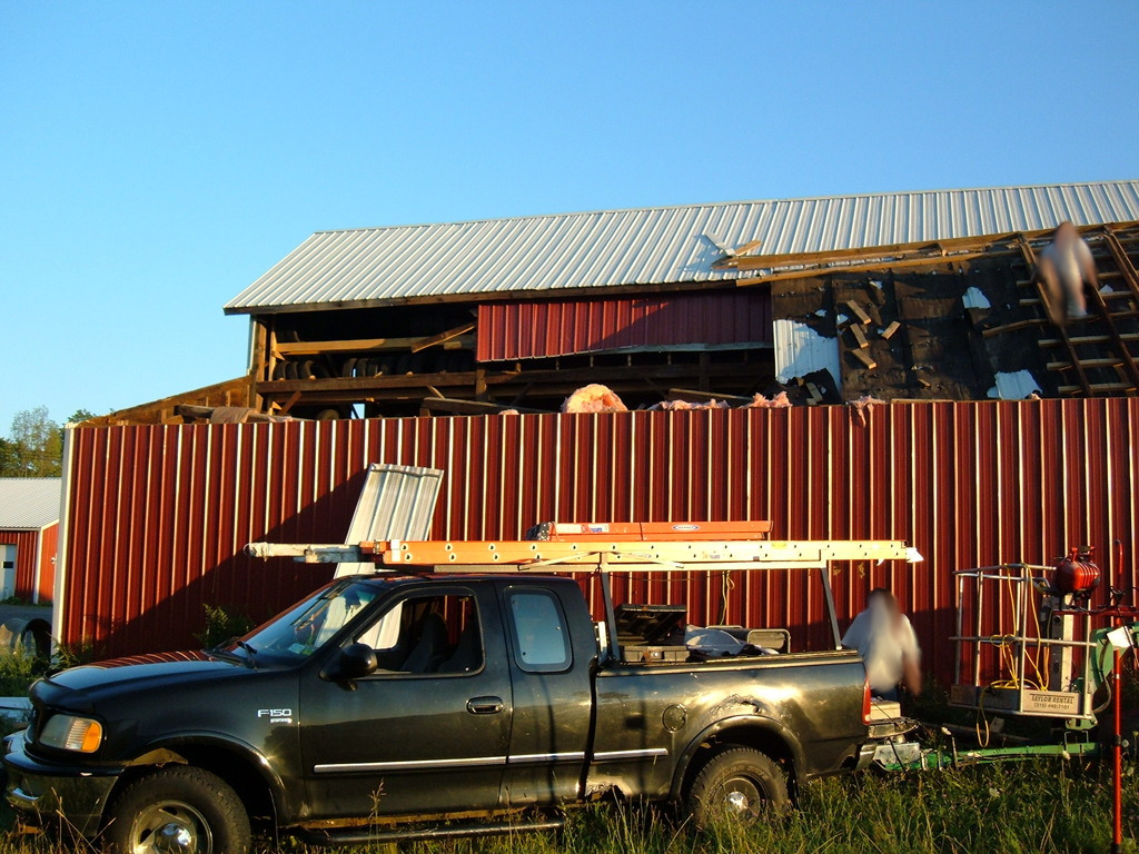
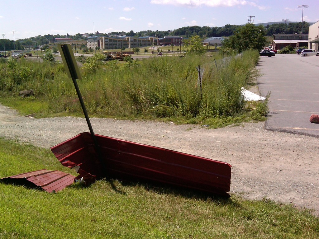
A team of meteorologists surveyed storm damage in Burlington Flats. The team determined that a tornado initially touched down just west of the intersection of Fish and Game Road and Gardner Road. A photo indicated a funnel just west of the initial touchdown location. Convergent damage included two large wagons blown toward the northwest, while several large trees were uprooted and blown down toward the northeast. Damage occurred at and near a barn, including a several hundred pound tub of sand being moved a few feet, a broken window, and damage to a wooden structure. Corn was also sheared in a field. Damage in this area indicated top wind speeds of 75 to 80 mph, indicating an EF0 intensity.
 |
 |
 |
 |
 |
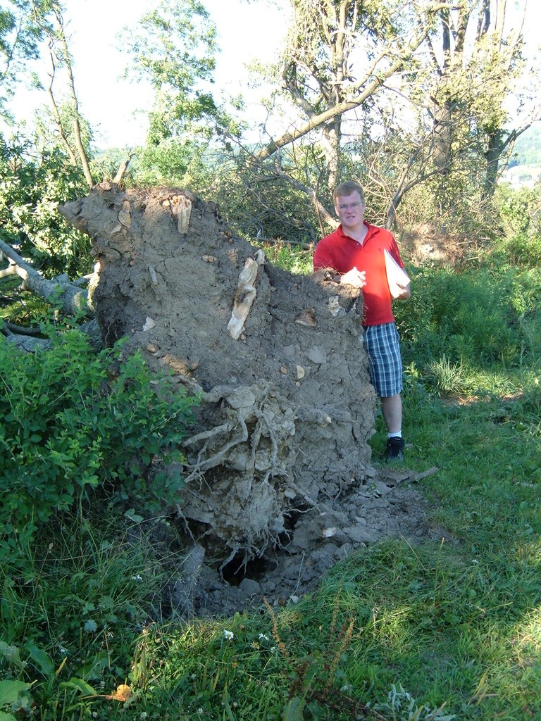 |
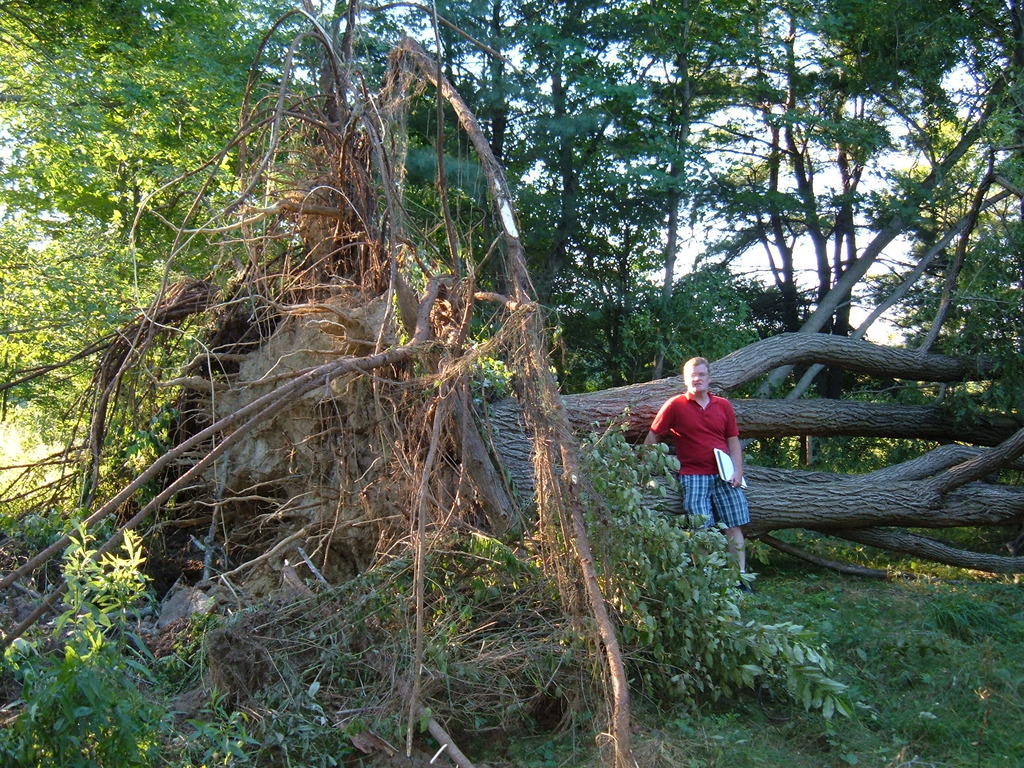
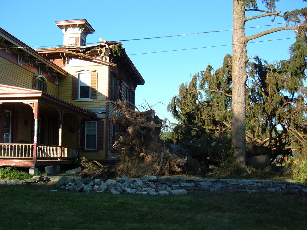
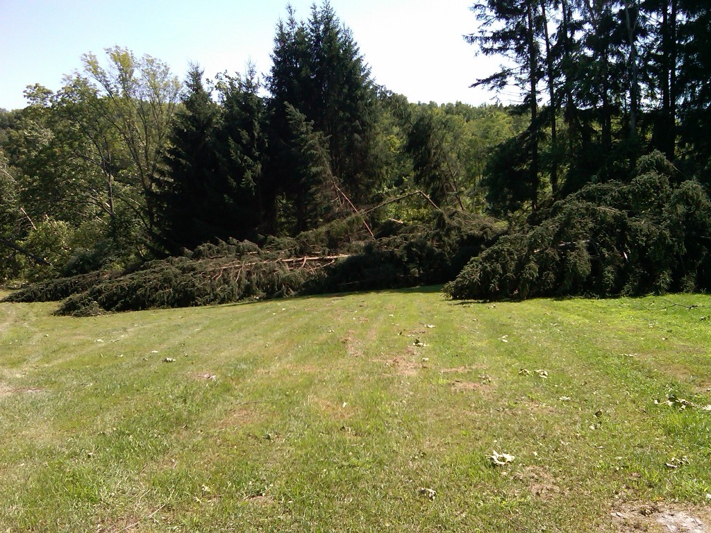
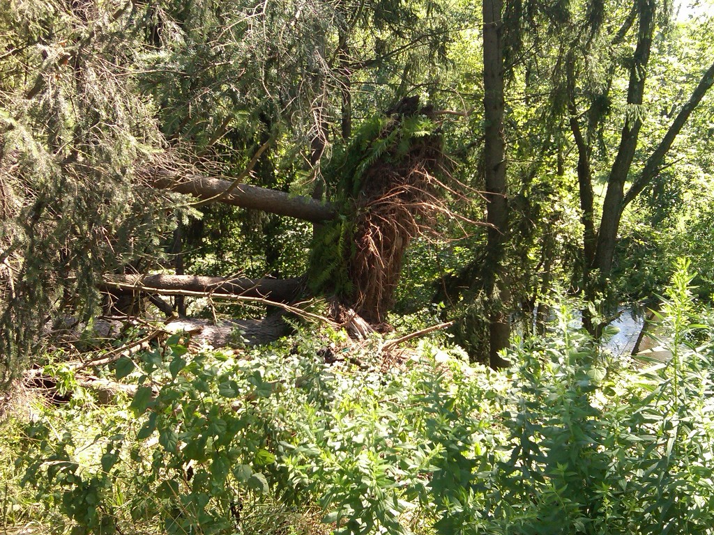
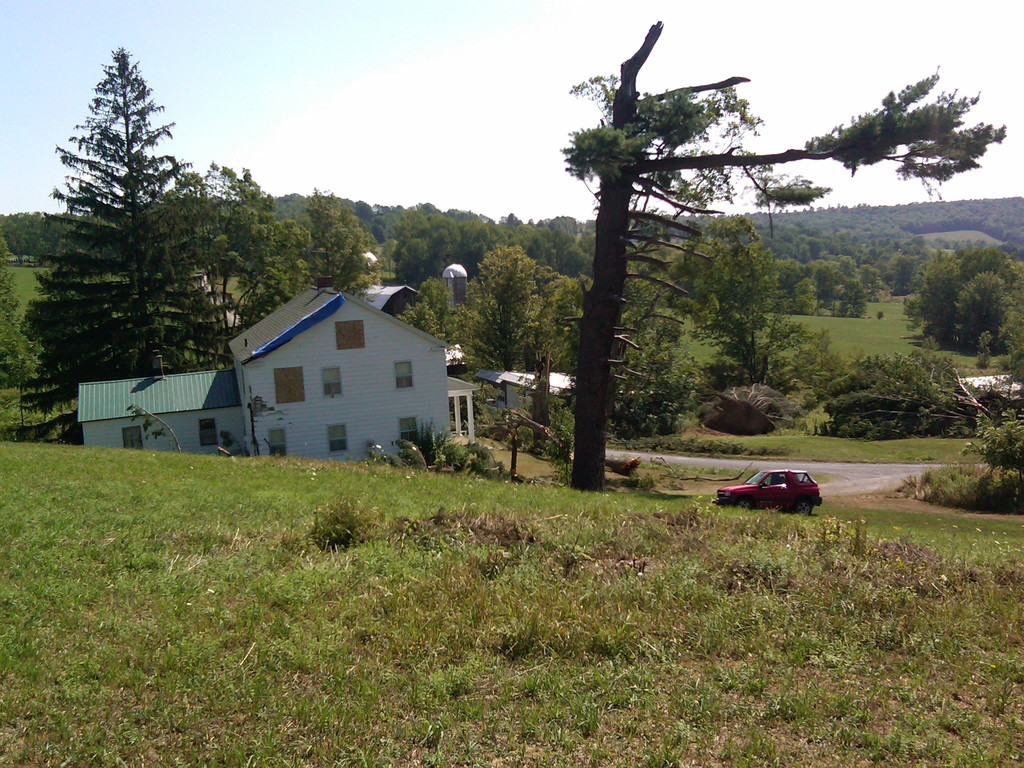
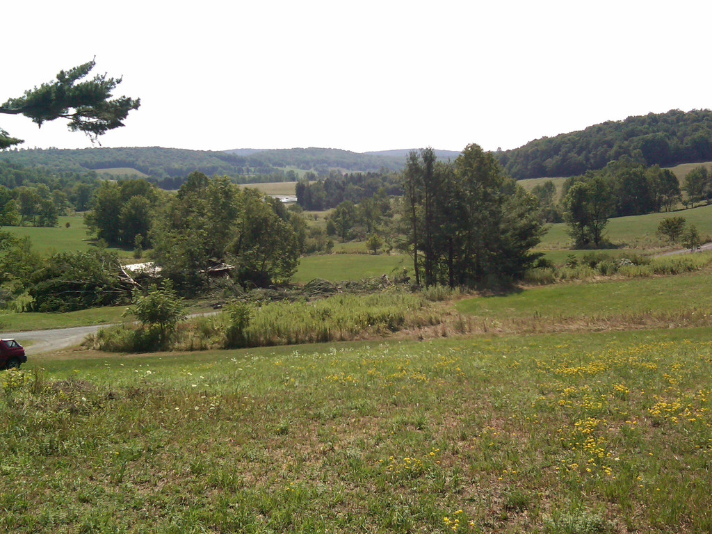
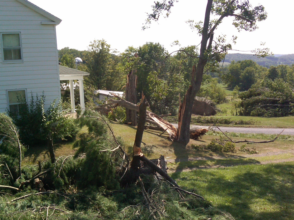
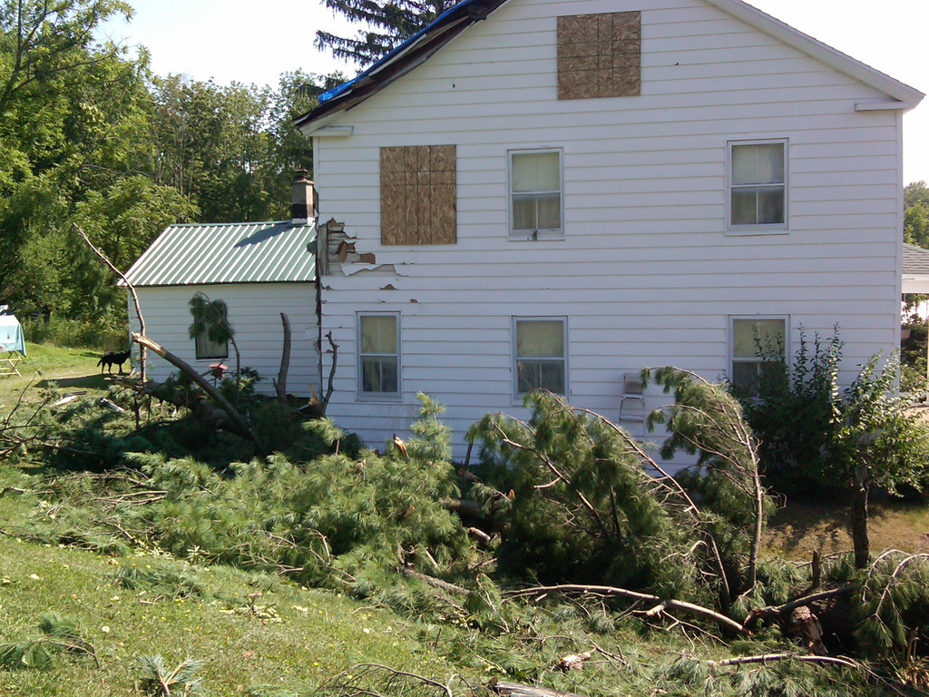
The tornado appeared to dissipate briefly, in a field just east of Gardner Road, then a second touchdown occurred at a creek near 162 Chapin Road. EF1 damage was surveyed in this area, including 10 to 20 large, uprooted trees, and a large barn blown several inches off of its foundation. One of the large trees hit a house and damaged the roof. Damage in this area was also convergent, as the top of a large tree was determined to be blown northeast of Chapin Road, while several other trees were uprooted and blown toward the northwest. The tornado crossed Chapin Road and dissipated in a corn field west of county Route 51. Damage in this area indicated top wind speeds of 85 to 90 mph.
 |
 |
 |
 |
 |
 |
 |
A tornado touched down near West Locust Avenue and Route 6 just west of Honesdale. Primary damage was to numerous trees which were uprooted and snapped. One home was damage and a shed was destroyed by trees falling. Minor damage to other homes and buildings occurred such as shingles blown off and objects tossed. Trees and debris were in a very convergent pattern indicative of a tornado. Some of the shingles were found on the upwind side of the storm. The tornado moved southeast across the Lackawaxen River and weakened as it moved up the hill on the other side.
 |
 |
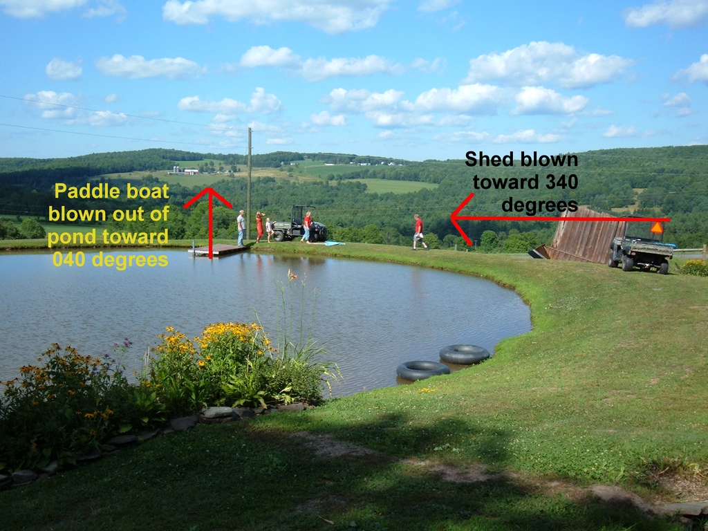
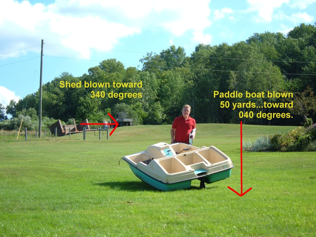
A National Weather Service Team of meteorologists surveyed storm damage in Guilford Township along Phillips-Odell Road and determined that an EF0 tornado occurred in that area at 4:00 PM EDT on Friday, July 29th. Convergent damage in the area included a flipped shed, some minor tree damage, and a paddle boat blown approximately 50 yards from a lake. An eyewitness indicated that a rotating funnel of strong winds passed over the area at the time of the damage. The tornado initially touched down west of Phillips-Odell Road, then dissipated in a field east of the road.
 |
 |
 |
 |
This is the same storm as the previous tornado reported. A second touch down and area of damage was surveyed near the high school and middle school. This tornado was a little bit smaller and weaker. Still it took some shingles off a roof of a home and damaged some trim on another home. A couple dozen trees were snapped or uprooted along its path. Insulation from the roof of the middle school which was under construction was strewn to the north and northeast of the path.
A team surveyed storm damage in Richfield Springs and determined that a microburst of strong, straight-line winds occurred near 64 Lake Street. A large garage west of lake street sustained significant damage to its roof. Some debris from the roof was carried into some woods on the east side of lake street. No other damage was found.
 |
 |
 |
 |
 |
Thunderstorm winds damaged a home and took down some trees on Hawley road on the west side of Montrose near Route 706. The thunderstorm then produced a significant microburst about a mile south-southeast of Montrose impacting property along Peterson Road, Meshoppen Creek Road, and Bolles Road. Numerous trees were uprooted and snapped. A tree damaged the roof and side of a house and another crushed a farm outbuilding. Windows were blown out on a home and damage was done to a silo and barn. This damaged occurred along Peterson Road. The microburst then blew through farm fields and wooded areas taking down numerous trees. It crossed Meshoppen Road and Bolles Road snapping additional trees on nearby properties and then appeared to weaken as it moved up a hillside. The pattern that the trees fell in at each of the locations surveyed was slightly divergent which is indicative of a microburst.
 |
 |
 |
 |
Severe winds associated with a microburst struct scranton in the memorial stadium area. Damage occurred to businesses along providence road to roofs, siding, windows and signs. Trees were snapped and blown down as it crossed the Lackawanna river and railroad tracks. Some damage to trees and at least one business on the other side of the river on Mineral Avenue and Capouse Avenue.
 |
 |
 |
 |
 |
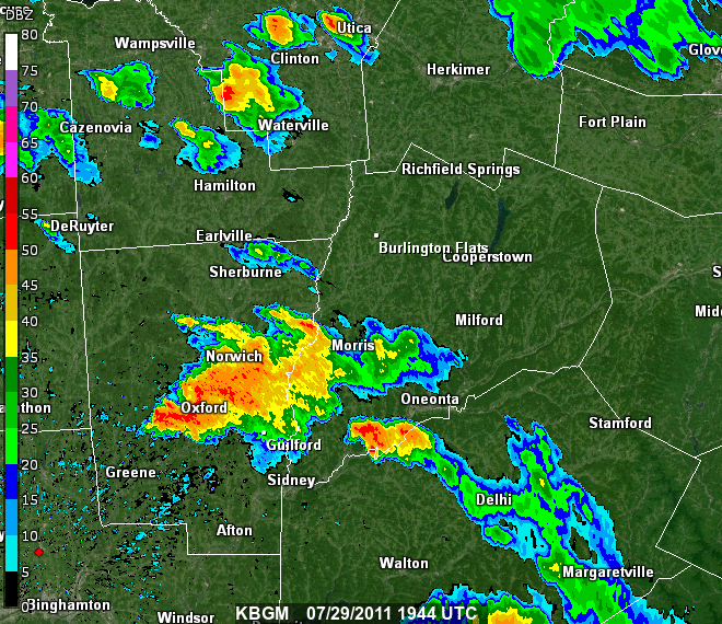
The 0.5 Base Reflectivity animation below is from the NWS Binghamton radar site. The loop was from 3:44 PM EDT (1944 UTC) to 5:31 PM EDT (2131 UTC) July 29, 2011.
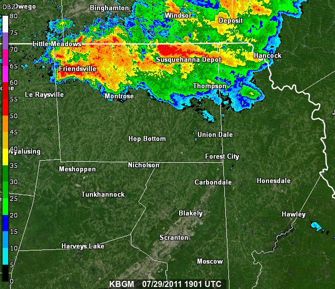
The 0.5 Base Reflectivity animation below is from the NWS Binghamton radar site. The loop was from 3:01 PM EDT (1901 UTC) to 5:35 PM EDT (2135 UTC) July 29, 2011.
The information in this statement is preliminary and subject to change pending final review of the event(s) and publication in National Weather Service Storm Data.
For reference, the Enhanced Fujita Scale classification can be found here.

