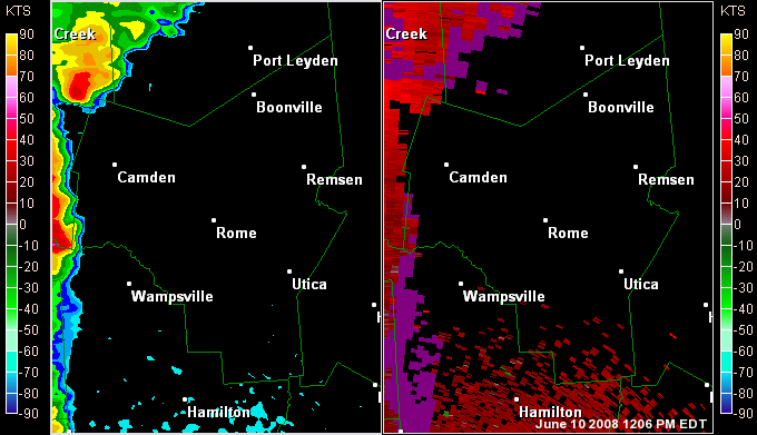
After several days of hot, humid conditions an upper level short wave moved across the area during the morning hours producing scattered to numerous showers and thunderstorms across the northern parts of central New York. There was a pause in thunderstorm activity across the region, then as a cold front approached and swept across the area thunderstorms developed along ahead and along the front.
Thunderstorm Produces 80 to 90 mph Straight Line Wind in Southwest Bradford County From Tuesday Evenings Storms
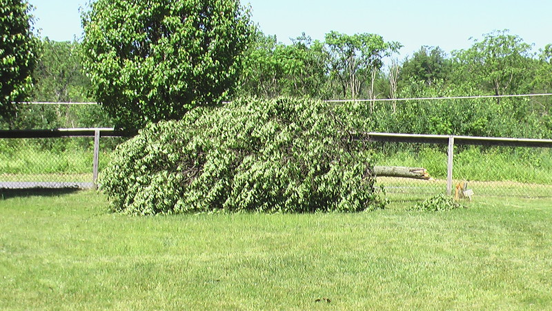
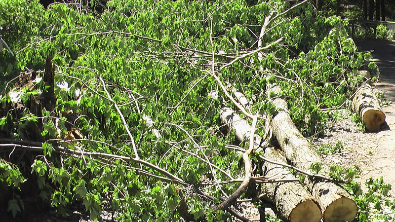
A severe thunderstorm slammed through the southwest part of Bradford County Tuesday evening between 525 PM EDT and 535 PM EDT. The thunderstorm produced an estimated 90 mph wind gust that tore part of a roof off a barn a few miles southwest of Canton. Two pieces of wood from the barn roof were driven into the ground by the strong winds. There were also slate shingles blown off a roof of another barn one of which was driven into the ground by the intense winds. Additionally, southwest of Canton, there were numerous trees snapped and uprooted in a divergent to straight line path.
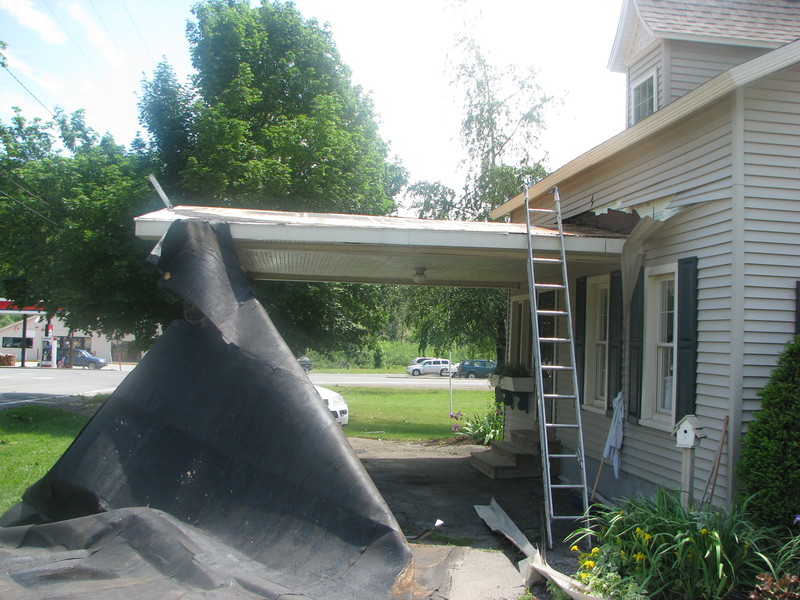
The storm then tracked northeast and produced significant damage to the town of Alba Pennsylvania. Alba was particularly hard hit as numerous large trees were uprooted and snapped. The falling trees knocking down numerous power lines and power poles. A small shed was also heavily damaged by the wind in Alba. Additionally, there was some siding and shingles blown off a few homes. Winds were estimated between 80 and 90 mph in alba.
Between Alba and Canton along Route 14 another roof was partially torn off a barn and a few portable toilets were blown one-quarter mile down the road. A garage was also collapsed by the wind in this area. winds were estimated at 90 mph.
Damage Photos
Click for a larger view.
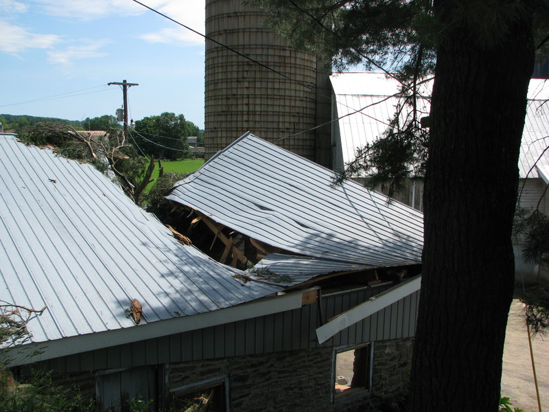 Roof damage to barn. |
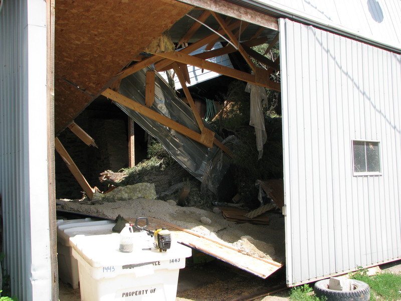 Inside view of damaged to barn. |
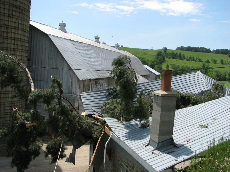 Another view of the barn damage. |
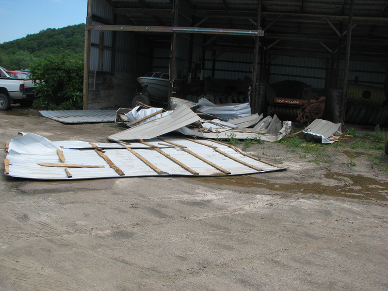 Parts of roof. |
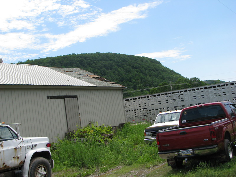 Roof damage. |
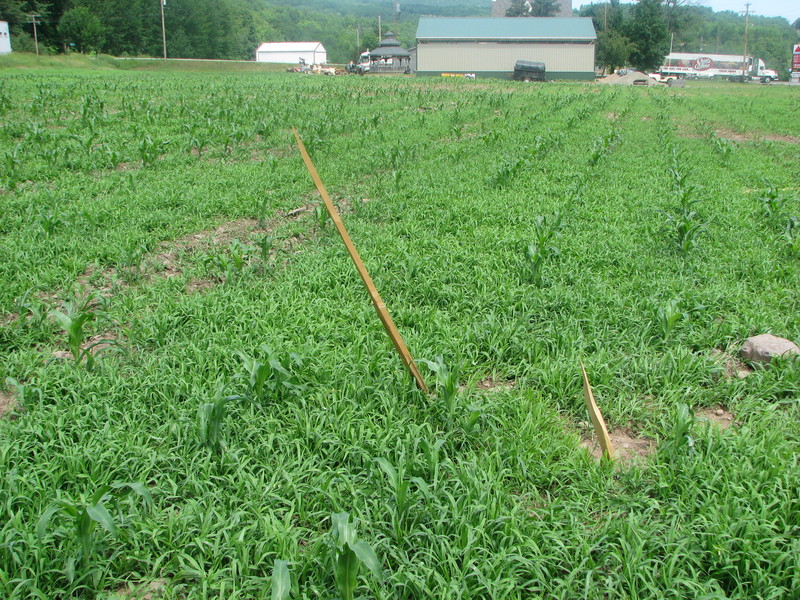 Wood projectiles. |
 Roof damage. |
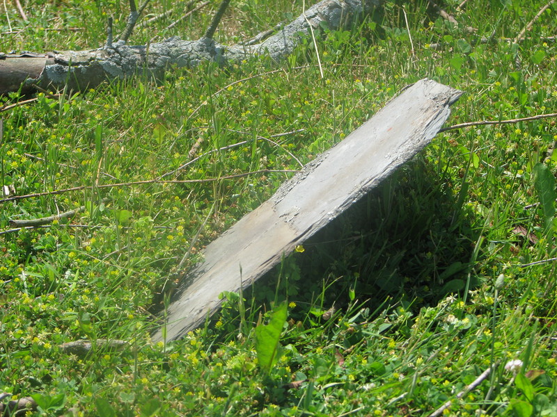 Another projectile stuck in the ground. |
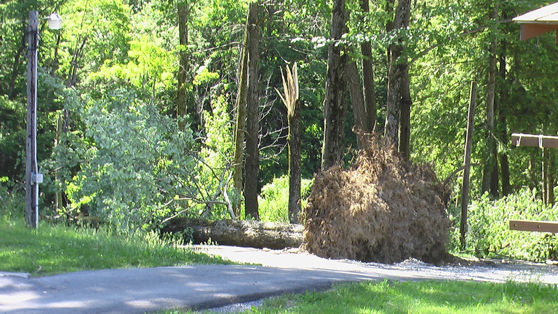
 Large tree down. |
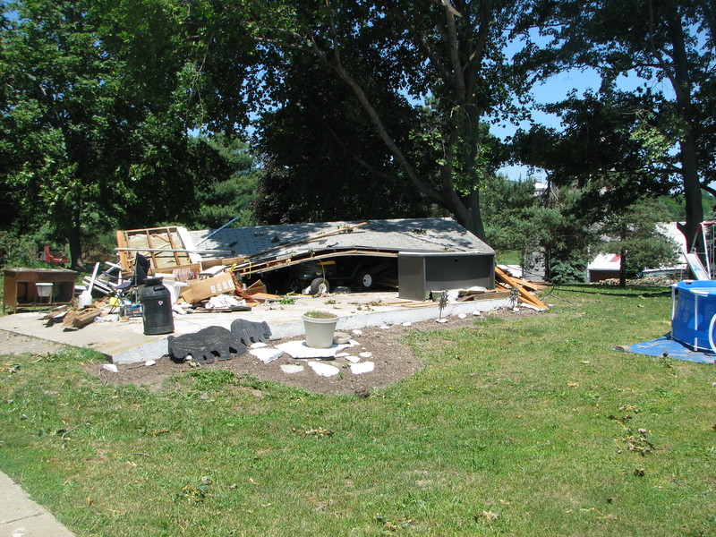 Small garage destroyed. |
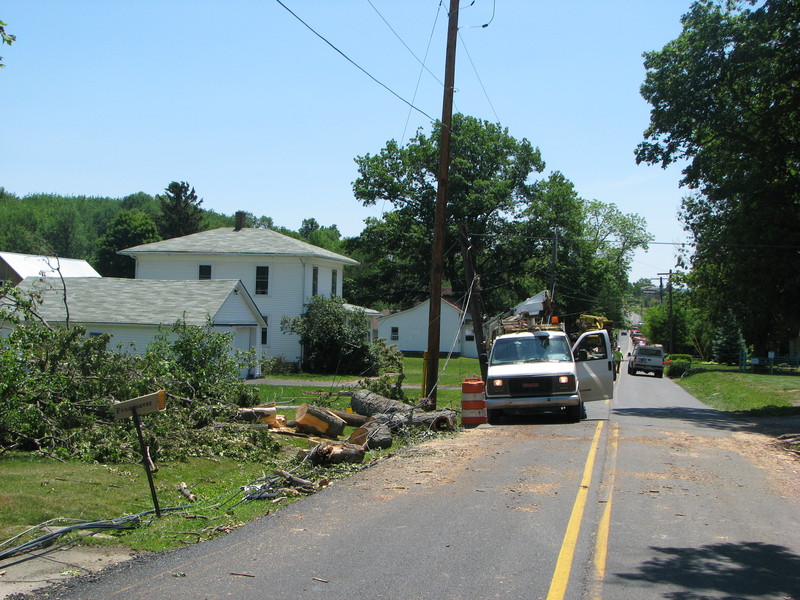 Clean up of power lines and trees. |
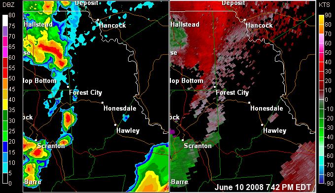
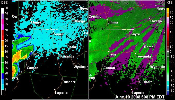
Radar loop of the severe storms.
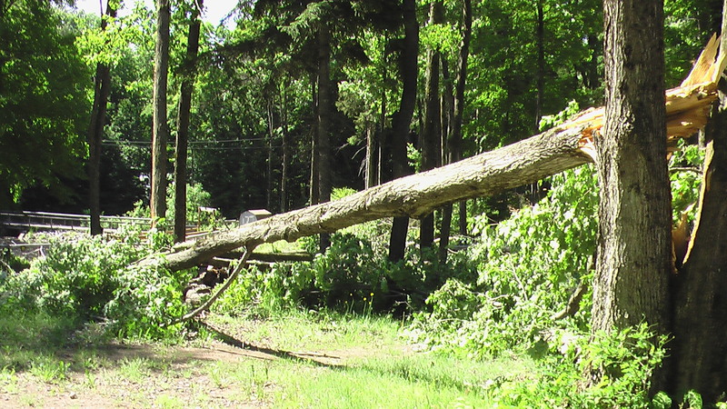
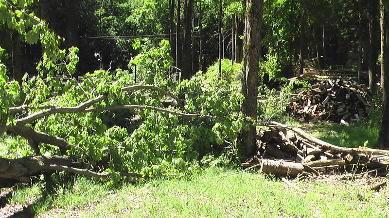
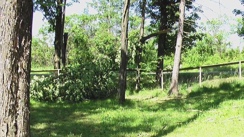
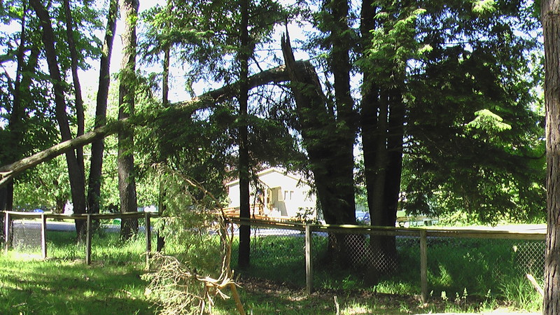
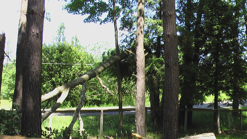
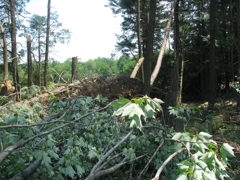
Straight Line Wind Damage In Taberg From Tuesday's Storms
The National Weather Service conducted a storm survey in Oneida County of a thunderstorm that affected the Taberg area during the early afternoon of Tuesday June 10th 2008.
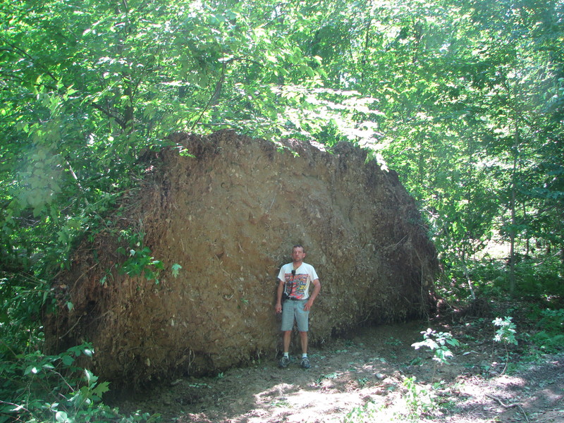
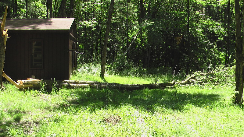
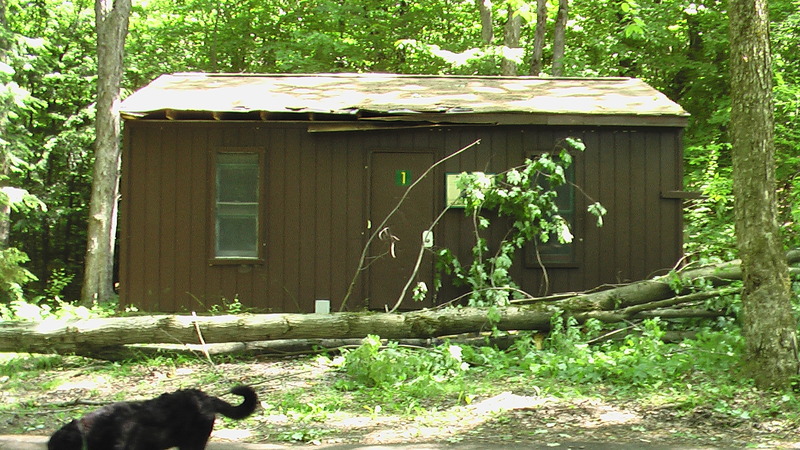
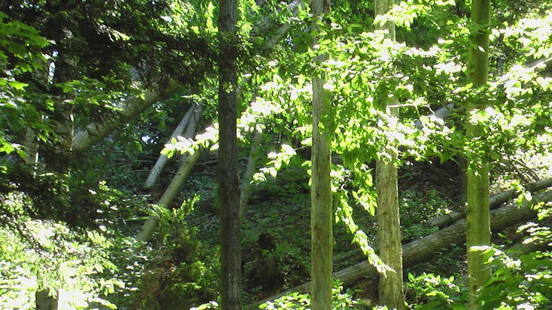
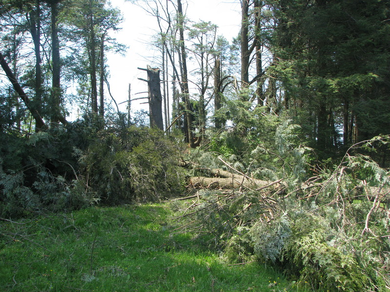
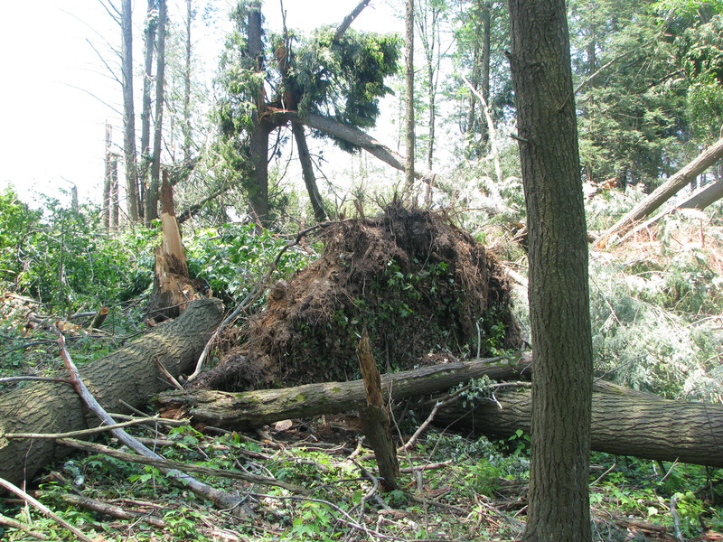
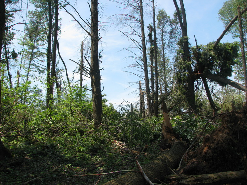
Thunderstorm winds produced concentrated damage to hardwood and softwood trees at Camp Kiwanis near the Village of Taberg. Approximately 40 trees on camp property were affected by storm winds. Most of the trees were very mature, 2 to 3 foot diameter trunks that averaged 40 to 50 feet tall. Some trees could have been 75 feet in height. Elsewhere around the area, isolated tree damage was noted, including a 6 foot diameter maple on Skinner Road that was snapped off near the bottom of the trunk. All trees were in full canopy. Some of the felled trees were noted to be weakened from age, disease or insects.
No structural damage due to wind was noted, however a camp cabin was clipped by one of the falling trees causing damage to the roof and gutters. Nobody was injured.
Based on the unidirectional damage pattern, and information obtained from eyewitnesses, the most likely cause of this damage was from straight line winds associated with a small thunderstorm microburst. Ground level winds speeds are estimated at 60 to 65 mph which caused no structural damage. wind speeds at treetop level likely approached 90 mph which was strong enough to cause the considerable tree damage. Narrow and steep terrain features near the camp may have also helped to locally accelerate winds as they impacted this small area.
Damage Photos
Click for a larger view.
 |
 |
 |
 |
 |
 |
 |
 |
 |
 |
 |
Radar loop of the severe storms.
Thunderstorm Produces 80 mph Straight Line Winds Across a Small Area in Southeast Wayne County Pennsylvania on Tuesday Evening June 10th
The National Weather Service surveyed wind damage in and around the town of Beach Lake in eastern Wayne County Pennsylvania on Friday June 13th. The damage occurred with a storm that moved across the area during the evening on the 10th. The most damage was found along Rosencrantz Road, about half a mile south of Route 652. In that area, several trees were uprooted or snapped by straight line winds estimated at 80 mph. The area of damage was approximately 100 yards long and 50 yards wide. The storm moved across that area at around 815 PM.
Scattered tree damage occurred elsewhere across wayne county during the evening on the 10th as a severe thunderstorm moved rapidly across the area.
Damage Photos
Click for a larger view.
 |
 |
 |
 |
Radar loop of the severe storms.