Preliminary Storm Reports.
More information will be place here as time allows.
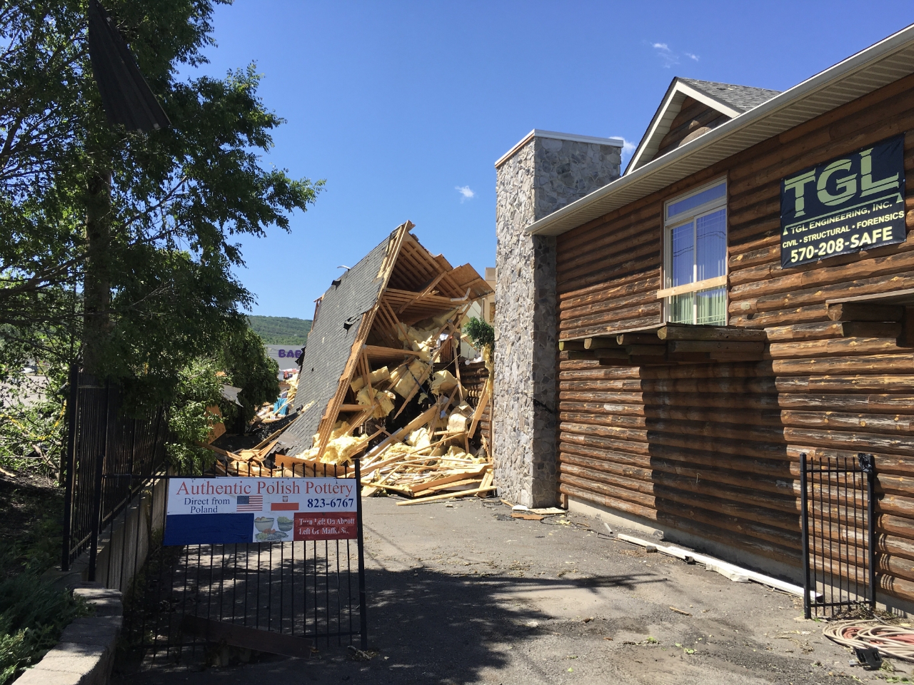
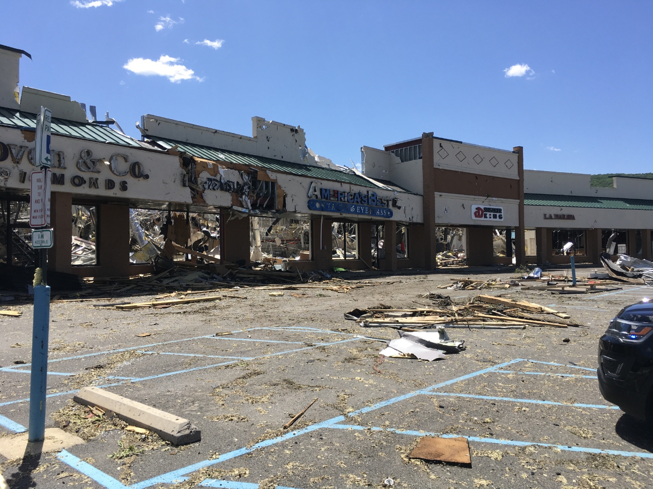
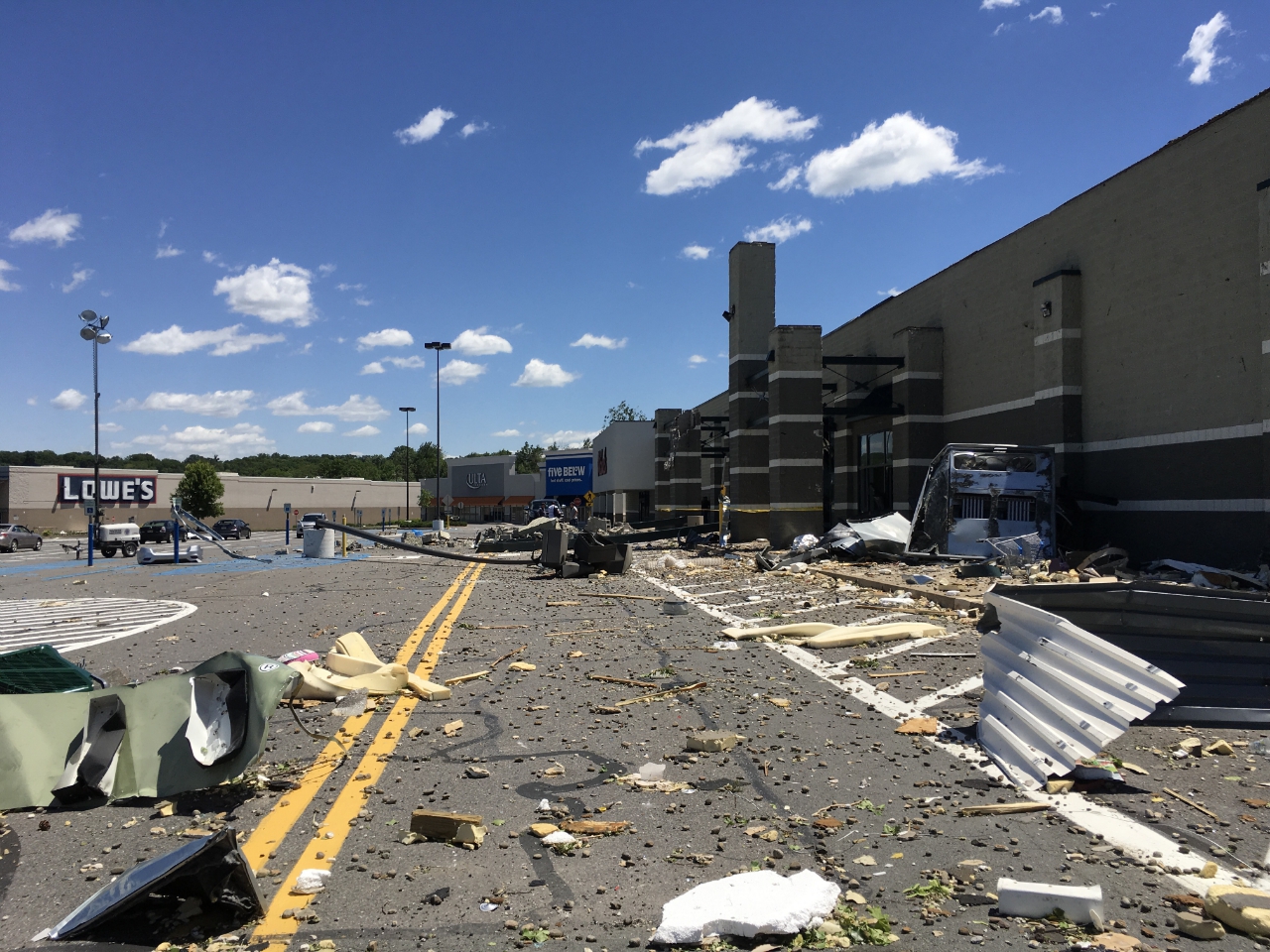
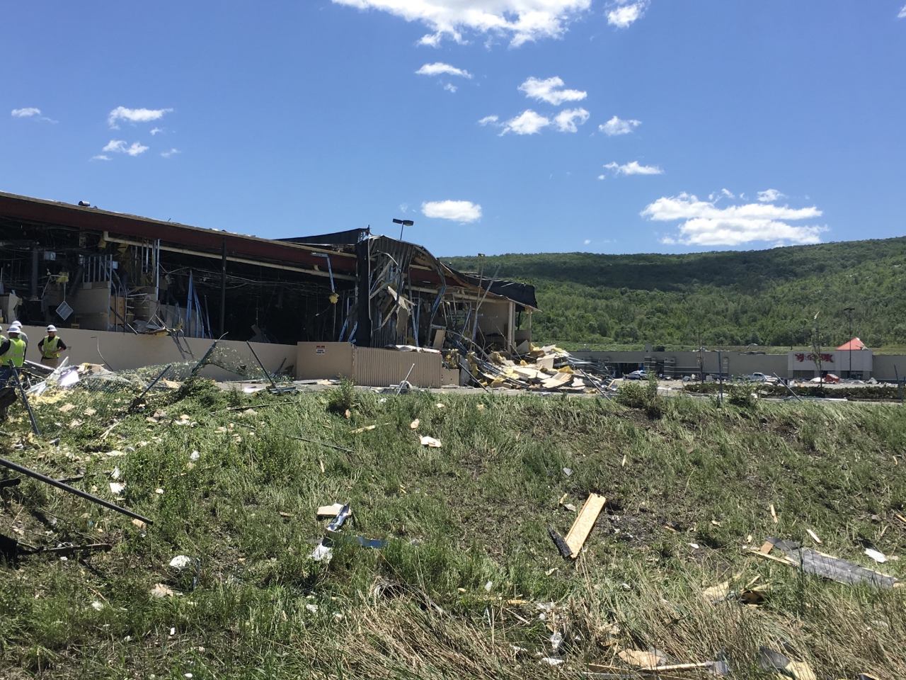
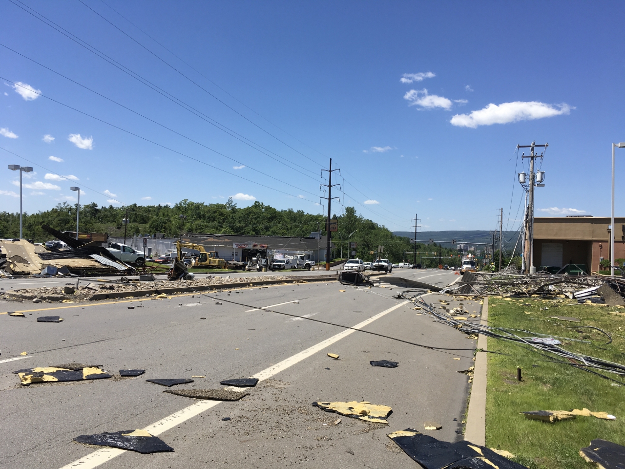
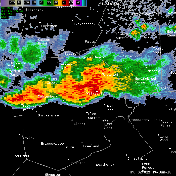
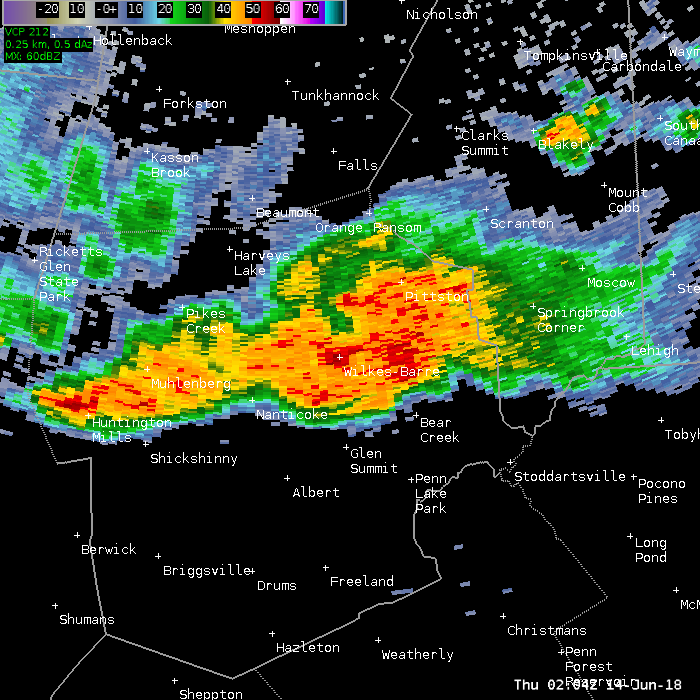
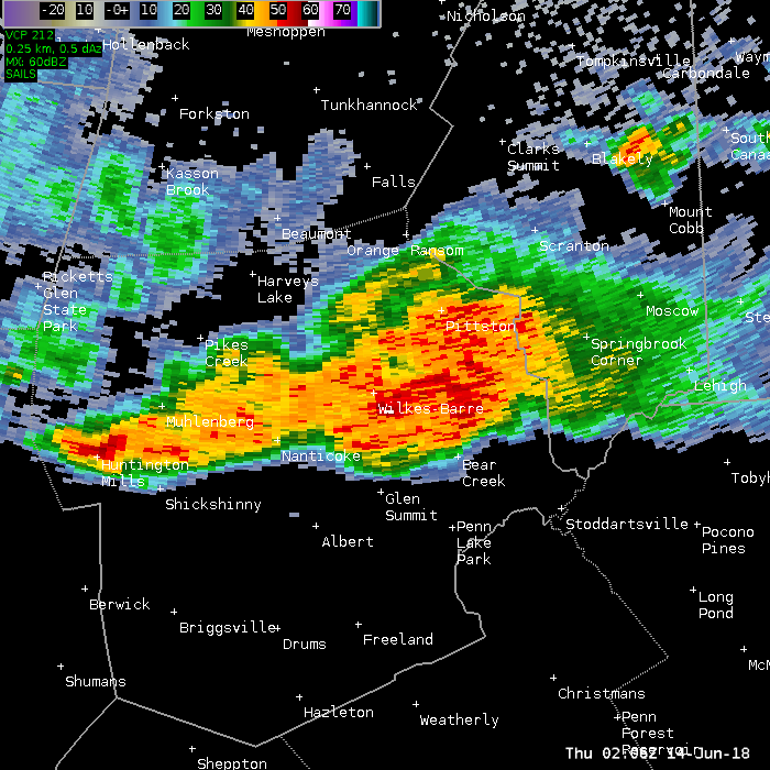
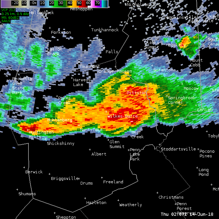
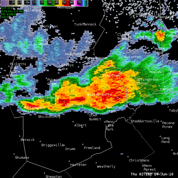
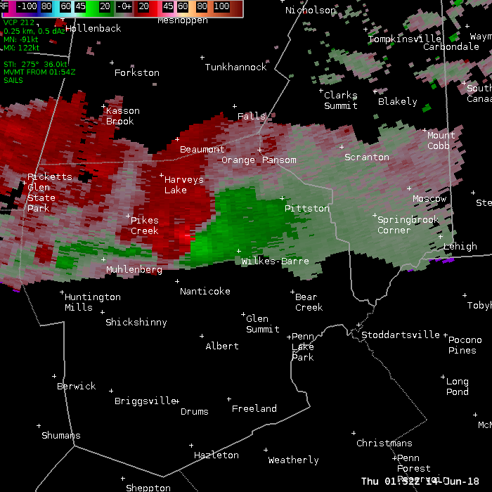
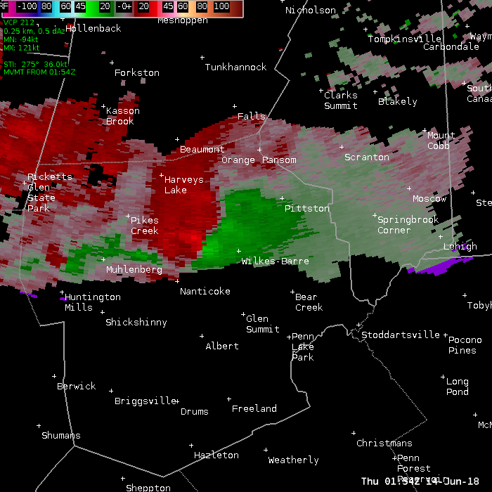
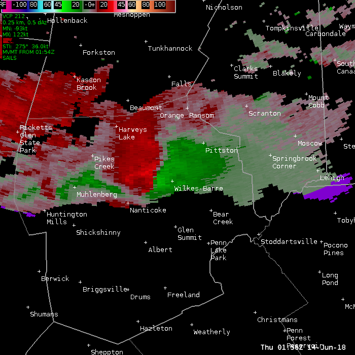
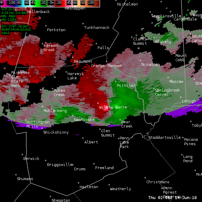
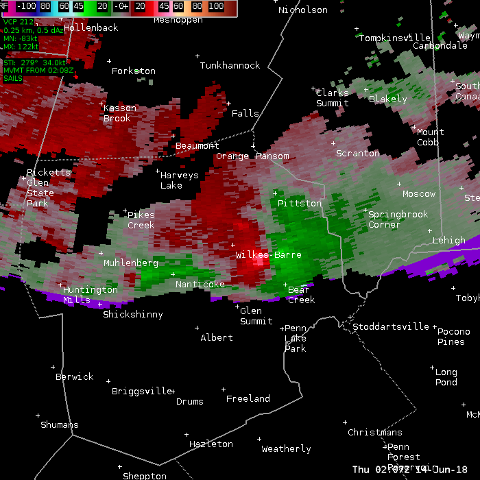
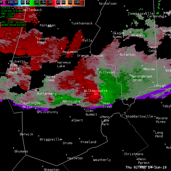
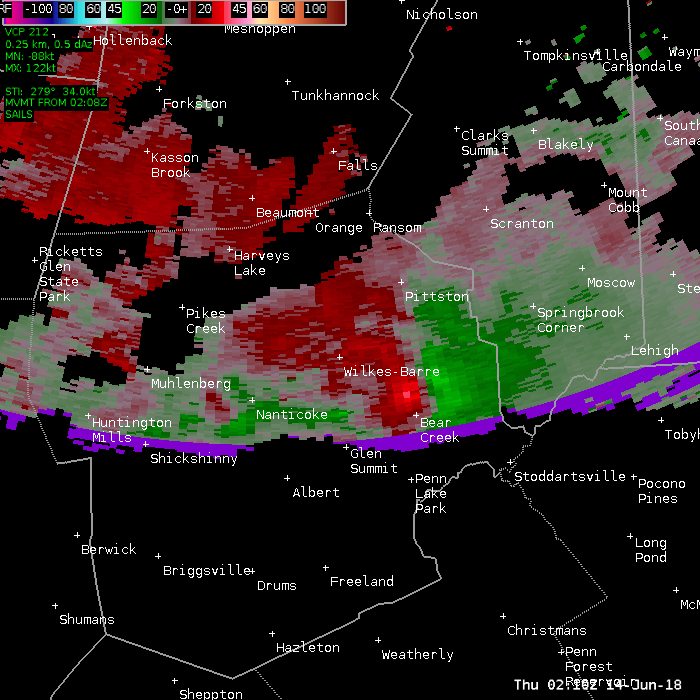
Wilkes-Barre Tornado
Summary
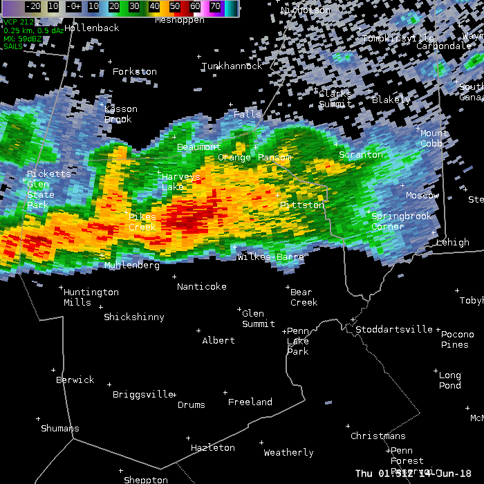
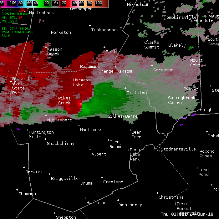
A severe thunderstorm moved across Luzerne County between 930 and 1030 PM EDT on Wednesday June 13 2018, producing an EF2 tornado in Wilkes-Barre Township around 1000 pm. The tornado touched down at Mundy Street and Highland Park Boulevard near the Wyoming Valley Mall, then traveled across I-81 and up into the woods on Wilkes-Barre Mountain. Tornado damage continued on a broken path through the State Game Lands before dissipating near Llewelyn Corners and I-476. Numerous roofs were destroyed and windows blown out throughout the shopping center. Some structures were sheared off near their foundation. Power poles were snapped with numerous lines down. Several signs were destroyed, and debris was scattered throughout the region. One piece of sign was found approximately 7 miles from the mall area.
The Civil Air Patrol executed an overflight of the area and this photo data will be reviewed along with other scientific and visual data. Final adjustments to the tornado width, path length and direction are possible before a final report is issued.
Some pictures from the survey. Click for a larger view.
|
Damage at Wyoming Valley Mall. |
Loss of roof. |
Damage to store fronts. |
|
More store front damage. |
Damage to wall. |
Debris thrown across road. |
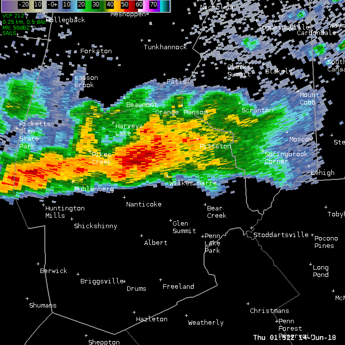
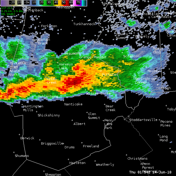
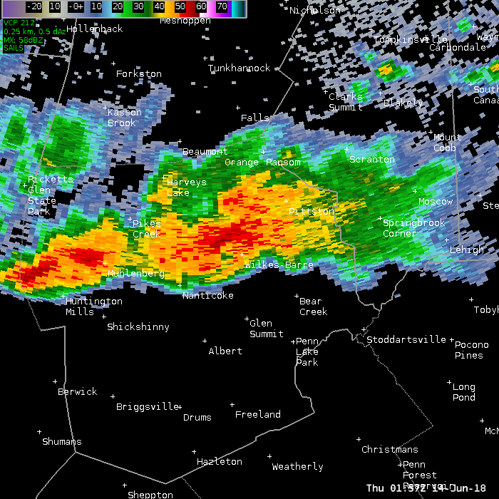
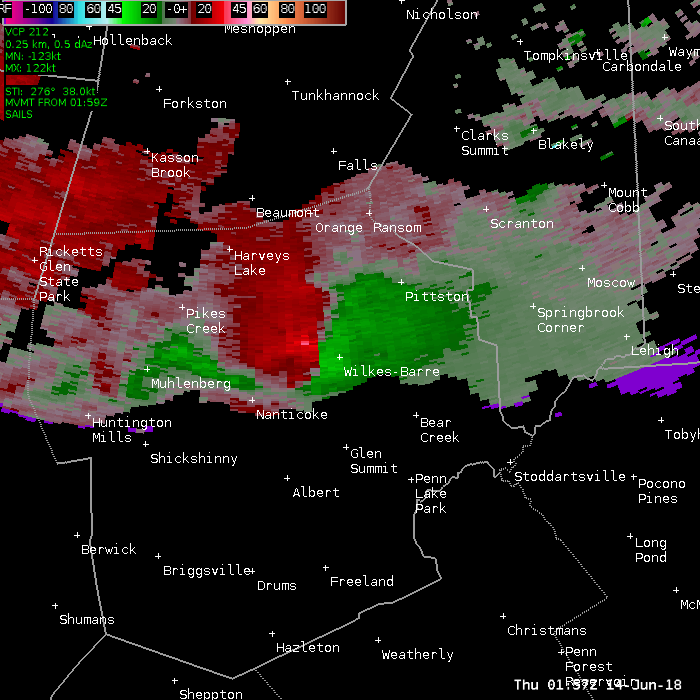
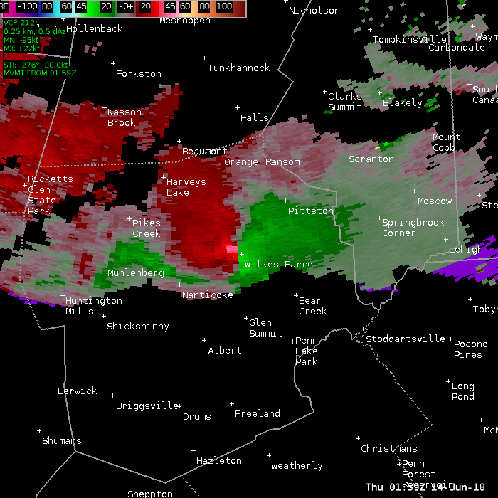
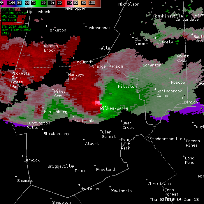
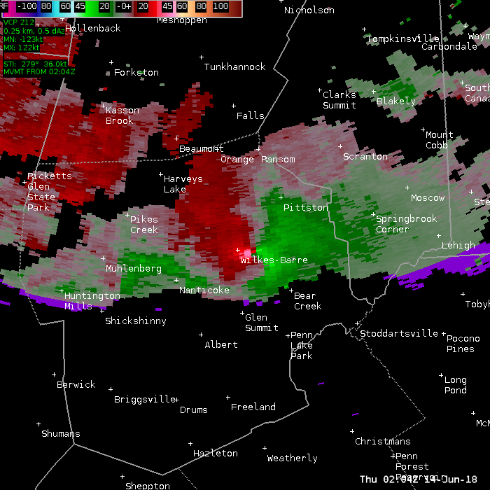
Below is a series of 0.5 degree base reflectivity images. Move your pointer over each times to see an image.
0151z 0152z 0154z 0156z 0157z 0159z 0201z 0202z 0204z 0206z 0207z 0208z 0210z 0212z
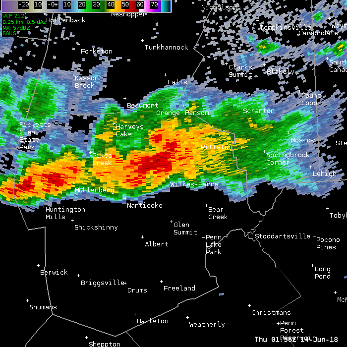
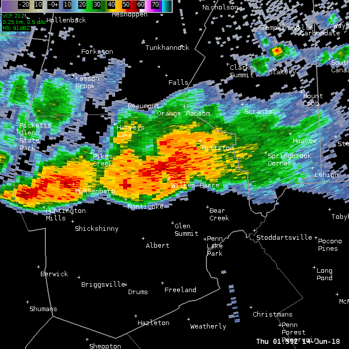
Below is a series of 0.5 degree Storm Relative Motion images. Move your pointer over each times to see an image.
0151z 0152z 0154z 0156z 0157z 0159z 0201z 0202z 0204z 0206z 0207z 0208z 0210z
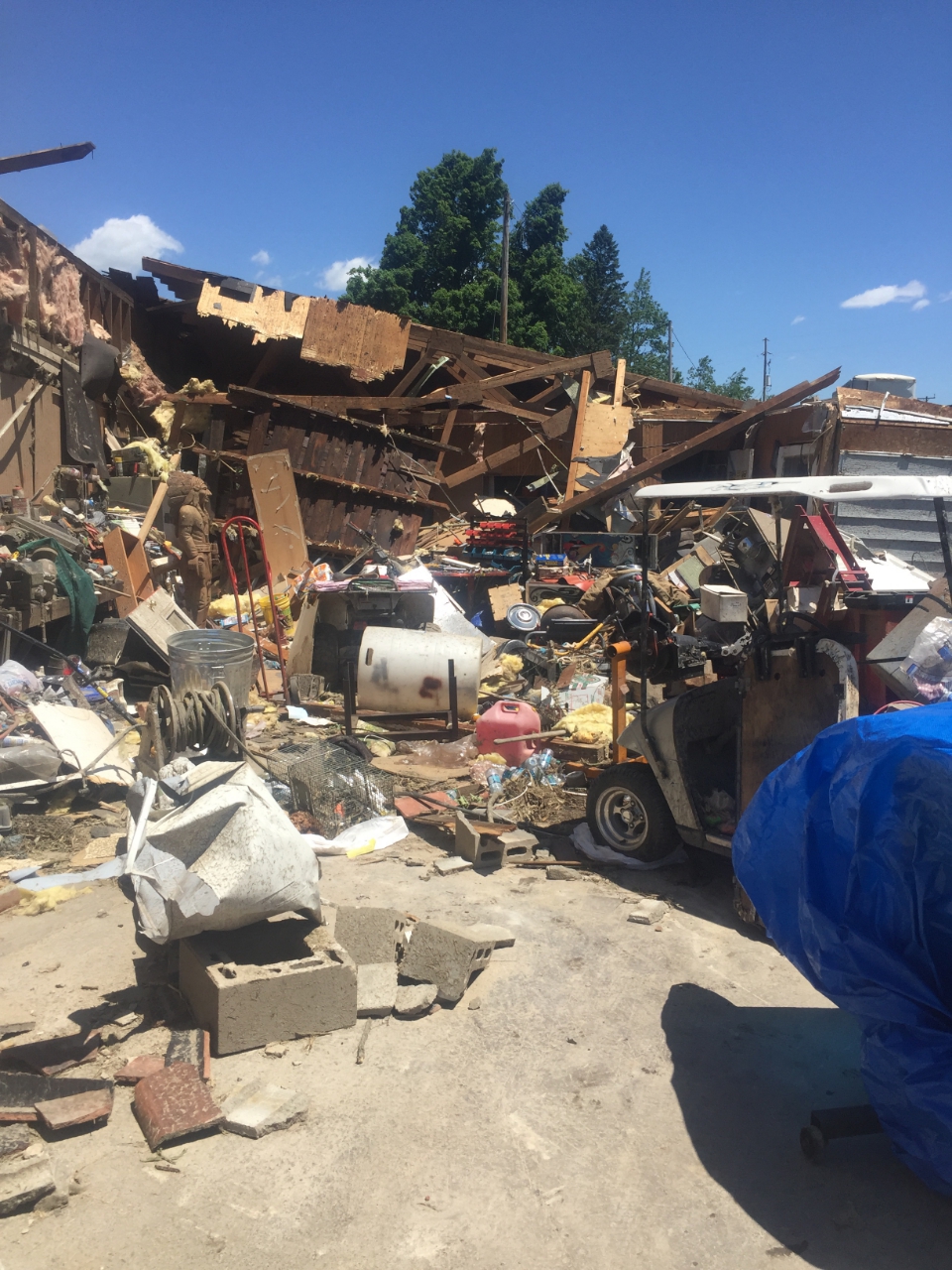
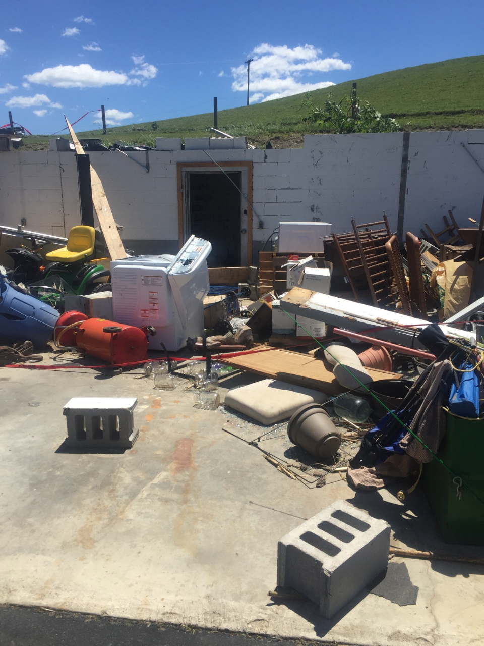
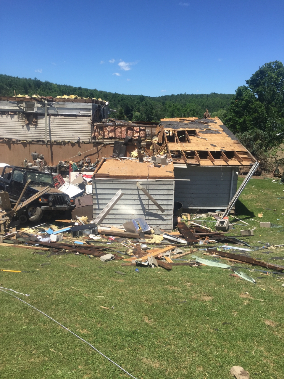
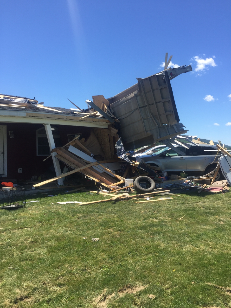
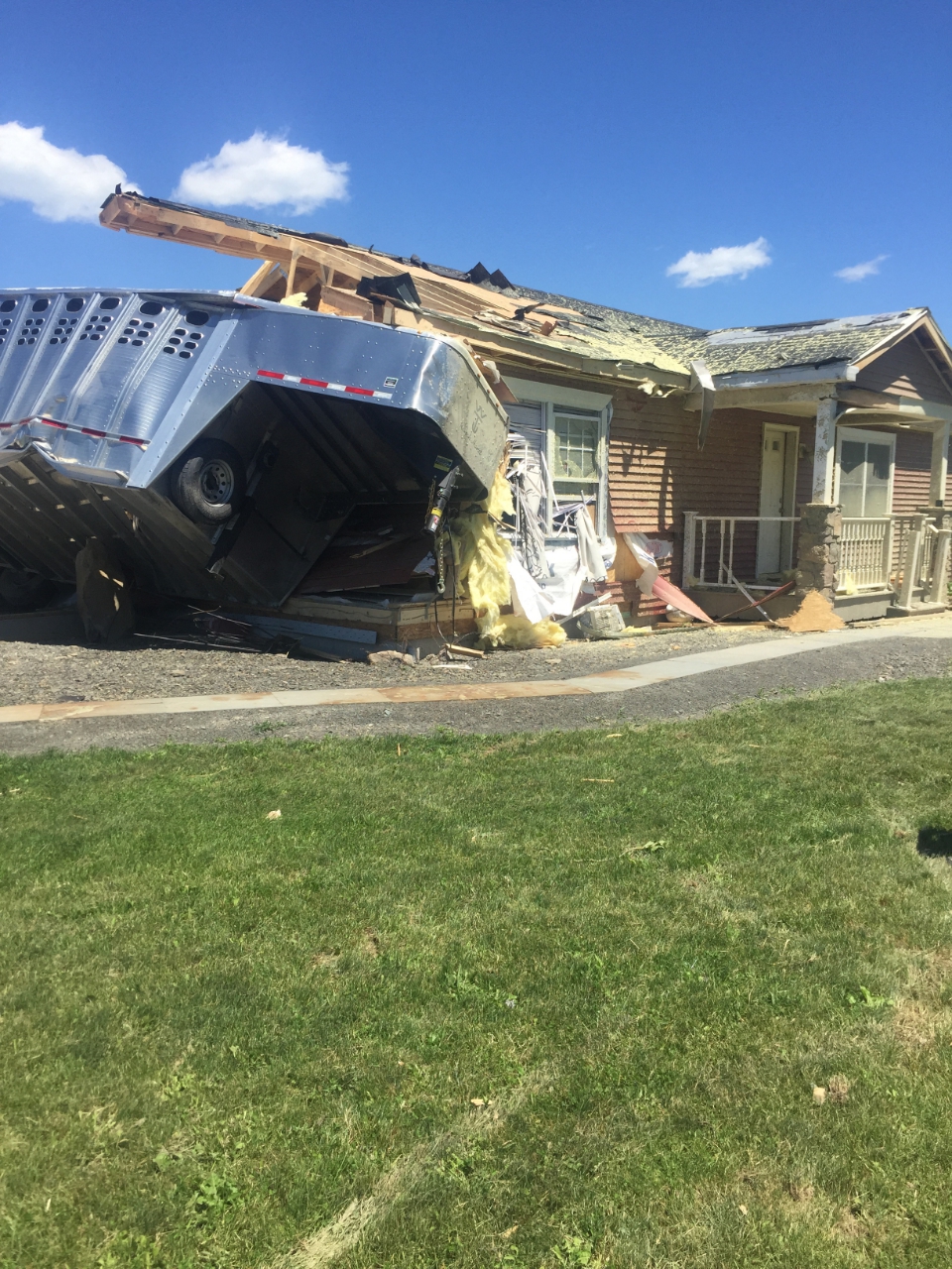
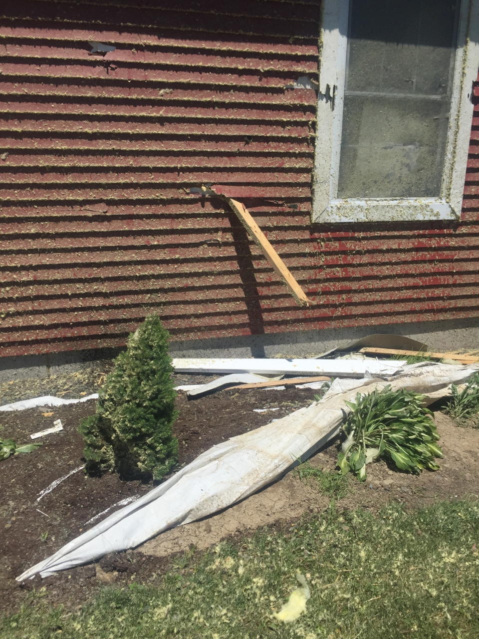
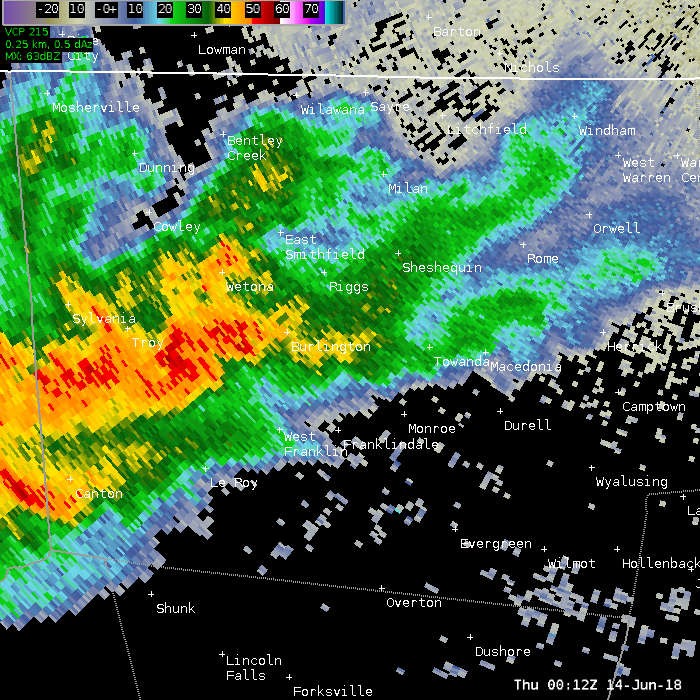
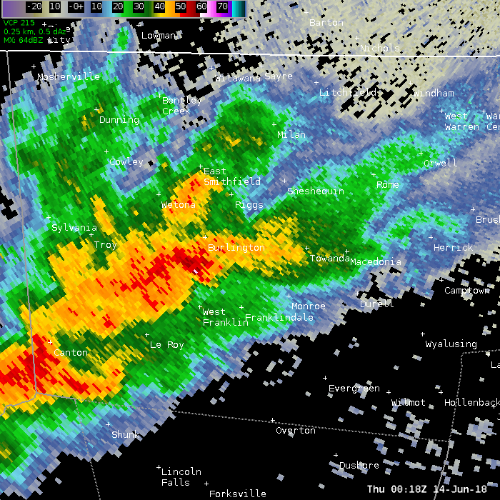
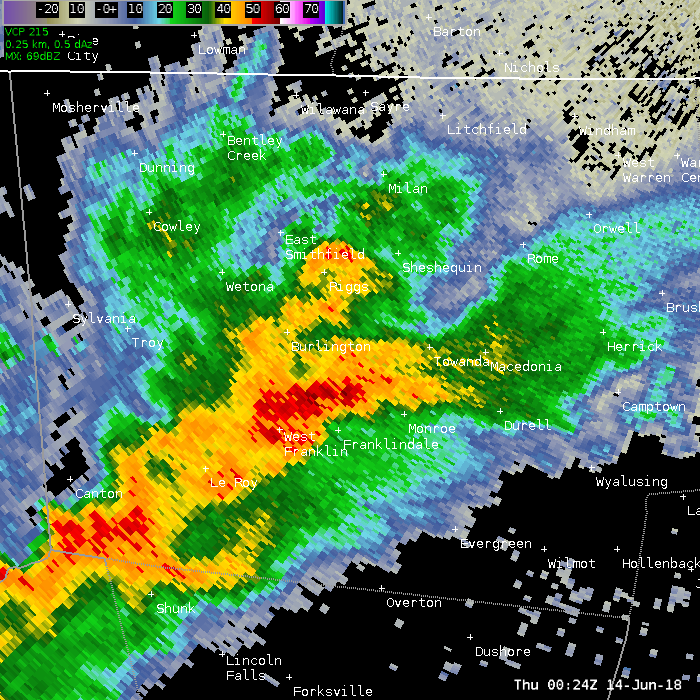
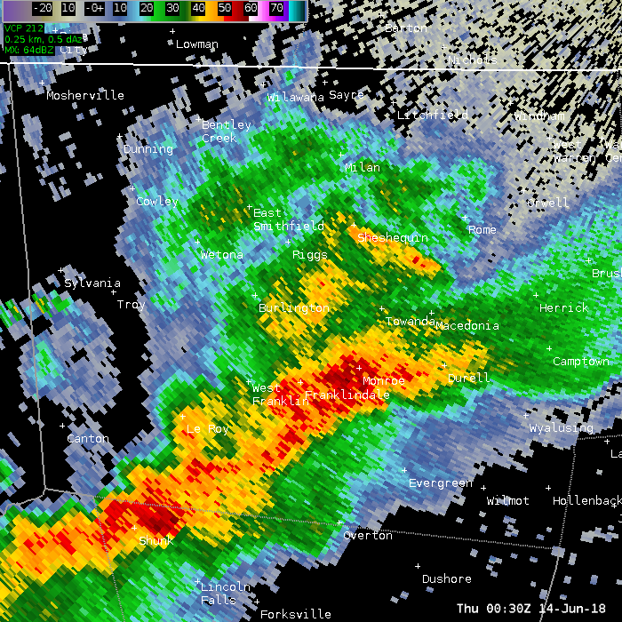
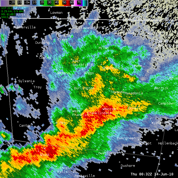
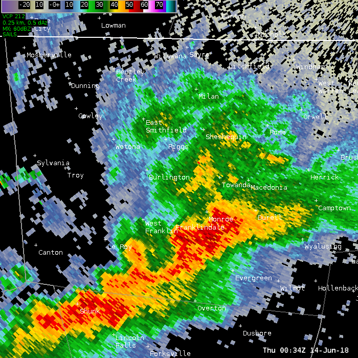
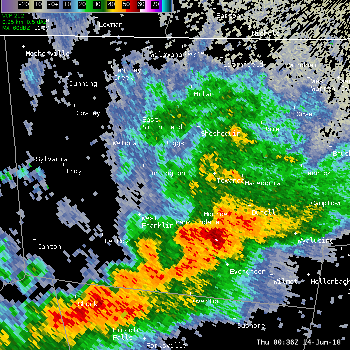
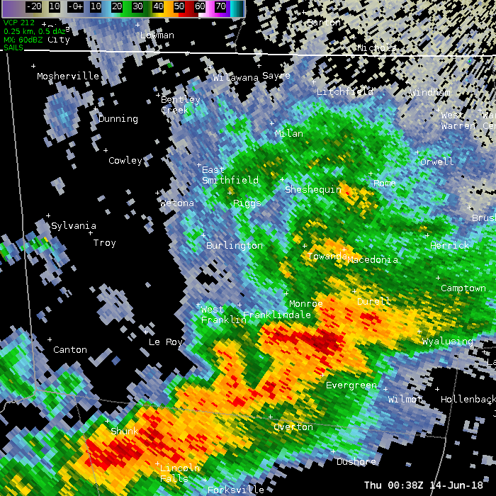
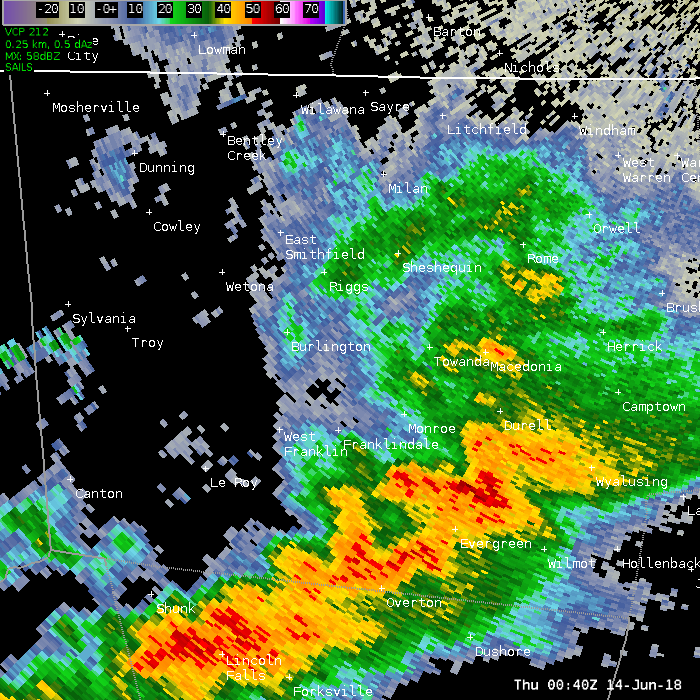
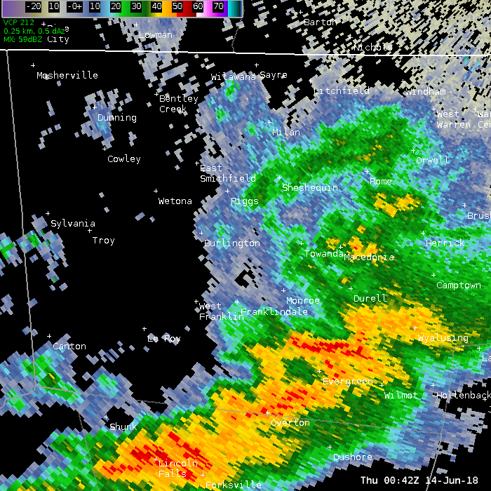
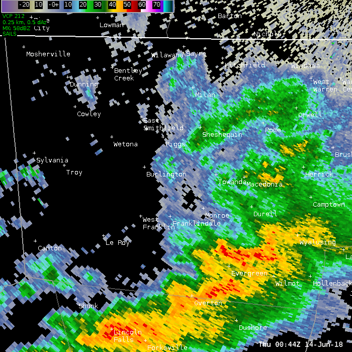
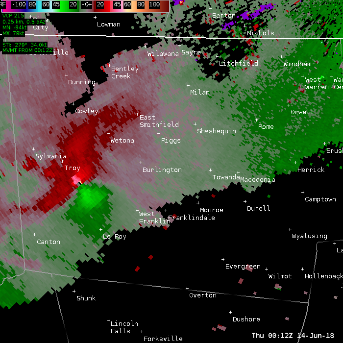
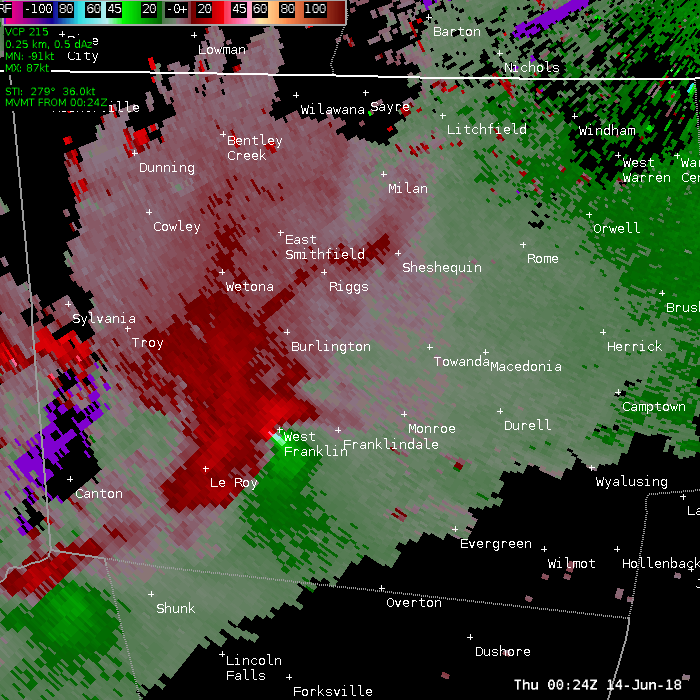
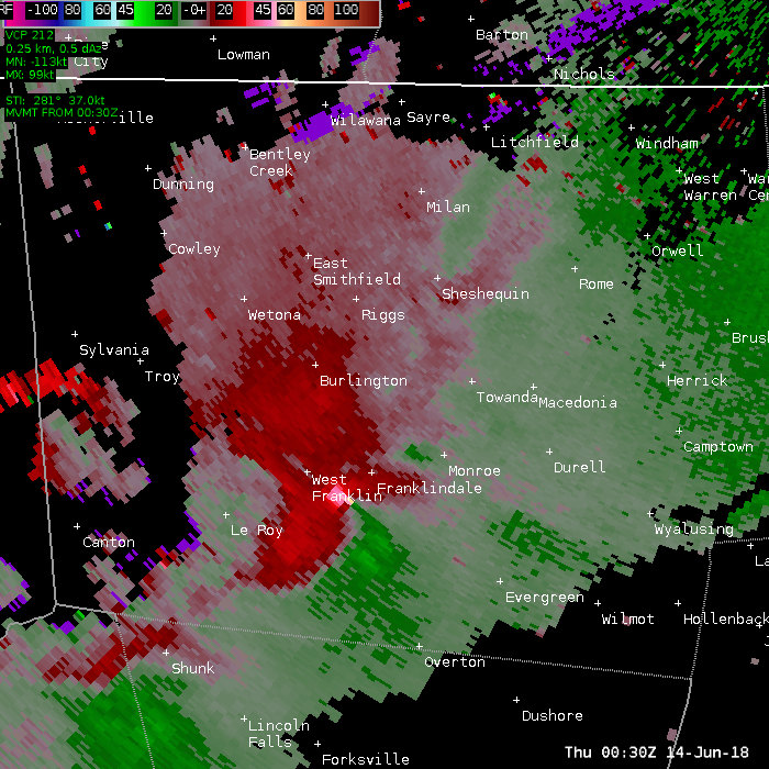
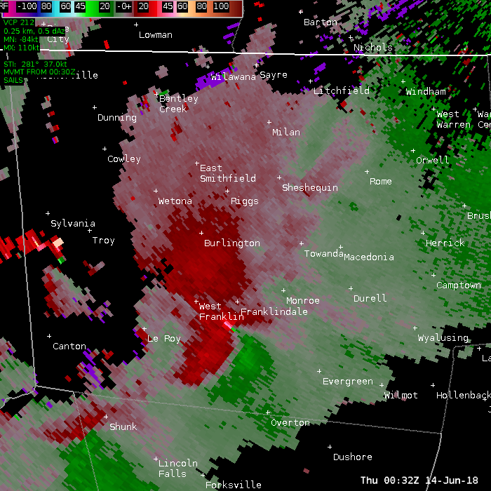
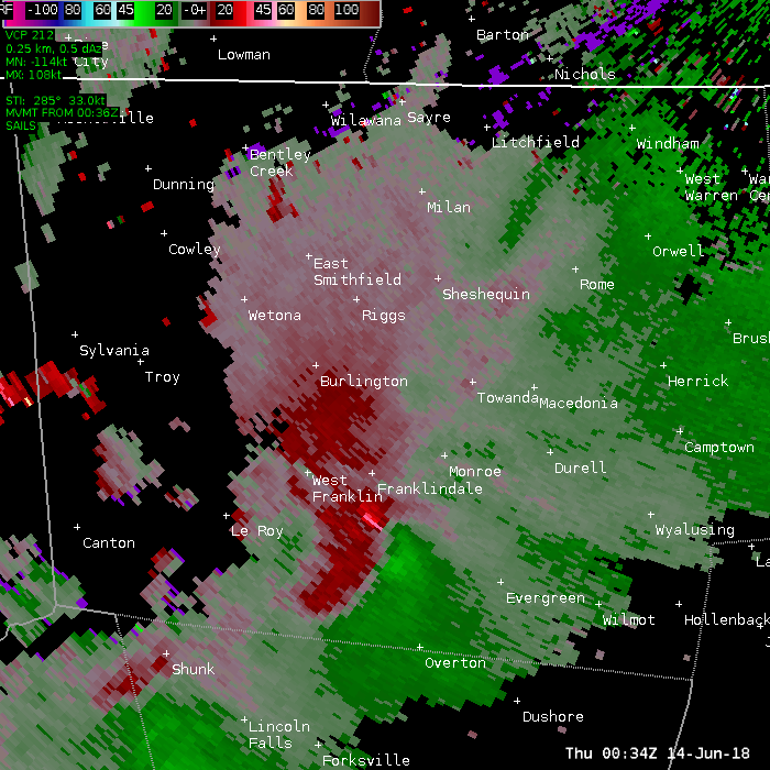
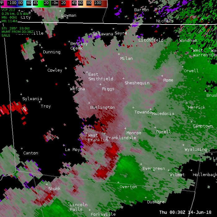
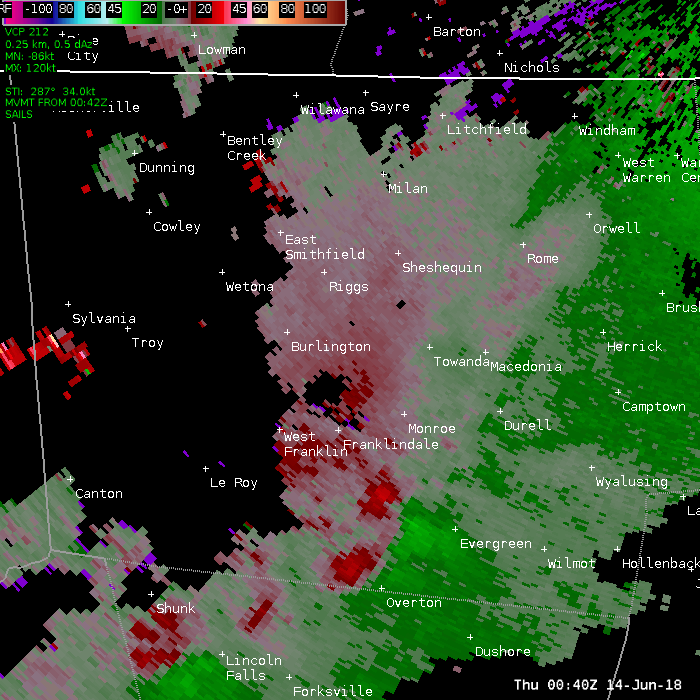
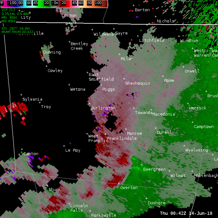
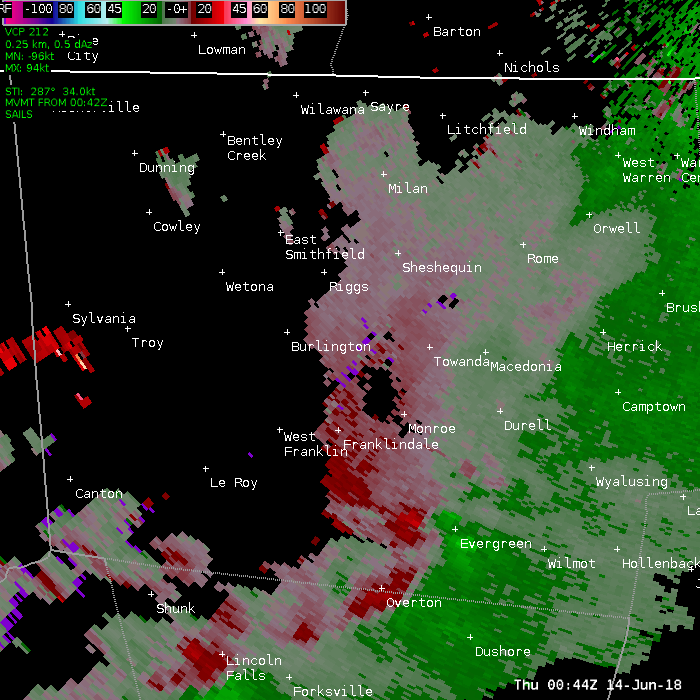
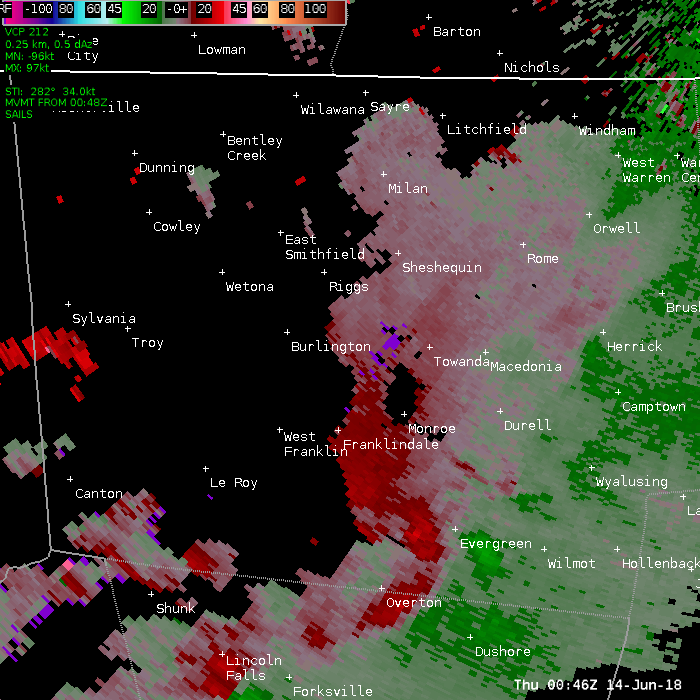
Bradford County Tornado
Summary
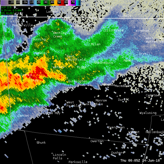
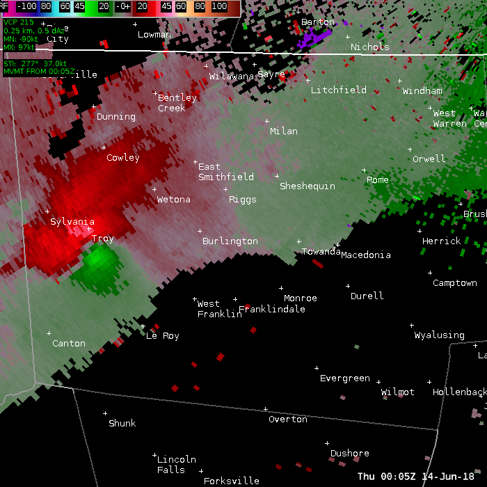
A tornado touched down in Granville TWP along Granville road and it heavily damaged a small machinery shop and an adjacent home. The tornado continued southeast into Leroy TWP and a hit another house leading to a considerable amount of roof damage along with a trailer being thrown 80 yds. The tornado continued southeast into West Franklin near the intersection of routes 414 and 514. Several additional homes and a church were damaged due to the tornado with one of the home being destroyed. Further southeast, the tornado moved a trailer into a house and destroyed a garage. The tornado then lifted in Franklin TWP leveling many trees along the path.
Some picture from the survey. Click for a larger view.
|
Home damage Franklin Township PA |
More damage to home Franklin Township PA |
Roof off Franklin Township PA |
|
Damage to home Southside Rd Franklin Township PA |
Trailer push into house. |
Board in wall. |
Below is a series of 0.5 degree base reflectivity images. Move your pointer over each times to see an image.
0005z 0012z 0018z 0024z 0030z 0032z 0034z 0036z 0038z 0040z 0042z 0044z 0046z
Below is a series of 0.5 degree Storm Relative Motion images. Move your pointer over each times to see an image.
0005z 0012z 0018z 0024z 0030z 0032z 0034z 0036z 0038z 0040z 0042z 0044z 0046z


