Strong to severe storms moved across parts of central New York and northeast Pennsylvania on June 22, 2025. The storms produced heavy rainfall at times causing flooding in some areas. The map below shows rainfall amounts from June 21st to June 23rd with most of the rainfall occurring on the 22nd.
Click on image below for a larger view.
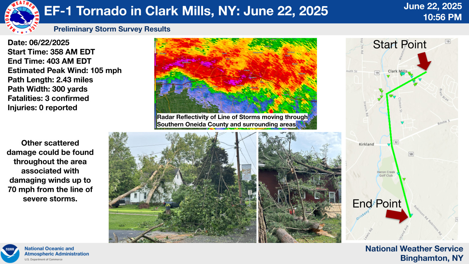
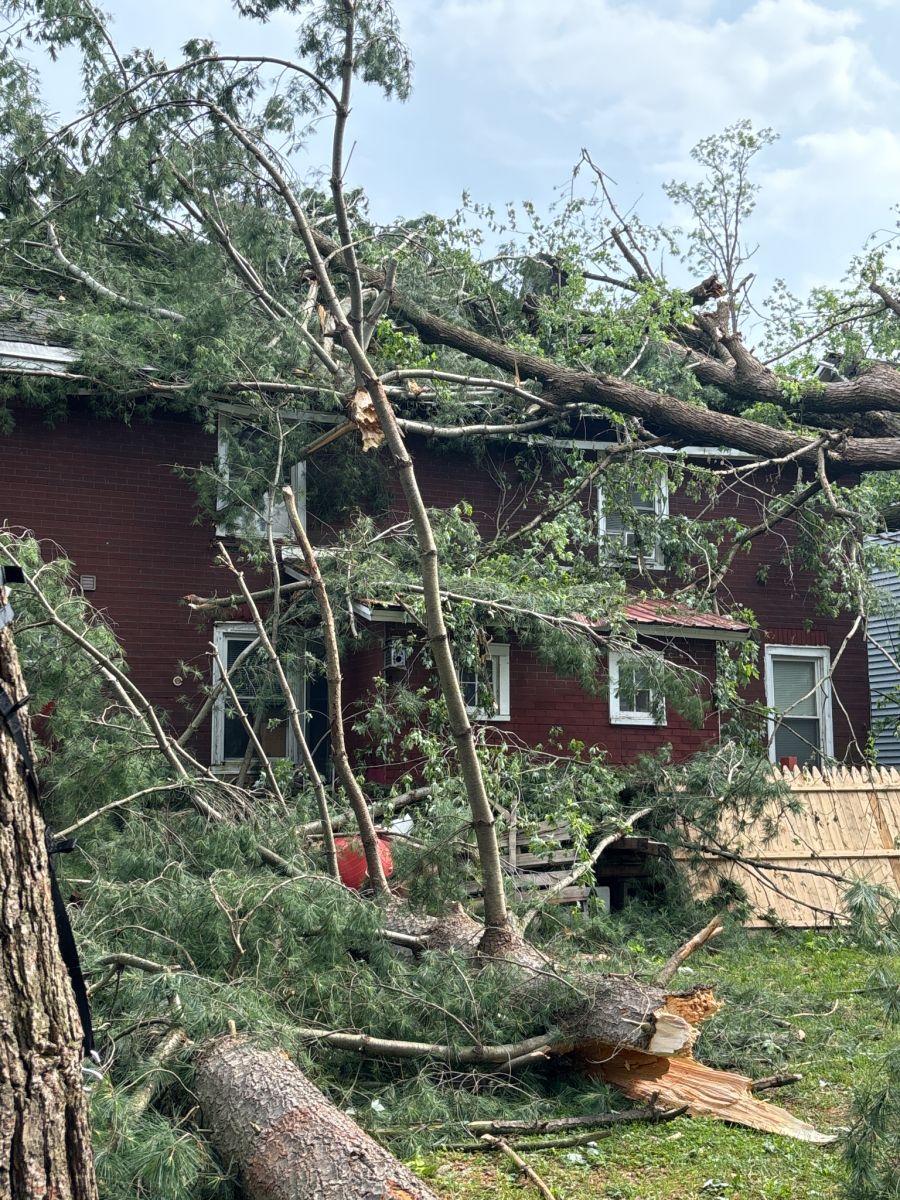
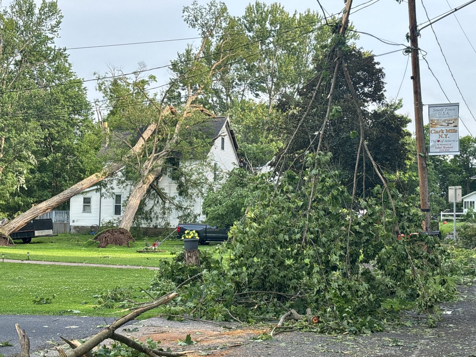
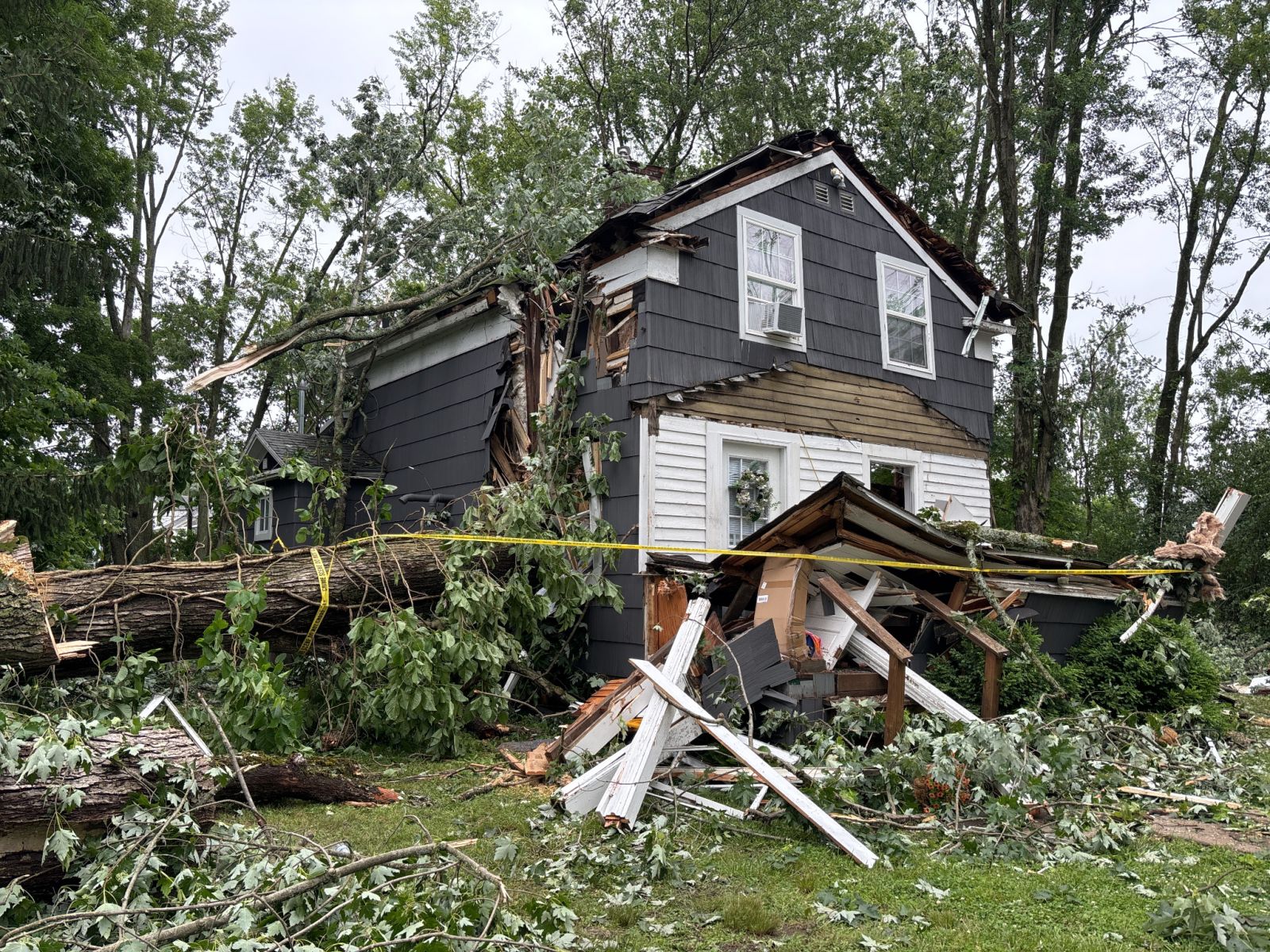
Public Information Statement
National Weather Service Binghamton NY
1003 PM EDT Sun Jun 22 2025


...NWS Damage Survey Results for Clark Mills Tornado...

Rating:                 EF1
Estimated Peak Wind:    105 mph
Path Length /statute/:  2.43 miles
Path Width /maximum/:   300 yards
Fatalities:             3
Injuries:               0

Start Date:             06/22/2025
Start Time:             03:58 AM EDT
Start Location:         1 NNE Clark Mills / Oneida County / NY
Start Lat/Lon:          43.0928 / -75.3669

End Date:               06/22/2025
End Time:               04:03 AM EDT
End Location:           1 N Clinton / Oneida County / NY
End Lat/Lon:            43.0629 / -75.3713

Survey Summary:
A deadly pre-dawn tornado spun up at a kink in a line of severe
thunderstorms, in Clark Mills of Oneida County NY.
Numerous trees were uprooted or snapped, with many of them on
structures. 3 homes were sliced or crushed by trees. 2 residents
were killed in one of the heavily-damaged homes, and a third
fatality occurred on the crushed end of another residence.
The tornado quickly became intense while traveling southwest
initially, and unfortunately destroyed a historic grist mill along
Oriskany Creek. The tornado then became absorbed into the
southward motion of the line of thunderstorms, traveling along
Kirkland Avenue before ending. While there was this focused
corridor of convergent enhanced EF1 tornado damage, other
scattered tree damage could be found throughout the area
associated with damaging winds up to 70 mph from the line of
severe storms.

The National Weather Service would like to thank impacted
residents for sharing their accounts, as well as Oneida County
Emergency Services, Town of Kirkland Department of Highways,
New York Office of Emergency Management, and Clark Mills
Volunteer Fire Department for their tremendous assistance
in conducting this storm survey.

&&

EF Scale: The Enhanced Fujita Scale classifies tornadoes into the
following categories:

EF0.....65 to 85 mph
EF1.....86 to 110 mph
EF2.....111 to 135 mph
EF3.....136 to 165 mph
EF4.....166 to 200 mph
EF5.....>200 mph

NOTE:
The information in this statement is preliminary and subject to
change pending final review of the event and publication in
NWS Storm Data.
Storm damage photos. Click on image for a larger view.
 |
 |
 |
Click on image below for a larger view.
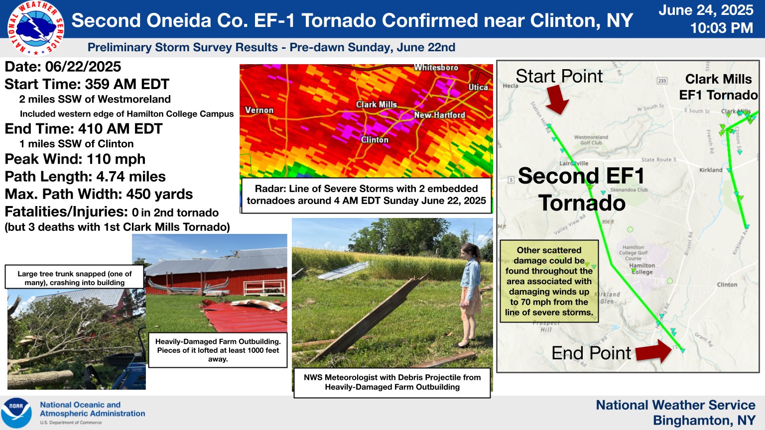
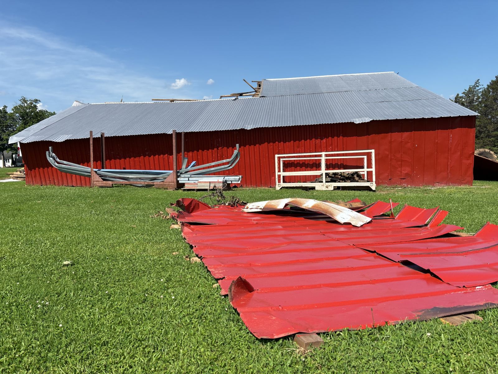
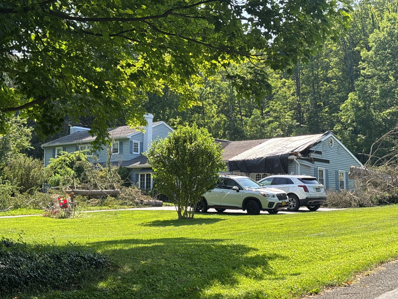
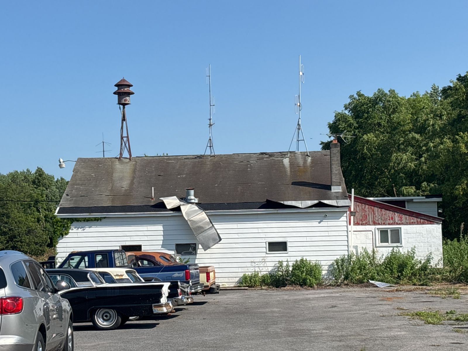
Public Information Statement
National Weather Service Binghamton NY
841 PM EDT Tue Jun 24 2025


...NWS Damage Survey for 06/22/2025 Second Confirmed Tornado...


Rating:                 EF1
Estimated Peak Wind:    110 mph
Path Length /statute/:  4.74 miles
Path Width /maximum/:   450 yards
Fatalities:             0
Injuries:               0

Start Date:             06/22/2025
Start Time:             03:59 AM EDT
Start Location:         2 SSW Westmoreland / Oneida County / NY
Start Lat/Lon:          43.0897 / -75.4404

End Date:               06/22/2025
End Time:               04:10 AM EDT
End Location:           1 SSW Clinton / Oneida County / NY
End Lat/Lon:            43.0316 / -75.3932

Survey Summary:
A pre-dawn line of severe thunderstorms dropped across Oneida
County. Rotation occurred in a kink in the line of storms,
generating an EF1 tornado from just south of Westmoreland,
through the western edge of the Hamilton College Campus, to near
Clinton in Oneida County NY. Numerous trees were uprooted or
snapped, and a farm sustained significant damage to its silo and
outbuildings. Debris from the farm was lofted at least 1000 feet
across the field, with some of it impaling the ground as debris
missiles. While there was this focused corridor of convergent
enhanced EF1 tornado damage, other scattered tree damage could be
found throughout the area associated with damaging winds up to
70 mph from the line of severe storms.

The National Weather Service would like to thank impacted residents
as well as a trained skywarn spotter for sharing their accounts of
this tornado. We also thank Oneida County Emergency Services,and the
Hamilton College Emergency Manager for their tremendous assistance
in completing this survey.

&&

EF Scale: The Enhanced Fujita Scale classifies tornadoes into the
following categories:

EF0.....65 to 85 mph
EF1.....86 to 110 mph
EF2.....111 to 135 mph
EF3.....136 to 165 mph
EF4.....166 to 200 mph
EF5.....>200 mph

NOTE:
The information in this statement is preliminary and subject to
change pending final review of the event and publication in
NWS Storm Data.
Storm damage photos. Click on image for a larger view.
 |
 |
 |
The radar loop is from the National Weather Service radar in Binghamton, NY. This is a loop of base reflectivity at 0.5 degree elevation. The loop was from 08:01 PM EDT June 21, 2025 (0001 UTC June 22, 2025) to 07:59 PM EDT June 22, 2025 ( 2359 UTC June 22, 2025).
Addition Information
EF Scale: The Enhanced Fujita Scale classifies tornadoes into the following categories:
Microburst: A convective downdraft with an affected outflow area of less than 2 1/2 miles wide and peak winds lasting less than 5 minutes. Microbursts may induce dangerous horizontal/vertical wind shears, which can adversely affect aircraft performance and cause property damage.
Graphical Displays
Past Data

