 Start Location...6 SE Tunkhannock in Wyoming County PA
Summary
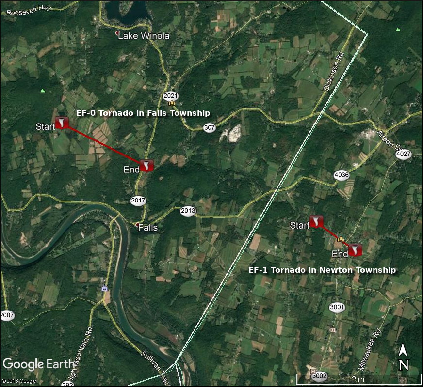
A convergent pattern, consistent with a tornado, was evident in a tall grass field where the tornado first appeared to touch down near Pine Hill Road in Falls Township. Several small hardwood trees were snapped on the other side of the road. The tornado continued to track southeast, snapping a utility pole on Post Hill Road and uprooting dozens of hardwood trees on Windy Hill Lane. Additional intermittent tree damage was observed in a narrow path that ended near Buttermilk Road (likely where the tornado lifted). A resident on Buttermilk Road, who was outside their house at the time of the tornado passed through, sustained a minor injury when hit by debris.
The damage when the tornado was at peak intensity was consistent with an EF-0 tornado with maximum sustained winds near 80 mph.
The National Weather Service in Binghamton would like to thank the Wyoming County Emergency Management for their assistance with this storm survey.
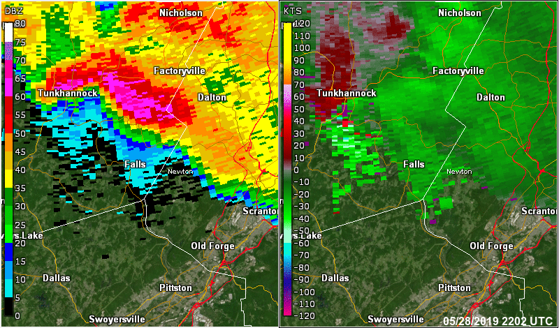
Radar loop below is from 6:02 PM EDT (2202 UTC) to 6:29 PM EDT (2229 UTC).
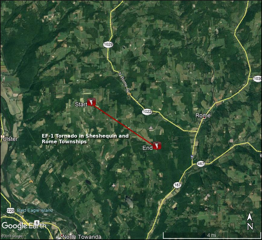
EF-1 Tornado in Sheshequin Township and Rome Township
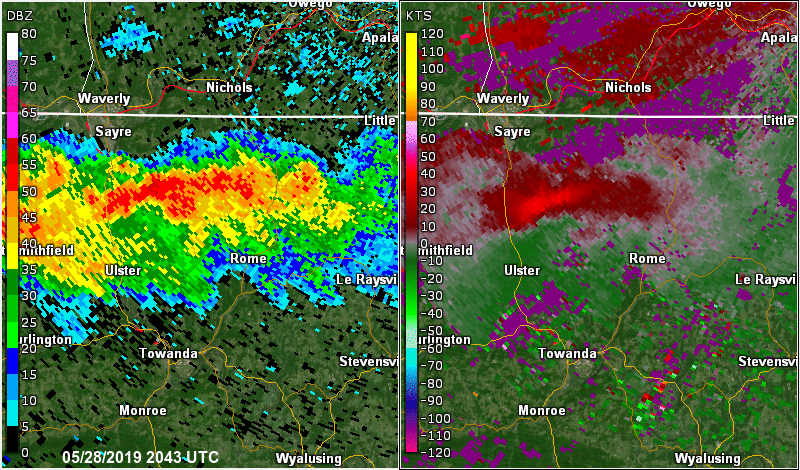
 Start Location...4 ENE Ulster in Bradford County Pennsylvania
Summary
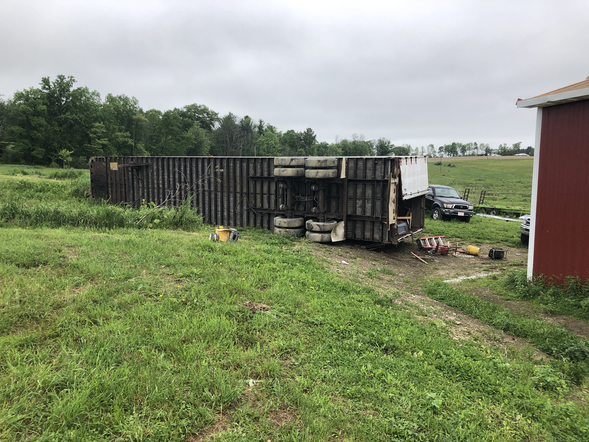
The tornado initially touched down just north of the intersection of Ghent Hill and Sackett roads, where a convergent pattern was noted in a tall grass field. This observation is consistent with a description provided by the property owner. A trailer was overturned and pulled several dozen feet into the inflow of the vortex as the tornado traveled southeastward. Roofing material from a barn was lofted over a house and into an area of trees located several dozen yards to the southeast of Ghent Hill Road. Wind speeds appeared to increase in this area as the width of damage decreased, with several hardwood trees snapped. This was consistent with wind speeds near 100 mph.
Intermittent damage was noted elsewhere along the damage path, with trees uprooted or overturned. Additional home damage was noted on Lake Road as the tornado moved from Sheshequin to Rome Township. Appearing to briefly strengthen once again, the tornado snapped numerous trees adjacent to a property off Maloney Road. Soffit damage and debris-splattered siding was also noted at the house on this property. The tornado lifted just west of Dry Run road at 5:47 PM.
The National Weather Service in Binghamton thanks Bradford County Emergency Management personnel with their assistance in conducting this survey.
Radar loop below is from 4:43 PM EDT (2043 UTC) to 5:03 PM EDT (2103 UTC).
Click for a larger view.
|
Trailer on its side. |
Roof damage. |
Home damaged. |
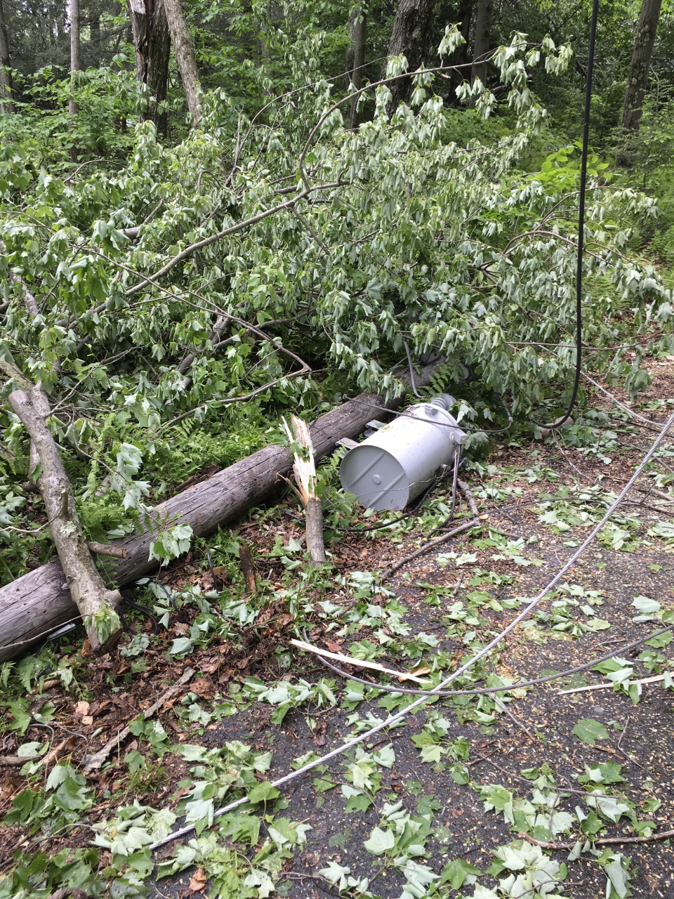
EF-1 Tornado in Newton Township
Start Location...5 SW Waverly in Lackawanna County PennsylvaniaSummary
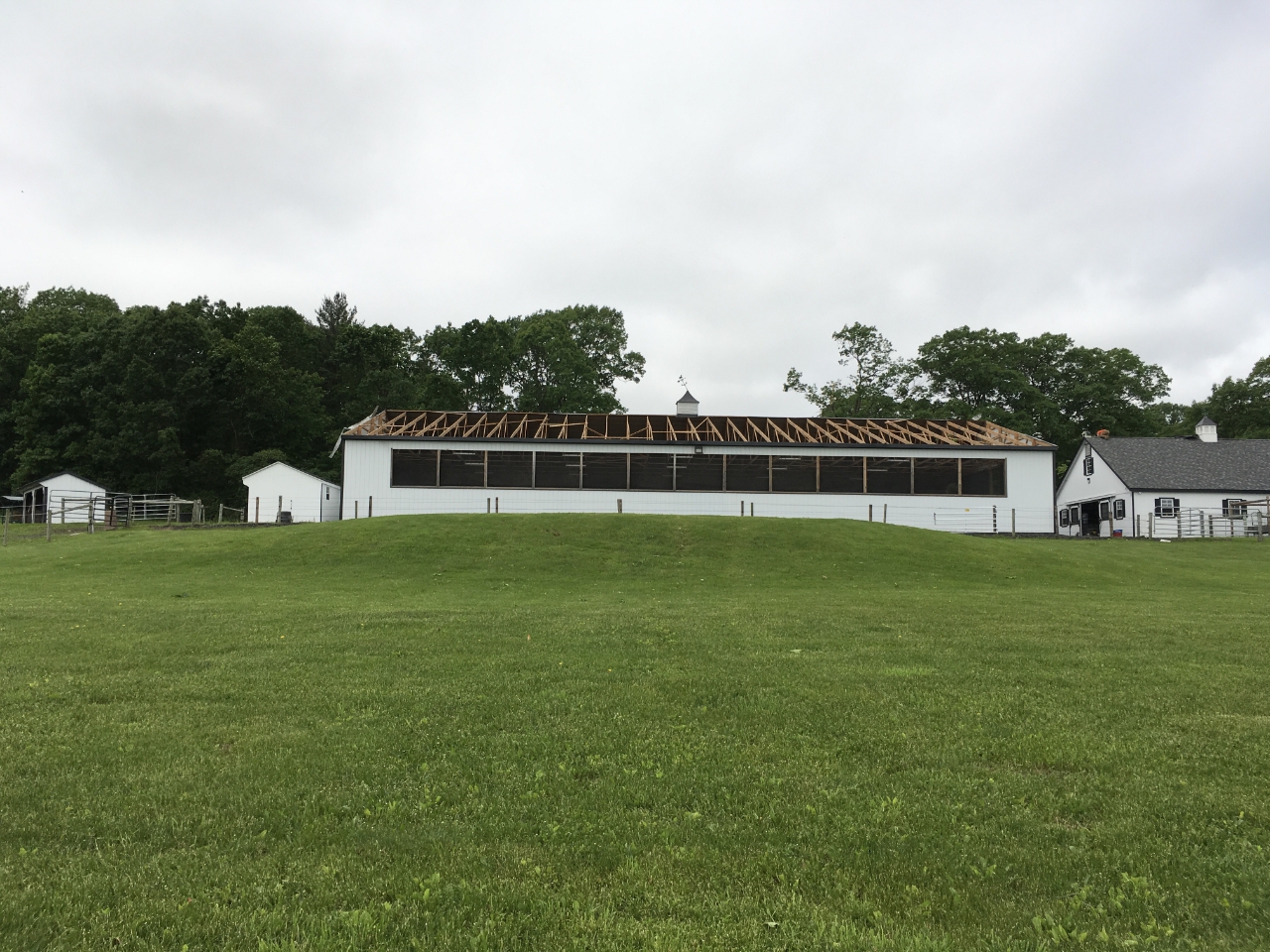
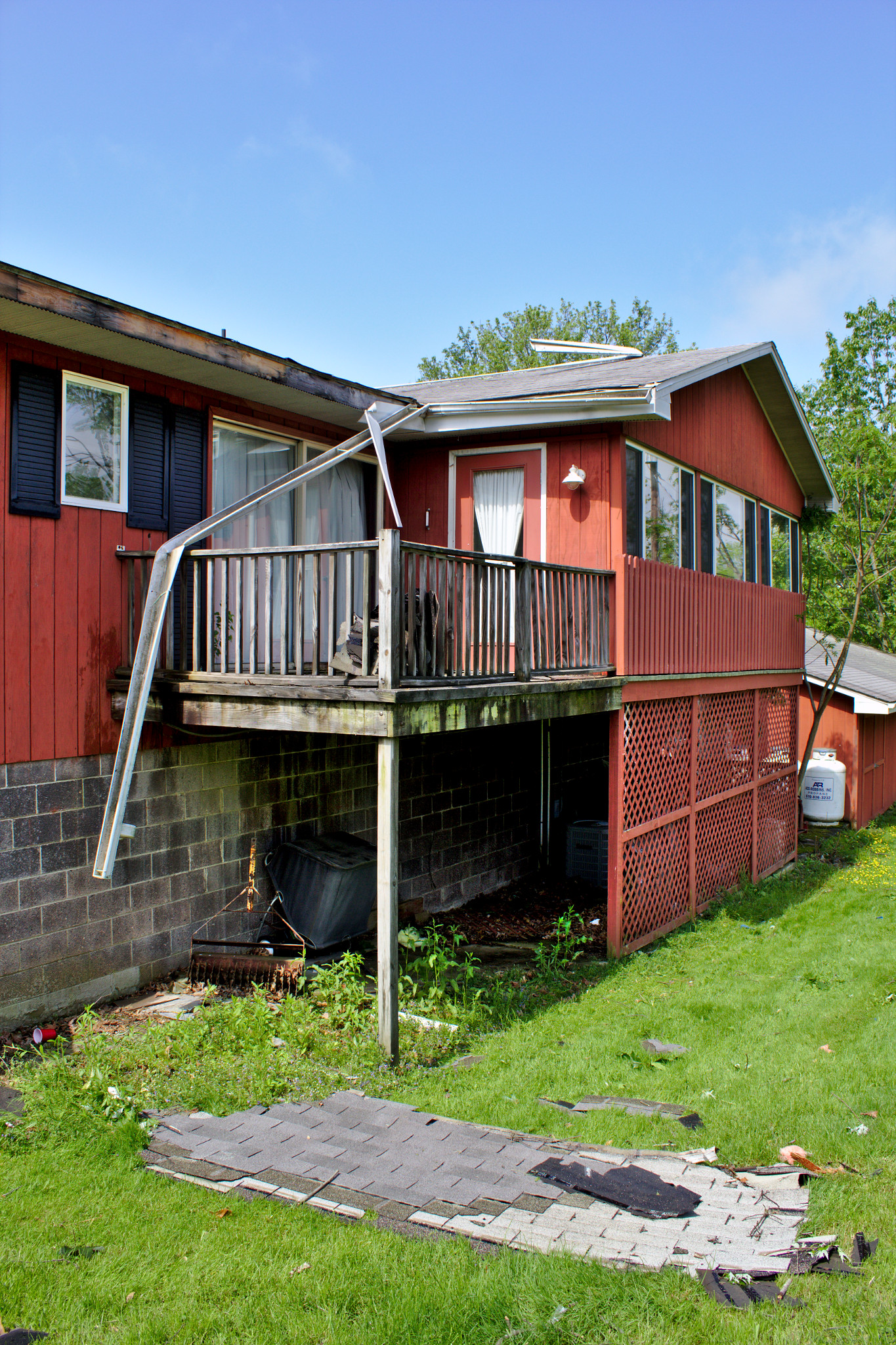
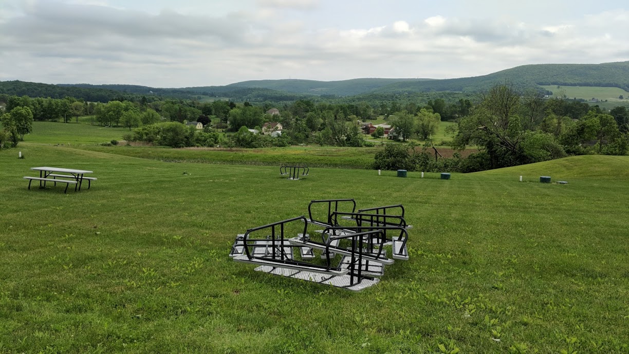
Around 6:18 PM, a tornado touched down just northwest of the Countryside Community Church in Newton Township, lifting the roof off of a nearby barn and damaging windows and siding at the church. The storm traveled southeast towards Newton Ransom Blvd, causing damage to several homes, snapping and uprooting trees. The storm continued to move southeast towards the Red Barn Village Bed and Breakfast, causing additional roof damage, uprooting trees, and overturning small structures including sheds.
The National Weather Service in Binghamton thanks Lackawanna County Emergency Management personnel with their assistance in conducting this survey.
Radar loop below is from 6:02 PM EDT (2202 UTC) to 6:29 PM EDT (2229 UTC).
Pictures from the survey. Click for a larger view.
|
Damage to barn. |
Damage to building. |
Damage to church. |
|
Roof impaled by board. |
Siding damaged. |
Tables thrown into field. |
|
Wide shot of damage facing northwest. The storm was moving towards the camera. |
||
Microburst Confirmed in Madison Township
Summary
Wind damage started near Jubilee Rd near Lake Kahagon in Madison Township. Many trees and power lines were downed. Several homes were damaged due to fallen trees.
The National Weather Service in Binghamton thanks Lackawanna County Emergency Management personnel with their assistance in conducting this survey.
Click for a larger view.
|
Wind damage in Lake Kahagon, PA area. |
Roof damaged by fallen tree in Lake Kahagon, PA area. |
Trees down on northwest side of Lake Kahagon, PA. |
Microburst Confirmed in Rome and Wysox Townships
Summary
A microburst began near Dry Run Road, just south of where the Bradford County tornado lifted. Trees, mostly hardwood, were intermittently snapped and uprooted along the 1.5 mile path. Minor shingle damage was noted to the roof of a home on Dry Run Road. In addition, an unsecured carport was overturned and blown east-southeastward on the property. The last tree damage associated with this straight-line wind event was observed on the east side of PA-187, in far northern Wysox Township.
The National Weather Service in Binghamton thanks Bradford County Emergency Management personnel with their assistance in conducting this survey.
For reference:
EF Scale: The Enhanced Fujita Scale classifies tornadoes into the following categories:
| EF0 | Weak | 65 to 85 mph |
| EF1 | Weak | 86 to 110 mph |
| EF2 | Strong | 111 to 135 mph |
| EF3 | Strong | 136 to 165 mph |
| EF4 | Violent | 166 to 200 mph |
| EF5 | Violent | >200 mph |
A microburst is a convective downdraft with an affected outflow area of less than 2 1/2 miles wide and peak winds lasting less than 5 minutes. Microbursts may induce dangerous horizontal/vertical wind shears, which can adversely affect aircraft performance and cause property damage. Straight-line winds are generally any wind that is not associated with rotation, used mainly to differentiate them from tornadic winds.
Additional Information:
Radar Links: