Tornado Confirmed near North Chemung County New York
Summary
The National Weather Service in Binghamton, NY has confirmed a tornado near North Chemung in Chemung County New York on September 2, 2014.
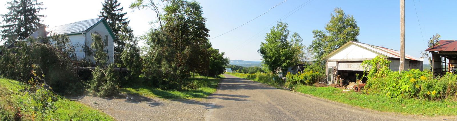
A tornado touched down just east of Elston Hollow Road at 7:10 PM EDT September 2nd and tracked east northeast knocking down numerous trees along its path. There were many hard and soft woods snapped and uprooted as the tornado tracked across Breesport-North Chemung Road to Federal Road. It was on Rederal Road where the most intense damage was seen in the EF-1 category. Maximum winds here were estimated at about 100 mph. One barn was completely collapsed and one had its roof blown off. A pickup truck was lifted and dropped 6 to 12 feet. The truck was attached to a trailer which was dragged up to 12 feet. There was also damage to several homes along the path with all the damage being confined to the roofs or siding. After Federal Road the tornado continued east northeast and downed many trees before lifting on Barnes Hill Road in the far southwest part of the town of Van Etten. The tornado was on the ground for about 5 to 10 minutes.
Click on the image below for a larger view.
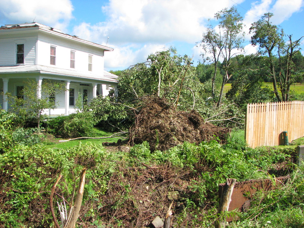
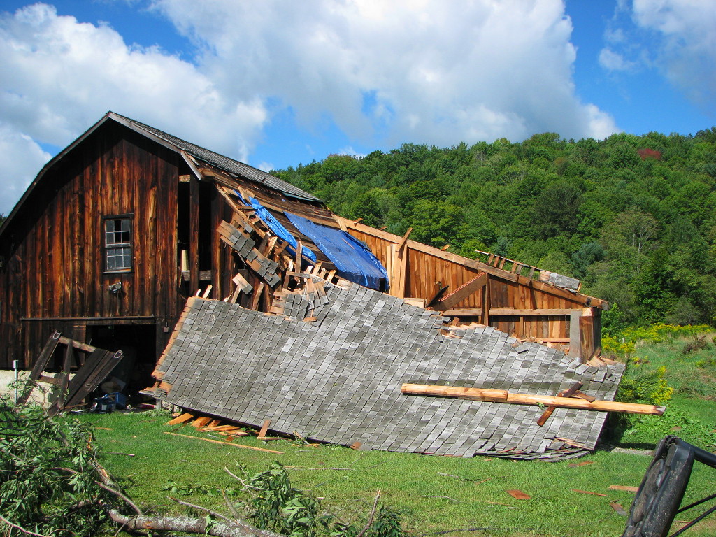
Damage images:
Click for a larger view.
|
House and tree damage. |
Barn damaged. |
Roof and siding damage. |
Tornado confirmed near Afton in Chenango County New York
Summary
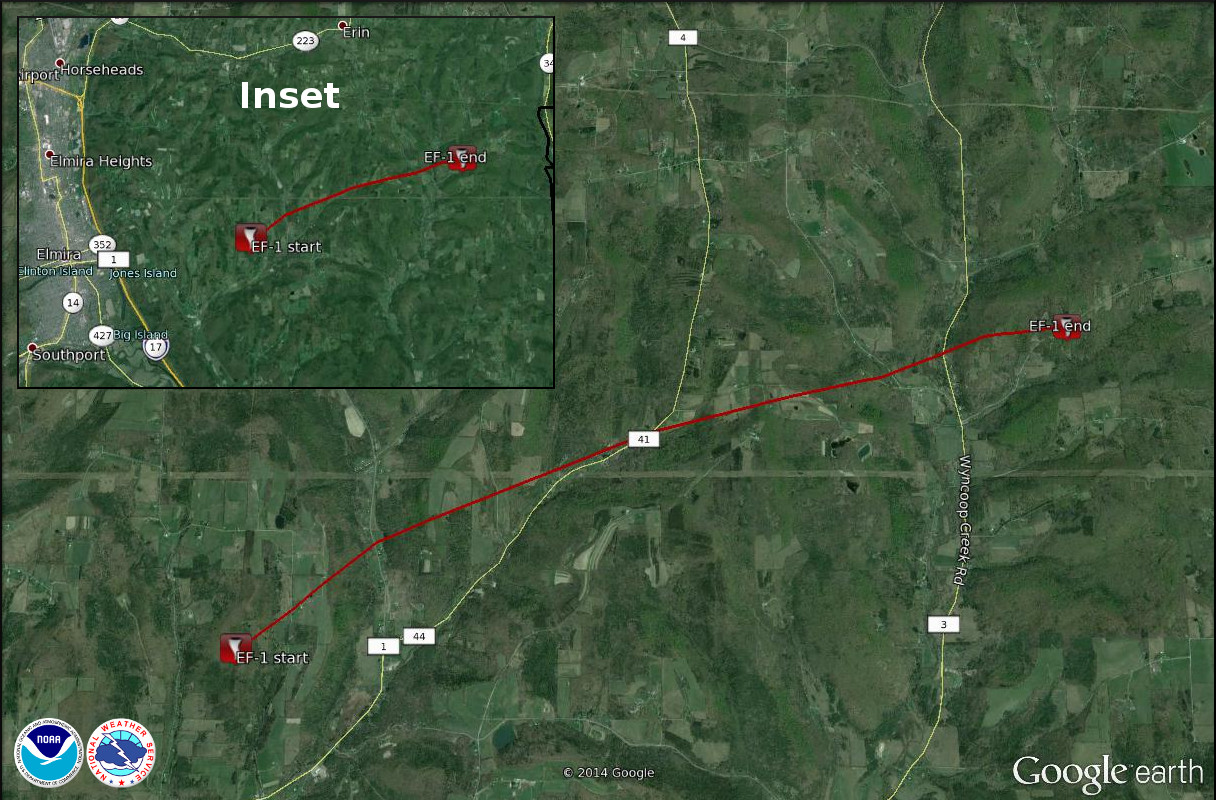
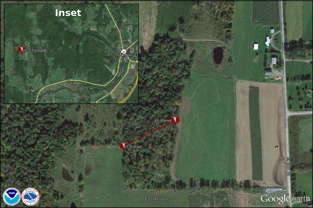
The National Weather Service in Binghamton, NY has confirmed a tornado near Afton in Chenango County New York on 9/2/2014.
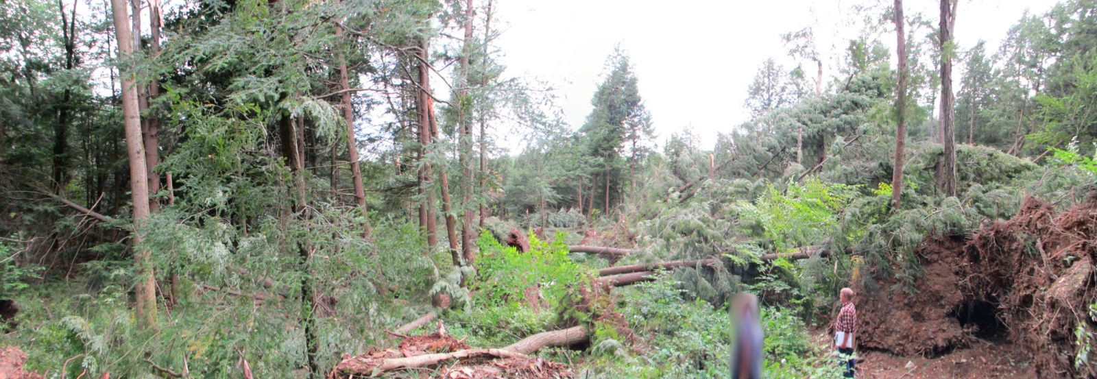
A National Weather Service Storm Survey Team has surveyed damage associated with an EF-1 tornado in southwest Chenango County approximately 5 miles west of Afton New York. Maximum wind speeds with the tornado were estimated at 100 mph. The tornado touched down at 8:32 PM EDT on September 2nd about 300 yards west of Saint Johns Road near the intersection with Hill Top Drive. The tornado was only on the ground for about 150 yards and the width of the tornado was approximately 50 yards. Numerous snapped and uprooted trees were found in the path of the storm with a convergent pattern of damage.
Trees downed by brief tornado in the Afton, NY area. Click for a larger view.
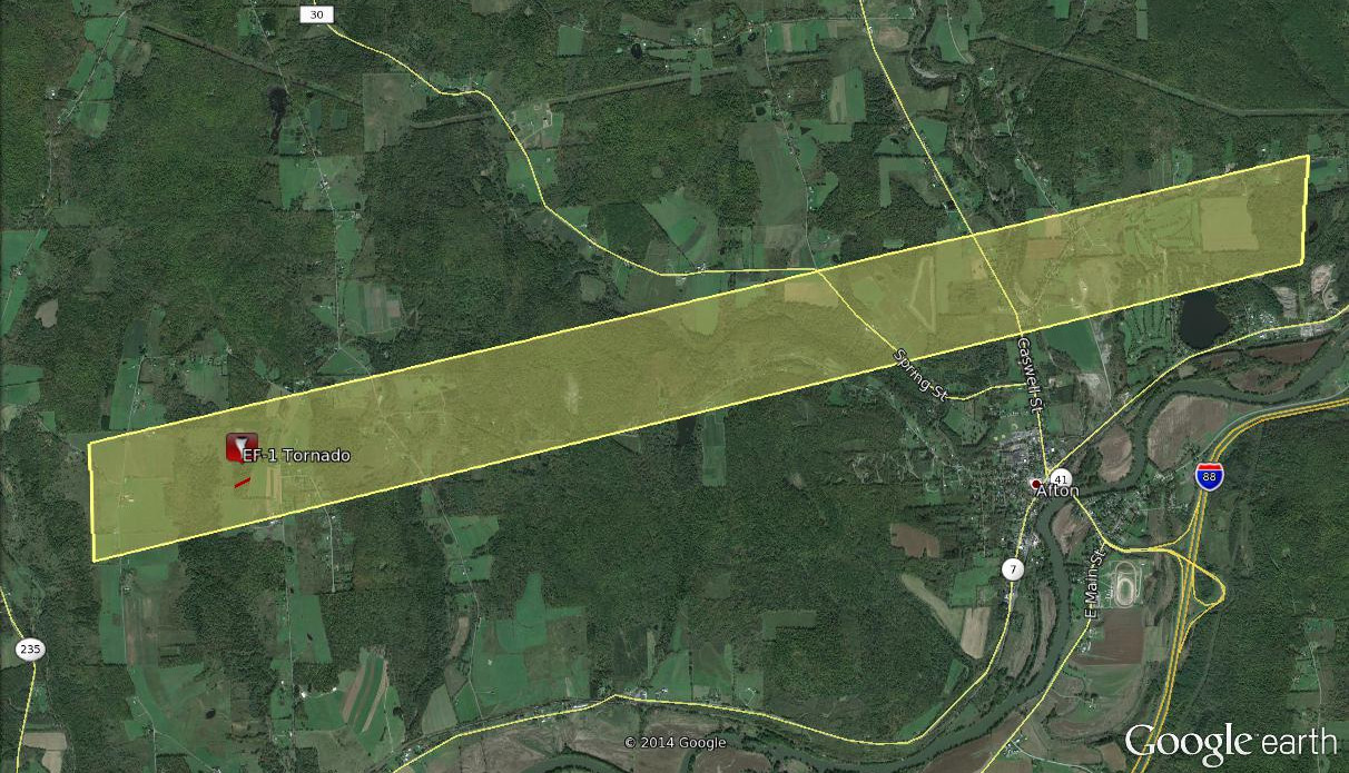
Microburst/Straight line wind damage confirmed near Afton in Chenango County New York
Summary
The National Weather Service in Binghamton, NY has confirmed a straight line wind damage near Afton in Chenango County New York on 09/02/2014.
A National Weather Service Storm Survey Team has completed a survey of damage from a series of microbursts that moved across southern Chenango County between 8:30 PM and 8:45 PM EDT on September 2nd. Maximum wind speeds were estimated at 90 mph. Damage to trees was first noted a few hundred yards west of Oak Hill Road approximately 6 miles west of Afton, NY. Strong winds struck a home on Oak Hill Road, overturning two large farm hay wagons, uprooting two large trees, and peeling part of a roof off of a barn. Additional damage to trees was noted along Saint John Road which included tornado tornado damage just to the west of the road. Sporadic tree damage was noted farther east along Hall Road. East of route 41 damage to many trees occurred at the Afton Golf Course just northeast of Afton, NY.
The image below shows the approximate area of wind damage. Wind damage was spotty and may have occurred near or outside of the area shown. In addition the EF-1 tornado is included. Click on the image for a larger view.
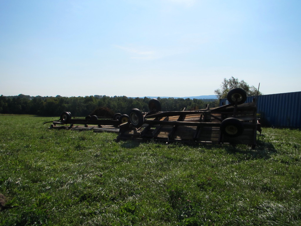
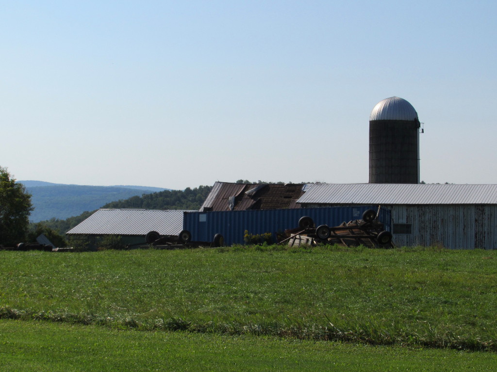
Click on images below for a larger view.
|
Hay wagons over turned. |
Barn roof peeled off. |
Trees down and structure damage. |
For reference:
A microburst is a convective downdraft with an affected outflow area of less than 2 1/2 miles wide and peak winds lasting less than 5 minutes. Microbursts may induce dangerous horizontal/vertical wind shears, which can adversely affect aircraft performance and cause property damage. Straight-line winds are generally any wind that is not associated with rotation, used mainly to differentiate them from tornadic winds.
Storm survey in town of Chenango confirms straight line winds
A National Weather Service meteorologist visited a section of the Town of Chenango between Upper Front Street and Chenango Bridge Road (Route 12a). The neighborhood is intersected by Jacobs Highway, Bishop, Carmichael and Merrill Roads.
Damage was confined mainly to trees, and structures struck by large fallen limbs. The damage is consistent with locally enhanced straight-line winds. Winds were estimated to be approximately 50 to 60 mph. Most trees and branches were snapped off at the mid to high trunk level, but there was no evidence of rotation. It was noted that several of the tree groves in the area were aging mixed hardwoods and softwoods with canopy heights in excess of 60 feet above the ground. It was likely that the damage was a result of enhanced wind accelerations sinking into the Chenango River Valley from the higher terrain just to the south (Smith Hill), causing a whipping and snapping effect to some of the taller trees.
The damage occurred on September 2, 2014 at approximately 8 pm.
For reference:
A microburst is a convective downdraft with an affected outflow area of less than 2 1/2 miles wide and peak winds lasting less than 5 minutes. Microbursts may induce dangerous horizontal/vertical wind shears, which can adversely affect aircraft performance and cause property damage. Straight-line winds are generally any wind that is not associated with rotation, used mainly to differentiate them from tornadic winds.
Additional Information: