National Weather Service United States Department of Commerce


Tornadoes of March 30, 2022

Overview
 

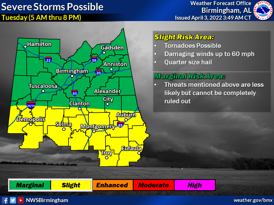
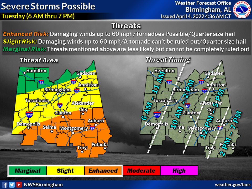
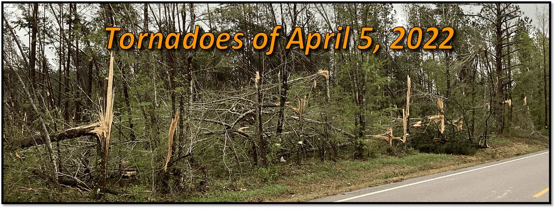
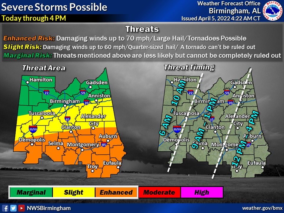
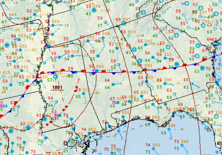
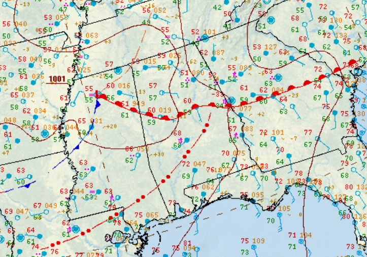
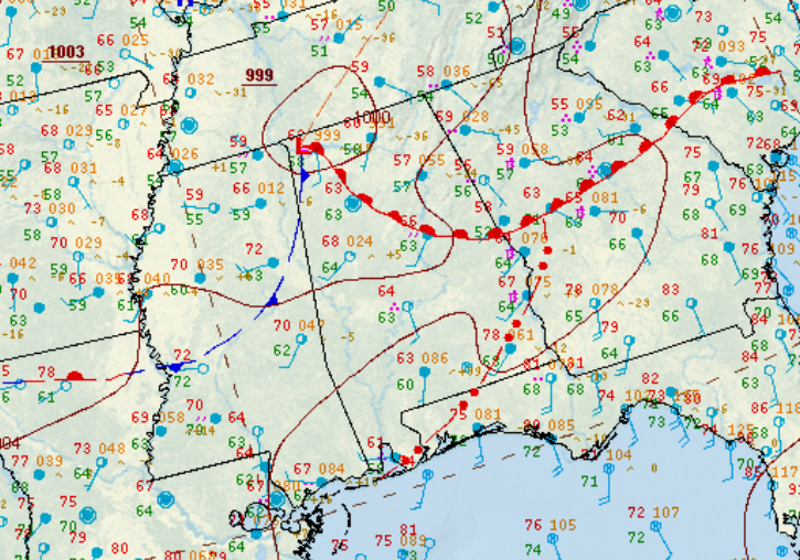
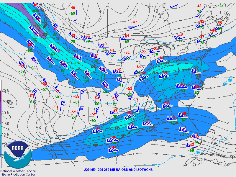
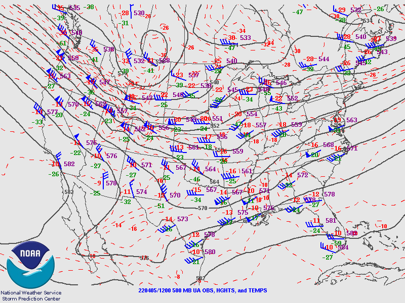
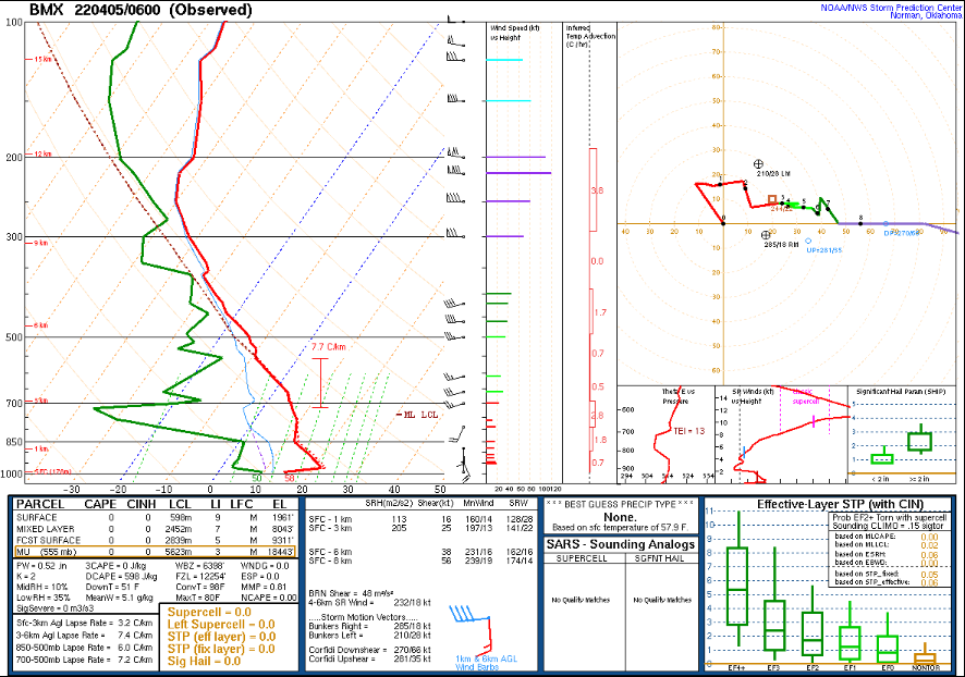
An upper-level disturbance moved across the Deep South in the early morning hours of April 5, 2022. This fostered the development of a surface low which moved across Central Mississippi into Central Alabama. A broad area of strong to severe thunderstorms impacted the region as a result of an increasingly unstable air mass and favorable wind shear. Thunderstorms in the morning initially posed a threat of large hail and damaging winds. Hail up to baseball size was reported from one such storm in Marengo County. Later in the morning, storms became more surface-based and a tornado threat resulted, mainly impacting the southern and southeastern portions of Central Alabama.

 
Interactive Tornado Map


Surveys
 

**The data below are considered PRELIMINARY.**

 
Location/Clickable Detailed Summary Link
Damage Rating/Estimated Maximum Wind Speeds
Injuries/Fatalities
Damage Path Length/Width
Starting Point/Time
Ending Point/Time
Wildwood Lane Tornado
(Elmore County)
EF-2
134 mph
None 4.36 miles
900 yards
1 SSE Wetumpka
32.5183/-86.2036
10:54 am CDT
4 E Wetumpka
32.5399/-86.1344
11:00 am CDT
Little Patsaliga Creek Tornado
(Pike/Montgomery Counties)
EF-2
120 mph

 
None 12.67 miles
1100 yards
1 NW Ansley
31.8960/-86.1267
11:03 am CDT
3 ESE Pine Level
32.0474/-86.0047
11:19 am CDT
Burlington Tornado
(Elmore County)
 
EF-0
85 mph
None 5.31 miles
300 yards
3 E Claud
32.5728/-86.0225
11:06 am CDT
4 WNW Yates Dam
32.6103/-85.9444
11:13 am CDT
Chewacla Creek Tornado
(Macon County)
 
EF-1
90 mph
None 4.25 miles
250 yards
1 NNW Franklin
32.4656/-85.8051
11:19 am CDT
4 WNW Uphapee Creek
32.5099/-85.7551
11:24 am CDT
Buck Creek Tornado
(Tallapoosa County)
EF-0
80 mph

 
None 1.75 miles
110 yards
3 NW Reeltown
32.6498/-85.8352
11:22 am CDT
4 NNW Reeltown
32.6678/-85.8144
11:25 am CDT
Old US Hwy 231 Tornado
(Pike/Montgomery Counties)
EF-1
100 mph
None 7.62 miles
550 yards
2 NW Orion
31.9833/-86.0358
11:34 am CDT
3 ESE China Grove
32.0056/-85.9095
11:45 am CDT
Blackman Tornado
(Chambers County)
EF-0
80 mph
None 0.44 miles
200 yards
2 ESE Ridge Grove
32.8765/-85.5300
11:45 am CDT
2 E Ridge Grove
32.8803-85.5240
11:46 am CDT
Mascot Road Tornado
(Bullock County)
EF-1
95 mph
None 1.58 miles
600 yards
2 N Beans Crossroads
32.0402/-85.8342
11:50 am CDT
3 NNE Beans Crossroads
32.0445/-85.8079
11:52 am CDT
Chewalla Creek Tornado
(Barbour County)
EF-1
95 mph
None 1.54 miles
200 yards
2 NNW Eufaula
31.9176/-85.1598
12:38 pm CDT
3 NNE Eufaula
31.9275/-85.1364
12:40 pm CDT
 
Outlooks & Reports
 

Day 3 Outlook
Local Day 3 Outlook
April 3 at 350 am

Day 2 Outlook
Local Day 2 Outlook
April 4 at 440 am

Day 1 Outlook
Local Day 1 Outlook
April 5 at 425 am

Surface Charts
 

Surface Chart
Surface Analysis
April 5 at 10 am

Surface Chart
Surface Analysis
April 5 at 1 pm

Surface Chart
Surface Analysis
April 5 at 4 pm

Upper Air Charts
 

250 mb
250 mb Analysis
April 5 at 7 am

500 mb
500 mb Analysis
April 5 at 7 am

850 mb
850 mb Analysis
April 5 at 7 am

250 mb
250 mb Analysis
April 5 at 7 pm

500 mb
500 mb Analysis
April 5 at 7 pm

850 mb
850 mb Analysis
April 5 at 7 pm

KBMX Sounding
KBMX Sounding
April 5 at 1 am

KBMX Sounding
KBMX Sounding
April 5 at 1 pm