Tropical system in the Gulf expected to gradually strengthen the next couple of days off the Florida Panhandle and Alabama coasts. Instances of flash flooding will be possible through Thursday along the eastern and central Gulf Coast. Severe thunderstorms will develop and move along a cold front crossing the Upper Midwest, and through the Ohio Valley/Mid-Atlantic on Tuesday. Read More >
May 5, 2017 Non-Tornadic Example
By Aviva Braun
Collaborators: Josh Smith, Bill Wojcik, Les Colin and Dave Groenert
Prior to the May 5th event, we knew that there would be thunderstorms and that the instability would be heightened as an upper level closed low dipped south of the CWA and wrap-around moisture poured into the region from the south.
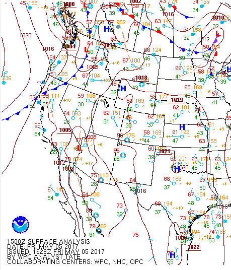
The 15Z surface analysis showed an approaching front associated with the incoming low:
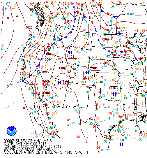
By 00Z May 6, we had a strong southerly wind and temperatures had increased as the front pushed into Idaho:
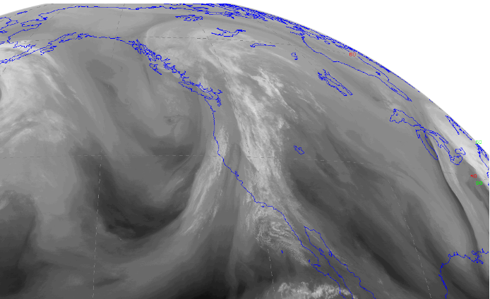
Here is a water vapor image from noon MDT May 5th:
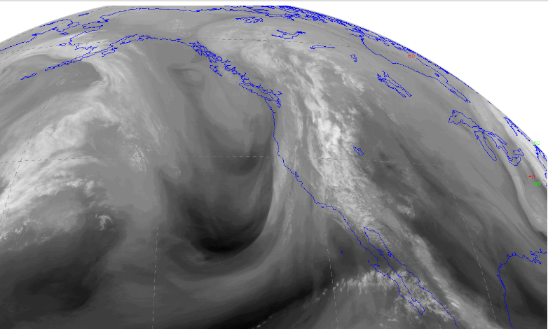
And again from 6 pm MDT May 5th:
During the first portion of the day, showers began, but nothing really seemed to develop into strong systems, as the Boise shield seemed to be in play. This changed right around 22Z as the first severe system moved into the region from Nevada and passed over Owyhee County. While other case-study-worthy systems developed that evening over Malheur County, particularly over the northern part of the county, the focus of this study will be on the Owyhee storm.
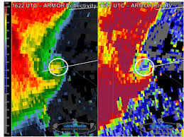
The reason for focusing on the Owyhee storm is that we saw something we don’t see often in our CWA: SRM data that looked tornadic at first glance. However, once taking a closer look, it become obvious that it was indeed not a tornado. Let’s take a look.
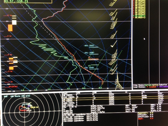
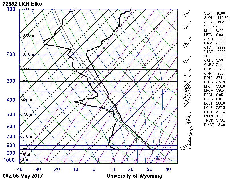
There is no doubt that there was instability to tap into that afternoon. With not much of a cap present in the morning sounding, the convective temperature expected to be 89F, and forecast temperatures to reach into the 80s, the atmosphere was ripe for severe thunderstorms.
The morning sounding already had a decent amount of shear, with 20-40 kts of bulk shear:
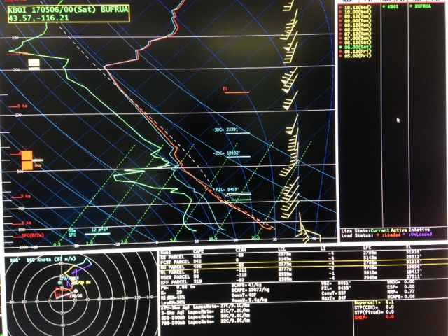
The afternoon sounding had CAPE values around 400 J/kg and LI values around -4C:
As the storm in question developed in Elko’s area, Elko’s afternoon sounding has been provided as well. This sounding was more unstable than the Boise sounding, indicating that the atmosphere was highly favorable for severe thunderstorm development in northeastern Nevada.
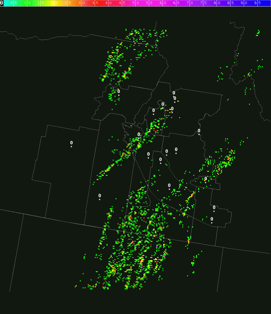
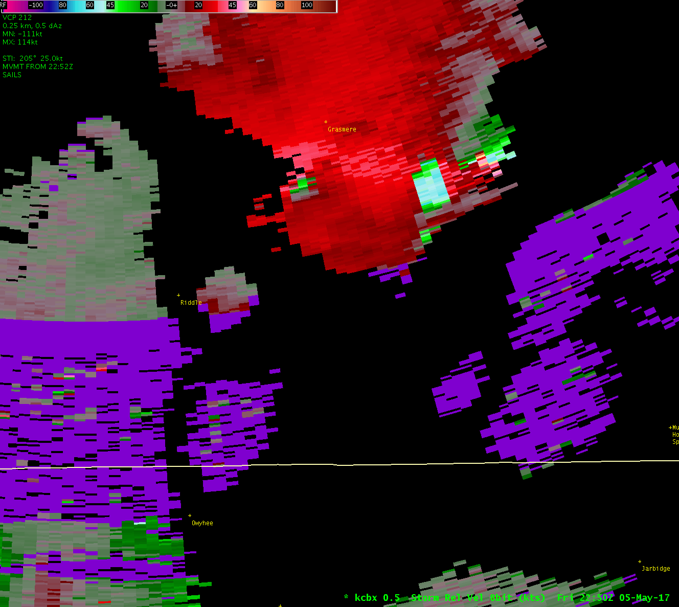
There were many thunderstorms that afternoon:
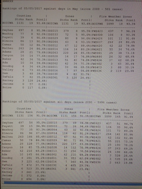
Looking at how that afternoon ranked in terms of days in May and all days in general, Owyhee County’s lightning rank was around 95%:
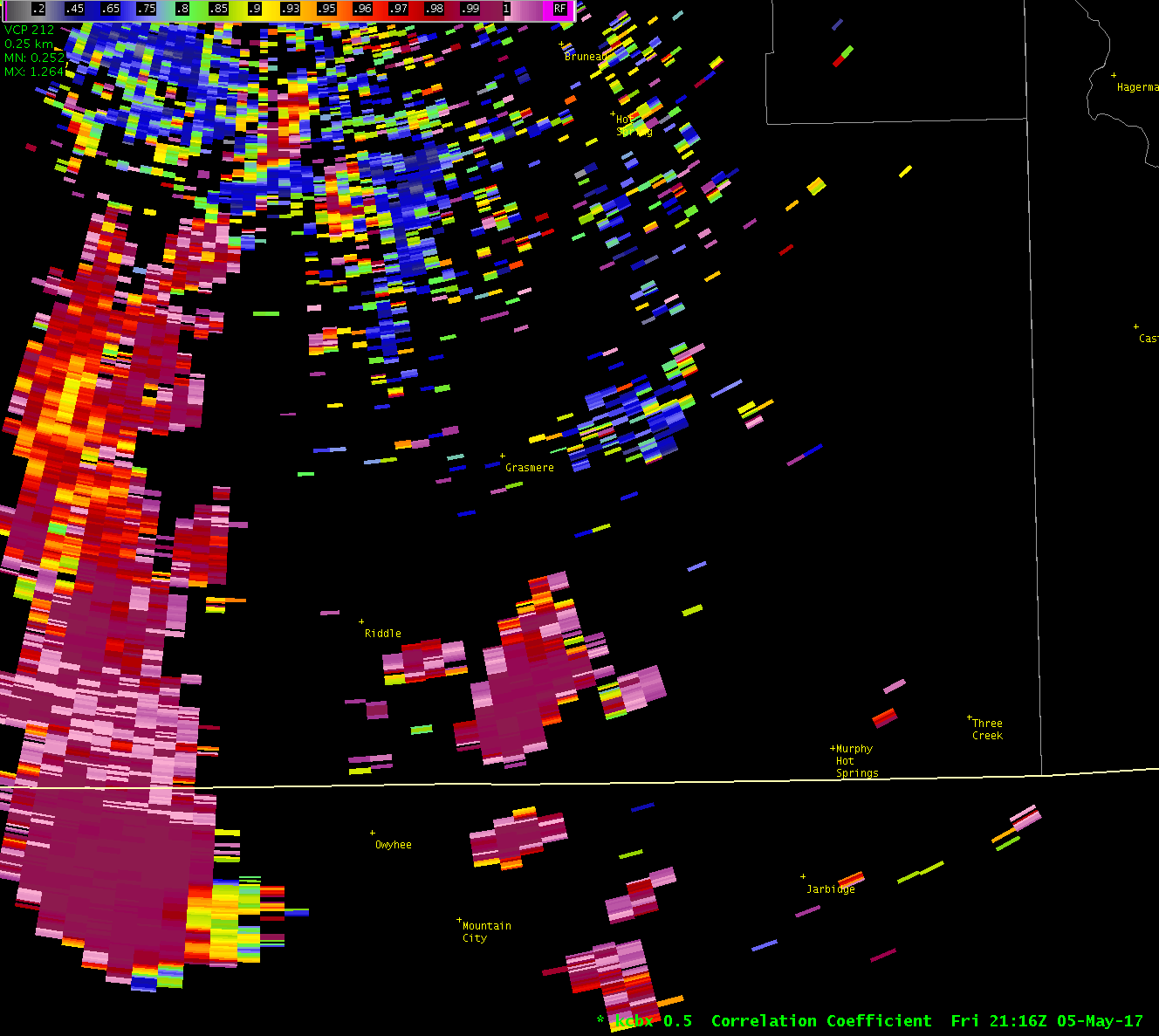
At 21.30Z, a large thunderstorm passed north out of Nevada and into Owyhee County. Within 15 minutes, and after seeing a 3-body scatter spike, a severe thunderstorm warning was issued for 1-inch hail. With time, reflectivities of 50 dBz above elevations indicated in Josh’s severe hail study, and MRMS data, suggested hail up to 1.25 inches in diameter. This detail was warned on within the two and a half hours that we followed this storm, before it dissipated. Please note that the 0.5 degree cut was at about 5500 ft AGL.
Lets now look at the 0.5 degree Z field:
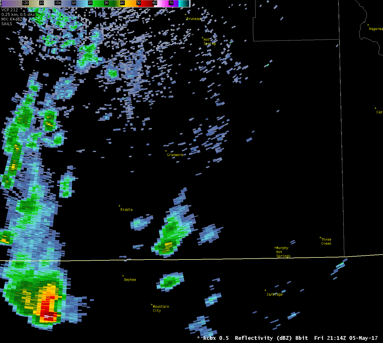
Notice the 3-body scatter-spike throughout the system’s lifecycle. This system was a right-mover relative to the general flow, which was from the south. Those systems moving out of the south tended to weaken as they moved north, but also, in interacting with the thunderstorm in question, weakened it before it had the opportunity to cross east out of Owyhee County.
The 3-body scatter-spike can be more clearly seen on CC imagery:
Let’s move on to the SRM data. At 0.5 degrees:
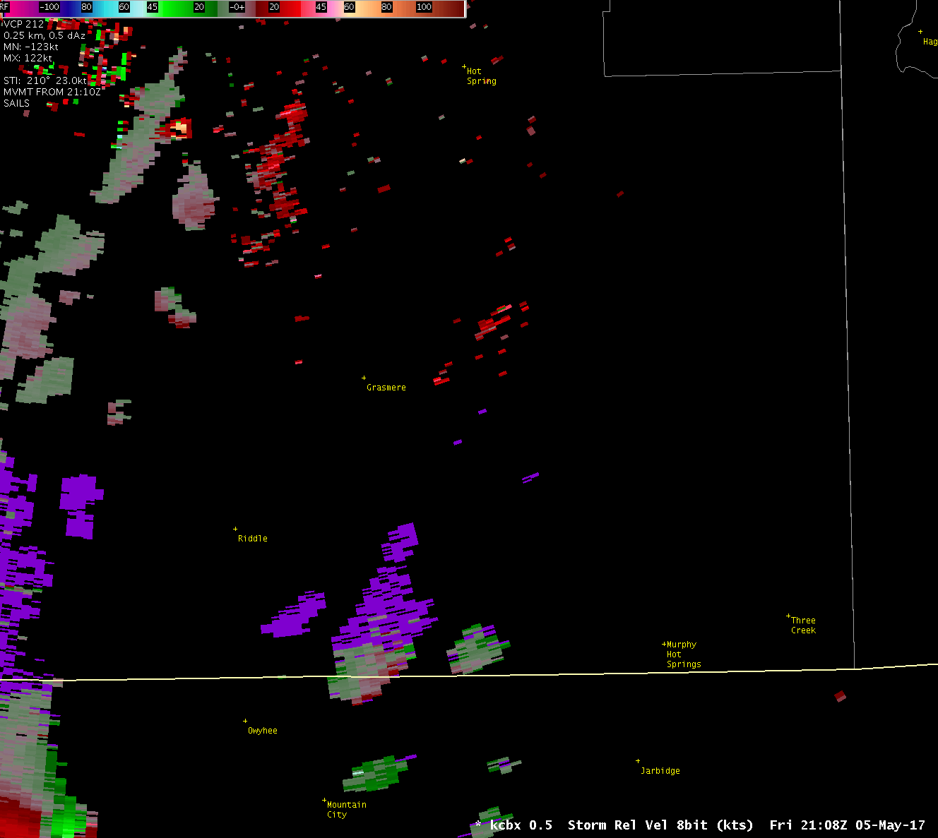
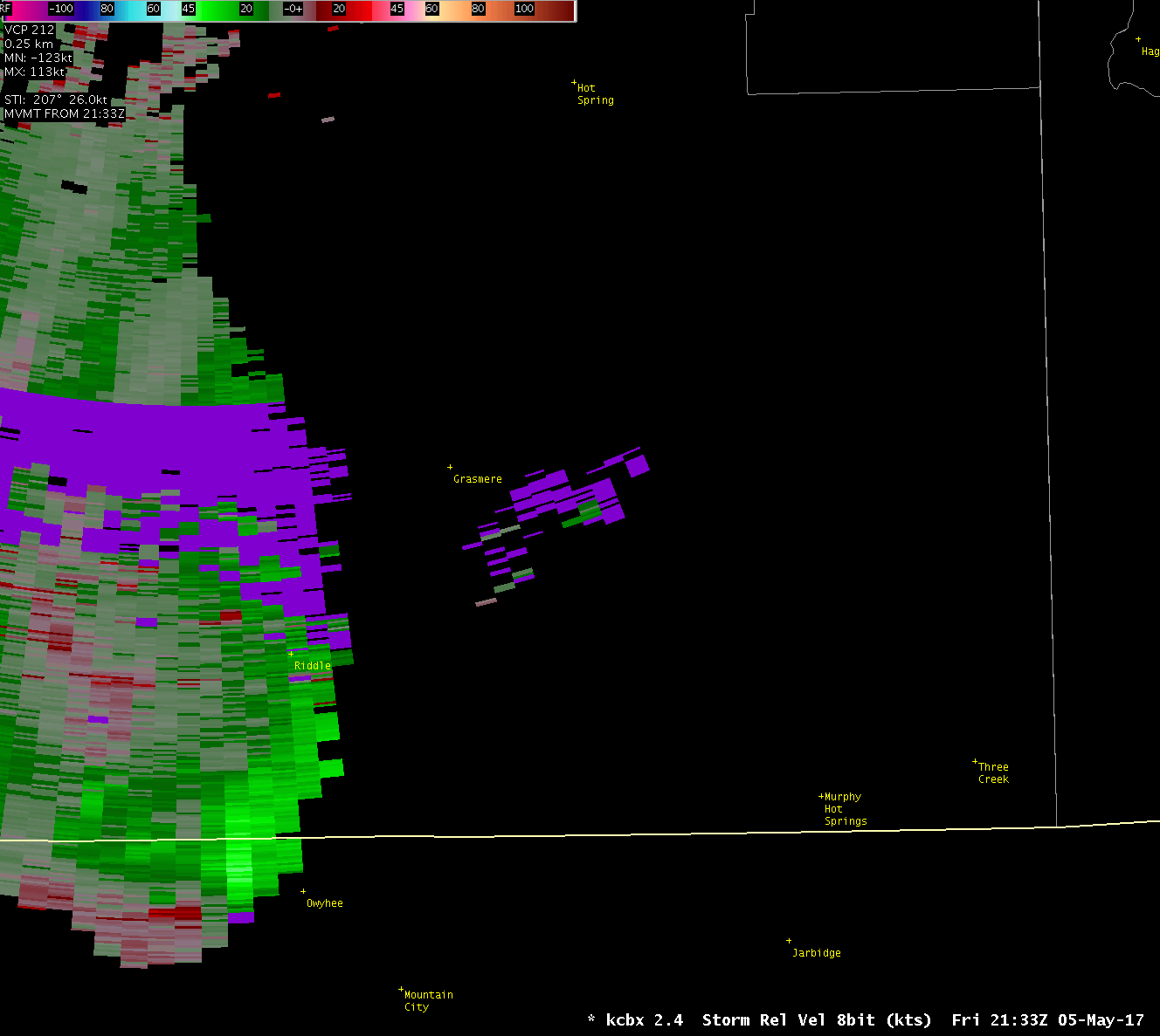
The storm certainly looks like it has rotation. Near the ID-NV border, notice the inbound-outbound wind field is counter-clockwise and is not tight, indicating a larger rotation for the system. This rotation will translate into the cuts above. However, notice that after the system emerges from the range-folding, that the inbound-outbound wind-field changes several times. This is our first clue that the velocity data may not be reliable. Second, the rotation couplet tightens to what may be considered tornadic rotation, but it is going the wrong way. If the general storm’s atmosphere was CCW, the tornado should have been CCW. This “tornado” was CW. Third, if we did indeed have a tornadic wind-field, we should have seen inbound winds to the east, strong at the center of the rotation and then decreasing outward, and outbound toward the west, again strong at the center of the rotation and weakening outward. This was not the case. Instead, we had may different directions in the wind-field on either side of the strong rotation.
This is not a realistic tornadic wind-field. It is a dealiasing failure:
Lastly, given the distance from the radar at this point, it would have been hard to see a tornado if there had been one. Note that while strong winds up to 90 kts were indicated by the radar, they were indeed not realistic given all the other issues with the wind-field.
There was rotation through several cuts of the system; it did seem to be a large and strong storm with midlevel rotation. This was the SRM wind-field at 1.3 degrees:
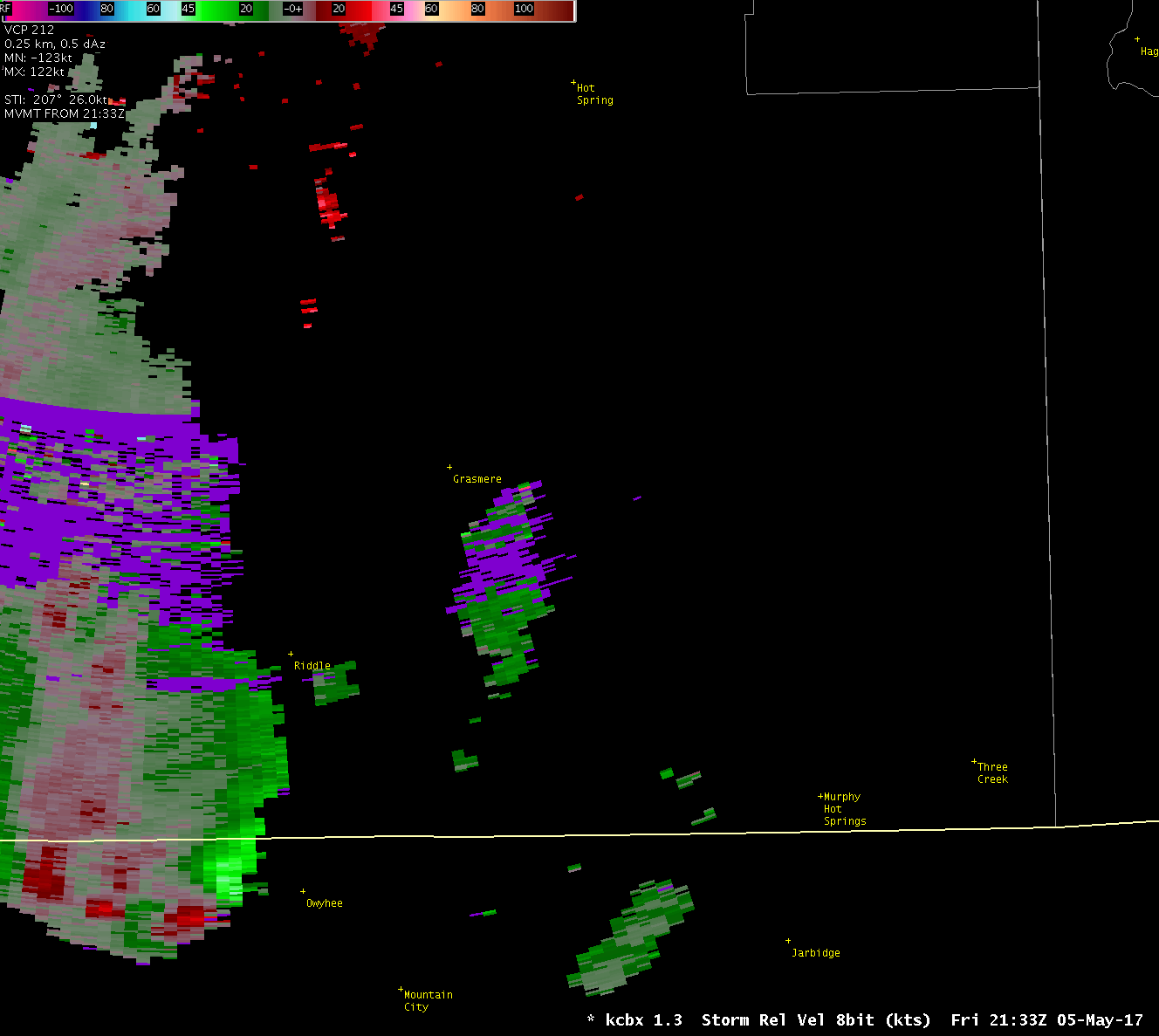
This was the SRM wind-field at 2.4 degrees:
The last thing to note about this system is the location of the “tornadic” rotation relative to the appendage that could have been mistaken for a hook-echo at first glance (the appendage can be seen the the reflectivity image between 2330Z and 2350Z, developing on the south side of the system). They were not co-located, which is a necessary aspect to a tornadic signature. Apologies for not having still Z and SRM imagery side-by-side to show this here. In fact, the SRM-indicated rotation was out ahead of the system in a low reflectivity area.
This unrealistic wind-field issue has been a problem in this part of our CWA before and it likely will not be the last. Instead, we can learn from this example and recognize this pattern in the future to prevent any future confusion.
This storm did in fact produce a lot of large hail and the severe thunderstorm warning certainly verified. See:
https://www.facebook.com/kboi2/videos/1541447965866904/
Please note that Tim has been working to save the May 5th AWIPS data and we should all have access to it soon enough.
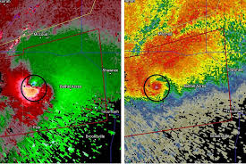
An example of a tornadic signature on radar can be viewed below. There are several aspects to note here.
1) Surrounding the strong velocity couplet in the image on the top right, is a decreasing velocity wind-field in the same direction as the couplet.
2) The velocity couplet is co-located with the hook and high reflectivities.
3) The CC hole (aka, debris ball) is also co-located with the hook. It would be hard to get that kind of CC signature out where our example took place as there was likely only sagebrush around.