HOME
FORECAST
Local
Graphical
Aviation
Marine
Rivers and Lakes
Hurricanes
Severe Weather
Fire Weather
Sunrise/Sunset
Long Range Forecasts
Climate Prediction
Space Weather
PAST WEATHER
Past Weather
Astronomical Data
Certified Weather Data
SAFETY
INFORMATION
Wireless Emergency Alerts
Weather-Ready Nation
Brochures
Cooperative Observers
Daily Briefing
Damage/Fatality/Injury Statistics
Forecast Models
GIS Data Portal
NOAA Weather Radio
Publications
SKYWARN Storm Spotters
StormReady
TsunamiReady
Service Change Notices
EDUCATION
NEWS
SEARCH
Search For
NWS
All NOAA
ABOUT
About NWS
Organization
For NWS Employees
National Centers
Careers
Contact Us
Glossary
Social Media
NWS Transformation
Local forecast by
"City, St" or ZIP code
Sorry, the location you searched for was not found. Please try another search.
Multiple locations were found. Please select one of the following:
Location Help
News Headlines
🌀 Local Hurricane Guide
🌴 Tropical Weather Resources
Customize Your
Weather.gov
Enter Your City, ST or ZIP Code
Remember Me
LOADING...
Charleston, SC
Weather Forecast Office
April 13, 2020 Tornado Outbreak
Weather.gov
>
Charleston, SC
> April 13, 2020 Tornado Outbreak
Current Hazards
River Flooding
Briefing Page
Space
Winter
Local Outlook
Drought
Thunderstorms
Hurricanes
Graphical Outlook
Current Conditions
Air Quality
Observations (Map)
Satellite
Rainfall
Observations (List)
Marine Obs (Map)
Tide Levels
Radar
Local KCLX Enhanced Radar
Local KCLX Standard Radar (low bandwidth)
Regional Standard Radar (low bandwidth)
National Standard Radar (low bandwidth)
Forecasts
Aviation
Forecasters' Discussion
Map View
Tropical
Hourly View
Marine & Tides
Heat
Coastal Flood
Beach & Surf
Recreation/Lake Moultrie
Fire
Local Forecasts
Local Graphics
Tropical
Winter
Rivers and Lakes
Current & Past Streamflow
Ensemble River Guidance
River Forecast Centers
River Observations (Map)
River Forecasts (Map)
Climate and Past Weather
CoCoRaHS
24 Hour Summary
Snowfall Records
Past Observed Weather
Past Rainfall
Drought Outlook
Climate Prediction
Past Significant Events
Local Tropical Cyclone History
Local Climate Data/Plots
Today in Weather History
Coastal Flood Event Database
Tropical Cyclone Reports
Drought Information Statement
Local Programs
About Our Office
Local Product Criteria
Event/Decision Support
CoCoRaHS
Education
Office FAQ
Science/Technology
Social Media
Storm Spotters
Text Products
Upper Air
WRN Ambassadors
Weather Safety
Cooperative Weather Observers
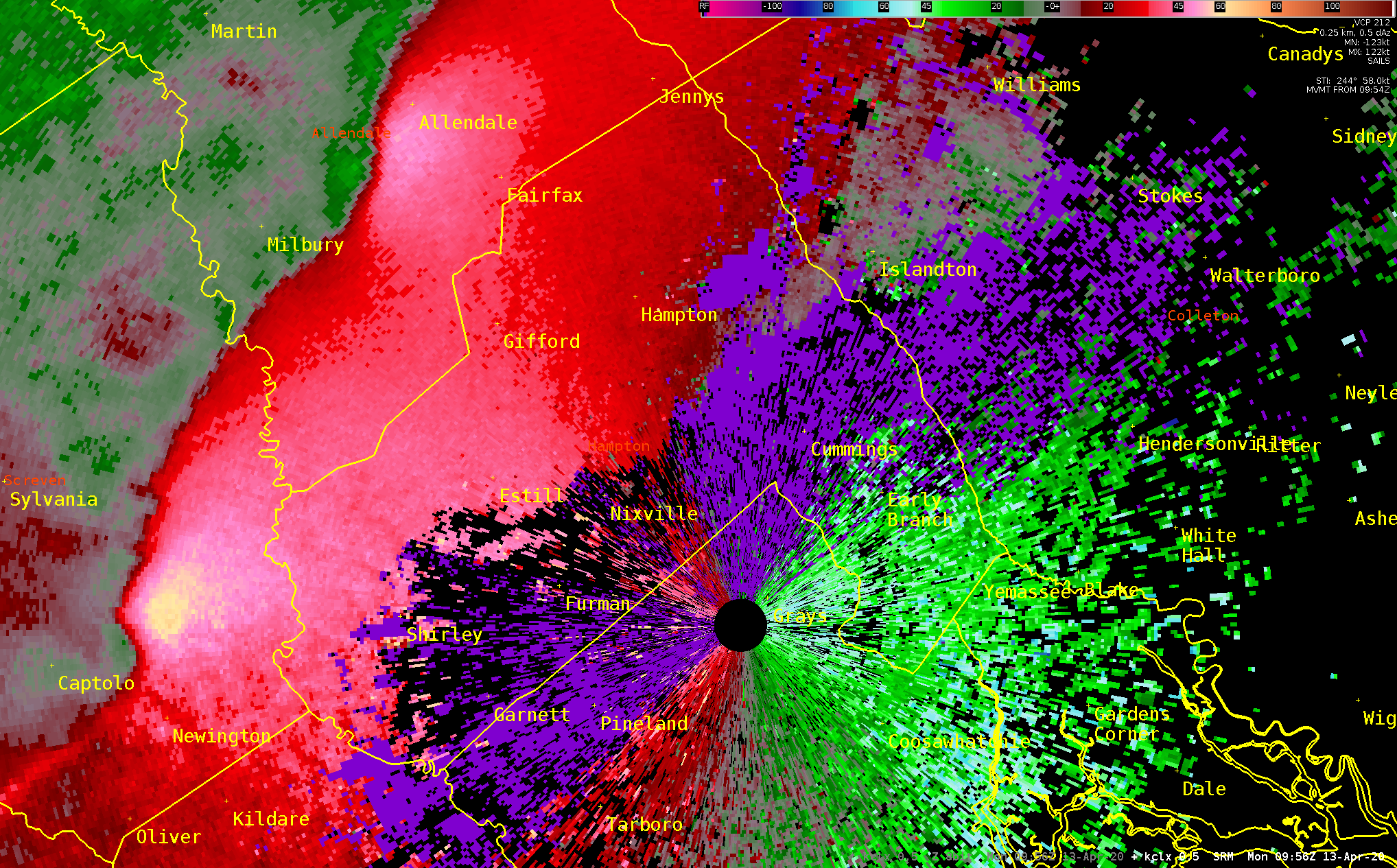
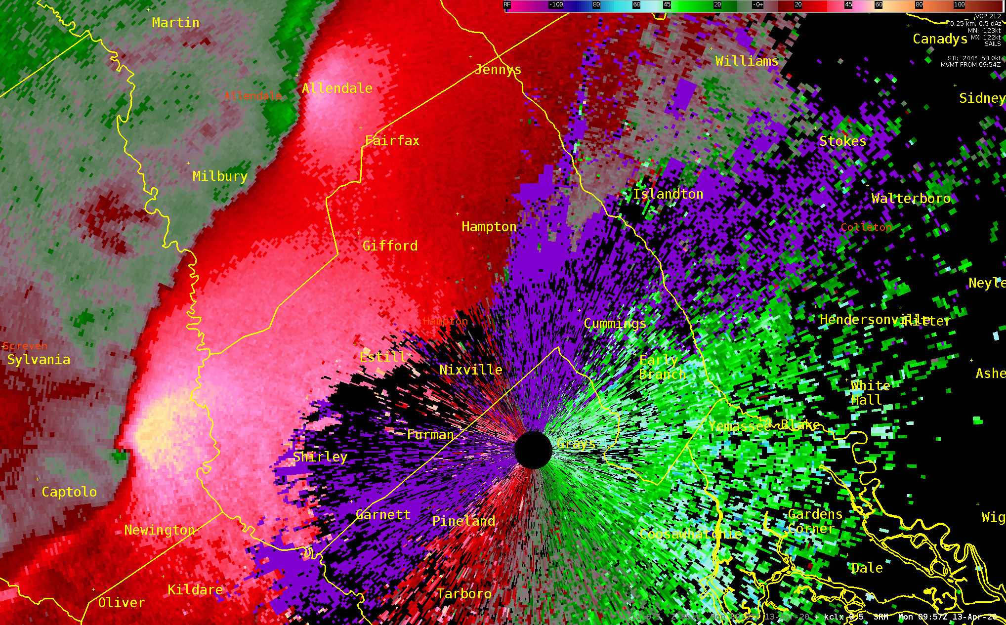
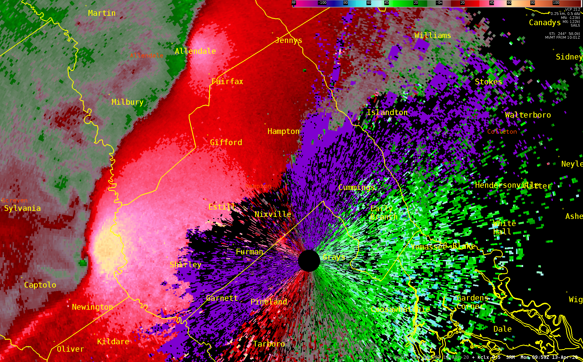
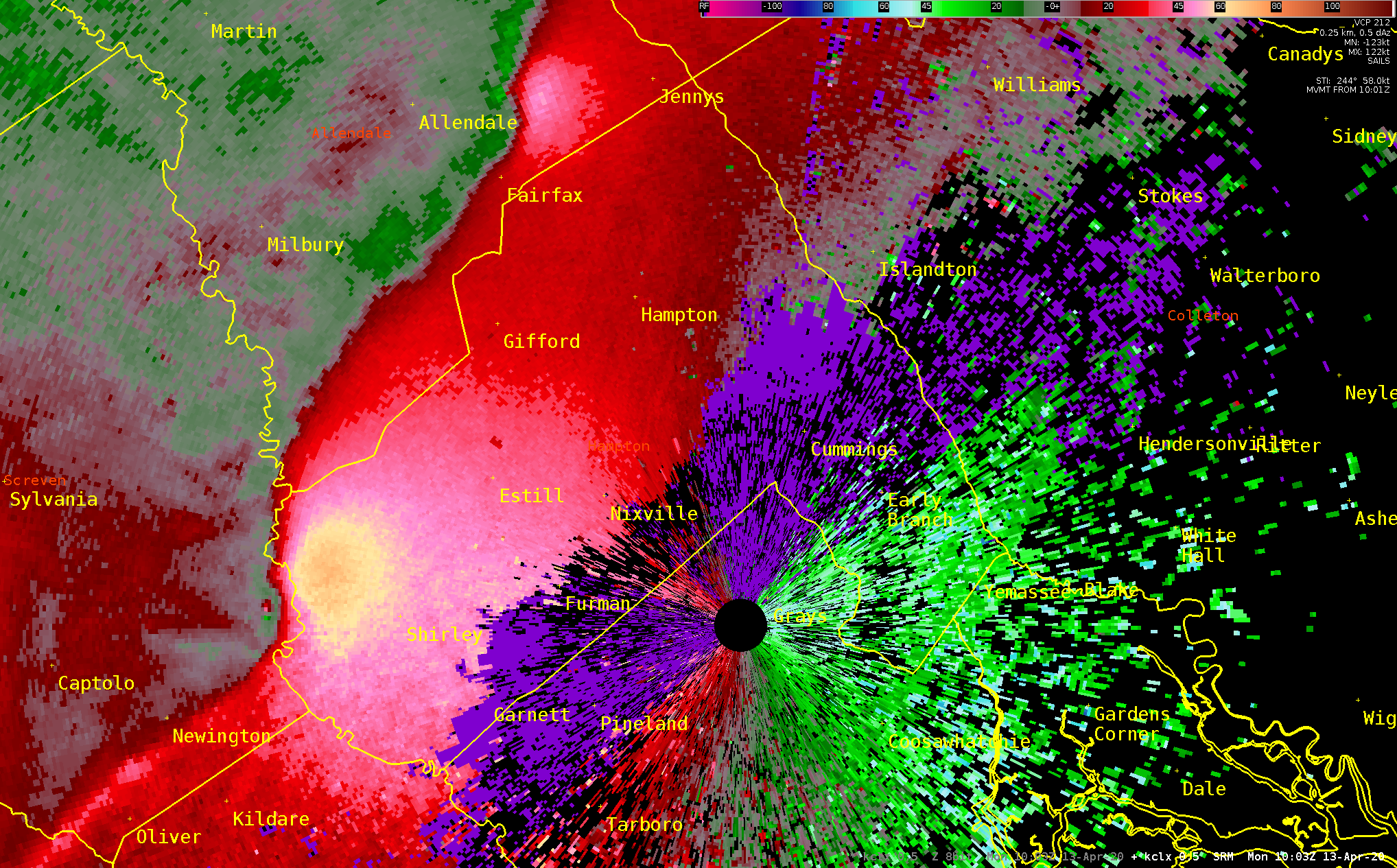
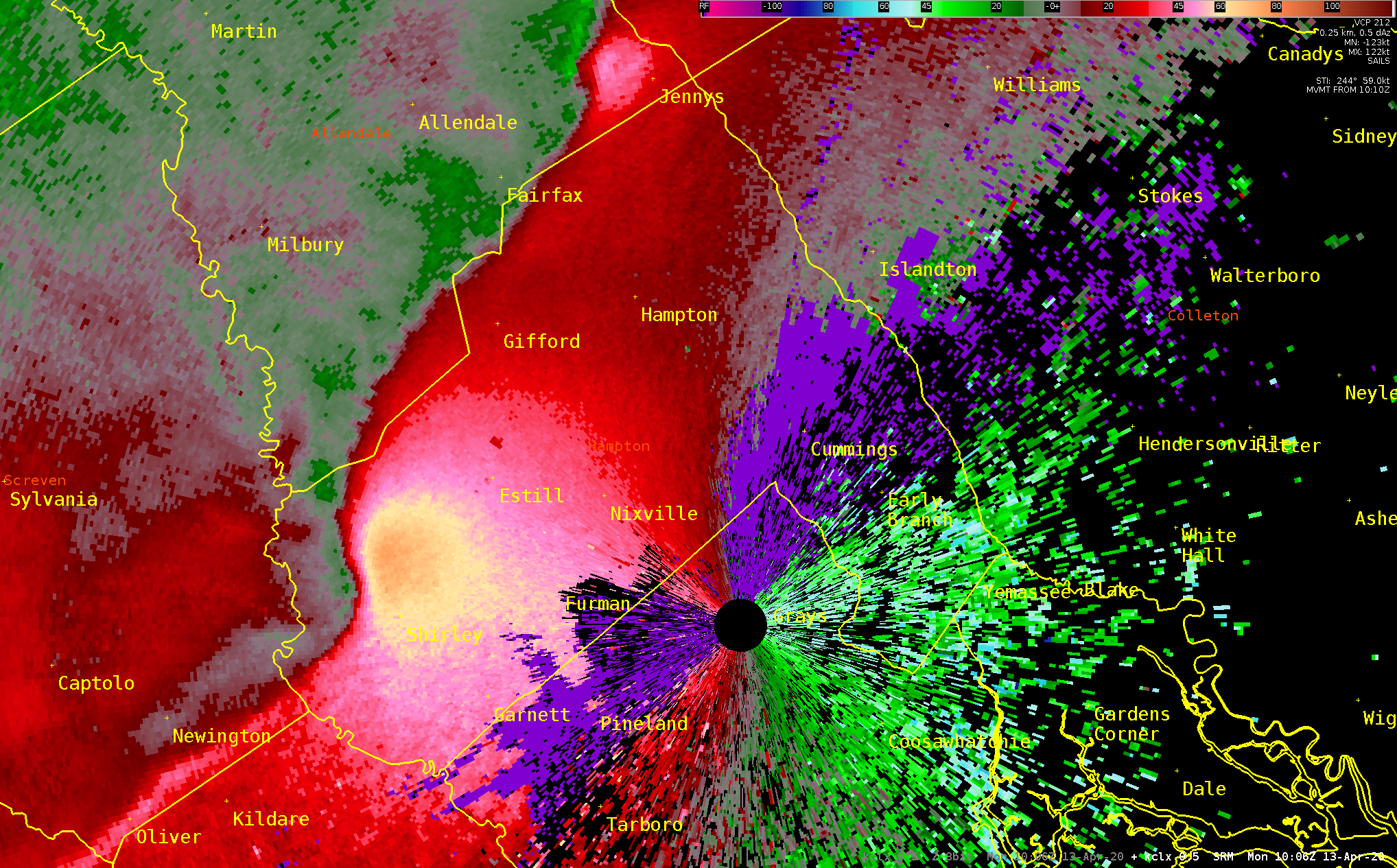
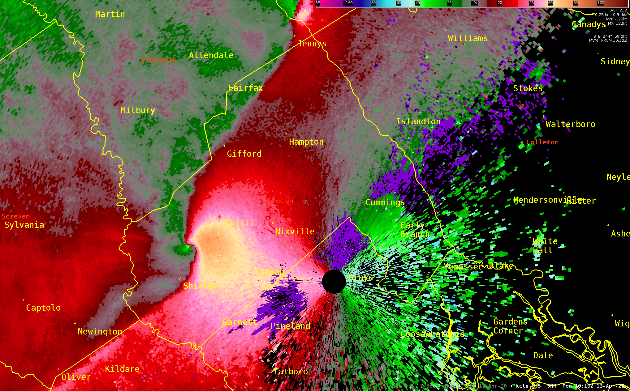
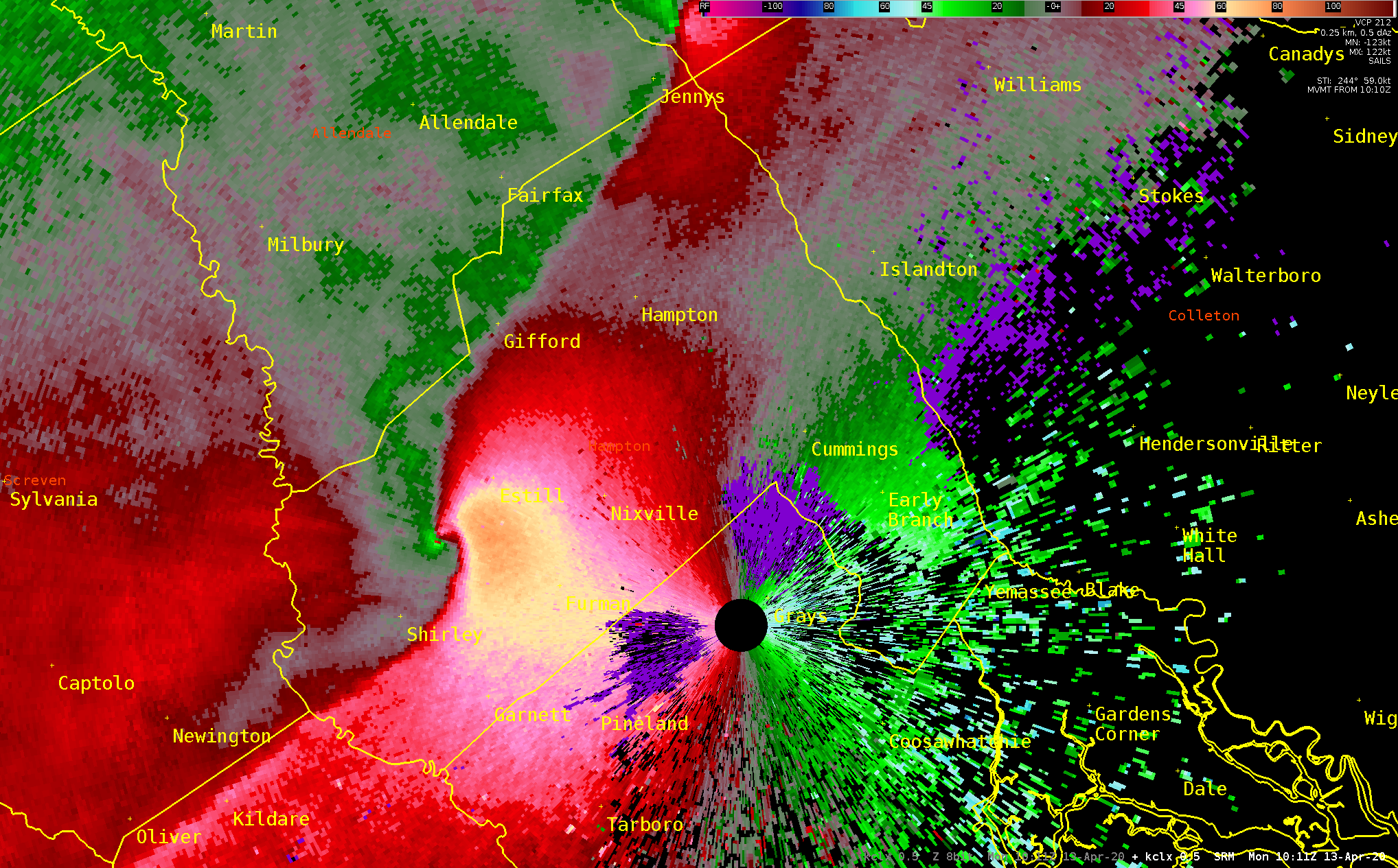
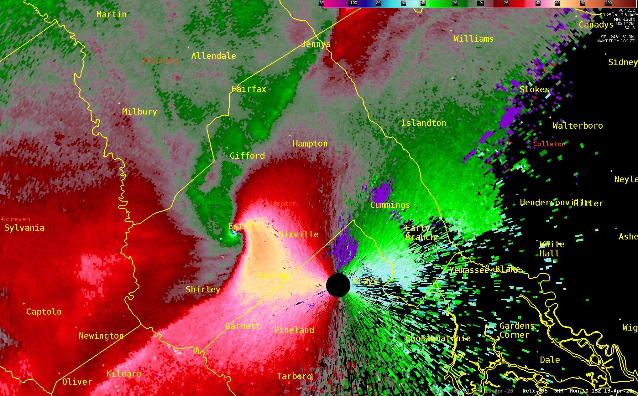
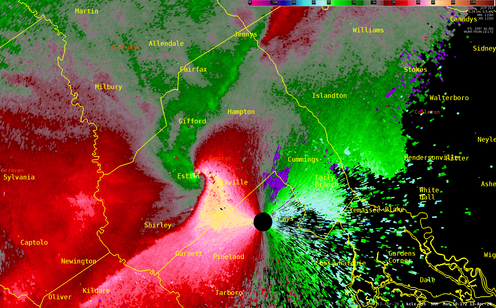
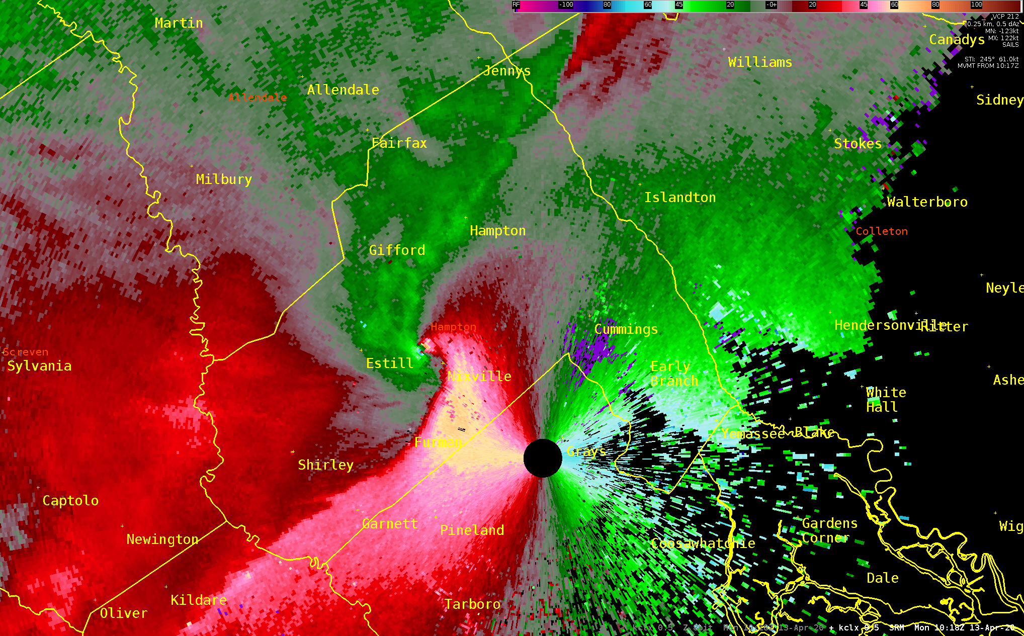
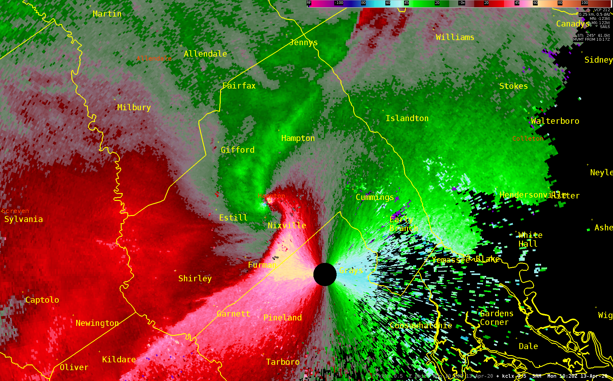
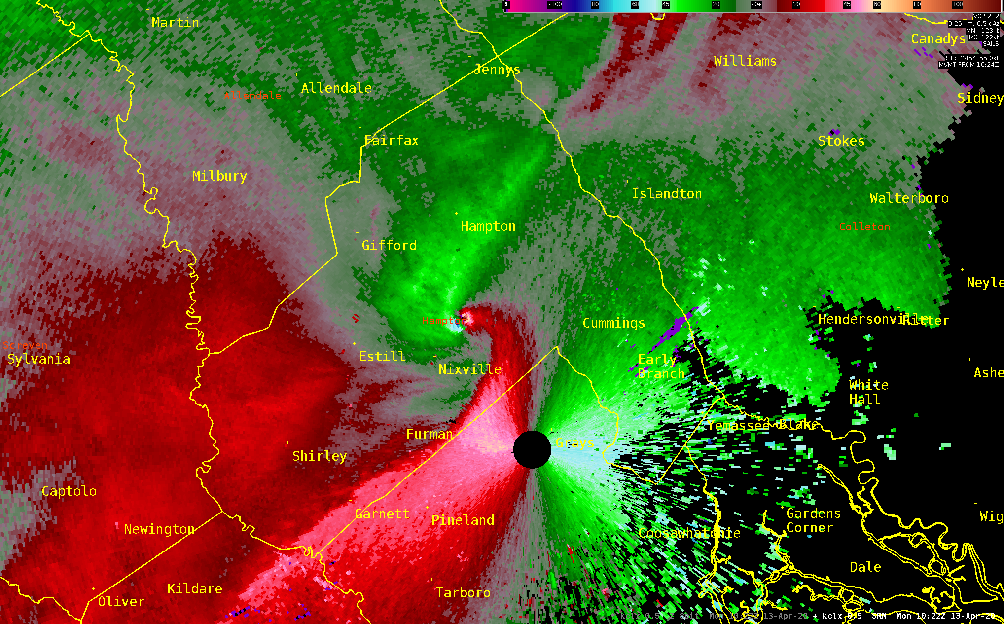
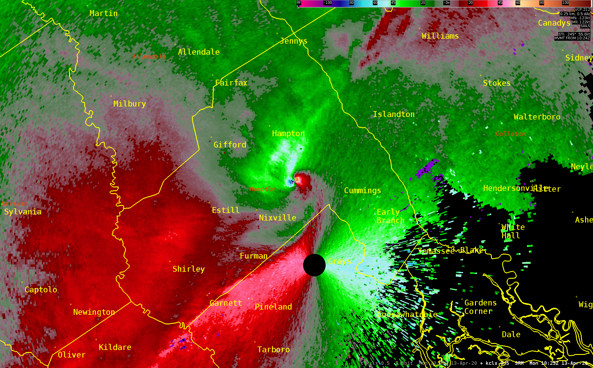
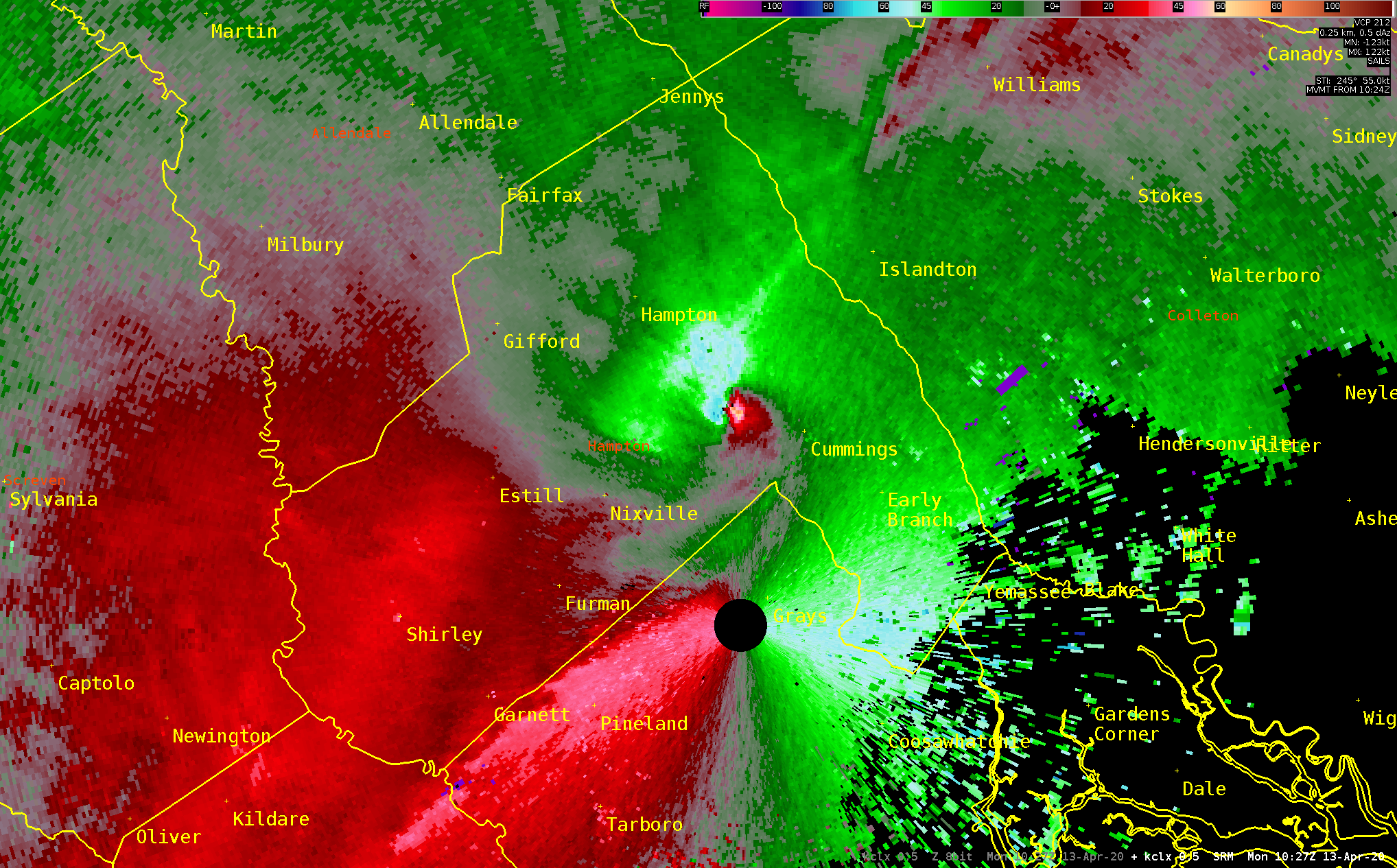
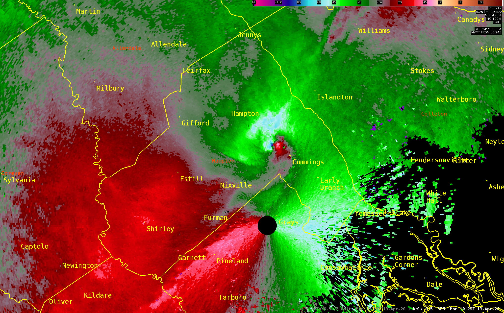
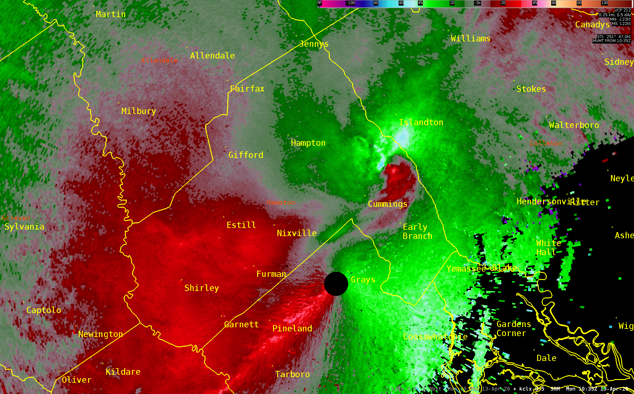
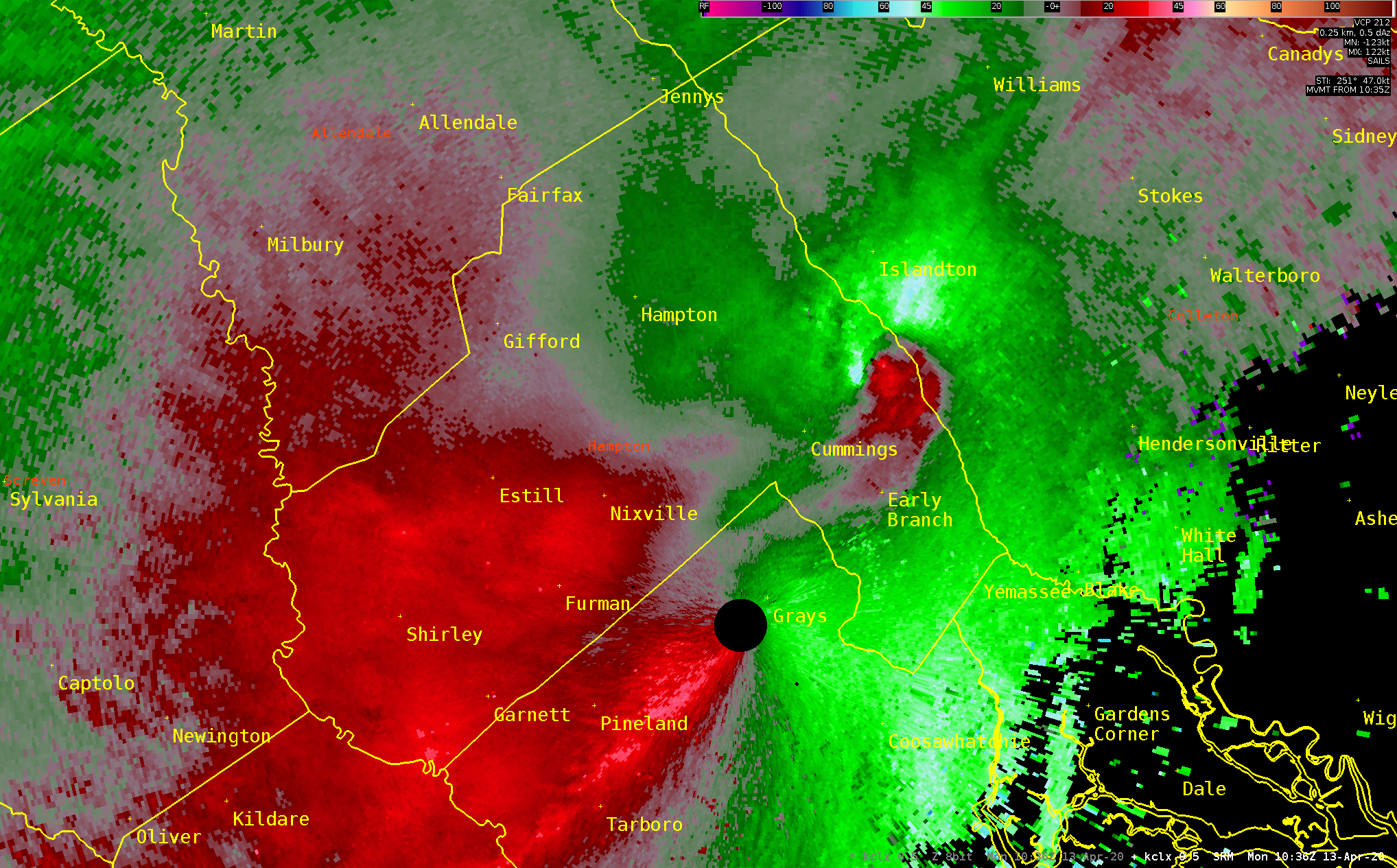
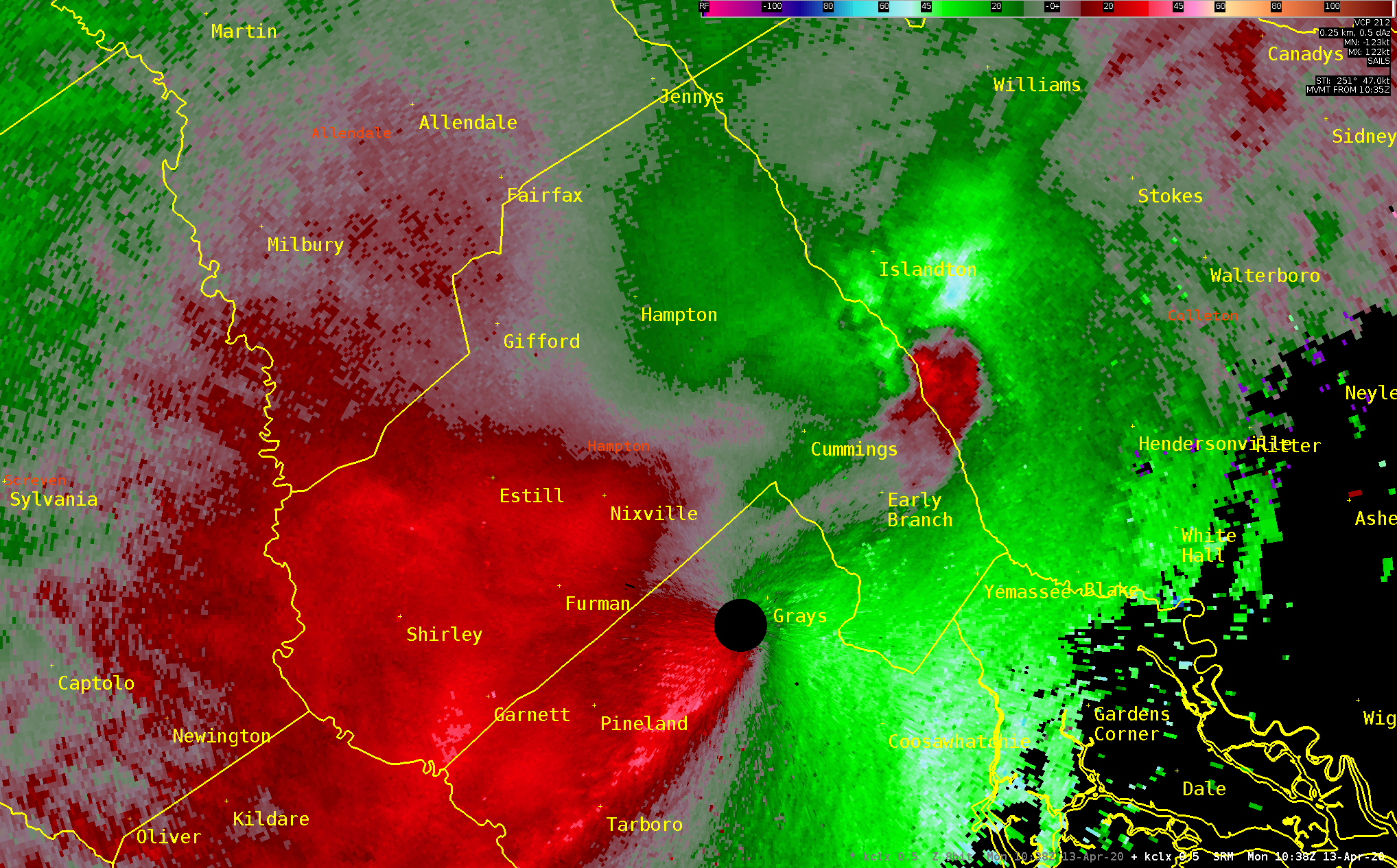
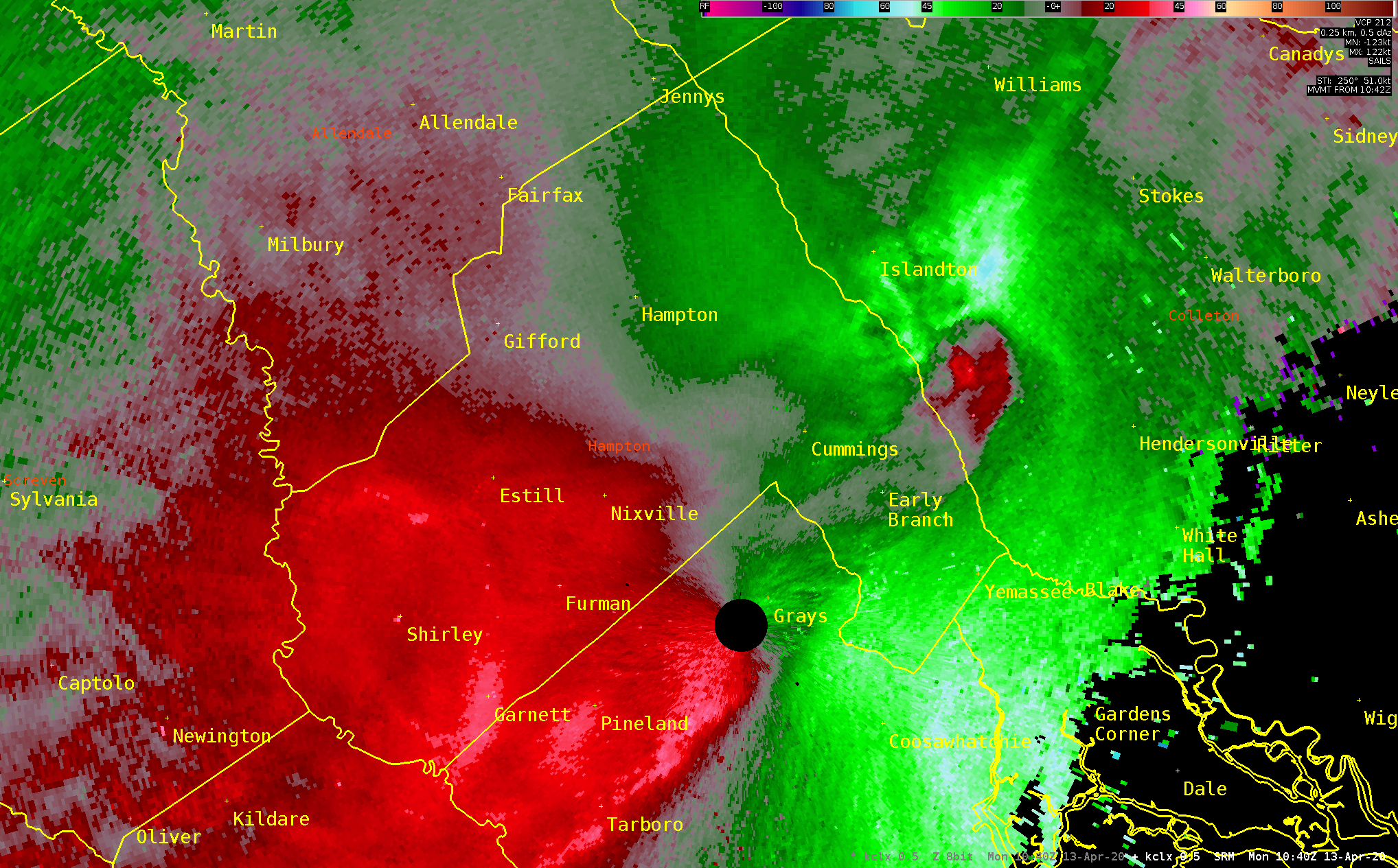
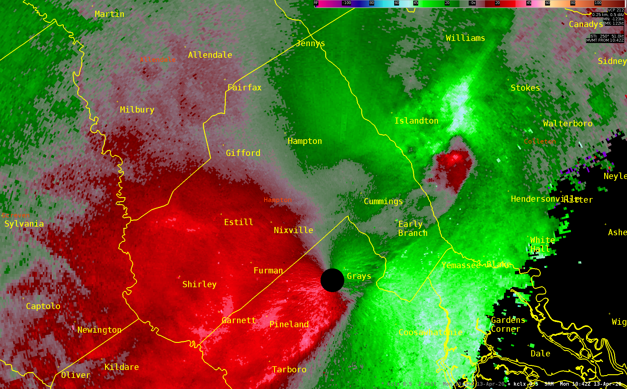
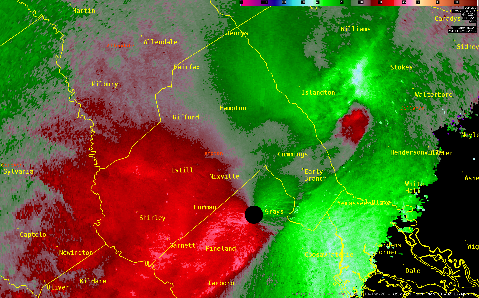
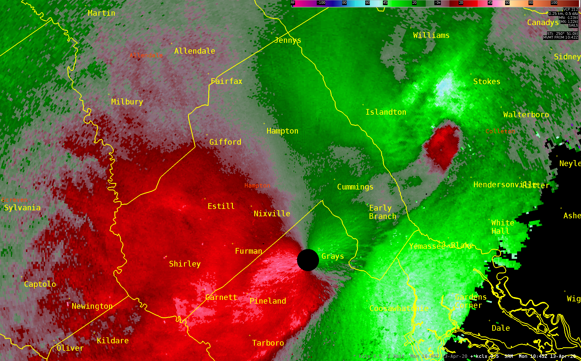
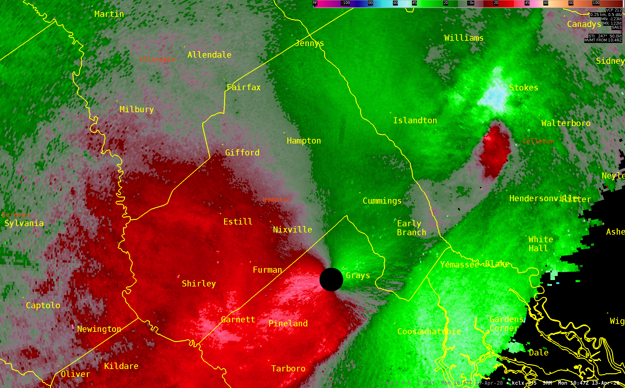
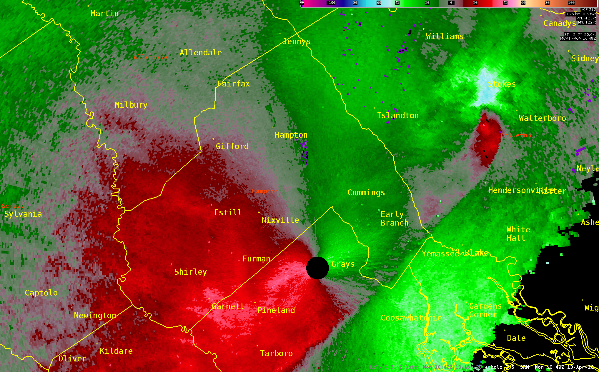
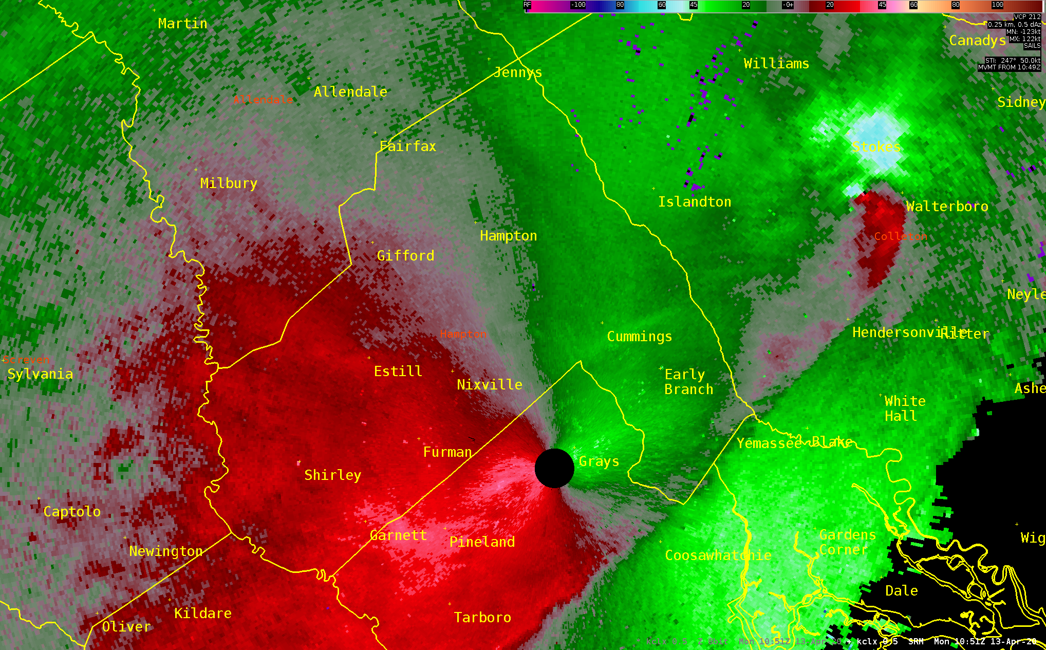
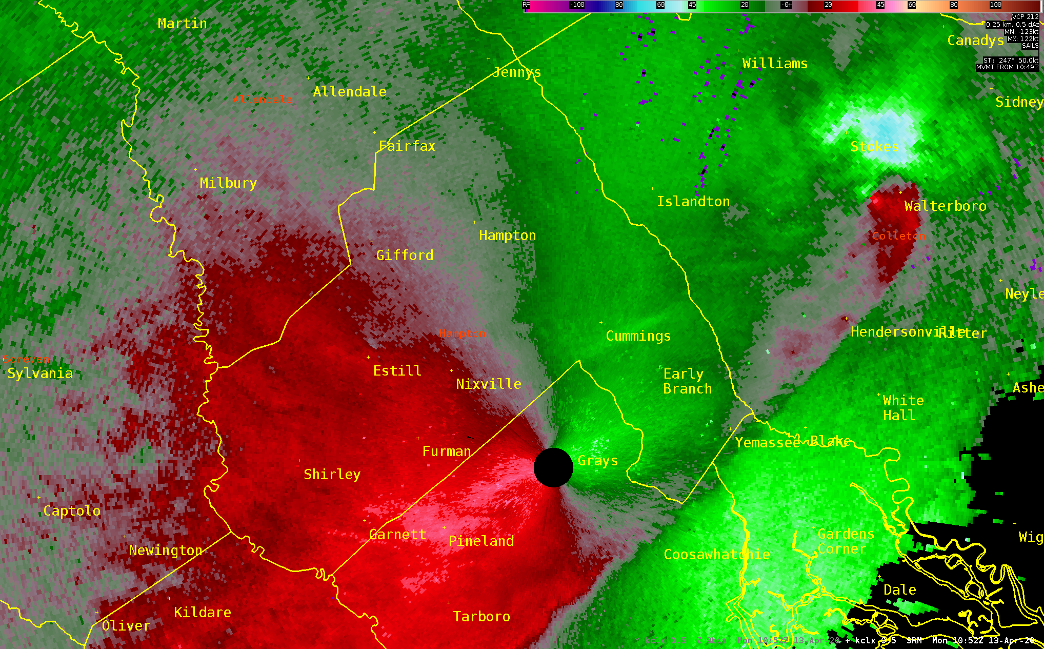
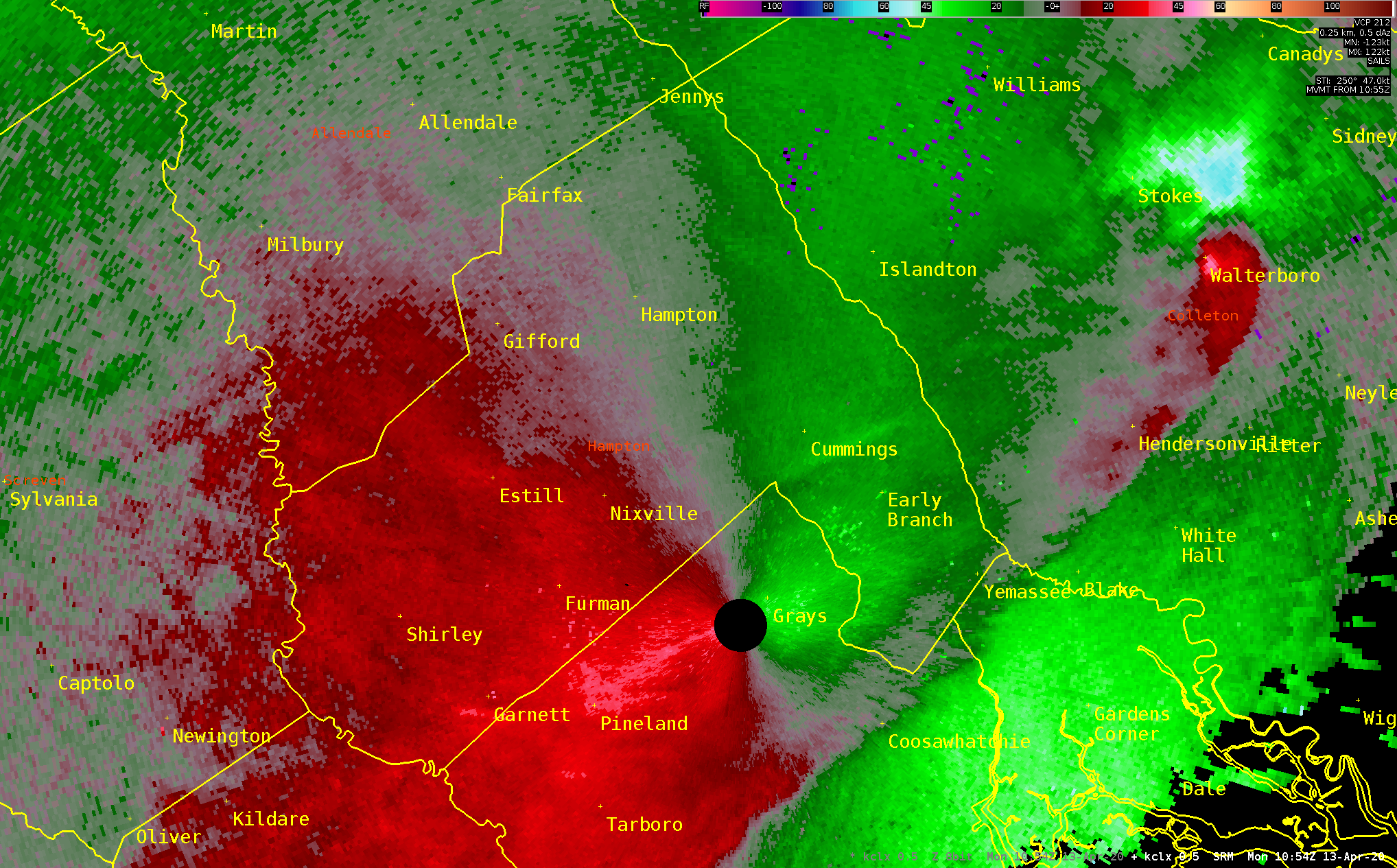
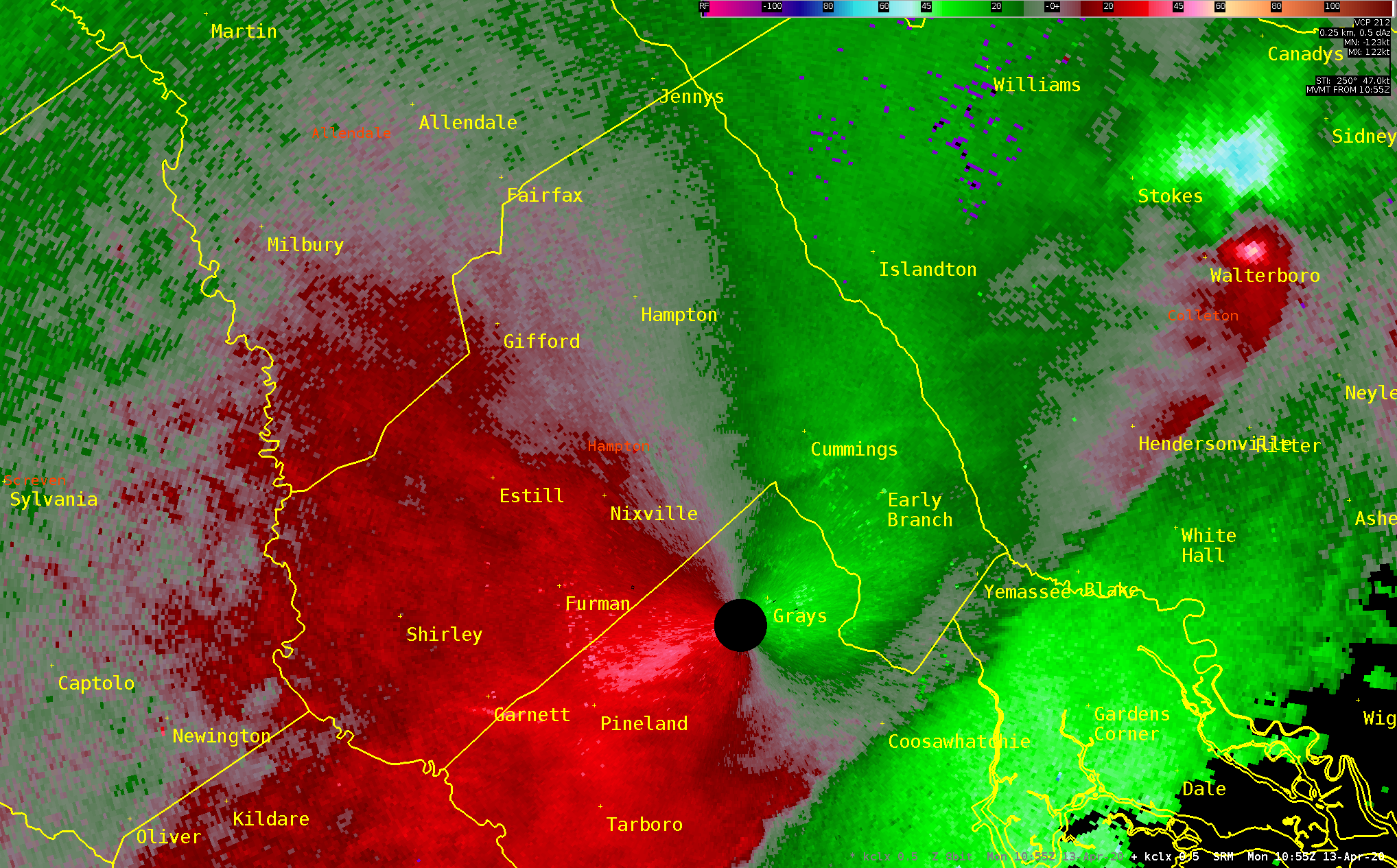
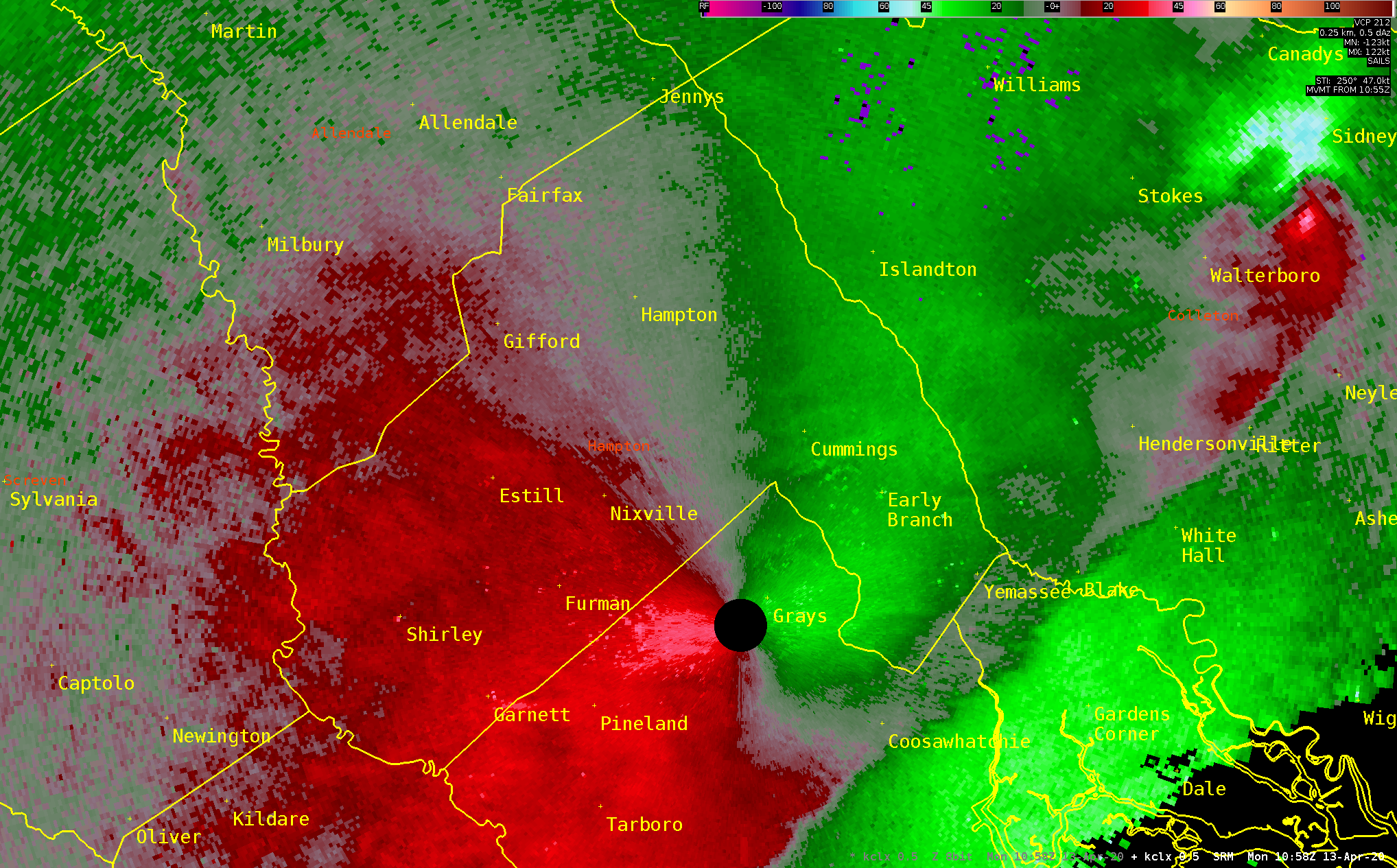
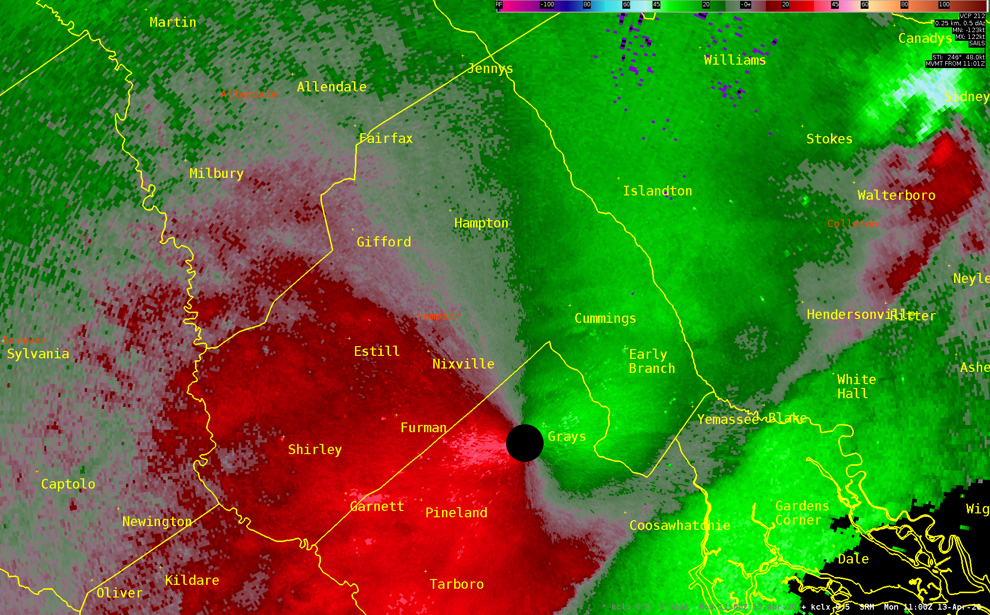
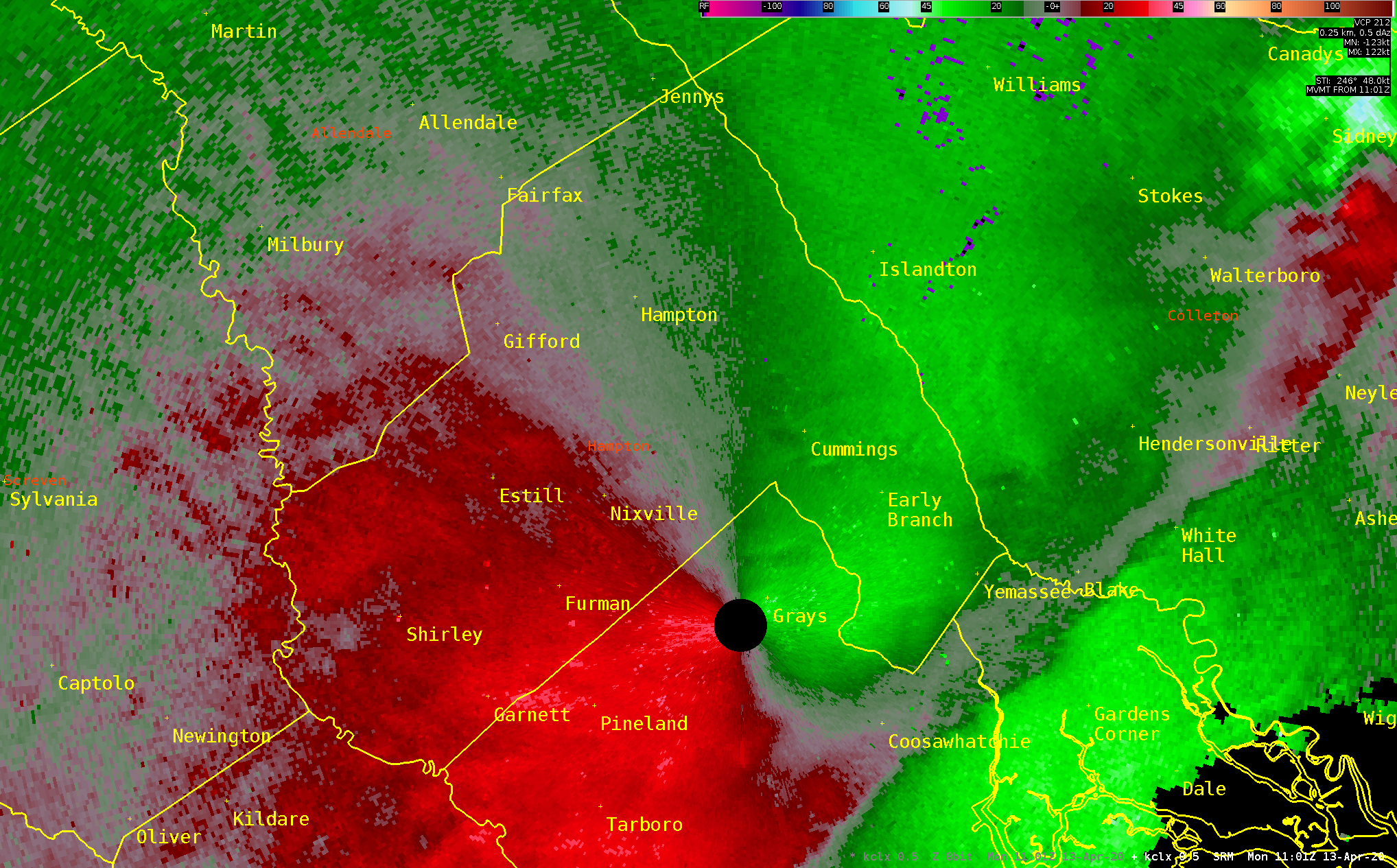
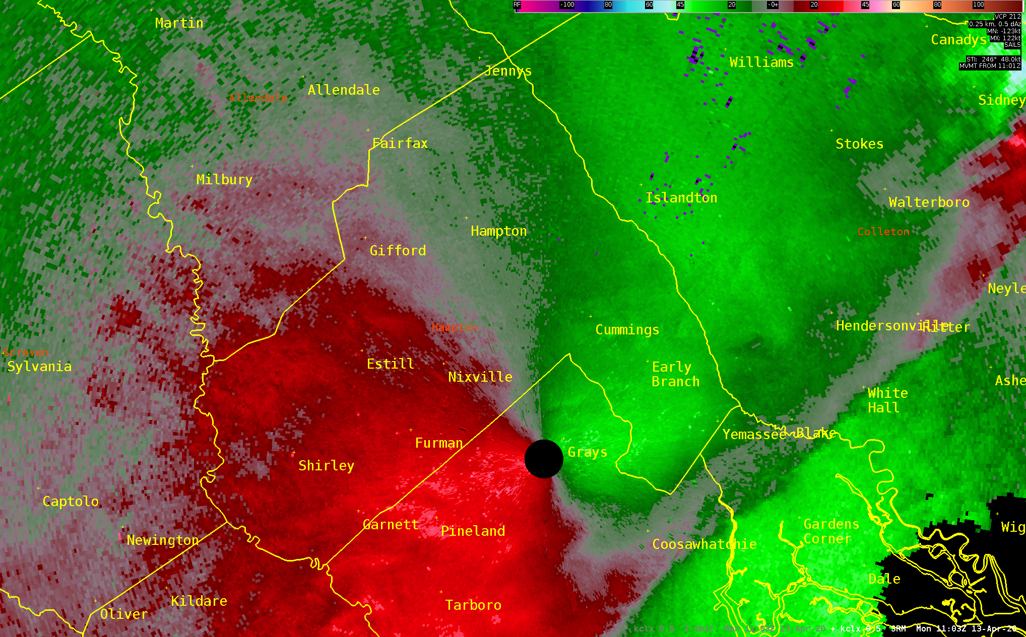
Screven/Allendale/Hampton/Colleton Tornadoes - KCLX 0.5° Storm-relative Velocity
Start Loop
Stop Loop
Radar
Current Weather
Rivers & Lakes
Satellite
Forecast Maps
Hour by Hour Forecast
Tropical Weather
Graphical Hazards
Weather Briefing
Forecast Discussion
Text Products
Marine & Tide
Coastal Flood
Lake Moultrie
Fire Weather
Climate Plots
Skywarn Spotter Program
NOAA Weather Radio
Follow us on X
Follow us on Facebook
Follow us on YouTube
CHS RSS Feed


 Coastal Flood