Charleston, SC
Weather Forecast Office
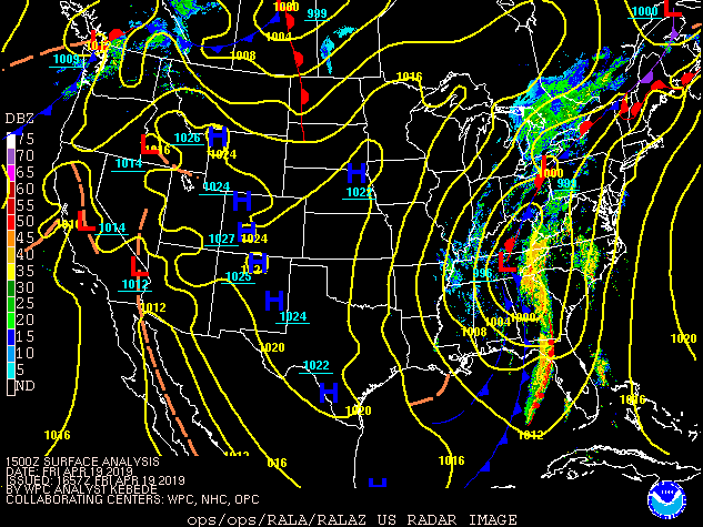
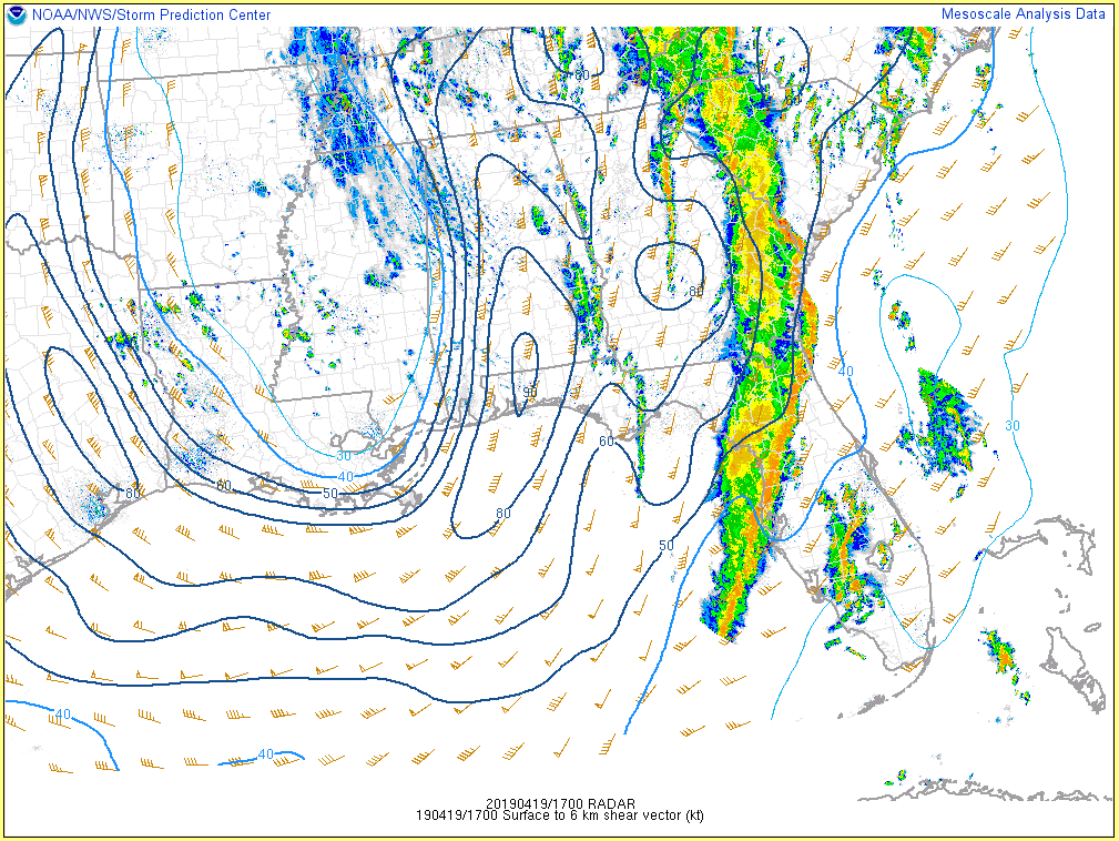
An unseasonably deep upper-level trough of low pressure and an associated surface low pressure affected the region on April 19, 2019. Very strong low to mid-level winds contributed to the development of a strong squall line and damaging winds ahead of a surface cold front which tracked eastward through southeast Georgia and southeast South Carolina during the early to mid afternoon.
Click on images below to enlarge
 |
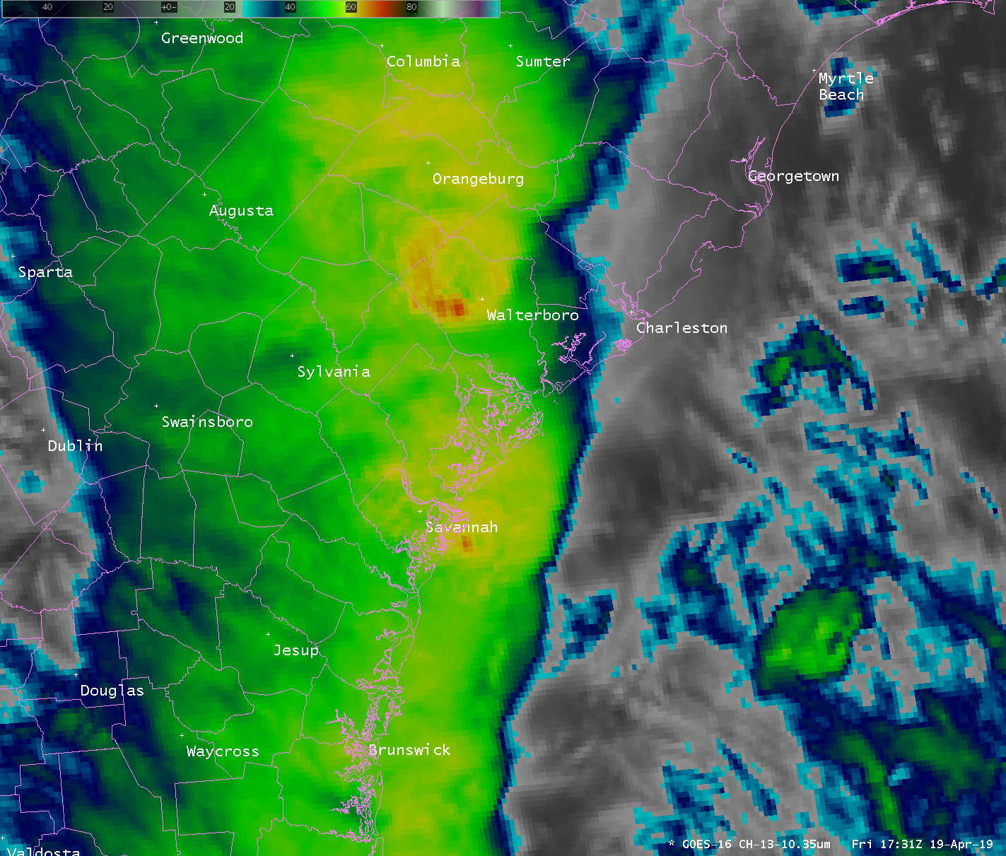 |
| GOES Visible Satellite Image (11 AM EDT) | GOES IR Satellite Image (131 PM EDT) |
Click on images below to enlarge
 |
| Radar Reflectivity Loop (11 AM EDT to 354 PM EDT) |
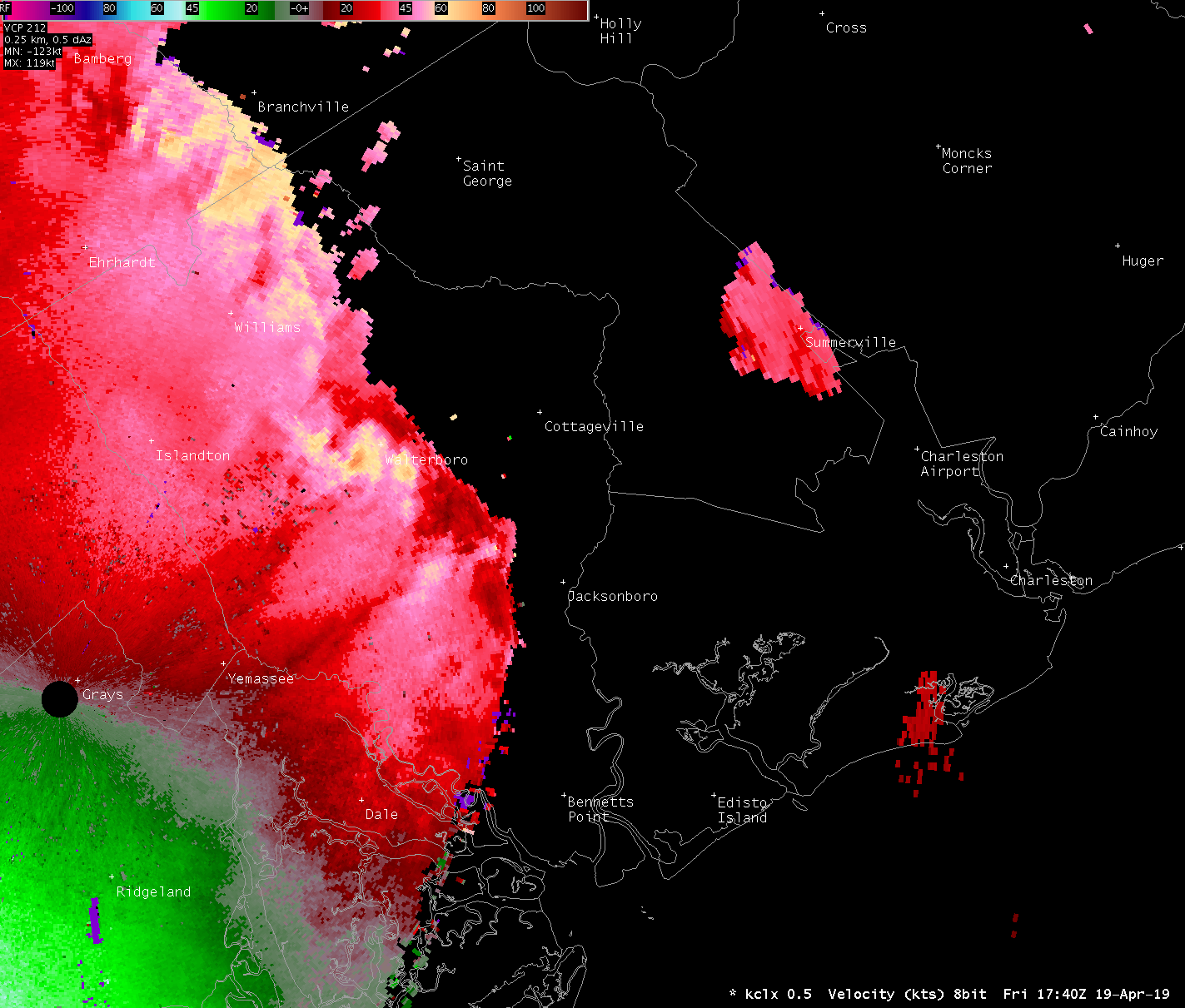 |
| Charleston, SC Doppler Radar Velocity (140 PM EDT) - Note the 80+ knot winds near Walterboro, SC |
(click images to enlarge)
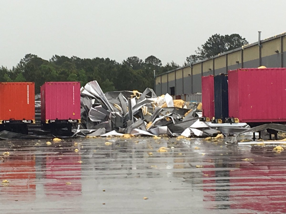 |
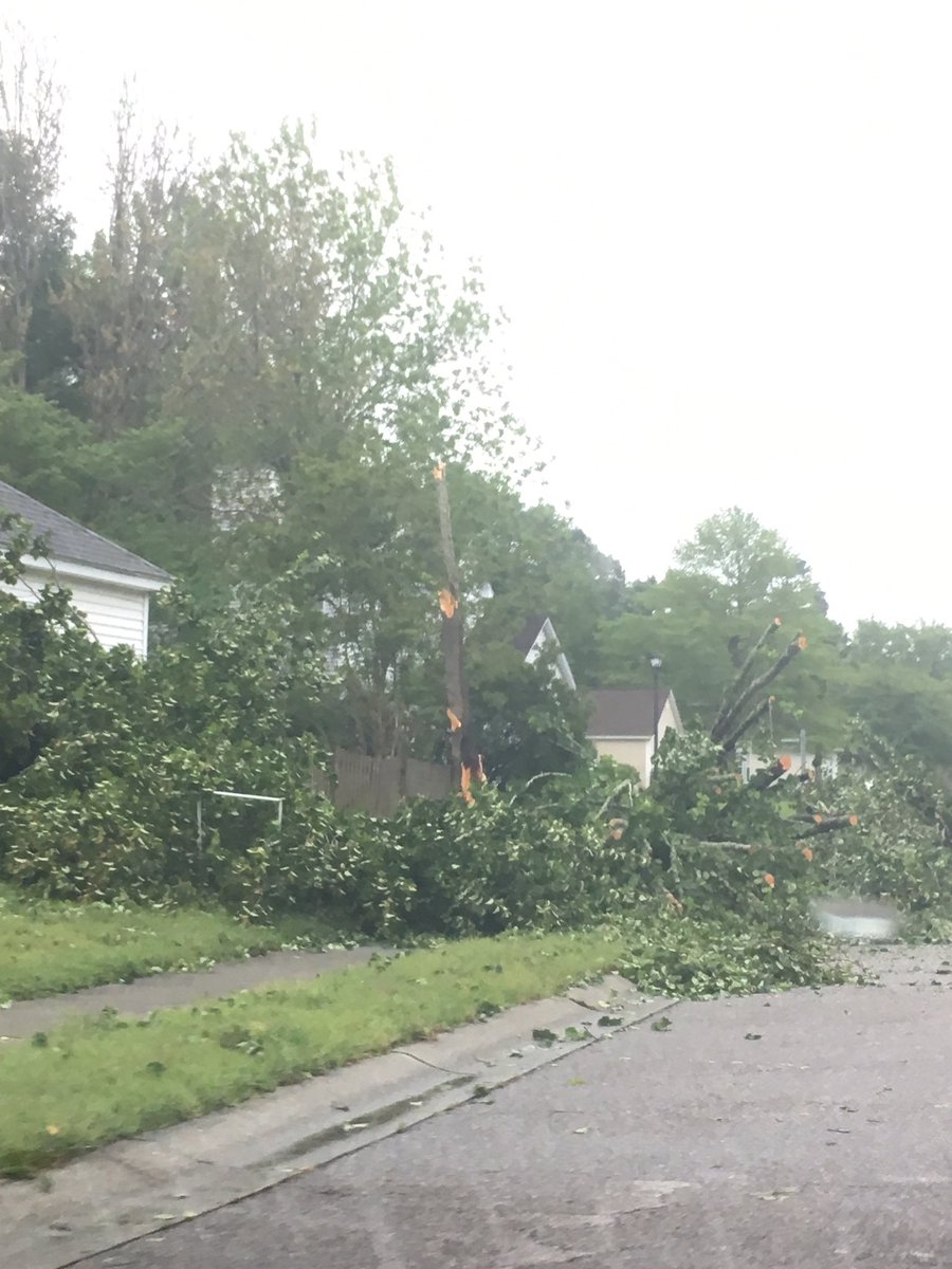 |
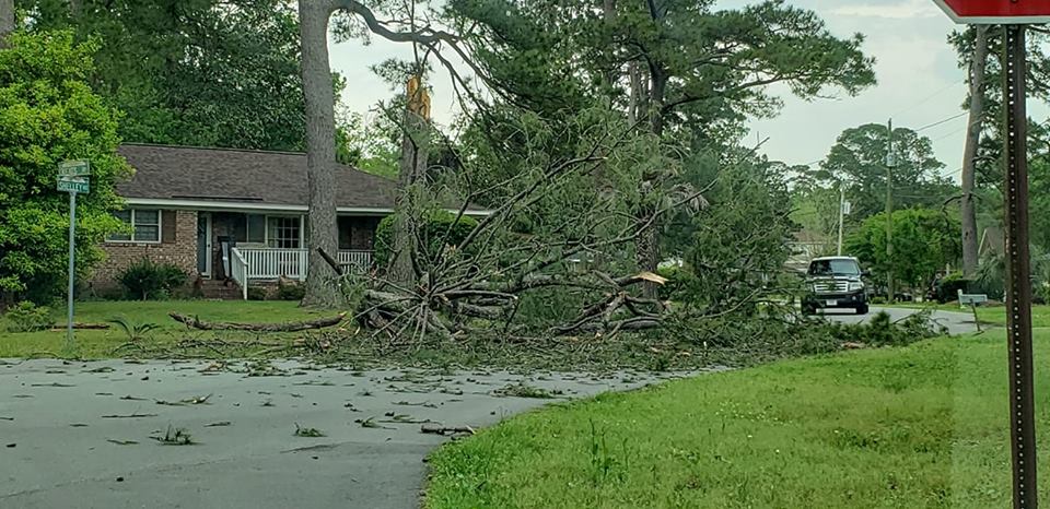 |
| Port Wentworth, GA (courtesy of WTOC) | Mount Pleasant, SC | West Ashley, SC |
Forecasts
Local Forecasts
Graphical
Weather Activity Planner
Forecaster Discussion
Aviation
Beach
Fire Weather
Lake Moultrie
Marine/Tides
Rivers
Winter
Heat
Past Weather
Observed Weather
Climate Data/Plots
Observed Rainfall
Event Summaries
Today in Weather History
Coastal Flood Event Database
Local Tropical Cyclone History
Tropical Cyclone Reports
US Dept of Commerce
National Oceanic and Atmospheric Administration
National Weather Service
Charleston, SC
5777 South Aviation Avenue
North Charleston, SC 29406-6162
(843) 747-5860
Comments? Questions? Please Contact Us.


 Coastal Flood