| EF0 Tornado within the Savannah National Wildlife Refuge (Jasper County, SC) | ||||||
| Start Time | Max EF-Scale Rating | Max Wind Speed | Max Path Width | Path Length | Fatalities | Injuries |
|---|---|---|---|---|---|---|
| 5:14 PM EDT | EF0 | 65 mph | 60 yards | 0.64 mi | 0 | 0 |
|
A weak, short-lived tornado briefly touched down in the Savannah National Wildlife Refuge, in southern Jasper County, SC. The tornado initiated just east of Plantation Island Trail, where it snapped some small tree limbs and tops of some trees. It moved toward the north-northwest, snapping more small tree limbs, before crossing Laurel Hill Wildlife Drive, ending just south of South Carolina State Road 170. |
||||||
Click the tornado icon on the map to display the damage survey summary and on the tornado track for tornado details.

 |
 |
 |
 |
 |
| EF0 | EF1 | EF2 | EF3 | EF4 |
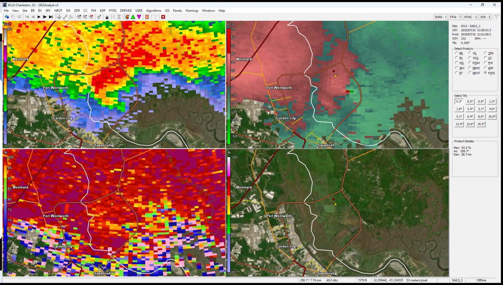
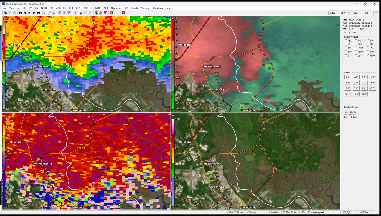

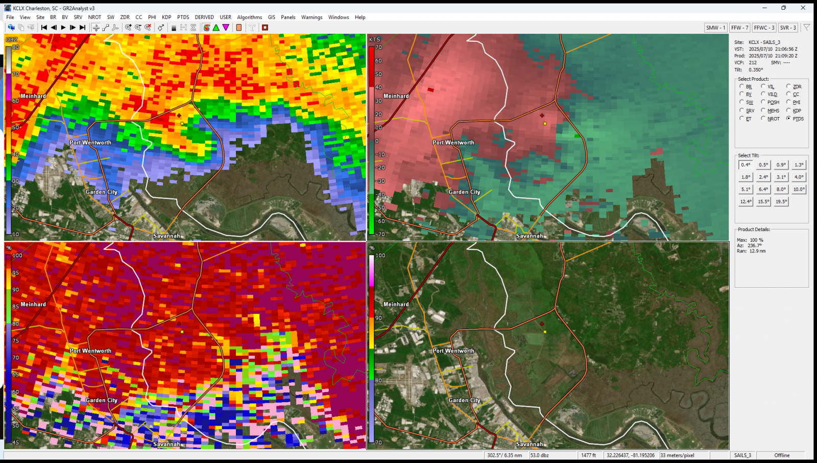
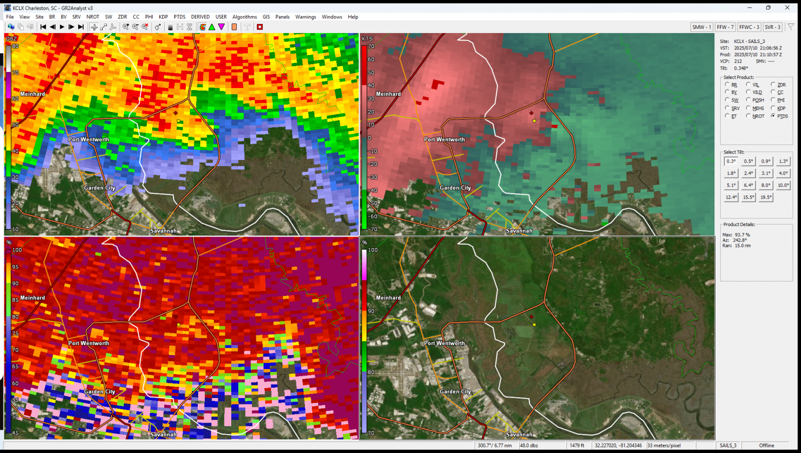
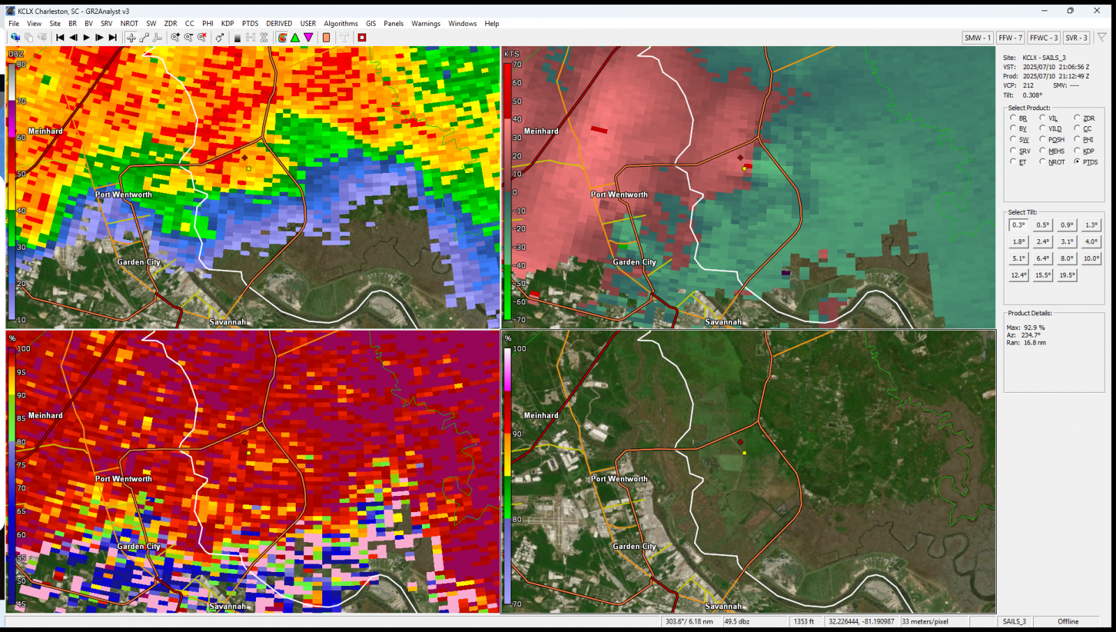
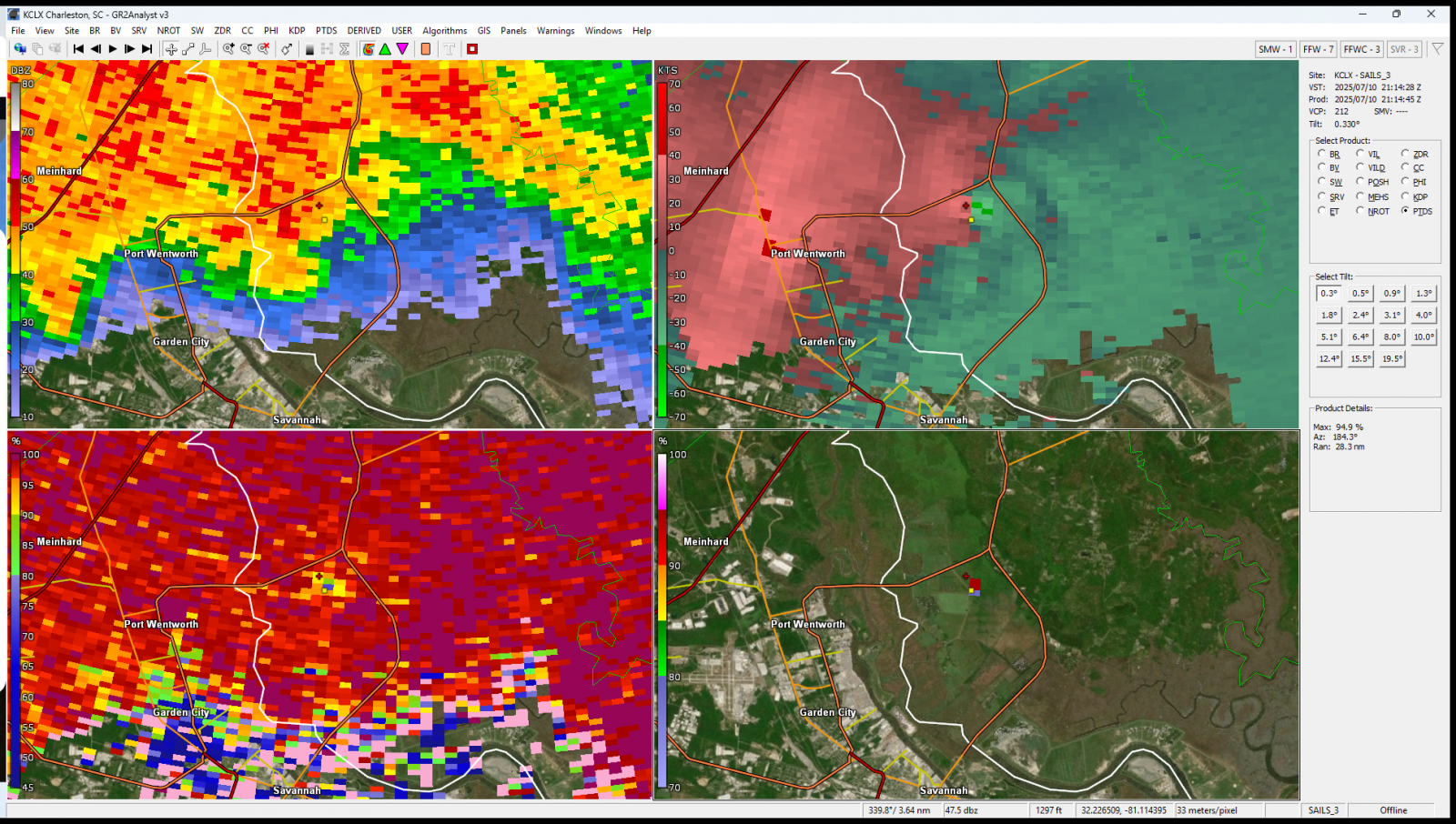

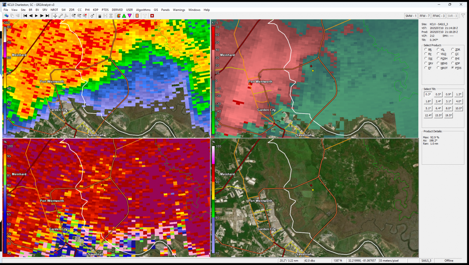
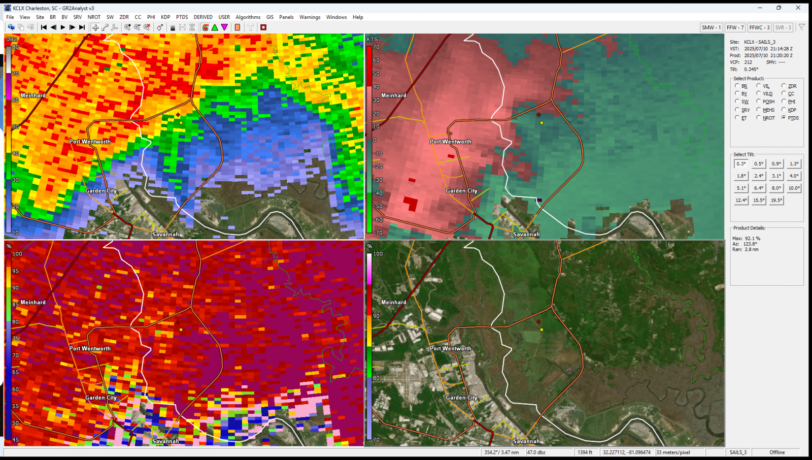
Above: Four-panel radar display from July 10, 2025 from 5:01 PM until 5:20 PM. The top-left is base reflectivity, top-right is storm relative velocity, bottom-left is correlation coefficient , and bottom-right is probabilistic tornadic debris signature (PTDS). The tornado started at the yellow square and ended at the red plus icon. The four-panel radar image from 21:14 UTC (5:14 PM EDT) is particularly significant. As the tornado tracked from the yellow square to the red plus icon, the correlation coefficient plummeted and the new Probabilistic Tornadic Debris Signature (PTDS) spiked to 95%, confirming tornadic debris.
Storm Photos |
||||||
|
||||||


 Coastal Flood