
Visible Satellite
A mesoscale convective system (MCS) moved across northern Georgia and upstate South Carolina during the early morning of Saturday, March 15, 2008. The MCS then evolved into a quasi-linear convective line that pushed southeast across southern South Carolina and southeast Georgia ahead of a cold front. Numerous reports of large hail and tornadoes, along with many injuries, were received across southern South Carolina and parts of Southeast Georgia. NWS Charleston damage survey teams found that 3 EF-1 and 3 EF-2 tornadoes struck southern South Carolina and Southeast Georgia. A map of storm reports across the Southeast U.S. can be found here.
Rarely do the coastal Carolinas and southeast Georgia experience the dangerous combination of an extremely sheared wind environment along with steep mid-level lapse rates and volatile surface-based instability. Couple these factors with a strong upper-level disturbance moving into the southern Mid-Atlantic region and the stage became ripe for classic supercell development.
An ominous indication of the potential shear and mid level instability was evident during the evening of Friday, March 14 when isolated supercells developed over north Georgia producing a series of tornados including a fatal EF-3 in Polk and Floyd Counties and an EF-2 in metro Atlanta. These cells moved southeast into the central Savannah River area after midnight while weakening. This activity was followed by a rapidly moving MCS which tracked eastward through Mississippi and Alabama overnight. Severe thunderstorms rolled into parts of north Georgia and the South Carolina upstate after dawn before weakening.
When the dawn arose across southeast Georgia and the eastern Carolinas, there was evidence that an unstable mid-level environment had worked into the midlands. Low stratus which earlier forecast models had suggested being widespread across the region, were confined to the immediate Gulf Coast region and only pockets of stratocumulus were noted over the coastal and piedmont areas. Surface heating during the morning and early afternoon hours greatly contributed to the impressive deep-layer instability which preceded the band of supercell thunderstorms across the northern half of southeast Georgia and along the I-95 corridor in eastern South Carolina.
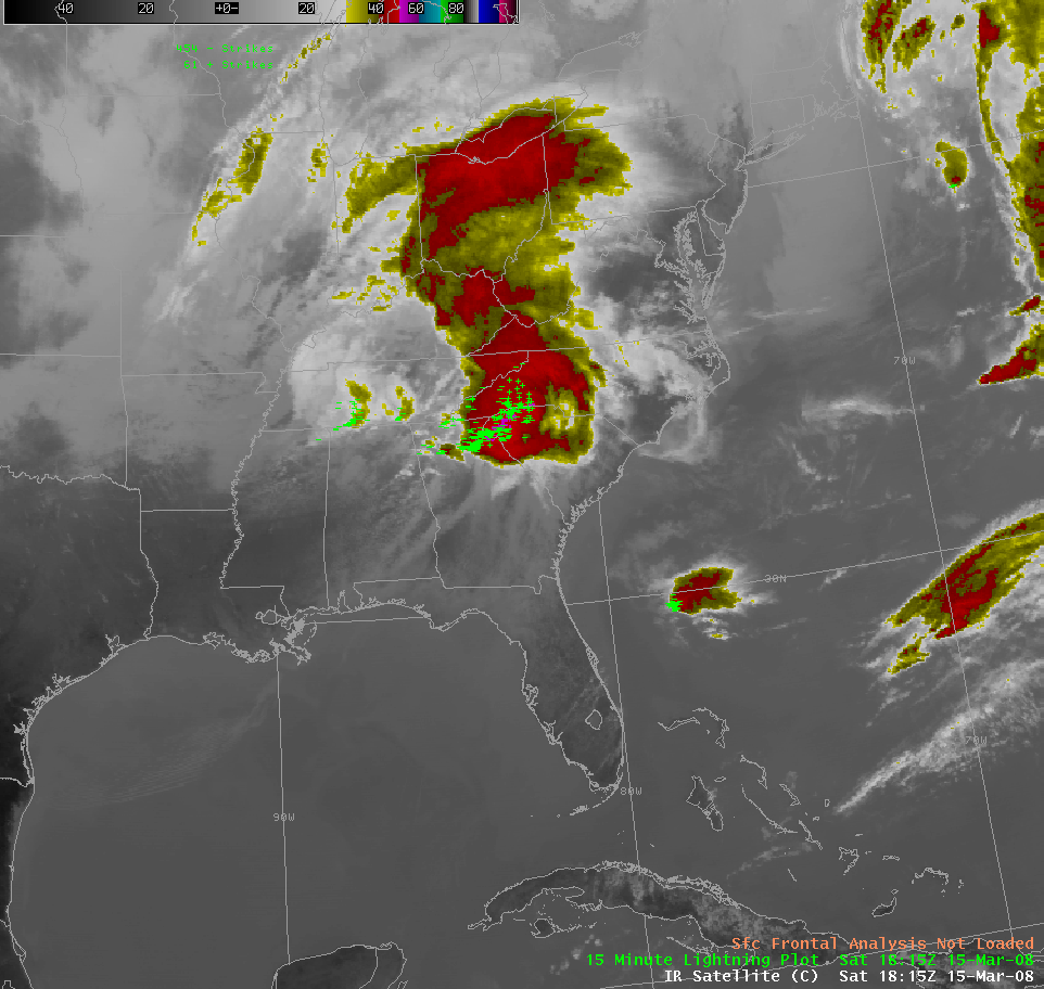
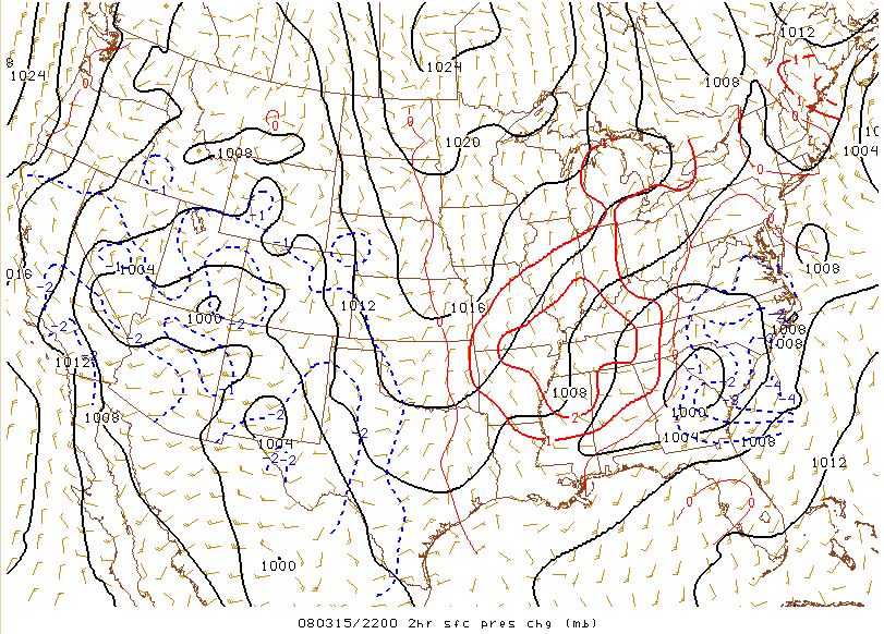
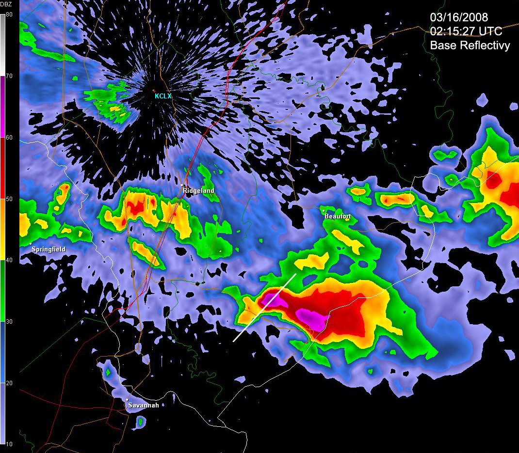
At 1800Z (1 PM EDT), a linear band of thunderstorms was developing on the downwind flank of the previous MCS which had weakened late in the morning over the South Carolina upstate and North Carolina Mountains (see 1815Z IR satellite image). By 2115Z (415 PM EDT), the line had developed further and pushed into central SC (see 2115Z IR satellite image). Around this time, the NWS Storm Prediction Center issued a Potentially Dangerous Situation (PDS) Tornado Watch from southern North Carolina through central GA, including southern South Carolina. An ill-defined surface warm front analyzed around midday along the North and South Carolina border was initially forecast by numerical guidance to be the main low-level forcing mechanism with the impending shortwave. This feature at the surface became secondary to a new convectively induced surface low pressure to the west of Augusta, Georgia in the mid afternoon. Strong pressure falls developed from the Altamaha River region of southeast Georgia northward over most of eastern South Carolina between 1800Z (1 PM EDT) and 2200Z (5 PM EDT). Wind fields were increasing ahead and to the south of the main shortwave diving into the North Carolina Piedmont with 0-1 km helicities as high as 500-600 m2/s2 developing along the Interstate 95 corridor. With mid-afternoon Convective Available Potential Energy (CAPE) values from 1400-2000 J/KG, Energy Helicity Index (EHI) values were between 3 and 5 along this axis. At the same time, analyzed Lifted Indices (LI) between Augusta, Georgia and Statesboro, Georgia reached -13 degrees C. Parameters such as these are found very infrequently during the month of March anywhere in the Southeast United States. NWS Charleston locally extended the Tornado Watch southward over the Savannah River area toward evening. By the time the boundary pushed into far southeast Georgia by late evening, the severe weather was over.
Additional Interesting Aspects of this Event:
* Fog was observed early in the morning over central South Carolina (most likely left over by the MCS that passed to the north). The southern extent of this fog deck created a thermal boundary running from west to east across WFO Columbia's CWA, which appeared to be a focal point of the long track supercell that went through Branchville, producing an EF-3 tornado.
* The inversion held in place to allow maximum surface heating and buildup of energy during the day, before rapidly breaking down as the meso low entered the region. This inversion held in place along the coast where the sea breeze pushed through and where high clouds remained the longest over southeast Georgia, thus limiting some potential for tornadoes along the South Carolina and Georgia coasts as well as over inland over parts of southern Georgia.
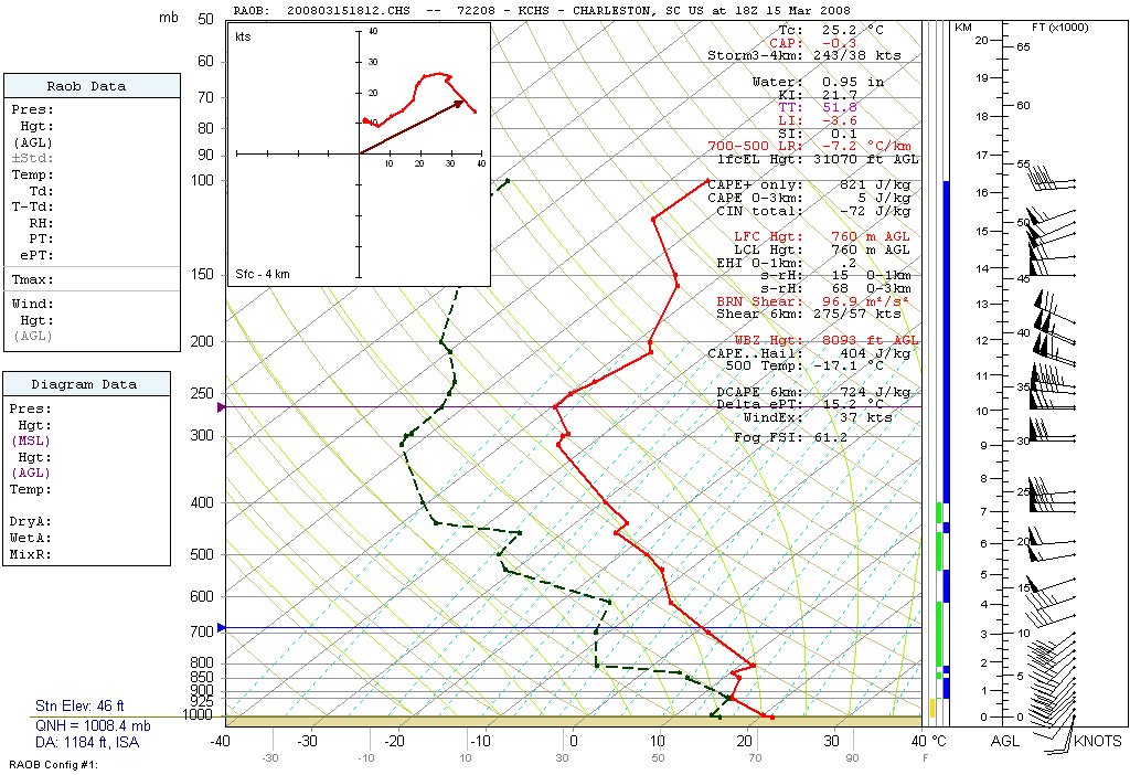
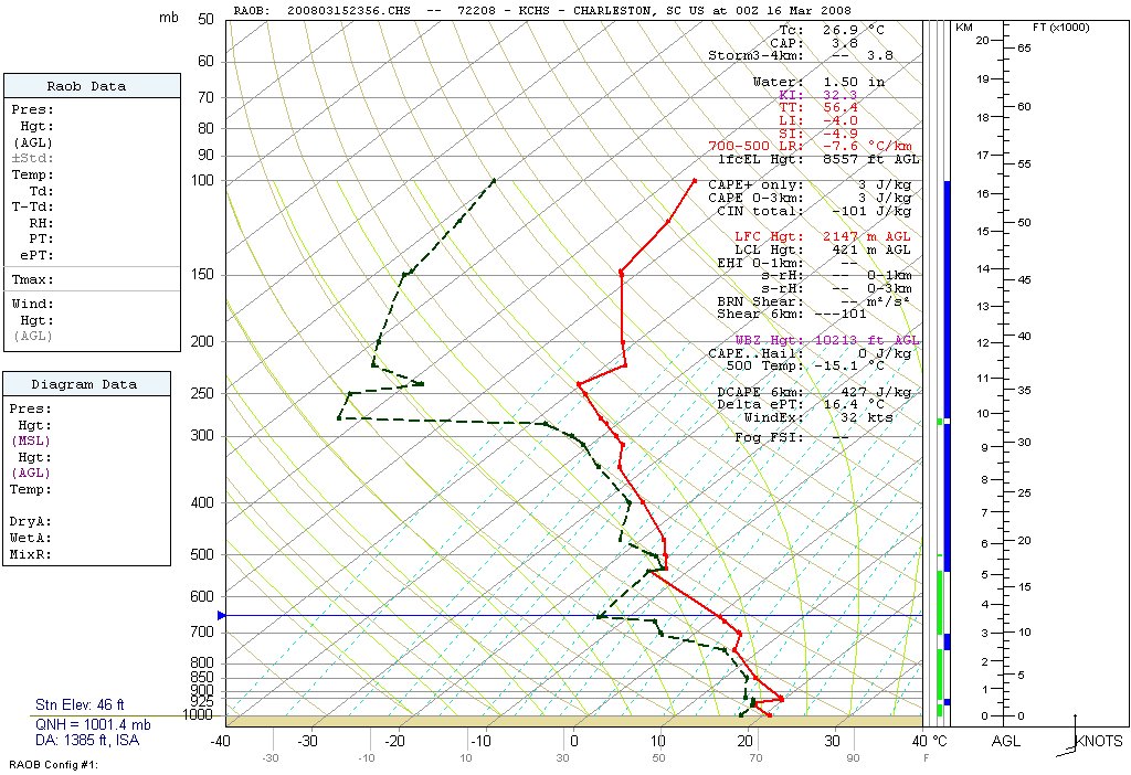
* The Level of Free Convection (LFC) and Lifted Condensation Level (LCL) around 760 meters seen on the 18Z March 15 and 00Z March 16 CHS soundings were well below the 2000 meter threshold favorable for tornadoes. Interestingly, even though an inversion was present above the LFC/LCL, the LFC/LCLs were the same, suggesting deep convection and quick initiation if the inversion was to break later in the afternoon.
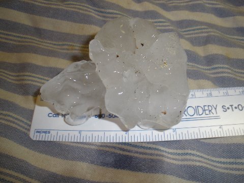
* Both the 18Z and 00Z CHS soundings favored high mid-level instability despite a sea breeze that had pushed through earlier in the afternoon. This created a classic coastal setup in which a thin layer of stable air existed near the surface while tremendous mid-level instability remained aloft. CAPE values of 404 J/KG in the -10 to -30 degree C hail growth zone, mid-level lapse rates near -7.5 degrees C, freezing levels near 10,500 feet, wet bulb zero heights near 8,500 feet, -17 degree C temperatures at 500 millibars, and Lift Indices around -4 degrees C favored large hail between 1 to 2 inches with the possibility of >2 inches in some locations. As storms reached the vicinity of the South Carolina and Georgia coastline, they encountered the sea breeze and shortly thereafter became elevated, bringing an end to tornadic activity. The storms, however, remained dangerous hail producers as mid-level instability remained favorable for large hail and damaging winds. Hail as large as tea cups (picture courtesy of Curtis Gorlich) was reported on Hilton Head Island, South Carolina causing significant damage to 62 aircraft at Hilton Head Airport as storms pushed offshore. Click here for a KCLX 0.5 degree radar reflectivity image and here for a KCLX cross-section of the storm as it moved over Hilton Head Island around 1015 PM EDT.
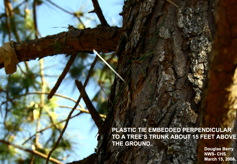
* A truly phenomenal cell that morphed into a long track supercell that was a traceable feature from its initiation northwest of Birmingham, Alabama around 1545Z to around Gainesville, Georgia by 1900Z. On this track, the cell first began to produce lightning around 1700Z to the northwest of Anniston, Alabama. The cell first began to obtain supercell characteristics about 1730Z as it crossed over into Georgia to the south of Rome. The developing storm showed it was already a force to be reckoned with, as it absorbed nearby cells approaching from the south and southwest in its early stages. When it reached Georgia, the supercell was on a heading of 240 degrees at 52 knots. At 1815Z, just west of Holly Springs, Georgia, it developed a hook echo. At 20Z, it was a deeply rotating supercell with a well defined bounded weak echo region bearing down on the South Carolina/Georgia border near Elberton, Georgia on a due west to east track. Before the supercell reached Saluda, South Carolina, it began to move right at about 285 degrees. The cell produced tornadoes across northern Columbia County (EF0) into Aiken County (EF2). At 2254Z this same cell produced a powerful EF3 tornado which pummeled the town of Branchville, South Carolina in northern Orangeburg County. The classic supercell clipped the far northern part of Berkeley County before moving off the coast near Georgetown and eventually moving out over the Gulf Stream and then beyond, as it likely became the focal point of a large MCS. The path length of this lone cell exceeded 600 statute miles.
* With 6 tornadoes being confirmed, this event ties for third most for any day across the Charleston CWA since 1950, and the most ever in March.
In conclusion, this event was very rare, especially considering the time of year. Early indications of the environment on this day suggest that if supercells were not closely interacting with each other and only 2 or 3 cells were able to develop with greater spacing between them, there would have been the potential for them to produce even stronger tornadoes.
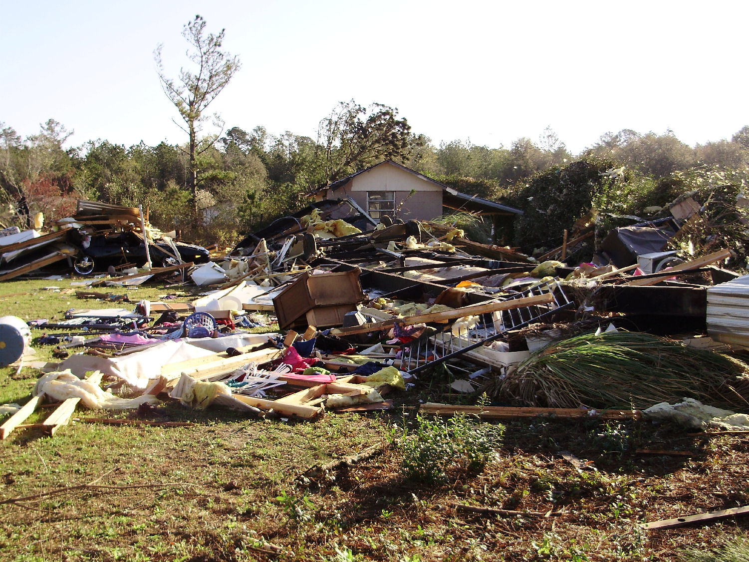
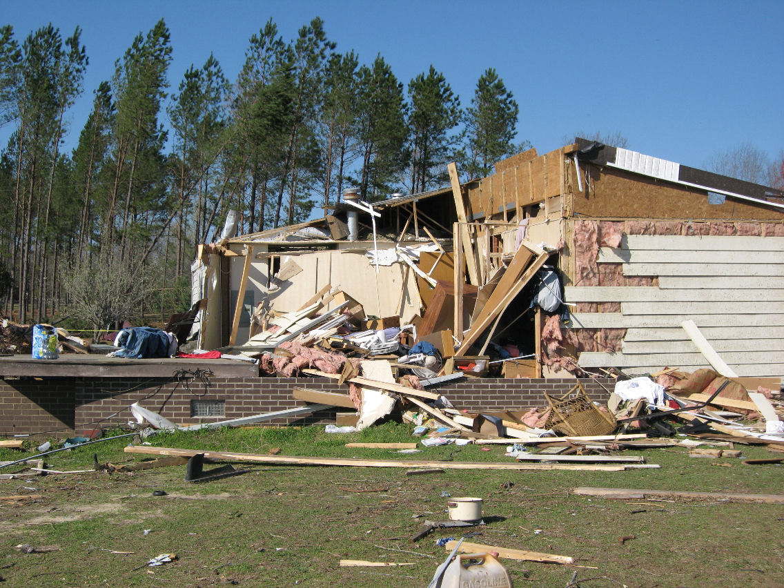
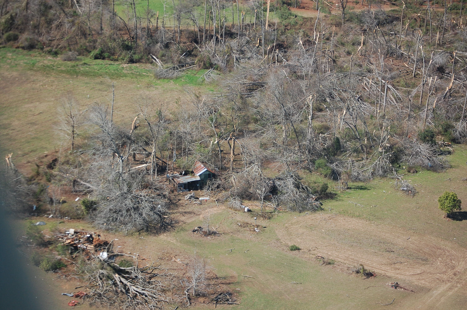
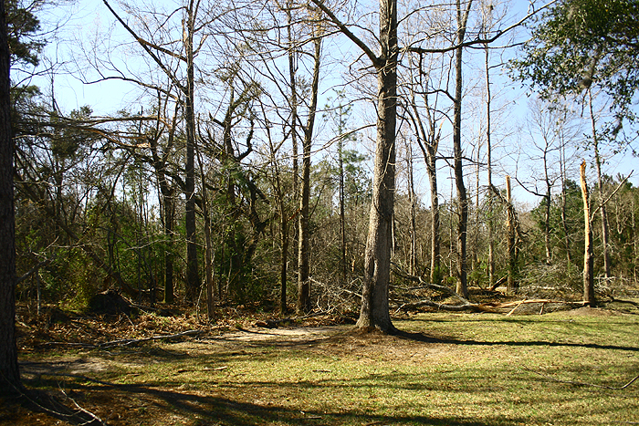
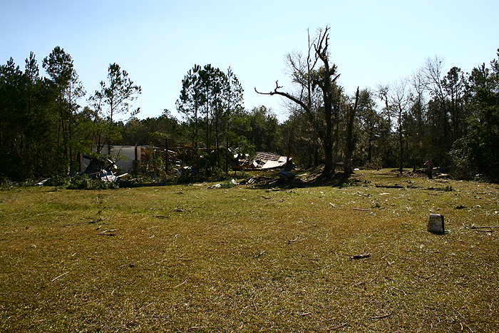
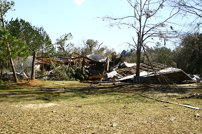
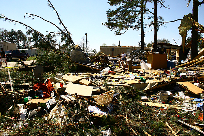
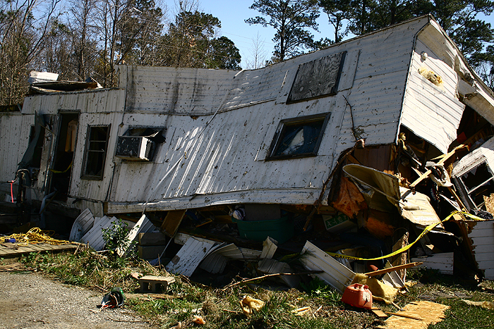
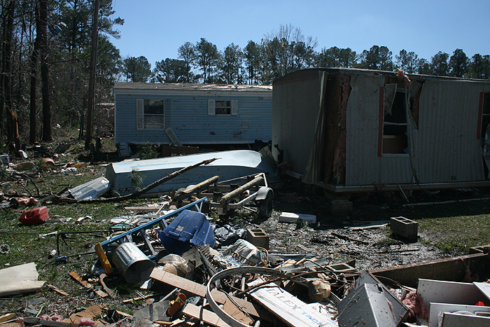
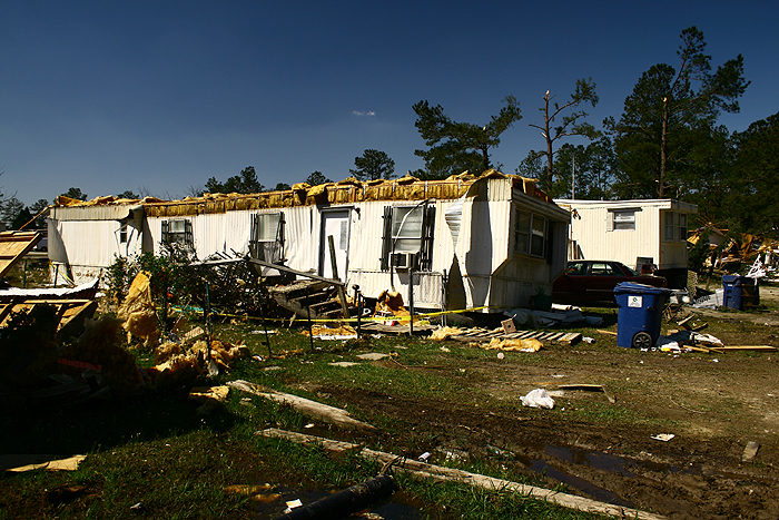
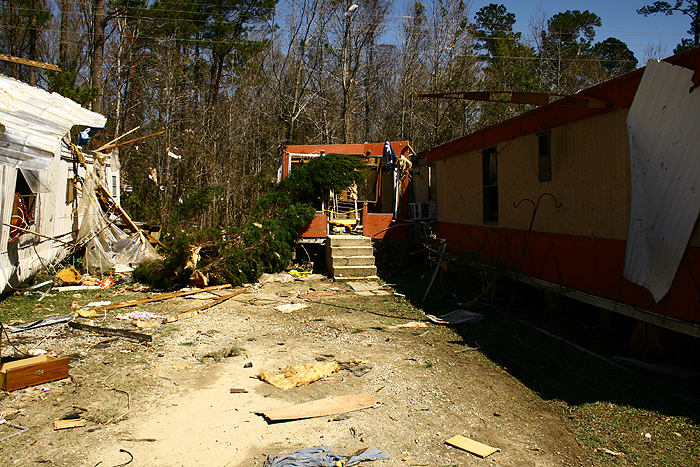
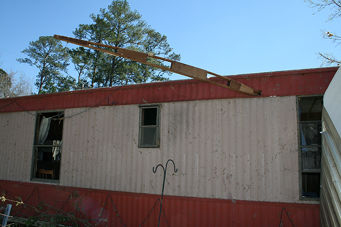
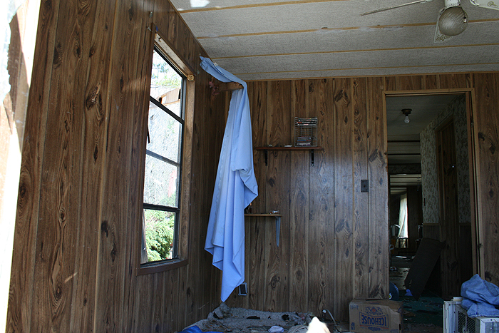
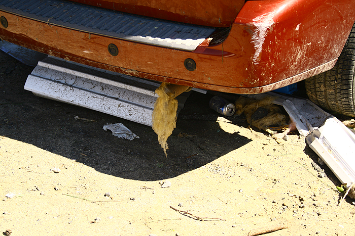
Damage photos courtesy of NWS Charleston
|
 |
|
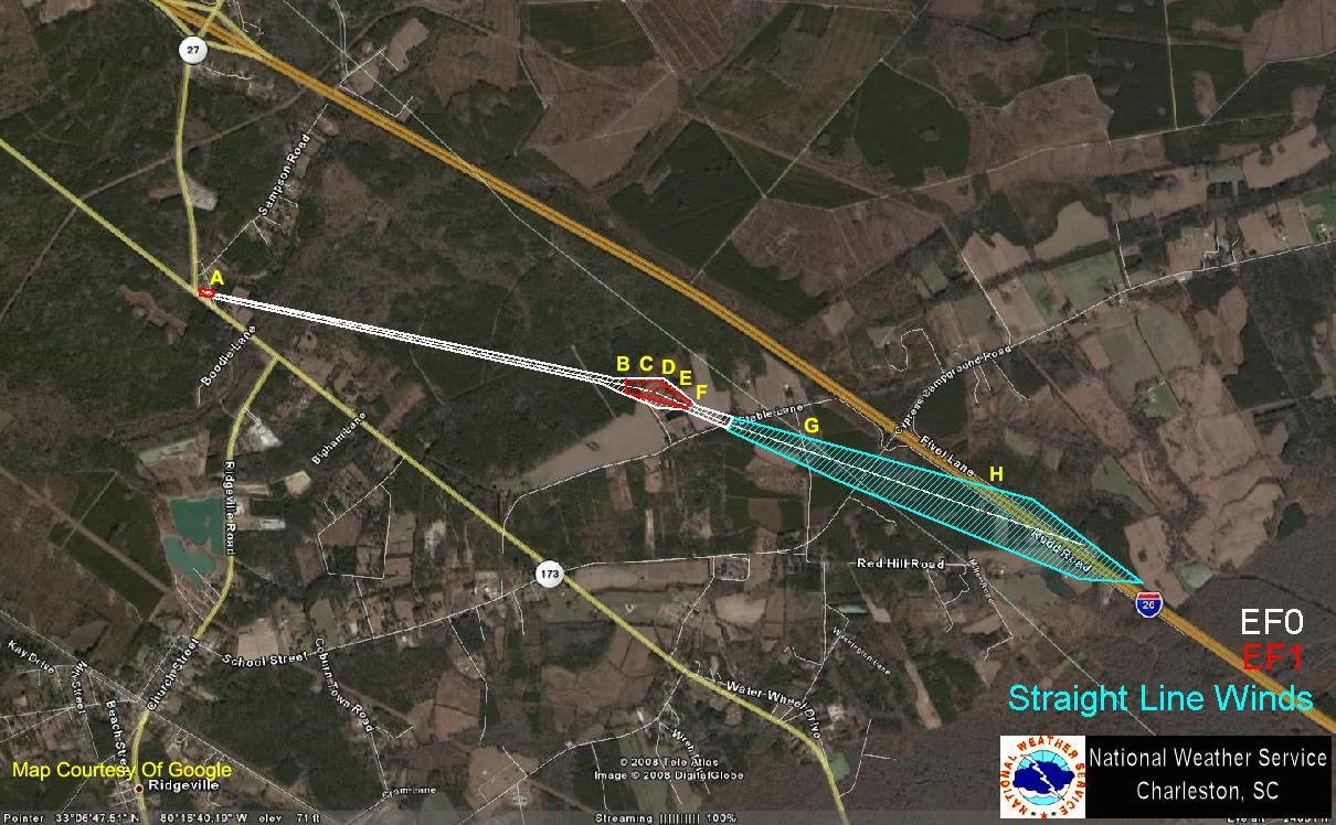
Point A |
Point B - 1 |
Point B - 2 |
Point B - 3 |
Point C |
|
Point D |
Point E - 1 |
Point E - 2 |
Point E - 3 |
Point F |
|
Point G - 1 |
Point G - 2 |
Point H |
Damage photos courtesy of NWS Charleston
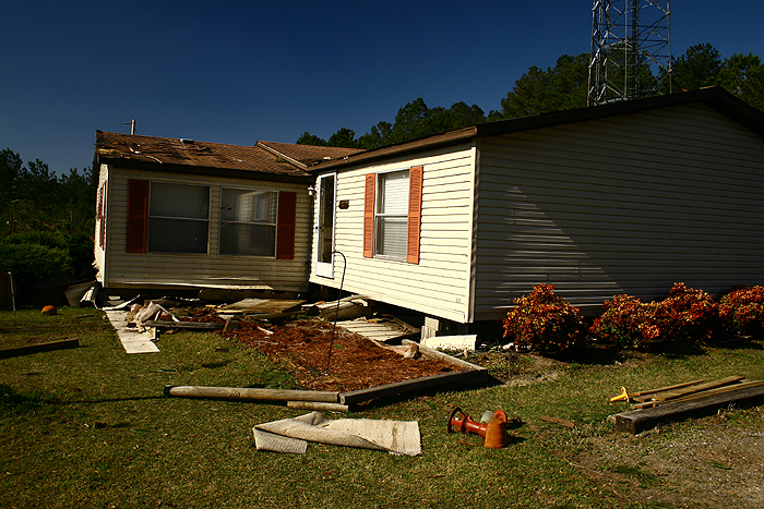
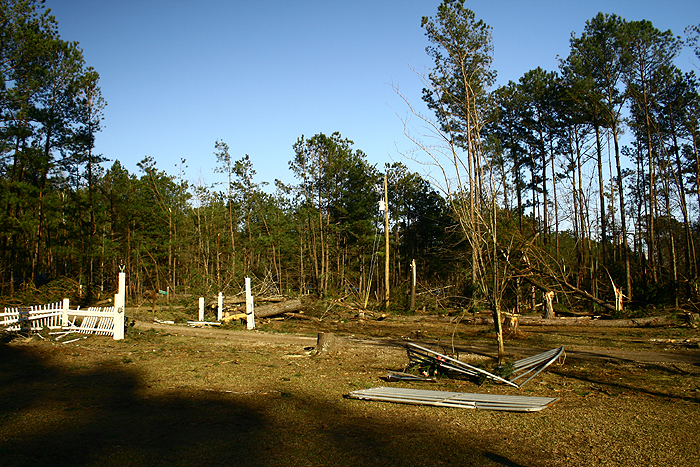
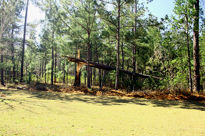
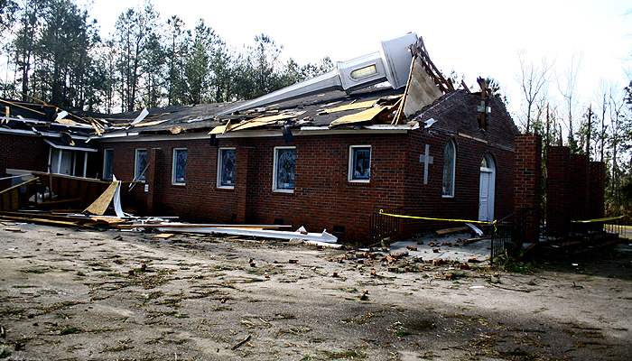
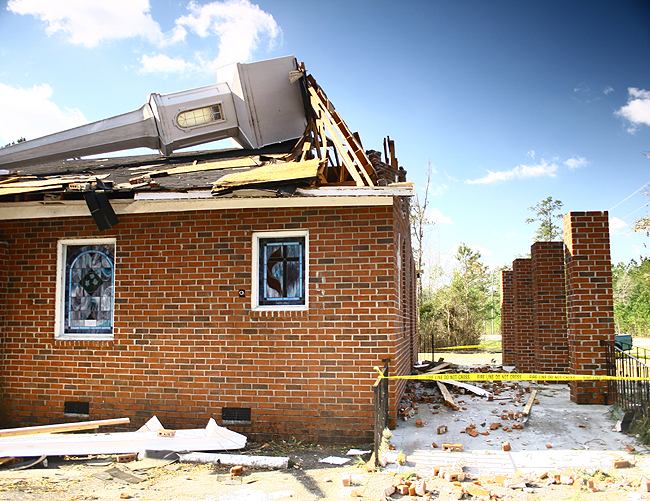
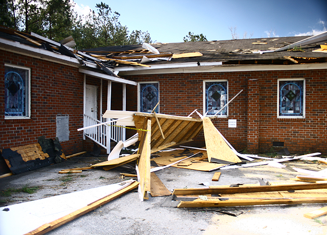
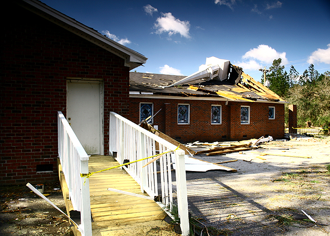
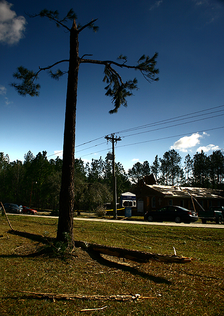
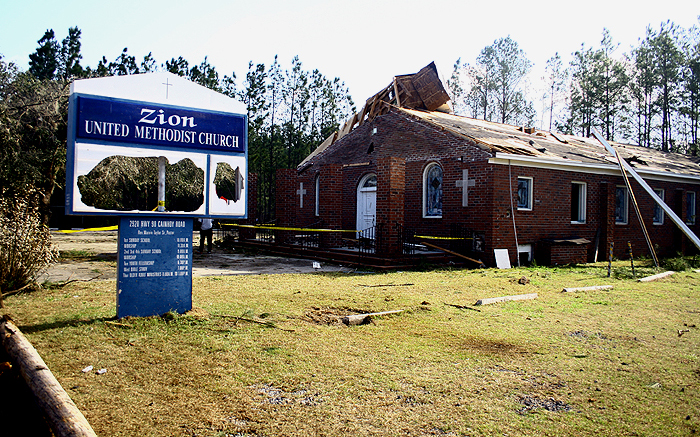
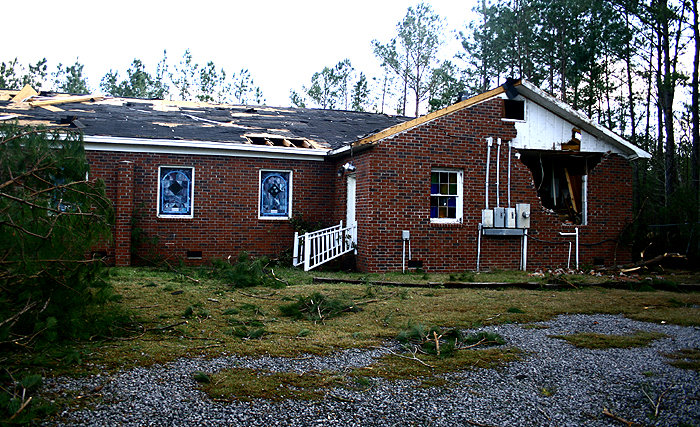
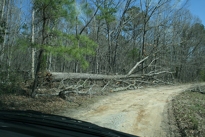
AT 836 PM EDT...A TORNADO TOUCHED DOWN NORTH OF CAINHOY SC...IN A
PLANTATION WEST OF CAINHOY ROAD. THIS TORNADO PRODUCED EF1
DAMAGE...WITH WIND SPEEDS OF 86-95 MPH...AS IT SEVERELY DAMAGED A
LARGE STORAGE SHED AND KNOCKED DOWN SEVERAL LARGE TREES. THE
TORNADO WEAKENED...PRODUCING EF0 DAMAGE TO MAINLY TREES AS IT
CONTINUE ACROSS THE PLANTATION. THE TORNADO THEN STRENGTHENED TO AN
EF1...WITH WIND SPEEDS OF 95-105 MPH...AS IT CROSSED CAINHOY ROAD
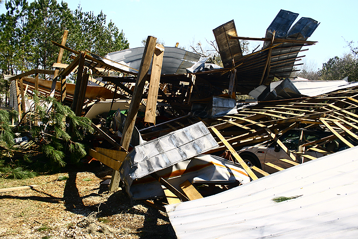
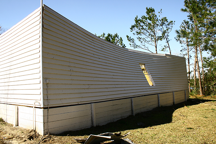
AND STRUCK THE MOUNT ZION METHODIST CHURCH. THE CHURCH SUFFERED
COMPLETE FAILURE OF THE FRONT PORCH...AND HAD A PORTION OF THE ROOF
DECK UPLIFTED AND STEEPLE KNOCKED OVER. PORTIONS OF THE OUTER BRICK
WALL ALSO SUFFERED SIGNIFICANT DAMAGE. THE TORNADO CONTINUED INTO A
FIELD BEHIND THE CHURCH BEFORE LIFTING. THE TOTAL LENGTH OF THE
TORNADO WAS 1.2 MILES WITH A PATH WIDTH OF 406 FT.
|
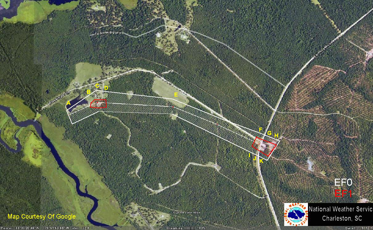 |
| Point A | Point B: 1/2 | Point C | Point D | Point E | Point F | Point G: 1/2/3 | Point H | Point I: 1/2 | Point J | Point K |
Damage photos courtesy of NWS Charleston
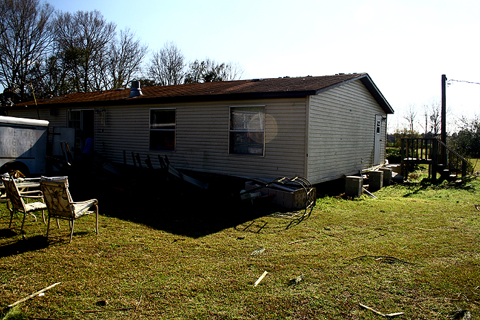
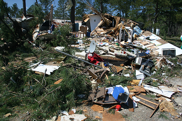
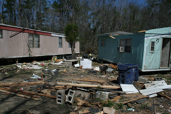
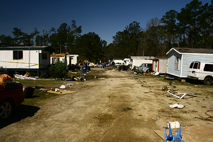
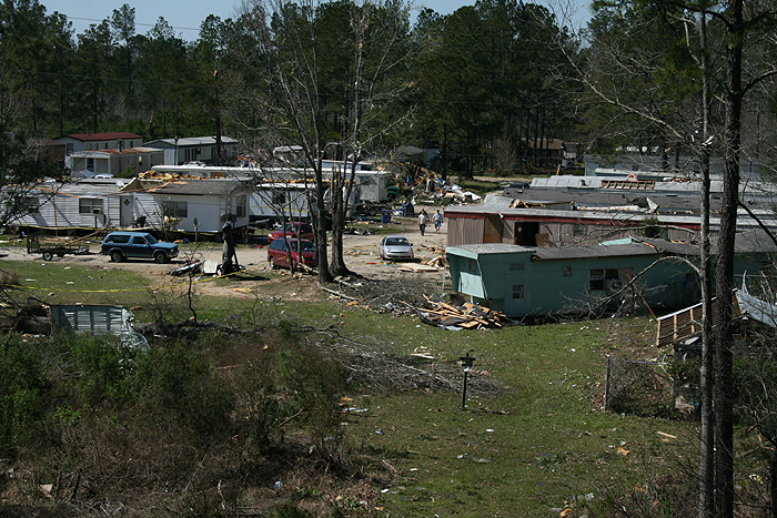
AT 825 PM EDT..A TORNADO TOUCHED DOWN NORTH OF MOUNT HOLLY SC...NEAR
STRAWBERRY...IN THE STRAWBERRY HILL MOBILE HOME PARK JUST EAST OF
HIGHWAY 52. THIS TORNADO PRODUCED EF1 DAMAGE IN THE STRAWBERRY
MOBILE HOME PARK...WITH WIND SPEEDS OF 100-110 MPH. EXTENSIVE DAMAGE
OCCURRED TO TWO MOBILE HOMES...MODERATE DAMAGE TO SIX MOBILE HOMES
AND SLIGHT DAMAGE TO ANOTHER SIX MOBILE HOMES. LARGE TREES WERE ALSO
SNAPPED OFF ALONG THE TRUNK OR UPROOTED. THIS TORNADO INJURED 7
PEOPLE. THE TORNADO THEN CONTINUED ACROSS OLD HIGHWAY 52...LIFTING
NEAR ANGEL LANE...WHILE CONTINUING TO PRODUCE EF1 DAMAGE WITH
SEVERAL PINE TREES SNAPPED ALONG THE TRUNK OR UPROOTED. THE TOTAL
LENGTH OF THE TORNADO WAS 0.6 MILES WITH A PATH WIDTH OF ABOUT 530
FT.
|
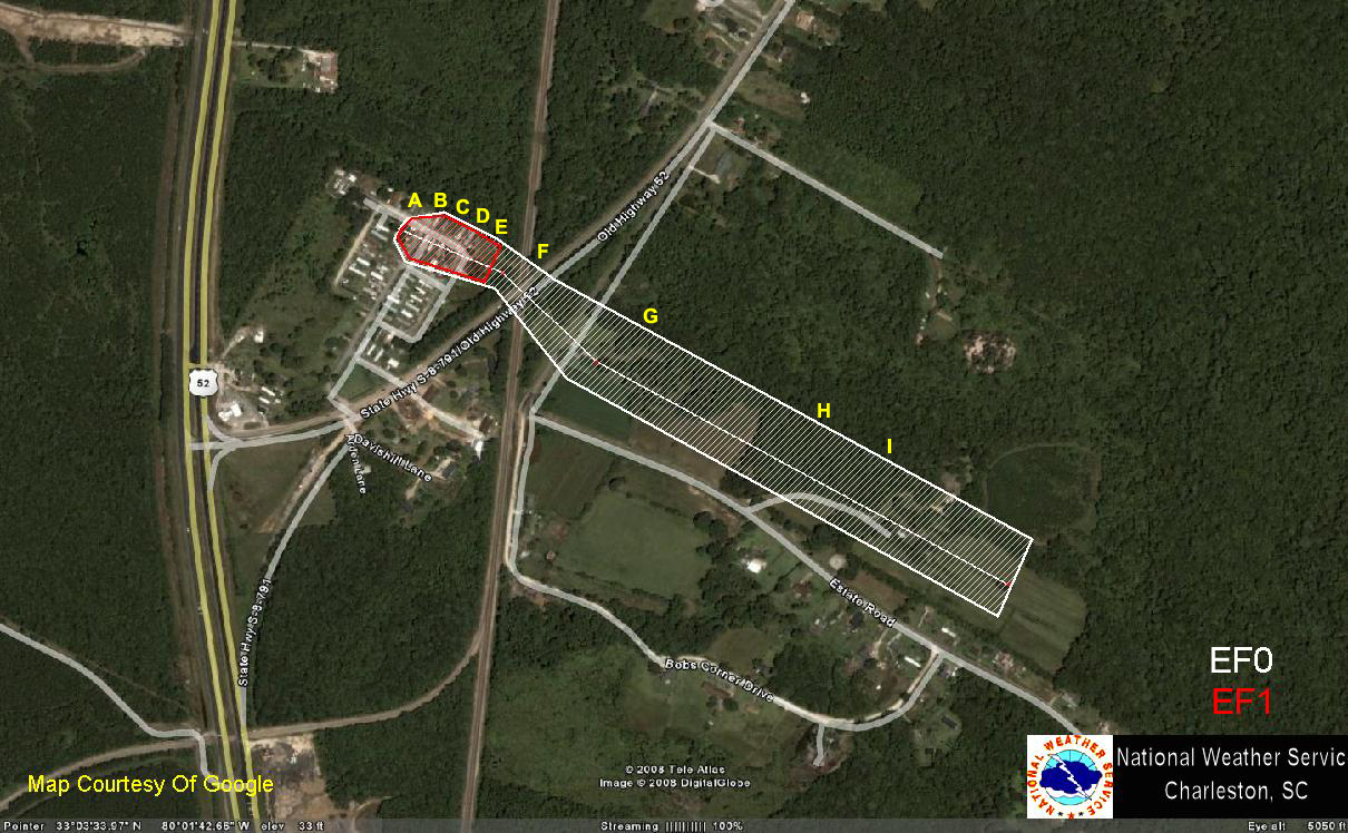 |
| Point A: 1/2 | Point B: 1/2 | Point C: 1/2 | Point D: 1/2/3/4 | Point E: 1/2 | Point F | Point G | Point H | Point I |
Damage photos courtesy of NWS Charleston except otherwise noted
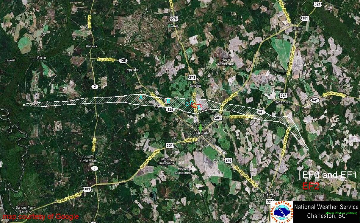
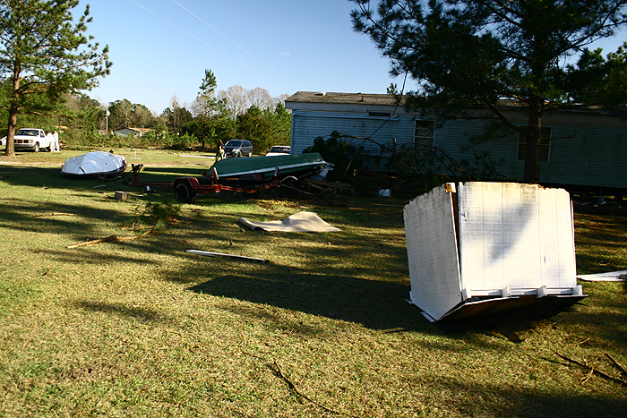
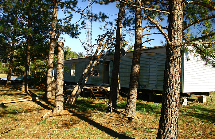
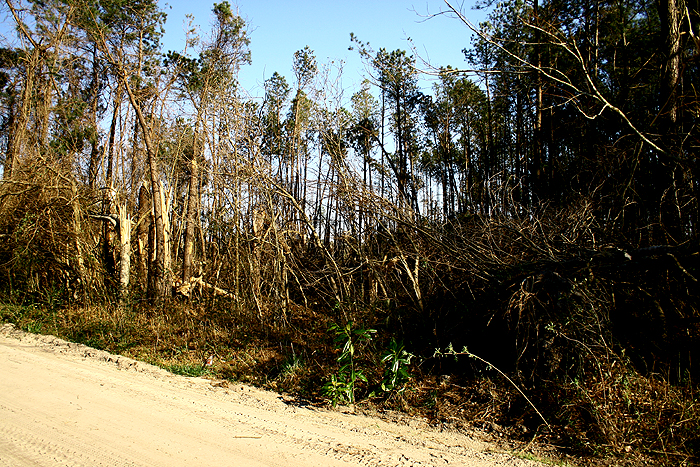
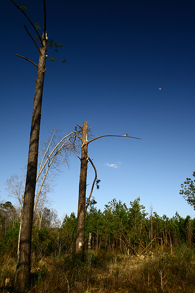
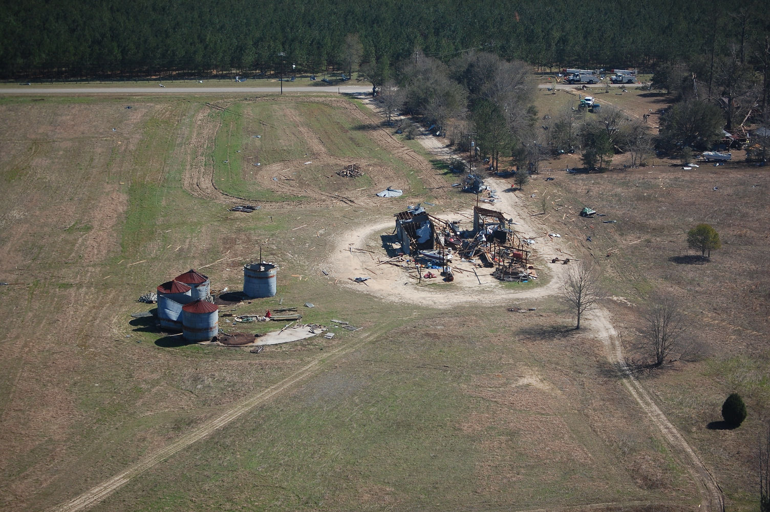
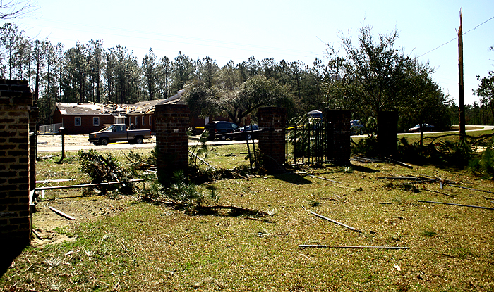
A TORNADO TOUCHED DOWN IN WESTERN ALLENDALE COUNTY ABOUT 3.5 MILES
SOUTH-SOUTHWEST OF MARTIN AT 712 PM AND TRAVELED EAST OR
EAST-SOUTHEAST 18 MILES BEFORE LIFTING ABOUT 2 MILES NORTHEAST OF
FAIRFAX AT 735 PM. THIS TORNADO UPROOTED OR SNAPPED OFF A COUPLE
THOUSAND TREES, DESTROYED TWO MOBILE HOMES, TOPPLED A CELL PHONE
TOWER, PRODUCED MAINLY MINOR ROOF DAMAGE TO MANY DOZEN HOMES,
KNOCKED DOWN NUMEROUS POWER LINES AND POWER POLES, DESTROYED OR
SEVERELY DAMAGED A COUPLE DOZEN VEHICLES, DESTROYED SEVERAL
OUTBUILDINGS, BARNS, AND SHEDS, AND OVERTURNED AN EMPTY TRACTOR
TRAILER. THIS TORNADO REACHED A MAXIMUM WIDTH OF 3/4 OF A MILE WIDE
ALONG ROUTE 29 BETWEEN ALLENDALE AND SEIGLING. WHEN THE TORNADO
PUSHED A DOUBLEWIDE MOBILE HOME OFF THE FOUNDATION, FAMILY OF EIGHT
TOOK SHELTER IN THE BATHTUB. ONE INJURY OCCURRED WHEN A PERSON DROVE
A CAR INTO A TREE THAT HAD FALLEN ACROSS A ROAD. THIS TORNADO WAS
RATED AN EF2 WITH WIND SPEEDS OF 115 TO 125 MPH. THERE WAS SPORADIC
STRAIGHTLINE WIND DAMAGE WITH WINDS UP TO 90 MPH OCCURRING UP TO A
COUPLE OF MILES SOUTH OF THE TORNADO PATH. THIS RESULTED IN DOWNED
TREES AND POWER LINES AND MAINLY MINOR DAMAGE TO HOMES AND
BUSINESSES ESPECIALLY IN THE ALLENDALE AREA.
|
 |
|
Point A |
Point B |
Point C |
Point D |
Point E |
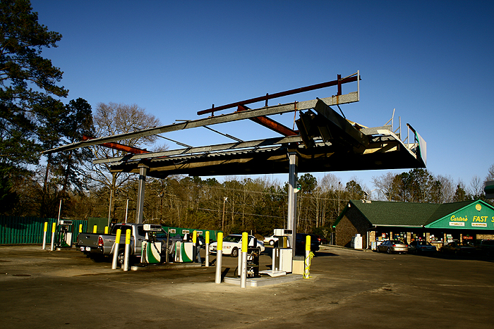
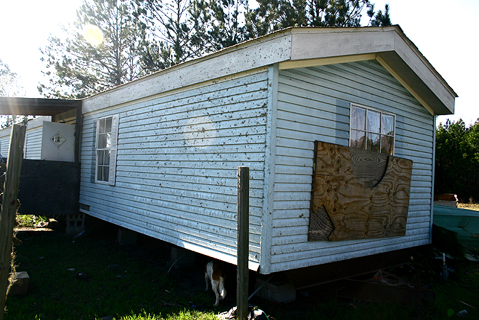
Additional Damage Photos
courtesy of Allendale County Emergency Management
|
|
 |
 |
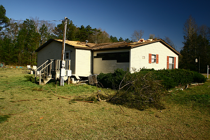
Damage photos courtesy of NWS Charleston except otherwise noted
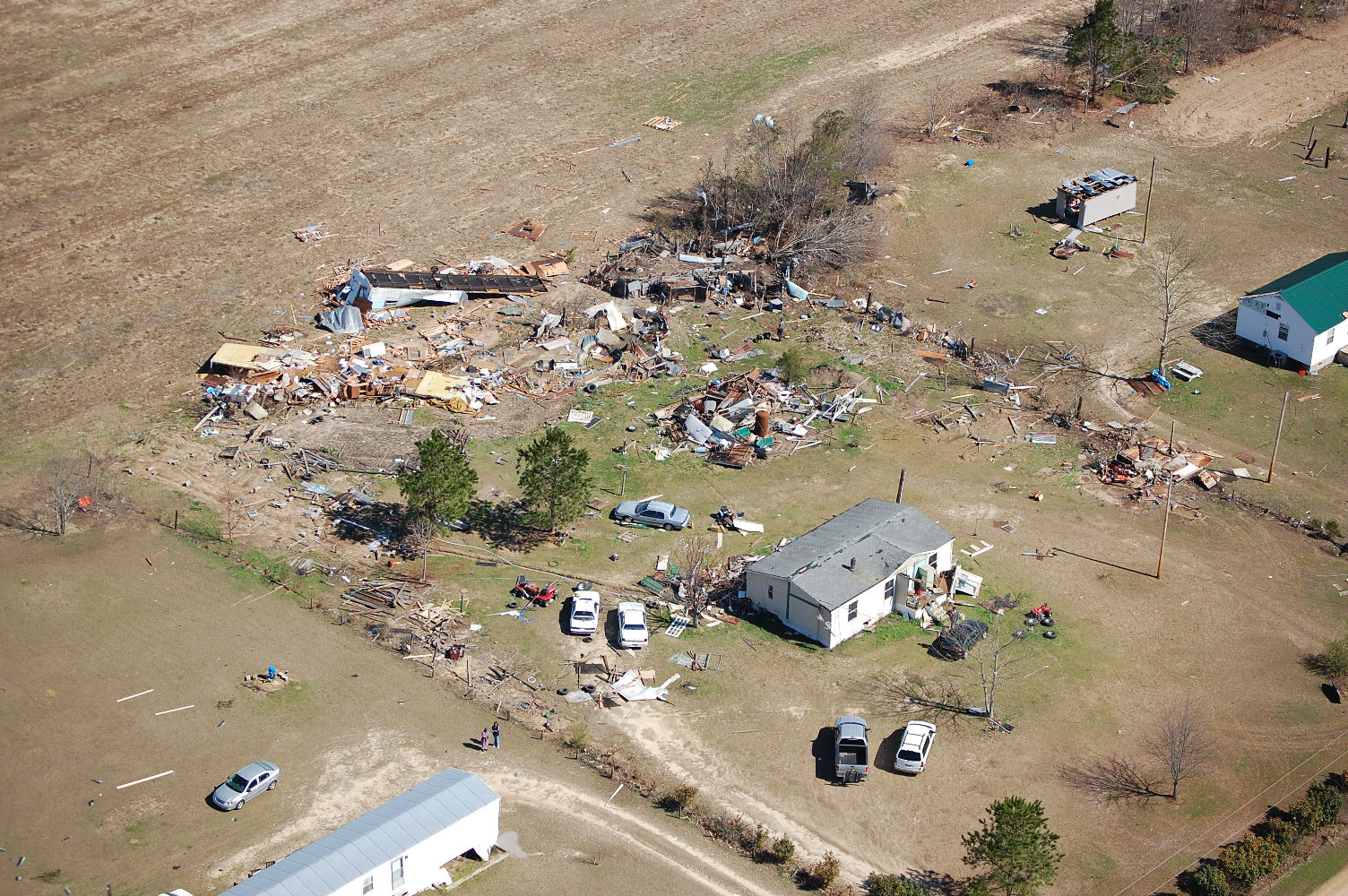
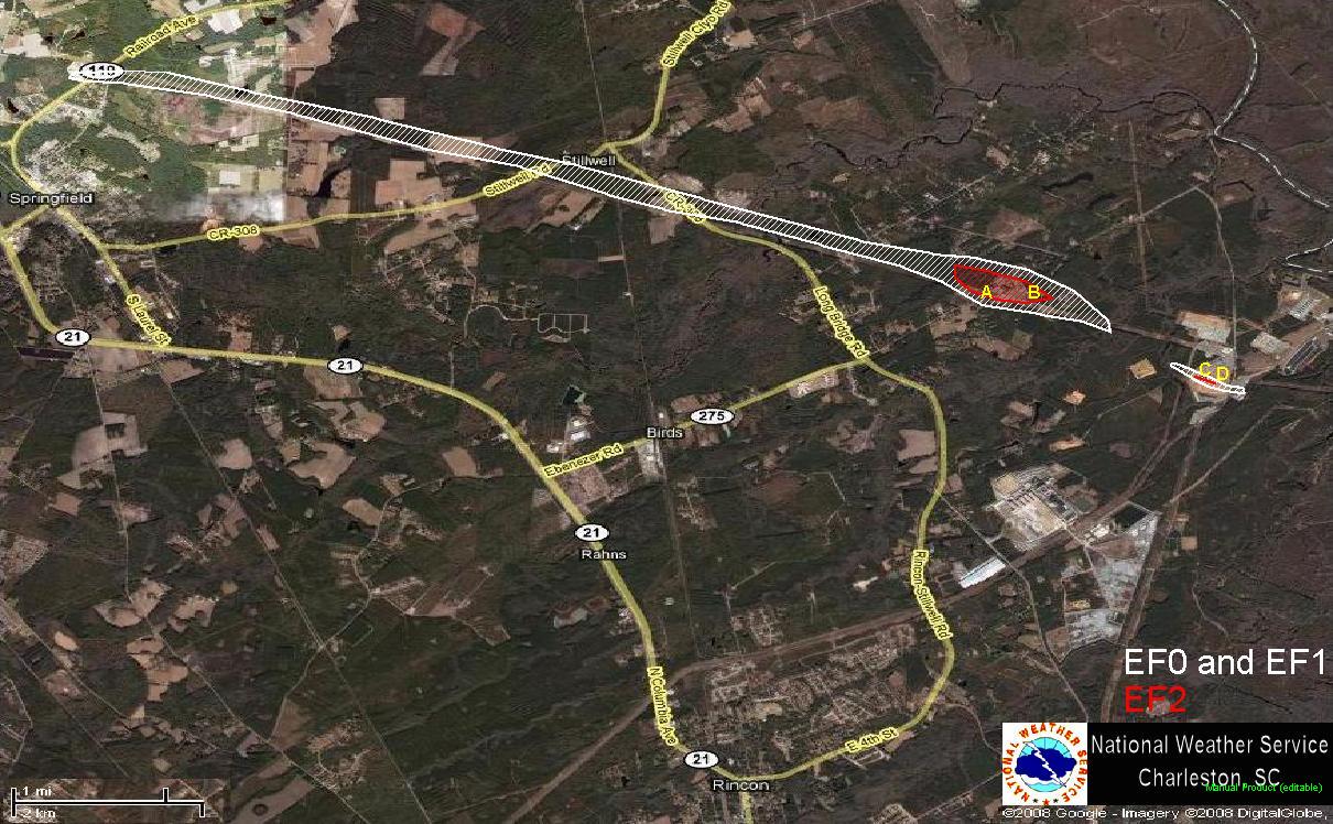
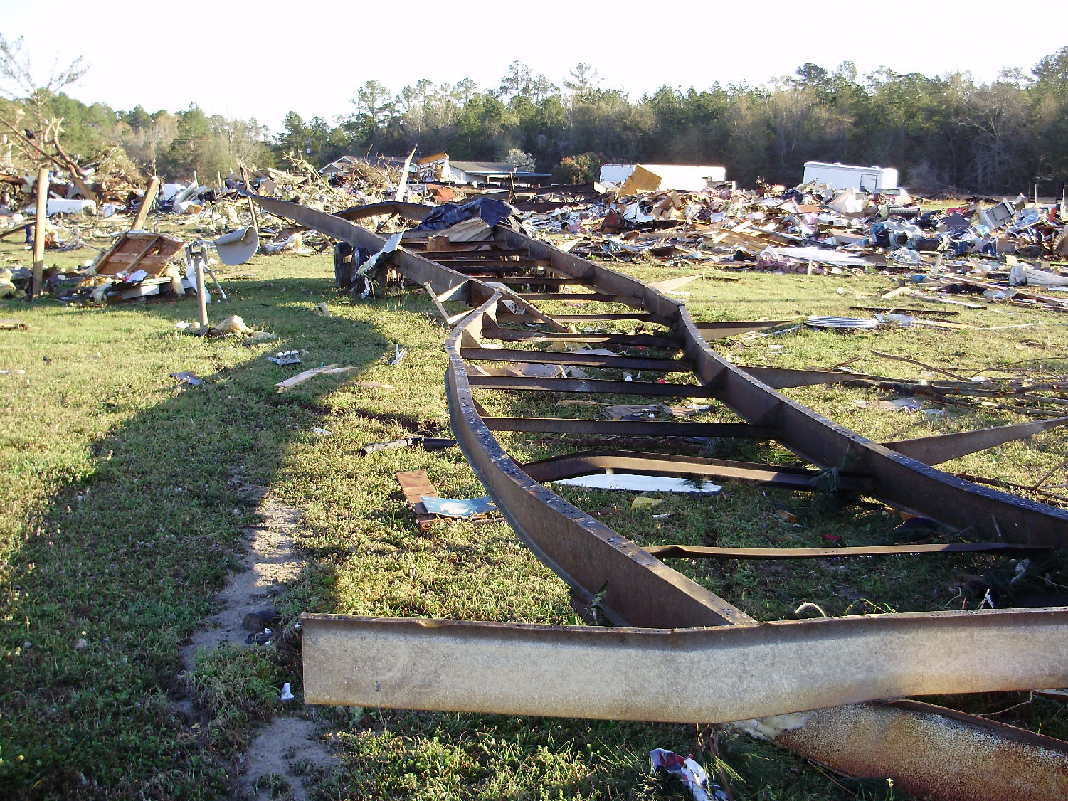
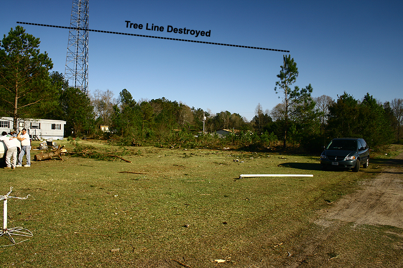
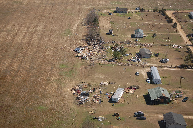
A TORNADO TOUCHED DOWN IN EFFINGHAM COUNTY 1 MILE NORTHEAST OF
SPRINGFIELD AT 934 PM AND TRAVELED SOUTHEAST ABOUT 7 MILES BEFORE
LIFTING AT 943 PM ABOUT 6.5 MILES EAST-SOUTH OF SPRINGFIELD. THIS
TORNADO DESTROYED THREE MOBILE HOMES, DAMAGED THREE TO FOUR DOZEN
HOMES, KNOCKED DOWN 15 HIGH VOLTAGE TRANSMISSION TOWERS, DESTROYED
OR DAMAGED ABOUT 20 VEHICLES, DESTROYED NUMEROUS OUTBUILDINGS,
SHEDS, AND BARNS. FIVE PEOPLE WERE INJURED WHEN THE MOBILE HOME THEY
WERE IN WAS BLOWN OVER AND ROLLED A TIME OR TWO. ANOTHER PERSON WAS
INJURED WHEN THEY DROVE A CAR INTO A TREE THAT HAD FALLEN ACROSS THE
ROAD. THIS TORNADO WAS 1/4 MILE WIDE AT ITS WIDEST POINT WHEN IT
CROSSED EBENEZER ROAD AND WAS RATED AN EF2 WITH WIND SPEEDS OF 110
TO 120 MPH.
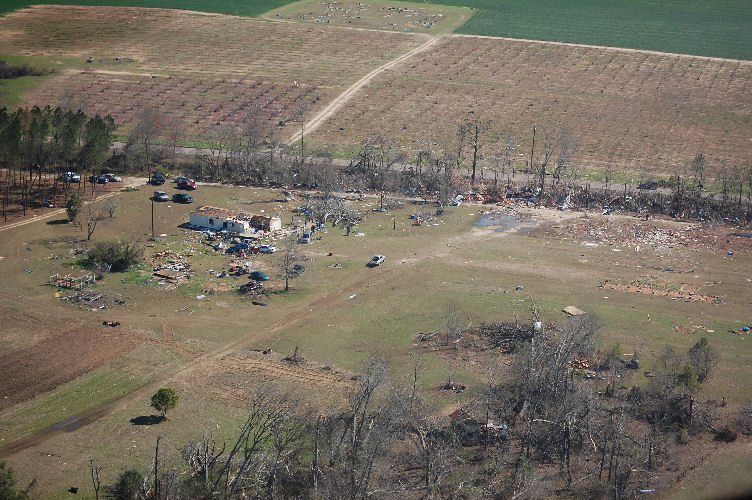
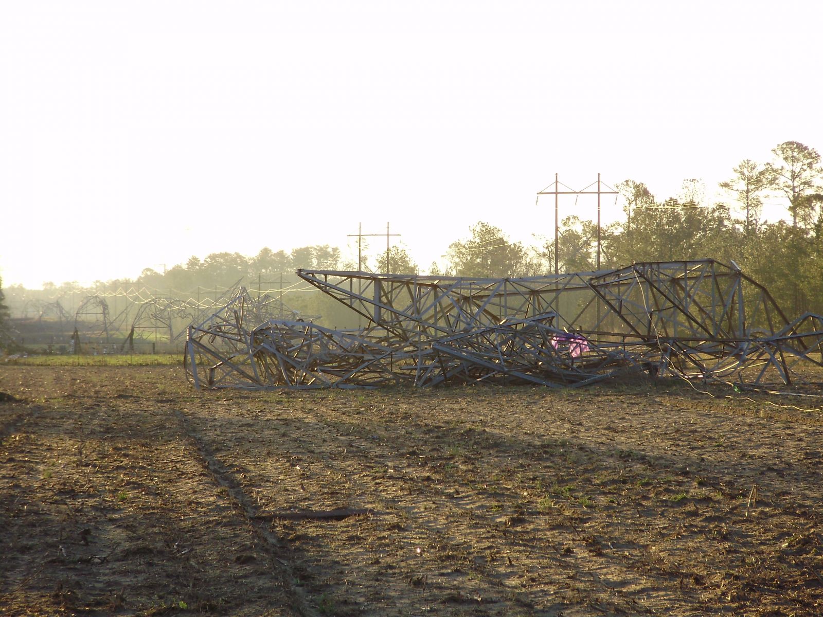
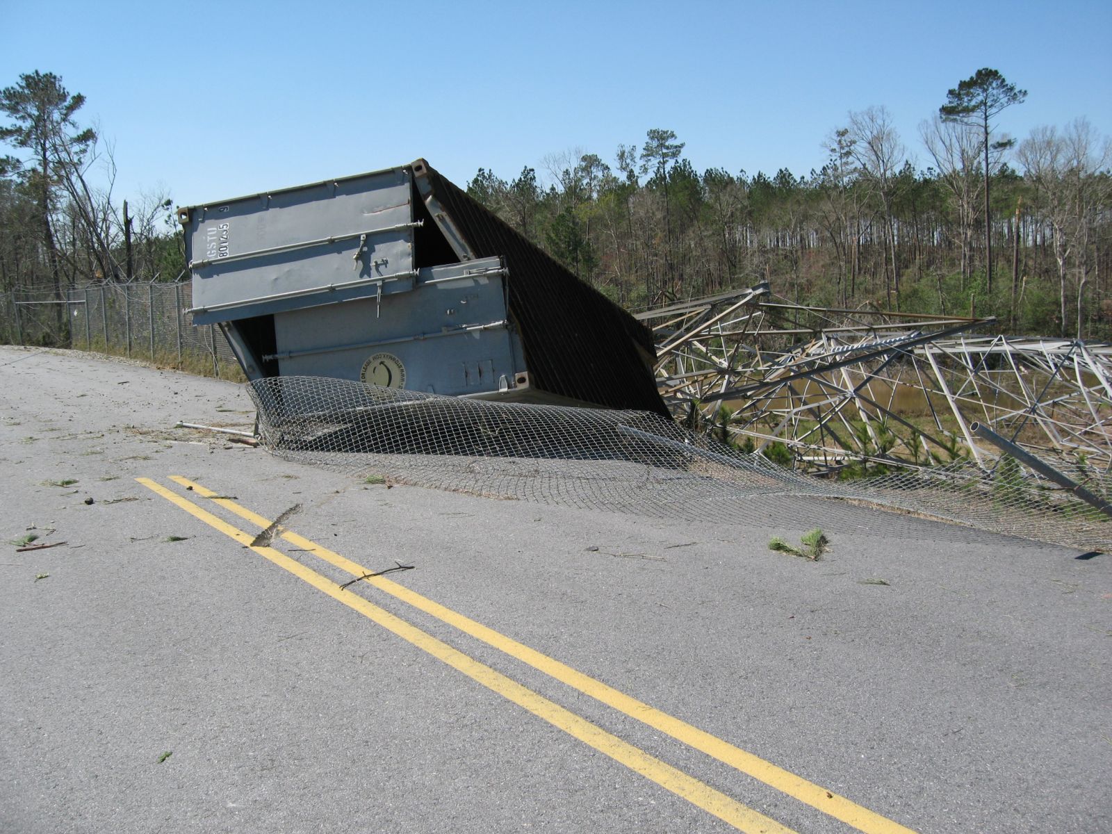
A SECOND TORNADO DEVELOPED AROUND 944 PM ABOUT 3.5 MILES NORTHEAST
OF RINCON JUST NORTHWEST OF THE GEORGIA POWER MCINTOSH PLANT AND
TRAVELED SOUTHEAST ABOUT 1/2 MILE THROUGH THE PLANT BEFORE LIFTING
JUST SOUTHEAST OF THE PLANT. THIS TORNADO DESTROYED A WATER COOLING
TOWER, DAMAGED ANOTHER WATER COOLING TOWER AND SEVERAL BUILDINGS,
TOPPLED TWO HIGH VOLTAGE TRANSMISSION TOWERS, KNOCKED DOWN OR
UPROOTED SEVERAL DOZEN TREES, TOSSED TRACTOR TRAILER CARGO
CONTAINERS WITH EQUIPMENT INSIDE UP TO 100 YARDS. IN ADDITION...AT
THE TIME OF THE SURVEY ONE OF THE TRACTOR TRAILER CARGO CONTAINERS
COULD NOT BE FOUND. A STEEL HOIST/ROOF ASSEMBLY WEIGHING A COUPLE
THOUSAND POUNDS USED TO LOAD AND UNLOAD HEAVY ITEMS WAS TOSSED 100
FEET. INITIAL DAMAGE ESTIMATES TO THE POWER PLANT WERE FROM 2 TO 3
MILLION DOLLARS. THIS TORNADO WAS UP TO 100 YARDS WIDE AND WAS RATED
AN EF2 WITH WIND SPEEDS FROM 120 TO 130 MPH.
|
 |
|
Point A |
Point B |
Point C |
Point D |
Additional Damage Photos
courtesy of Effingham County Emergency Management
 |
 |
 |
An Investigation of the Significant Tornado Outbreak in Southern South Carolina and North Coastal Georgia on March 15, 2008 by Frank Alsheimer, Robert Bright, Jon Jelsema, Wendy Moen, John Quagliariello, and Doug Berry
Event Summary Team: Doug Berry, Mike Emlaw, John Quagliariello, Steven Taylor, Frank Alsheimer, Jon Jelsema, Wendy Sellers, Robert Bright


 Coastal Flood
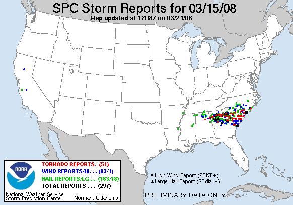