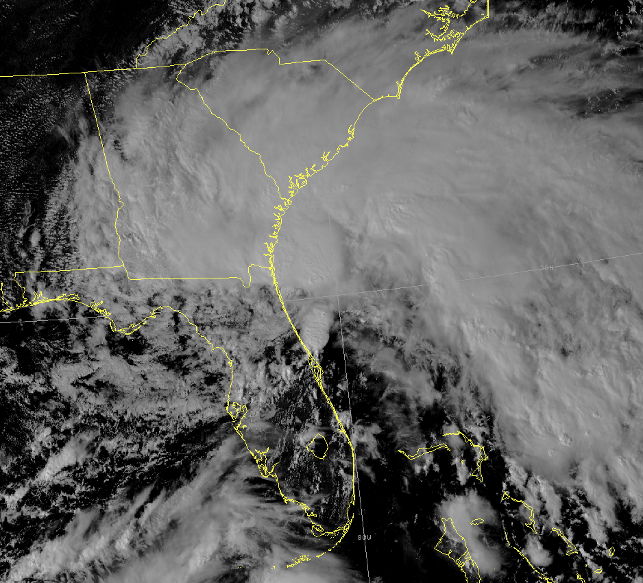
Tropical Storm Tammy formed during the morning hours of October 5th about 20 miles south-southeast of Jacksonville, FL. Tammy then moved to the north-northwest paralleling the northeast Florida coast and made landfall near Mayport, FL just before 8 PM EDT that evening. The storm weakened to a tropical depression on the morning of October 6 as it moved across Georgia. The strongest winds were well north of the center for the entire duration of the tropical storm. Tropical storm warnings were issued early on the 5th from Cocoa Beach, FL north to the South Santee River in South Carolina. All tropical storm warnings were dropped during the late morning hours of the 6th.
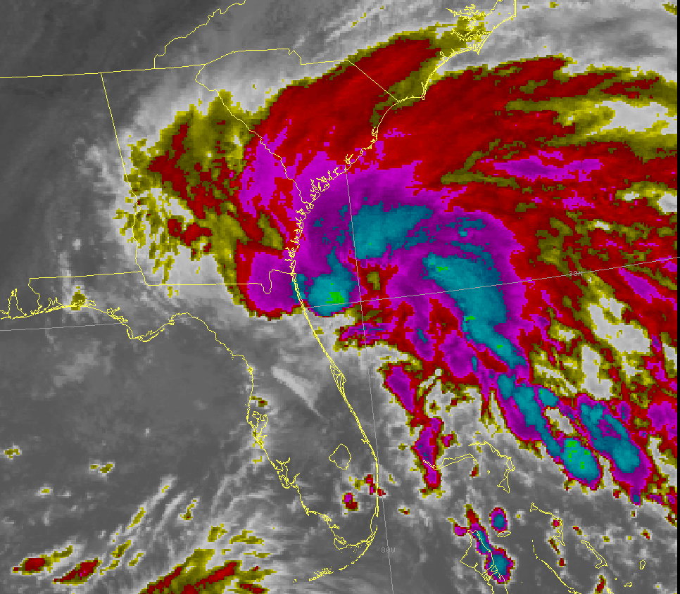
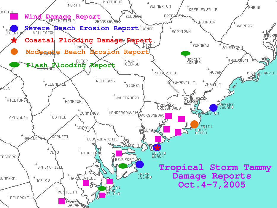
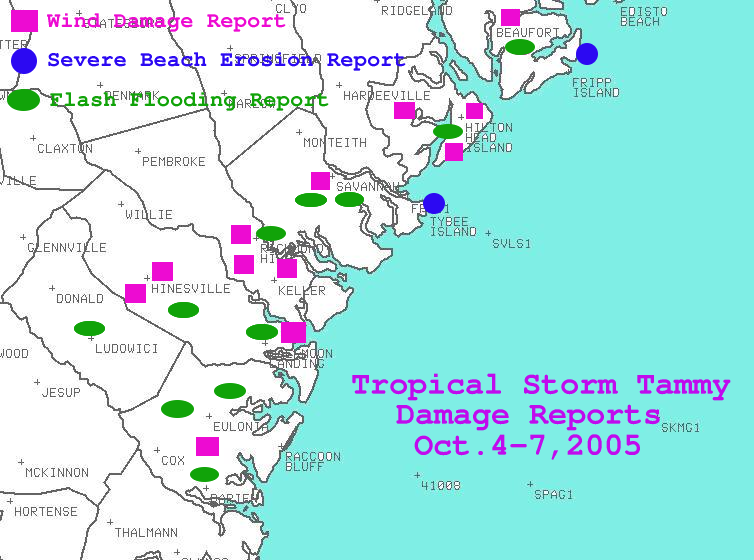
Heavy rainfall occurred with this storm with the worst flooding in southeast Georgia in McIntosh County where 15-20 roads were washed out, 2 pond dams burst and 5 homes were damaged. Some tree damage occurred along the coast, most widespread in Beaufort County where around 30 trees were knocked down. Significant beach erosion occurred, especially on Hunting Island, Edisto Beach and Isle of Palms in South Carolina and on Tybee Island in Georgia. Several feet of beach were lost along much of the coast and several homes were damaged on Edisto Beach. No tornadoes were reported.
 |
 |
 |
 |
 |
|
OFFICIAL SITES...NWS OR FAA:
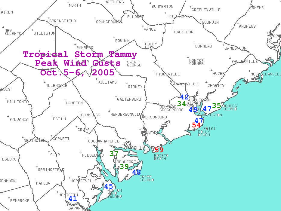
CHARLESTON SC AIRPORT (CHS)...
MAX 2 MINUTE AVG 28 KT FROM 110 DEGREES AT 1619 UTC ON 10/5/05
PEAK WIND 35 KT FROM 120 DEGREES AT 1618 UTC ON 10/5/05
SAVANNAH GA AIRPORT (SAV)...
MAX 2 MINUTE AVG 26 KT FROM 050 DEGREES AT 1935 UTC ON 10/5/05
PEAK WIND 32 KT FROM 110 DEGREES AT 0611 UTC ON 10/6/05 (THE LATEST OF TWO OCCURRENCES)
COASTAL WATERS:
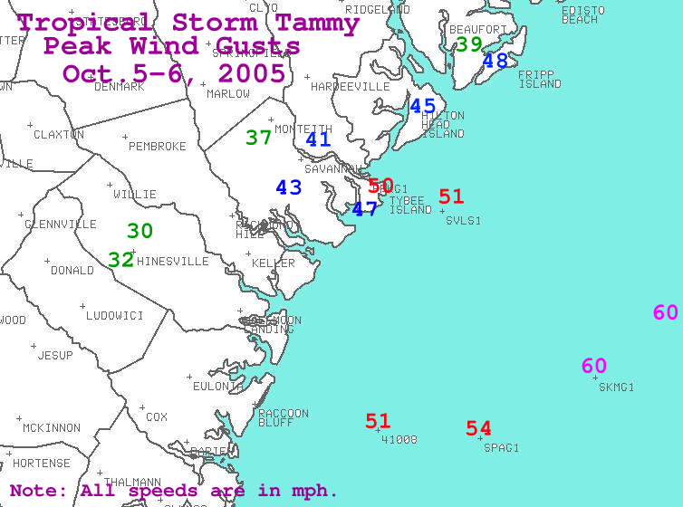
NDBC 41004 EDISTO BUOY...
MAX 8 MINUTE AVG 38 KT FROM 120 DEGREES AT 0120 UTC ON 10/6/05
PEAK WIND 48 KT FROM 110 DEGREES AT 0150 UTC ON 10/6/05
NDBC 41008 GRAYS REEF BUOY...
MAX 8 MINUTE AVG 35 KT FROM 120 DEGREES AT 0130 UTC ON 10/6/05
PEAK WIND 46 KT FROM 110 DEGREES AT 0150 UTC ON 10/6/05
SABSOON TOWER R8/TYBG1(34 METERS)...
MAX 8 MINUTE AVG 42 KT FROM 100 DEGREES AT 0229 UTC ON 10/6/05
PEAK WIND 54 KT FROM 100 DEGREES AT 0229 UTC ON 10/6/05
SABSOON TOWER R2/SPAG1(50 METERS)...
MAX 8 MINUTE AVG 44 KT FROM 100 DEGREES AT 0231 UTC ON 10/6/05
PEAK WIND NOT AVAILABLE
CMAN STATION:
FBIS1 FOLLY BEACH:
MAX 10 MIN AVG 35 KT FROM 100 DEGREES AT 2030 UTC ON 10/5/05
PEAK WIND 48 KT FROM 100 DEGREES AT 2100 UTC ON 10/5/05
UNOFFICIAL SITES:
DOWNTOWN CHARLESTON SOUTH CAROLINA (CHL)...
MAX SUSTAINED 10 MIN AVG 30 KT FROM 100 DEGREES AT 1948 UTC ON 10/5/05
PEAK WIND 43 KT FROM 100 DEGREES AT 1948 UTC ON 10/5/05
PINEVILLE SC...
MAX SUSTAINED 10 MIN AVG 15 KT FROM 080 DEGREES AT 0920 UTC ON 10/6/05
PEAK WIND 30 KT FROM 080 DEGREES AT 0920 UTC ON 10/6/05
FORT PULASKI...
MAX SUSTAINED AVG 33 KT FROM UNKNOWN DEGREES AT 2330 UTC ON 10/5/05
PEAK WIND 44 KT FROM UNKNOWN DEGREES AT 0212 UTC ON 10/6/05
 |
 |
OFFICIAL SITES:
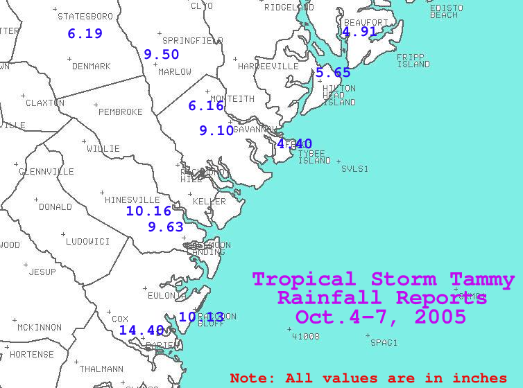
SAVANNAH AIRPORT (SAV)..........4.44 INCHES
CHARLESTON AIRPORT (CHS)........3.63 INCHES
CHARLESTON CITY (CHL)...........3.58 INCHES
UNOFFICIAL SITES:
SAVANNAH........................6.49 INCHES
HILTON HEAD.....................5.65 INCHES
HINESVILLE......................5.16 INCHES
METTER..........................4.69 INCHES
LADSON..........................3.54 INCHES
JAMES ISLAND....................2.23 INCHES
ISLE OF PALMS...................2.16 INCHES
WALTERBORO......................2.02 INCHES
SOUTH CAPERS ISLAND HIGHEST TIDE 7.57 FT MLLW AT 1554 UTC ON 10/6/05
HIGHEST DEPARTURE...2.47 FT MLLW AT 0624 UTC ON 10/6/05
CHARLESTON HARBOR HIGHEST TIDE 7.60 FT MLLW AT 1542 UTC ON 10/6/05
HIGHEST DEPARTURE...2.56 FT MLLW AT 0530 UTC ON 10/6/05
FRIPP ISLAND SC HIGHEST TIDE 8.93 FT MLLW AT 0300 UTC ON 10/6/05
HIGHEST DEPARTURE...3.25 FT MLLW AT 0712 UTC ON 10/6/05
FORT PULASKI (SAVANNAH GA) HIGHEST TIDE 9.85 FT MLLW AT 0312 UTC ON 10/6/05
HIGHEST DEPARTURE...4.18 FT MLLW AT 0742 UTC ON 10/6/05


 Coastal Flood