Scattered strong to severe thunderstorms are expected today across the Mid-Atlantic and forecast to contain heavy to excessive rainfall. Numerous instances of flash flooding are possible in southern Virginia and north-central North Carolina. Severe thunderstorms are also possible across the northern Great Plains today. Elevated to Critical Fire Weather located across the Intermountain West. Read More >
Rainy River Basin Summary Page
How can you share precipitation reports with the National Weather Service? Join CoCoRaHS (link)!
This page contains resources for river and lake levels across the Rainy River Basin, encompassing parts of northwest Ontario and northeast Minnesota. If flooding is forecast, briefings will be posted to this page. View the latest water level update image (shown right) here. |
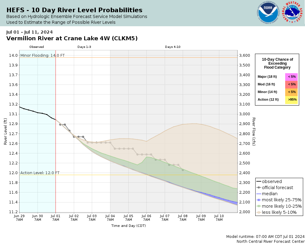
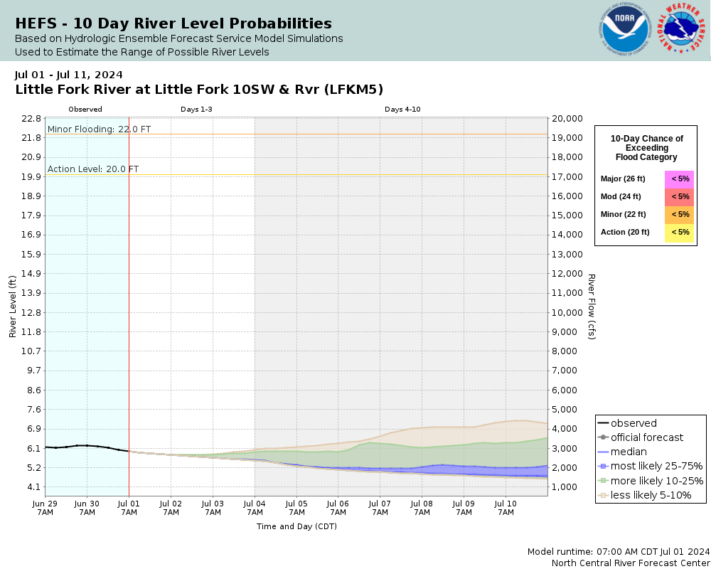
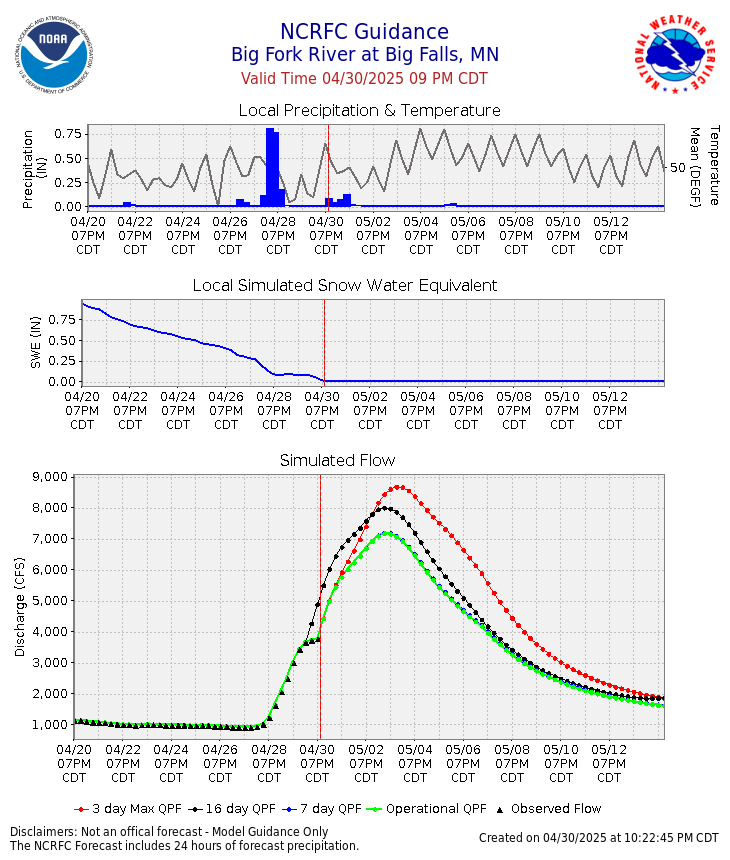
Observed and Forecast River Levels
|
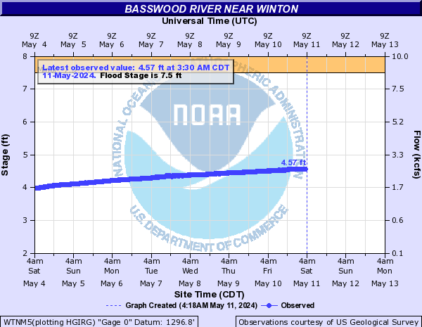
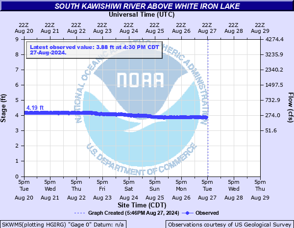
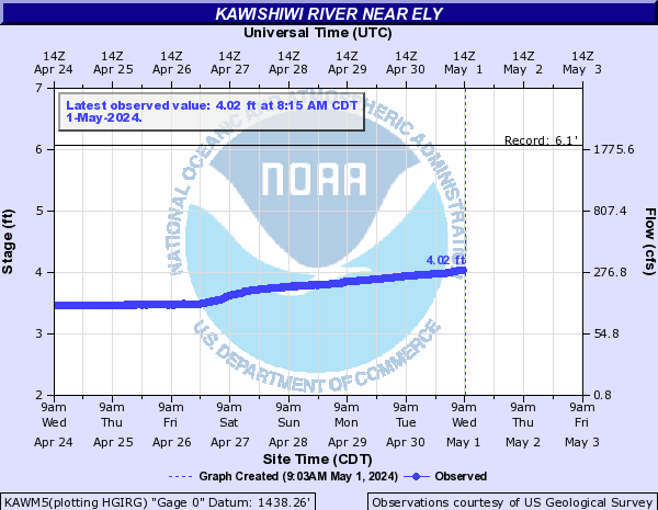
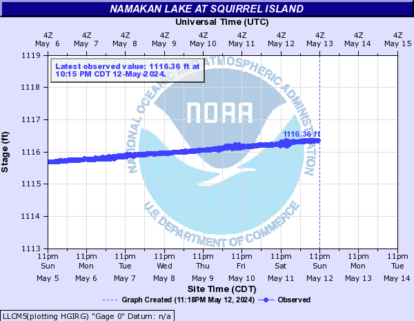
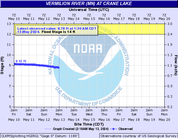
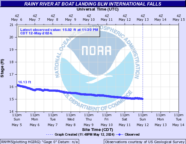
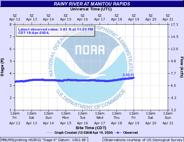
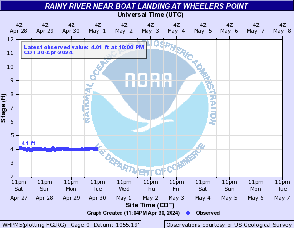
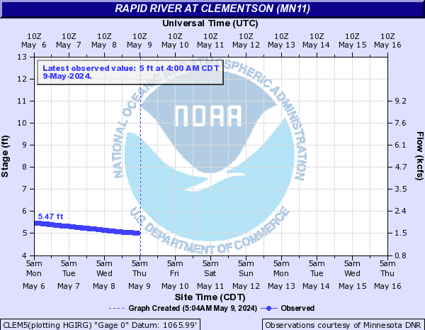
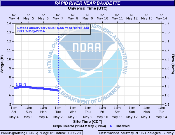
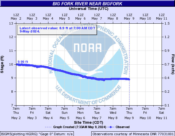
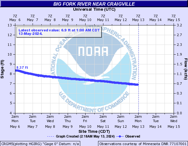
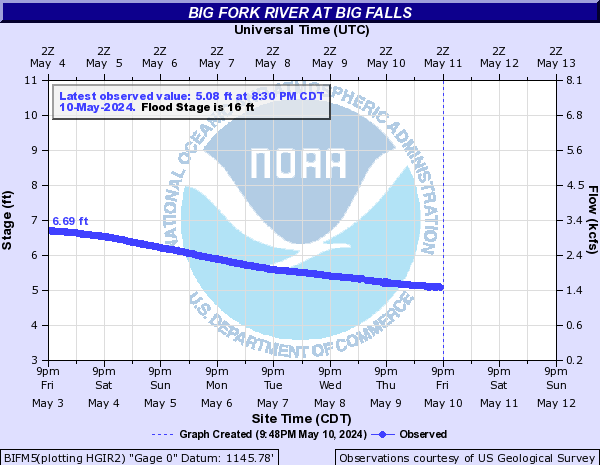
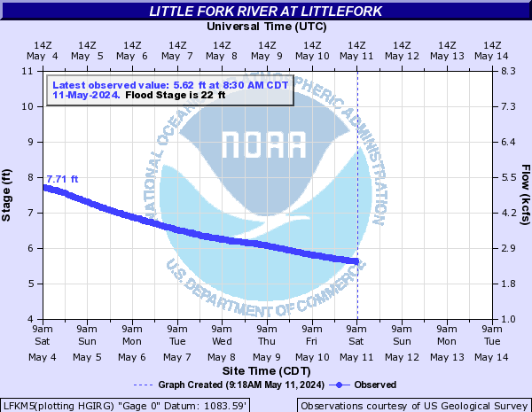
Current River Levels organized roughly from upstream to downstream as the water flows.
|
 |
|
|
|
|
|
|
|
Turtle River near Mine Centre (Live data - credit Environment and Climate Change Canada)
|
|
|
|
|
|
|
|
|
See Lake of the Woods Control Board website for current data
For official notices and general forecast information, check the Lake of the Woods Control Board Notice page (updated often)
NWS Grand Forks issues official Flood Warnings for the U.S. side of Lake of the Woods
|
|
|
|
 |
|
|
 |
|
|
 |
|
|
 |
Precipitation & Snowpack Observations
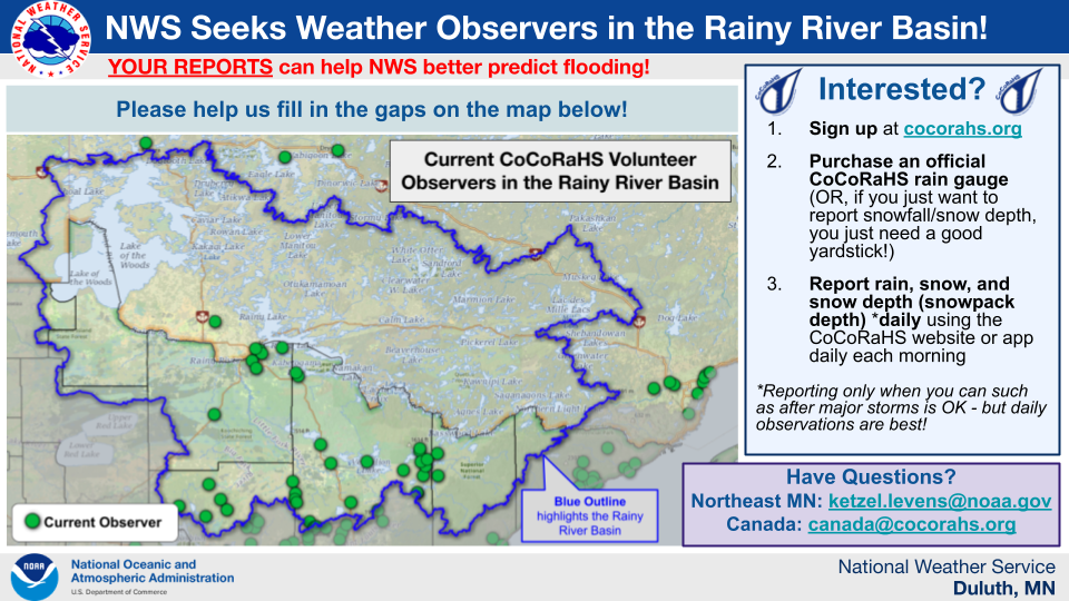
National Weather Service Seeks New Volunteer Precipitation Observers to Better Predict Flooding
DULUTH, MN — The National Weather Service is recruiting additional volunteer precipitation observers throughout the Rainy River Basin. From the headwaters of the Kawishiwi River to those on and near Basswood Lake, Lake Vermilion, Kabetogama Lake, Namakan Lake, Rainy Lake, to the Forks rivers and the Rainy River itself downstream of International Falls/Fort Frances - we want to find volunteers to report precipitation, snowfall, and snow depth/snowpack liquid water equivalent. Ideally we would like to find those who can submit daily reports of rain, snow, and snow pack depth, but even those who can volunteer to just send occasional reports of the snow pack depth are welcome to sign up!
Why are we looking for volunteer precipitation observers? We want more observations so we can better predict flooding. We need good “ground truth” observations of the precipitation and snow pack to make better forecasts of lake and river levels - particularly during the spring snowmelt season. While there are already some volunteer observers in this area, more observations are needed, especially in rural areas where we don’t currently have any observers - see the attached flyer and graphic for a map. Without ground truth observations, flooding forecasts and outlooks are based solely on simulated snow cover, interpolated from observations far away, which may not accurately represent regional conditions, and rarely capture local maximums.
Those who are interested in becoming a volunteer observer should do so through the Community Collaborative Rain, Hail and Snow Network, or CoCoRaHS. Getting started with CoCoRaHS is easy!
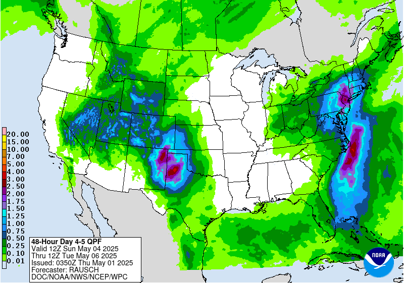
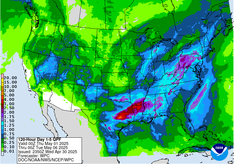
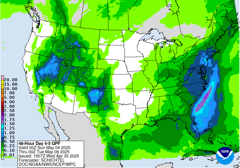
Forecast Precipitation
For the latest weather forecast in the US, visit the NWS Forecast Points page: NWS Forecast Points page for International Falls
For the latest weather forecast in Canada, please visit Environment and Climate Change Canada: Forecast for Fort Frances
|
|
|
|
 |
 |
 |
|
|
|
|
 |
 |
 |
|
|
|
|
 |
 |
 |
|
|
|
 |
 |
|
|
|
|
 |
 |
 |
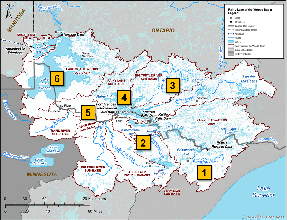
Map of the Rainy River Basin

 |
Media use of NWS Web News Stories is encouraged! Please acknowledge the NWS as the source of any news information accessed from this site. |
|