Overview
|
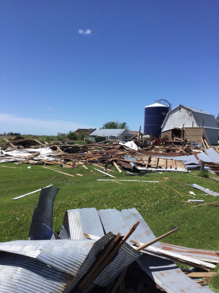
At 1:04 AM on 5/22/2019, a brief tornado touched down southeast of Anita, causing damage to a barn and nearby trees. This tornado was on the ground for 1.09 miles and was rated an EF-1, with maximum winds estimated of 95 mph.
|
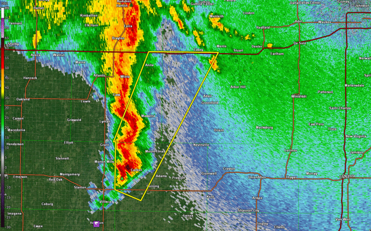 Radar Reflectivity 1243-144 AM |
Tornado:
|
|
||||||||||
|
||||||||||
|
Tornado - Anita
Track Map 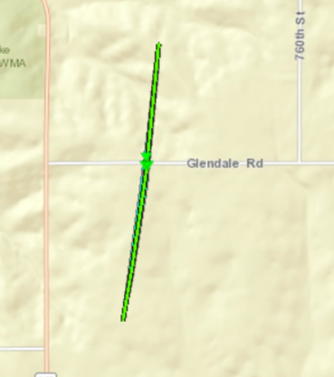 
Downloadable KMZ File
|
|
Tornado - Adair
Track Map 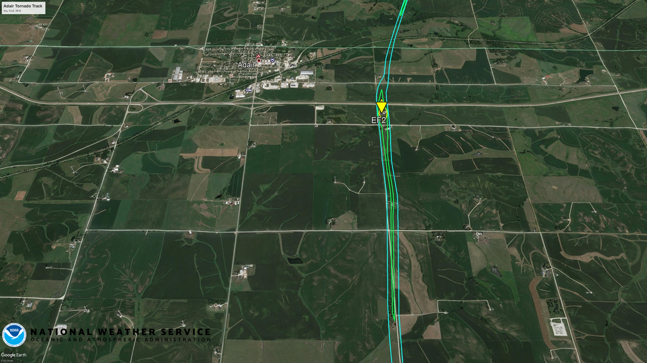
Downloadable KMZ File
|
The Enhanced Fujita (EF) Scale classifies tornadoes into the following categories:
| EF0 Weak 65-85 mph |
EF1 Moderate 86-110 mph |
EF2 Significant 111-135 mph |
EF3 Severe 136-165 mph |
EF4 Extreme 166-200 mph |
EF5 Catastrophic 200+ mph |
 |
|||||
Public Information Statement
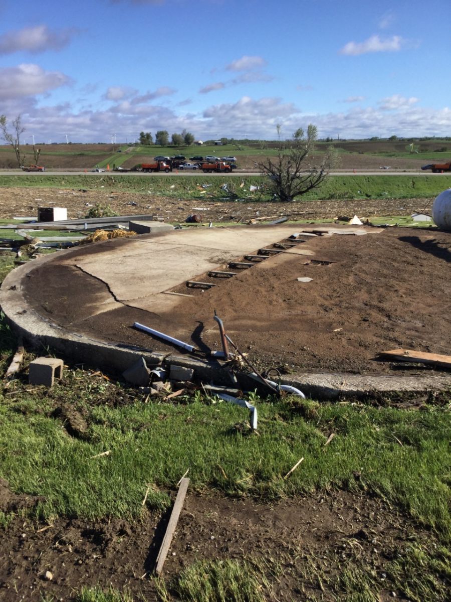
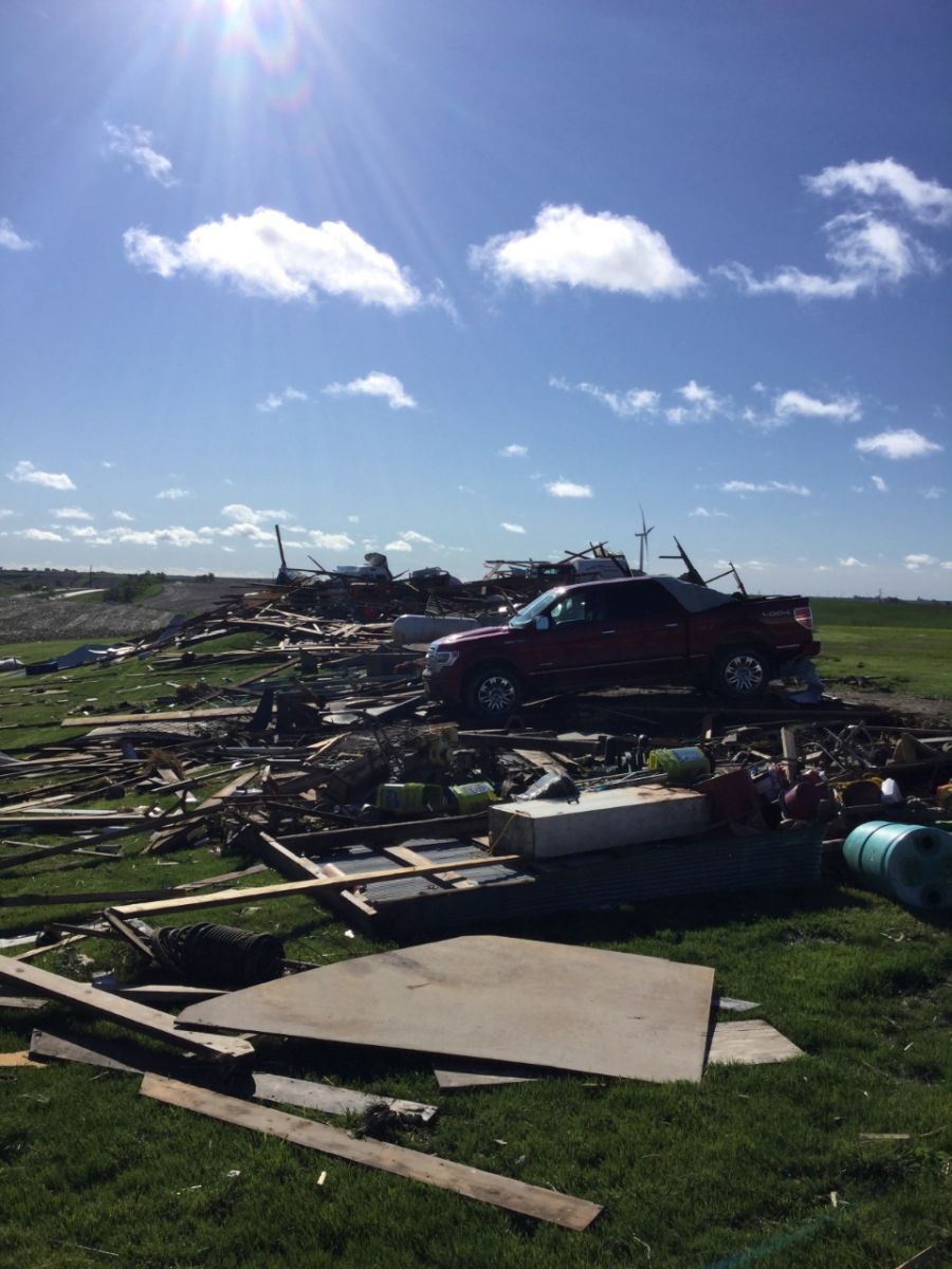
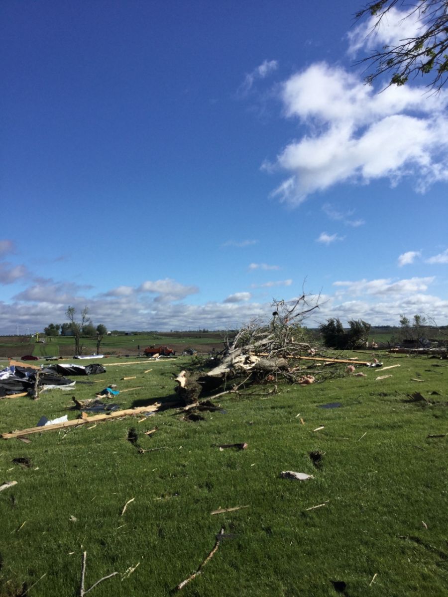
PUBLIC INFORMATION STATEMENT
NATIONAL WEATHER SERVICE DES MOINES IA
337 PM CDT Wed May 22 2019


...NWS Damage Survey for 05/22/2019 Tornado Event - UPDATE #1...

.UPDATE...Damage southeast of Anita was determined to be
from a tornado.

.OVERVIEW...
A tornado developed quickly 3.2 miles south southeast of
Adair, Iowa early Wednesday morning, May 22nd, 2019 resulting
in one fatality and one injury. A rural homestead located
just south of Interstate 80 received extensive damage to a
single-family residence and outbuildings. The damage survey
team also found lesser damage to single family residences and
outbuildings located south of the main impacted home.

Another tornado has been determined to have occurred southeast
of Anita.  This tornado actually occurred around 25 minutes
before the Adair tornado and demolished an old bard, tossing
debris about one third of a mile downstream.  The remainder of
the path was across rural cropland with a total path length of
just over one mile.

.Adair Tornado...

Rating:                 EF-2
Estimated Peak Wind:    120-130 MPH
Path Length /Statute/:  4.8 miles
Path Width /Maximum/:   150 YARDS
Fatalities:             1
Injuries:               1

Start Date:             May 22nd, 2019
Start Time:             129 AM CDT
Start Location:         3.2 miles South Southeast Adair
Start Lat/Lon:          41.45571/-94.62489

End Date:               May 22nd, 2019
End Time:               137 AM CDT
End Location:           2.2 miles Northeast Adair
End Lat/Lon:            41.52401/-94.61519


.Anita Tornado...

Rating:                 EF-1
Estimated Peak Wind:    90-100 MPH
Path Length /Statute/:  1.1 Miles
Path Width /Maximum/:   50 Yards
Fatalities:             0
Injuries:               0

Start Date:             May 22nd, 2019
Start Time:             104 AM CDT
Start Location:         2.6 miles South Southeast Anita
Start Lat/Lon:          41.40873/-94.75239

End Date:               May 22nd, 2019
End Time:               106 AM CDT
End Location:           1.6 miles southeast of Anita
End Lat/Lon:            41.42434/-94.74970

EF Scale: The Enhanced Fujita scale classifies tornadoes in
the following categories.

EF0...Weak......65 TO 85 MPH
EF1...Weak......86 TO 110 MPH
EF2...Strong....111 TO 135 MPH
EF3...Strong....136 TO 165 MPH
EF4...Violent...166 TO 200 MPH
EF5...Violent...>200 MPH

Note:
The information in this statement is preliminary and subject to
change pending final review of the event and publication in
NWS Storm Data.

$$
 |
Media use of NWS Web News Stories is encouraged! Please acknowledge the NWS as the source of any news information accessed from this site. |
|