
A slow moving front will bring rounds of strong to severe thunderstorms and heavy rainfall to the central Plains eastward to the east-central U.S.. The first widespread significant heat wave of summer for the Intermountain West and Plains is expected to develop today and expand through next week. Dangerous heat will continue to impact portions of the Southwest and Southeast. Read More >
Overview
|
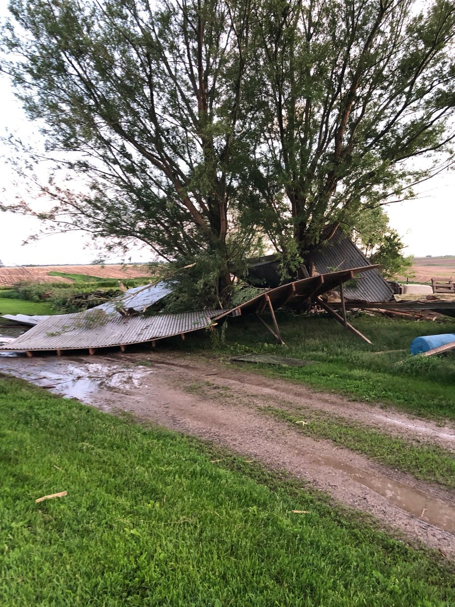
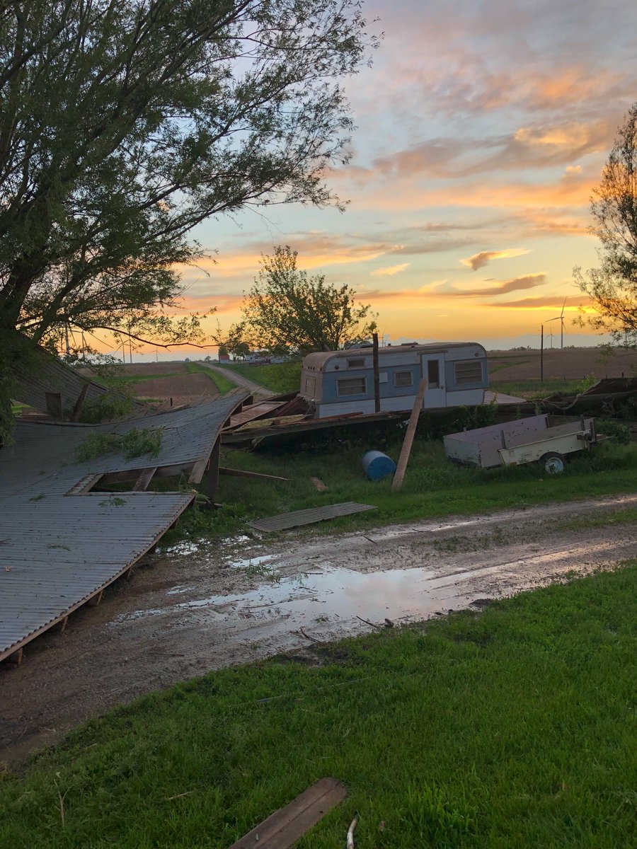
An upper level low pressure system was in place across the state of Iowa Wednesday, May 29th, 2019. A surface boundary was stretched across Iowa from northwest to southeast across the state from near Storm Lake southeastward into southeast Iowa. This boundary provided the focus for thunderstorm development throughout the late afternoon and evening hours. The low levels environment provided the needed conditions for many of these storms to rotate and produce funnel clouds and brief, weak tornadoes. Many of the tornadoes that occurred were brief touchdowns in open ares with no damage. Two of the tornadoes caused damage, one in Poweshiek County and one south of Iowa Falls near Owasa. |
 Caption |
 |
 |
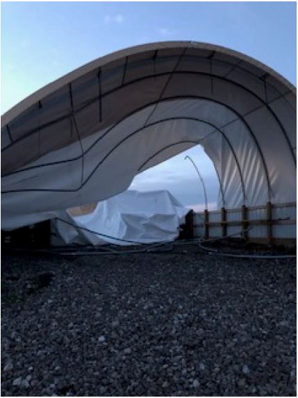 |
| Outbuilding Damage SW Deep River | Outbuilding Damage SW Deep River | Hoop Building Damage SW Deep River |
Tornadoes
|
Tornado #1 - 5.3 mi SE Montezuma
Track Map 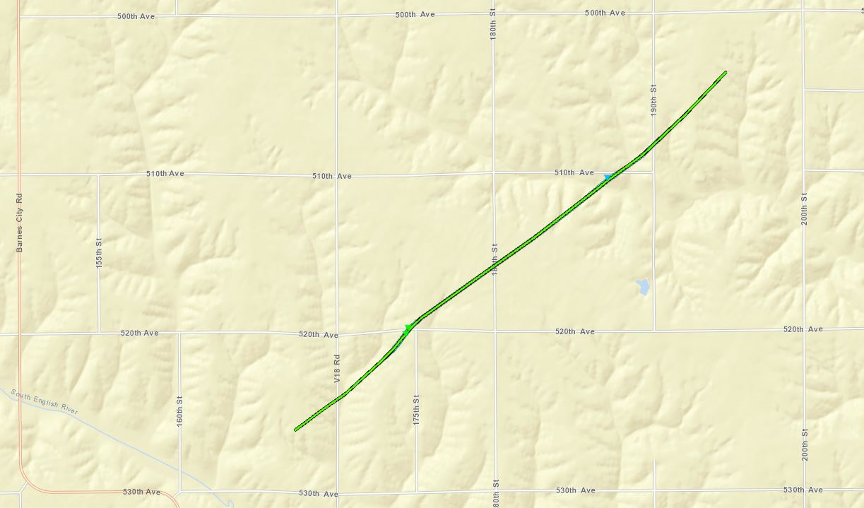 
Downloadable KMZ File |
||||||||||||||||
|
||||||||||||||||
|
Tornado #2 - 1.9 mi N Pocahontas
Track Map 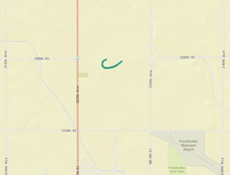
Downloadable KMZ File |
||||||||||||||||
|
||||||||||||||||
|
Tornado #3 - 6.5 mi SSW Schaller
Track Map 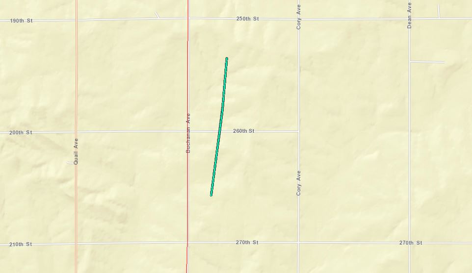
Downloadable KMZ File |
||||||||||||||||
|
||||||||||||||||
|
Tornado #4 - 1.4 mi SE Bradgate
Track Map 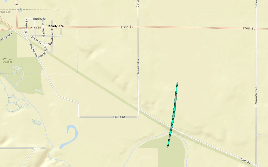
Downloadable KMZ File |
||||||||||||||||
|
||||||||||||||||
|
Tornado #5 - 2.7 mi WNW Owasa
Track Map 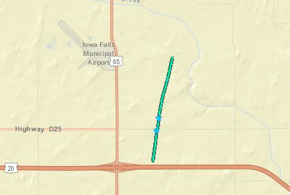
Downloadable KMZ File |
||||||||||||||||
|
||||||||||||||||
|
Tornado #6 - 2.8 mi SW Eldora
Track Map 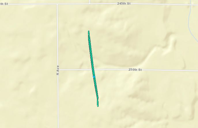
Downloadable KMZ File |
||||||||||||||||
|
||||||||||||||||
The Enhanced Fujita (EF) Scale classifies tornadoes into the following categories:
|
Tornado #7 - 2.0 mi E New Providence
Track Map 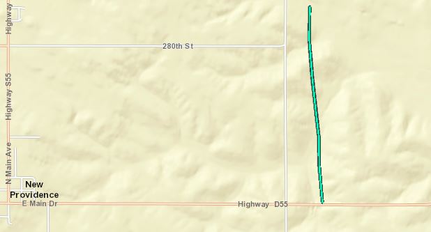
Downloadable KMZ File |
||||||||||||||||
|
||||||||||||||||
|
Tornado #8 - 1.3 mi E Steamboat Rock
Track Map 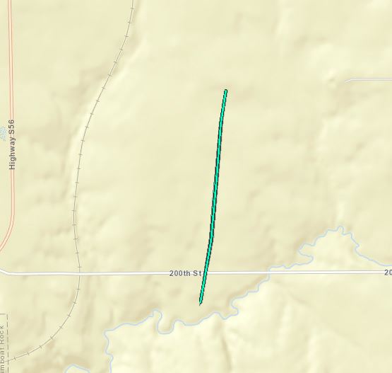
Downloadable KMZ File |
||||||||||||||||
|
||||||||||||||||
|
Tornado #9 - 2.0 mi S Early
Track Map 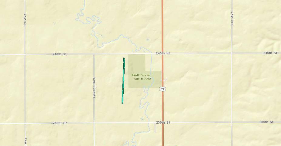
Downloadable KMZ File |
||||||||||||||||
|
||||||||||||||||
|
Tornado #10 - 1.1 mi NE Deep River
Track Map 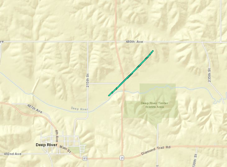
Downloadable KMZ File |
||||||||||||||||
|
||||||||||||||||
|
Tornado #11 - 2.2 mi SE Guernsey
Track Map 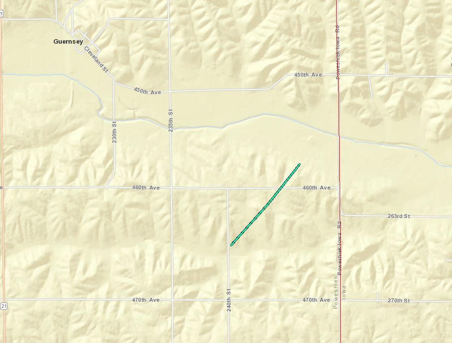
Downloadable KMZ File |
||||||||||||||||
|
||||||||||||||||
|
Tornado #12 - 3.1 mi ESE Garden City
Track Map 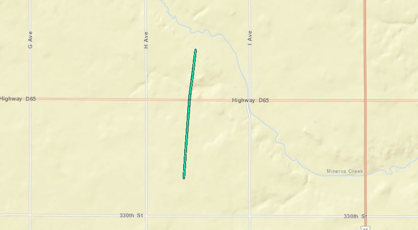
Downloadable KMZ File |
||||||||||||||||
|
||||||||||||||||
| EF0 Weak 65-85 mph |
EF1 Moderate 86-110 mph |
EF2 Significant 111-135 mph |
EF3 Severe 136-165 mph |
EF4 Extreme 166-200 mph |
EF5 Catastrophic 200+ mph |
 |
|||||
Wind & Hail:
Add a written summary or simply an LSR map in this section. If writing an extensive report, you can break the report down into wind and hail below (otherwise delete).
Wind
Insert summary here.
| Caption | Caption | Caption | Caption |
Hail
Insert summary here.
| Caption | Caption | Caption | Caption |
Photos & Video
Header
| Caption (source) |
Caption (source) |
Caption (source) |
Caption (source) |
Radar
Header
| Caption | Caption | Caption | Caption |
Storm Reports
Insert storm reports here. Copy in PNS or paste map.
Environment
Insert synoptic summary.
| Figure 1: Caption | Figure 2: Caption | Figure 3: Caption |
Near-storm environment summary.
| Figure 4: Caption | Figure 5: Caption | Figure 6: Caption |
Additional environmental data.
| Figure 7: Caption | Figure 8: Caption | Figure 9: Caption |
 |
Media use of NWS Web News Stories is encouraged! Please acknowledge the NWS as the source of any news information accessed from this site. |
|

