A heat wave over the Southwest will intensify late week, peaking and expanding into the Intermountain West and northern High Plains this weekend. Severe thunderstorms and heavy rain are expected over portions of the Plains and Mississippi Valley tonight, which will shift to parts of the Upper Midwest and mid-Mississippi Valley Friday. Monsoonal showers and flooding persist in the Desert Southwest. Read More >
Overview
|
A large low pressure system resulted in a range of impacts across the central US, from wind and fire danger in the central plains to blizzard conditions across the northern plains. In Iowa, storms developed in the early evening and continued in a line across the area through the night. Early storms produced a number of tornadoes, especially across parts of western Iowa with damage reported in Pocahontas, Humboldt, and southern Hancock counties. Information there and in a few other location is still being analyzed to determine tornado occurrence and subsequent size and strength. In addition, up to tennis ball sized hail was reported. This information remains preliminary as damage information continues to be gathered.
Other NWS Office Event Summaries:
Last update: April 15, 2022 3:54am CDT. |
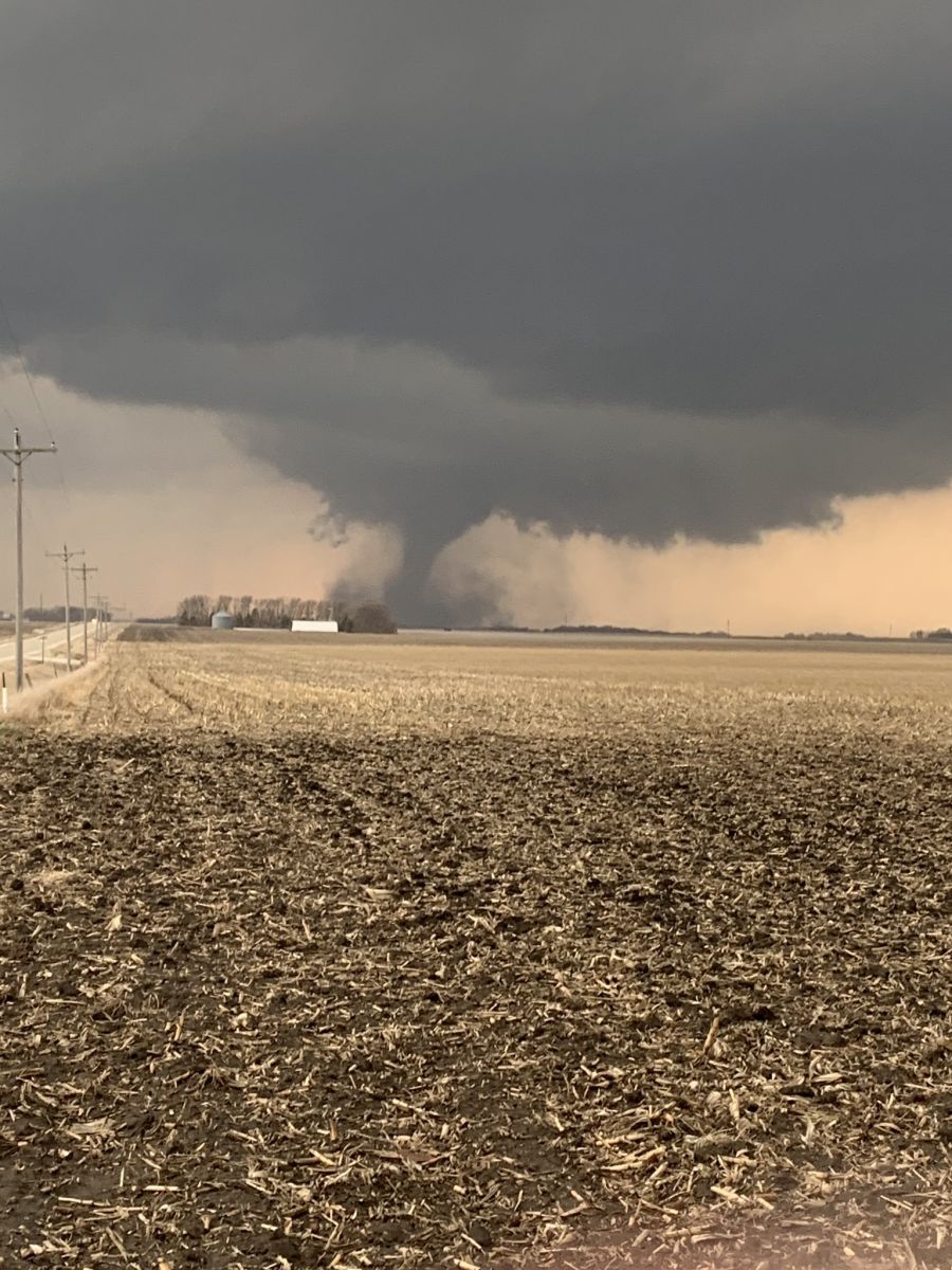 Tornado near Gilmore City around 6:20pm. Photo by Kaylan Patel. |
 |
 |
|
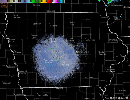
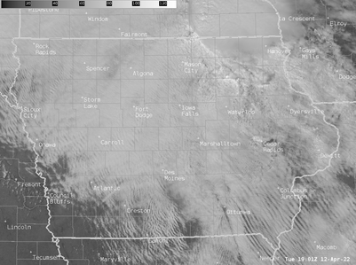
| Des Moines radar loop | Visible satellite imagery loop | caption 3 here |
Tornadoes:
|
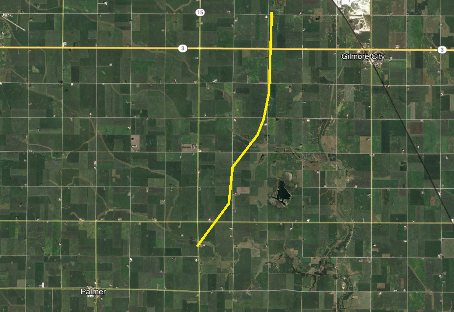
Tornado #1 - Palmer to Gilmore City
|
|
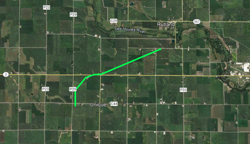
Tornado #2 - Southwest of Rutland
|
|
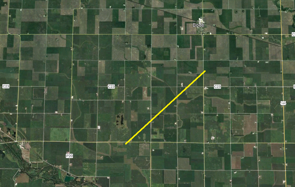
Tornado #3 - East of Bradgate
|
|
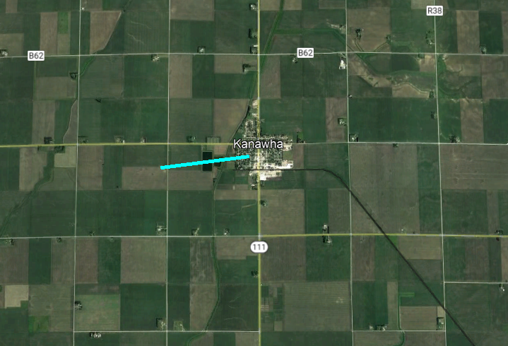
Tornado #4 - Kanawha
|
|
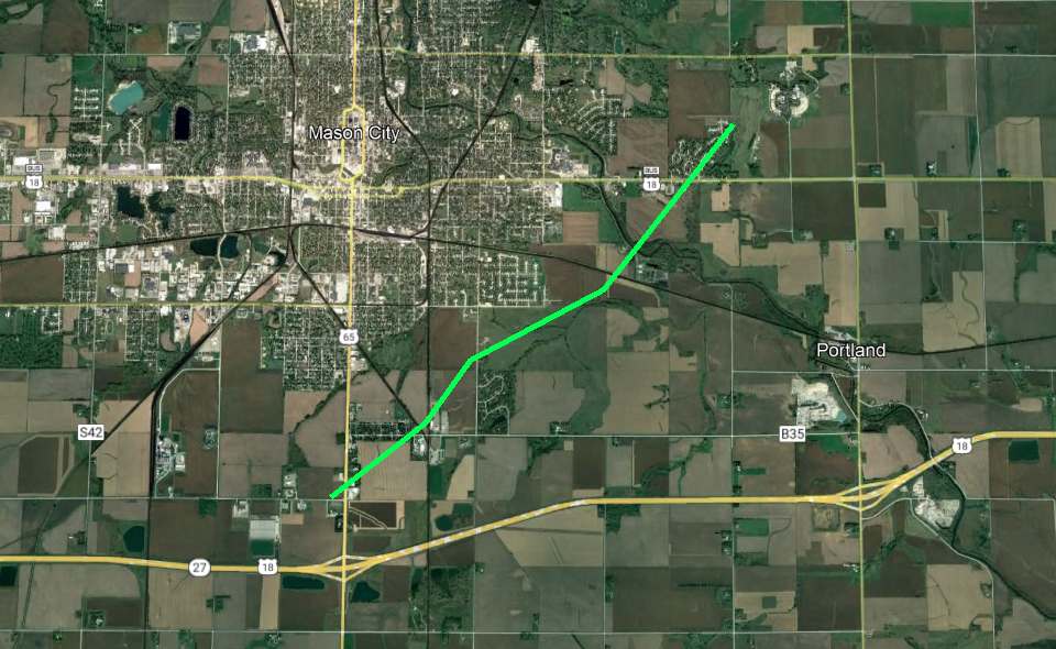
Tornado #5 - Mason City
|
The Enhanced Fujita (EF) Scale classifies tornadoes into the following categories:
| EF0 Weak 65-85 mph |
EF1 Moderate 86-110 mph |
EF2 Significant 111-135 mph |
EF3 Severe 136-165 mph |
EF4 Extreme 166-200 mph |
EF5 Catastrophic 200+ mph |
 |
|||||
Photos & Video
Additional photos/videos on this Twitter Moment
Header
| Caption (source) |
Caption (source) |
Caption (source) |
Caption (source) |
Storm Reports
Preliminary storm reports. Note that the number of tornado icons on the map below and in the text summary does not equal the number of tornadoes as some tornadoes have multiple reports.
Click map below to go to an interactive map viewer

Environment
Synoptic Environment
 |
 |
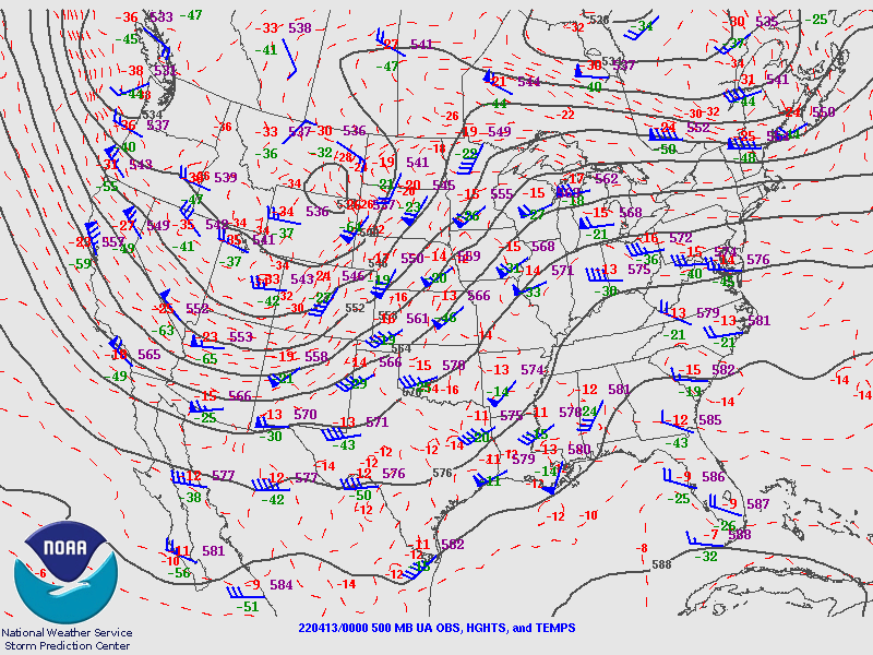 |
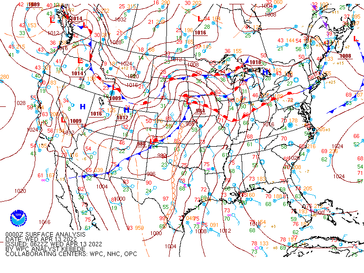
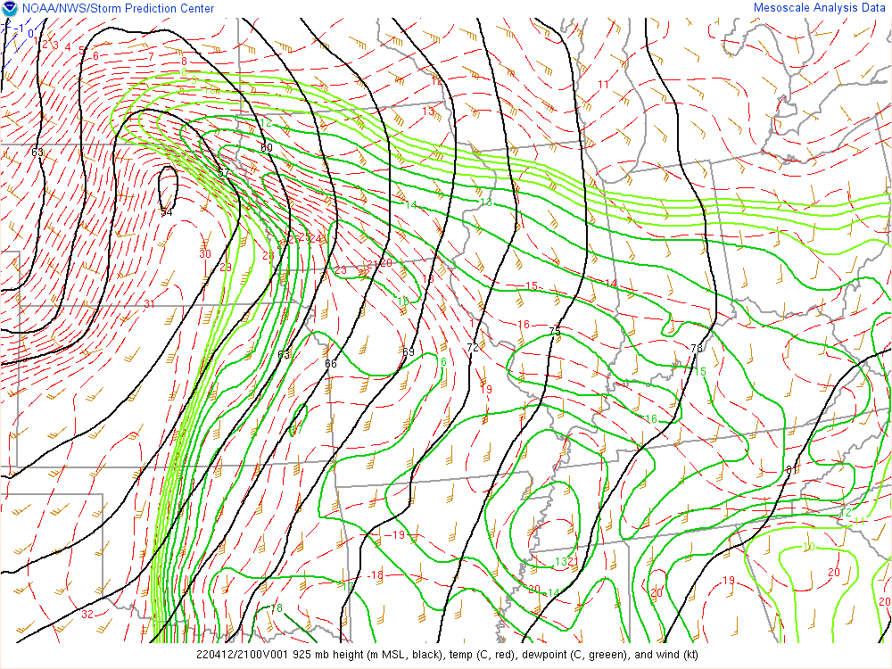
| Figure 1: Analyzed surface map at 7pm April 12th (00z April 13th). | Figure 2: 925 mb map loop from 21z (4pm) April 12th to 06z (1am) April 13th. | Figure 3: Analyzed 500 mb map from 7pm April 12th (00z April 13th). |
Near-storm Environment
 |
 |
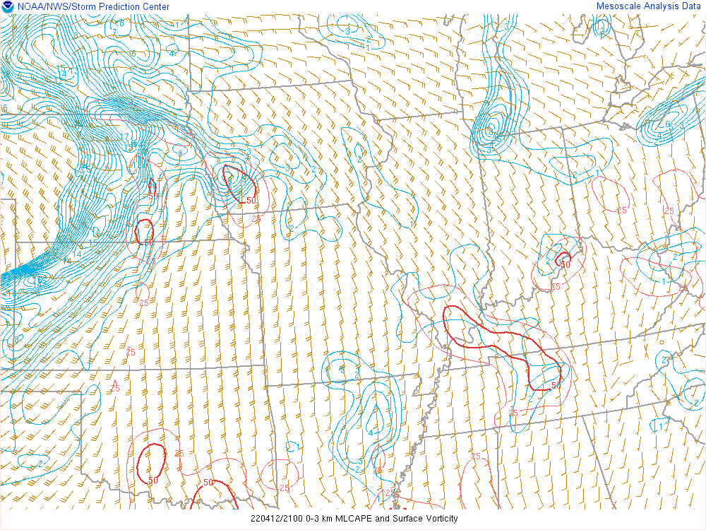 |
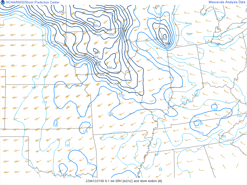
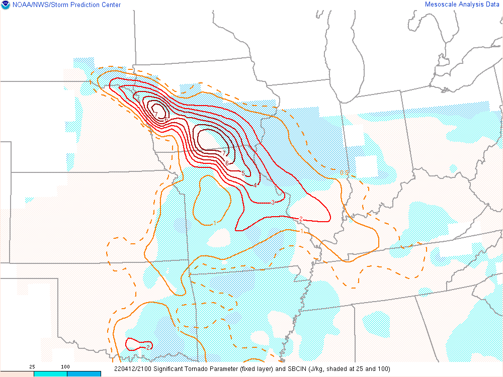
| Figure 4: The Storm Relative Helicity (m2/s2) is a measure of the potential for cyclonic updraft rotation in right-moving supercells. Larger values of 0-1-km SRH (greater than 100 m2 s-2) suggest an increased threat of tornadoes with supercells. For SRH, larger values are generally better, but there are no clear thresholds between non-tornadic and significant tornadic supercells. | Figure 5: Significant Tornado Parameter utilizes 0-1 km storm relative helicity, surface based CAPE, surface based LCL height, and 0-6 km bulk wind difference. Historically, the majority of significant tornadoes (EF-2+) have been associated with values over 1, while most non-tornadic supercells have been associated with values less than 1. | Figure 6: Loop of the 3-km CAPE (J/kg) and surface relative vorticity. Areas of large 0-3 km CAPE tend to favor strong low-level stretching and can support tornado formation when co-located with significant vertical vorticity near the ground. |
 |
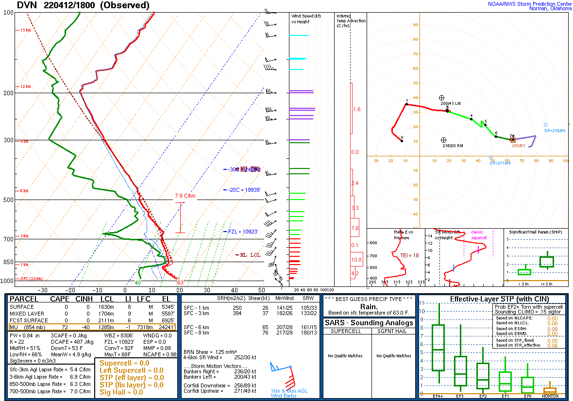 |
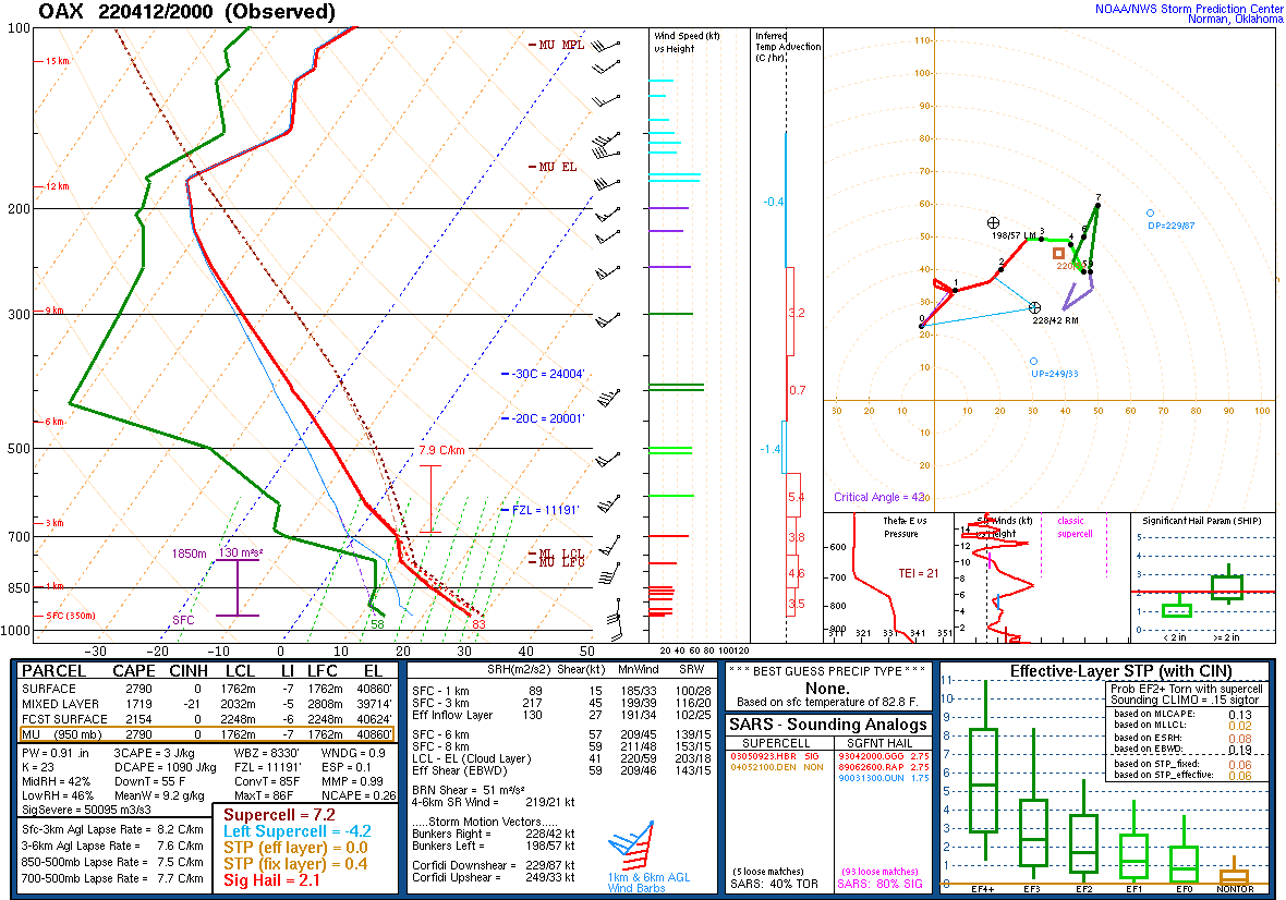
| Figure 7: NWS Omaha 20z sounding samples the unstable warm sector of the system a couple hours before storm initiation. | Figure 8: NWS Davenport 18z sounding samples the atmosphere several hours before storms made it to the area. |
 |
Media use of NWS Web News Stories is encouraged! Please acknowledge the NWS as the source of any news information accessed from this site. |
|