These images are updated once an hour between +15 and +25 after the hour.
Snow, Ice and Wind Chill Graphics
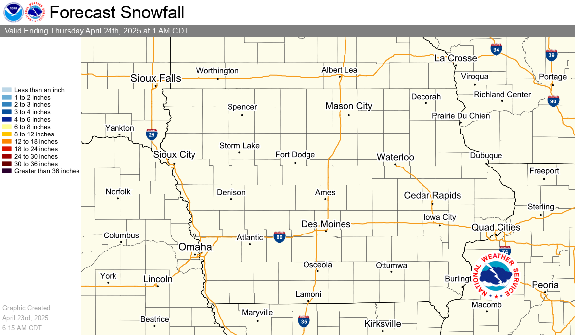
Snowfall
Snowfall accumulation measured in six hourly periods, starting at 12am, 6am, 12pm, and 6pm CST (+1 CDT).
|
12 Hour Snow Accumulation Forecast |
24 Hour Snowfall Accumulation Forecast |
|
48 Hour Snow Accumulation Forecast |
72 Hour Snow Accumulation Forecast |
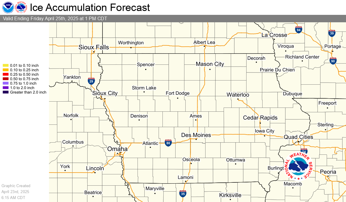
Ice
Ice accumulation measured in six hourly periods, starting at 12am, 6am, 12pm, and 6pm CST (+1 CDT).
|
12 Hour Ice Accumulation Forecast |
24 Hour Ice Accumulation Forecast |
|
48 Hour Ice Accumulation Forecast |
72 Hour Ice Accumulation Forecast |
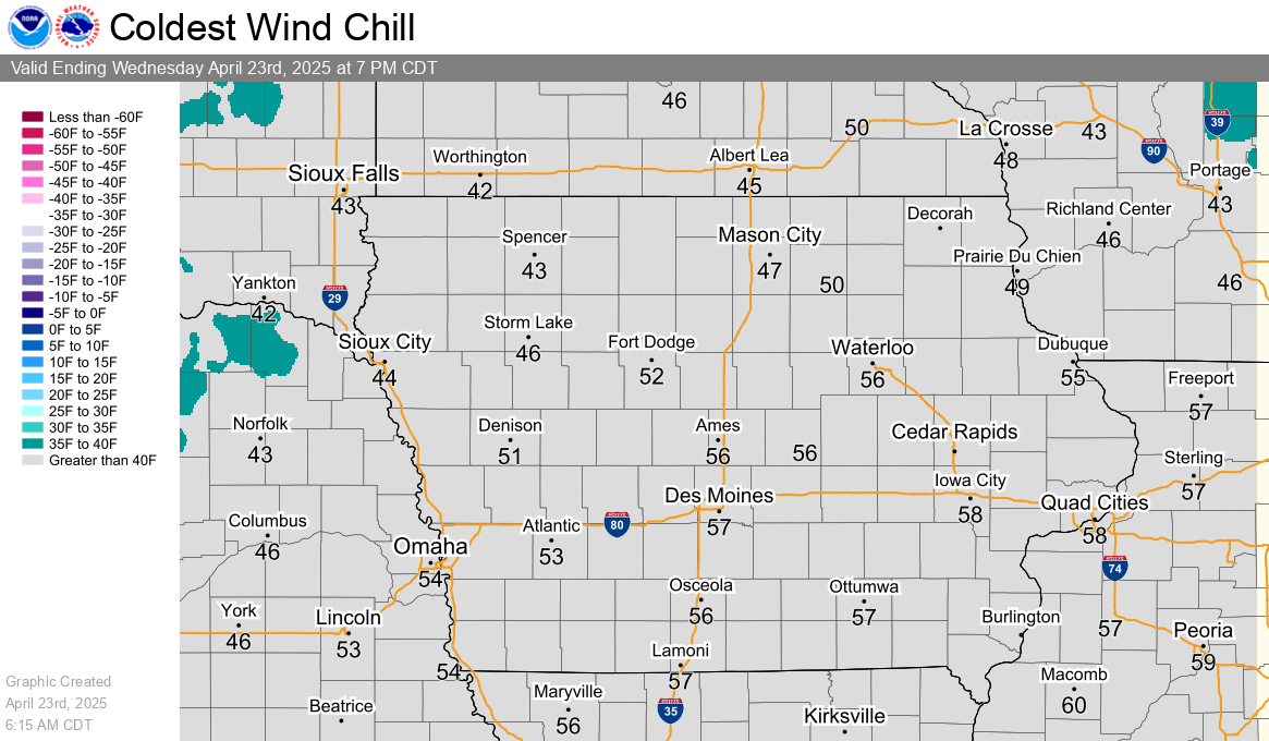
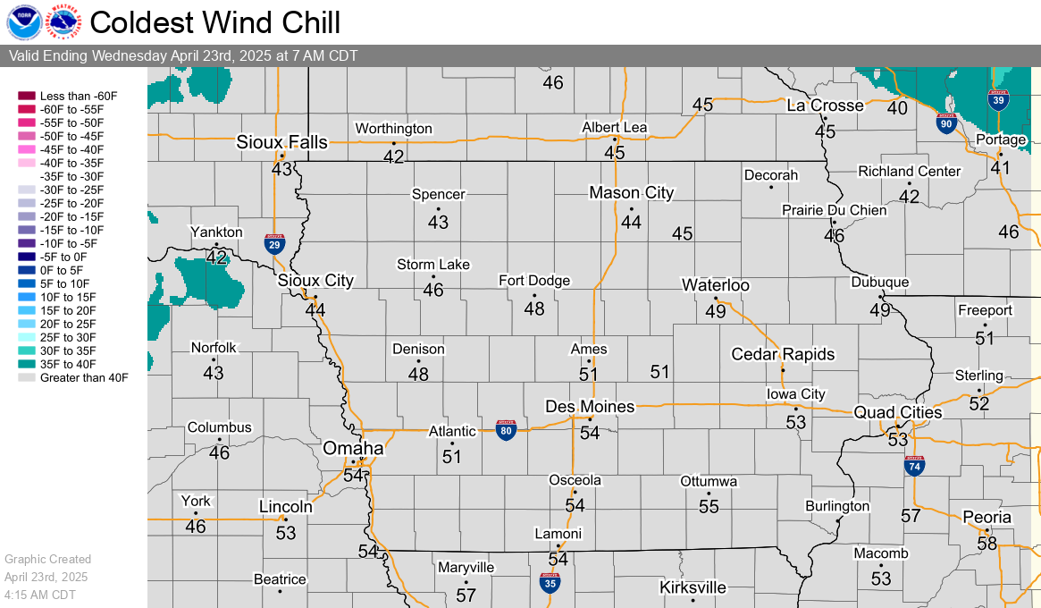
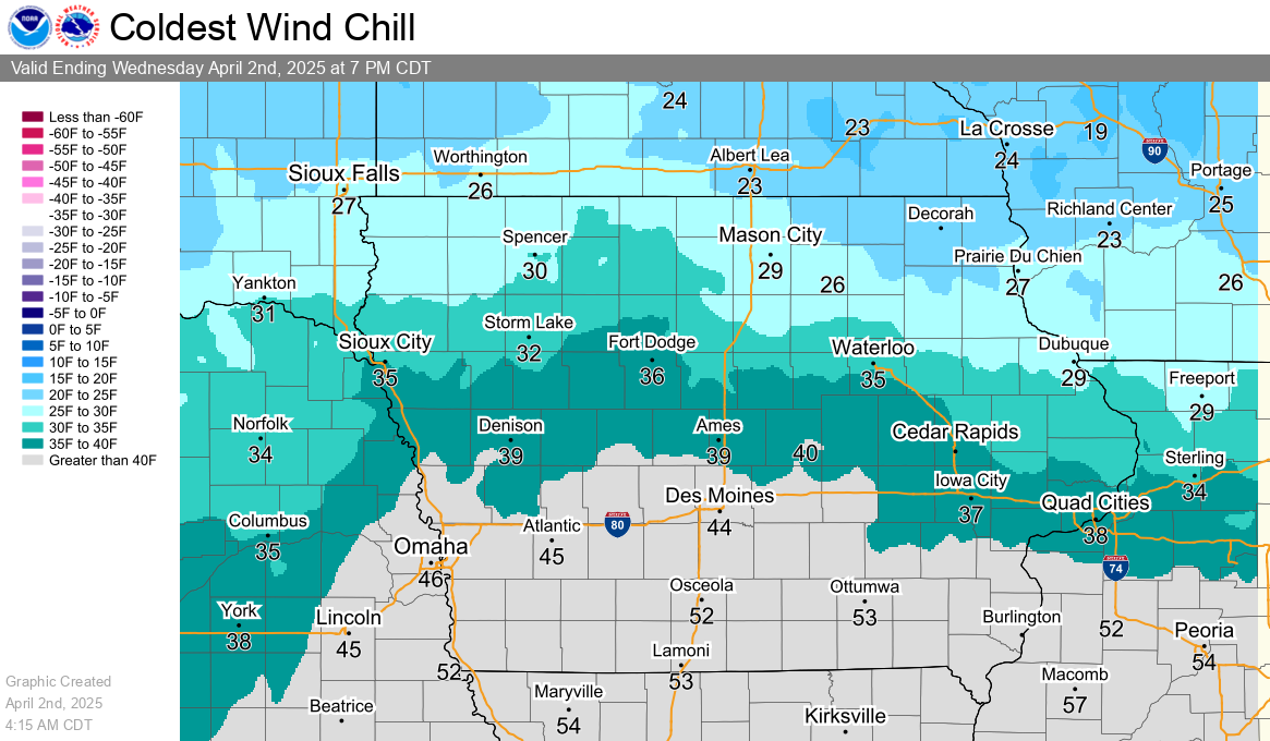
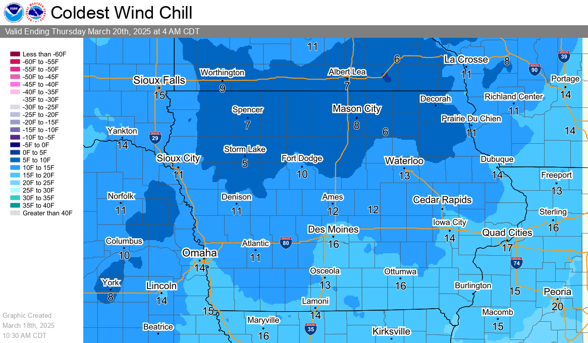
Wind Chill
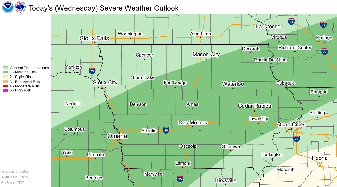
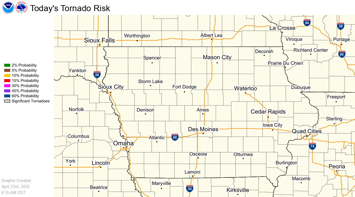
Severe Weather Graphics
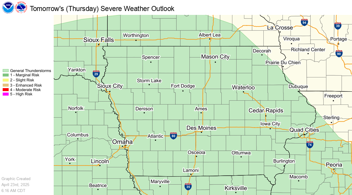
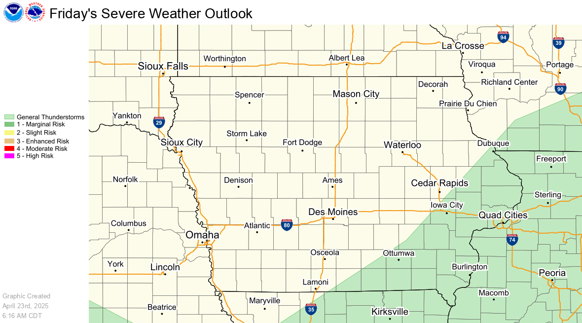
SPC Day 1 Outlook
|
SPC Day 1 Severe Weather Outlook |
SPC Day 1 Tornado Outlook |
|
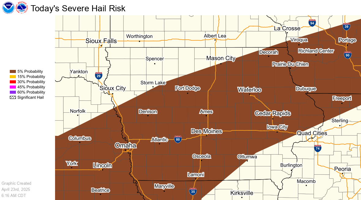
SPC Day 1 Hail Outlook |
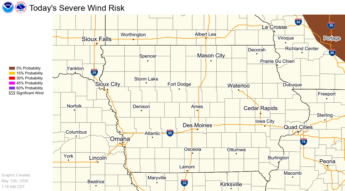
SPC Day 1 Wind Outlook |
SPC Day 2 and 3 Outlooks
|
SPC Day 2 Severe Weather Outlook |
SPC Day 3 Severe Weather Outlook |
Precipitation Graphics
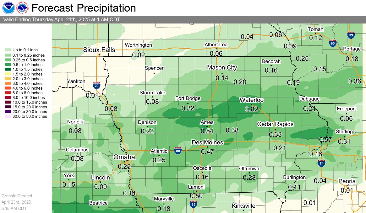
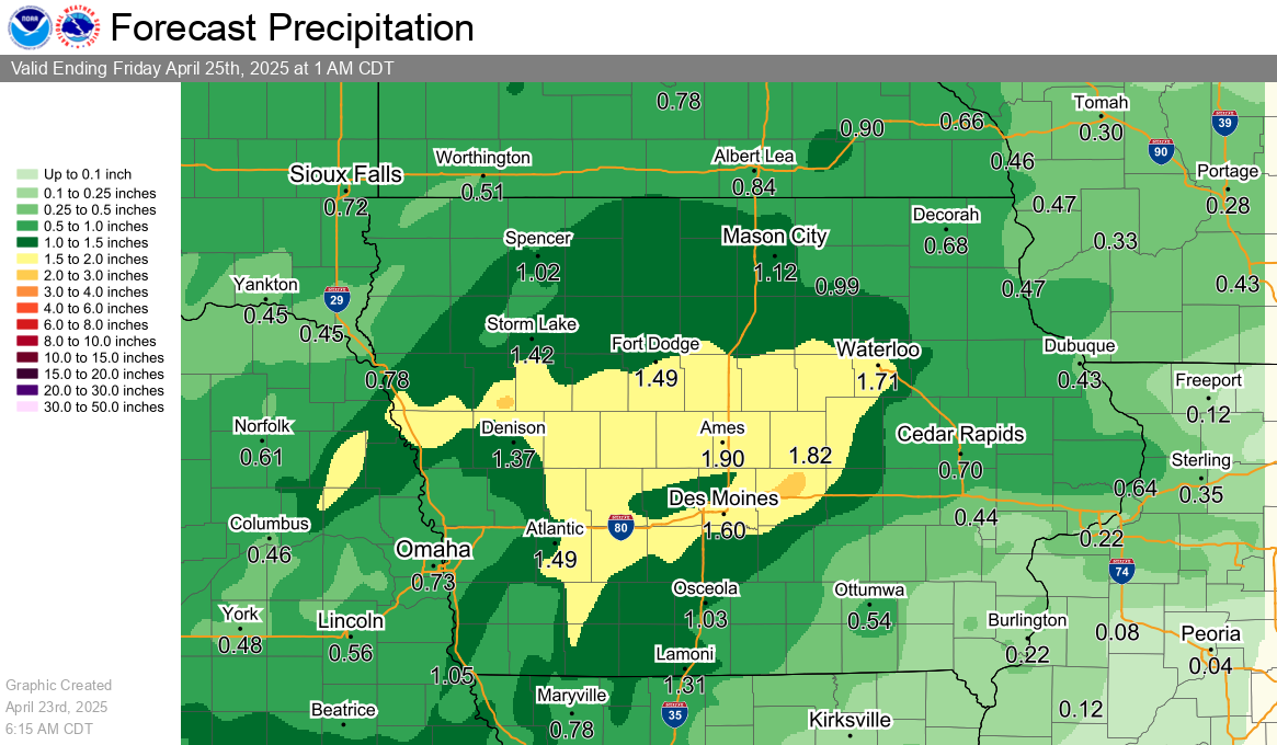
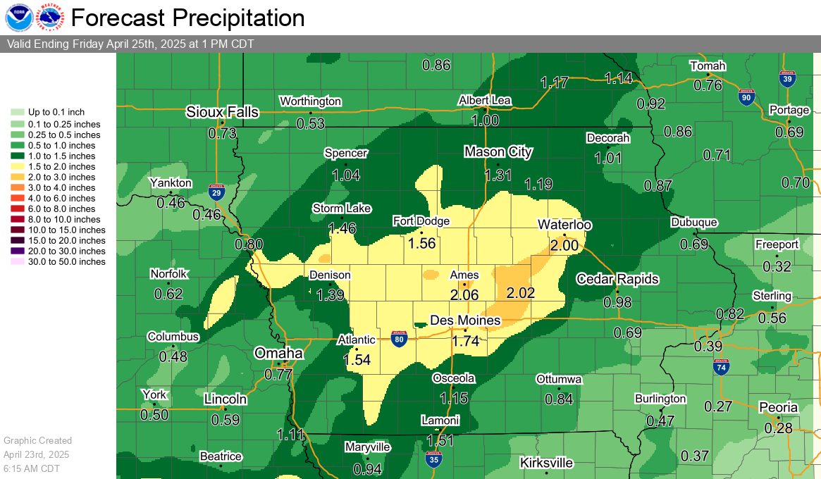
Rainfall Forecasts
Precipitation accumulation measured in six hourly periods, starting at 12am, 6am, 12pm, and 6pm CST (+1 CDT).
|
24 Hour Rainfall Forecast |
2 Day Rainfall Forecast |
|
3 Day Rainfall Forecast |
7 Day Rainfall Forecast |
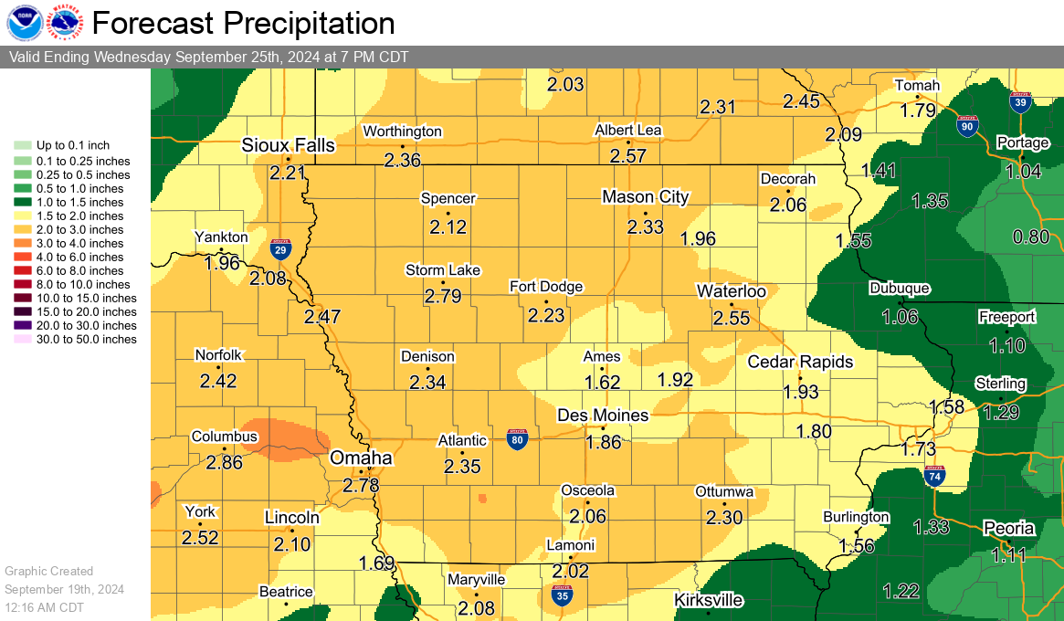
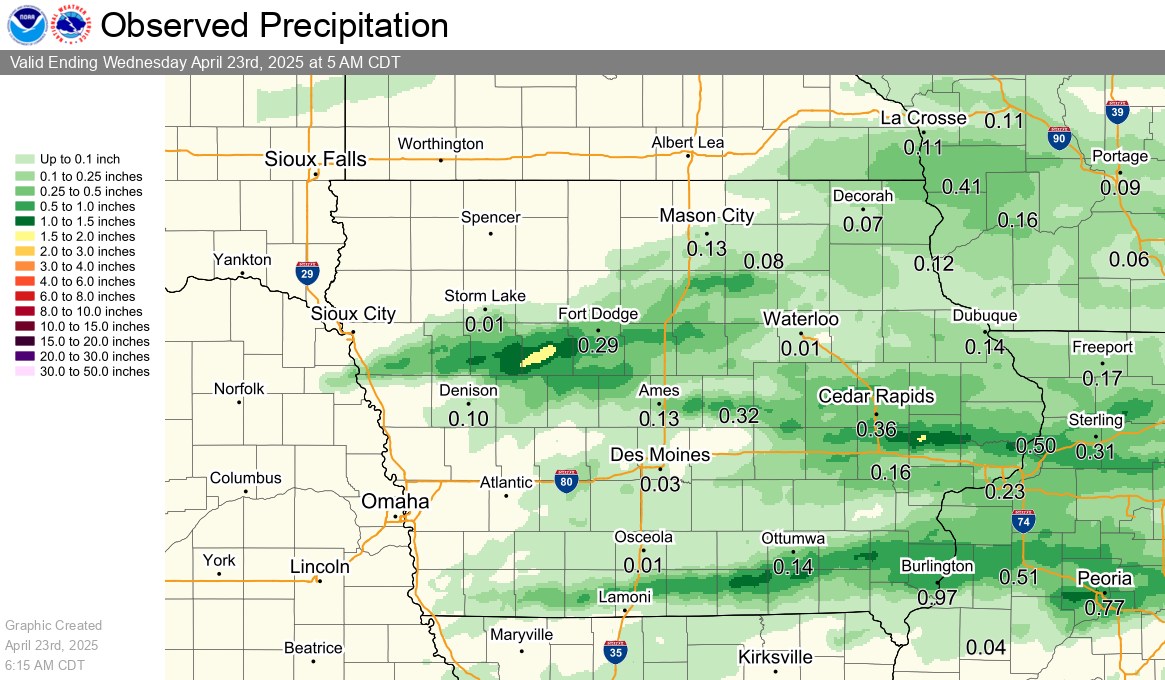
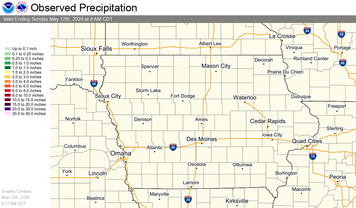
Observed Precipitation
|
Previous 24 Hours of Precipitation |
Previous 72 Hours of Precipitation |
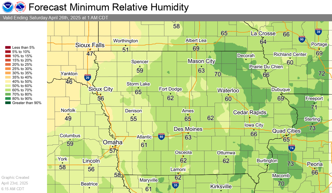
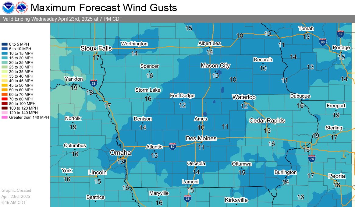
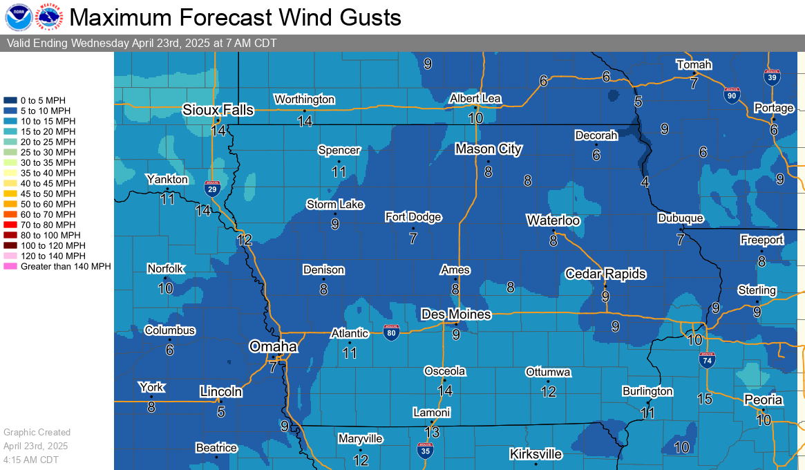
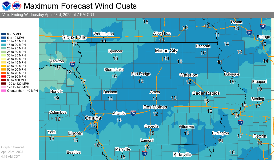
Humidity and Wind Graphics
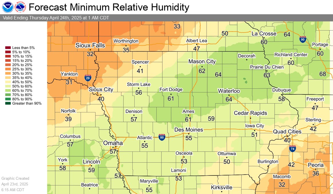
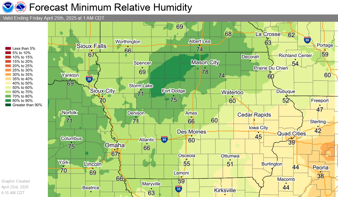
Minimum Relative Humidity Forecasts
|
Today's Minimum Relative Humidity Forecast |
Tomorrow's Minimum Relative Humidity Forecast |
|
Day 3 Minimum Relative Humidity Forecast |
|
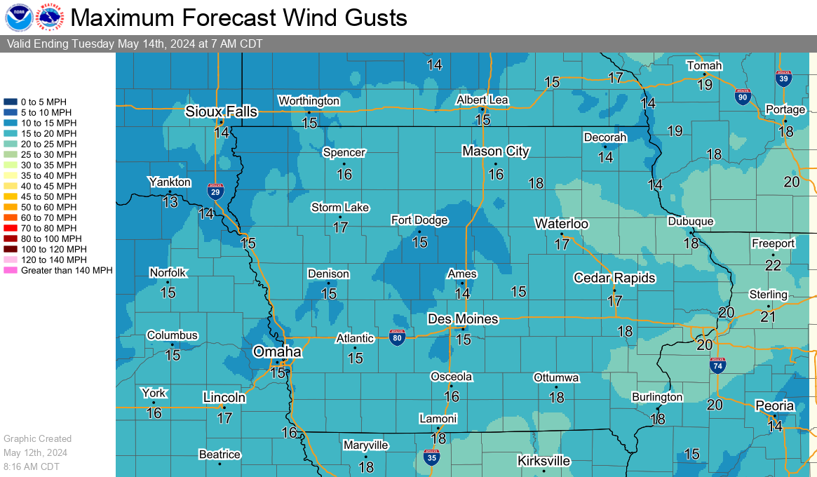
Maximum Wind Gust Forecasts
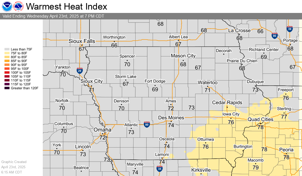
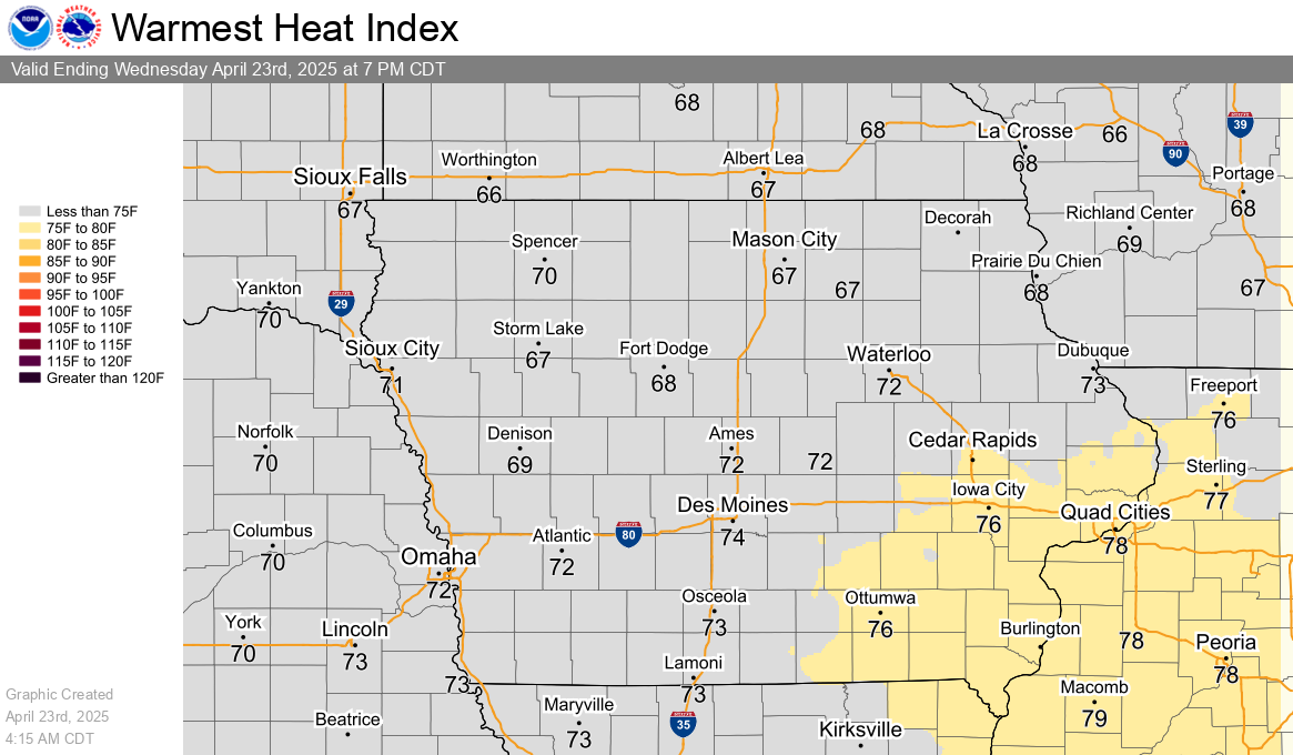
Heat Index Graphics