
Heavy rain and widely scattered severe storms capable of large hail, damaging winds, and possibly a tornado are expected over portions of the central and southern Plains into the Lower Missouri Valley. Unseasonable warmth will continue for a few more days across the Midwest and Southeast where several daily record highs could fall. Read More >
 |
Current Conditions Staying Safe |
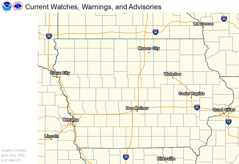 |
| Current Watches, Warnings, and Advisories |
|
A Wind Advisory means that sustained winds of 30 mph for one hour and/or frequent gusts of at least 45 mph are occurring or expected within the next 36 hours. These winds will make it difficult to drive high profile vehicles. Small, unsecured objects may be blown around by these winds. A High Wind Watch means that sustained winds of 40 mph for one hour and/or frequent gusts of at least 58 mph are expected within the next 12 to 48 hours. Check to make sure all loose objects outside are secured. Plan to postpone any unnecessary driving during this time since these winds will make driving difficult, especially for high profile vehicles. These winds may damage trees, power lines and small structures. A High Wind Warning means that sustained winds of 40 mph for one hour and/or frequent gusts of at least 58 mph are occurring or expected within the next 36 hours. Ensure that all objects outside are secured. Refrain from any unnecessary driving during this time since these winds will make driving very difficult, especially for high profile vehicles. Winds this strong may damage trees, power lines and small structures. |
 |
 |
|
|
|
|
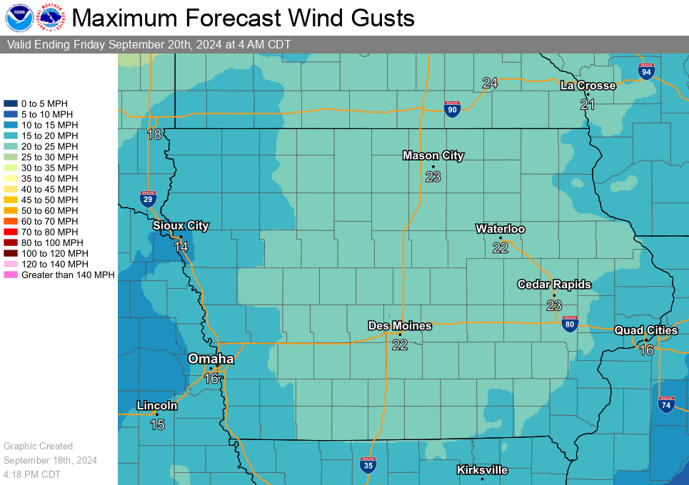
Click each image above to view a larger version. The tonight time period runs from 6pm to 6am CST.
|
|
 |
 |
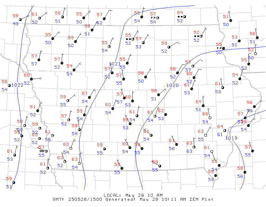
| Current Surface Map (Temperature, Dew Point, Winds, and Weather) - How to Decode Wind Charts |
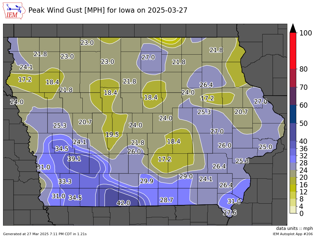
Highest Wind Gusts Recorded Today |
Below is a listing of ways you can reduce the inconvenience or damage done by strong winds:



 Follow us on X
 Follow us on Facebook
 Follow us on YouTube
 DMX RSS Feed