
Scattered strong to severe thunderstorms may pose a risk for damaging wind gusts over the Carolinas, southeast Virginia, and the Tennessee Valley Sunday afternoon then the northern Plains from late afternoon into Sunday night. Monsoonal thunderstorms may cause locally considerable flash, urban, and small stream flooding in the Southwest U.S. the next few days. Read More >
Record-setting early winter snowfall and cold temperatures combined to ensure that a considerable snowpack lingered into spring 2001. Snowmelt had already sent the Iowa and Wapsipinicon Rivers over flood stages in March, when during the first week of April a strong storm system fanned warm temperatures northward accelerating the snowmelt across the upper Mississippi River basin. Another storm system mid month sent even warmer temperatures surging northward along with severe thunderstorms and heavy rain. The prolonged abnormally warm conditions resulted in rapid snow melt and produced near record flooding over counties bordering the Mississippi River. Additional heavy rain fell over the headwaters of the Mississippi during the third week of April. This added streamflow led to secondary crests over Minnesota, northern Iowa, and Wisconsin, and helped to prolong the flooding, or broaden crests on the Mississippi from the Wisconsin/Illinois border to counties north of St. Louis, MO. Strong winds accompanying the storms forced water over sandbag dykes and levees causing additional damage. At Moline additional flooding occurred when backwaters from the Mississippi caused flooding at the mouth of the Rock River.
To aid with flood preparations, the Illinois Department of Transportation distributed and pre-positioned 692,000 sandbags to flood prone areas. Communities impacted by the flooding called upon the National Guard, prison inmates, and hundreds of volunteers to help with flood fighting efforts. By late month eight Illinois and ten Iowa counties had been declared disaster areas, with damages and related flood costs estimated to be several million dollars. By late April ten Iowa counties had been declared disaster areas, with damages estimated over 4.7 million dollars. Other preliminary estimates showed 40 homes had been destroyed, 62 homes suffered major damage, 1,516 homes sustained some damage, and 129 businesses were closed due to flooding.
Flooding continued along the Mississippi River from Dubuque, IA to Quincy, Il into May. The month began with widespread major to near record flooding which continued on the Mississippi River into May, with major flooding along the Mississippi River generally from Burlington northward and moderate flooding south of Burlington. Continued rain, heavy at times, kept the river above flood stage for most of May.
In fact, heavy rains helped lead to a second crest on the Mississippi River. This second crest was higher than the first crest, from Keithsburg southward. Persistent heavy rains, especially over southeast Iowa, northeast Missouri and westcentral Illinois, led to flooding on Mississippi River tributaries, which in turn led to a third crest on the Mississippi River, along with prolonged flooding. The third crest was higher than the second crest, from Burlington southward.
Once the Mississippi River began falling, it fell rapidly at times. During this time, Mississippi River stage changes over 24 hour periods were as much as around 1 foot or more.
 |
|
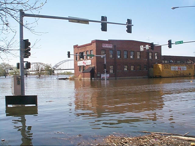
Flooding of the Mississippi River in downtown Davenport, Iowa |
 |
|
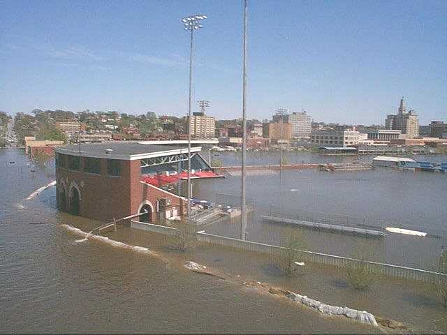
Flooding of the John O'Donnell Stadium in Davenport, Iowa |
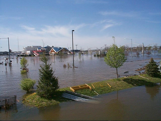 |
| April 2001 flooding of the Mississippi River in Davenport, Iowa |
|
Photos by Donna Dubberke, NWS Quad Cities Warning Coordination Meteorologist |
Listed are the highest crests for the month of April 2001 for points along the Mississippi River:

