
Widespread life-threatening flash and urban flooding will continue to pose a significant threat to life and property in south-central Texas. Catastrophic fiver flooding, with rapid rises on small streams, arroyos, and typically dry washes, is expected. Monsoonal showers persist across the Great Basin and Southwest with greatest flash flooding in southern Arizona. Read More >
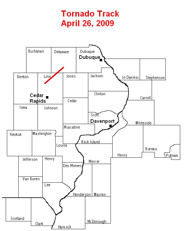
A team from the National Weather Service in the Quad Cities conducted a storm damage survey on April 27, 2009 to investigate damage from a tornado that moved through east central Iowa on the 26th. It was determined that the damage was caused most likely by a single tornado moved along a nearly continuous path 22 miles long through northern Linn County and southern Delaware County. The damage path extended from roughly 2 miles west of Alburnett, or 10 miles north of Cedar Rapids, to about 5 miles west of Hopington, or 10 miles southeast of Manchester. Damage was rated as EF1* along most of the damage path.
*ENHANCED FUJITA /EF/ SCALE INFORMATION...
PLEASE NOTE THE NUMBERS BELOW ARE APPROXIMATE WIND SPEEDS FOR DAMAGE
CATEGORIES.
EF0... 65 - 85 MPH
EF1... 86 - 110 MPH
EF2... 111 - 135 MPH
EF3... 136 - 165 MPH
EF4... 166 - 200 MPH
EF5... 201 MPH OR GREATER
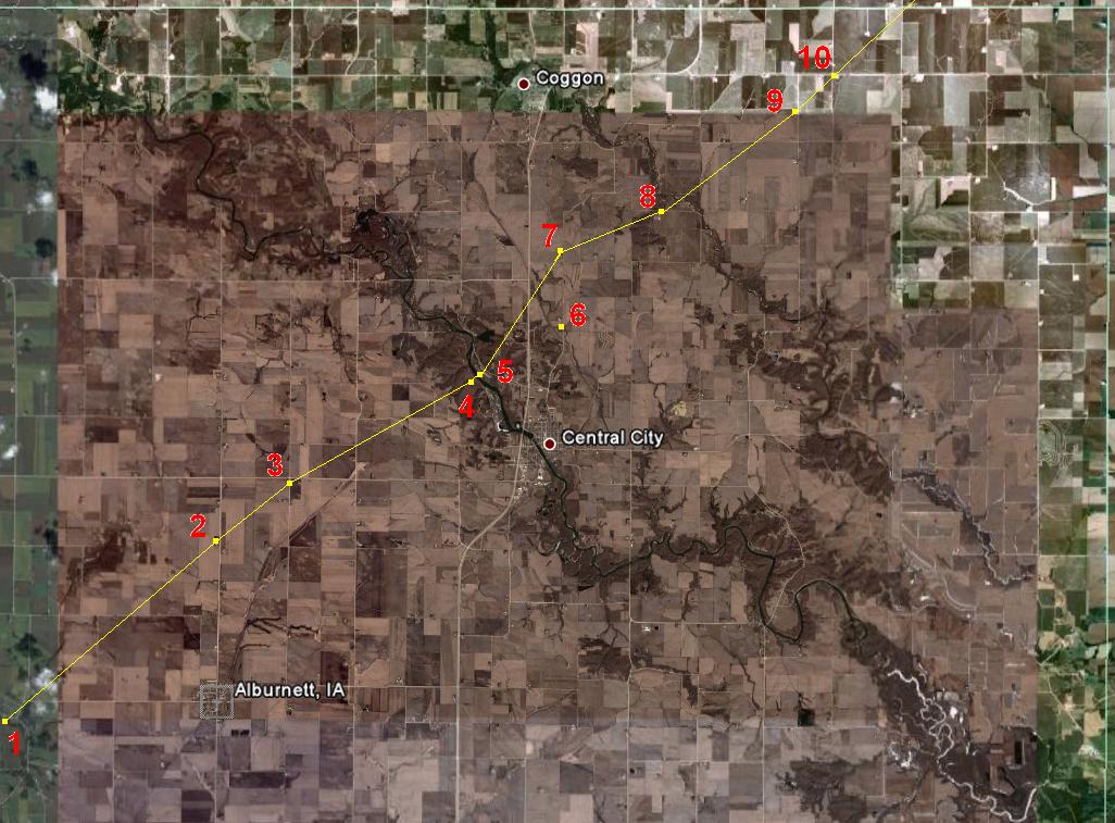
The following are some of the findings of the damage survey.
Notes corresponding to the numbers in the images are listed further down.
Linn County
Delaware County
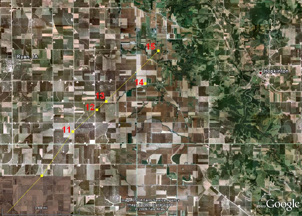
11. Power lines down.
12. Damage to farm roughly 1 mile SW of Buck Creek. One outbuilding pushed off foundation, two others heavily damaged with large portions of roof blown off. A few large pine trees snapped off near base. Debris extended northeast into fields. Power lines were damaged 1 mile southwest of this location. Storm hit at 520 pm CDT. Rated EF1.
13. Power lines blown down, tree uprooted, and debris caught in fences. Rated EF1.
14. Tree uprooted and pieces of roofing material and debris caught in fence.
15. Small outbuildings damaged and destroyed at farm. Barn was pushed off its foundation. House had broken windows and damage to roof. Storm hit at 530 pm CDT Rated EF1.
Photos:
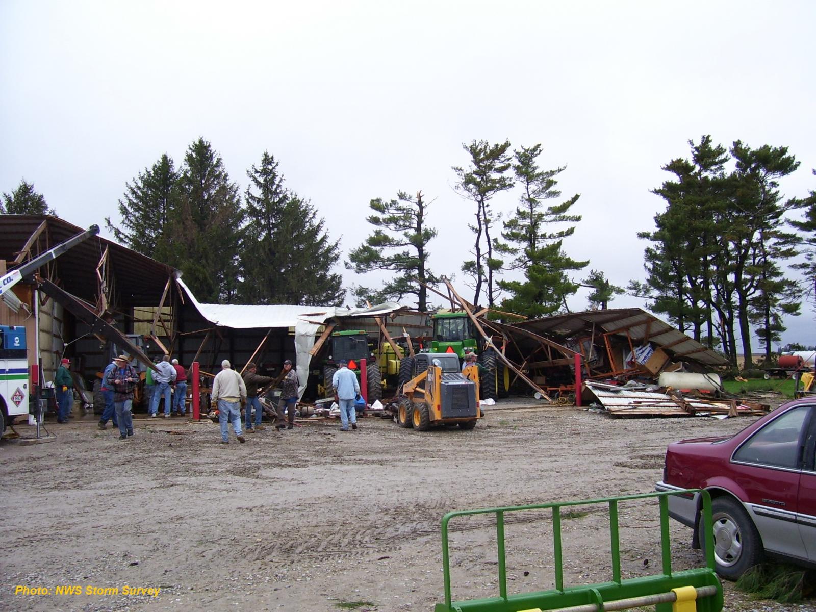
Damage to farm north of Albernett

Another view of damage to farm north of Alburnett.
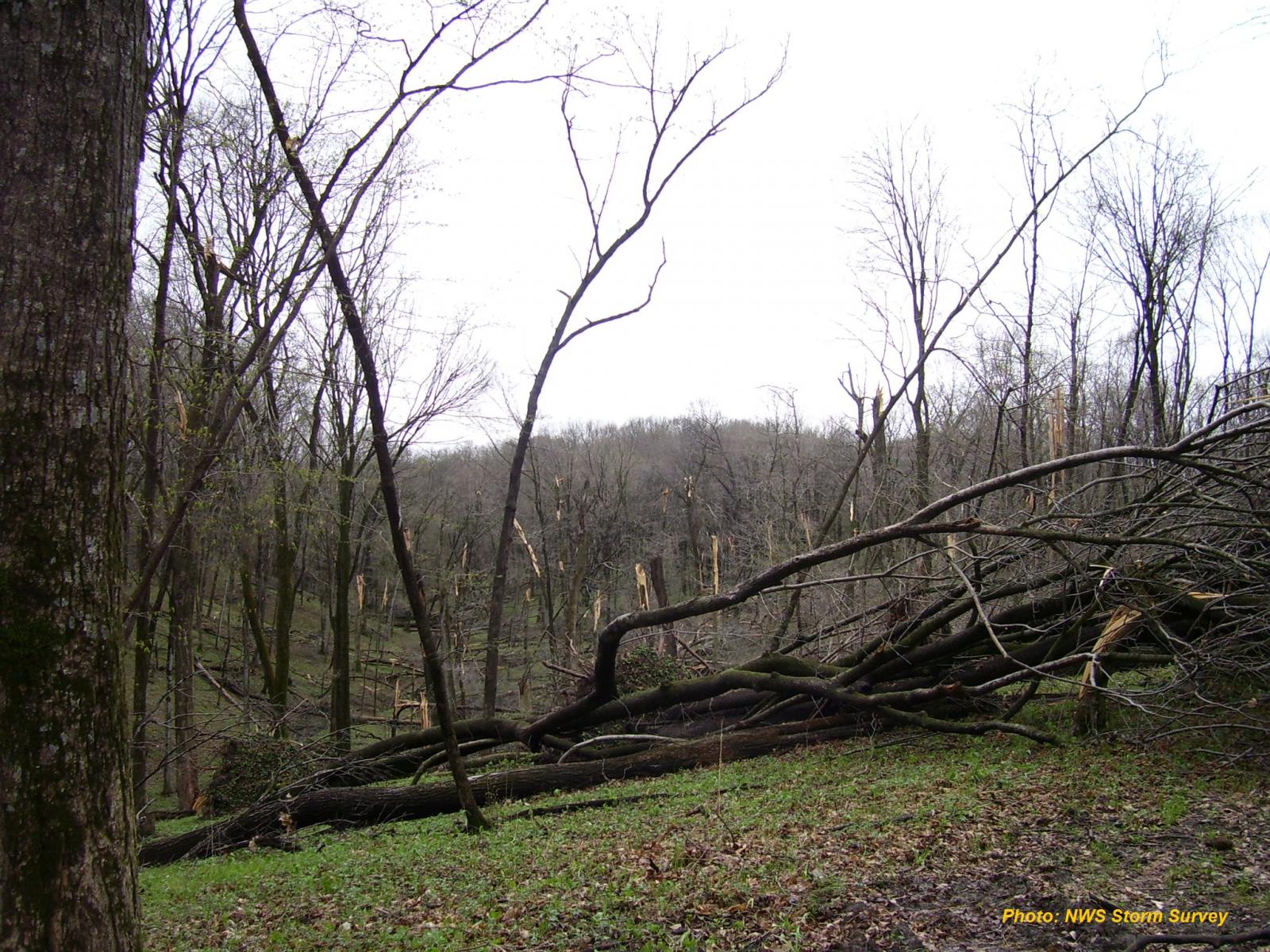
Damage to trees at Pinicon Ridge Park in northern Linn County.
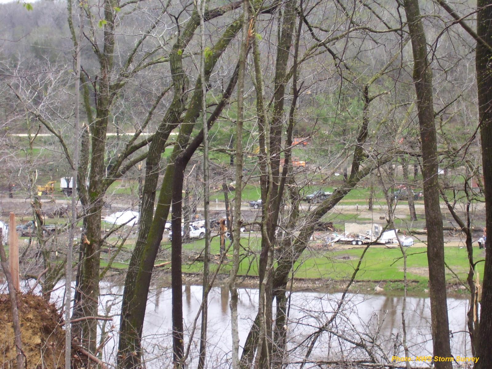
Damage to campers and campground at Pinicon Ridge Park along the Wapsipinicon River in northern Linn County.
%20004.jpg)
Damage to farm about 3 miles south of Delhi in southern Delaware County. (photo courtesy of Delaware County Emergency Management)

