
Scattered thunderstorms with severe gusts, hail and a tornado risk are possible near a cold front from the Ohio Valley to the Mid-Atlantic tonight. Tropical Storm Bertha is expected to bring tropical storm conditions to portions of the Gulf Coast from the panhandle of Florida into Louisiana through Wednesday. Read More >
Quad Cities, IA/IL
Weather Forecast Office
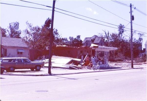
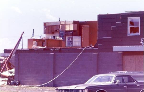
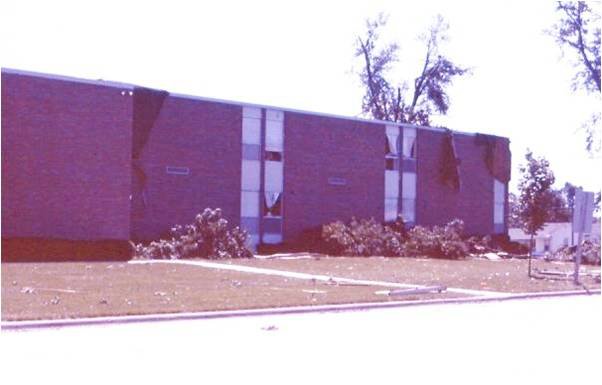
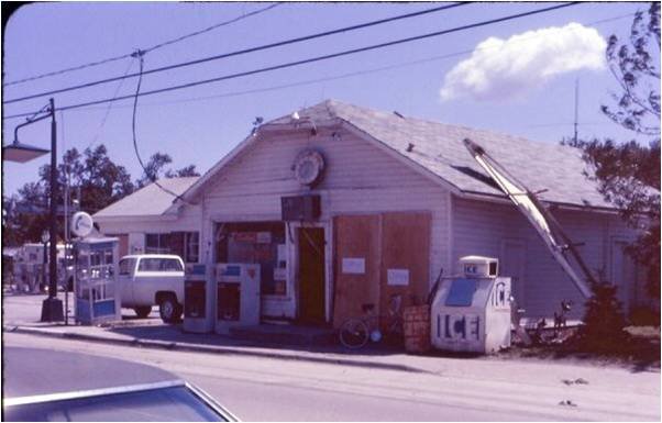
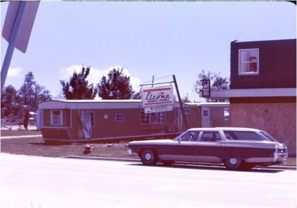
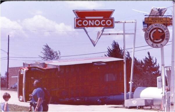
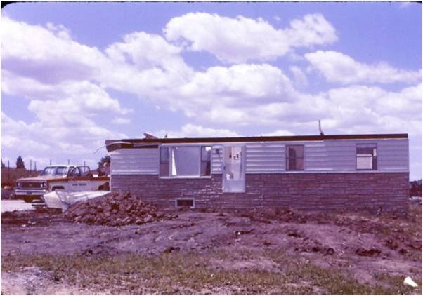
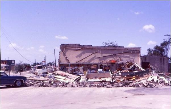
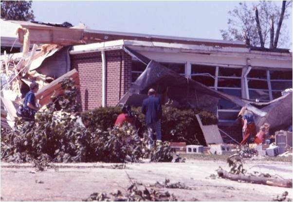
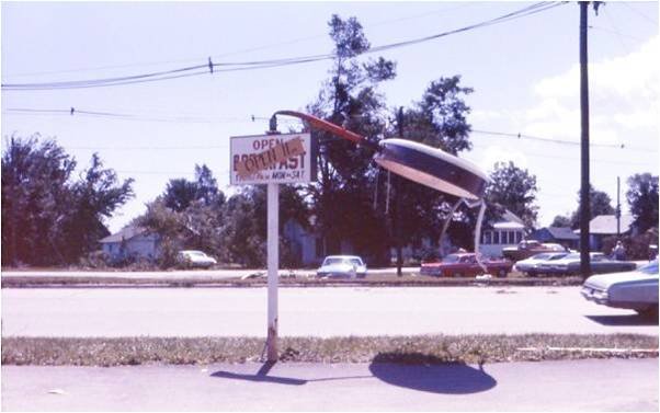
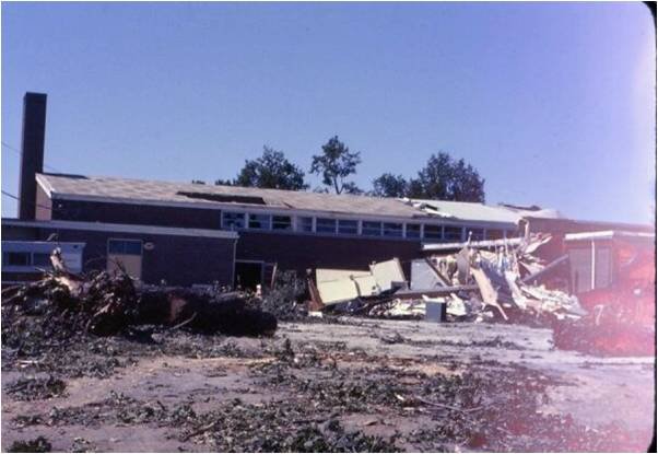
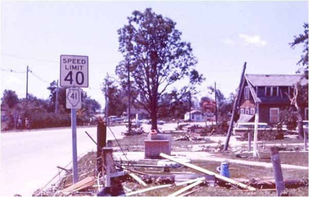
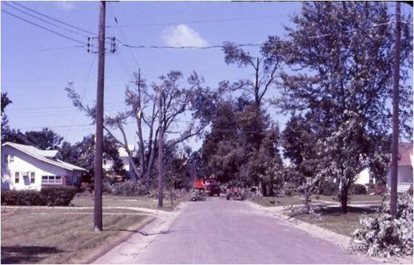
On June 14, 1974, a tornado touched down in southern Rock Island County and continued through Mercer and Warren counties before ending in northern Knox County. This tornado took an erratic path as it traveled a total of 53 miles and caused 2 injuries. The most intense damage path, rated F3 in intensity, occurred in Knox County and extended from approximately 7 miles north to 10 miles south of Abingdon, IL. In Abingdon, the damage resulted in about 200 homes being damaged or destroyed. Total storm damages were estimated at more than $2 million.
June 14, 1974 Storm Reports
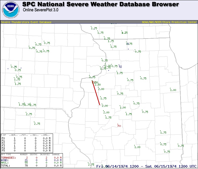 |
| Tornado path (red line) and hail reports (green) from June 14, 1974 from the Storm Prediction Center (SPC) National Severe Weather Database. |
Photos from June 14, 1974
If you have any photos or additional reports from this event, please send them to us at w-dvn.webmaster@noaa.gov
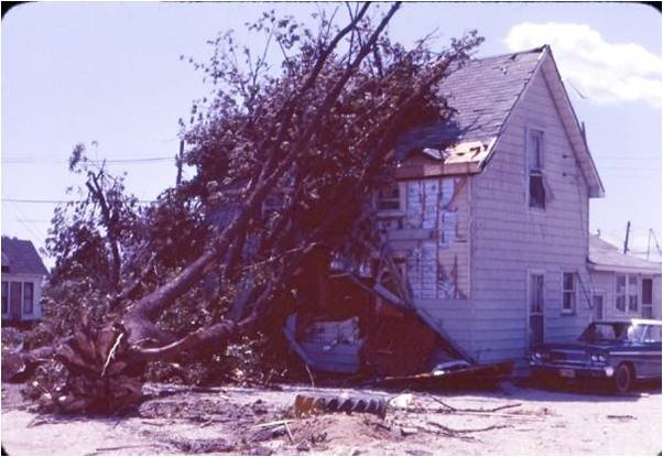
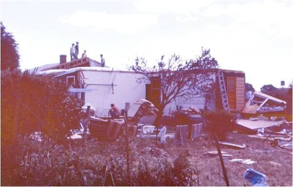
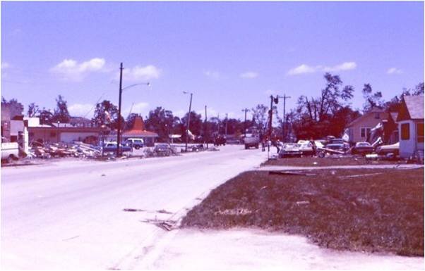
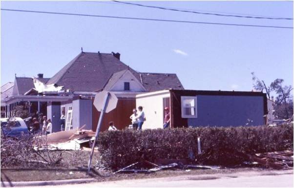
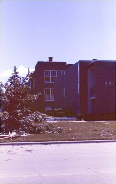
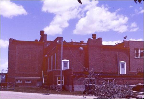
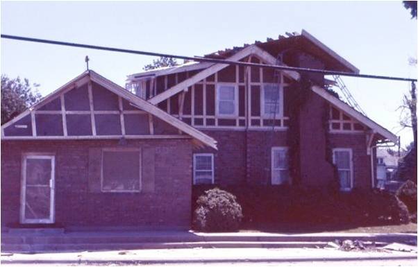
Below are photos of the damage that occurred near Abingdon, IL. To see a larger image, simply click on the picture. (Photos relayed by Ethan Schisler)
 |
 |
 |
 |
 |
 |
 |
 |
 |
 |
 |
 |
 |
 |
 |
 |
 |
 |
 |
 |
 |
 |
 |
 |
Hazardous Weather
Watches, Warnings, & Advisories
Briefing
Hazards Page
View Local Storm Reports
Submit Report
Road Reports
Text Products
Forecasts
Fire Weather
Briefing
Hourly Forecast Graphs
Forecast Discussion
User-Defined Area
Activity Planner
Local Forecasts
Space Weather
Text Products
River Graphs
Airport Forecasts
Snow and Ice Probabilities
Winter Storm Severity Index (WSSI)
Current Conditions
Observations
Drought Monitor
Radar
Satellite
Text Products
Rivers and Lakes
River Graphs
Sunrise/Sunset Tables
Seasons (Equinoxes/Solstices)
Road Reports
Past Weather
Recent Observation History
Climate Summaries
Past Events
Climate Normals/Averages
Climate Records
Climate/Almanac Data
Holiday Climatology
Climate Maps
Monthly Climate Stats
Annual Climate Stats
Observation Site History
Sunrise/Sunset Tables
US Dept of Commerce
National Oceanic and Atmospheric Administration
National Weather Service
Quad Cities, IA/IL
9040 N Harrison Street
Davenport Municipal Airport
Davenport, IA 52806-7326
563-386-3976
Comments? Questions? Please Contact Us.

