Dangerous heat will expand from the Gulf Coast into the Southern Plains and Desert Southwest through week's end. Additional extreme heat impacting the Pacific Northwest will shift to the northern Plains by the weekend. Tropical Storm Bertha is expected to continue to impact portions of the northwestern Gulf Coast from south central Louisiana to the upper Texas coast today. Read More >
Overview
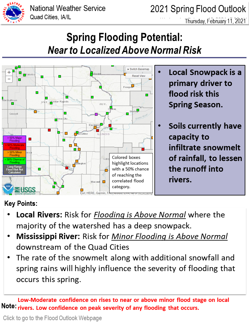
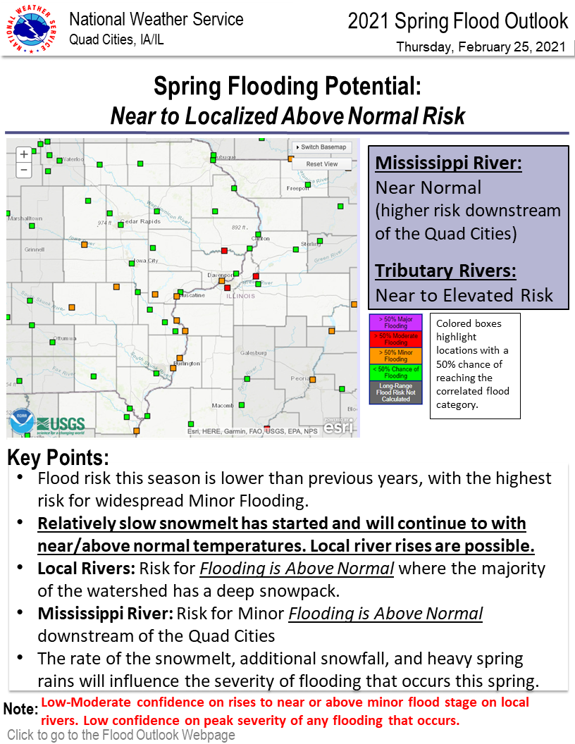
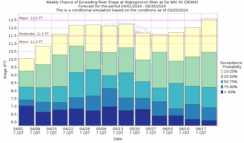
The Spring Flood and Water Resources Outlook is for the Quad Cities Hydrologic Service Area (HSA), which covers portions of eastern Iowa, northwest and west central Illinois, and extreme northeast Missouri. This includes the Mississippi River from above Dubuque, Iowa to below Gregory Landing, Missouri and its tributaries. The primary local river basins include the Maquoketa, Wapsipinicon, Cedar, Iowa, English, Skunk, North Skunk, and Des Moines Rivers in Iowa, the Fox River in Missouri, and the Pecatonica, Rock, Green, and La Moine Rivers in Illinois. This outlook is for the time period from March through May.
Probabalistic Hydrologic Outlook - March 11, 2021
Use the links below to find the Graphical Probabilities and the Numerical Probabilities respectively.
|
Graphical Hydrologic Outlooks |
Spring Flood Risk 2-Pager (Mar 11th, 2021) |
Statistical Hydrologic Outlook (Mar 11th, 2021) |
||||||
|
|
|
||||||
Flood Outlook
Updated 3/19/2021
The majority of the snow across the region has melted and as the bulk of it melted slowly, rivers were generally able to take the runoff with rises staying within the banks. There were a few rivers that saw rises from snowmelt runoff cause some minor flooding, but these were limited to localized areas and generally just caused minor lowland and farmland flooding.
The snowmelt runoff is currently working down the Mississippi River, with peak levels due to the snowmelt water expected through March 25th. These peak levels are anticipated to stay below flood stage. However, additional rain is expected in the next week so river levels could rise to higher levels after the snowmelt crest moves through. With the river running at higher levels, runoff from heavy rains would bring a higher risk for flooding to occur.
The weather pattern is expected to stay active in the coming weeks, which could bring rain, additional snow or a combination of both to areas across the region. Any additional precipitation will have an impact on the flood risk as any areas that receive heavy rain or heavy snow will have the risk increase.
Key Points:
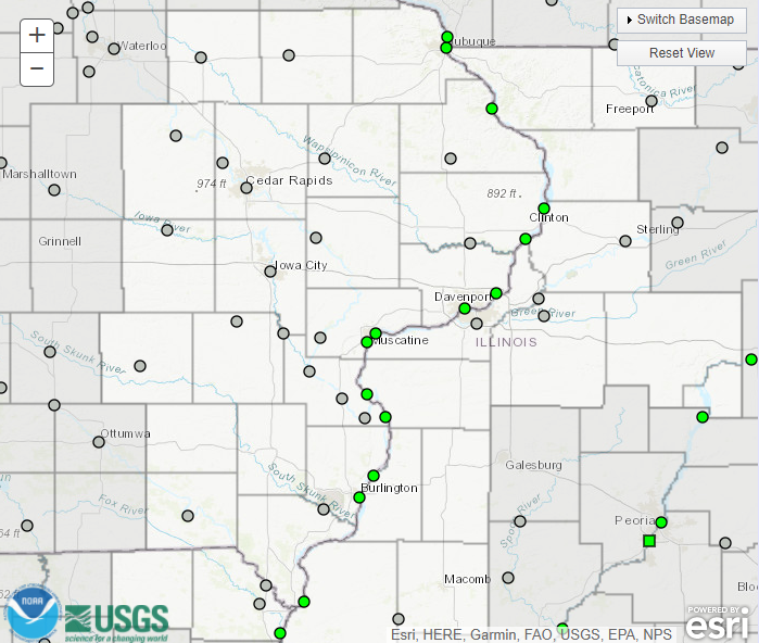
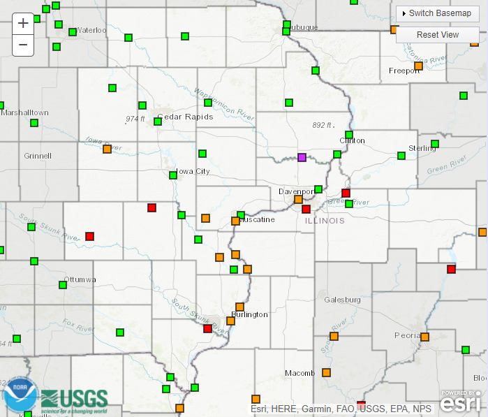
Advanced Hydrologic Prediction Service (AHPS)
 |
|
|
| Observed Conditions | Forecast Conditions | Long-Range Outlooks |
Flood Category definitions:
Many factors are have been considered when determining the overall flood risk for the Spring, with the combination of these influences factoring into the final determination. These factors are discussed in detail below.
Information Current as of 3/19/2021
Seasonal Precipitation
Precipitation this winter has averaged above normal for much of the NWS Quad Cities Hydrologic Service Area (HSA), however the larger-scale Upper Mississippi River watershed has averaged near to below normal precipitation.
 |
 |
Below you will find graphics of the precipitation accumulated this winter season (left) and how this amount of moisture compares to normal in percentage (right). These graphics are courtesy of the Midwest Regional Climate Center.
 |
 |
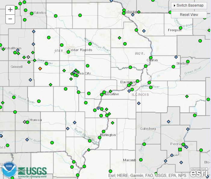
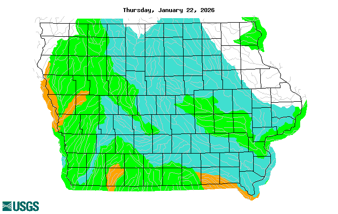
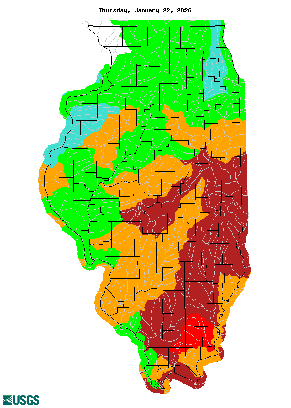
River Conditions
Streamflow analysis from the United States Geological Survey indicates the majority of the Upper Mississippi River watershed has rivers running at near to above normal streamflows. The higher flows are occurring as snowmelt runoff and recent rainfall runoff is moving through the river systems, which has caused rises in river levels. While these flows will drop as the snowmelt runoff works through these river systems, the period of time when the rivers are running at higher levels will cause an increased risk for flooding because the stream levels will already be running at higher levels. This essentially means that the river doesn’t have as much capacity to hold higher amounts of runoff.
|
|
|
 |
 |
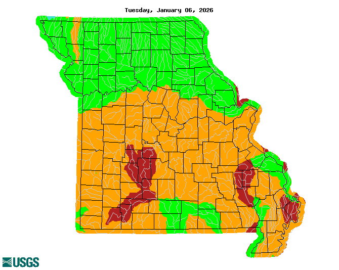 |
| Iowa | Illinois | Missouri |
| Images courtesy of the USGS |
Soil Conditions
Soils across much of the Upper Mississippi River watershed are near normal or drier than normal. The drier soils will help reduce the threat for flooding if and when heavy rains occur this spring.
|
|
| Image courtesy of the NWS Climate Prediction Center |
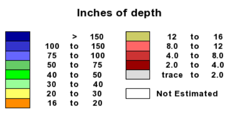
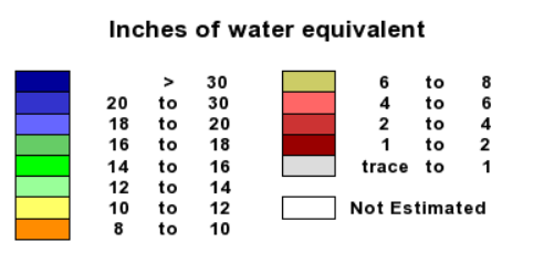
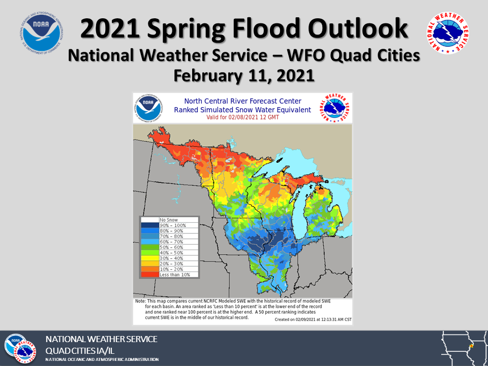
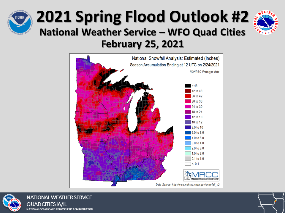
Snow Cover and Liquid Water Content
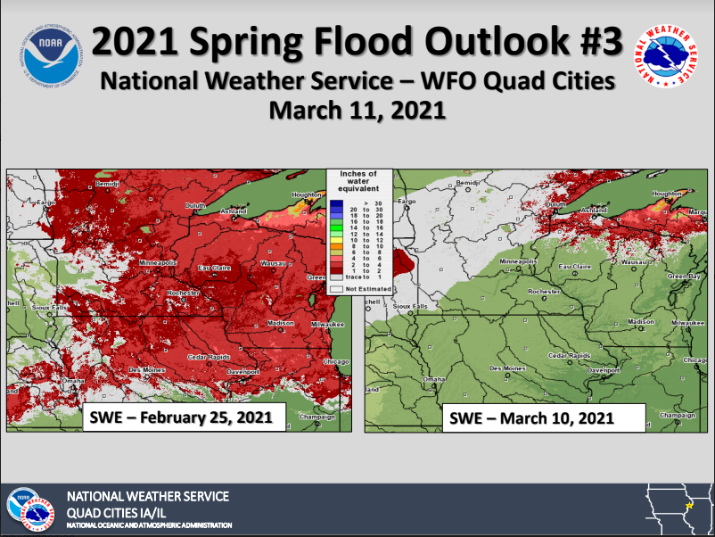
Temperatures through the first half of March allowed for an almost perfect melt of the snow across the region, which greatly reduced the amount of runoff entering the river systems simultaneously. It ended up taking 2 weeks to melt the 8-16 inches of snow that was on the ground as of late February as warm temperatures were observed during the day, but dropped below freezing at night which slowed the melting process.
Snowmelt runoff did cause rises on many rivers, but the slow pace of running into the rivers kept the majority of rivers below flood stage even with the surges of water in the river systems. The peak flows due to snowmelt will move down the Mississippi River between Dubuque, IA and Gregory Landing, MO through March 25th. However, additional rain is expected through the end of March, so with river levels being high with the ongoing snowmelt crest moving through, the risk for reaching flood levels will be a bit higher through the end of March and higher levels could be reached beyond the snowmelt crest.
|
||||
|
||||
| Images courtesy of the National Operational Hydrologic Remote Sensing Center (NOHRSC) |
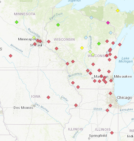
Frost Depth
Observations show that no frost remains in the soils for much of the region. Where there is frozen ground still is limited to the central and northern portions of Minnesota and Wisconsin. This is significant as new rain or snow across the region this spring will have the potential to be filtered into the ground rather than converted to 100% runoff.
| Frost Depths - North Central River Forecast Center | |||
Regional Frost Depths as of March 19, 2021 |
Ice Jam Flooding
Ice jamming is no longer a threat as ice has melted in all area rivers.
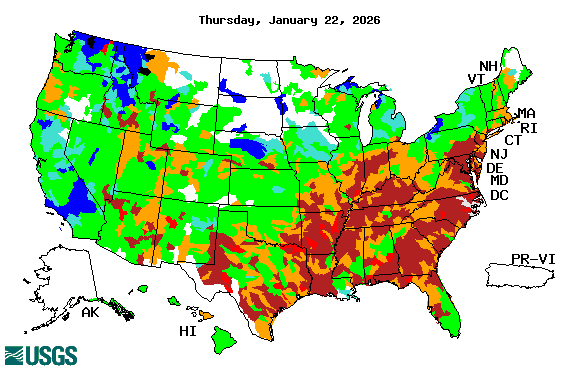
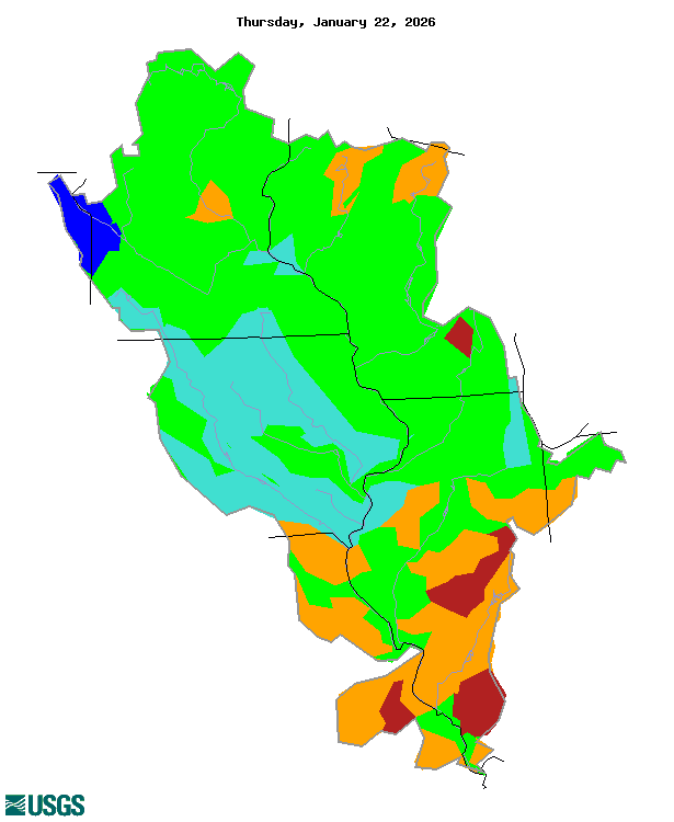
Drought
According to the U.S. Drought Monitor, there are no local areas observing drought conditions, however portions of the Midwest are seeing Abnormally Dry to Severe Drought conditions.
|
|
| Image courtesy of the US Drought Monitor |
| 8 to 14 day Temperature Outlook | 8 to 14 day Precipitation Outlook |
 |
 |
|
March Temperature Outlook |
March Precipitation Outlook |
 |
 |
Archived Recordings and Situation Reports:
 |
 |
 |
|||
| Feb 11, 2021 Webinar Recording | Feb 25, 2021 Webinar Recording | Mar 11, 2021 Webinar Recording | |||
 |
 |
|
|||
| 2021 Spring Flood Outlook #1 Document | 2121 Spring Flood Outlook #2 Document | 2121 Spring Flood Outlook #3 Document | |||
River and Streamflow Information:
Flood safety and flood insurance information:
Precipitation, temperature, and soil moisture information:
Questions or Comments
If you have questions or comments about this spring flood and water resource outlook please contact:
Jessica Brooks
Service Hydrologist
National Weather Service
9040 Harrison St
Davenport, IA 52806
Email: jessica.brooks@noaa.gov
 |
Media use of NWS Web News Stories is encouraged! Please acknowledge the NWS as the source of any news information accessed from this site. |
|


.png)