Quad Cities, IA/IL
Weather Forecast Office
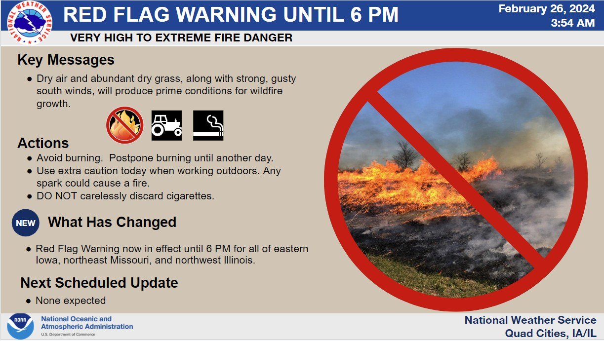 |
| A Red Flag Warning is in effect until 6 PM. Dry air and abundant dry grass, along with strong, gusty south winds, will produce prime conditions for wildfire growth. Avoid burning. Postpone burning until another day. Use extra caution today when working outdoors. Any spark could cause a fire. DO NOT carelessly discard cigarettes. |
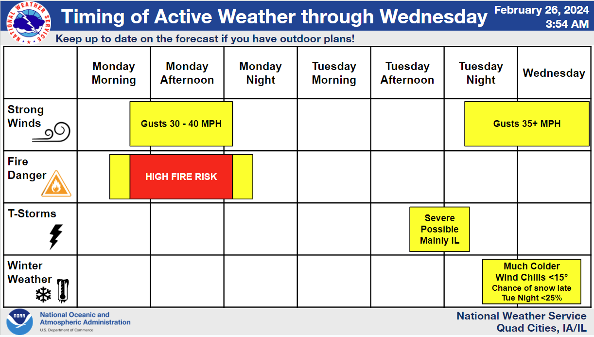 |
| Here is a timeline of the active, more-impactful, weather for the next few days. Today it will be windy, very warm, and very dry which will result in a High Fire Risk. Tuesday afternoon and evening, thunderstorms are possible. Some in NW IL might be severe. Tuesday night and Wednesday, it will be drastically colder with blustery northwest wind. At this time, little if any snow accumulations are expected. Wind chills by Wednesday morning will be in the single digits and teens! |
 |
| A few severe storms are possible Tuesday late afternoon, especially in Illinois. Please pay attention to the forecasts and be ready for a fast moving storm or two toward evening. |
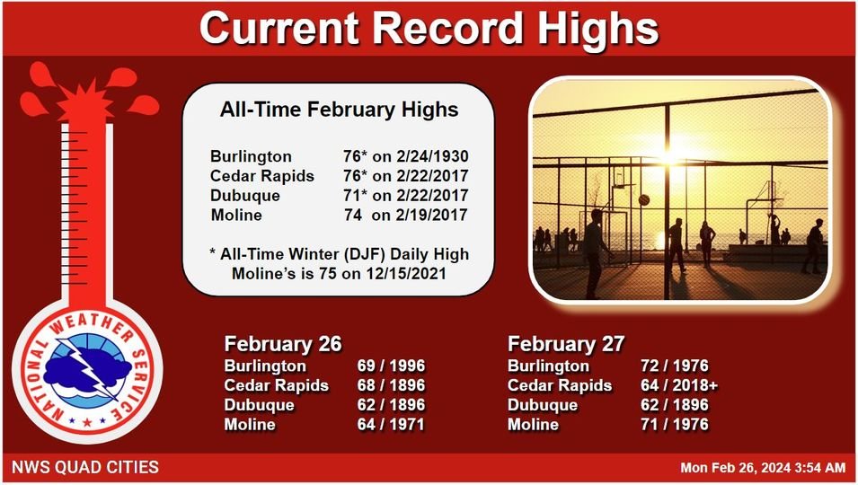 |
| Records will be broken today and tomorrow! Here are the current record highs for today and tomorrow as well as the All-Time February and Winter (Dec-Jan-Feb) Daily Record Highs. |
Hazardous Weather
Watches, Warnings, & Advisories
Briefing
Hazards Page
View Local Storm Reports
Submit Report
Road Reports
Text Products
Forecasts
Fire Weather
Briefing
Hourly Forecast Graphs
Forecast Discussion
User-Defined Area
Activity Planner
Local Forecasts
Space Weather
Text Products
River Graphs
Airport Forecasts
Snow and Ice Probabilities
Winter Storm Severity Index (WSSI)
Current Conditions
Observations
Drought Monitor
Radar
Satellite
Text Products
Rivers and Lakes
River Graphs
Sunrise/Sunset Tables
Seasons (Equinoxes/Solstices)
Road Reports
Past Weather
Recent Observation History
Climate Summaries
Past Events
Climate Normals/Averages
Climate Records
Climate/Almanac Data
Holiday Climatology
Climate Maps
Monthly Climate Stats
Annual Climate Stats
Observation Site History
Sunrise/Sunset Tables
US Dept of Commerce
National Oceanic and Atmospheric Administration
National Weather Service
Quad Cities, IA/IL
9040 N Harrison Street
Davenport Municipal Airport
Davenport, IA 52806-7326
563-386-3976
Comments? Questions? Please Contact Us.

