Overview
|
A line of showers and thunderstorms developed across from central Iowa south to central Missouri Monday afternoon ahead of a strong cold front. This line of storms slowly progressed eastward, reaching eastern Iowa and northeast Missouri Monday evening. Some thunderstorms in the line became severe, producing damaging winds, large hail up to quarter size, and one confirmed tornado across southeast Iowa and northeast Missouri. |
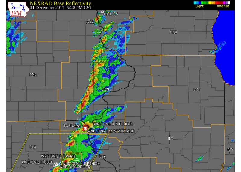 Radar Animation (3:55 P.M. - 8:00 P.M.) (IEM) (Click to zoom) |
Tornadoes:
|
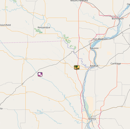
Tornado - Wayland, MO
Track Map 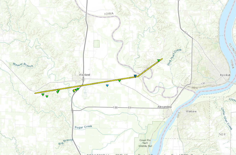 
(Click to zoom) |
||||||||||||||||
The Enhanced Fujita (EF) Scale classifies tornadoes into the following categories:
| EF0 Weak 65-85 mph |
EF1 Moderate 86-110 mph |
EF2 Significant 111-135 mph |
EF3 Severe 136-165 mph |
EF4 Extreme 166-200 mph |
EF5 Catastrophic 200+ mph |
 |
|||||
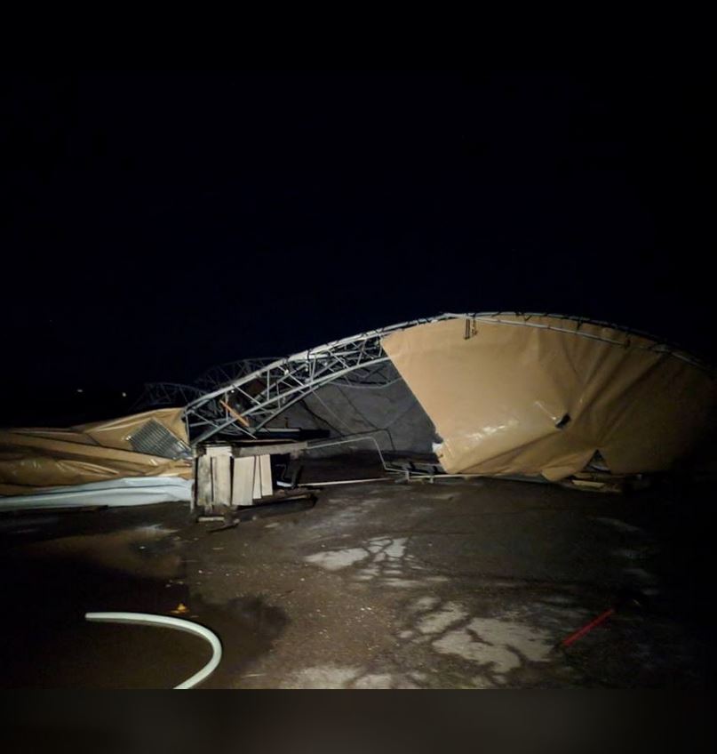
Photos & Video:
Header
 |
 |
 |
 |
| Snapped power poles next to HWY 27 (NWS Storm Survey) |
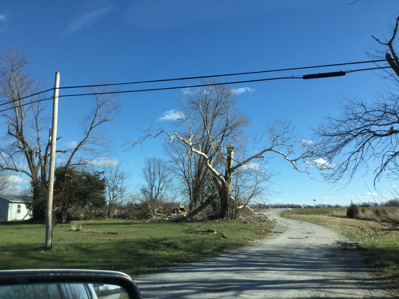
Tree Damage next to HWY 27 (NWS Storm Survey) |
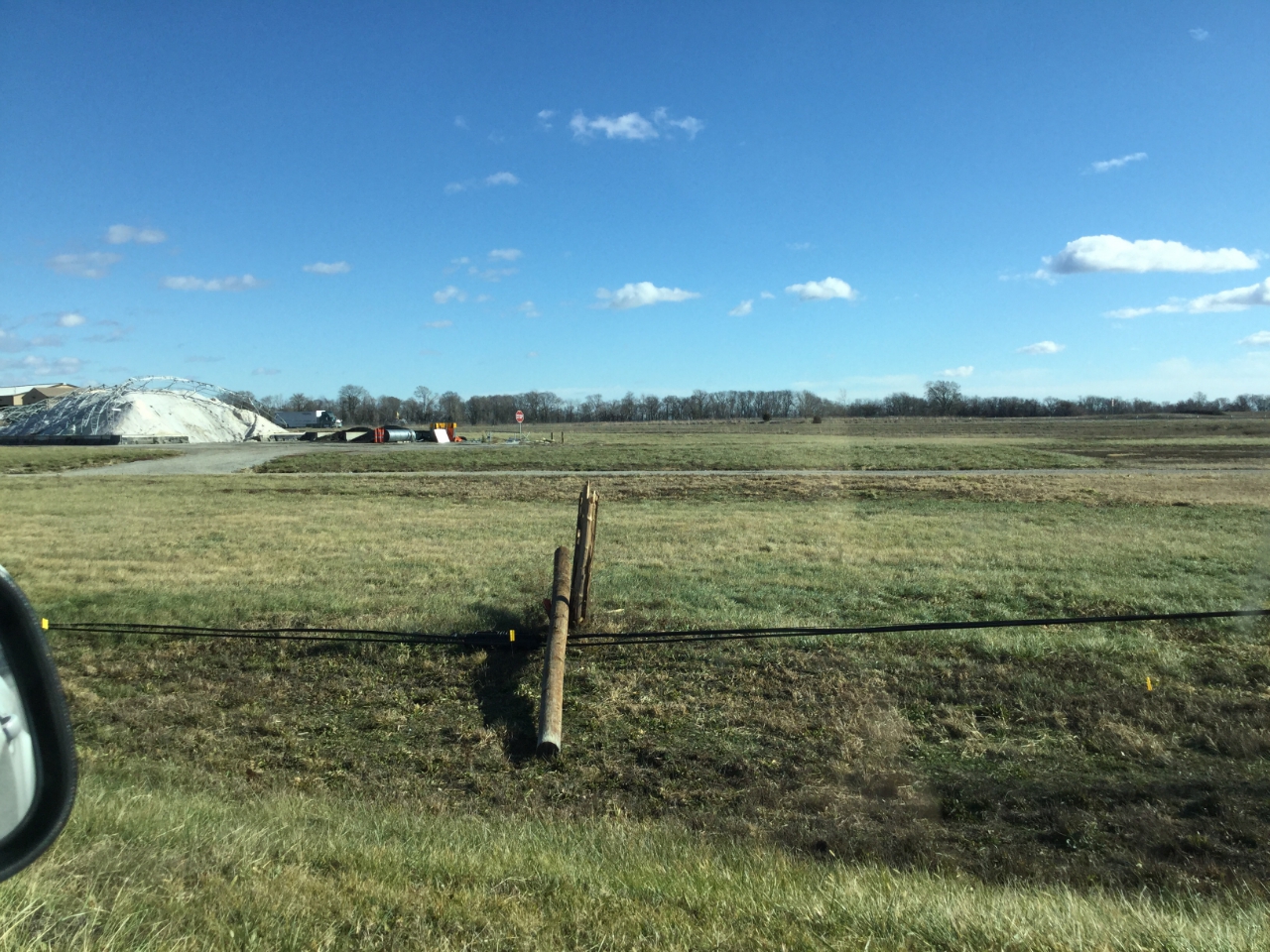
Destroyed DOT Salt Shelter (courtesy KHQA) |
Overturned Semi on HWY 27 (courtesy KHQA) |
Storm Reports
Environment
Additional environmental data.
 |
 |
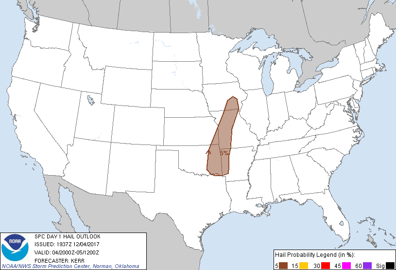 |
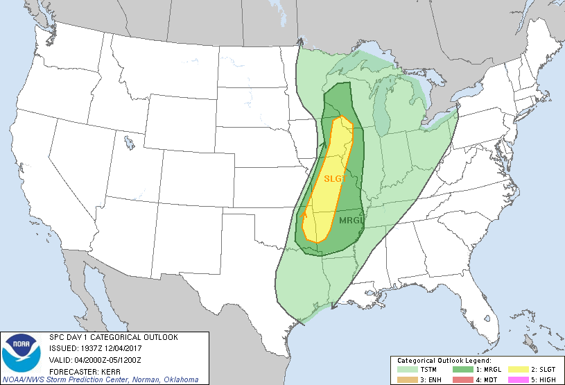
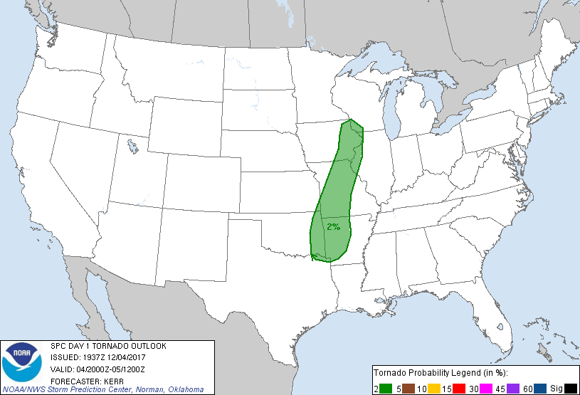
| Figure 1: SPC Day 1 Outlook (20:00 UTC) | Figure 2: SPC Day 1 Tornado Outlook (20:00 UTC) | Figure 3: SPC Day 1 Hail Outlook (20:00 UTC) |
 |
||
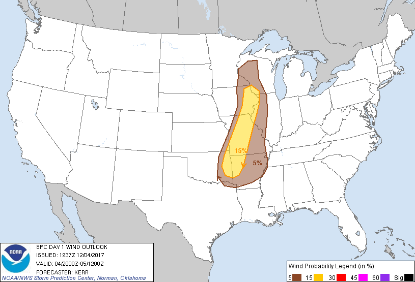
| Figure 4: SPC Day 1 Wind Outlook (20:00 UTC) |
 |
Media use of NWS Web News Stories is encouraged! Please acknowledge the NWS as the source of any news information accessed from this site. |

