Dangerous and extreme heat will remain across portions of the southern U.S. this week. Heavy rainfall may bring significant flash flooding across portions of the Mid-Atlantic and Northeast through the night, and additional flash flooding concerns across New England on Wednesday. Monsoonal thunderstorms will bring a flash flood risk to the Four Corners region, especially in burn scar areas Read More >
Overview
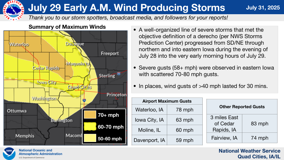
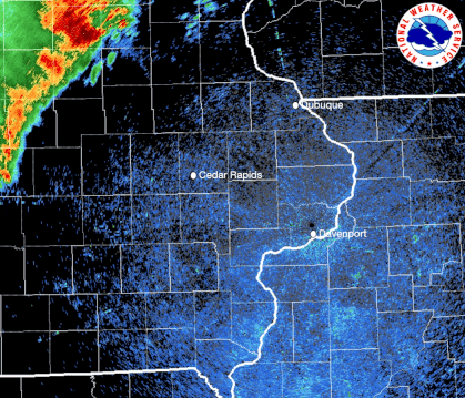
The NWS Storms Prediction Center has stated that the line of storms from South Dakota and northeast Nebraska through Iowa would meet the objective definition of a derecho. More about derechos.
More on this event: NWS Sioux Falls, SD
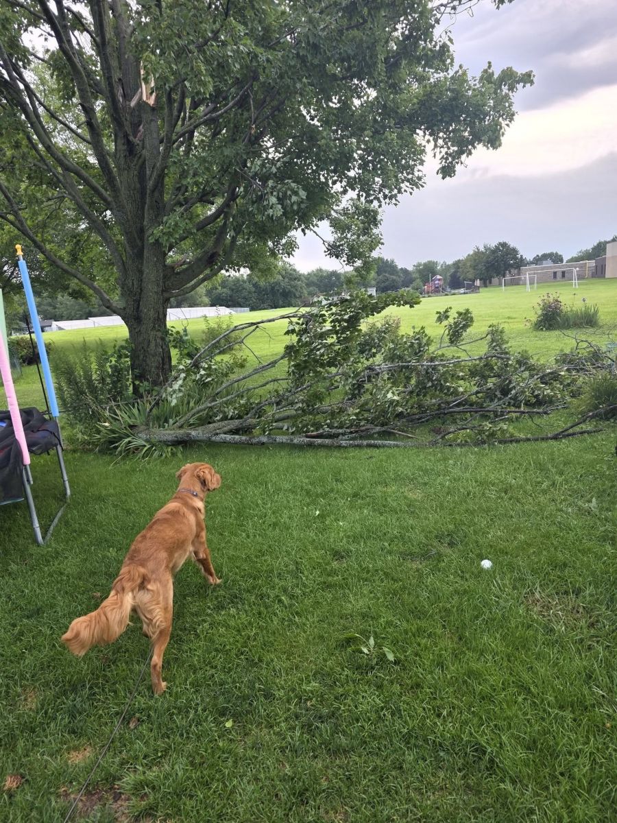
Photos & Video
 |
 |
 |
 |
|
Central City, IA Carrie Callan |
Lake Delhi, IA Prefers Unnamed |
Sigourney, IA Darian Graff |
Davenport, IA Jon White |
 |
 |
 |
|
Central City, IA Gracyn Freund - KGAN |
Aurora, IA Michael Ellis |
Parkview, IA Dusty Mizer |
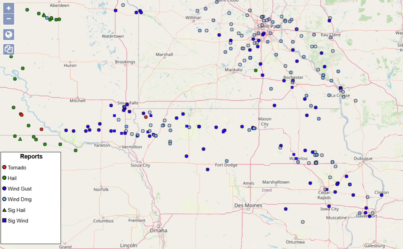
Storm Reports
|
Regional Storm Report Map |
Local Storm Report Map |
 |
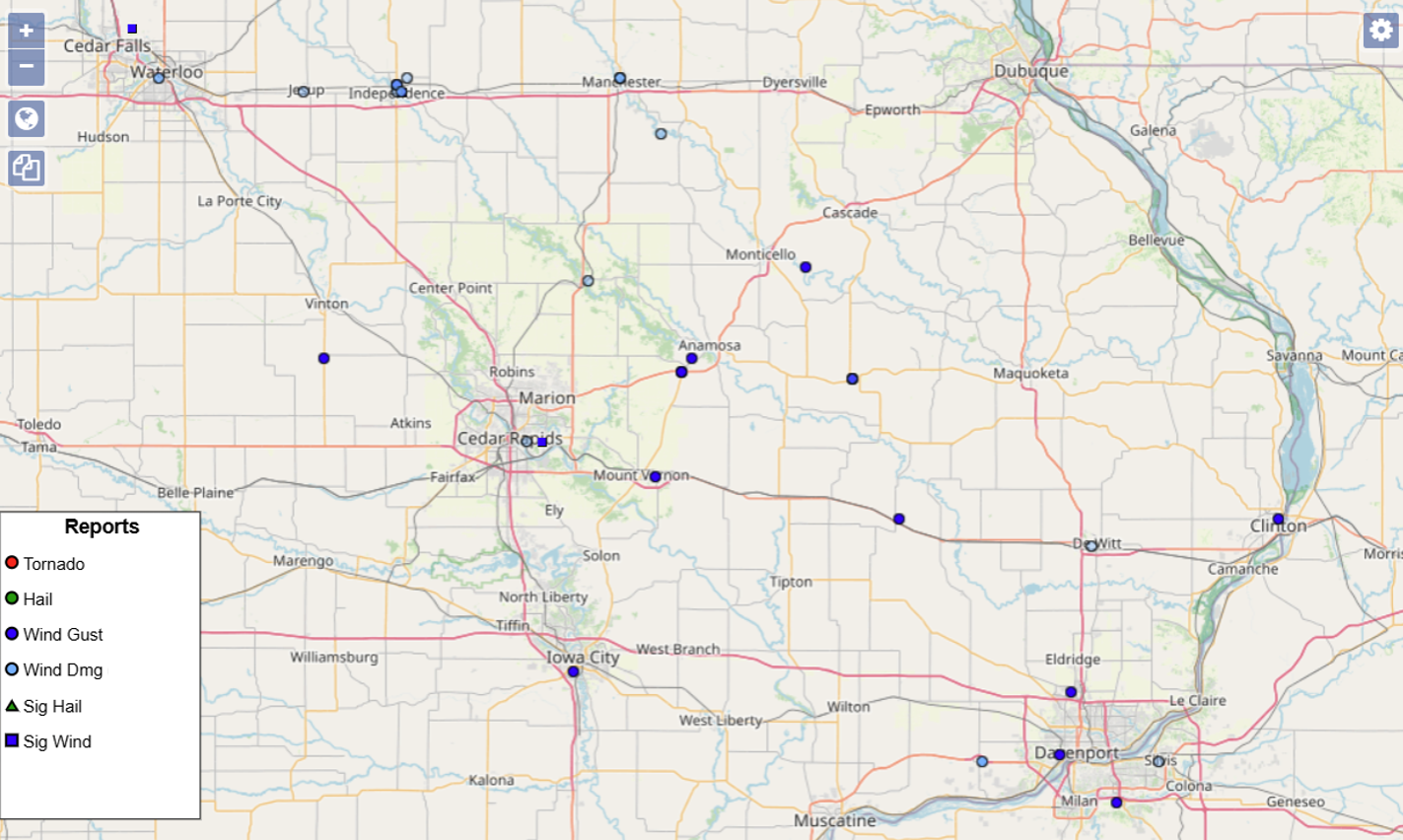 |
| Interactive Storm Report Map (SPC) Nationwide Storm Report Map Image (SPC) |
|
Preliminary Local Storm Report...Summary
National Weather Service Quad Cities IA IL
1002 AM CDT Tue Jul 29 2025
..TIME... ...EVENT... ...CITY LOCATION... ...LAT.LON...
..DATE... ....MAG.... ..COUNTY LOCATION..ST.. ...SOURCE....
..REMARKS..
0340 AM Tstm Wnd Gst 3 NNW Moline 41.52N 90.51W
07/29/2025 M54 MPH Rock Island IL Dept of Highways
IADOT RWIS.
0342 AM Tstm Wnd Gst Moline Quad-City Airpor 41.45N 90.50W
07/29/2025 M60 MPH Rock Island IL ASOS
ASOS.
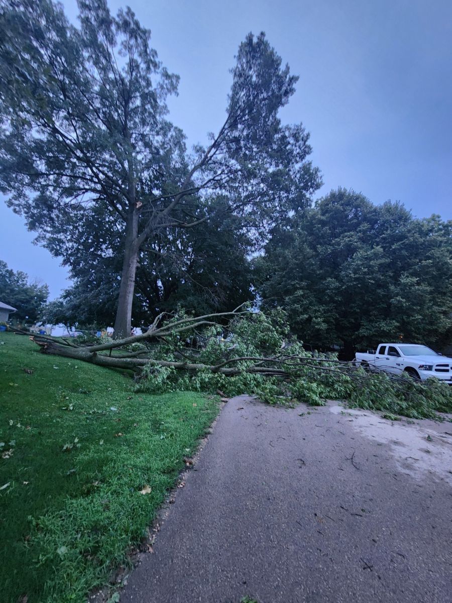
0400 AM Tstm Wnd Dmg East Moline 41.51N 90.42W
07/29/2025 Rock Island IL Public
Large tree uprooted near the town border of
East Moline and Silvis. Photo of damage
relayed via social media. Time estimated by
radar.
0329 AM Tstm Wnd Gst Davenport Municipality 41.61N 90.59W
07/29/2025 M59 MPH Scott IA ASOS
Davenport Municipal Airport ASOS.
0334 AM Tstm Wnd Gst Davenport 41.52N 90.61W
07/29/2025 E60 MPH Scott IA Trained Spotter
0220 AM Tstm Wnd Gst Cedar Rapids Municipali 41.88N 91.72W
07/29/2025 M52 MPH Linn IA Public
ASOS.
0226 AM Tstm Wnd Gst 3 E Cedar Rapids 41.97N 91.61W
07/29/2025 M83 MPH Linn IA Trained Spotter
From PWS.
0230 AM Tstm Wnd Gst Lisbon 41.92N 91.39W
07/29/2025 M60 MPH Linn IA Public
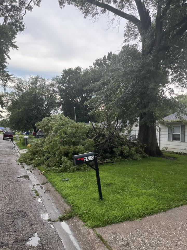
0230 AM Tstm Wnd Dmg Central City 42.20N 91.52W
07/29/2025 Linn IA Broadcast Media
Photo relayed of large tree branch broken
off. Time estimated by radar.
0240 AM Tstm Wnd Gst 1 S Mount Vernon 41.91N 91.42W
07/29/2025 M52 MPH Linn IA Dept of Highways
IADOT RWIS.
0300 AM Tstm Wnd Dmg 1 W Sigourney 41.34N 92.22W
07/29/2025 Keokuk IA Trained Spotter
Large tree branch split from a pear tree.
Branch seems to be at least 6 inches in
diameter.
0500 AM Rain 1 W Sigourney 41.34N 92.22W
07/29/2025 M2.50 Inch Keokuk IA Public
0820 AM Rain 1 W Sigourney 41.34N 92.22W
07/29/2025 M2.50 Inch Keokuk IA Trained Spotter
Rainfall total from overnight.
0228 AM Tstm Wnd Gst 1 NE Fairview 42.09N 91.32W
07/29/2025 M58 MPH Jones IA Mesonet
Personal weather station.
0230 AM Tstm Wnd Gst 1 SSW Fairview 42.07N 91.34W
07/29/2025 M74 MPH Jones IA Dept of Highways
IADOT RWIS.
0235 AM Tstm Wnd Gst 1 S Fairview 42.07N 91.34W
07/29/2025 M74 MPH Jones IA Mesonet
Mesonet station RCRI4 Anamosa.
0241 AM Tstm Wnd Gst 3 ESE Monticello Munici 42.22N 91.10W
07/29/2025 M65 MPH Jones IA Public
PWS.
0308 AM Tstm Wnd Dmg Wyoming 42.06N 91.01W
07/29/2025 Jones IA Public
Pine tree snapped across roadway and
flagpole broken.
0308 AM Tstm Wnd Gst Wyoming 42.06N 91.01W
07/29/2025 M71 MPH Jones IA Public
0241 AM Tstm Wnd Gst Iowa City Municipality 41.64N 91.55W
07/29/2025 M63 MPH Johnson IA ASOS
ASOS.
0308 AM Tstm Wnd Gst Dubuque Regional Arpt 42.40N 90.71W
07/29/2025 M52 MPH Dubuque IA ASOS
ASOS.
0309 AM Tstm Wnd Gst 1 E Dubuque Regional Ar 42.40N 90.70W
07/29/2025 M52 MPH Dubuque IA ASOS
ASOS station KDBQ Dubuque Arpt.
0345 AM Tstm Wnd Gst 3 NW Kingston 41.02N 91.07W
07/29/2025 M52 MPH Des Moines IA Mesonet
Personal weather station.
0423 AM Tstm Wnd Gst Burlington Regional Air 40.78N 91.13W
07/29/2025 M52 MPH Des Moines IA ASOS
ASOS.
0232 AM Tstm Wnd Dmg Manchester 42.49N 91.46W
07/29/2025 Delaware IA Emergency Mngr
Trees and power lines down.
0237 AM Tstm Wnd Dmg 3 WSW Delhi 42.41N 91.38W
07/29/2025 Delaware IA Broadcast Media
Photos of tree damage around Lake Delhi.
1003 AM Rain Dewitt 41.82N 90.55W
07/28/2025 M1.10 Inch Clinton IA Public
0330 AM Tstm Wnd Dmg Dewitt 41.82N 90.55W
07/29/2025 Clinton IA Trained Spotter
Many small to medium tree branches down.
0345 AM Tstm Wnd Gst 2 W Fulton 41.86N 90.19W
07/29/2025 M58 MPH Clinton IA Trained Spotter
Time estimated by radar. Minor tree damage
was also noted nearby.
0946 AM Tstm Wnd Dmg Dewitt 41.82N 90.55W
07/29/2025 Clinton IA Public
0309 AM Tstm Wnd Gst Lowden 41.86N 90.92W
07/29/2025 E65 MPH Cedar IA CO-OP Observer
Persisting for the past 5 to 10 minutes.
0140 AM Tstm Wnd Dmg Jesup 42.47N 92.07W
07/29/2025 Buchanan IA Public
Broken tree branches estimated 4 inches in
diameter. Another tree uprooted. Time
estimated by radar.
0140 AM Tstm Wnd Gst 1 N Independence 42.48N 91.89W
07/29/2025 E70 MPH Buchanan IA Trained Spotter
Trees leaning 15-20 degrees from vertical.
0141 AM Tstm Wnd Gst 2 ENE Hazleton 42.63N 91.86W
07/29/2025 E70 MPH Buchanan IA CO-OP Observer
Duration of at least 5 minutes.
0144 AM Tstm Wnd Dmg Hazleton 42.62N 91.91W
07/29/2025 Buchanan IA Emergency Mngr
Trees down in town.
0146 AM Tstm Wnd Dmg 2 ENE Hazleton 42.63N 91.86W
07/29/2025 Buchanan IA CO-OP Observer
Two 10 inch diameter trees downed. Time
estimated.
0148 AM Tstm Wnd Dmg 1 N Independence 42.48N 91.89W
07/29/2025 Buchanan IA Trained Spotter
Trees down.
0148 AM Tstm Wnd Dmg Independence 42.47N 91.89W
07/29/2025 Buchanan IA Emergency Mngr
Tree down in town.
0150 AM Tstm Wnd Dmg 1 E Independence 42.47N 91.88W
07/29/2025 Buchanan IA Public
Large trees uprooted.
0150 AM Tstm Wnd Dmg 2 NE Independence 42.49N 91.87W
07/29/2025 Buchanan IA Public
Large tree down. Many 1-3 inch diameter
branches down.
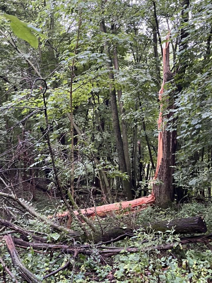
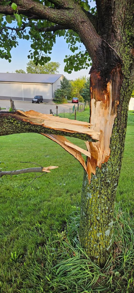
0154 AM Tstm Wnd Dmg Aurora 42.62N 91.73W
07/29/2025 Buchanan IA Public
Photo of 14 inch diameter oak tree snapped
that narrowly missed falling on a house and
garage. Photo relayed via social media. Time
estimated by radar.
0200 AM Tstm Wnd Gst 1 ESE Independence 42.47N 91.88W
07/29/2025 M77 MPH Buchanan IA Mesonet
Mesonet station EW8796 Independence.
0201 AM Tstm Wnd Gst 5 S Vinton 42.09N 92.03W
07/29/2025 M61 MPH Benton IA Public
PWS.
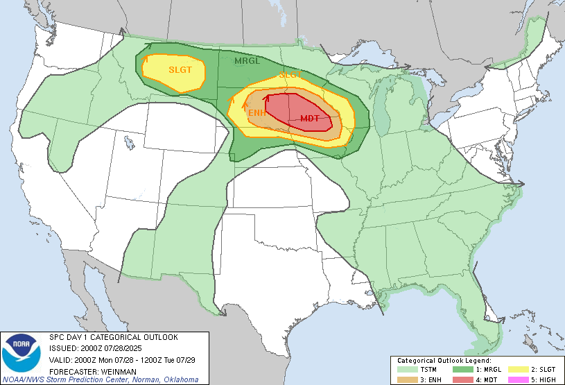
Outlooks and Environment
Storm Prediction Center Outlooks
 |
 |
 |
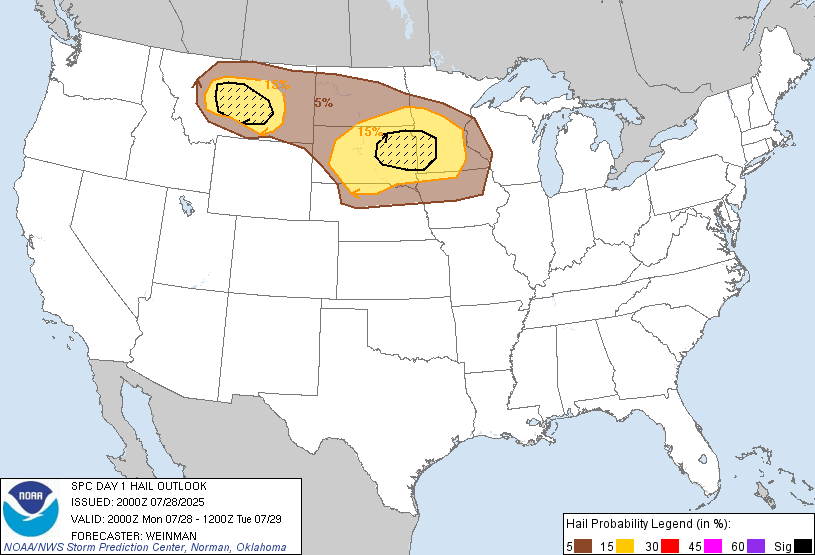 |
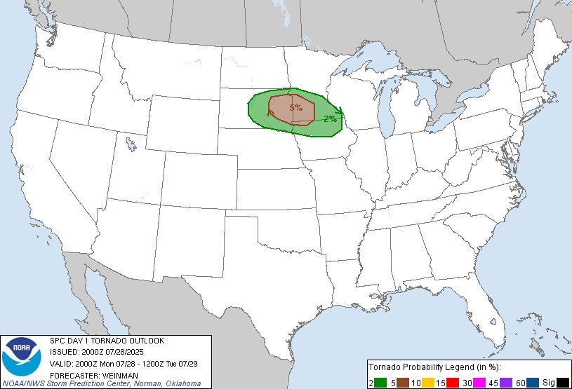
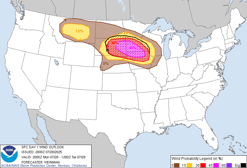
| SPC Day 1 2000z Outlook |
Tornado Risk Probabilities
|
Severe Wind Risk Probabilities **Sig Severe Possible** |
Severe Hail Risk Probabilities
|
Watches and Mesoscale Discussions
 |
 |
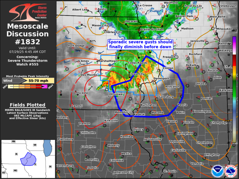 |
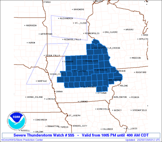
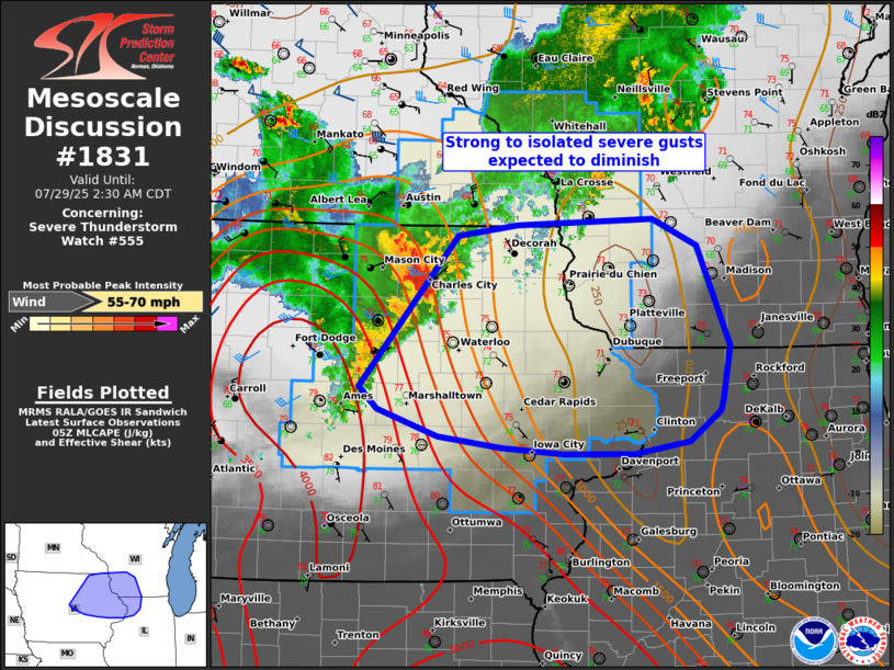
| Severe Thunderstorm Watch #555 | Mesoscale Discussion #1831 | Mesoscale Discussion #1832 |
Local Soundings and Radar Profiler Data at DVN
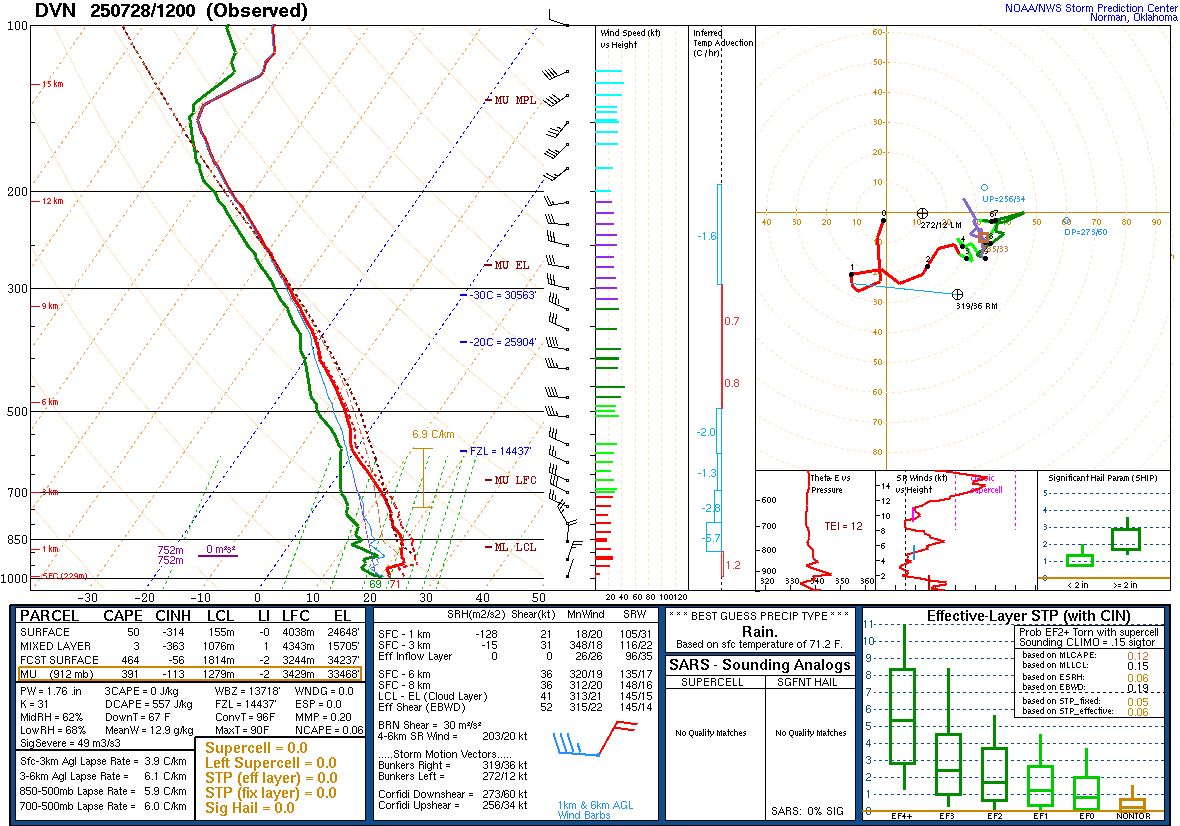 |
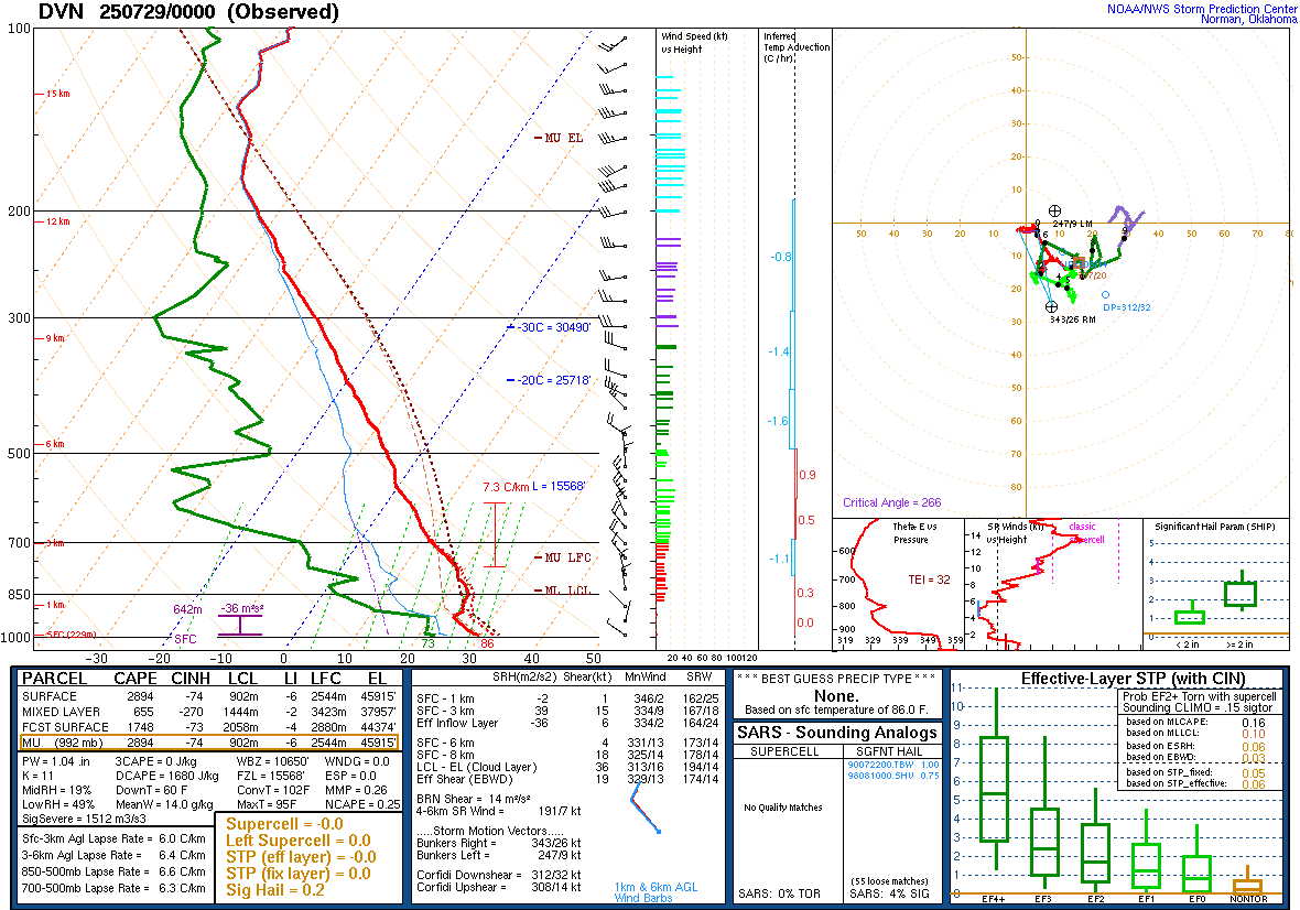 |
| 07/28/2025 - 7:00AM | 07/28/2025 7:00PM |
 |
|
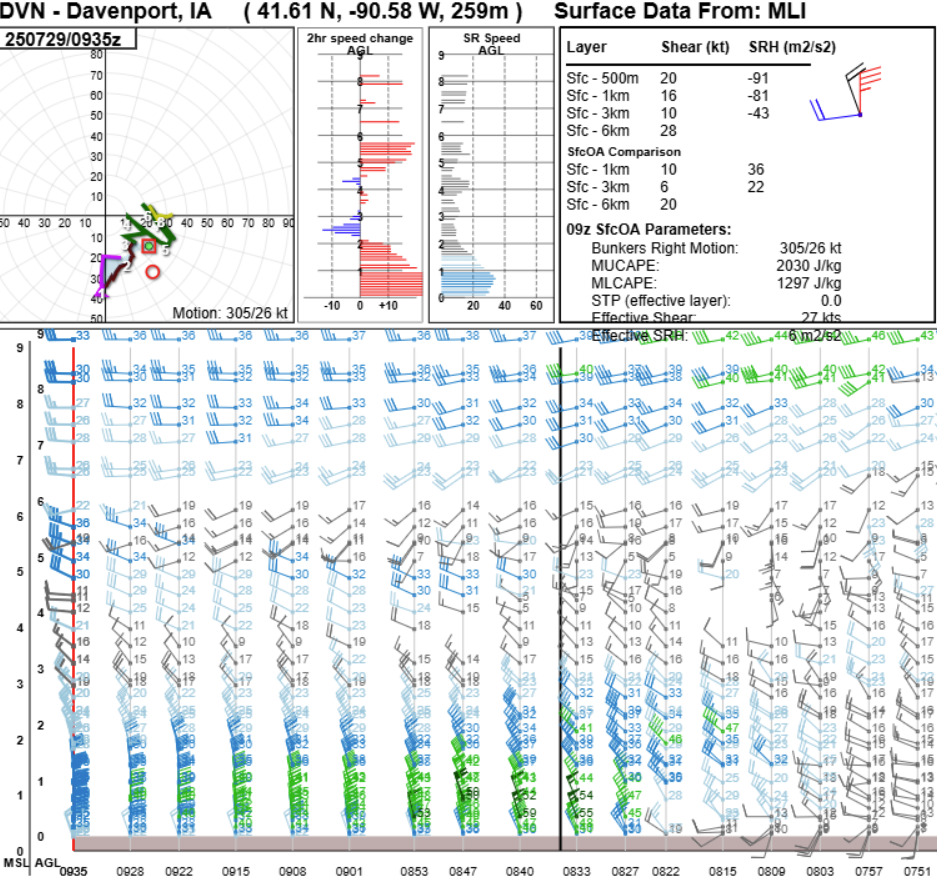
KDVN VWP Data from 2:30 A.M. (right) to 4:30 A.M. (left) This is the NWS Quad Cities (DVN) Doppler Radar vertical wind profile data in the hour following the line of storm passage. This shows the well-defined rear-inflow jet that had developed within the long-lived line of storms. It likely had weakened at this point compared to the northwest of the Quad Cities. Often the rear-inflow jet is a factor in severe winds. |
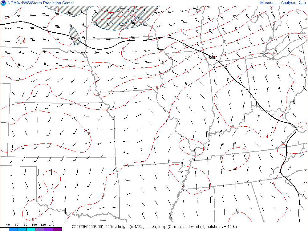
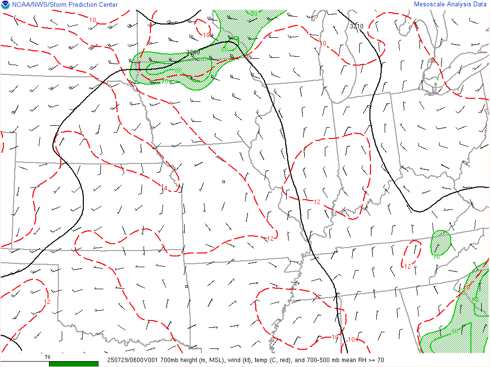
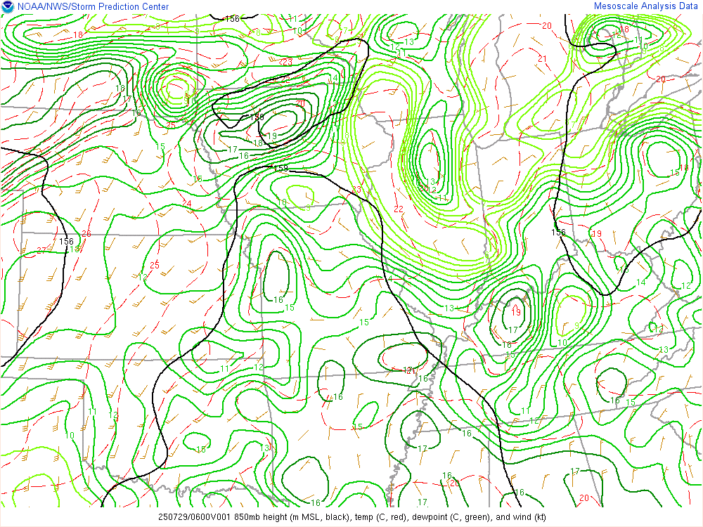
Synoptic Environment
 |
 |
 |
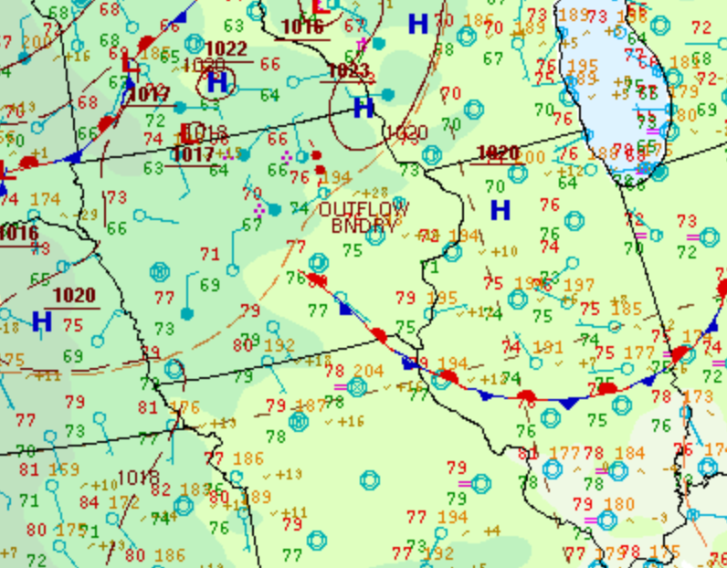 |
| 500 mb Chart at 1am | 700 mb Chart at 1am | 850 mb Chart at 1am | Surface Chart at 1am (WPC) |
Mesoscale Environment
 |
 |
 |
 |
|
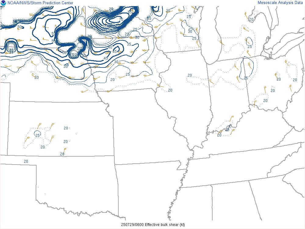
Wind Shear Favorable for Organized Convection |
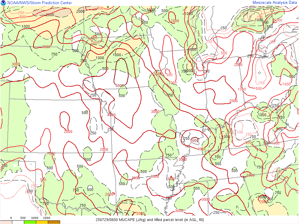
Instability Favorable for Organized Convection |
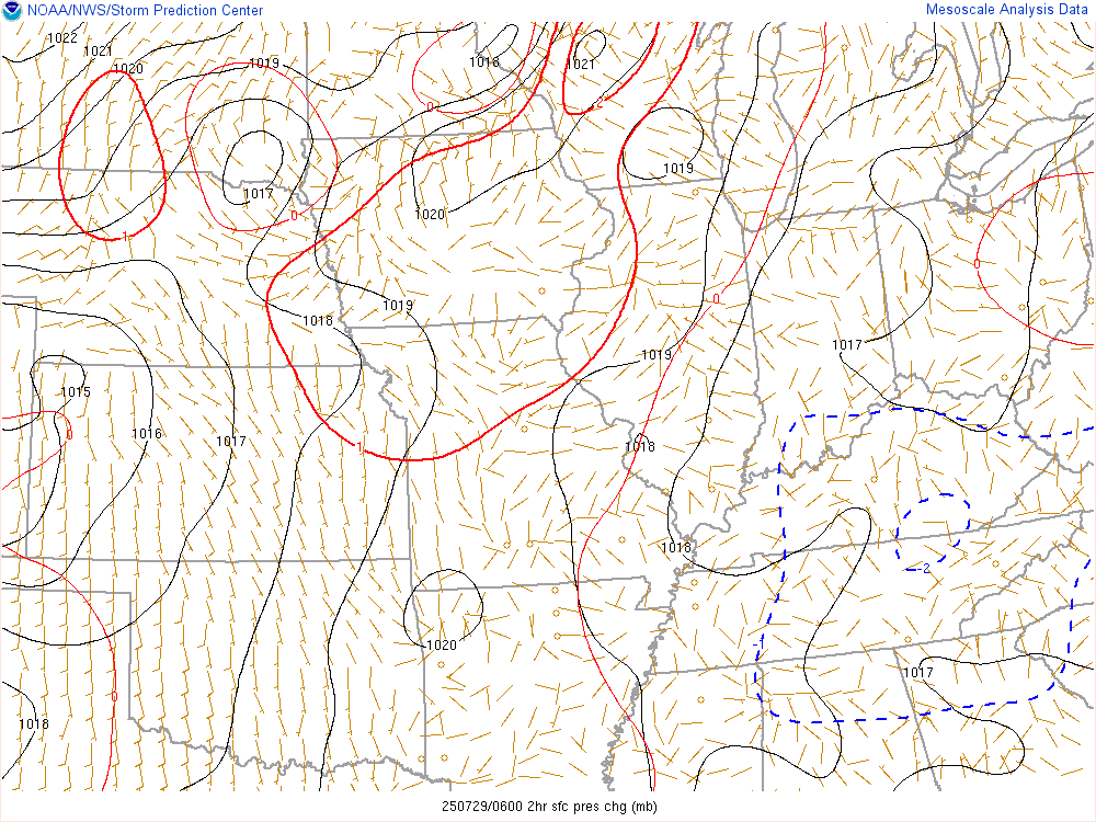
Pressure Change |
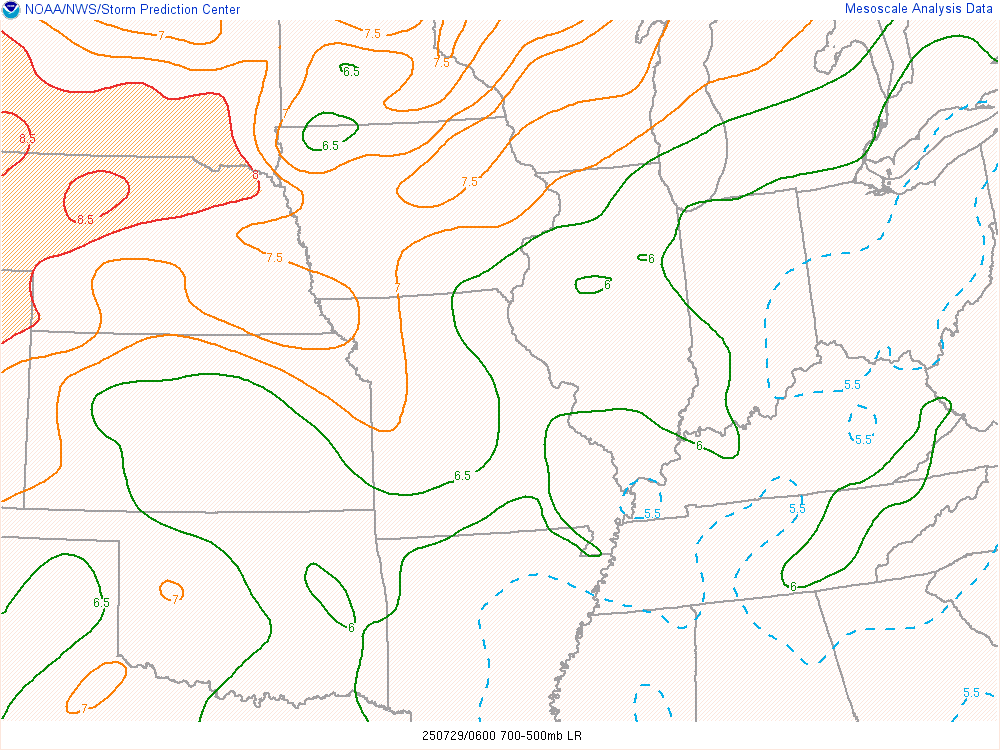
Mid Level Lapse Rates Favorable for Storm Maintenance |
 |
 |
 |
|
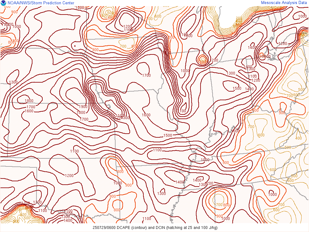
Downdraft CAPE Favorable for Strong Downdraft Winds |
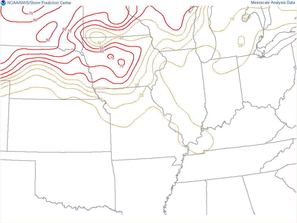
MCS Maintenance Indicative of Storm Longevity |
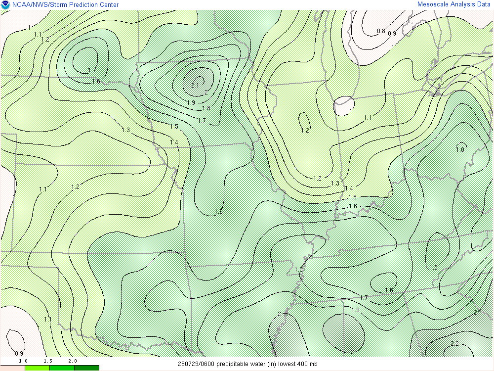
Precipitable Water Favorable for Heavy Rain |
 |
Media use of NWS Web News Stories is encouraged! |
|