Overview
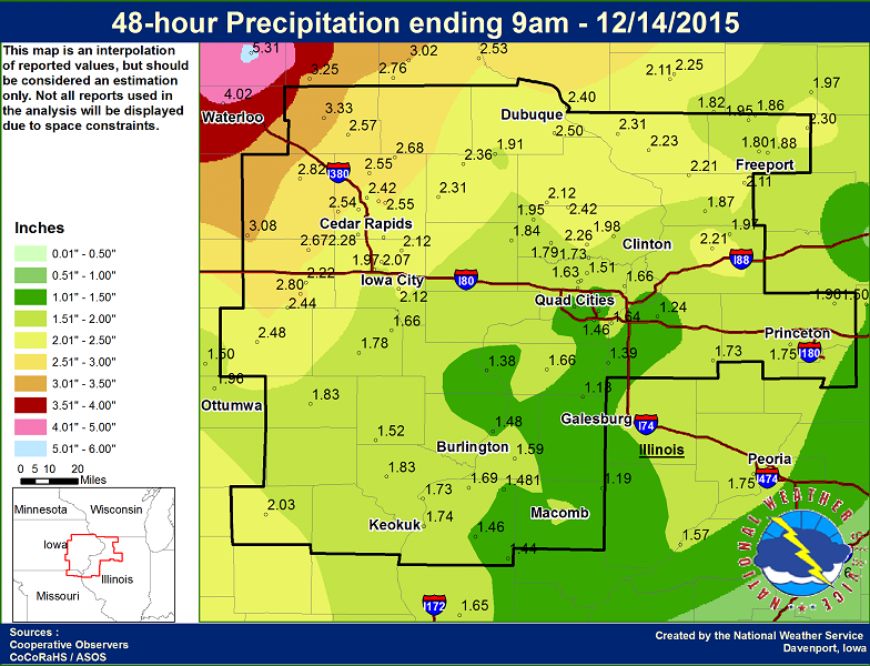
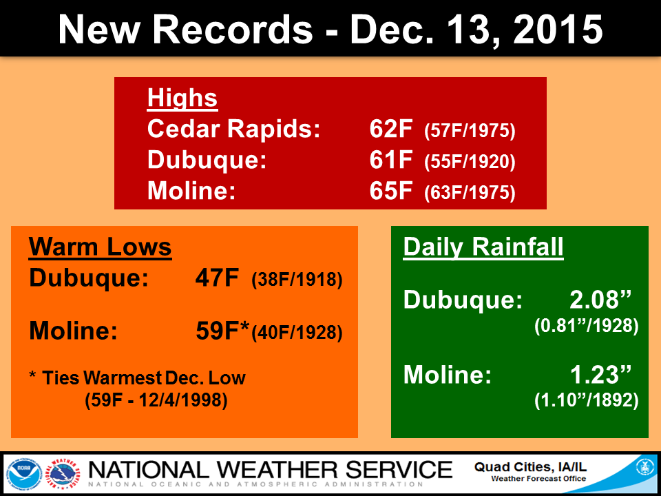
| A strong low pressure system moved across the Midwest December 13th and 14th, bringing unseasonably warm and wet conditions. Widespread rainfall was common with amounts generally between 1.20" and 3.30" across eastern Iowa, northwest Illinois, and northeast Missouri. Dubuque, IA saw its rainiest day in the month of December receiving 2.08" on the 13th. The highest rainfall amounts fell north of an Ottumwa, IA to Dubuque, IA line. Minor to major river flooding resulted from the unseasonably high rainfall totals. Record warmth was also prevalent for mid December, with most of the area seeing readings in the lower 60s on Sunday, December 13th. Many temperature and precipitation records were broken with this strong system. | .png) |
 |
Flooding:
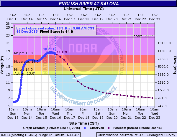
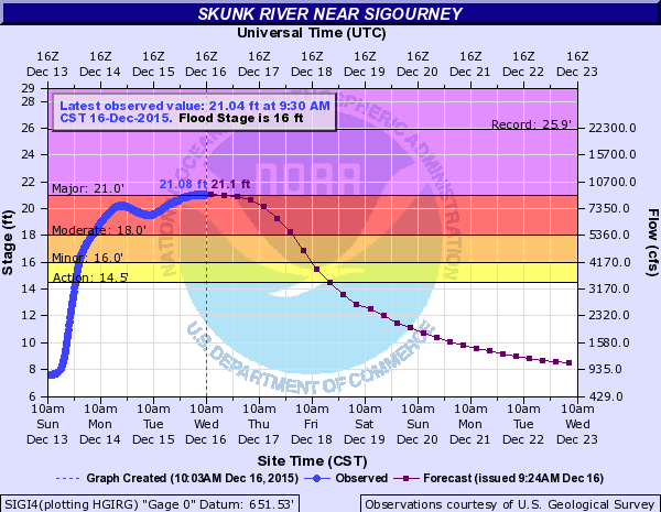
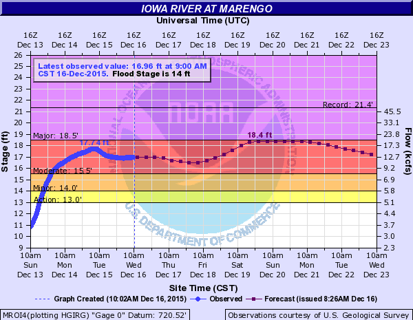
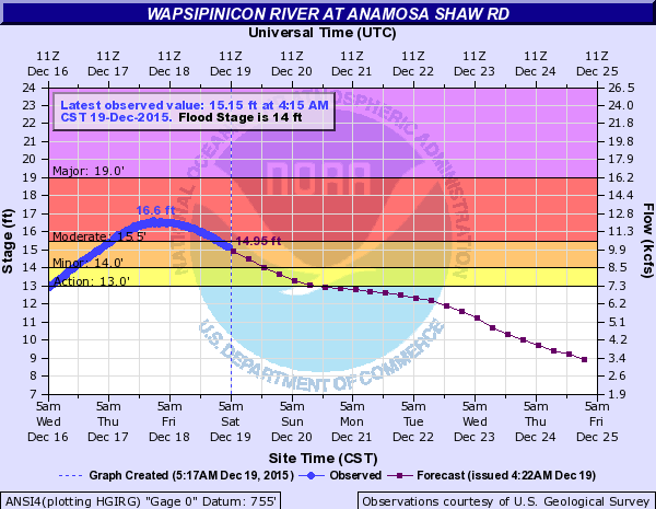
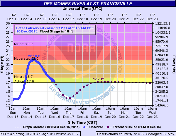
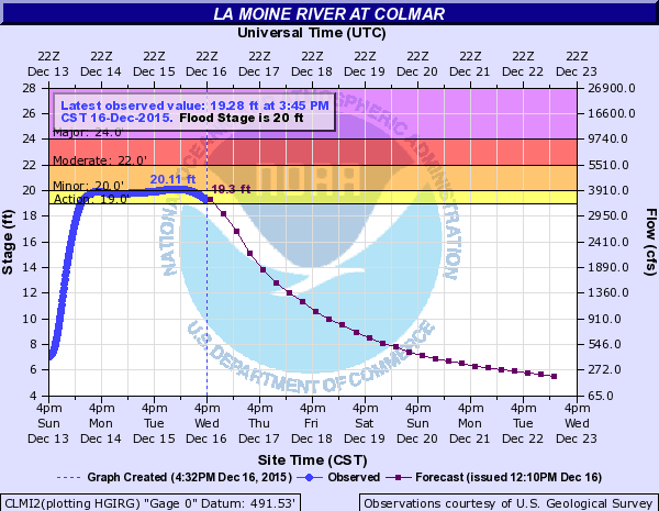
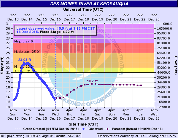
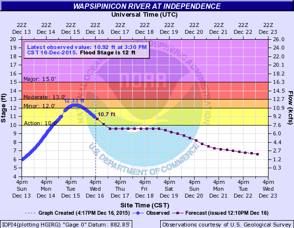
Minor to major flooding was observed on several rivers across the area. Below are some hydrographs of locations that experienced flooding.
Hydrographs
| MAJOR FLOODING | |||
 |
 |
.png) |
|
| Kalona, IA | Sigourney, IA | De Witt, IA | |
| MODERATE FLOODING | |||
 |
 |
 |
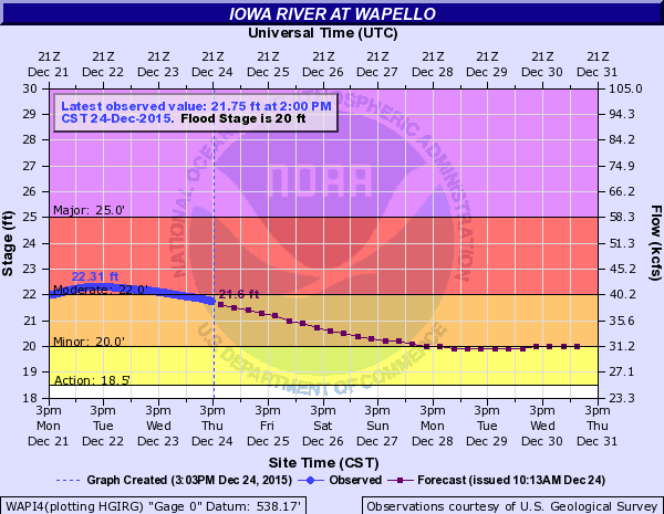 |
| Marengo, IA | Anamosa, IA | St. Francisville, MO | Wapello, IA |
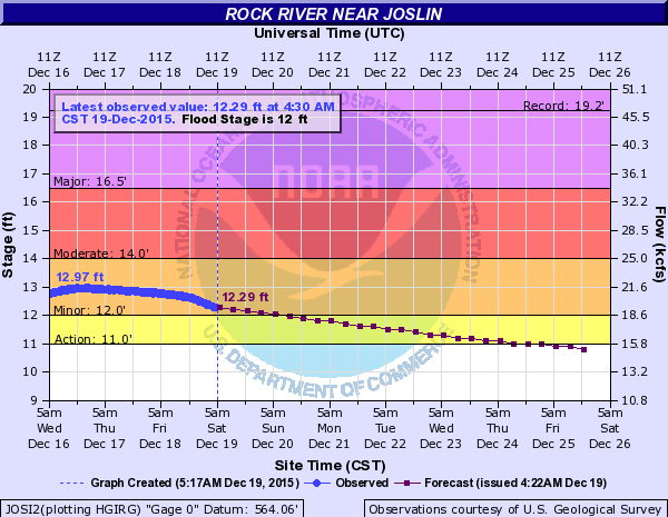
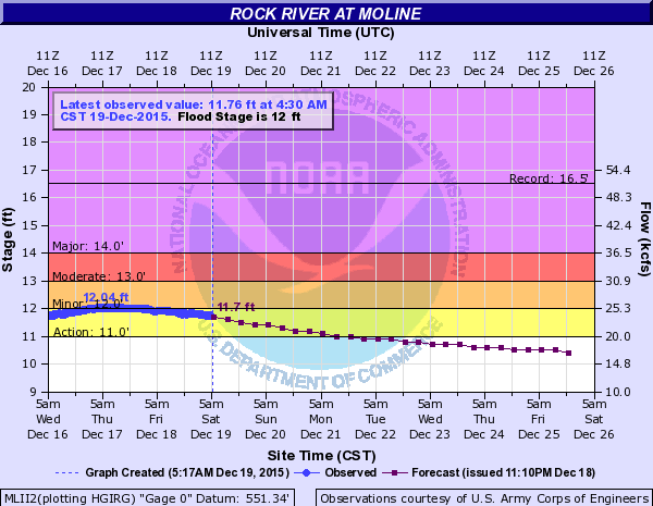
| MINOR FLOODING | |||
 |
 |
 |
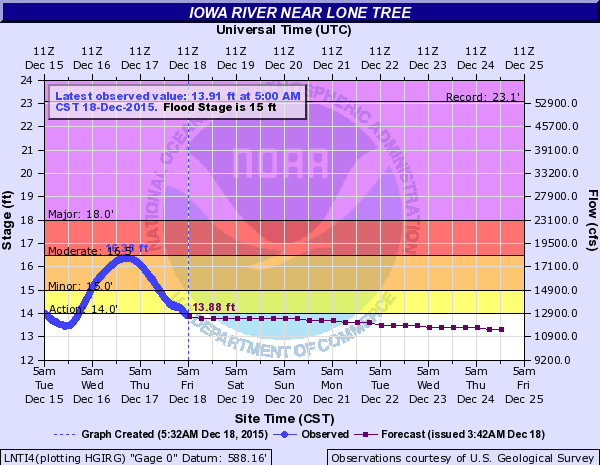 |
| Colmar | Keosauqua | Indepedence, IA | Lone Tree, IA |
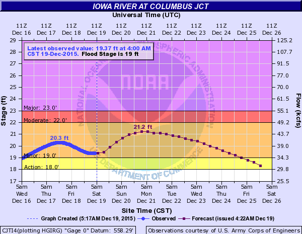 |
 |
 |
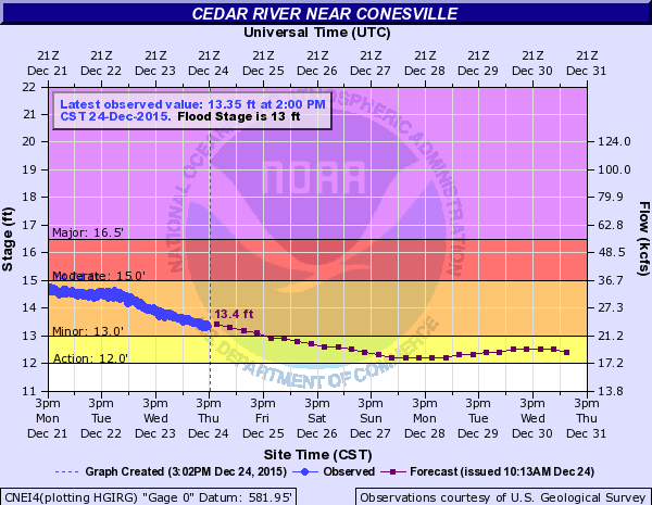 |
| Columbus Jct | Joslin | Moline | Conesville, IA |
.png) |
|||
| Oakville, IA |
|
 |
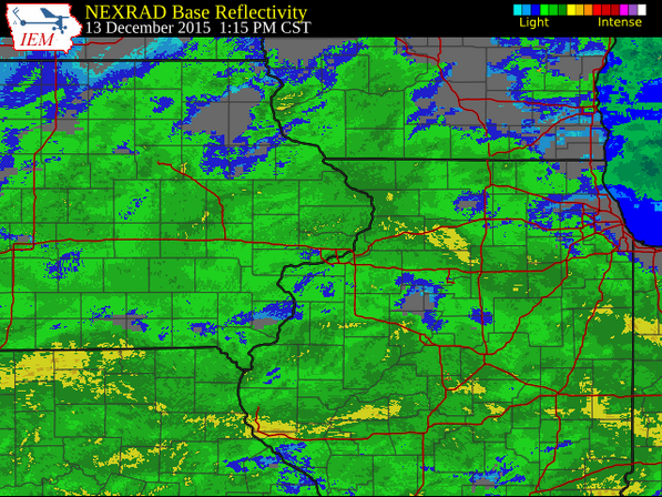
Radar:
| Click on image for the Iowa Environmental Mesonet Radar Loop. |
 |
Storm Reports:
|
|
|
 |
Media use of NWS Web News Stories is encouraged! Please acknowledge the NWS as the source of any news information accessed from this site. |
|

