Quad Cities, IA/IL
Weather Forecast Office
|
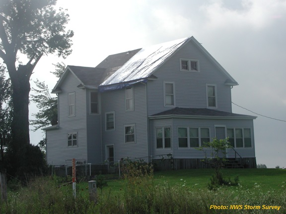
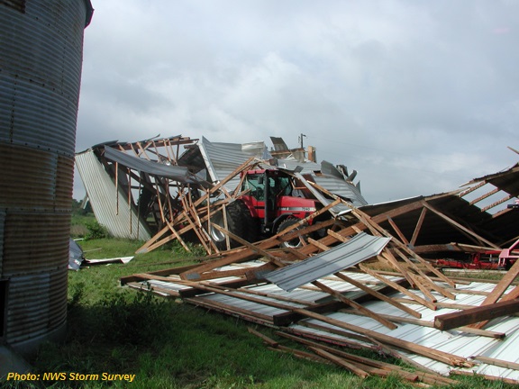
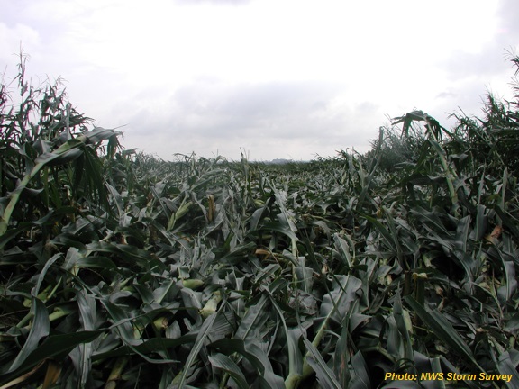
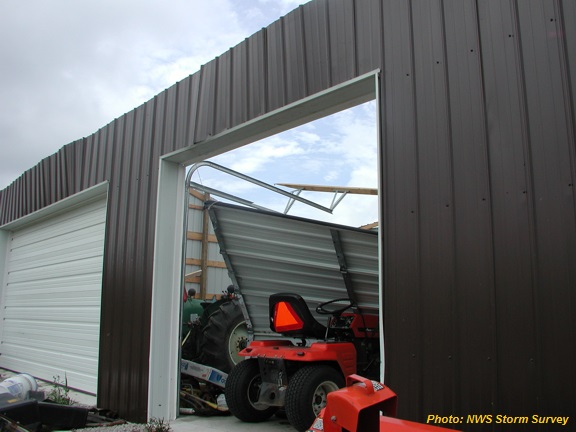
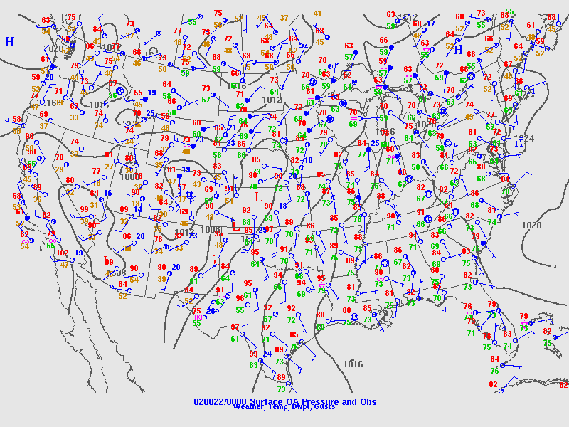
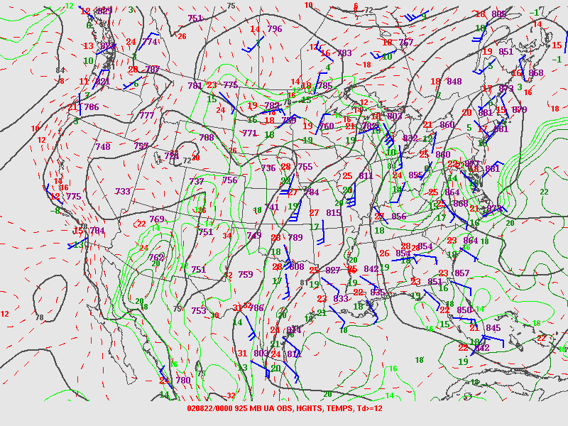
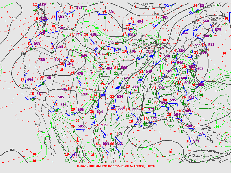
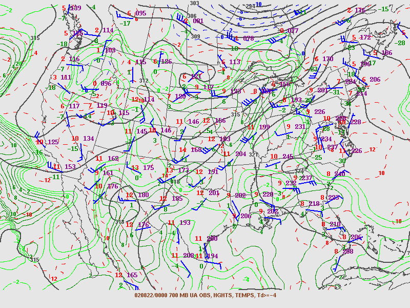
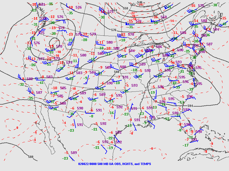
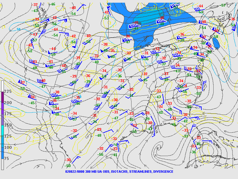
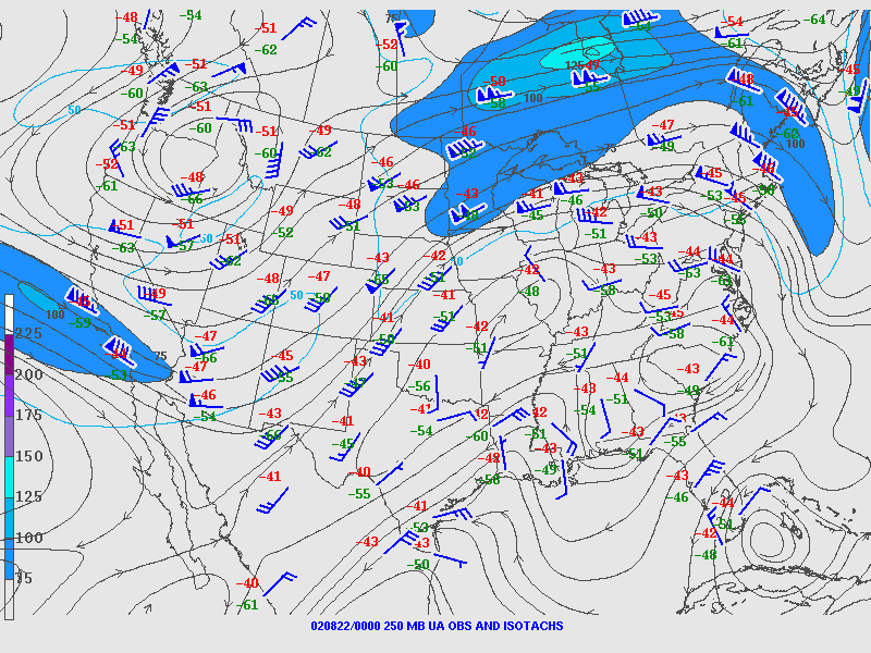
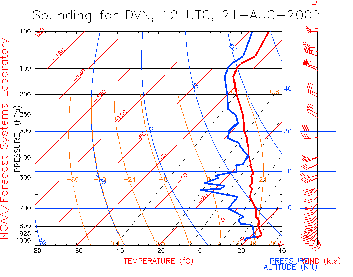
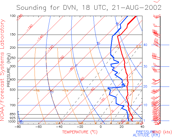
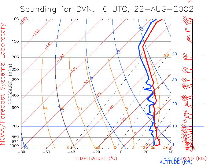
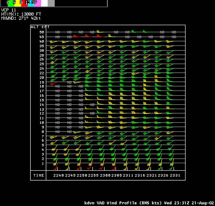
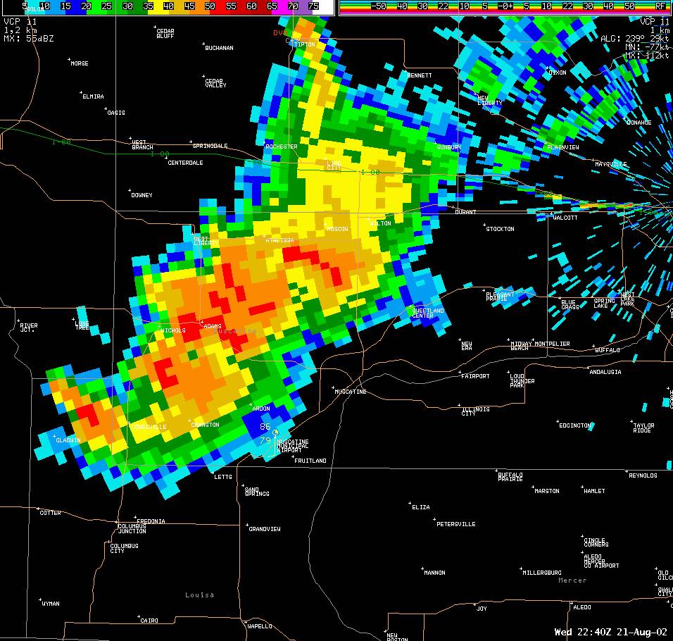
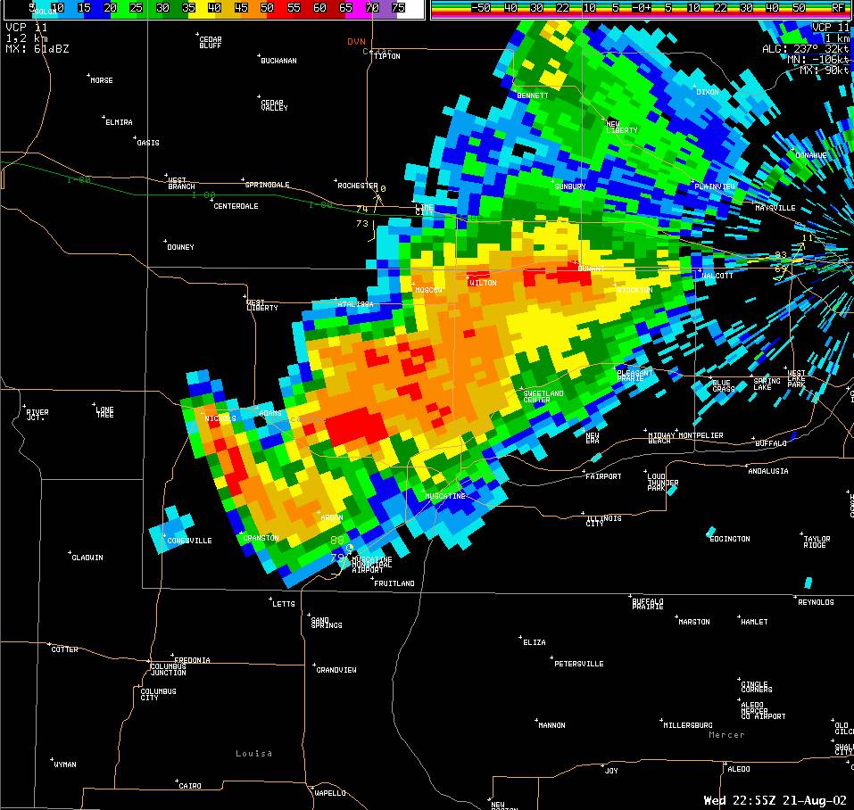
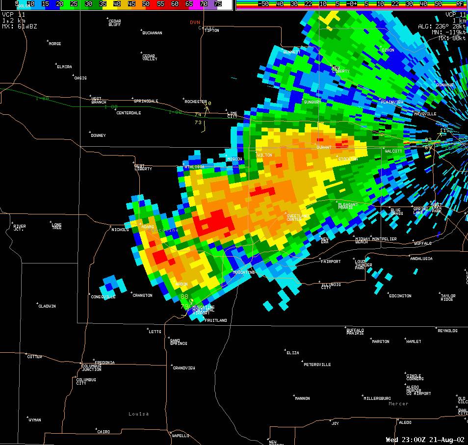
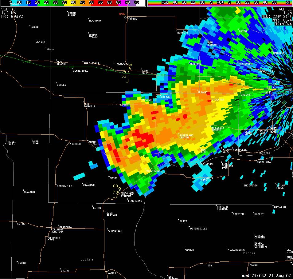
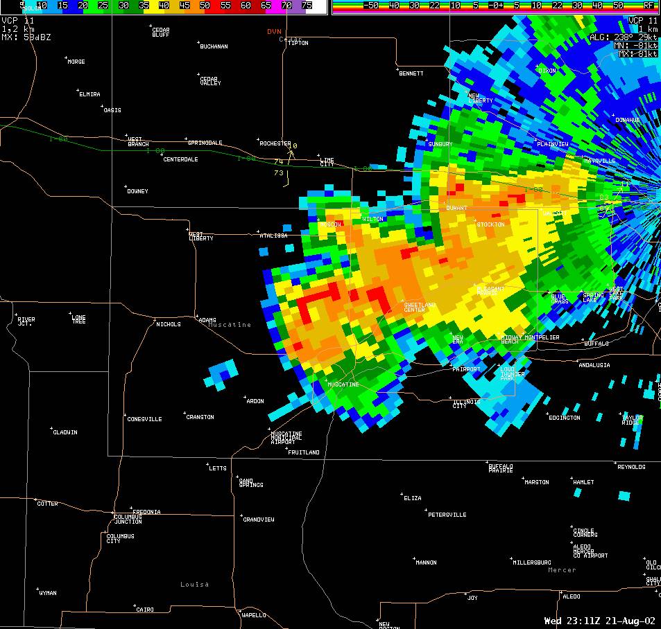
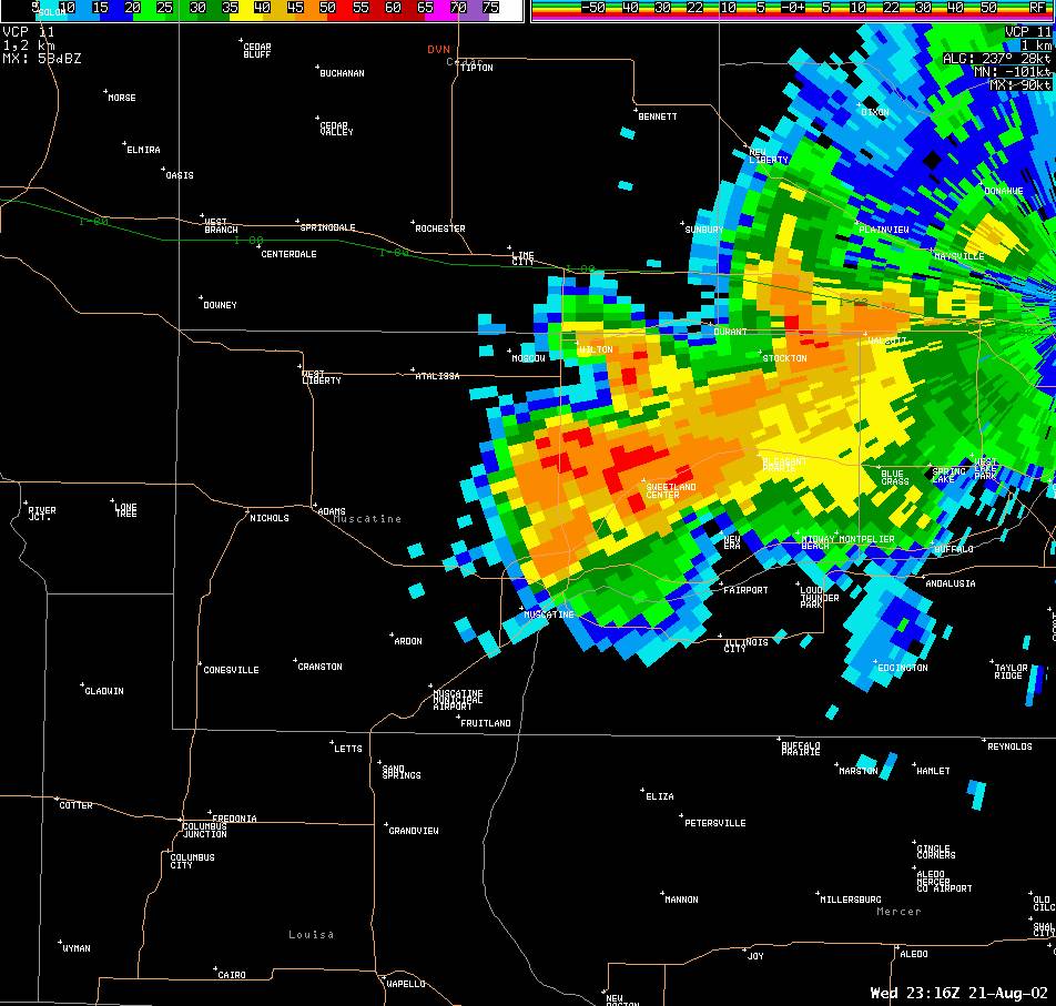
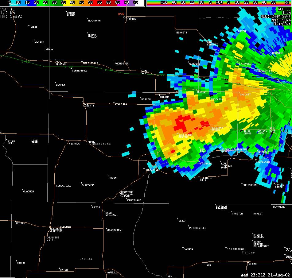
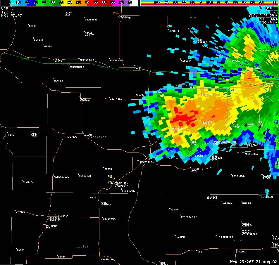
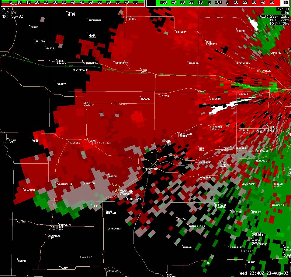
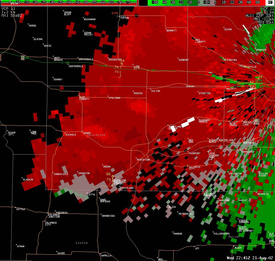
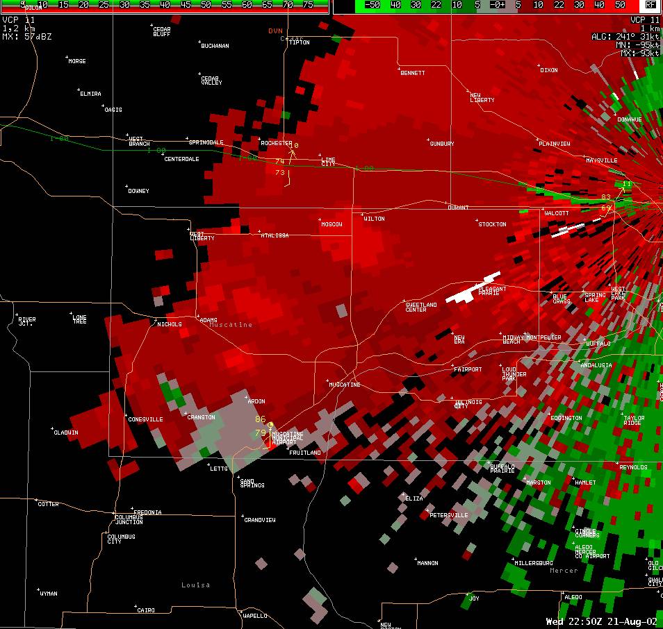
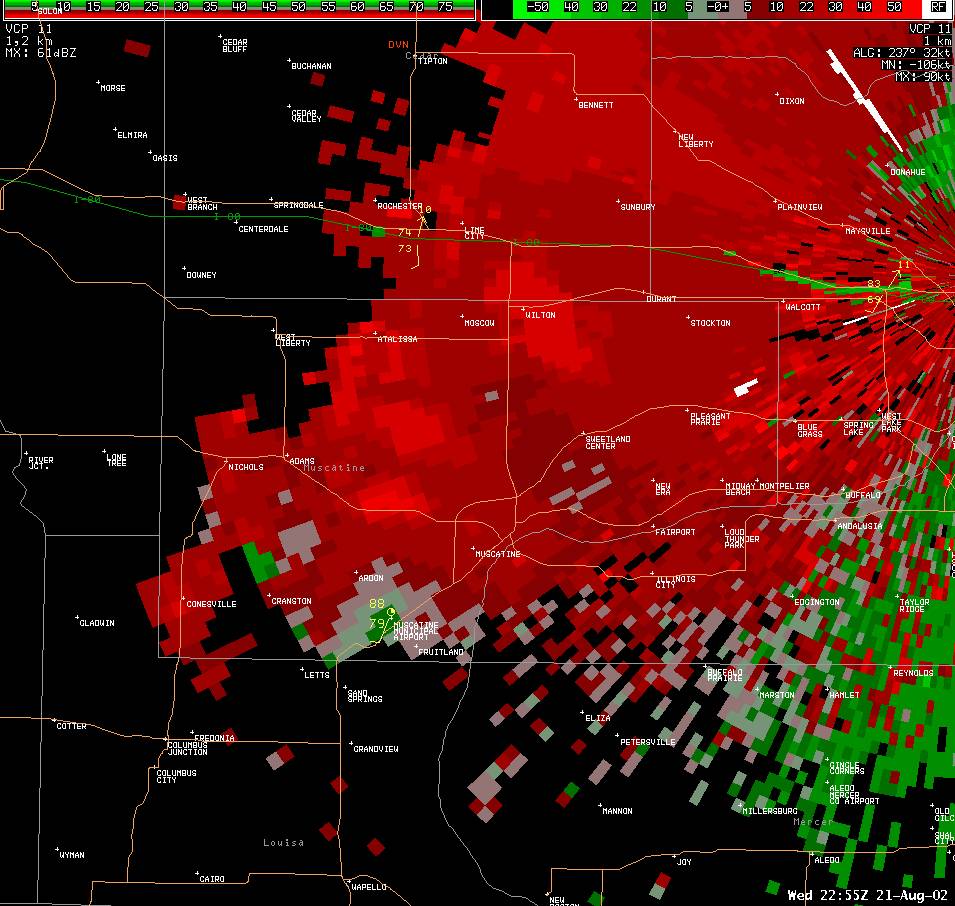
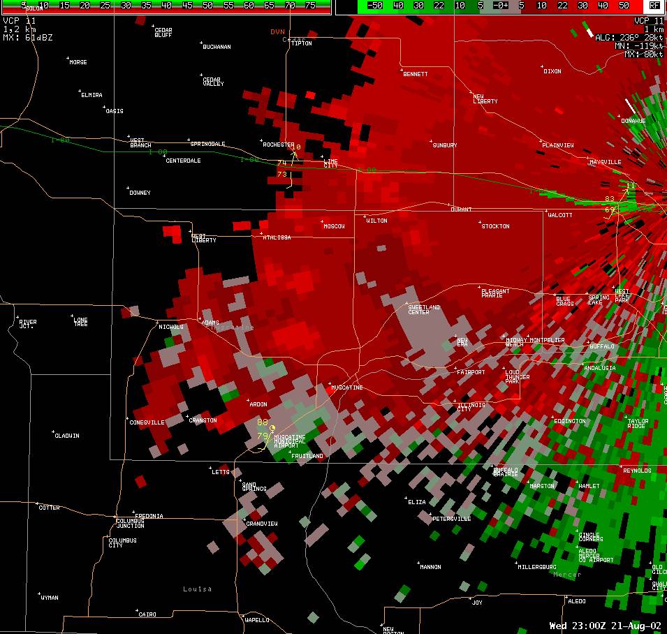
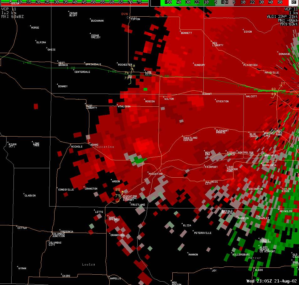
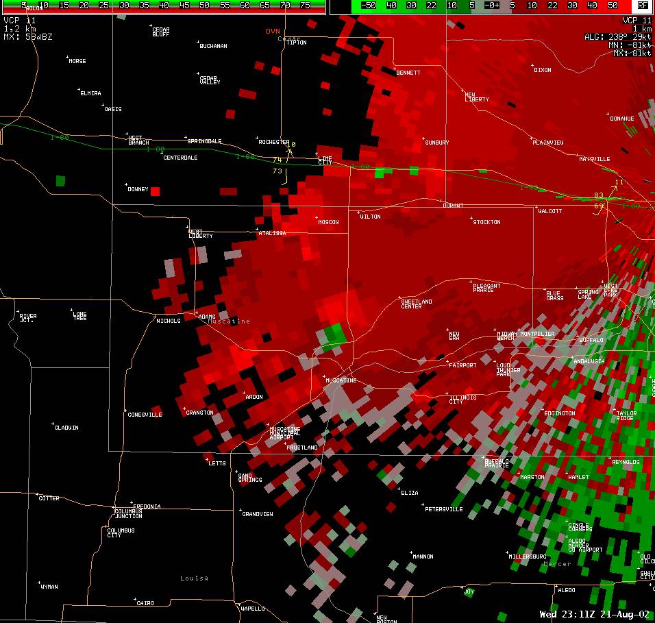
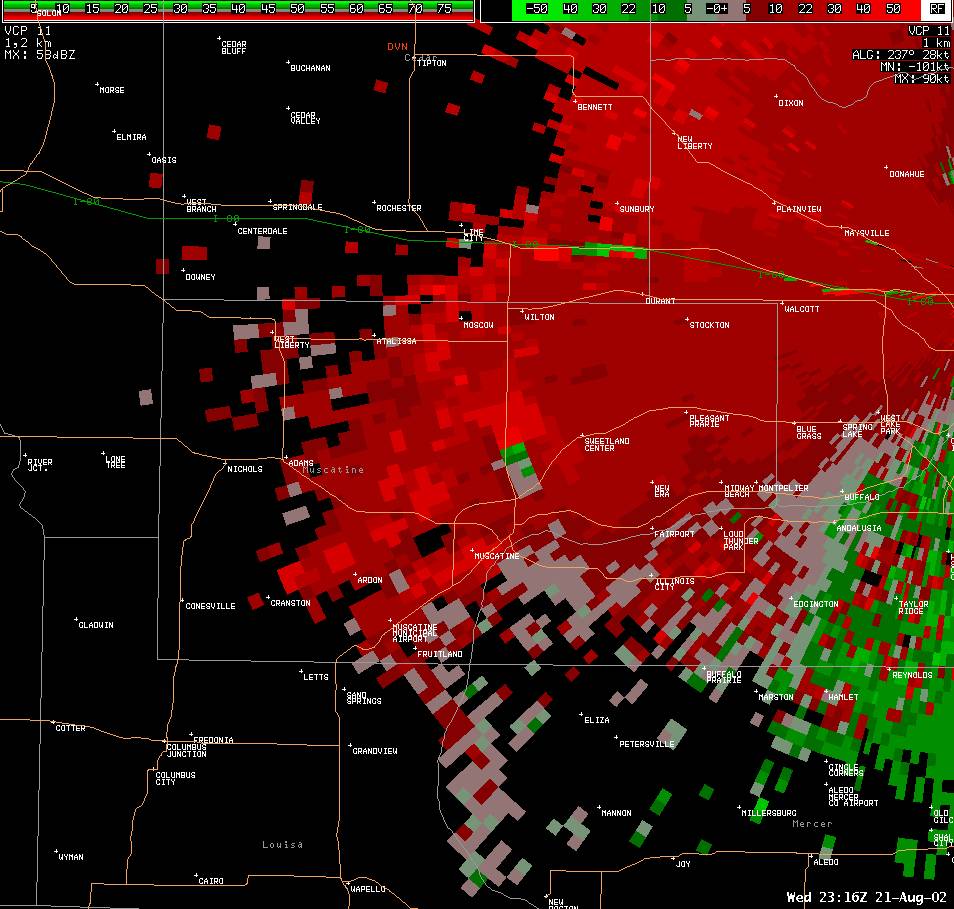
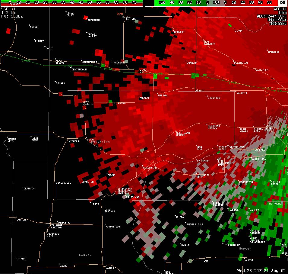
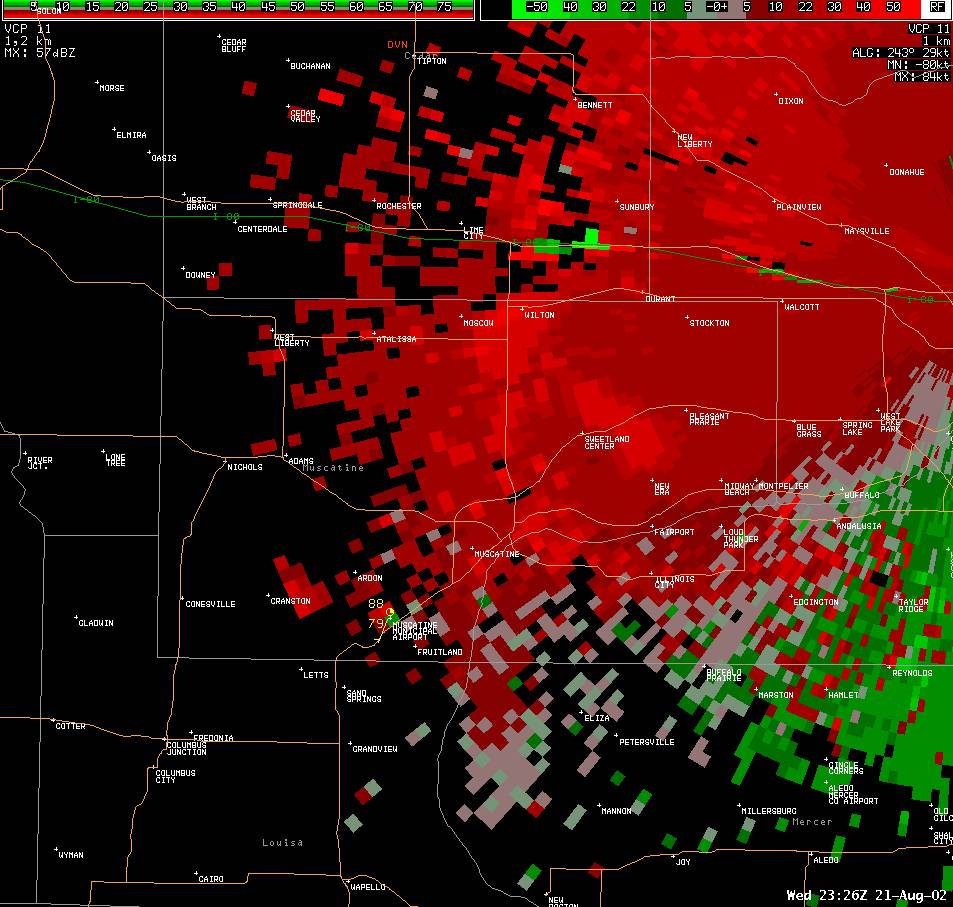
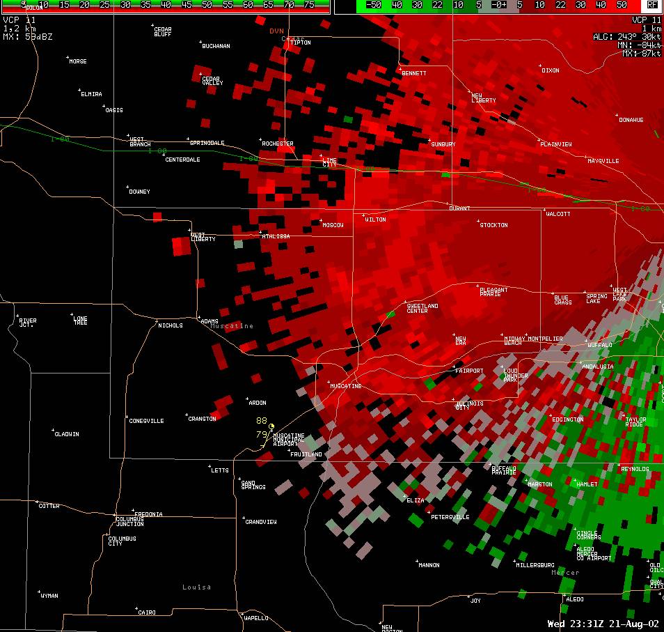
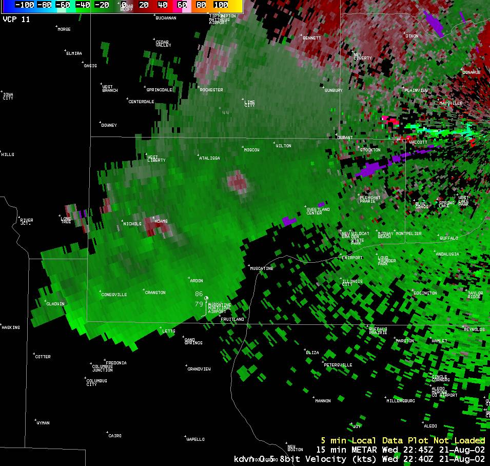
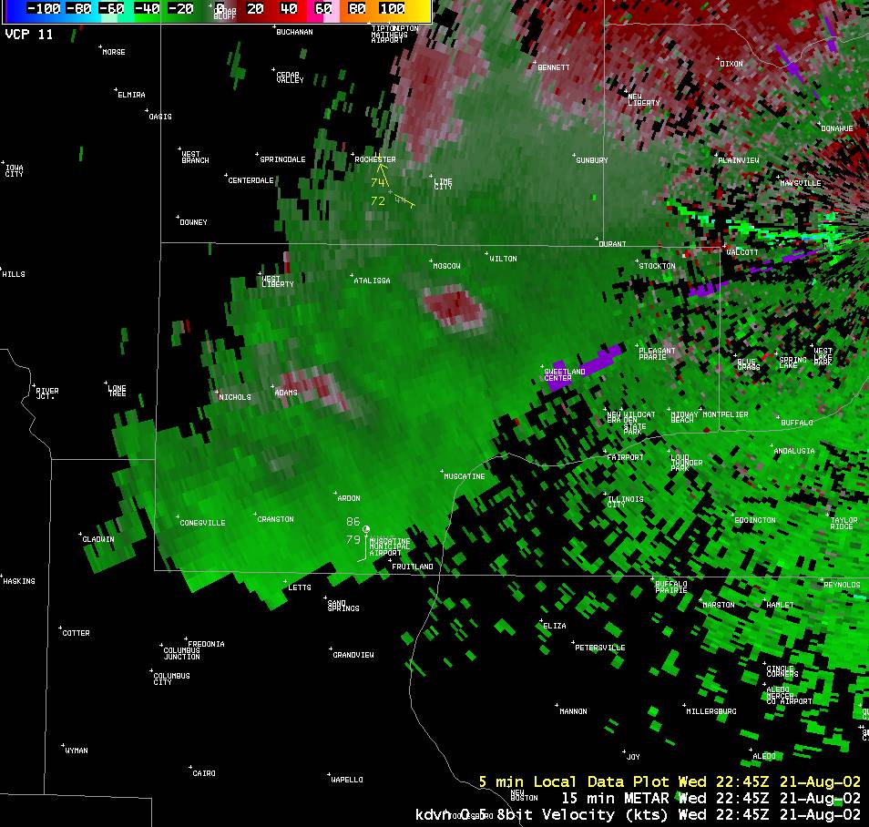
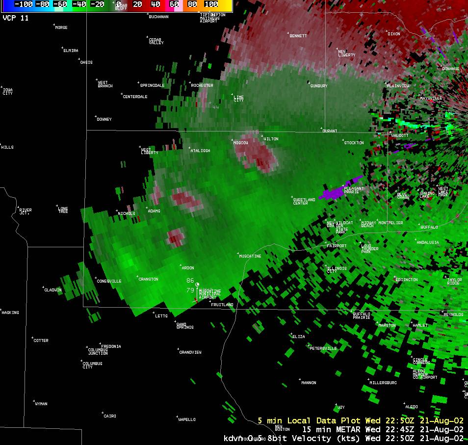
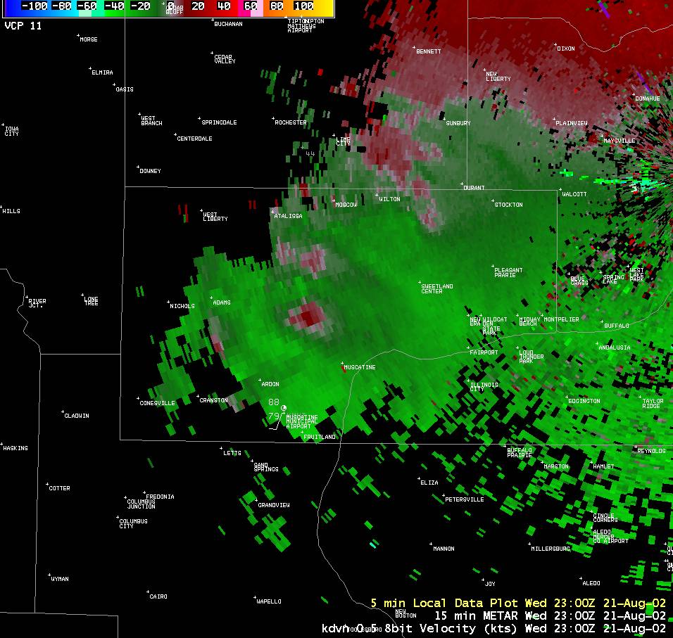
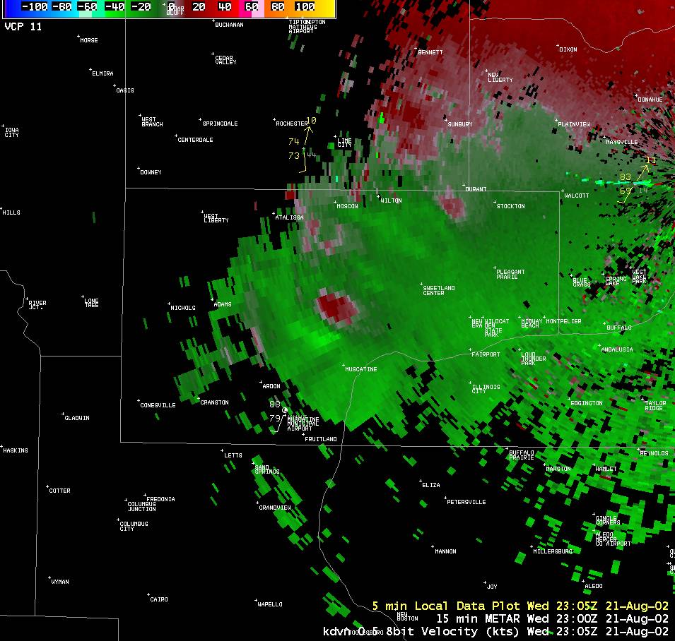
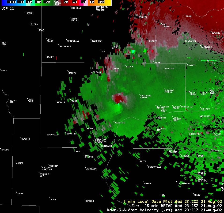
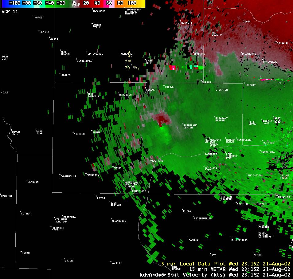
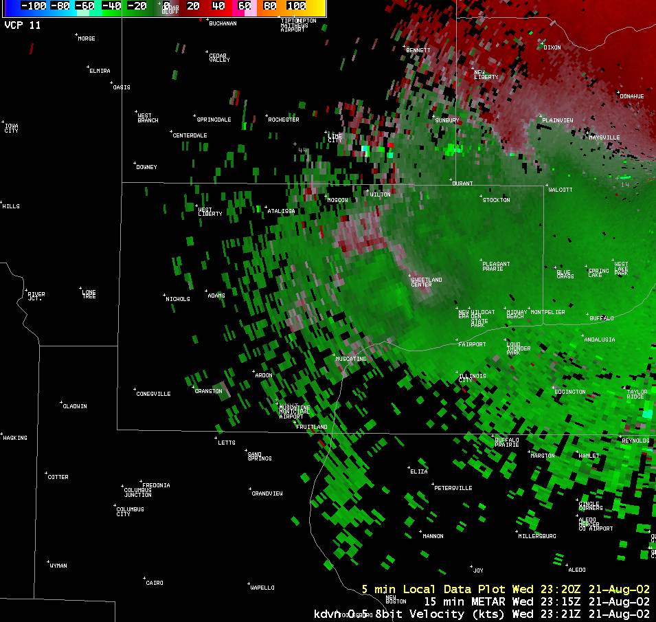
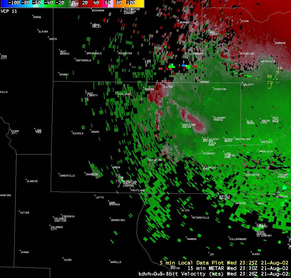
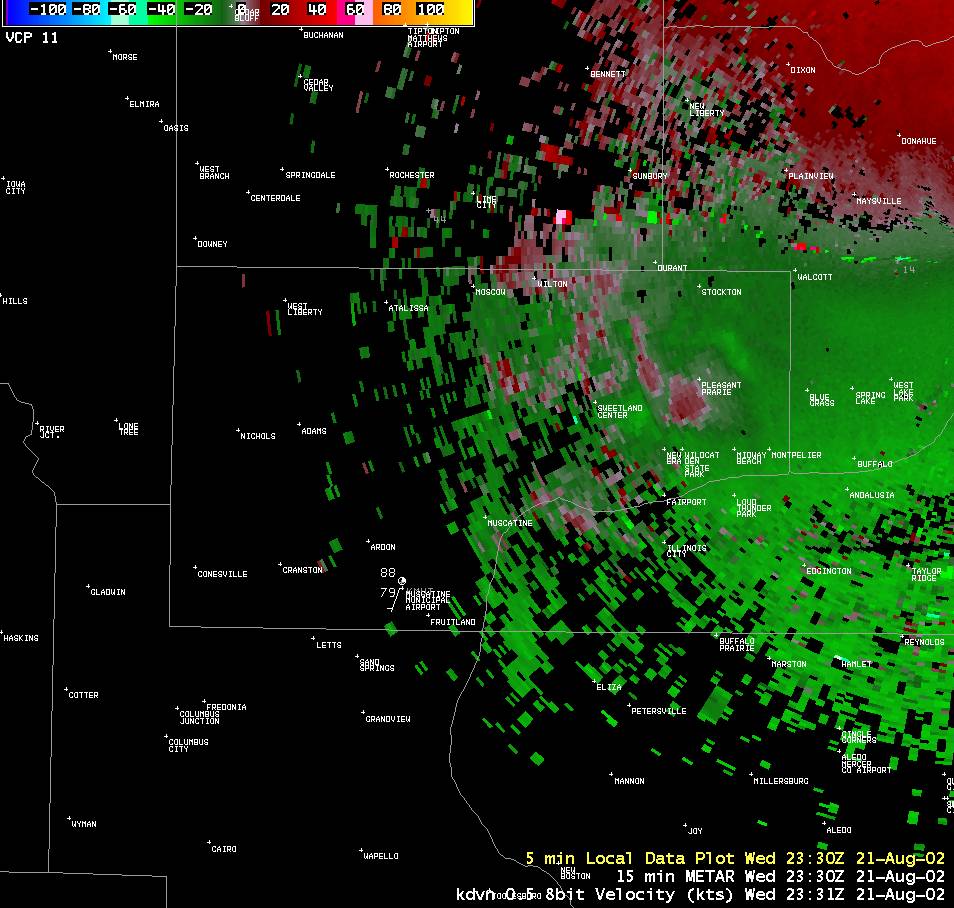
Shortly after 6 p.m. on 21 August 2002, an F1 tornado touched down in Muscatine County just north of Muscatine on Hwy 38. The tornado had about a 1.6 mile path destroying two sheds and causing roof damage to another shed and a farm house, in addition to scattered tree damage. The synoptic and mesoscale environment that day supported severe weather mainly in the mode of straight-line winds. A non-supercell tornado developed in a non-descending mode as a cell interacted with a convective boundary. The use of high resolution 8-bit velocity data was key to the decision to warn and helped provide a 4 minute lead time before the tornado was reported by a nearby amateur radio operator. See especially the radar data at 2311Z and 2316Z. |
|||
| STORMDATA | |||
Observed Data |
Radar Imagery |
||
|
|
|||
Hazardous Weather
Watches, Warnings, & Advisories
Briefing
Hazards Page
View Local Storm Reports
Submit Report
Road Reports
Text Products
Forecasts
Fire Weather
Briefing
Hourly Forecast Graphs
Forecast Discussion
User-Defined Area
Activity Planner
Local Forecasts
Space Weather
Text Products
River Graphs
Airport Forecasts
Snow and Ice Probabilities
Winter Storm Severity Index (WSSI)
Current Conditions
Observations
Drought Monitor
Radar
Satellite
Text Products
Rivers and Lakes
River Graphs
Sunrise/Sunset Tables
Seasons (Equinoxes/Solstices)
Road Reports
Past Weather
Recent Observation History
Climate Summaries
Past Events
Climate Normals/Averages
Climate Records
Climate/Almanac Data
Holiday Climatology
Climate Maps
Monthly Climate Stats
Annual Climate Stats
Observation Site History
Sunrise/Sunset Tables
US Dept of Commerce
National Oceanic and Atmospheric Administration
National Weather Service
Quad Cities, IA/IL
9040 N Harrison Street
Davenport Municipal Airport
Davenport, IA 52806-7326
563-386-3976
Comments? Questions? Please Contact Us.

