
Dangerous heat will expand from the Gulf Coast into the Southern Plains and Desert Southwest through week's end. Additional extreme heat impacting the Pacific Northwest will shift to the northern Plains by the weekend. Tropical Storm Bertha is expected to continue to impact portions of the northwestern Gulf Coast from south central Louisiana to the upper Texas coast today. Read More >
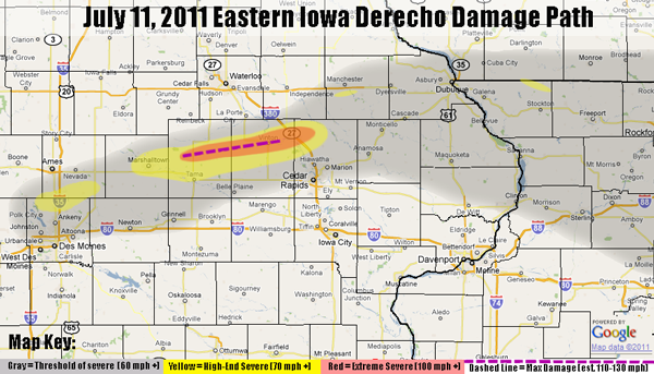
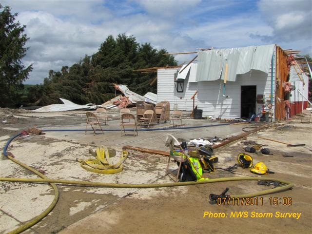
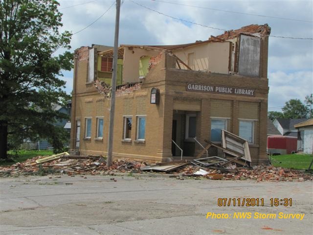
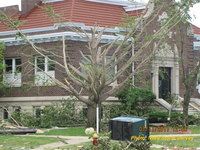
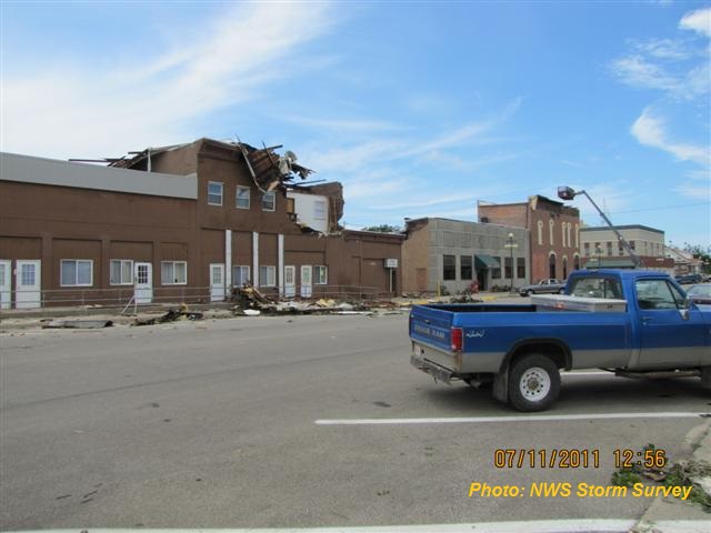
A strong thunderstorm complex moved through east central Iowa and northern Illinois early Monday morning, July 11th. Damaging winds exceeded 100 mph at times and uprooted large trees, downed power lines, and ripped roofs off of buildings. Portions of northern Tama, northern Benton, and northwestern Linn County were hardest hit. National Weather Service storm survey teams assessed damage and estimated wind speeds in the 110 to 130 mph range in these hardest hit areas.
Details for some of the local communities follow:
Garrison Iowa: straight line wind of 110 to 130 mph produced widespread damage to structures. Many roofs were partially or fully removed and the walls of some buildings collapsed, including the fire station and town library. Nearly every tree was significantly damaged or snapped off . Power outages were widespread.
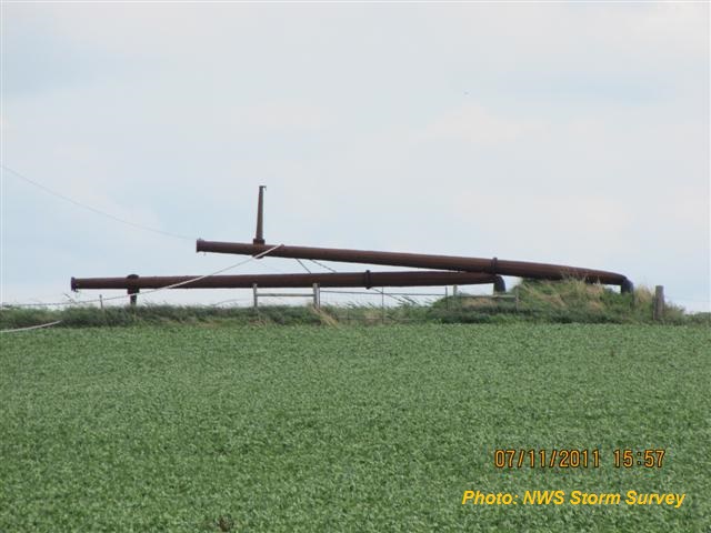
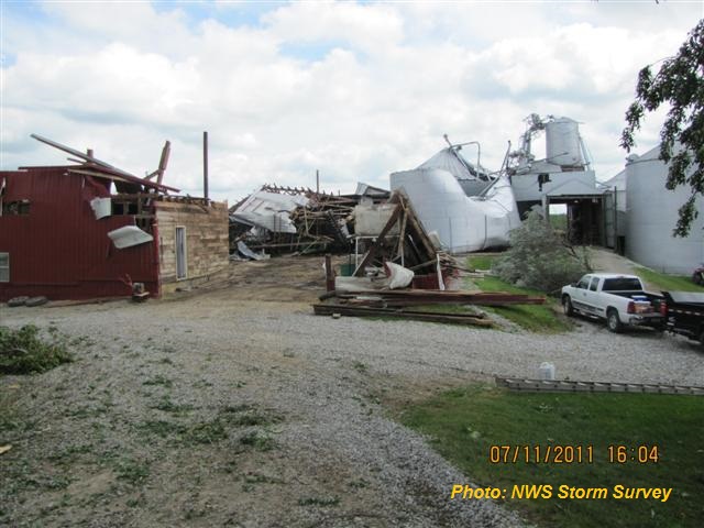
Between Garrison and Vinton, 2 pairs of steel electrical transmission towers were bent over. Several farms received devastating damage, including a house that lost its roof and most exterior walls and another that lost nearly every grain bin and outbuilding.
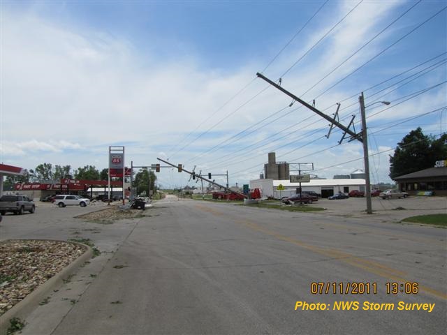
At Vinton, Iowa: straight line wind in excess of 110 mph caused damage to numerous roof structures and some exterior walls, including a downtown apartment building. Nearly every tree was significantly damaged or snapped off.
 |
 |
 |
| Garrison, IA Fire Department | Garrison, IA Public Library | Metal power transmission poles bent over. Flattened corn in foreground. Between Garrison and Vinton. |
 |
 |
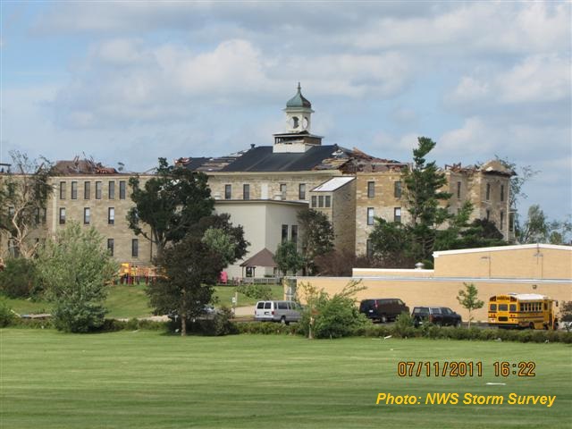 |
| Devastated farm between Garrison and Vinton | Hwy 218 on west side of Vinton. Several large power poles down. | Iowa Braille School. Vinton, IA |
 |
 |
 |
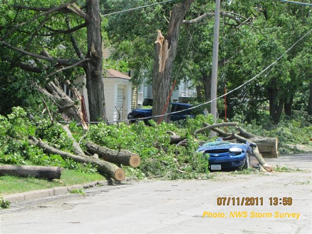
| Trees and power lines down on cars and homes in Vinton, IA | Vinton, IA Public Library lost all trees and some windows. | View down 5th Street in Vinton from intersection of 5th and 2nd. |
Local Storm Reports Map - Click on Map for interactive display.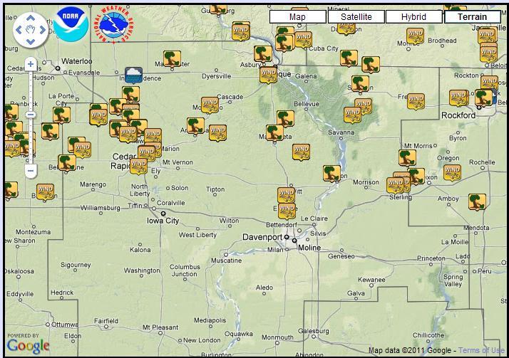 |
National Storm Reports Map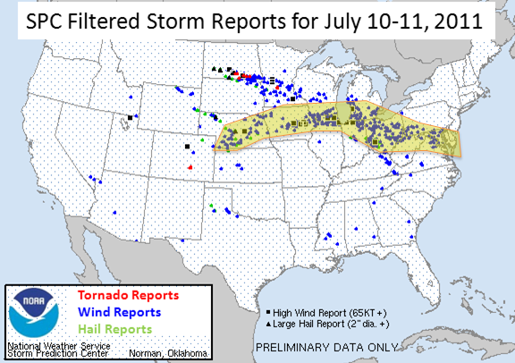 |

Radar loop courtesy Iowa Environmental Mesonet.
This thunderstorm complex fits the description of a bow echo "derecho" which is a widespread, long-lived windstorm that is associated with a band of rapidly moving showers or thunderstorms. The term bow echo refers to the arched, bow-like structure of the thunderstorm complex seen in the radar reflectivity data above. The same thunderstorm complex that produced widespread wind damage in the Central Plains and Midwest actually persisted all the way to the Mid Atlantic, producing a swath of nearly continuous wind damage of varying magnitude.
The Evolution: The storm first took shape as a cluster of low end severe storms over southern Nebraska during the late afternoon of July 10. The system continued northeastward and entered western Iowa after midnight, still as a line of marginally severe storms. As the system passed through the northern Des Moines metro area around 3:30am, it interacted with an outflow boundary from the storms to the north and rapidly intensified as it accelerated eastward. Over the next hour and a half the storm plowed eastward through Story, Marshall, and Tama Counties, blasting the area with winds of up to 105 mph, the equivalent of an EF1 tornado. The storm continued to track eastward, intensifying further as it plowed through Benton and Linn Counties with peak winds estimated at 110 to 130 mph. The storm then began to weaken but remained severe as it continued eastward into northern Illinois and the southern Great Lakes region before dissipating in Maryland mid-afternoon. Thousands of trees were downed in eastern Iowa alone and numerous structures were damaged or destroyed.
The Environment: Derechos are able to last for several hours, and their gust fronts produce high end damage. In order for these storms to last so long, they need both instability and wind shear. Instability refers to the storm's ability to tap into the warm moist air near the surface as it develops. Meteorologists use the term CAPE (Convective Available Potential Energy) as a way to measure the amount of instability. Wind shear refers to how the wind changes at different heights above ground. Generally, severe weather is likely when the atmosphere has a combination of both high instability and high shear values. In this case, there was plenty of warm moist air at the surface. Temperatures as of 2AM were near 80F across Central Iowa, and dew points were in the mid 70s. This contributed to high CAPE values of near 5000 J/kg. At the same time, the wind shear in the lowest 3000 ft of the atmosphere was near 30 kts, which is quite high.

