Scattered thunderstorms with severe gusts, hail and a tornado risk are possible near a cold front from the Ohio Valley to the Mid-Atlantic tonight. Tropical Storm Bertha is expected to bring tropical storm conditions to portions of the Gulf Coast from the panhandle of Florida into Louisiana through Wednesday. Read More >
Overview
 |
|
|||||||
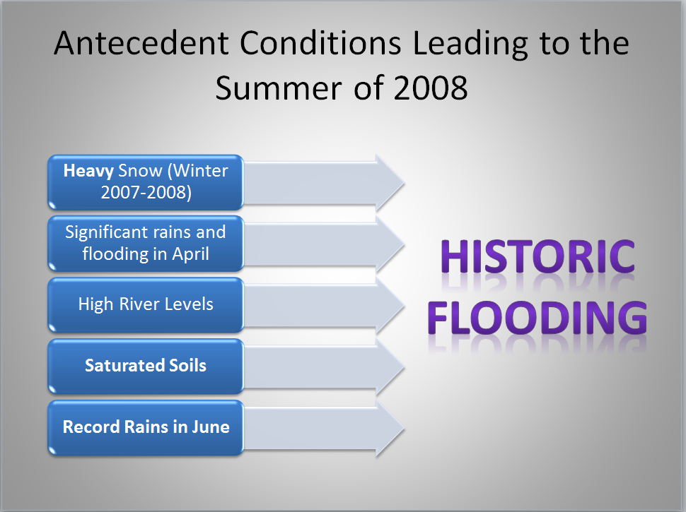
Conditions Before the Flood
 |
 |
 |
 |
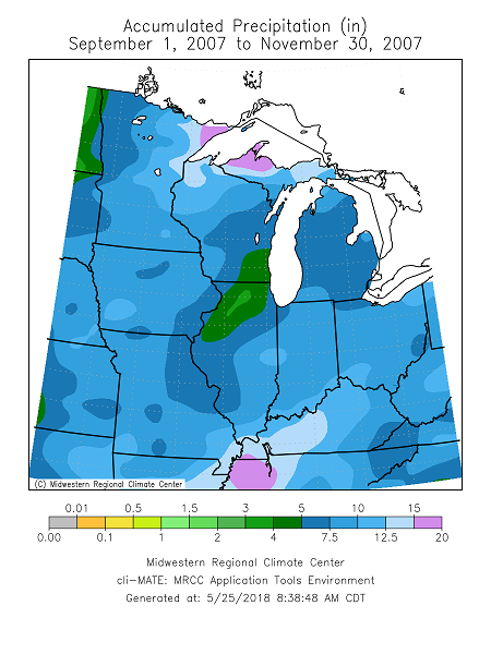
| Fall 2007 Rainfall 5 to 10 Inches |
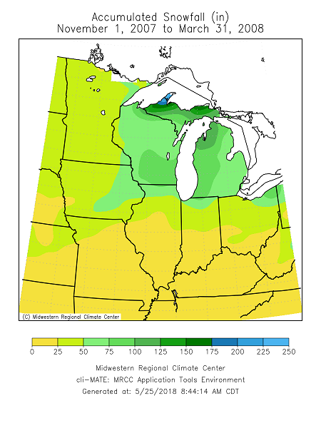
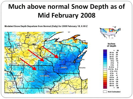
Winter 2007-08 Snowfall 40 - 60 Inches |
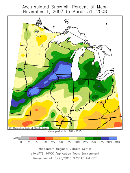
Winter 2007-08 Snowfall 1.5 to 2.5 Times Above Normal |
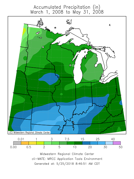
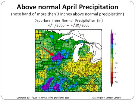
Spring 2008 Rainfall 10 - 20 Inches |
 |
 |
 |
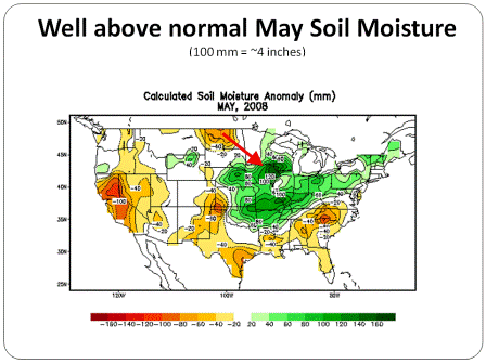 |
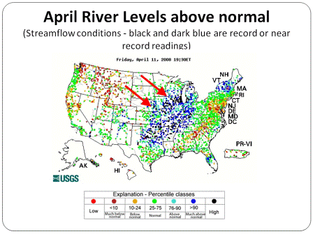
| Mid Feb. 2008 Snow Depth | April 2008 Rainfall | April 2008 River Levels | May 2008 Soil Moisture Content |
The 2008 Flood
|
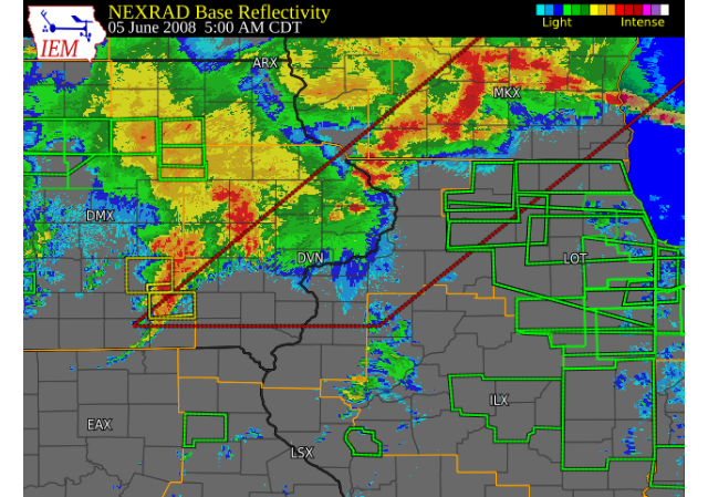
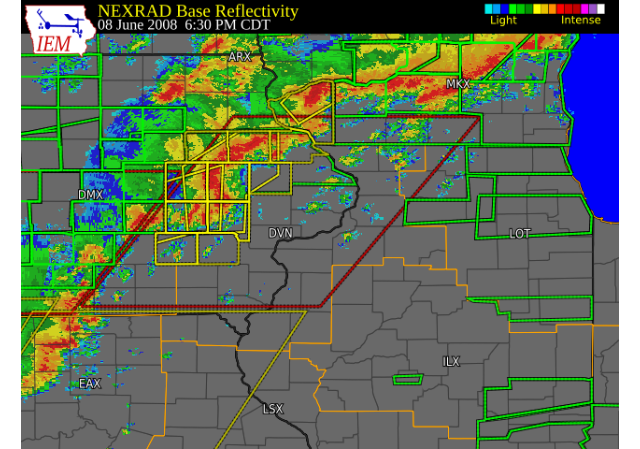
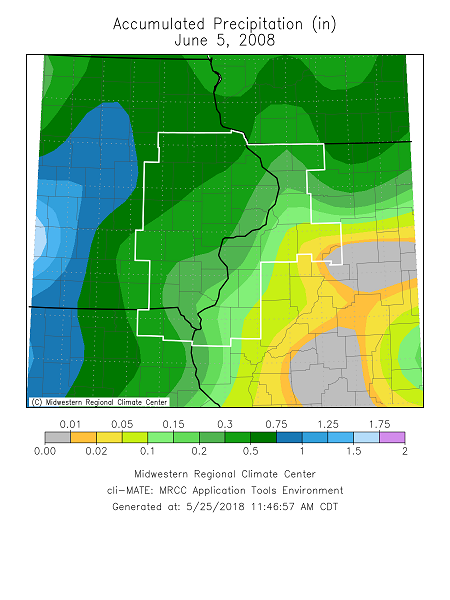
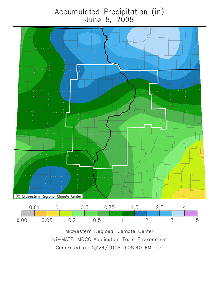
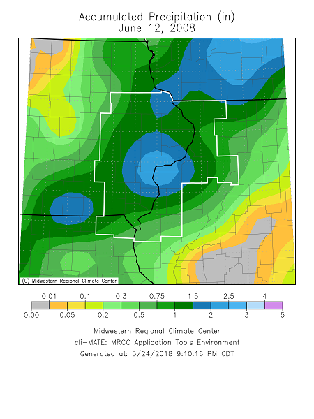
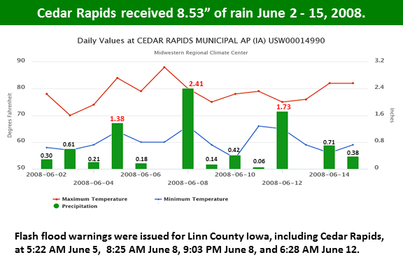
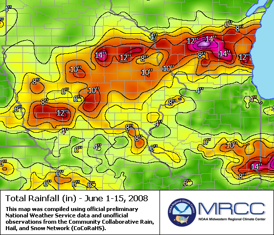
June 2008 With extremely wet soils and rivers already running high, two heavy rainfall events occurred in early June. These events saw the rain turn almost completely into runoff as saturated soils left no storage for the water. The first event was June 4th and 5th, where the axis of heavy rain fell from central Iowa into southern and central Wisconsin. The second event was June 8th and 9th. While much of eastern Iowa observed at least an inch, the areas that were the most wet across the northeast quadrant were hit with another 1.50 to 3.00 inches. Because of all of this rain, by June 12, 2008 record flooding was already occurring or expected for many eastern Iowa rivers. |
|||||||||
|
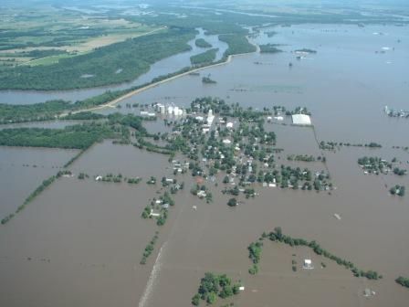
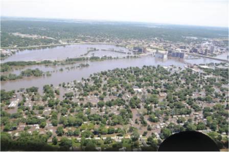
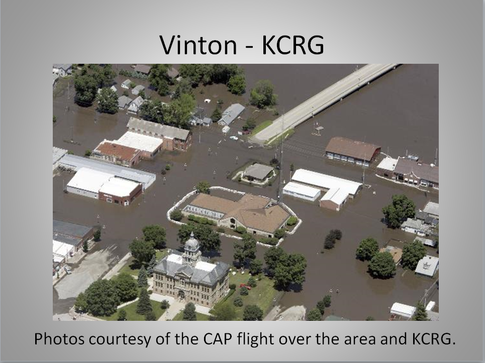
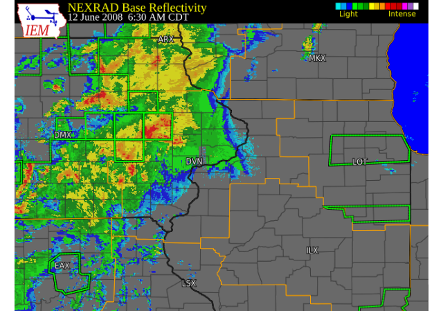
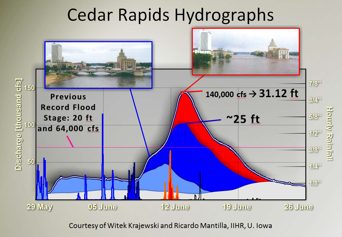
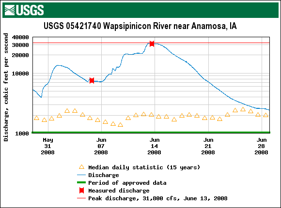
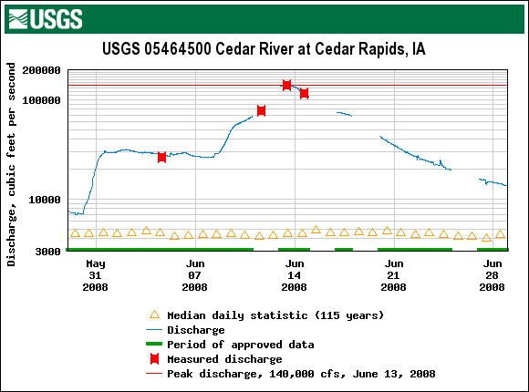
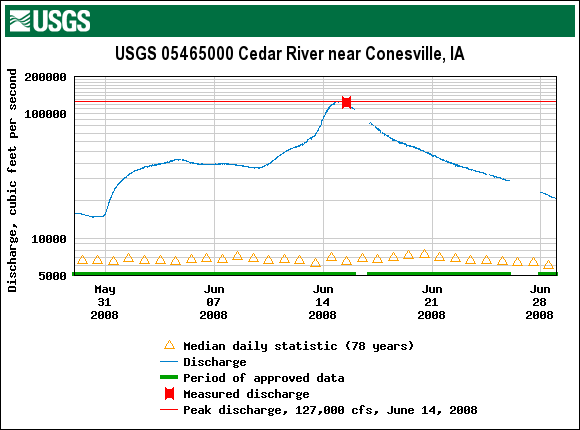
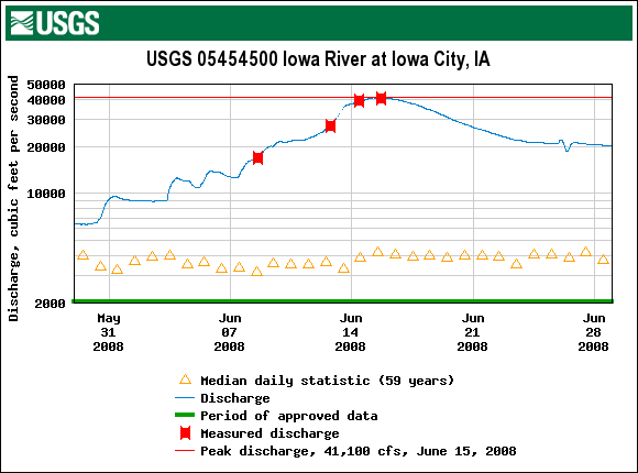
The Flash Flood of June 12-13, 2008 Record flooding was ongoing on many rivers in eastern Iowa by June 12th. Then, another significant heavy rainfall event occurred the night of June 12th and morning of June 13th. The axis of the heavy rain in this event fell on top of the already record flood moving down the Cedar and Iowa River basins. This flash flood raised river levels significantly and was a key contributor to the crest at Cedar Rapids being over 11 feet above the previous record. One measure of the magnitude of the flooding was that the staff gage in Vinton, IA was raised to be able to read higher levels, and the water in Cedar Rapids was so high, it overflowed the streamgage. The United States Geological Survey (USGS) was able to take a few manual measurements, but due to the gage loss, real-time information on river stages and flow was minimal. |
 |
||||||||
|
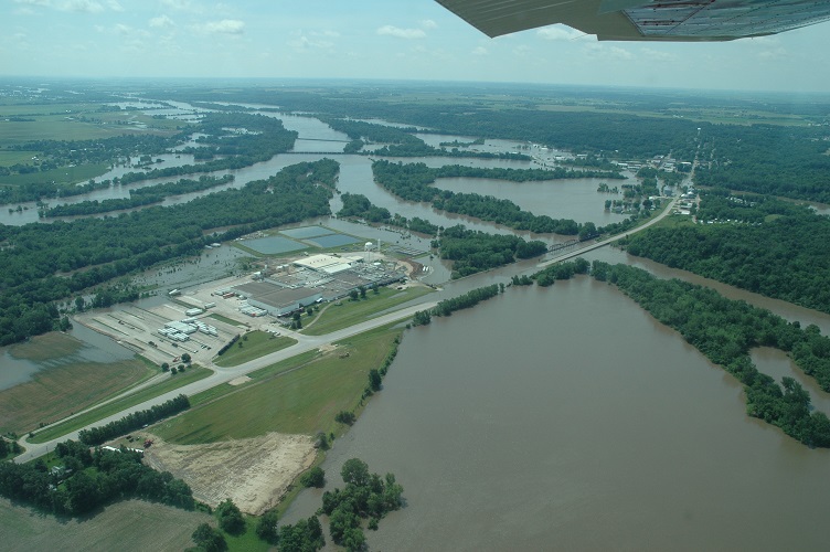
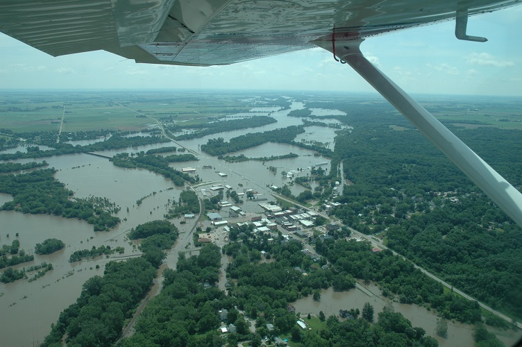
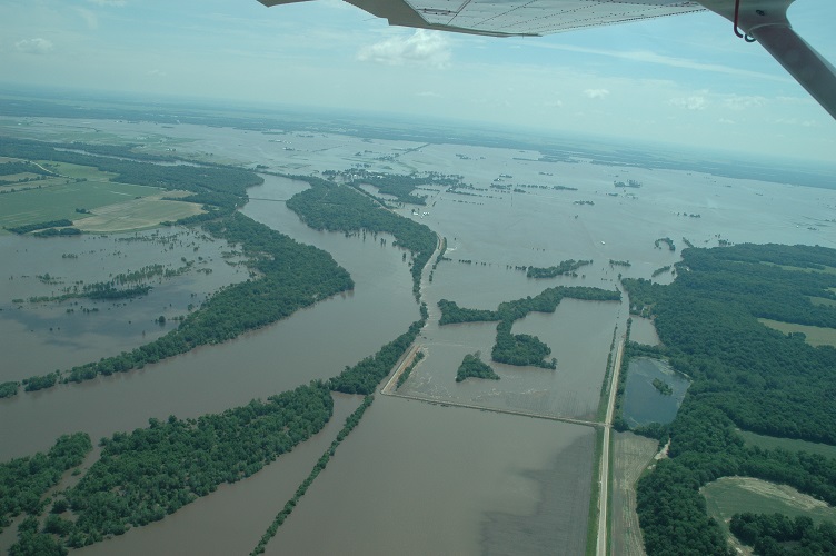
Columbus Junction to the Mississippi River The Iowa and Cedar Rivers meet at Columbus Junction, IA. At this point the crests from both rivers hit at nearly the same time, and the combined river flow going down the lower part of the Iowa River was nearly twice that which occurred during the Great Flood of 1993. Several levees breeched in this stretch of the river, but the most notable being the levee just west of the city of Oakville. Water that moved through this levee failure flooded the entire town. From the entry of the Iowa River into the Mississippi River, the extreme amounts of water also caused record flooding on the Mississippi River as 1993 flood levels were passed from the Keithsburg, IL area through Burlington, IA. |
|||||||||
|
|
|||||||||
|
|||||||||
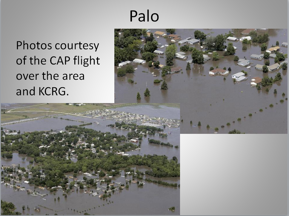
Photos Courtesy of the Civil Air Patrol
_CAP.JPG) |
_CAP.JPG) |
_CAP.JPG) |
| Cedar River June 13, 2008 | Cedar Rapids Bridge June 16, 2008 | Cedar Rapids Bridge June 16, 2008 |
_CAP.JPG) |
 |
 |
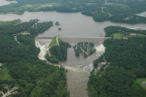
| Cedar River June 13, 2008 | Coralville Spillway | Cedar - Iowa Confluence |
 |
 |
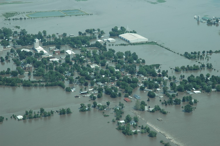 |
| Columbus Junction | Oakville Breach | Oakville |
Radar/Rainfall Maps
| Cedar Rapids Rainfall Graph June 2 to June 15 2008 | Regional Rainfall June 1-15 2008 | |||||||||||||||||||||||||||
 |
 |
|||||||||||||||||||||||||||
|
||||||||||||||||||||||||||||
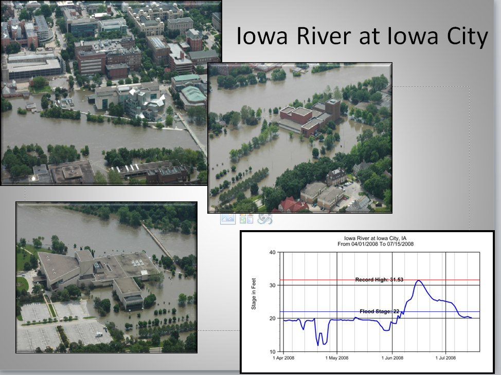
2008 River Crest Levels
| The Flood of 2008 resulted in record flooding along the length of the Cedar, much of the Iowa, and parts of the Wapsipinicon and Mississippi rivers. The new record crests ranged from just under one half foot at Keithsburg, IL to over 11 feet at Cedar Rapids, Iowa. | ||||||||||||||||||||||||||||||||||||||||||||||||||||||||||||||||||||||||||||||||||||||||||||||||||||
 |
 |
 |
 |
 |
||||||||||||||||||||||||||||||||||||||||||||||||||||||||||||||||||||||||||||||||||||||||||||||||
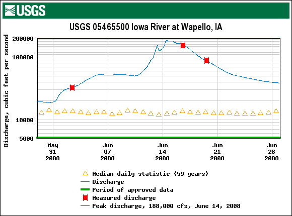
| Anamosa Hydrograph | Cedar Rapids Hydrograph | Conesville Hydrograph | Iowa City Hydrograph | Wapello Hydrograph | ||||||||||||||||||||||||||||||||||||||||||||||||||||||||||||||||||||||||||||||||||||||||||||||||
* = also on 6/01/1851
|
||||||||||||||||||||||||||||||||||||||||||||||||||||||||||||||||||||||||||||||||||||||||||||||||||||
Environment
 |
 |
 |
| SPC Event Review June 5, 2008 |
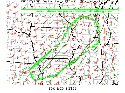
SPC Event Review June 8, 2008 |
SPC Event Review June 12, 2008 |
Additional Information
Reports:
|
 |
Media use of NWS Web News Stories is encouraged! Please acknowledge the NWS as the source of any news information accessed from this site. |
|