Dangerous heat will expand from the Gulf Coast into the Southern Plains and Desert Southwest through week's end. Additional extreme heat impacting the Pacific Northwest will shift to the northern Plains by the weekend. Tropical Storm Bertha is expected to continue to impact portions of the northern Gulf Coast from the western Florida Panhandle to southeastern Louisiana through tonight. Read More >
Overview
|
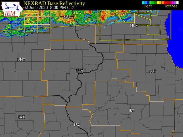
A an extended period of showers and thunderstorms affected the area from Tuesday morning into Friday morning of this week. While there were periods that were dry during this time, those that were not had intense heavy rainfall, flash flooding, damaging wind and large hail. A hot an humid air mass provided the energy needed for thunderstorms, and weak upper level systems were the catalyst for thunderstorm development. Seventeen severe thunderstorm warnings were issued along with seven flash flood warnings. |
Storm Reports
PRELIMINARY LOCAL STORM REPORT...SUMMARY
NATIONAL WEATHER SERVICE QUAD CITIES IA IL
1117 AM CDT FRI JUN 5 2020

..TIME...   ...EVENT...      ...CITY LOCATION...     ...LAT.LON...
..DATE...   ....MAG....      ..COUNTY LOCATION..ST.. ...SOURCE....
            ..REMARKS..

0700 AM     HAIL             1 ENE PRINCETON         41.68N 90.34W
06/03/2020  E1.25 INCH       SCOTT              IA   PUBLIC

            DELAYED REPORT.

0701 AM     TSTM WND GST     2 N PRINCETON           41.70N 90.36W
06/03/2020  E50 MPH          SCOTT              IA   TRAINED SPOTTER

            ALSO PEA HAIL.

0705 AM     HAIL             1 ESE PRINCETON         41.67N 90.34W
06/03/2020  M1.00 INCH       SCOTT              IA   TRAINED SPOTTER

            OCCURRING RIGHT NOW.

0759 AM     TSTM WND DMG     5 NNE WYANET            41.43N 89.56W
06/03/2020                   BUREAU             IL   PUBLIC

            SOCIAL MEDIA REPORT WITH PICTURES OF TWO
            DESTROYED GRAIN BINS, AND A TOPPLED ELEVATOR
            AT THIS LOCATION. TIME IS BASED ON RADAR.

0805 AM     FLASH FLOOD      GENESEO                 41.45N 90.16W
06/03/2020                   HENRY              IL   EMERGENCY MNGR

            REPORTS FLASH FLOODING OF URBAN AREAS IN
            GENESEO WITH ROADS CLOSED DUE TO HIGH WATER.

0811 AM     TSTM WND DMG      NW PRINCETON           41.38N 89.47W
06/03/2020                   BUREAU             IL   TRAINED SPOTTER

            CORRECTS THE TIME FROM THE PREVIOUS TSTM WND
            DMG REPORT FROM NW PRINCETON. REPORTED POWER
            OUT ON THE NORTHWEST SIDE OF TOWN. THERE WAS
            A 2 INCH TREE DIAMETER TREE LIMB DOWN IN THE
            DRIVEWAY. ALSO, HEAVY RAIN AND PEA SIZE
            HAIL.

0815 AM     TSTM WND DMG     PRINCETON               41.38N 89.47W
06/03/2020                   BUREAU             IL   EMERGENCY MNGR

            NUMEROUS TREES DOWN IN TOWN WITH POWER
            OUTAGES REPORTED.

0815 AM     TSTM WND DMG     1 SE PRINCETON          41.37N 89.45W
06/03/2020                   BUREAU             IL   CO-OP OBSERVER

            TREE DOWN OVER THE STREET AND SEVERAL
            SMALLER BRANCHES ALSO DOWN.

0819 AM     FLASH FLOOD      PRINCETON               41.38N 89.47W
06/03/2020                   BUREAU             IL   EMERGENCY MNGR

            LOT OF WATER FLOWING OVER STREETS IN TOWN,
            MAKING DRIVING DIFFICULT IF NOT IMPOSSIBLE.

0826 AM     HAIL             BUREAU                  41.29N 89.37W
06/03/2020  E1.00 INCH       BUREAU             IL   TRAINED SPOTTER

            OCCURRING RIGHT NOW.

0826 AM     TSTM WND GST     BUREAU                  41.29N 89.36W
06/03/2020  E50 MPH          BUREAU             IL   TRAINED SPOTTER

            POWER OUT AND LAWN FURNITURE BLOWN ACROSS
            THE YARD. NEAR ZERO VISIBILITY IN HEAVY
            RAIN.

0829 AM     TSTM WND DMG     1 W HENNEPIN            41.25N 89.34W
06/03/2020                   PUTNAM             IL   CO-OP OBSERVER

            TREE DOWN ON GARAGE AND SEVERAL LARGE TREE
            LIMBS DOWN ON THE GARAGE. WIND GAUGE OVER
            THE DOOR MEASURED 60 MPH. ALSO REPORTED GOLF
            BALL SIZE HAIL.

0830 AM     HAIL             HENNEPIN                41.26N 89.32W
06/03/2020  M0.75 INCH       PUTNAM             IL   EMERGENCY MNGR


0944 AM     HEAVY RAIN       CASCADE                 42.30N 91.01W
06/03/2020  E1.23 INCH       DUBUQUE            IA   BROADCAST MEDIA

            REPORT VIA MEDIA.

0950 AM     TSTM WND DMG     CAMERON                 40.89N 90.52W
06/03/2020                   WARREN             IL   LAW ENFORCEMENT

            911 OPERATOR REPORTED POWERLINES DOWN IN
            CAMERON DUE TO THUNDERSTORM WINDS.

1011 AM     HEAVY RAIN       1 SE PRINCETON          41.37N 89.45W
06/03/2020  M1.22 INCH       BUREAU             IL   CO-OP OBSERVER


0656 PM     HAIL             BLUE GRASS              41.51N 90.76W
06/03/2020  E0.75 INCH       SCOTT              IA   PUBLIC

            SPOTTER DRIVING THROUGH BLUE GRASS REPORTED
            HAIL 3/4 OF AN INCH OR LARGER WITH WIND
            GUSTS AROUND 55 MPH.

0701 PM     HAIL             2 ENE SPRING LAKE       41.53N 90.68W
06/03/2020  M0.75 INCH       SCOTT              IA   TRAINED SPOTTER

            SPOTTER REPORTED DIME SIZE HAIL AT WEST LAKE
            CAMPGROUND.

0712 PM     HAIL             BLUE GRASS              41.51N 90.76W
06/03/2020  M1.75 INCH       SCOTT              IA   FIRE DEPT/RESCUE

            QUARTER TO GOLF BALL SIZE HAIL.

0755 PM     FLASH FLOOD      1 ENE NEW ERA           41.47N 90.89W
06/03/2020                   MUSCATINE          IA   PARK/FOREST SRVC

            CORRECTS PREVIOUS FLASH FLOOD REPORT FROM 1
            ENE NEW ERA. CULVERT WASHED OUT A PORTION OF
            THE PARK BOUNDARY TRAIL AT WILDCAT DEN STATE
            PARK. TIME ESTIMATED FROM RADAR.

0758 PM     TSTM WND DMG     2 SW ILLINOIS CITY      41.38N 90.93W
06/03/2020                   ROCK ISLAND        IL   AMATEUR RADIO

            REPORTED A 5 TO 6 INCH DIAMETER BRANCH
            ACROSS THE ROAD. TIME WAS ESTIMATED USING
            RADAR.

0759 PM     HAIL             FAIRPORT                41.44N 90.90W
06/03/2020  M0.75 INCH       MUSCATINE          IA   TRAINED SPOTTER

            PEA TO DIME SIZED HAIL FALLING
            INTERMITTENTLY.

0840 PM     FLASH FLOOD      4 W ANDALUSIA           41.44N 90.81W
06/03/2020                   ROCK ISLAND        IL   TRAINED SPOTTER

            DELAYED REPORT. RUSHING WATER, 3 TO 4 INCHES
            IN DEPTH FLOWED OVER IL HIGHWAY 92, 4 MILES
            WEST OF ANDALUSIA.

0815 AM     HEAVY RAIN       CONROY                  41.73N 92.00W
06/04/2020  E3.75 INCH       IOWA               IA   BROADCAST MEDIA

            RELAYED VIA BROADCAST MEDIA OF 3.5 TO 4
            INCHES OF RAIN IN CONROY IN 45 MINUTES.

0645 PM     TSTM WND DMG     VINTON                  42.16N 92.02W
06/04/2020                   BENTON             IA   BROADCAST MEDIA

            LARGE TREE BRANCH DOWN.

0905 PM     TSTM WND DMG     TIPTON                  41.77N 91.13W
06/04/2020                   CEDAR              IA   911 CALL CENTER

            REPORTS OF A FEW TREES BLOWN DOWN ACROSS
            ROADS IN TOWN.

0912 PM     HEAVY RAIN       4 N ATALISSA            41.63N 91.16W
06/04/2020  M4.10 INCH       CEDAR              IA   PUBLIC

            4.1 INCHES OF RAIN REPORTED TO FALL DURING
            THE PAST HOUR AND A HALF.

0945 PM     TSTM WND GST     DONAHUE                 41.70N 90.68W
06/04/2020  E65 MPH          SCOTT              IA   TRAINED SPOTTER

            ESTIMATED HIGH WIND GUST. HEAVY RAIN
            REPORTED TO BE BLOWING SIDEWAYS.

0946 PM     FLASH FLOOD      4 WNW SWEETLAND CENTER  41.52N 91.04W
06/04/2020                   MUSCATINE          IA   PUBLIC

            WATER FLOWING OVER HIGHWAY 38.

0958 PM     TSTM WND GST     DAVENPORT AIRPORT       41.61N 90.58W
06/04/2020  M61 MPH          SCOTT              IA   OFFICIAL NWS OBS

            61 MPH GUST MEASURED ON ASOS. 45 MPH
            SUSTAINED.

1003 PM     TSTM WND DMG     3 SE DAVENPORT          41.54N 90.56W
06/04/2020                   SCOTT              IA   LAW ENFORCEMENT

            LARGE TREE DOWN OVER THE ROAD AT ARLINGTON
            AVENUE AND E 15TH ST DAVENPORT.

1015 PM     TSTM WND GST     1 NNW DAVENPORT         41.57N 90.61W
06/04/2020  E60 MPH          SCOTT              IA   TRAINED SPOTTER

            TORRENTIAL RAINFALL ALSO REPORTED.

1015 PM     TSTM WND DMG     1 NNE DAVENPORT         41.56N 90.60W
06/04/2020                   SCOTT              IA   PUBLIC

            REPORT OF TREES BLOWN DOWN.

1028 PM     TSTM WND DMG     EAST MOLINE             41.51N 90.44W
06/04/2020                   ROCK ISLAND        IL   DEPT OF HIGHWAYS

            CORRECTS PREVIOUS TSTM WND DMG REPORT FROM
            EAST MOLINE. OFFICIAL REPORTED TREES AND
            BRANCHES DOWN IN THE CITY OF EAST MOLINE.
            TIME ESTIMATED BY RADAR.

1039 PM     FLASH FLOOD      1 SW BETTENDORF         41.55N 90.49W
06/04/2020                   SCOTT              IA   LAW ENFORCEMENT

            6 TO 8 INCHES OF WATER COVERING THE
            INTERSECTION AT MIDDLE ROAD AND STAFFORD
            BOULEVARD.

1111 PM     TSTM WND DMG     CAMBRIDGE               41.30N 90.20W
06/04/2020                   HENRY              IL   EMERGENCY MNGR

            MULTIPLE REPORTS OF BRANCHES AND FEW TREES
            DOWN IN CAMBRIDGE. TIME IS ESTIMATED FROM
            RADAR.

1113 PM     TSTM WND DMG     1 ESE CAMBRIDGE         41.30N 90.17W
06/04/2020                   HENRY              IL   EMERGENCY MNGR

            TREE UPROOTED AND ACROSS THE HIGHWAY AT THIS
            LOCATION.

1235 AM     TSTM WND GST     3 W STANLEY             42.64N 91.86W
06/05/2020  E50 MPH          BUCHANAN           IA   TRAINED SPOTTER


0110 AM     HEAVY RAIN       4 W STANLEY             42.63N 91.86W
06/05/2020  M1.66 INCH       BUCHANAN           IA   CO-OP OBSERVER

            MOST OF AMOUNT FELL DURING THE PAST HOUR AND
            A HALF.

0145 AM     TSTM WND DMG     MANCHESTER              42.49N 91.46W
06/05/2020                   DELAWARE           IA   EMERGENCY MNGR

            CORRECTS PREVIOUS TSTM WND DMG REPORT FROM
            MANCHESTER. PART OF A ROOF TORN OFF A
            STORAGE SHED. THE ROOF DEBRIS WAS BLOWN FROM
            EAST TO WEST, AND ALSO SNAPPED A POWER POLE.
            TIME ESTIMATED.

0530 AM     HEAVY RAIN       MANCHESTER              42.49N 91.46W
06/05/2020  M3.00 INCH       DELAWARE           IA   BROADCAST MEDIA

            PUBLIC REPORT RELAYED VIA KCRG.

0730 AM     HEAVY RAIN       2 NNW WARNER            41.45N 90.40W
06/05/2020  M1.28 INCH       HENRY              IL   TRAINED SPOTTER

            .

0752 AM     HEAVY RAIN       1 W BETTENDORF          41.56N 90.49W
06/05/2020  M1.70 INCH       SCOTT              IA   TRAINED SPOTTER

            24 HOUR STORM TOTAL.
 |
Media use of NWS Web News Stories is encouraged! Please acknowledge the NWS as the source of any news information accessed from this site. |
|