Flash flooding threatens areas from the Tennessee Valley to the Carolinas as storms repeat along a stalled front. Monsoonal storms may trigger flooding in the Southwest. Dangerous heat expands across the Desert Southwest, Plains, mid-Mississippi Valley and Southern Tier. Critical fire weather for interior Pacific Northwest. Cooler, drier air brings brief relief to the Great Lakes and Northeast. Read More >
Overview
|
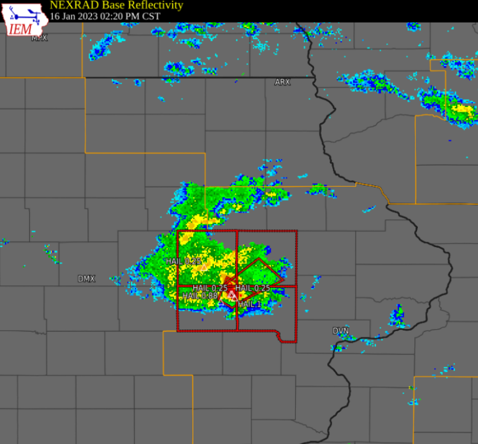
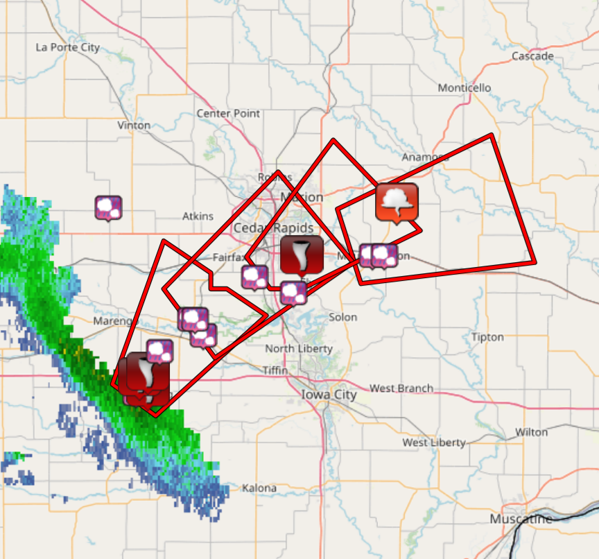
A large low pressure system spun northeast across Iowa on January 16, 2023 drawing mild temperatures northward into the area and sparking some showers and thunderstorms over portions of eastern Iowa. Temperatures had soared into the upper 40s to low 60s in parts of east central and southeast Iowa by early afternoon. One storm was severe producing two tornadoes between 2 PM and 3 PM CST. The first tornado touched down just northeast of Williamsburg, IA and the second one briefly touched down north of Ely, IA. Some large hail up to the size of a quarter was reported in Homestead, IA from this storm at 2:24 PM. Several other areas that the storm tracked over reported hail covering the ground. |
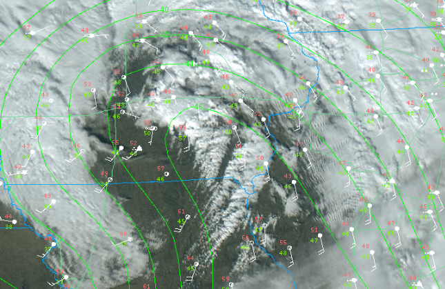 Satellite Image with Surface Observations and Dewpoint (contour) Jan. 16, 2023 18:56 UTC (12:56 PM) Courtesy College of DuPage |
Tornadoes:
Damage Assessment Toolkit (noaa.gov)
|
Tornado #1 - 2 NE Williamsburg, IA
Track Map 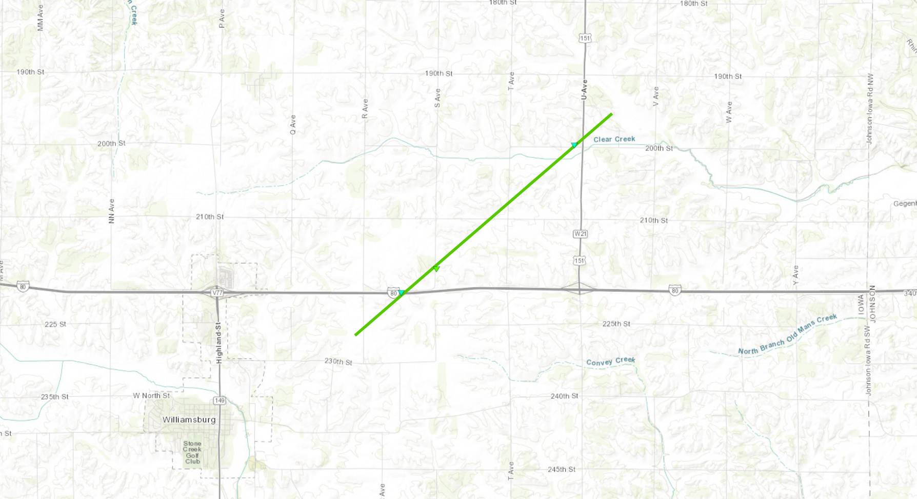 
|
||||||||||||||||
|
Tornado #2 - 3 NNW Ely, IA
Track Map 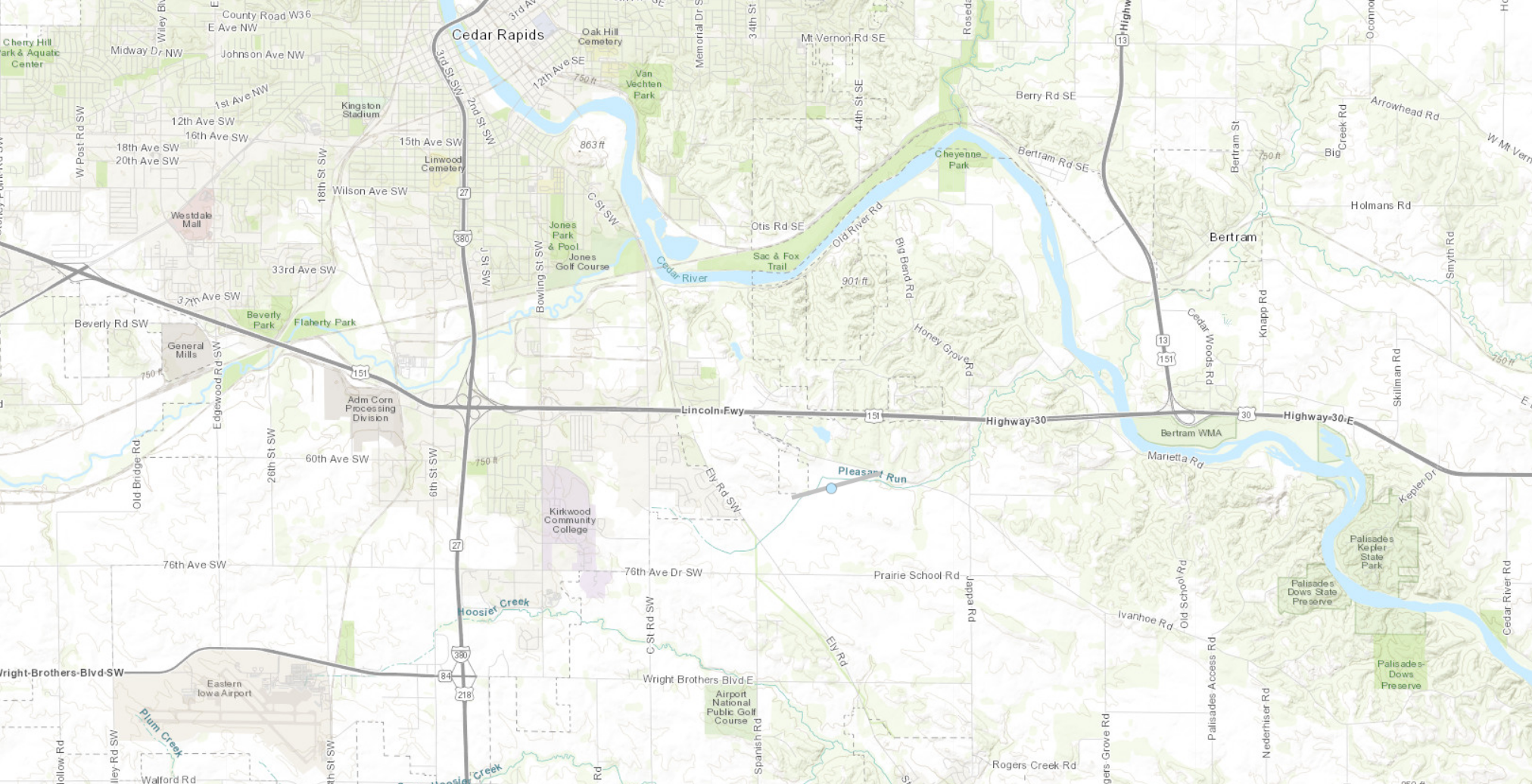 |
||||||||||||||||
The Enhanced Fujita (EF) Scale classifies tornadoes into the following categories:
| EF0 Weak 65-85 mph |
EF1 Moderate 86-110 mph |
EF2 Significant 111-135 mph |
EF3 Severe 136-165 mph |
EF4 Extreme 166-200 mph |
EF5 Catastrophic 200+ mph |
 |
|||||
Environment
SPC Severe Weather Event Page Jan 16, 2023
 |
 |
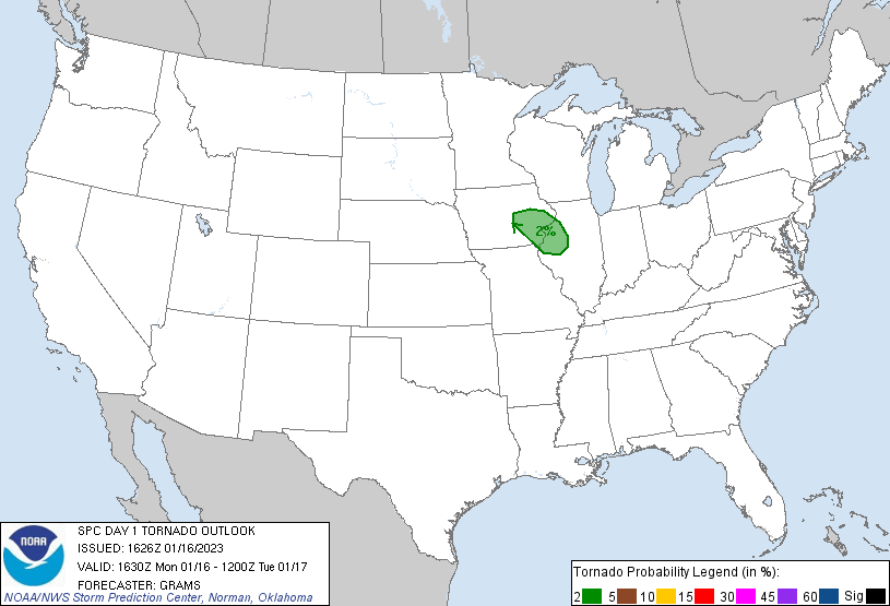 |
| Mesoscale Convective Discussion 0067 | 1026 AM CST Day 1 Convective Outlook | 1026 AM CST day 1 Tornado Outlook |
 |
Media use of NWS Web News Stories is encouraged! Please acknowledge the NWS as the source of any news information accessed from this site. |
|