Quad Cities, IA/IL
Weather Forecast Office
Ice Storm and Heavy Rain Overview
|
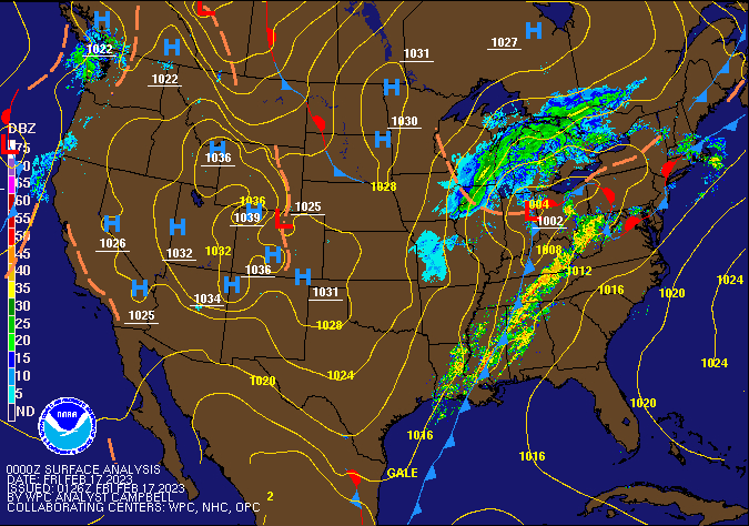
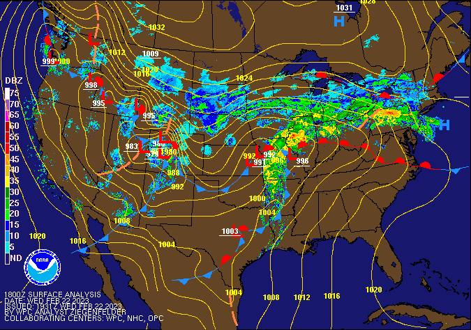
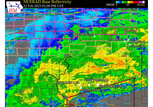
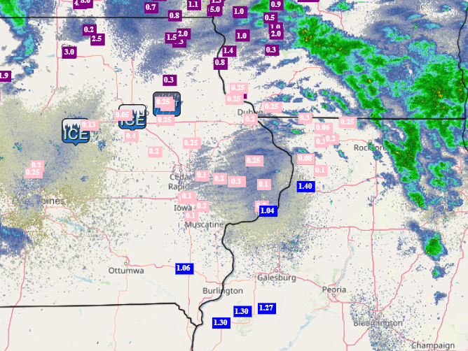
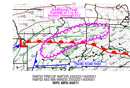
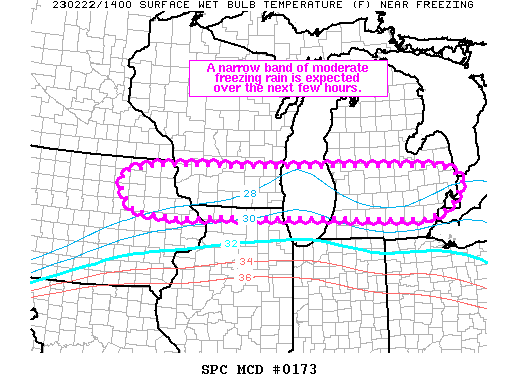
A well advertised storm system brough a mix of precipitation across all of eastern Iowa, northwest Illinois and northeast Missouri Wednesday, February 22nd. Precipitation began as rain during the early morning, but quickly changes to a mix of sleet and freezing rain as it progressed north over areas along and north of Interstate 80. This precipitation continued throughout the day before tapering off during the mid to late evening hours. Given the amount of moisture associated with this system, rain and ice amounts were high. Rainfall totals of around 1.00 - 1.50" were observed along and east of the Mississippi River. Ice amounts of a few hundredths up to three tenths of an inch were observed, with the later mainly along and north of the Highway 30 corridor. This ice lead to slippery travel conditions and power outages.
|
 Ice On Trees Outside of NWS Quad Cities Office (Andy Ervin) |
💧 Rainfall Maps 💧
| Thursday AM (900am) Local Rainfall Map |
Thursday AM (900am) Regional Rainfall Map |
|
 |
|
 |
Media use of NWS Web News Stories is encouraged! Please acknowledge the NWS as the source of any news information accessed from this site. |
|
Hazardous Weather
Watches, Warnings, & Advisories
Briefing
Hazards Page
View Local Storm Reports
Submit Report
Road Reports
Text Products
Forecasts
Fire Weather
Briefing
Hourly Forecast Graphs
Forecast Discussion
User-Defined Area
Activity Planner
Local Forecasts
Space Weather
Text Products
River Graphs
Airport Forecasts
Snow and Ice Probabilities
Winter Storm Severity Index (WSSI)
Current Conditions
Observations
Drought Monitor
Radar
Satellite
Text Products
Rivers and Lakes
River Graphs
Sunrise/Sunset Tables
Seasons (Equinoxes/Solstices)
Road Reports
Past Weather
Recent Observation History
Climate Summaries
Past Events
Climate Normals/Averages
Climate Records
Climate/Almanac Data
Holiday Climatology
Climate Maps
Monthly Climate Stats
Annual Climate Stats
Observation Site History
Sunrise/Sunset Tables
US Dept of Commerce
National Oceanic and Atmospheric Administration
National Weather Service
Quad Cities, IA/IL
9040 N Harrison Street
Davenport Municipal Airport
Davenport, IA 52806-7326
563-386-3976
Comments? Questions? Please Contact Us.

