Overview
|
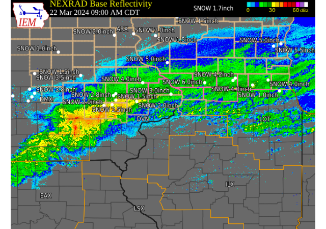
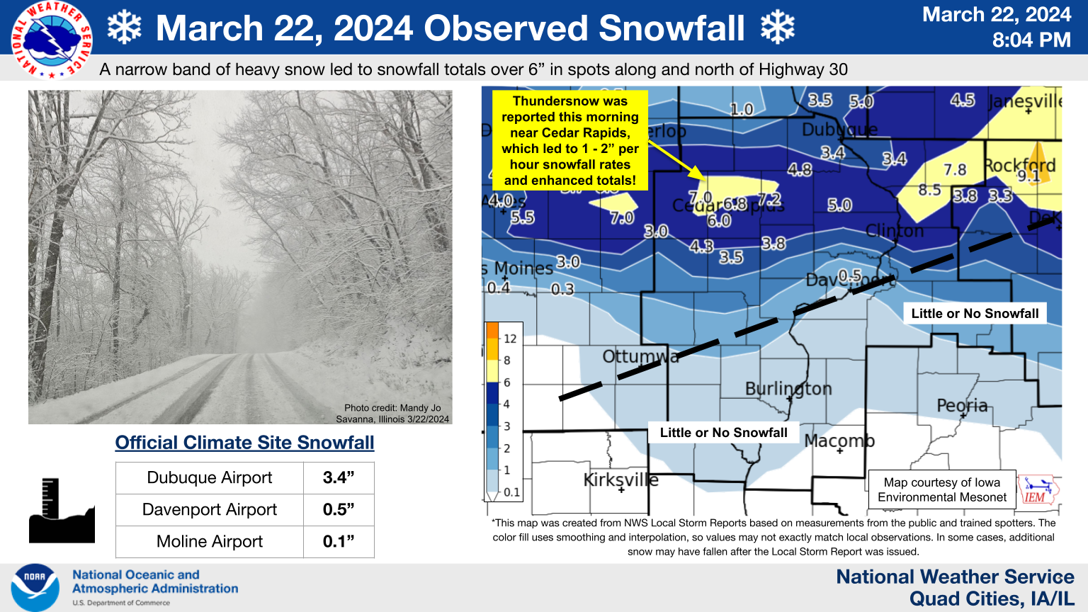
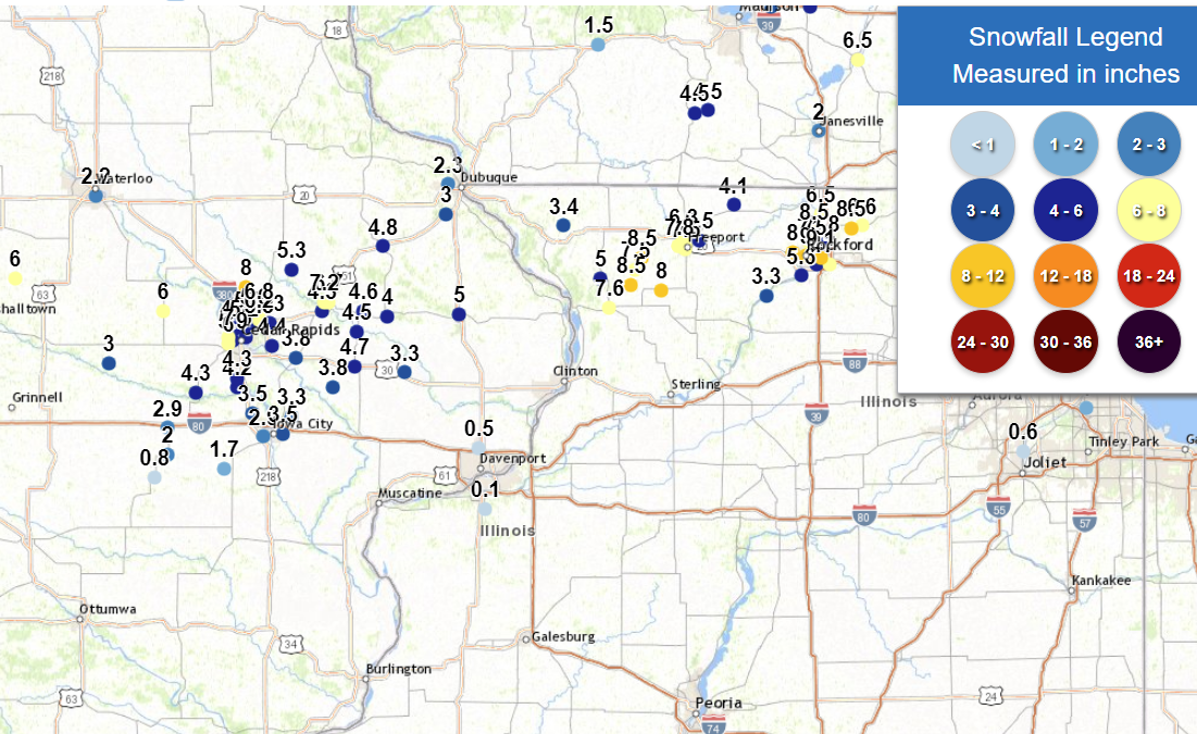
A quick moving, but potent early spring system brought a narrow band of heavy snow to portions of eastern Iowa, northern Illinois, and southern Wisconsin late Thursday night into early Friday afternoon (3/22/2024). A narrow band of 4 - 8"+ of snow fell roughly along and north of the Highway 30 corridor, with the highest axis from near Cedar Rapids to Savanna, IL to Freeport, IL. This system was accompanied by very strong "lift" along a tight temperature gradient, and when combined with an unstable air mass, resulted in bands of very heavy snowfall. In fact, the atmosphere was unstable enough to produce lightning and thunder with several reports early Friday morning near and southwest of Cedar Rapids, not too uncommon for late winter or early spring systems! "Thundersnow" is typically associated with higher snowfall rates of 1 - 2"+ per hour and can lead to impressive totals in a short amount of time. The heaviest snow reduced visibilities to under 1/4 of a mile and quickly led to snow covered and slippery roads, despite mild antecedent conditions with ground temperatures well above freezing. NWS Official Totals Dubuque Airport: 3.4" Notable (Non-NWS) Totals 6 SSE Elmoville, IL (Carroll County): 9.3" (CoCoRaHS)
|
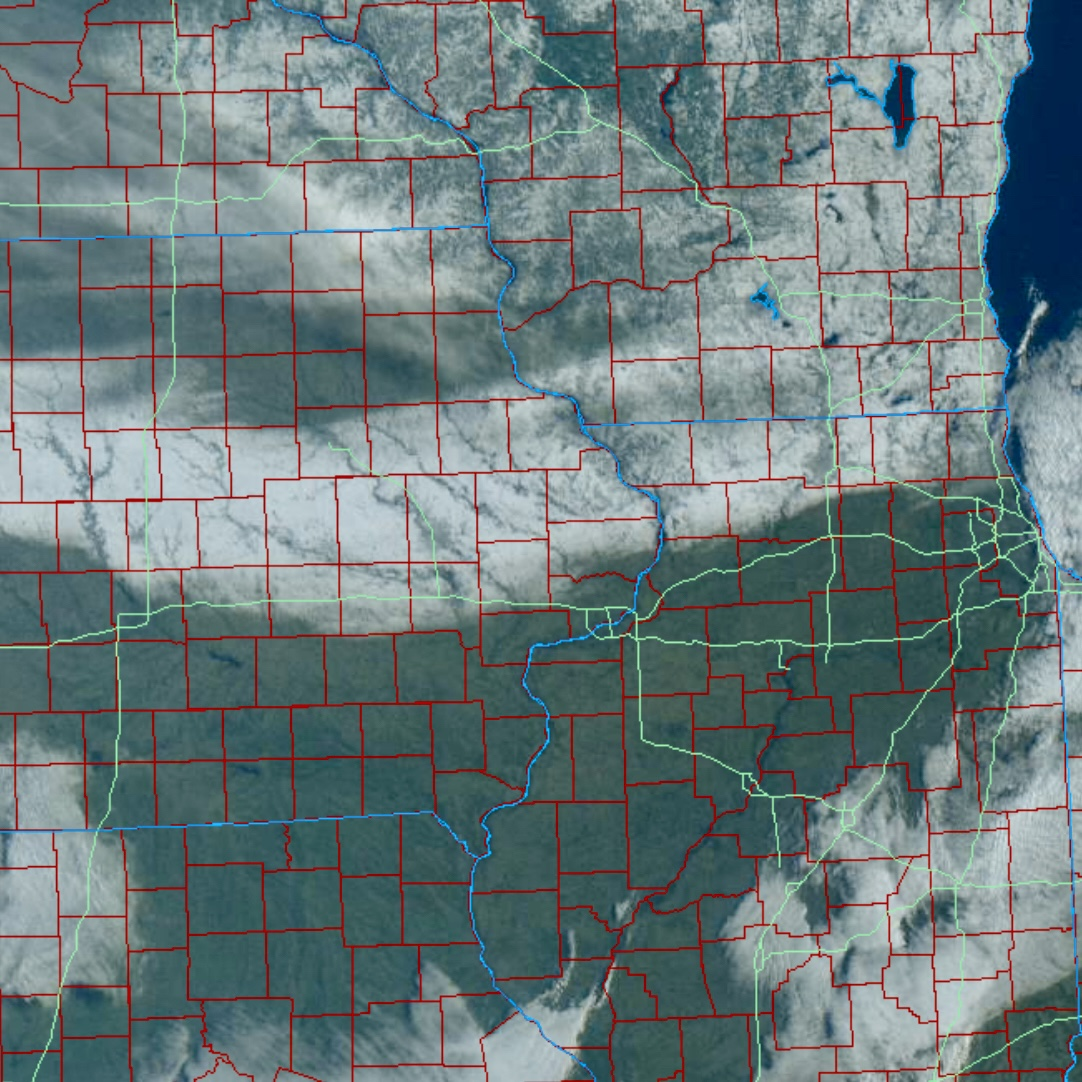
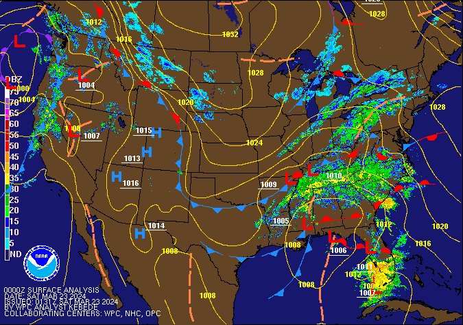 WPC Sea Level Pressure/Fronts/Radar Loop 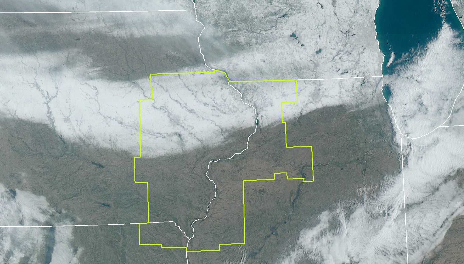 Visible Satellite 03/23/2024 |
Snow/Rain
â„ï¸ Snowfall / Rainfall Maps â„ï¸
| Midwest Snowfall Analysis Courtesy Iowa Environmental Mesonet |
|
Local Snowfall Analysis Courtesy Iowa Environmental Mesonet |
 |
 |
|
| 24-hr Local Rainfall Map Ending 8am Saturday (3/23/24) |
24-hr Local Snowfall Map Ending 8am Saturday (3/23/24) |
|
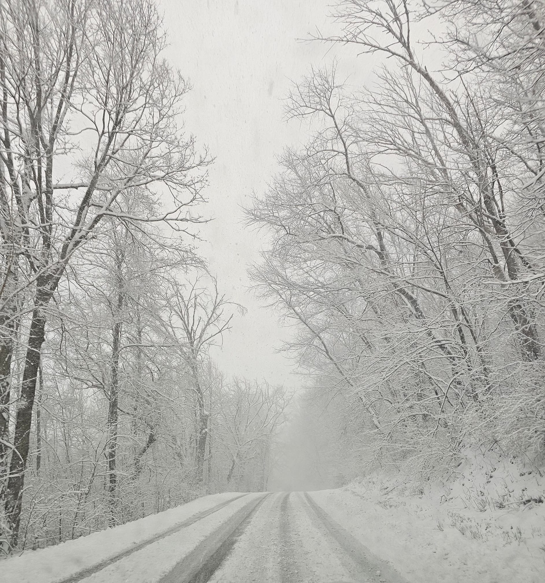
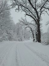
Photos
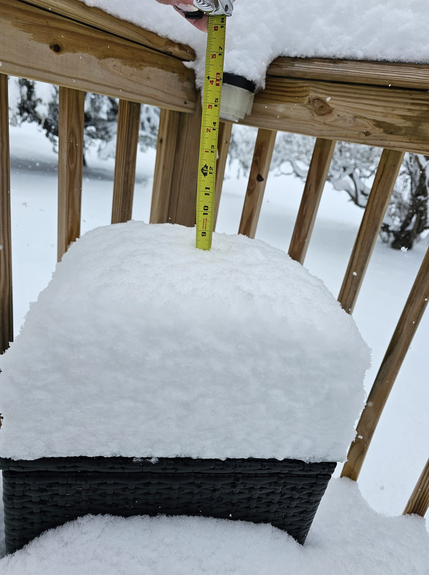 |
 |
 |
 |
| Freeport,IL (Kerry Weber 3/22/24) |
Savanna, IL (Mandy Jo 3/22/24) |
Loran, IL (Brittney Demeter 3/22/24) |
College of Dupage Visible Satellite 03/23/24 |
📠Storm Reports ðŸ“
Storm Reports Map - Courtesy IEM
 |
|
Public Information Statement ...MARCH 22, 2024 SNOWFALL REPORTS... Location Amount Time/Date Provider ...SLEET REPORTS... Location Amount Time/Date Provider Observations are collected from a variety of sources with varying |
Environment
 |
 |
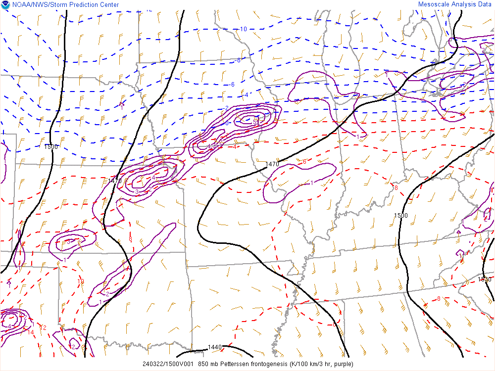 |
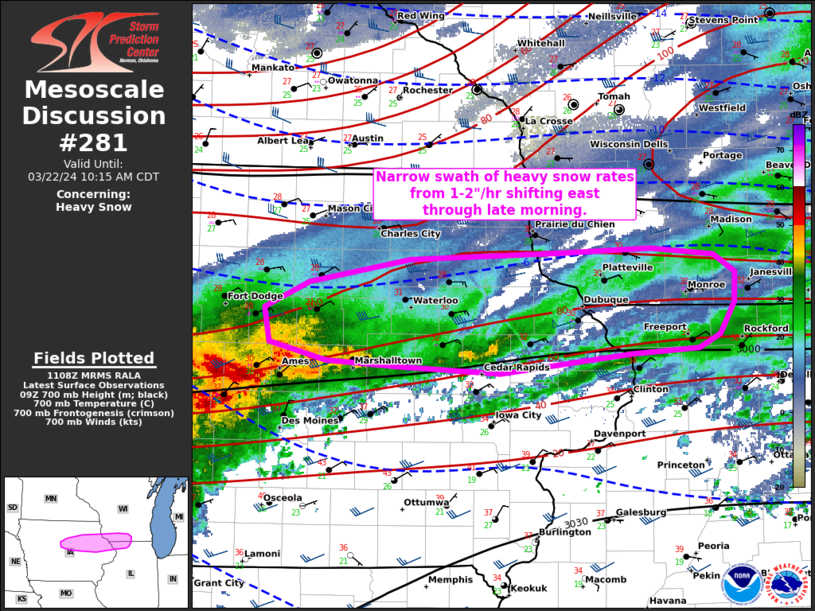
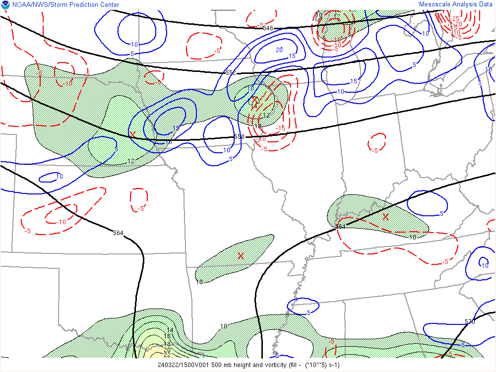
| SPC Mesoscale Discussion #281 | 500 mb Height map And Vorticity | 850 mb Frontogenetical Forcing |
 |
Media use of NWS Web News Stories is encouraged! Please acknowledge the NWS as the source of any news information accessed from this site. |
|