Widespread life-threatening flash and urban flooding continues in south-central Texas, with considerable flooding impacts possible across central Texas. Wildfire smoke is impacting air quality across much of the Great Lakes region into southern New England and the Mid-Atlantic. Monsoonal thunderstorms may produce isolated to scattered flash flooding across the Southwest into the Great Basin. Read More >
Event Summary: April 1st, 2018
|
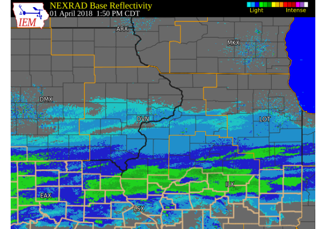
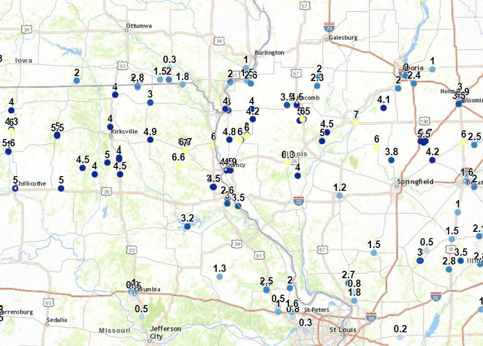
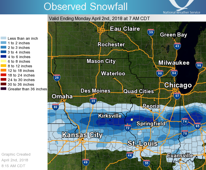
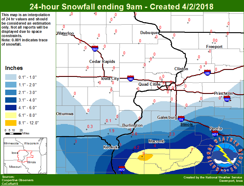
Light to moderate snow fell across portions of southeast Iowa, northeast Missouri, and west central Illinois on Sunday as an upper level storm system passed across the region. Snowfall amounts generally ranged from around 2 to 4 inches, with heavier amounts of 5 to 9 inches measured in far south Hancock and McDonough counties in Illinois.
|
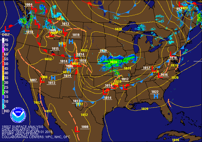 4/1/18 1 pm Surface Map |
Storm Reports
 |
 |
 |
| Interactive Map Link |
Regional Snowfall |
Local Snowfall |
SNOW REPORTS LISTED BY AMOUNT

 INCHES  LOCATION                 ST  COUNTY           TIME
 ------  -----------------------  --  --------------   -------
  9.0    AUGUSTA                  IL  HANCOCK          0530 AM
  6.0    INDUSTRY                 IL  MCDONOUGH        0831 PM
  6.0    1 S STILLWELL            IL  HANCOCK          0517 PM
  4.5    2 SSE MACOMB             IL  MCDONOUGH        0936 PM
  4.2    BENTLEY                  IL  HANCOCK          0700 AM
  4.0    KEOKUK                   IA  LEE              0801 PM
  4.0    CARTHAGE                 IL  HANCOCK          0724 PM
  3.5    1 SE ARGYLE LAKE STATE   IL  MCDONOUGH        0651 PM
  3.0    MEMPHIS                  MO  SCOTLAND         0600 AM
  3.0    KEOKUK L/D 19            IL  HANCOCK          0600 AM
  2.8    3 NW HITT                MO  SCOTLAND         0811 PM
  2.6    2 SE DALLAS CITY         IL  HANCOCK          0754 PM
  2.6    2 NE COLUSA              IL  HANCOCK          0600 AM
  2.3    2 S PRAIRIE CITY         IL  MCDONOUGH        0600 AM
  2.0    FORT MADISON             IA  LEE              0649 PM
  2.0    3 WNW MOUNT STERLING     IA  VAN BUREN        0524 PM
  1.8    3 ENE CHARLIE HEATH MEM  MO  CLARK            0727 PM
  1.5    CANTRIL                  IA  VAN BUREN        0520 PM
  1.0    1 WSW SPRING GROVE       IA  DES MOINES       0700 AM
  0.3    KEOSAUQUA                IA  VAN BUREN        0700 AM
Environment
 |
 |
|
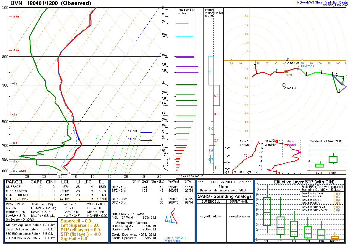
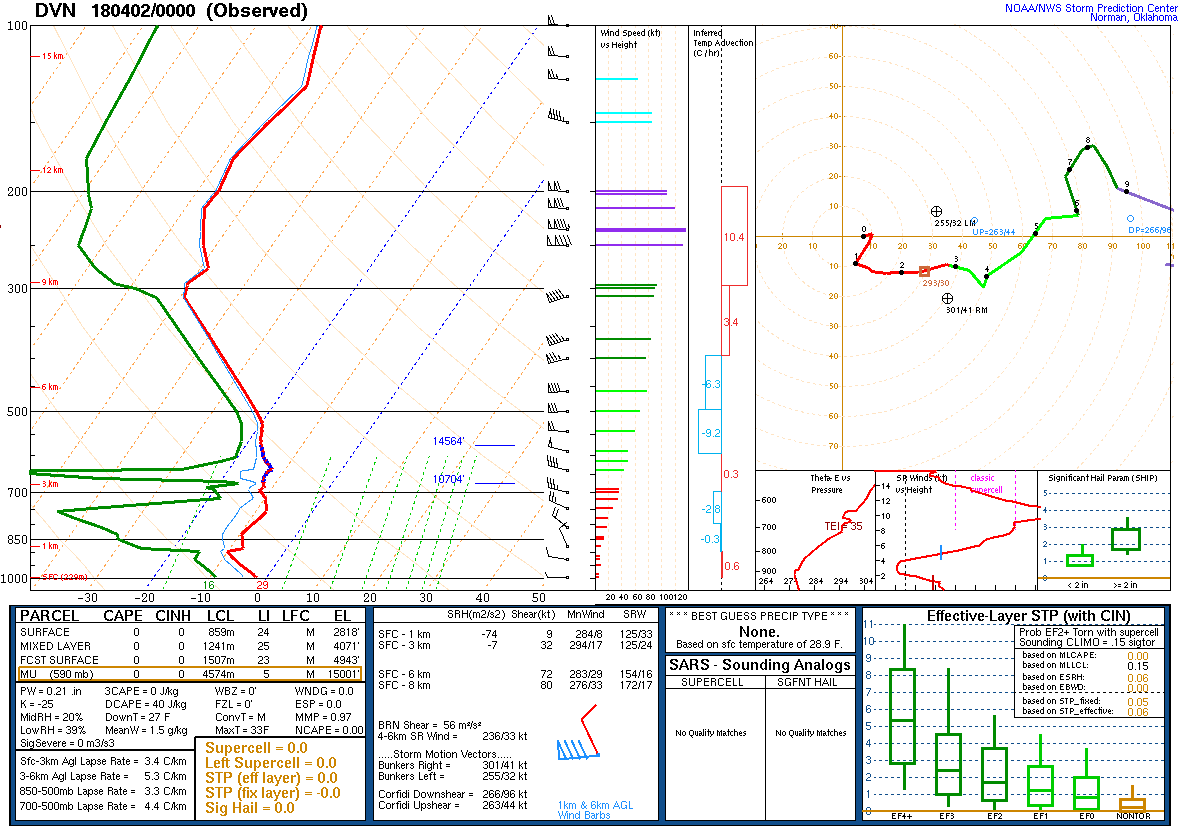
| Figure 1: 12Z 4/1 DVN Sounding | Figure 2: 00Z 4/2 DVN Sounding |
 |
Media use of NWS Web News Stories is encouraged! Please acknowledge the NWS as the source of any news information accessed from this site. |