Numerous severe thunderstorms are expected across a broad region from the Ohio Valley to the Mid-Atlantic and Northeast States today into tonight. Swaths of damaging wind gusts are expected and some tornadoes are possible. Bertha is expected to bring tropical storm conditions to portions of the Gulf Coast from the Florida Panhandle westward to southeastern Louisiana later today and Wednesday. Read More >
|
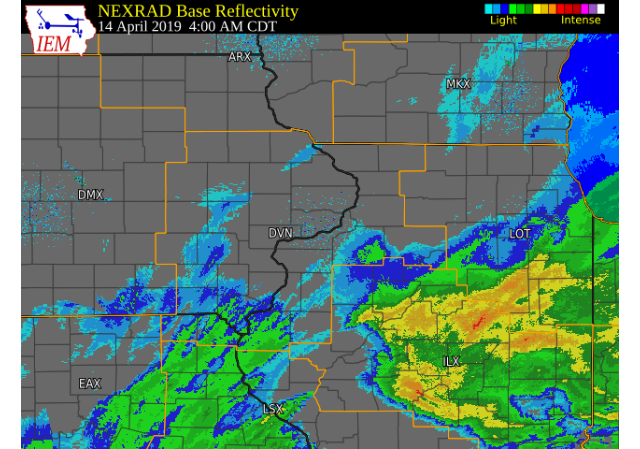
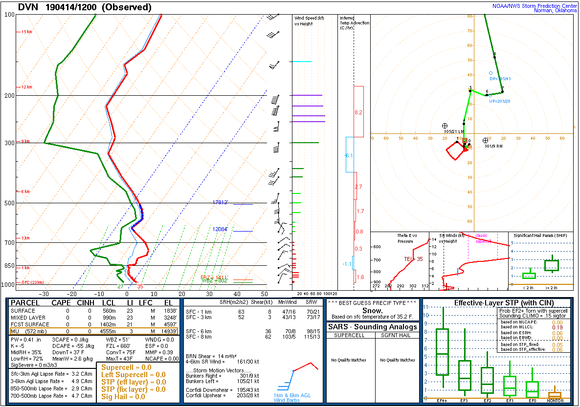
A storm system tracked into the middle Ohio River Valley during the day on Palm Sunday 2019 (April 14). This brought periods of heavy snow to the region during the morning and lasting into the afternoon. Snow fell from northeast Missouri into western Illinois. The heaviest snow fell in Bureau and Putnam counties where 5 to 8.5 inches of snow was reported. |
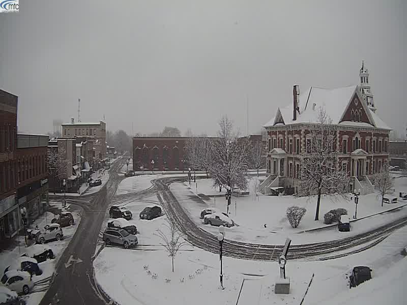
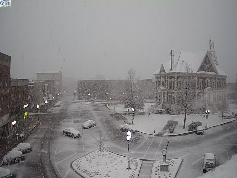 Macomb, IL 710 AM Courtesy: Regional Media - Virben Broadcasting |
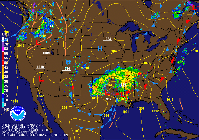 WPC Surface Map & Radar Loop |
Snow
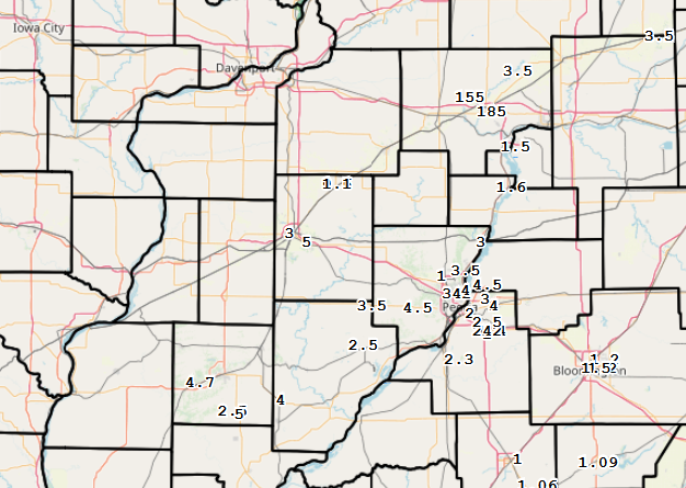
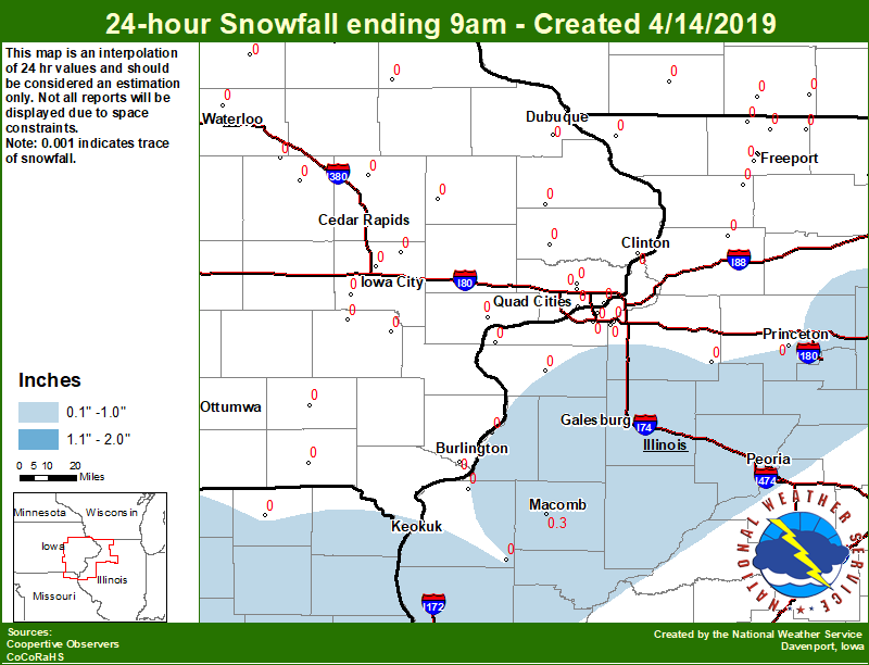
| Local Snowfall Map 9 AM CDT April 14, 2019 |
Regional Snowfall Map 9 AM CDT April 14, 2019 |
Local Snowfall Map 9 AM CDT April 15, 2019 |
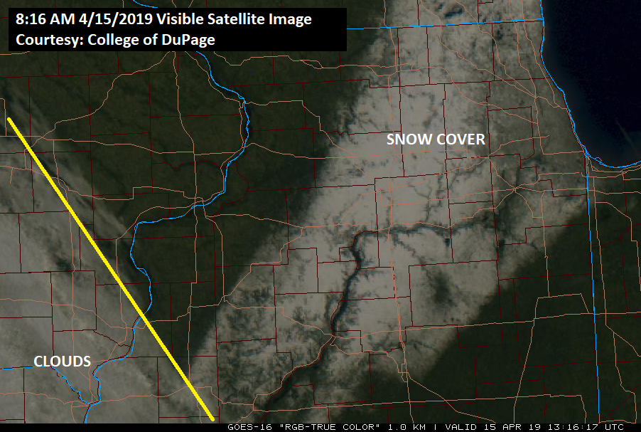
816 AM 4/15/2019 Visible Satellite Courtesy: College of DuPage |
 |
 |
 |
 |
24 hour snow fall in inches,
Reported between Midnight and 9 AM,
Sunday April 14, 2019.


....ILLINOIS....
Ottawa 4 SW                       0.3
Colchester 3.5 NE                 0.3
Romeoville                        0.0
Augusta                           0.0
Princeton 1.1 SE                  0.0
Princeton                         0.0
Coleta 1.4 SSW                    0.0
Tiskilwa 2.1 N                    0.0
Aledo                             0.0
Rockford ASOS                     0.0
Mundelein                         0.0
Roscoe 2SE                        0.0
Quad City Arpt 3 S                0.0
Dakota 4.8 NW                     0.0
Paw Paw 1 E                       0.0
Gladstone LD18                    0.0
Davis 0.5 N                       0.0
Steward                           0.0
Moline 0.7 NNE                    0.0
Freeport 2.0 NW                   0.0
Kewanee 1 E                       0.0
Dallas City 3.0 SSE               0.0
Galena                            0.0
Shannon 0.2 S                     0.0
Coal Valley 1.9 SE                0.0
Coal Valley 2.6 E                 0.0
Illinois City 6.7 SW              0.0
Winslow 4.3 ESE                   0.0
Freeport 2.9 WSW                  0.0
Freeport 1.7 NW                   0.0
....MISSOURI....
Columbia                          0.3
Memphis                           0.0
|
24 hour snow fall in inches,
Reported between Midnight and 9 AM,
Monday April 15, 2019.


....ILLINOIS....
Princeton 1.1 SE                  8.5
Princeton                         8.5
Mundelein                         6.8
Paw Paw 1 E                       4.5
Augusta                           4.0
Colchester 3.5 NE                 4.0
Steward                           3.4
Ottawa 4 SW                       3.0
Mendota 2 SE                      3.0
Rockford ASOS                     2.9
Kewanee 1 E                       2.8
Romeoville                        2.5
Rochelle                          2.0
Roscoe 2SE                        2.0
Rock Falls                        1.0
Streator 3 SE                     1.0
La Harpe                          0.0
Davis 0.5 N                       0.0
Freeport                          0.0
Freeport 2.0 NW                   0.0
New Windsor 2.0 N                 0.0
Aledo                             0.0
Quad City Arpt 3 S                0.0
Dallas City 3.0 SSE               0.0
Galena                            0.0
Illinois City 6.7 SW              0.0
Freeport 1.7 NW                   0.0
Freeport 2.9 WSW                  0.0
....MISSOURI....
Columbia                          0.1
Memphis                           0.0
....WISCONSIN....
Whitewater                        2.0
Beloit-College                    1.0
Monroe 1 W                        0.0
Darlington                        0.0
Brodhead 1 SW                     0.0
La Crosse WFO                     0.0
Viroqua                           0.0
Steuben 4SE 3 NE                  0.0
Madison-ASOS                      0.0
|
||
Photos
 |
 |
 |
|
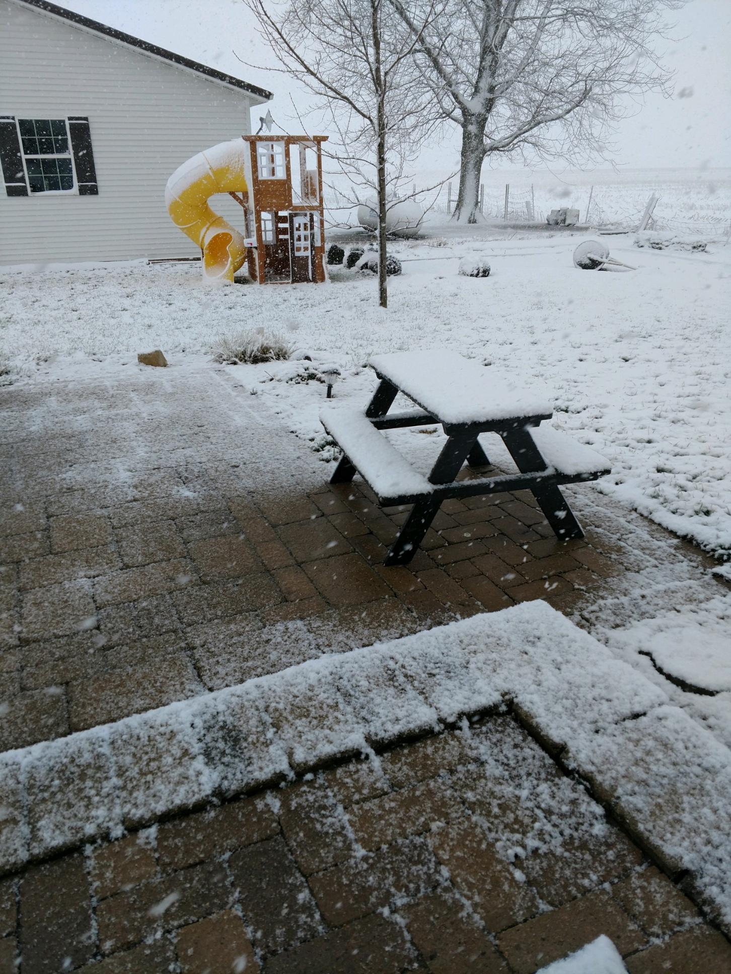
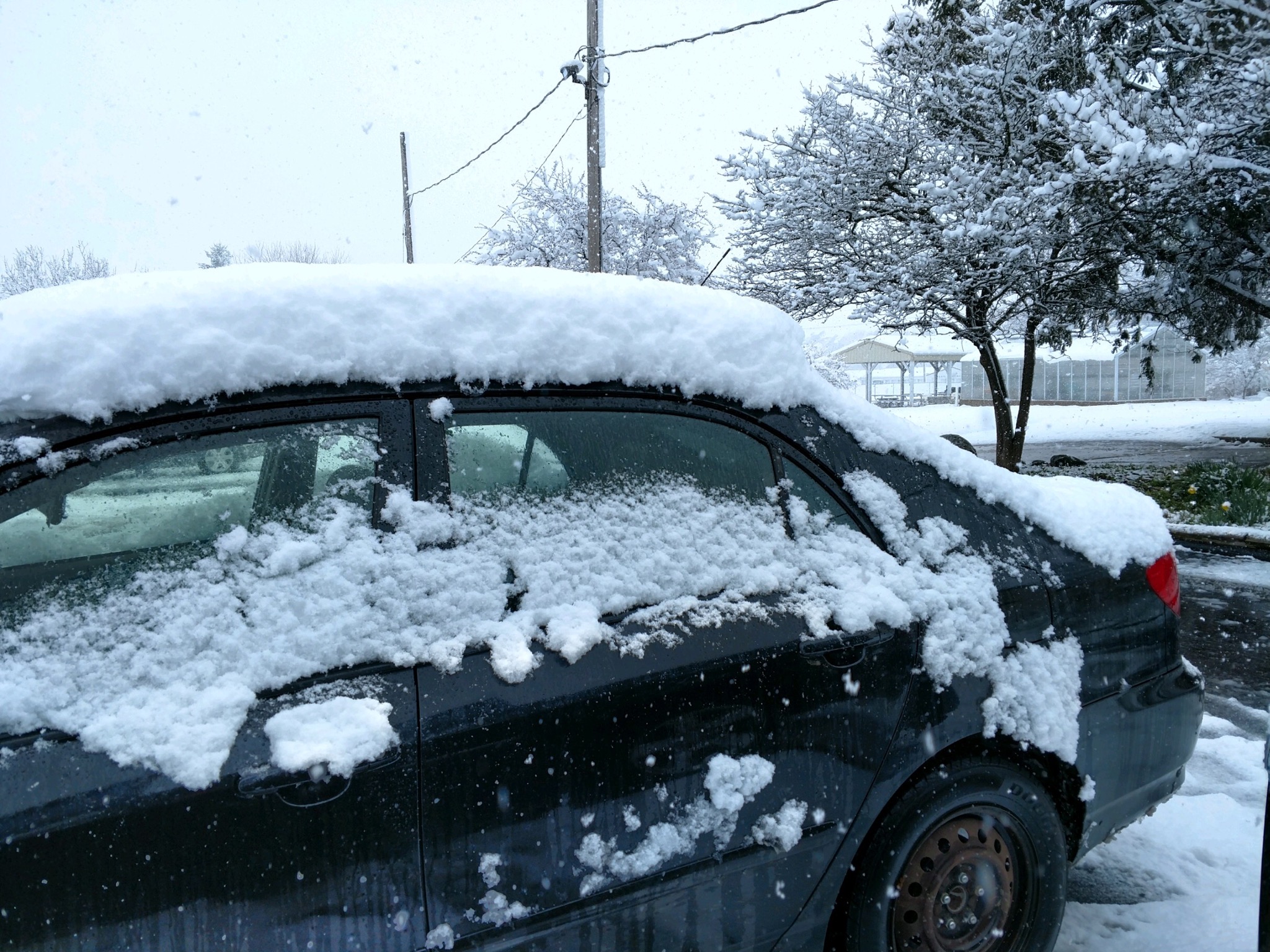
9 AM 5 miles NNE Wyanet, IL Courtesy A. Gray |
11 AM 5 miles NNE Wyanet IL Courtesy A Gray |
Macomb, IL 11 AM Courtesy: Regional Media - Virben Broadcasting |
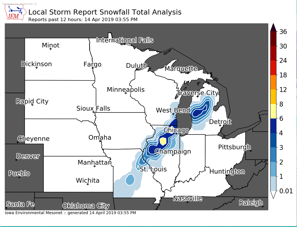
Storm Reports Map - Courtesy IEM
|
MAP BELOW AS OF ~11 AM 4/14/2019 |
|
|
|
Environment
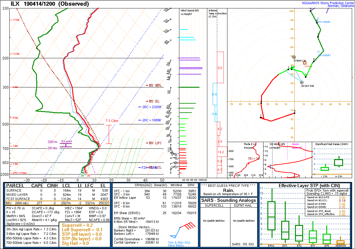
| Lincoln, IL Sounding 7 AM 04/14/2019 |
Davenport, IA Sounding 7 AM 04/14/2019 |
 |
 |
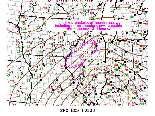
| SPC Mesoscale Discussion #338 | |
|
|
|
 |
Media use of NWS Web News Stories is encouraged! Please acknowledge the NWS as the source of any news information accessed from this site. |
|