
Widespread life-threatening flash and urban flooding continues in south-central Texas, with considerable flooding impacts possible across central Texas. Wildfire smoke is impacting air quality across much of the Great Lakes region into southern New England and the Mid-Atlantic. Monsoonal thunderstorms may produce isolated to scattered flash flooding across the Southwest into the Great Basin. Read More >
Overview
|
A fast moving line of showers and thunderstorms tracked east over eastern Iowa late Thursday evening. A brief, weak tornado touched down just northwest of Olin, IA damaging a metal shed and displacing a fire hydrant.
|
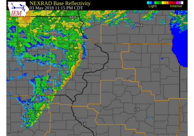 Radar Image (11:15 P.M.) (IEM) (Click to zoom) (Click here for Animation) |
Tornadoes:
|
Tornado - Olin, IA
Track Map 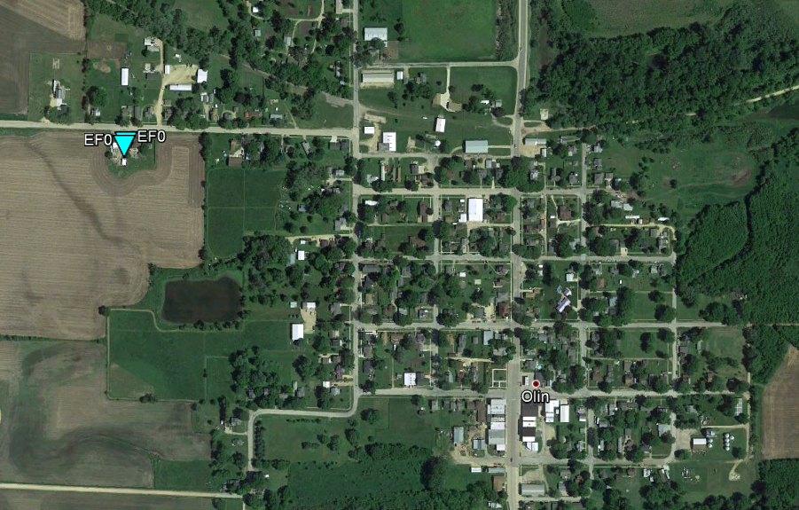 
Downloadable KMZ File |
||||||||||||||||
The Enhanced Fujita (EF) Scale classifies tornadoes into the following categories:
| EF0 Weak 65-85 mph |
EF1 Moderate 86-110 mph |
EF2 Significant 111-135 mph |
EF3 Severe 136-165 mph |
EF4 Extreme 166-200 mph |
EF5 Catastrophic 200+ mph |
 |
|||||
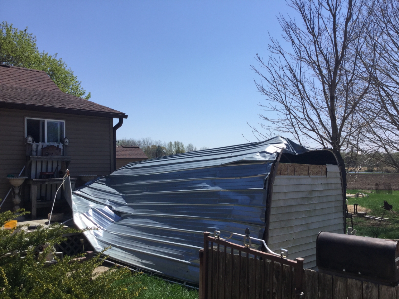
Photos & Video:
 |
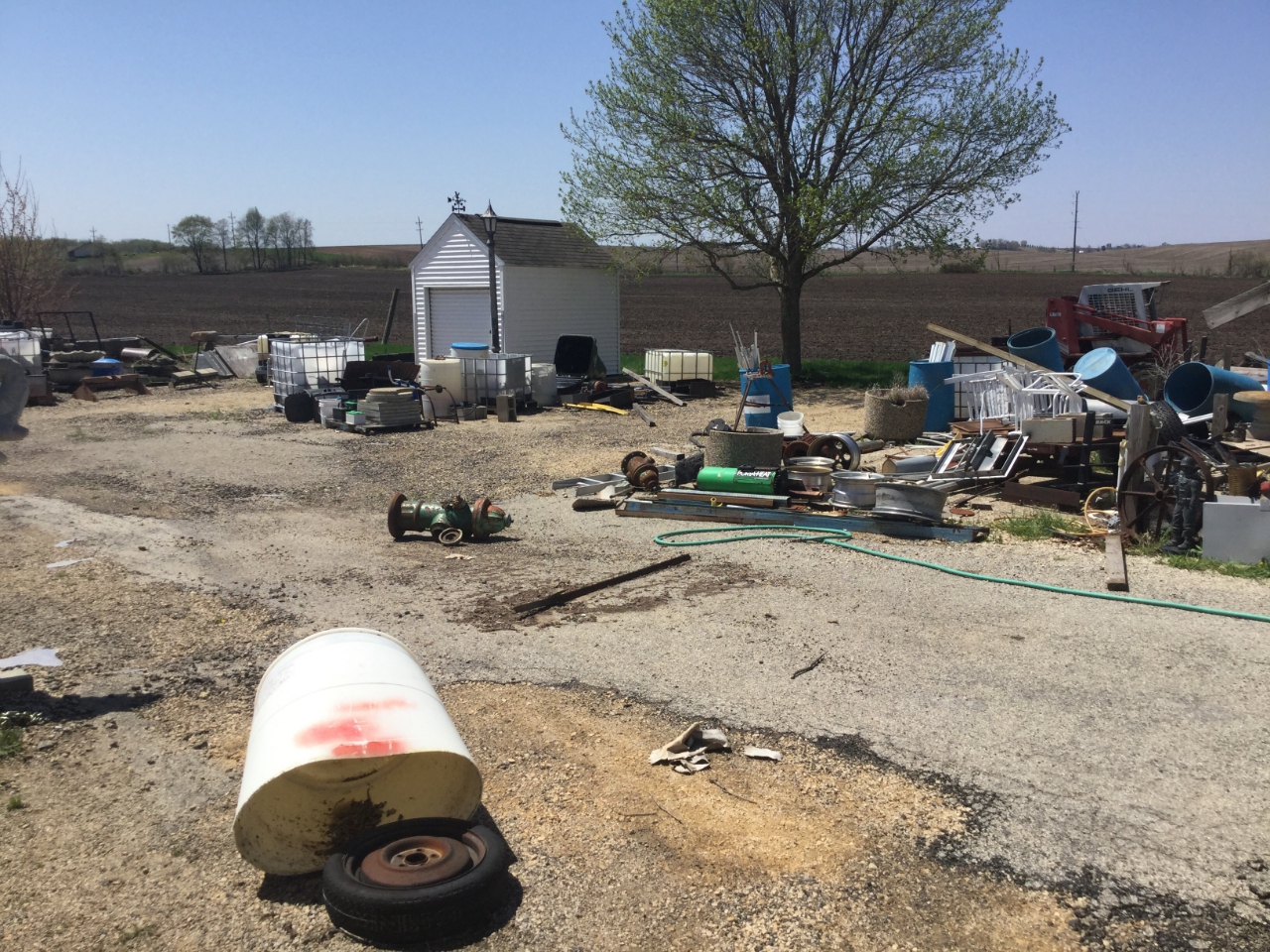 |
| Olin, IA (NWS Survey) |
Olin, IA (NWS Survey) |
Environment
 |
 |
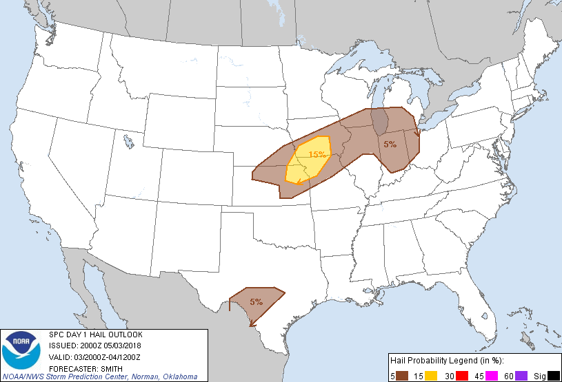 |
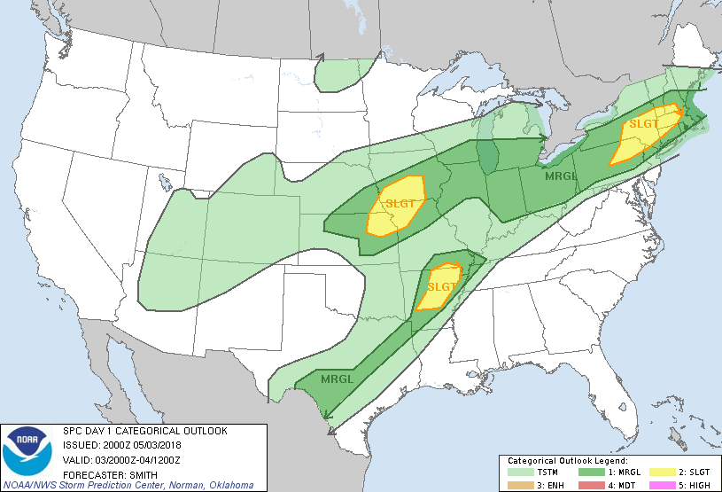
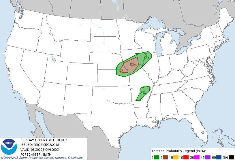
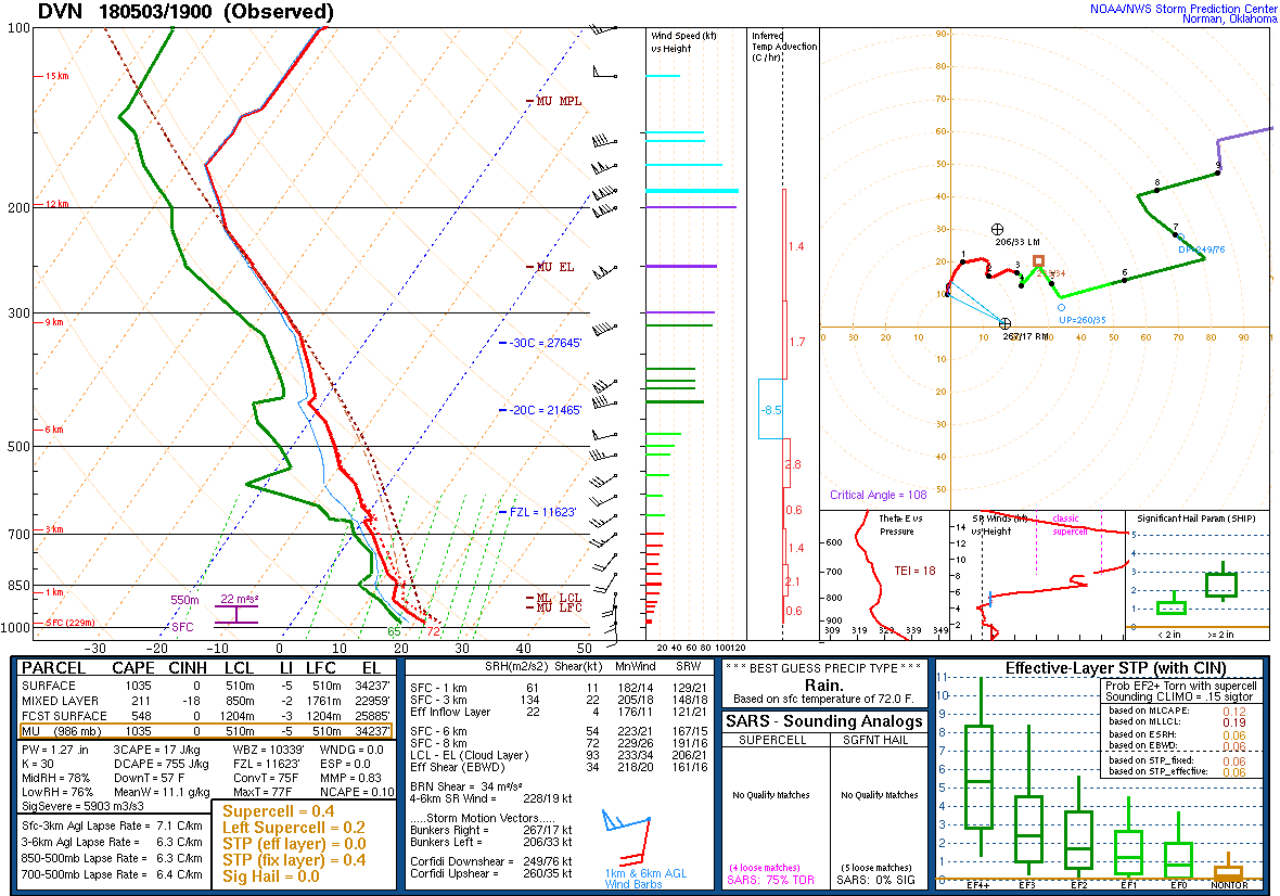
| Figure 1: SPC Day 1 Outlook (20:00 UTC) | Figure 2: SPC Day 1 Tornado Outlook (20:00 UTC) | Figure 3: SPC Day 1 Hail Outlook (20:00 UTC) |
 |
 |
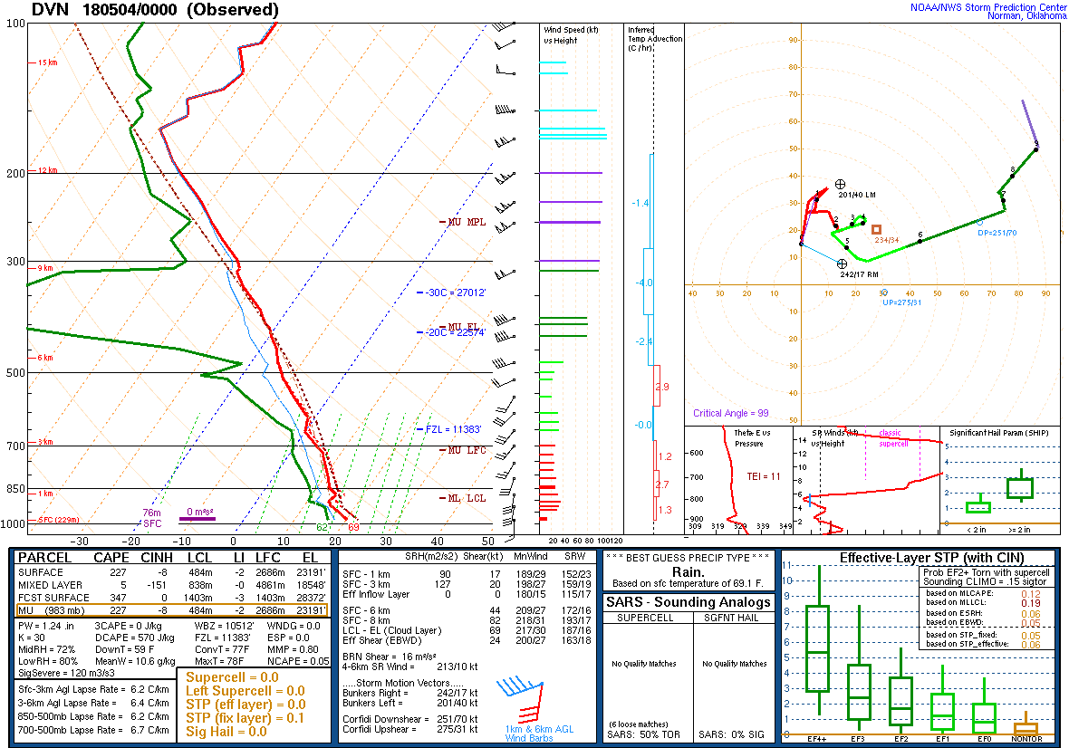 |
| Figure 4: SPC Day 1 Wind Outlook (20:00 UTC) | Figure 5: DVN Sounding: 5/3/18 19z | Figure 6: DVN Sounding: 5/4/18 00z |
 |
Media use of NWS Web News Stories is encouraged! Please acknowledge the NWS as the source of any news information accessed from this site. |
|

