Scattered thunderstorms with severe gusts, hail and a tornado risk are possible near a cold front from the Ohio Valley to the Mid-Atlantic tonight. Tropical Storm Bertha is expected to bring tropical storm conditions to portions of the Gulf Coast from the panhandle of Florida into Louisiana through Wednesday. Read More >
Overview
|
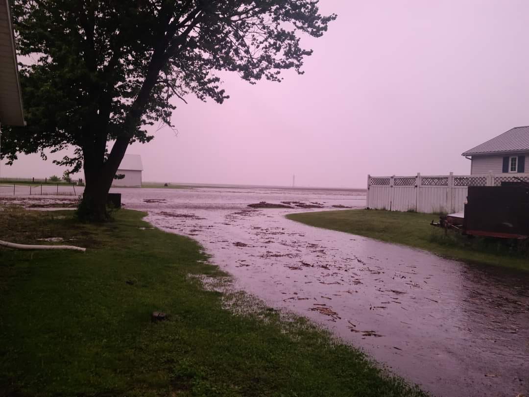
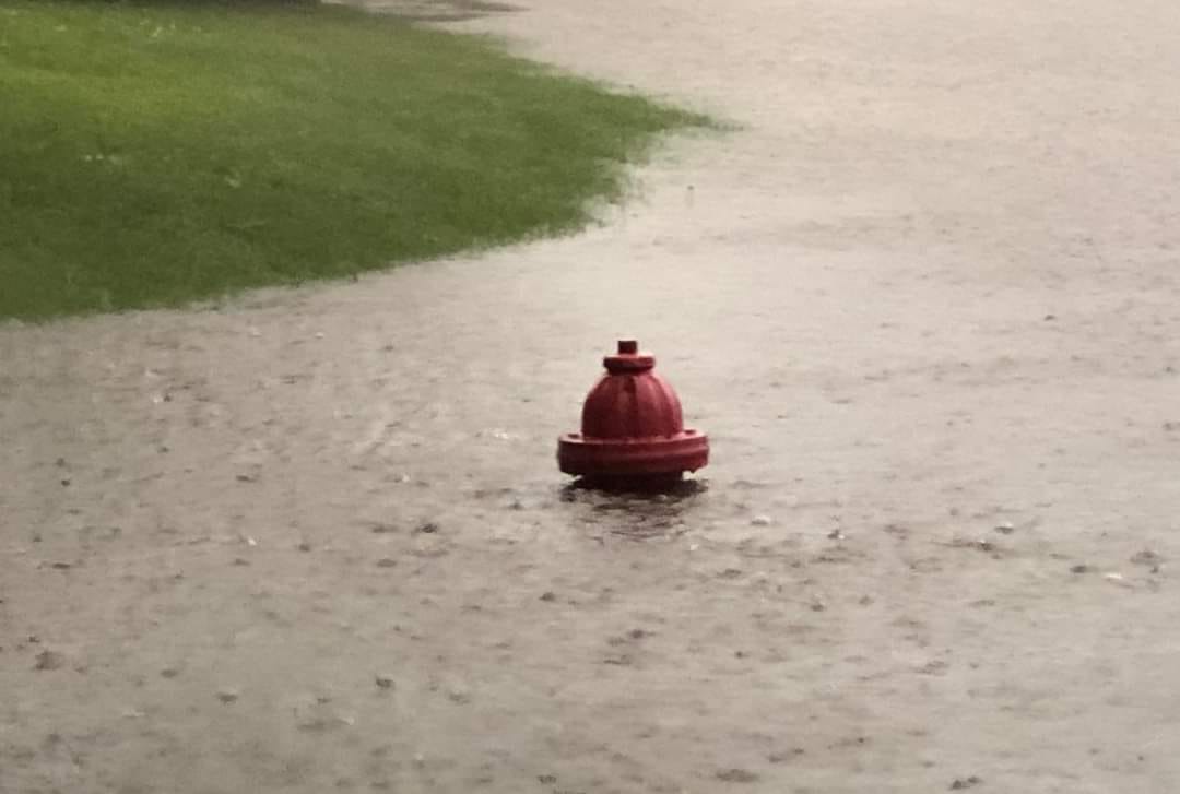
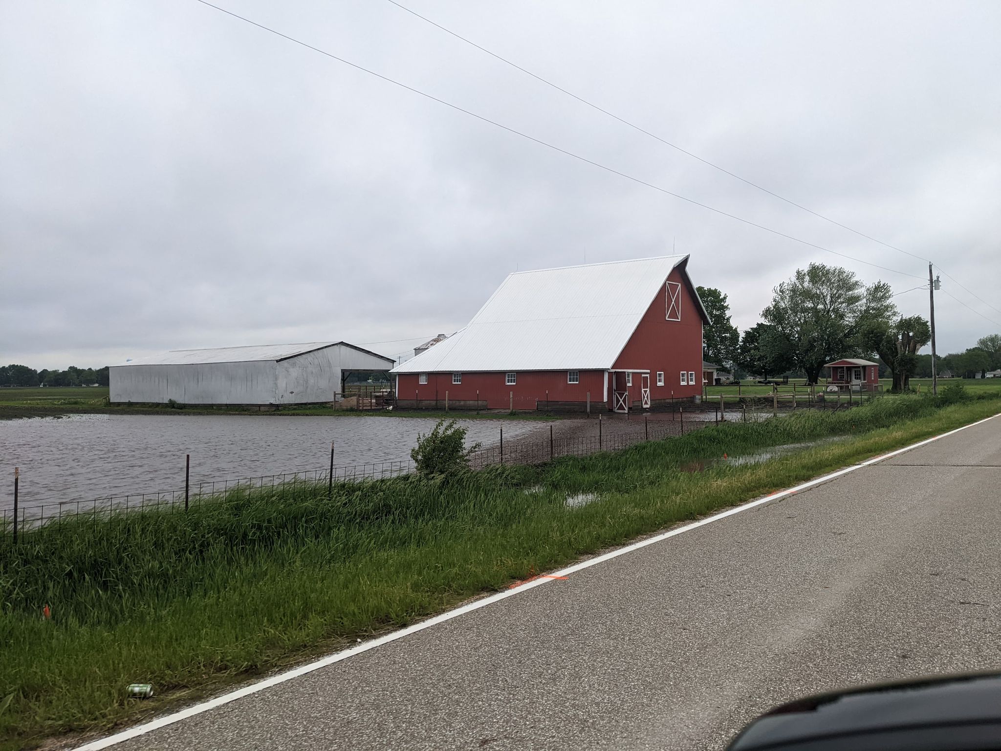
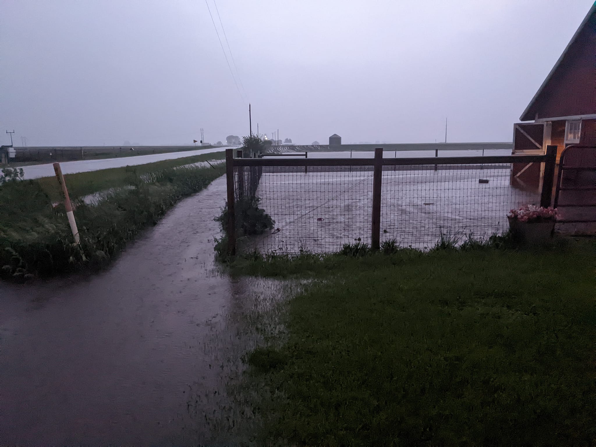
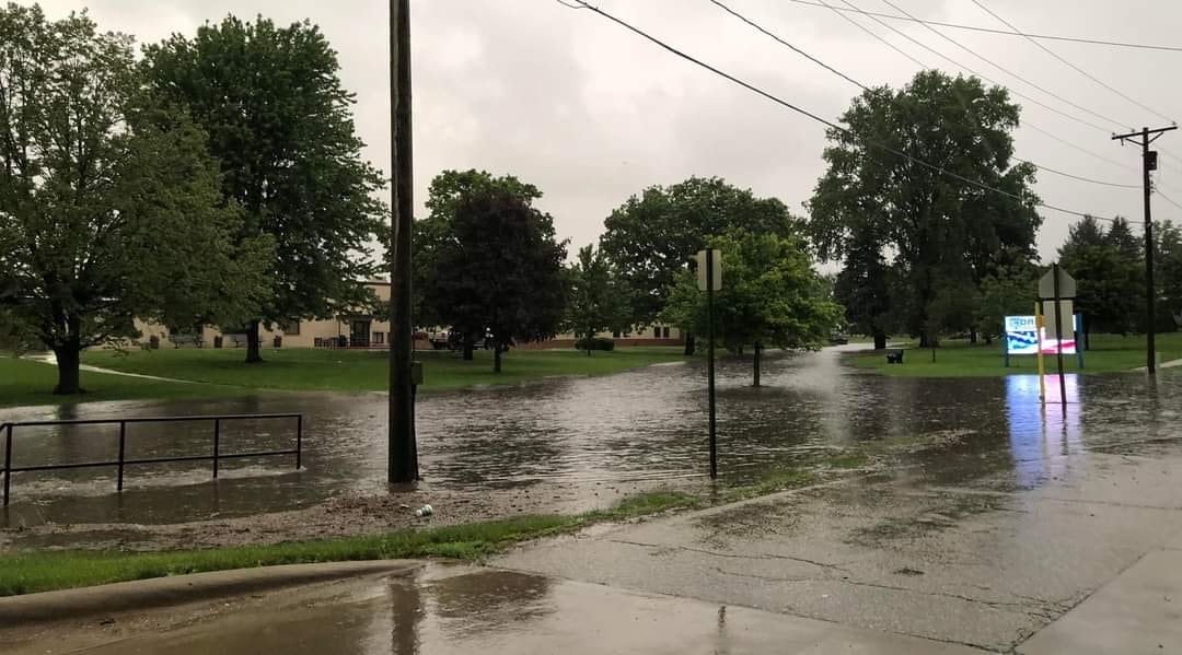
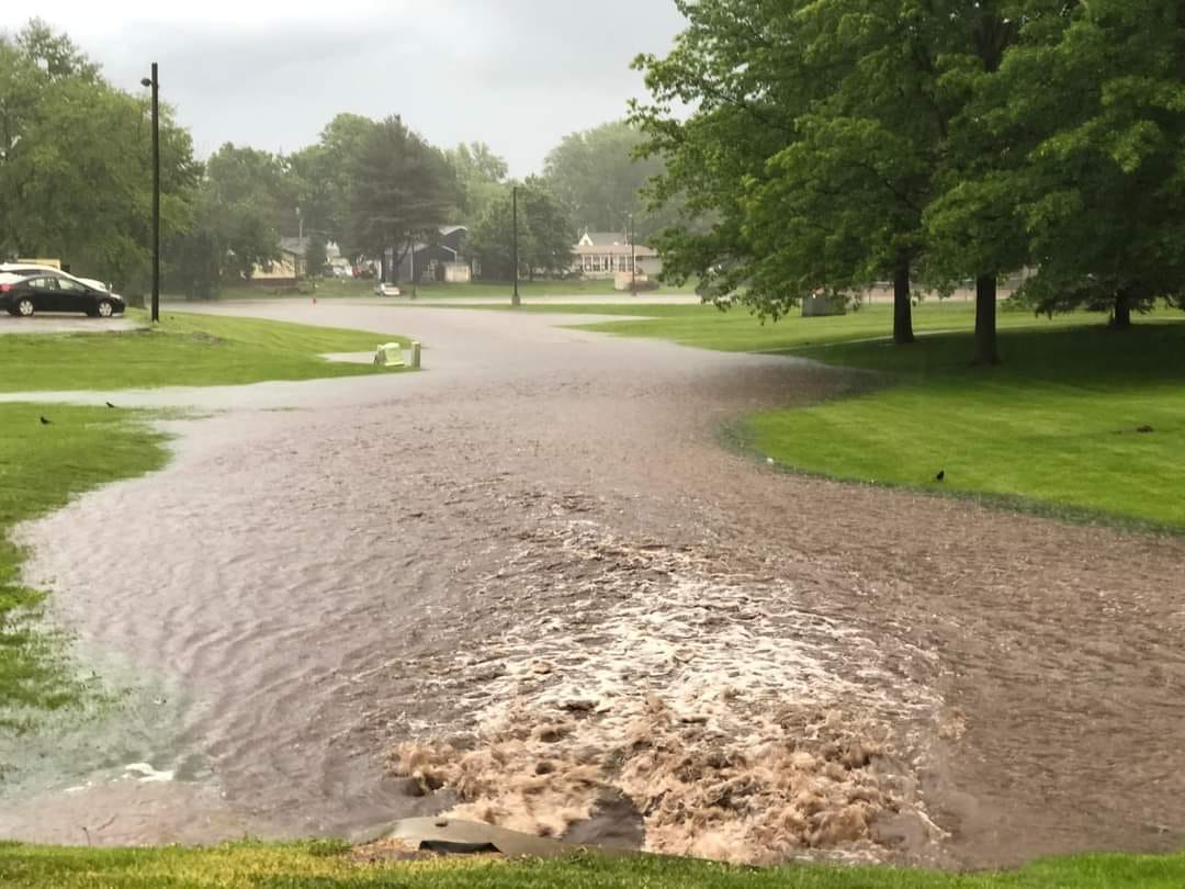
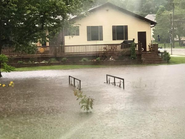
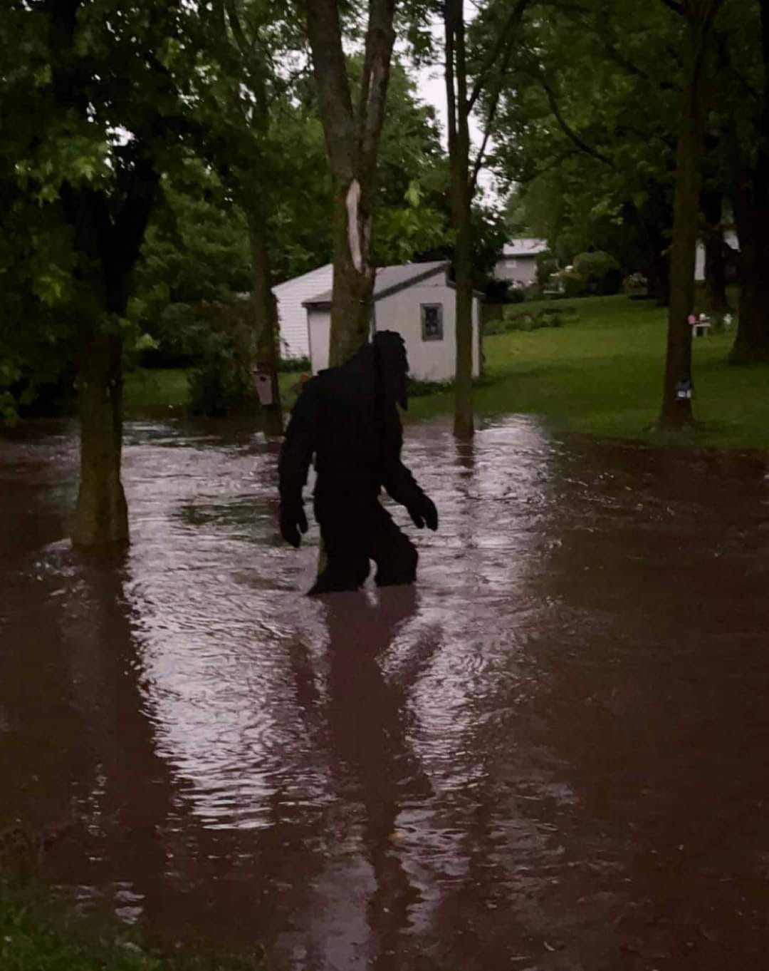
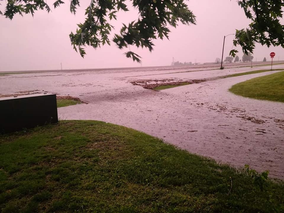
Several rounds of showers and thunderstorms developed across all of eastern Iowa, northwest Illinois and far northeast Missouri on the afternoon of Thursday May 26, 2022. These showers and storms formed in response to an area of low pressure moving across eastern Missouri into central Illinois during the afternoon and evening. This activity slowly rotated around the low, allowing showers/storms to produce torrential rainfall over areas they impacted. During the evening, repeated rounds of showers and storms impacted the city of Danville, IA, and lead to flash flooding across the city. Per emergency management, water flowed into homes, apartments and school and washed out several gavel roads on the west side of town. There was an unofficial measured rainfall amount of 9 inches in the city. |
(Courtesy Des Moines County EMA) |
Rain Reports
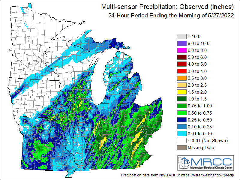 |
24 hour precipitation reports (in Inches), for eastern Iowa, northwest and west central Illinois, and northeast Missouri. Reported between Midnight and 9 AM, Friday May 27, 2022. ....IOWA.... Solon 0.3 ESE 1.68 Fairfield 1.35 Park View 0.2 WSW 0.90 Bellevue LD12 0.87 Dubuque LD11 0.75 West Point 7.5 NW 0.74 Riverdale 0.5 N 0.73 Ottumwa ASOS 6 NNW 0.63 Anamosa 3 SSW 0.61 Asbury 0.4 SW 0.59 Tipton 0.7 N 0.55 Ely 0.5 SE 0.53 Charlotte 1.9 WNW 0.50 Camanche 1.2 W 0.49 Waukon 3N 0.47 Le Claire 1.8 NNE 0.41 De Witt 0.41 Keokuk LD19 0.41 Ainsworth 7.4 N 0.40 Donnellson 0.38 Davenport 0.9 WNW 0.33 Wellman 4.0 E 0.28 Le Claire LD14 0.28 Dubuque #3 7 SW 0.27 Monticello 1 E 0.26 Washington 5.8 SW 0.25 Davenport Arpt 0.25 Wapello 5.4 SE 0.23 Rathbun Reservoir 2 N 0.21 Maquoketa 0.20 West Liberty 0.7 NNW 0.19 Iowa City Arpt 0.19 Dubuque Arpt 0.19 Iowa City 0.17 North Liberty 0.7 SSW 0.16 Cedar Rapids Arpt 0.16 Burlington 2S 0.15 Lowden 0.15 Centerville 0 NE 0.14 Cedar Rapids 2.7 NE 0.13 Keosauqua 0.13 Burlington Arpt 0.12 North English 0.09 Burlington 6.5 SSW 0.05 Salem 3.1 ESE 0.05 Parnell 0.1 SSW 0.05 Rickardsville 0.2 W 0.05 Muscatine 2N 0.05 Marion 1.7 NNW 0.04 Oskaloosa AWOS 9 ESE 0.04 Oelwein 1E 0.03 Washington 0.02 Marengo 2.6 SSW 0.01 Marengo 3.6 N 0.01 Central City 6.7 W 0.01 Fairfax 4.0 NW 0.00 Elkader 6SSW 0.00 Boone 1 SSW 0.00 Mount Auburn 2.2 NNW 0.00 Waterloo ASOS 5 NW 0.00 Oelwein AWOS 0.00 Mason City ASOS 6 W 0.00 Hampton 1 N 0.00 Grinnell AWOS 2 SSW 0.00 Guttenberg Dam 10 0.00 Marshalltown ASOS 4 N 0.00 Newton 1 NE 0.00 Fayette 1 NW 0.00 Pella 4 N 0.00 Pella AWOS 2 WSW 0.00 Marshalltown 1 NW 0.00 Ames US 30 2 SSE 0.00 NWS Johnston* 5 NNW 0.00 ....ILLINOIS.... Macomb 1.68 Augusta 1.56 Stockton 3.4 NNE 1.39 Gladstone LD18 1.10 Romeoville 1.02 Alexis 1 SW 0.90 Paw Paw 1 E 0.88 Mount Carroll 0.88 Walnut 5.3 ENE 0.80 Freeport 0.72 Steward 0.67 Princeton 1.1 SE 0.65 Princeton 0.65 Stronghurst 0.4 SSW 0.60 Joliet Arpt 0.56 Warsaw 5.8 SE 0.53 Freeport 1.7 NW 0.49 Colchester 3.5 NE 0.47 Hanover 0.2 NW 0.47 Freeport 2.9 WSW 0.45 Kewanee 1 E 0.43 Dallas City 3.0 SSE 0.41 Winslow 4.3 ESE 0.41 Rockford Arpt 0.41 Peoria Arpt 0.41 Mount Carroll 6.8 NNW 0.39 Ottawa 4 SW 0.38 Davis 0.5 N 0.36 Quincy Arpt 0.36 Rochelle Arpt 0.30 Coal Valley 2.6 E 0.28 Woodhull 0.3 ESE 0.28 Coal Valley 1.9 SE 0.24 Elizabeth 0.21 Aledo 0.21 Geneseo 2.0 NW 0.19 Ridott 0.1 NE 0.19 New Boston LD17 0.18 La Harpe 0.17 Fulton LD13 0.17 Prophetstown 0.2 SW 0.16 Lincoln NWS 0.16 Jacksonville Arpt 0.11 Quad City Arpt 0.11 Bloomington Airport 0.09 New Windsor 2.0 N 0.08 St Anne 0.08 Decatur Airport 0.08 Ill. City LD16 3 WNW 0.02 Mundelein 0.02 ....MISSOURI.... Chillicothe Arpt 0.55 Columbia Arpt 0.11 Kirksville Arpt 0.00 ....WISCONSIN.... Watertown-Arpt 1.27 Darlington 0.77 Beloit-College 0.55 Madison Arpt 0.28 Whitewater 0.24 Brodhead 1 SW 0.23 La Crosse WFO 0.02 Steuben 4SE 3 NE 0.02 Prairie du Chien AWOS 0.01 Viroqua 0.00 ....MINNESOTA.... Theilman 1SSW 0.13 Preston 0.00 |
Pictures
(all pictures in this summary were provided by Des Moines County EMA)
 |
 |
 |
 |
 |
 |
 |
 |
 |
Media use of NWS Web News Stories is encouraged! Please acknowledge the NWS as the source of any news information accessed from this site. |
|