Overview
|
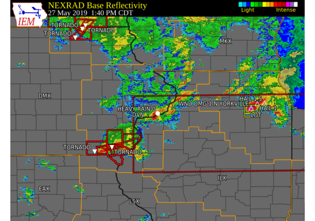
Showers and thunderstorms tracked eastward across parts of eastern Iowa and northern Illinois on Memorial Day 2019 as a low pressure system lifted a warm front through the region.
Some of the storms produced tornadoes during the early to mid afternoon hours. Very heavy rain also fell in a short amount of time in areas. Flash flooding occurred in the Quad Cities metro, with several feet of water on many streets.
|
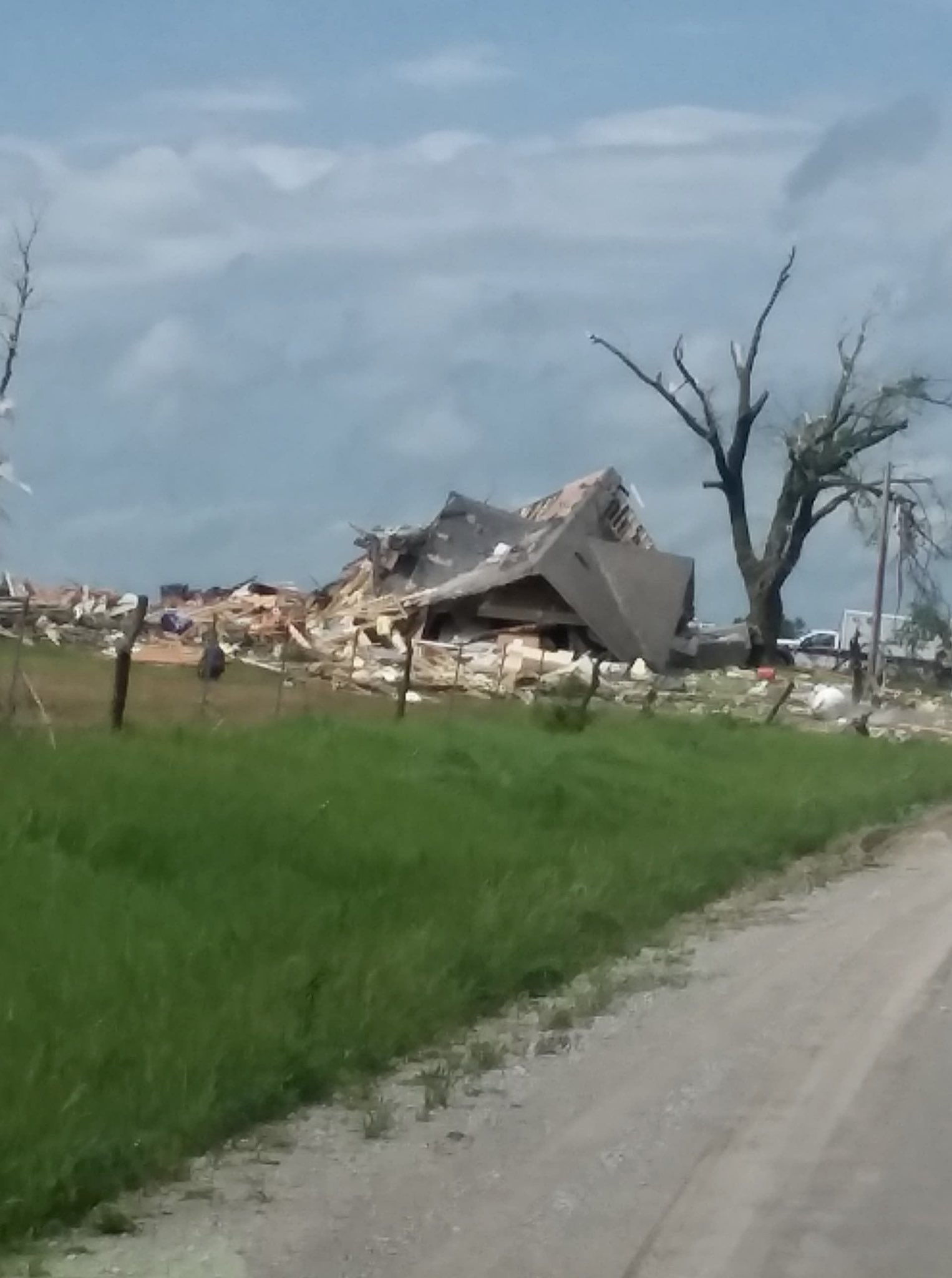 From Iowa Storm Chasing Twitter Photo By: Sherri Daughtery 4 miles NE Cantril, IA |
Tornadoes:
|
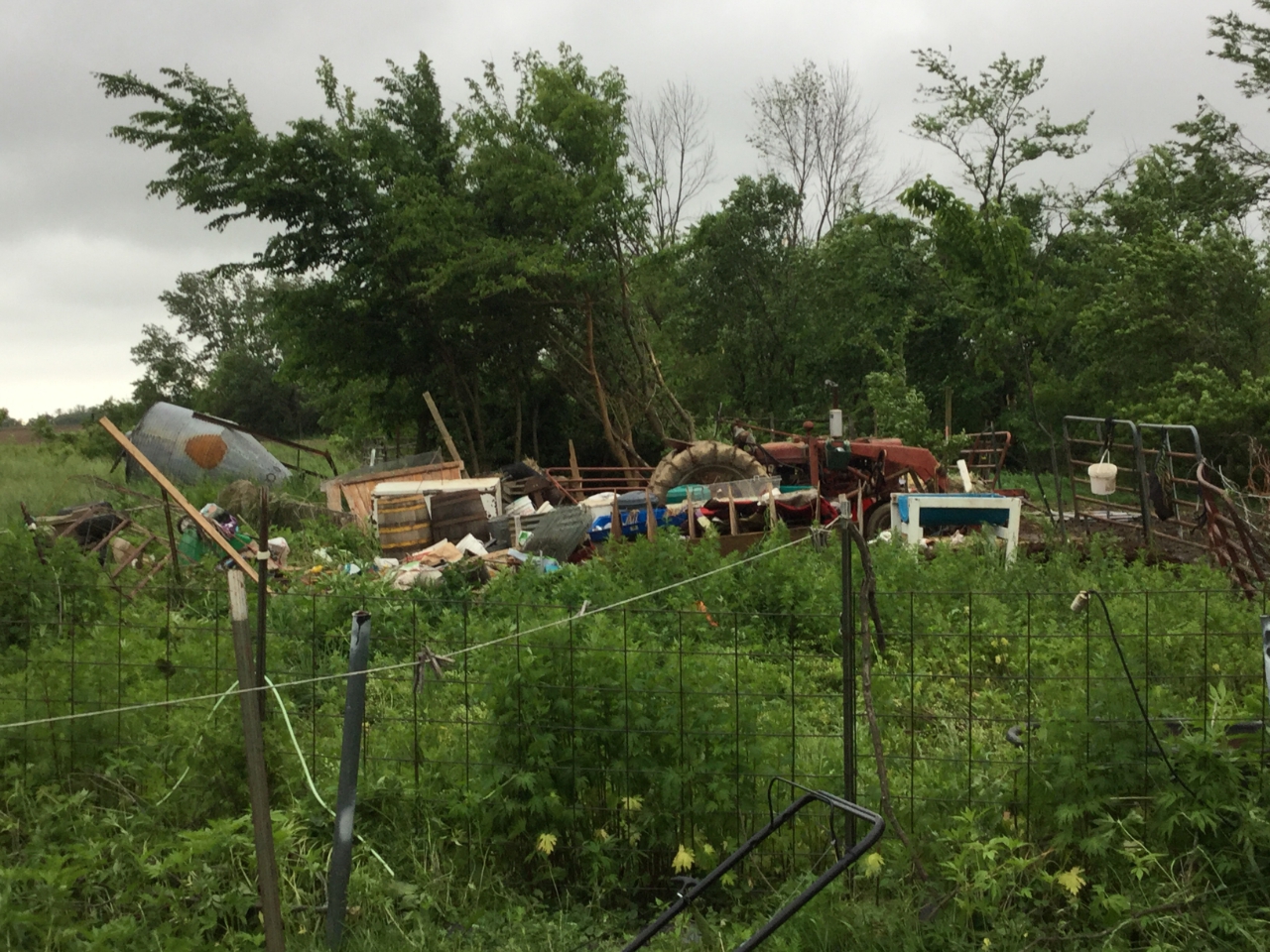
Tornado 1 - Southern Van Buren
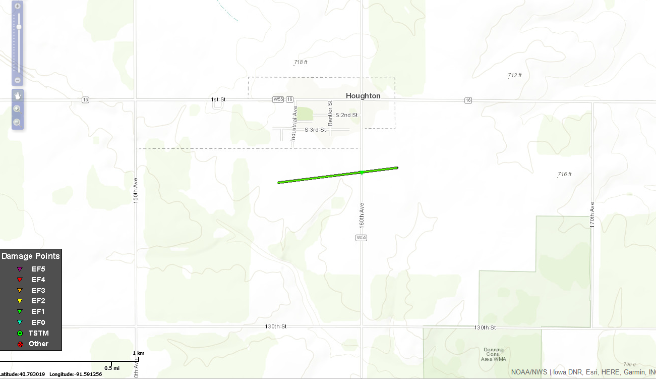
Track Map 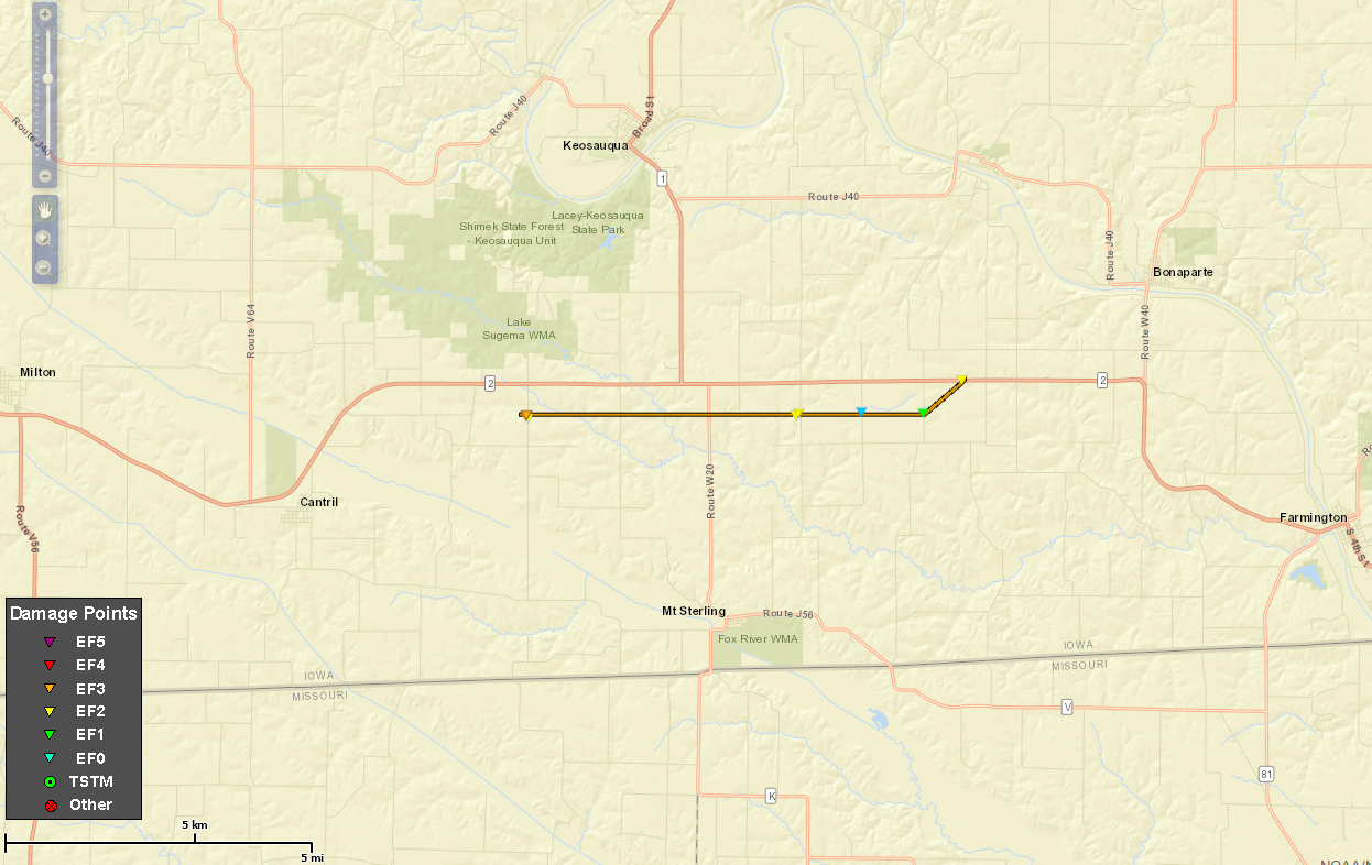 
|
|||||||||||||||||||||||||
|
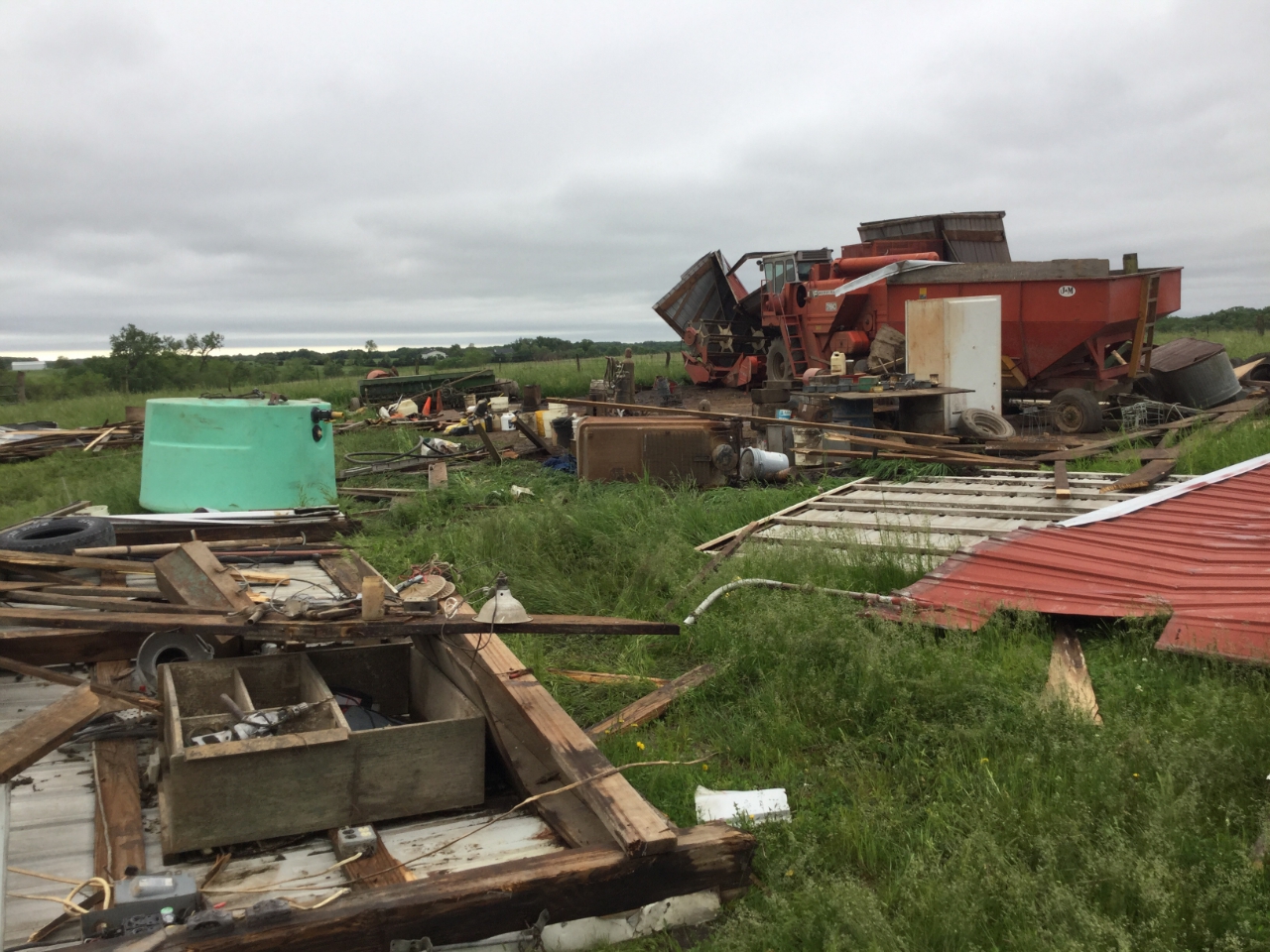
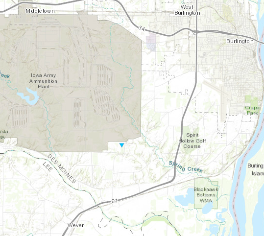
Tornado 2 - Houghton
|
||||||||||||||||
|
Tornado 3 - 3 SW Burlington
|
||||||||||||||||
The Enhanced Fujita (EF) Scale classifies tornadoes into the following categories:
| EF0 Weak 65-85 mph |
EF1 Moderate 86-110 mph |
EF2 Significant 111-135 mph |
EF3 Severe 136-165 mph |
EF4 Extreme 166-200 mph |
EF5 Catastrophic 200+ mph |
 |
|||||
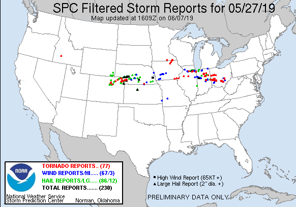
Storm Reports
| Interactive Storm Report Map | SPC Storm Reports |
 |
 |
PRELIMINARY LOCAL STORM REPORT...SUMMARY
NATIONAL WEATHER SERVICE QUAD CITIES IA IL
738 PM CDT MON MAY 27 2019
..TIME... ...EVENT... ...CITY LOCATION... ...LAT.LON...
..DATE... ....MAG.... ..COUNTY LOCATION..ST.. ...SOURCE....
..REMARKS..
0600 PM HEAVY RAIN 1 E CAMANCHE 41.79N 90.26W
05/27/2019 M1.15 INCH CLINTON IA CO-OP OBSERVER
CO-OP OBSERVER STATION CLNI4 CAMANCHE.
0445 PM HEAVY RAIN 1 SE DAVENPORT 41.54N 90.59W
05/27/2019 M1.91 INCH SCOTT IA TRAINED SPOTTER
7 AM TO 4:40 PM. TWO DIFFERENT EVENTS.
0259 PM HEAVY RAIN 1 WNW MORRISON 41.81N 89.98W
05/27/2019 M1.15 INCH WHITESIDE IL TRAINED SPOTTER
6 HR TOTAL.
0256 PM HEAVY RAIN 1 NW DAVENPORT 41.56N 90.62W
05/27/2019 M1.66 INCH SCOTT IA TRAINED SPOTTER
0253 PM HEAVY RAIN 2 E SPRING LAKE 41.52N 90.68W
05/27/2019 M1.47 INCH SCOTT IA PUBLIC
THIS RAIN FELL IN THE LAST 2 HOURS. 1.61
INCHES IN THE PAST 24 HRS.
0215 PM HEAVY RAIN 4 SE MT HAMILL 40.71N 91.57W
05/27/2019 M1.40 INCH LEE IA TRAINED SPOTTER
RAINFALL IN 1/2 HOUR.
0208 PM FLASH FLOOD 2 WNW MOLINE 41.50N 90.52W
05/27/2019 ROCK ISLAND IL TRAINED SPOTTER
16TH AVE BETWEEN 13TH ST AND 14TH ST. WATER
6 INCHES DEEP.
0203 PM TORNADO 1 WSW SPRING GROVE 40.73N 91.19W
05/27/2019 DES MOINES IA TRAINED SPOTTER
SPOTTER OBSERVED A TORNADO TOUCH DOWN
LOOKING NORTH OF LOCATION HEADING TOWARD
SPRING GROVE WHILE ON PHONE WITH NWS. TIME
EXACT.
0200 PM FLASH FLOOD 2 SSE DAVENPORT 41.54N 90.59W
05/27/2019 SCOTT IA TRAINED SPOTTER
17TH AND VINE ST HAS WATER 2.5 FEET DEEP.
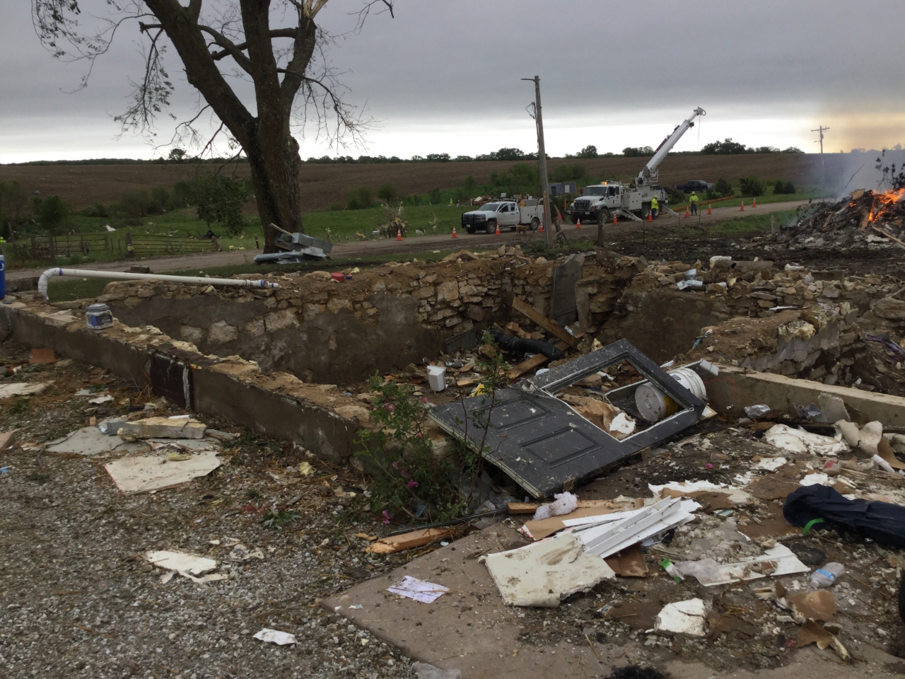
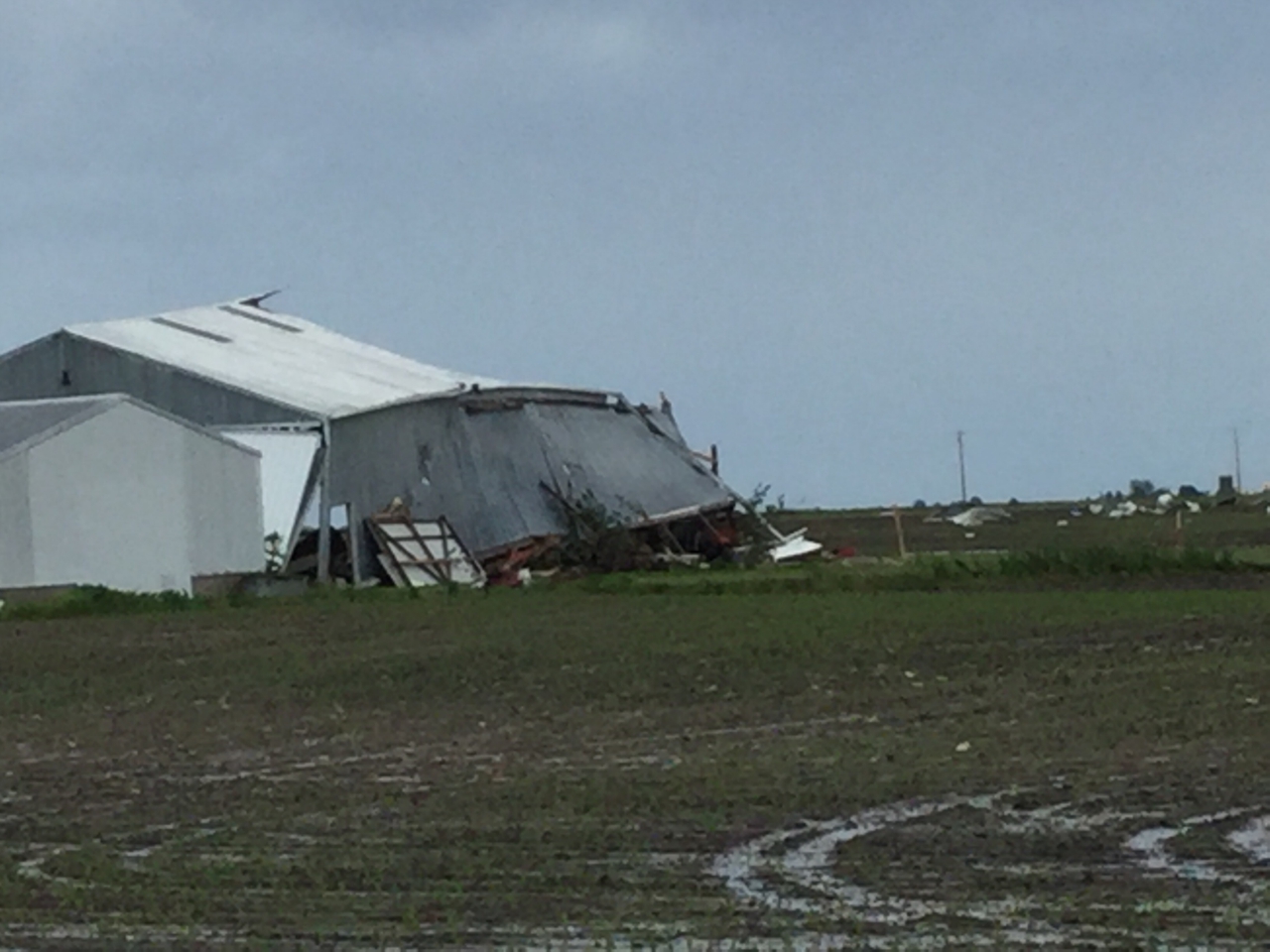
0145 PM TORNADO 1 S HOUGHTON 40.77N 91.61W
05/27/2019 LEE IA EMERGENCY MNGR
TWO BARNS DOWN.
0145 PM HEAVY RAIN 2 SE DAVENPORT 41.54N 90.57W
05/27/2019 U0.00 INCH SCOTT IA TRAINED SPOTTER
TORRENTIAL RAINS IS CAUSING SOME FLOODING ON
E 15TH STREET BETWEEN BRADY ST AND LE CLAIRE
ST. THE WATER IS BETWEEN 6 AND 12 INCHES
DEEP IN SPOTS.
0125 PM TORNADO 4 ENE CANTRIL 40.67N 92.00W
05/27/2019 VAN BUREN IA TRAINED SPOTTER
2 HOUSES DAMAGED OR DESTROYED ON JERSEY AVE
JUST SOUTH OF HIGHWAY 2.
|
|
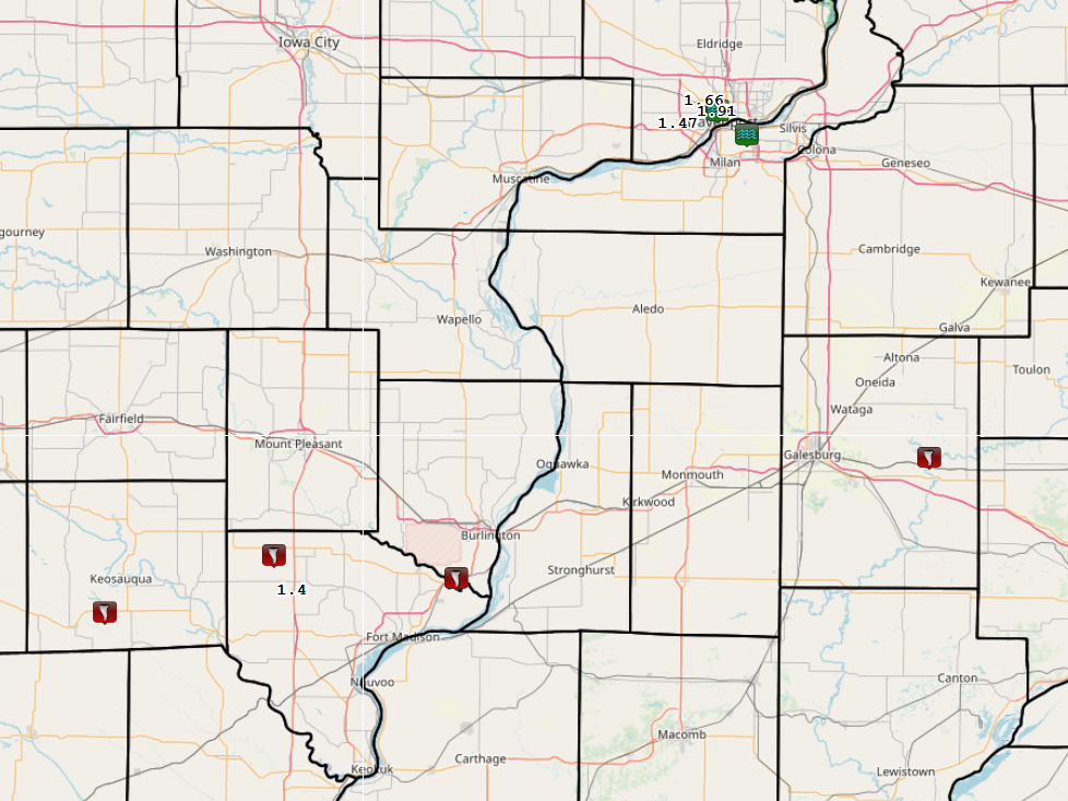
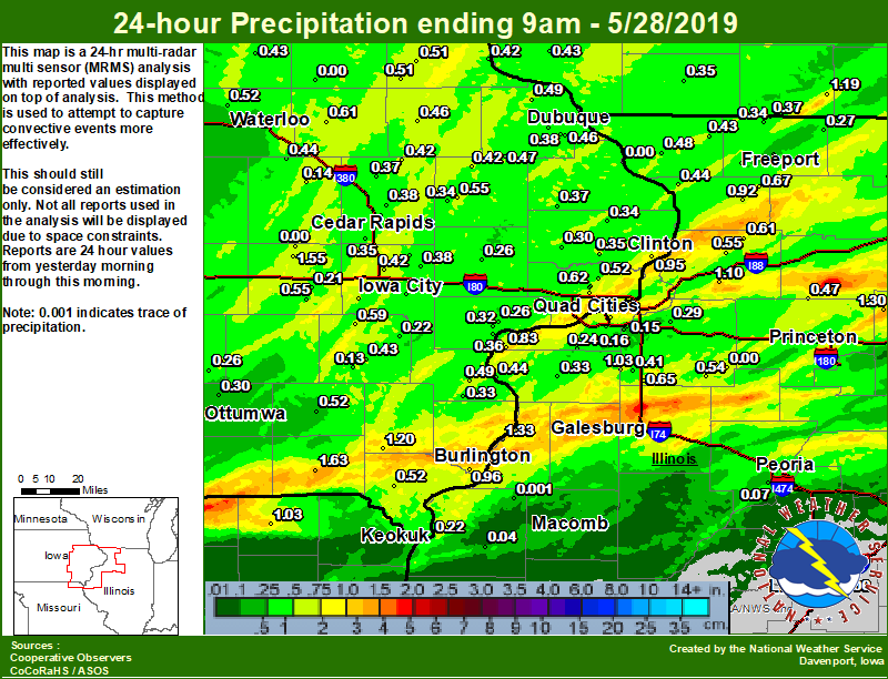
Rain Reports
| Local Rain Map | Regional Rain Map |
 |
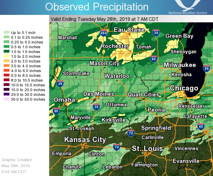 |
24 hour precipitation reports (in Inches),
for eastern Iowa, northwest and west central Illinois,
and northeast Missouri. Reported between Midnight and 9 AM,
Tuesday May 28, 2019.

....IOWA....
Davenport 0.9 WNW                1.91
Keosauqua                        1.63
Marengo                          1.55
Davenport 0.9 SSW                1.54
Salem 1S                         1.20
Bettendorf 1.6 WSW               1.15
Burlington Arpt 2 SW             1.07
Beaconsfield 1 NNE               1.03
Riverdale 0.5 N                  0.97
Burlington 6.5 SSW               0.96
Camanche 1.2 W                   0.95
Bettendorf 2.2 SE                0.94
Eldridge 0.6 S                   0.75
Davenport Arpt 5 N               0.64
Eldridge 0.7 SSW                 0.62
Independence 0.9 WNW             0.61
Wellman 4.0 E                    0.59
Le Claire LD14                   0.57
Parnell 0.1 SSW                  0.55
Anamosa 1.9 SE                   0.55
Waterloo ASOS 5 NW               0.52
Fairfield                        0.52
Park View 0.2 WSW                0.52
Donnellson                       0.52
Elkader 6SSW                     0.51
Strawberry Point                 0.51
Fayette 1 NW                     0.50
Cresco 1 NE                      0.49
Wapello 0.2 S                    0.49
Rickardsville 0.2 W              0.49
Albia 3 NNE                      0.48
Cascade                          0.47
Dubuque Arpt 7 SW                0.46
Manchester                       0.46
Mount Auburn 2.2 NNW             0.44
Centerville 0 NE                 0.44
Dubuque LD11                     0.43
Dubuque #3 7 SW                  0.43
Washington                       0.43
Tripoli 0 N                      0.43
Guttenberg Dam 10                0.42
Solon 0.3 ESE                    0.42
North Liberty 0.7 SSW            0.42
Monticello 1 E                   0.42
Coggon                           0.42
Asbury 0.4 SW                    0.41
Iowa City                        0.41
Boone 1 SSW                      0.39
Marion 1.7 NNW                   0.38
Peosta 2.9 E                     0.38
Iowa City 8.0 NE                 0.38
Maquoketa 4 W                    0.37
Central City 6.7 W               0.37
Muscatine                        0.36
Iowa City Arpt                   0.35
Cedar Rapids Arpt 5 SW           0.35
De Witt                          0.35
Anamosa 3 SSW                    0.34
Charlotte 1.9 WNW                0.34
Morning Sun 1.7 E                0.33
Pella 4 N                        0.32
Fairfax 4.0 NW                   0.32
Muscatine 2.1 N                  0.32
Calamus 2.0 NE                   0.30
Ames US 30 2 SSE                 0.30
Ottumwa ASOS 6 NNW               0.30
Mason City ASOS 6 W              0.30
Brighton                         0.29
Cedar Rapids 2.7 NE              0.29
Kalona 7.3 NNW                   0.28
Grinnell AWOS 2 SSW              0.28
Toledo 3 N                       0.27
Tipton 0.7 N                     0.26
Muscatine 2N                     0.26
Oskaloosa AWOS 9 ESE             0.26
Pella AWOS 2 WSW                 0.26
Rathbun Reservoir 2 N            0.23
Keokuk LD19                      0.22
Ainsworth 7.4 N                  0.22
Marshalltown 1 NW                0.21
Williamsburg                     0.21
Hampton 1 N                      0.20
Vinton                           0.14
Washington 5.8 SW                0.13
Marshalltown ASOS 4 N            0.11
NWS Johnston* 5 NNW              0.08
Bellevue LD12                    0.00
Marengo 3.6 N                    0.00
Oelwein AWOS                     0.00
....ILLINOIS....
Romeoville                       1.63
Gladstone LD18                   1.33
Mendota 2 SE                     1.30
Prophetstown 0.2 SW              1.10
New Windsor 2.0 N                1.03
Lanark 1.6 SSE                   0.92
Moline 0.7 NNE                   0.88
Paw Paw 1 E                      0.86
St Anne                          0.85
Illinois City 6.7 SW             0.83
Galesburg Arpt 3 SW              0.80
Ridott 0.1 NE                    0.68
Shannon 0.2 S                    0.67
Woodhull 0.3 ESE                 0.65
Coleta 1.4 SSW                   0.61
Morrison 3.2 E                   0.55
Galva 2.7 NE                     0.54
Steward                          0.53
Roscoe 2SE                       0.51
Elizabeth                        0.48
Walnut 5.3 ENE                   0.47
New Boston LD17                  0.44
Savanna 4.6 N                    0.44
Stockton 3.4 NNE                 0.43
Alpha 2.3 N                      0.41
Rochelle                         0.41
Rochelle AWOS                    0.37
Orangeville 2.8 NW               0.37
Ill. City LD16 3 WNW             0.35
Winslow 4.3 ESE                  0.34
Aledo                            0.33
Princeton 1.1 SE                 0.32
Princeton                        0.32
Quad City Arpt 3 S               0.30
Geneseo 2.0 NW                   0.29
Rockford ASOS                    0.27
Davis 0.5 N                      0.27
Freeport 2.9 WSW                 0.27
Mundelein                        0.26
Milan 8.8 SSW                    0.24
Freeport 2.0 NW                  0.23
Freeport 1.7 NW                  0.23
Pearl City 0.4 SW                0.23
Freeport                         0.20
Joliet                           0.18
Coal Valley 1.9 SE               0.16
Coal Valley 2.6 E                0.15
Streator 3 SE                    0.13
Ottawa 4 SW                      0.10
Colchester 3.5 NE                0.08
Peoria ASOS                      0.07
Macomb                           0.06
Bentley                          0.04
La Harpe                         0.00
Bloomington Airport              0.00
Decatur Airport                  0.00
Jacksonville AWOS                0.00
Kewanee 1 E                      0.00
Quincy ASOS                      0.00
Lincoln NWS                      0.00
....MISSOURI....
Memphis                          1.03
Kirksville ASOS                  0.44
Columbia                         0.10
Chillicothe 2 NW                 0.01
....WISCONSIN....
La Crosse WFO                    1.65
Viroqua                          1.58
Brodhead 1 SW                    1.19
Prairie du Chien AWOS            0.69
Steuben 4SE 3 NE                 0.67
Beloit-College                   0.59
Allenton-WWTP .6 NW              0.44
Lancaster 4WSW                   0.43
Whitewater                       0.38
Darlington                       0.35
Madison-ASOS                     0.27
Watertown-AWOS                   0.01
....MINNESOTA....
Preston                          1.78
Theilman 1SSW                    1.24
|
|
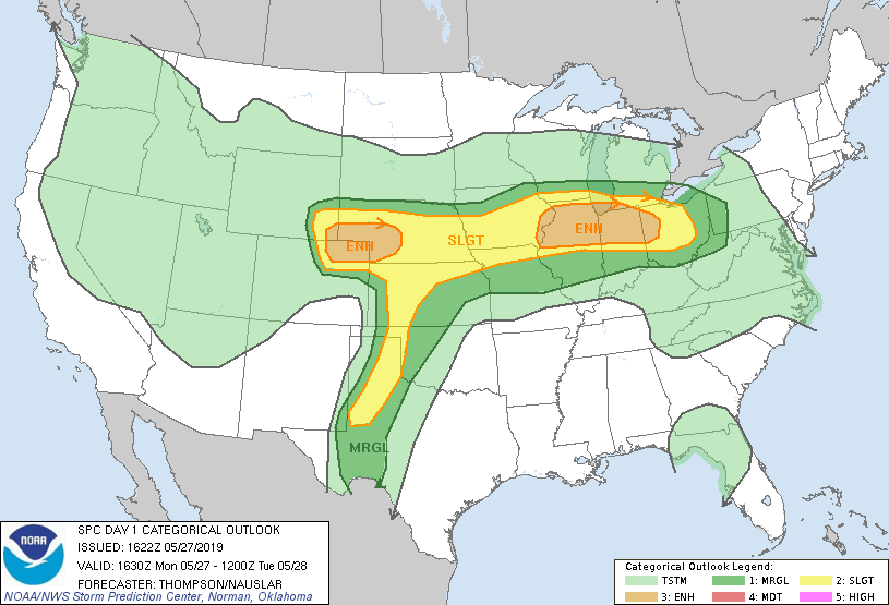
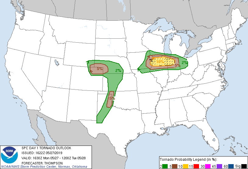
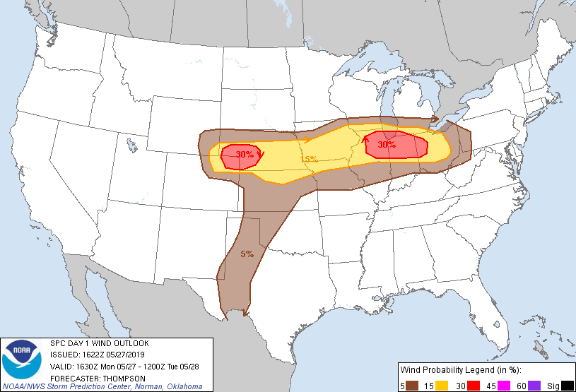
Environment
SPC EVENT REVIEW PAGE: 5/27/2019
 |
 |
 |
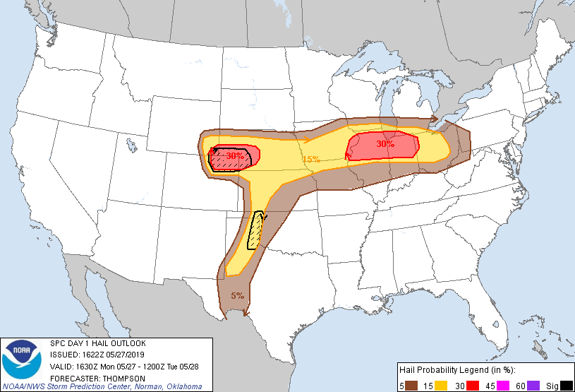 |
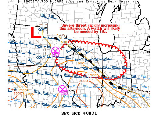
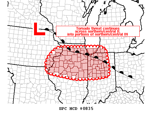
| 1130 AM OUTLOOK | 1130 AM TORNADO OUTLOOK | 1130 AM WIND OUTLOOK | 1130 AM HAIL OUTLOOK |
 |
 |
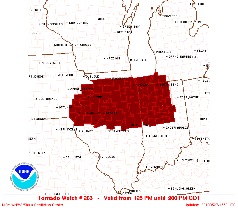 |
| MCD 0831 | MCD 0835 | TORNADO WATCH 263 |
 |
 |
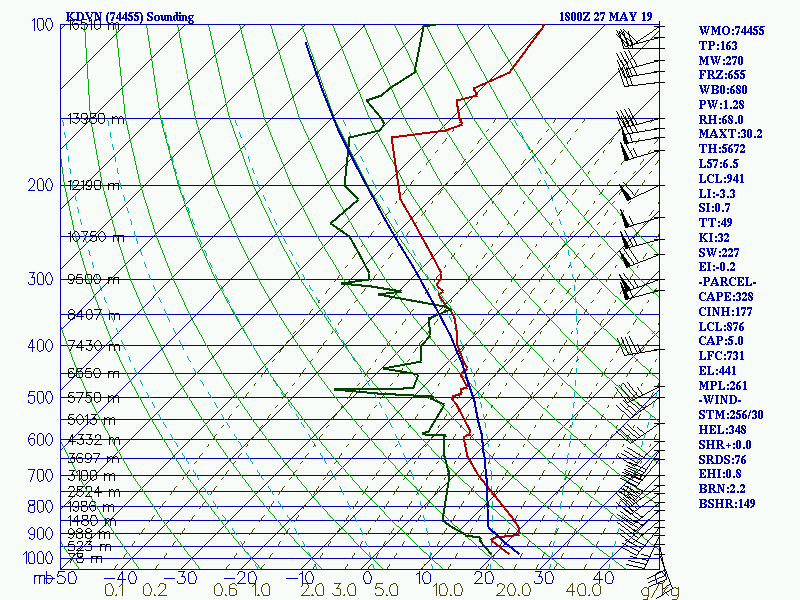
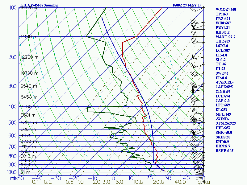
| 7 AM DAVENPORT, IA SOUNDING | 7 AM LINCOLN, IL SOUNDING |
 |
 |
| 1 PM DAVENPORT, IA SPECIAL SOUNDING | 1 PM LINCOLN, IL SPECIAL SOUNDING |
 |
Media use of NWS Web News Stories is encouraged! Please acknowledge the NWS as the source of any news information accessed from this site. |
|