
Life-threatening and locally catastrophic flash and urban flooding is expected across portions of south-central Texas through early Friday, with significant river flooding and rapid rises on small streams, arroyos, and typically dry washes expected. A significant heat wave continues for the Rockies, Northern Plains, and Great Lakes into the Mid-Atlantic, peaking in intensity through midweek. Read More >
Overview
|
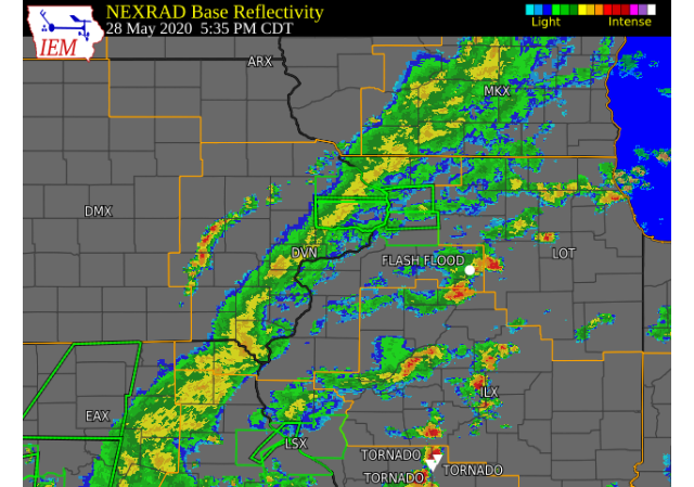
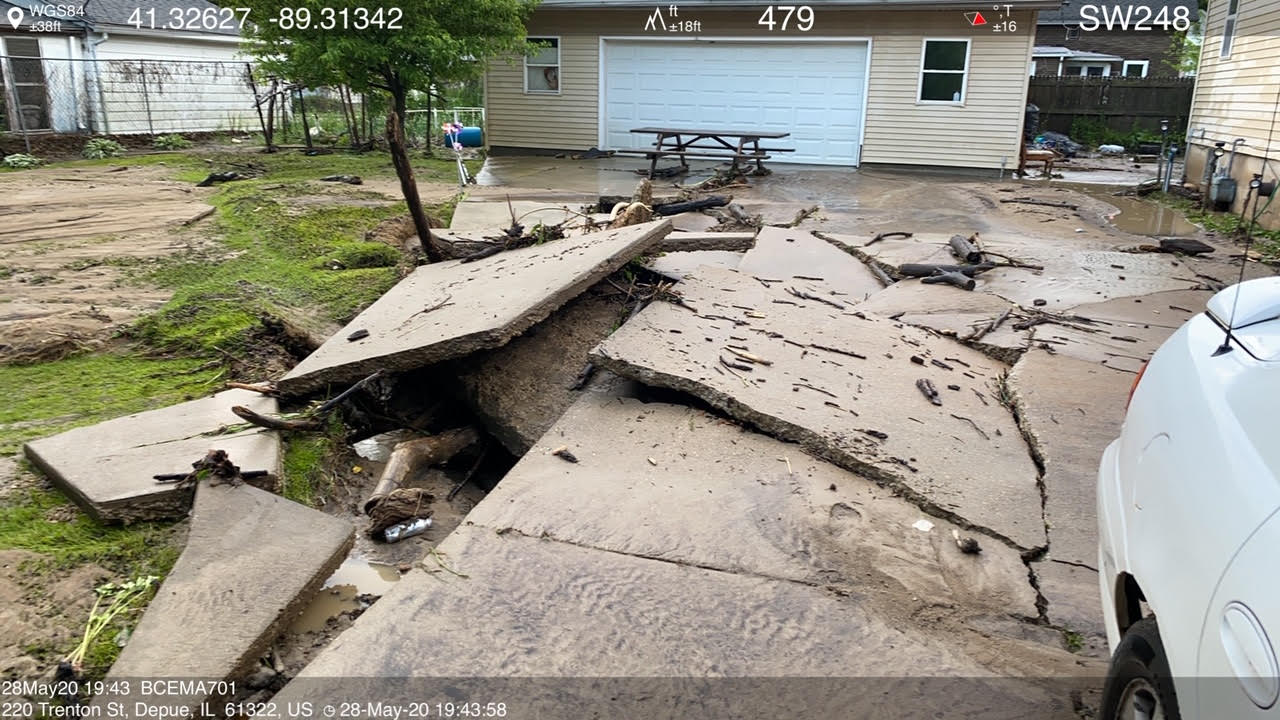
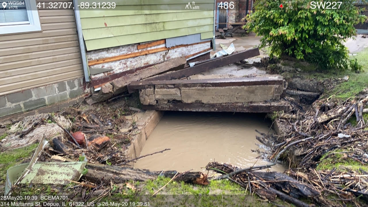
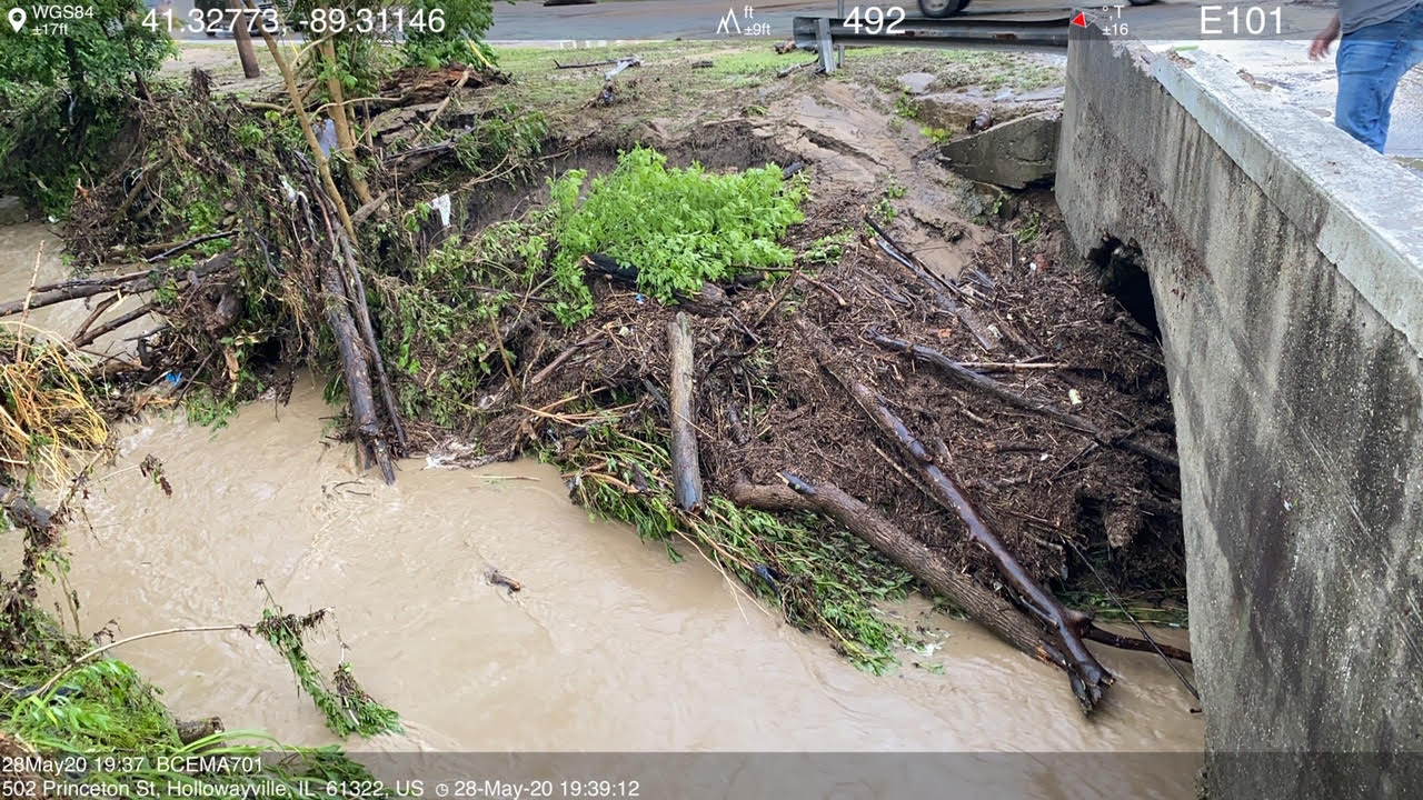
Thunderstorms moved over Bureau County, Illinois during the late afternoon/early evening hours of May 28, 2020. The city of DePue, IL saw approximately 3.00” of rain in 50 minutes which caused high impact flash flooding. Radar interrogation showed the heaviest rains began approximately 4:40 pm and continued through 5:30 pm, with lighter rain continuing beyond 5:30 pm. Public reports indicate that flash flooding began in the city at approximately 5:30pm and by 7:30pm the water had receded.
|
 Interactive Radar Loop |
Flash Flooding
Photos
 |
 |
 |
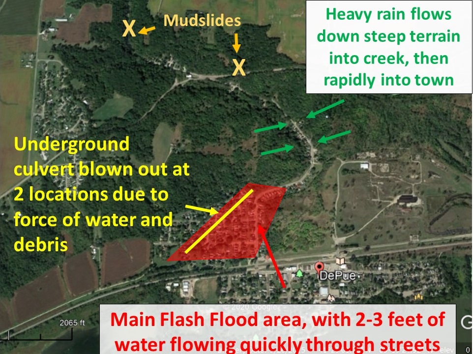 |
| Culvert Blowout | Culvert Blowout | Debris in creek as it enters town | Map |
Storm Reports
PRELIMINARY LOCAL STORM REPORT
NATIONAL WEATHER SERVICE QUAD CITIES IA IL
614 PM CDT FRI MAY 29 2020

..TIME...   ...EVENT...      ...CITY LOCATION...     ...LAT.LON...
..DATE...   ....MAG....      ..COUNTY LOCATION..ST.. ...SOURCE....
            ..REMARKS..

0535 PM     FLASH FLOOD      1 WSW DEPUE             41.33N 89.31W
05/28/2020                   BUREAU             IL   NWS STORM SURVEY

            VERY HEAVY RAINFALL OVER STEEP TERRAIN
            CAUSED SIGNIFICANT FLASH FLOODING IN AND
            NEAR DEPUE, IL LATE THURSDAY AFTERNOON.
            MUDSLIDES BLOCKED ROADWAYS AT TWO LOCATIONS
            NORTH OF DEPUE. THE HEAVY RAIN MOVED RAPIDLY
            DOWN BLUFFS INTO A CREEK, WHICH FLOWED
            RAPIDLY INTO THE TOWN. 2 TO 3 FEET OF WATER
            FLOWED RAPIDLY THROUGH STREETS. THE FORCE OF
            WATER AND DEBRIS ALSO BLEW OUT AN
            UNDERGROUND CULVERT AT 2 LOCATIONS. FLASH
            FLOODING IMPACTED MUCH OF THE NORTHWEST PART
            OF DEPUE. THERE WERE NO INJURIES.
|
 |
Media use of NWS Web News Stories is encouraged! Please acknowledge the NWS as the source of any news information accessed from this site. |
|

