Dangerous and extreme heat will remain across portions of the central U.S. this week, persisting across the mid to lower Mississippi Valley, Gulf Coast, southern Plains and portions of Texas. A heat wave over the Southwest U.S. will peak this weekend. Heavy to excessive rainfall may produce flash flooding from the Delmarva Peninsula north into the Hudson Valley today and tonight. Read More >
Overview
 |
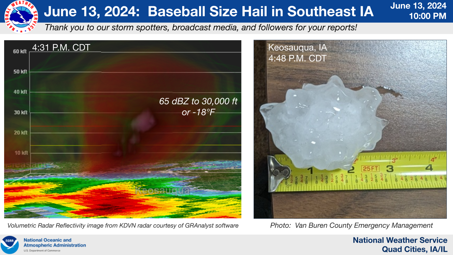 |
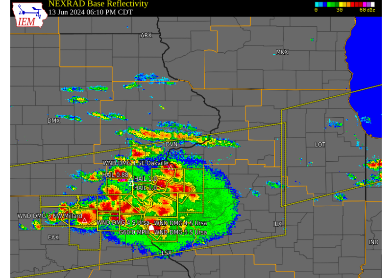
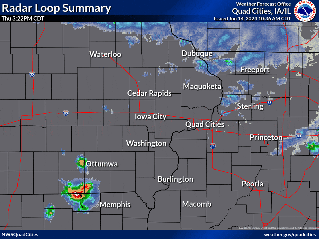
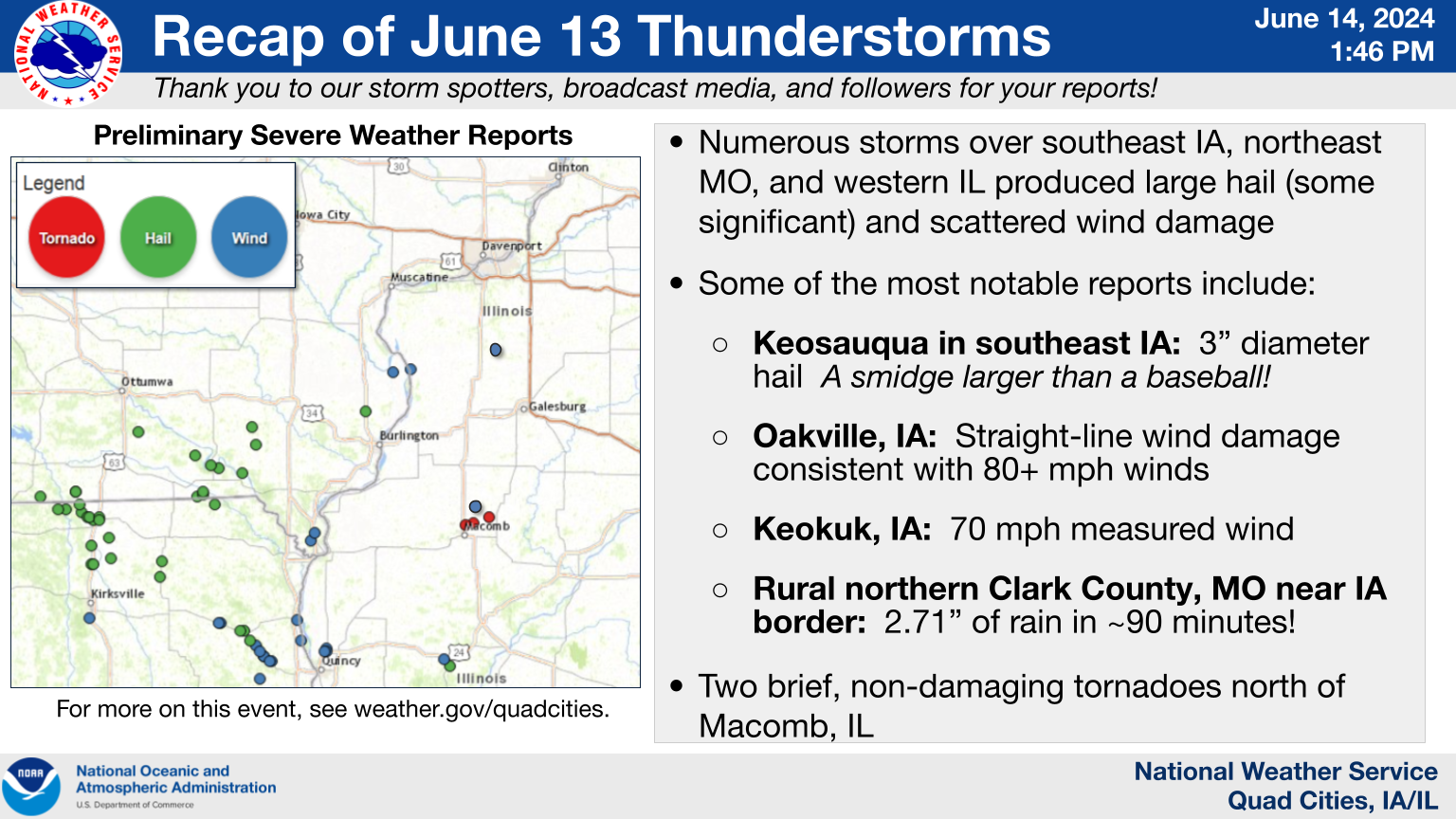
A warm, moist, and unstable air mass across the region ahead of a southward sinking cold front resulted in thunderstorm development, several being severe. These produced large hail and scattered damaging winds. Most hail reports ranged in size from quarter to golf ball size hail. The largest hail fell in Van Buren County near Keosauqua where 2 to 3 inch diameter hail fell. There were also a few reports of 60 to 80 MPH across far southeast Iowa into west central Illinois which damaged trees and knocked down several outbuildings. The most widespread damage occurred near Oakville, IA.
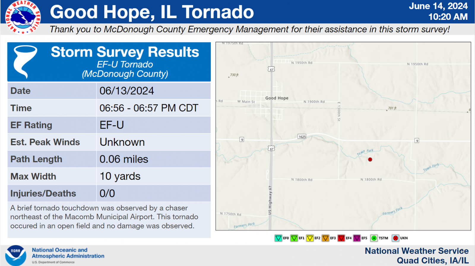
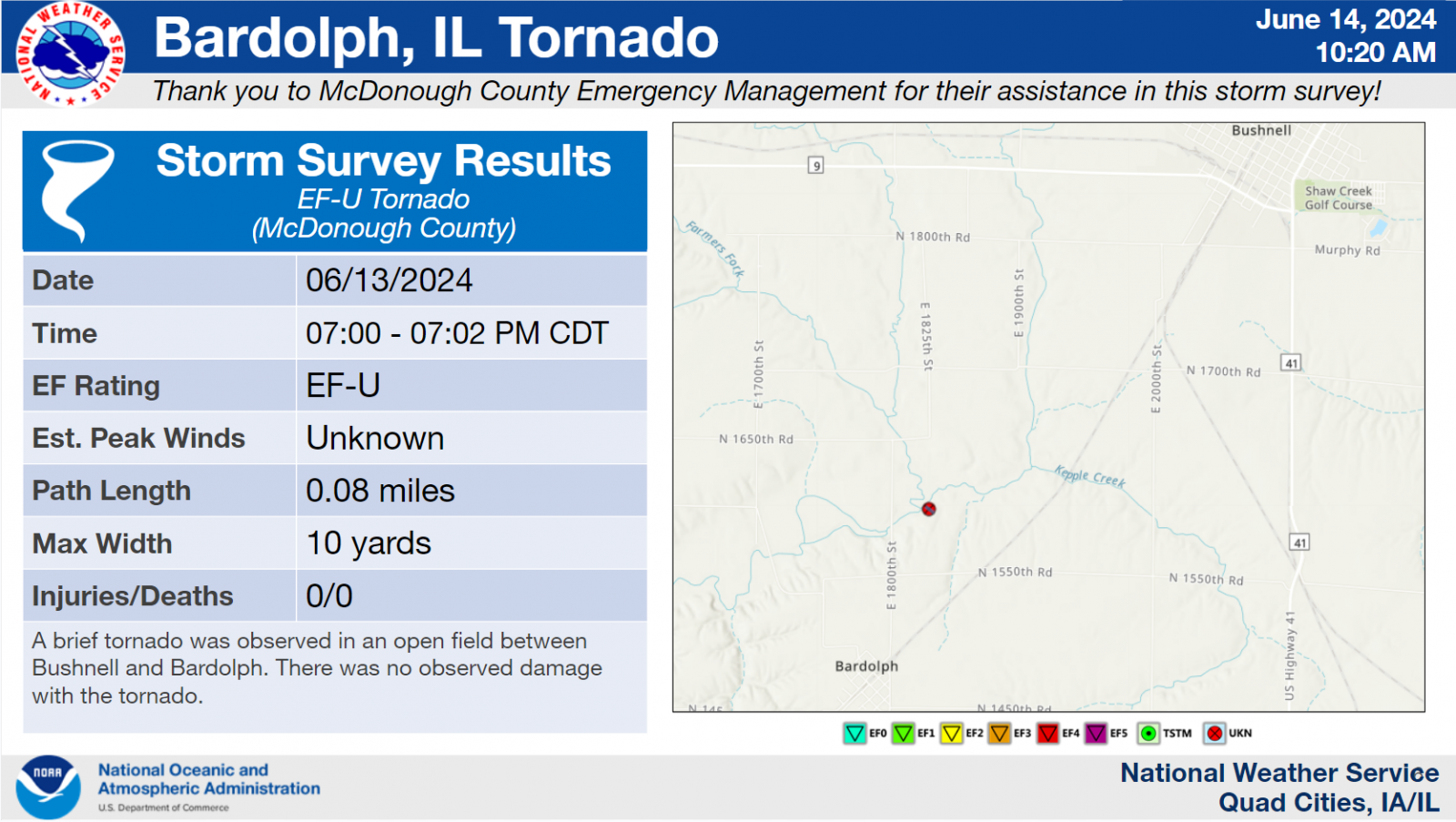
In addition, two brief tornadoes touchdown in northern McDonough County in west central Illinois and did not cause any damage.
Tornadoes
Damage Assessment Toolkit Viewer
The Enhanced Fujita (EF) Scale classifies tornadoes into the following categories:
| EF0 Weak 65-85 mph |
EF1 Moderate 86-110 mph |
EF2 Significant 111-135 mph |
EF3 Severe 136-165 mph |
EF4 Extreme 166-200 mph |
EF5 Catastrophic 200+ mph |
 |
|||||
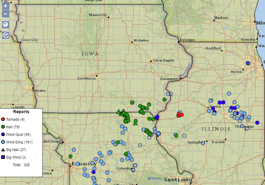
Storm Reports
|
Storm Report Map of County Warning Area and Adjacent Areas Note numbers of reports on key are nationwide totals from June 13 |
|
|
| Interactive Storm Report Map (SPC) |
| Nationwide Storm Report Map Image (SPC) |
Preliminary Local Storm Report...Summary
National Weather Service Quad Cities IA IL
1106 AM CDT Fri Jun 14 2024

..TIME...   ...EVENT...      ...CITY LOCATION...     ...LAT.LON...
..DATE...   ....MAG....      ..COUNTY LOCATION..ST.. ...SOURCE....
            ..REMARKS..

0436 PM     Hail             5 E Bible Grove         40.36N 92.21W
06/13/2024  M1.00 Inch       Scotland           MO   Public

            Corrects previous hail report from 5 E Bible
            Grove. Occurring right now at intersection
            of highway 15 and county T.

0439 PM     Hail             4 NE Lebanon            40.77N 92.04W
06/13/2024  M1.00 Inch       Van Buren          IA   Trained Spotter


0448 PM     Hail             Keosauqua               40.73N 91.96W
06/13/2024  M3.00 Inch       Van Buren          IA   Emergency Mngr

            Photo from county EM of 3 inch hail in
            Keosauqua.

0448 PM     Hail             3 ESE Keosauqua         40.72N 91.92W
06/13/2024  M1.75 Inch       Van Buren          IA   Trained Spotter

            A few golf ball size hail stones found. Time
            estimated by radar.

0453 PM     Hail             Keosauqua               40.73N 91.96W
06/13/2024  E1.75 Inch       Van Buren          IA   Public

            Updated report via mPING near downtown
            Keosauqua.

0454 PM     Hail             Bonaparte               40.70N 91.80W
06/13/2024  E1.50 Inch       Van Buren          IA   Trained Spotter

            VB38 reported ping pong hail.

0539 PM     Tstm Wnd Gst     1 SSW Mooar             40.44N 91.45W
06/13/2024  E70 MPH          Lee                IA   Trained Spotter

            Estimated 60 to 70 mph wind gusts.

0544 PM     Rain             3 ENE Charlie Heath Mem 40.59N 91.84W
06/13/2024  M2.70 Inch       Clark              MO   Trained Spotter

            storm total from Judy.

0546 PM     Tstm Wnd Gst     Keokuk Airport          40.47N 91.43W
06/13/2024  M70 MPH          Lee                IA   AWOS


0613 PM     Hail             4 NNW Hillsboro         40.88N 91.75W
06/13/2024  M0.88 Inch       Van Buren          IA   Trained Spotter


0613 PM     Tstm Wnd Gst     1 ENE Oakville          41.10N 91.03W
06/13/2024  E80 MPH          Louisa             IA   Emergency Mngr

            Roof blown off an unused hog shed. Suspected
            microburst winds. Time estimated from radar.

0615 PM     Tstm Wnd Dmg     1 SE Oakville           41.09N 91.03W
06/13/2024                   Louisa             IA   Public

            Report was relayed by broadcast media. 12
            inch tree broken off about a foot above the
            base. Open farm outbuilding destroyed.
            Pictures shared and show damage in one
            direction. Time of the event was estimated
            using radar.

0622 PM     Hail             2 SSW Hillsboro         40.81N 91.73W
06/13/2024  E1.00 Inch       Van Buren          IA   Public

            Reported via mPING. Time estimated by radar.

0624 PM     Hail             2 SW Hillsboro          40.81N 91.73W
06/13/2024  M1.00 Inch       Van Buren          IA   Public

            Report from mPING: Quarter (1.00 in.).

0630 PM     Tstm Wnd Dmg     Keithsburg              41.10N 90.94W
06/13/2024                   Mercer             IL   Trained Spotter

            Picture of a large branch broken off of a
            hickory tree.

0655 PM     Hail             3 SE Cantril            40.61N 92.03W
06/13/2024  E1.75 Inch       Van Buren          IA   Trained Spotter

            VB73.

0656 PM     Hail             3 W Charlie Heath Memor 40.58N 91.94W
06/13/2024  M1.50 Inch       Clark              MO   Trained Spotter


0656 PM     Tornado          1 ESE Good Hope         40.55N 90.65W
06/13/2024                   McDonough          IL   NWS Storm Survey

            A brief tornado touchdown was observed by a
            chaser northeast of the Macomb Municipal
            Airport. This tornado occurred in an open
            field and no damage was observed. Therefore
            the tornado will be rated EF-Unknown.

0656 PM     Tstm Wnd Dmg     3 N Scottsburg          40.59N 90.60W
06/13/2024                   McDonough          IL   Emergency Mngr

            Power pole knocked down from thunderstorm
            winds. Time estimated from radar.

0701 PM     Tornado          1 N Bardolph            40.51N 90.56W
06/13/2024                   McDonough          IL   NWS Storm Survey

            A brief tornado was observed in an open
            field between Bushnell and Bardolph. There
            was no observed damage with the tornado, and
            therefore has been assigned an EF-Unknown.

0709 PM     Hail             1 SE Dodgeville         40.94N 91.17W
06/13/2024  E1.00 Inch       Des Moines         IA   Storm Chaser


0711 PM     Hail             Wayland                 40.40N 91.58W
06/13/2024  M1.00 Inch       Clark              MO   Public

            delayed report, time estimated from radar.

0712 PM     Hail             3 WNW Mount Sterling    40.63N 92.00W
06/13/2024  E2.00 Inch       Van Buren          IA   Trained Spotter

            VB46.

0720 PM     Hail             3 W Mount Sterling      40.62N 92.00W
06/13/2024  E1.50 Inch       Van Buren          IA   Trained Spotter


0725 PM     Hail             Kahoka                  40.42N 91.72W
06/13/2024  E1.50 Inch       Clark              MO   Public

            Photo of hail larger than a quarter relayed
            via social media. Time estimated by radar.
Rain Reports
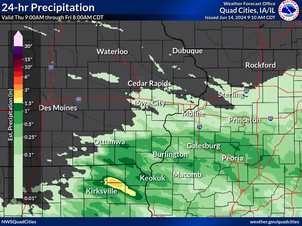
24 hour precipitation reports (in Inches),
for eastern Iowa, northwest and west central Illinois,
and northeast Missouri. Reported between Midnight and 9 AM,
Friday June 14, 2024.

....IOWA....
Danville 2.9 W                   1.73
Keokuk LD19                      1.28
Donnellson                       0.90
New London 1.5 SW                0.88
Hillsboro 5.8 SE                 0.84
Keosauqua                        0.82
Yarmouth 1.9 SW                  0.70
Mt Pleasant 1 SSW                0.68
Morning Sun 1.7 E                0.63
Burlington Arpt                  0.60
Wapello 5.4 SE                   0.54
Fort Madison 0.9 NE              0.53
Burlington 6.5 SSW               0.25
Salem 1S                         0.22
Columbus Jct 2 SSW               0.20
Fort Madison 7.7 N               0.19
Muscatine 3.0 NE                 0.14
Davenport 0.9 WNW                0.08
West Branch 2.3 SSW              0.08
Fairfield                        0.08
Davenport 1.0 NE                 0.07
Davenport 2.1 N                  0.06
....ILLINOIS....
Ogden                            1.62
Galesburg                        1.35
Prairie City 2S                  1.29
Stronghurst 0.4 SSW              1.21
Ottawa 4 SW                      0.80
Gladstone LD18                   0.61
Galva 0.9 SE                     0.60
Bentley                          0.59
Streator 3 SE                    0.51
St Anne                          0.43
Lincoln NWS                      0.41
Bloomington Airport              0.34
Joliet Arpt                      0.33
Monmouth 0.4 SE                  0.28
Augusta                          0.28
Quincy Arpt                      0.26
Windsor                          0.25
New Boston LD17                  0.25
Peoria Arpt                      0.23
Aledo                            0.22
McNabb 1.4 NW                    0.20
Jacksonville 2E                  0.20
Warsaw 5.8 SE                    0.17
Decatur Airport                  0.17
Ill. City LD16 3 WNW             0.15
Colona 0.5 ESE                   0.12
Romeoville                       0.12
Moline 0.7 NNE                   0.11
....MISSOURI....
Kahoka 5.2 ESE                   1.01
Kahoka 0.6 S                     0.75
Kirksville Arpt                  0.56
Outlooks and Environment
Storm Prediction Center Outlooks
 |
 |
 |
 |
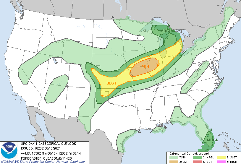
| SPC Day 1 1630z Outlook |
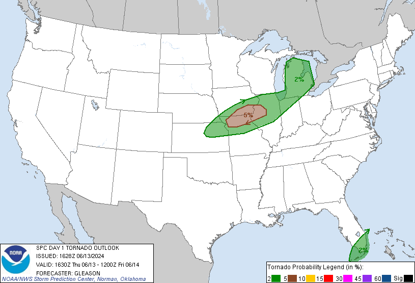
Tornado Risk Probabilities
|
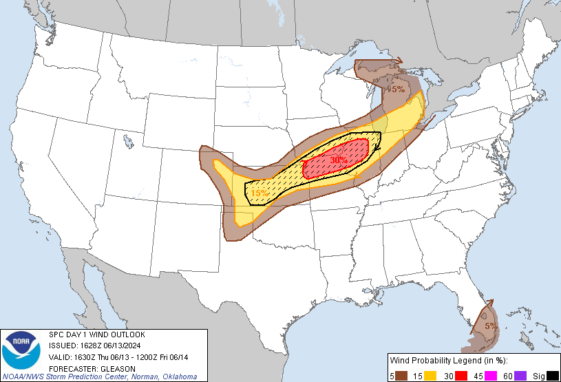
Severe Wind Risk Probabilities **Sig Severe Likely** |
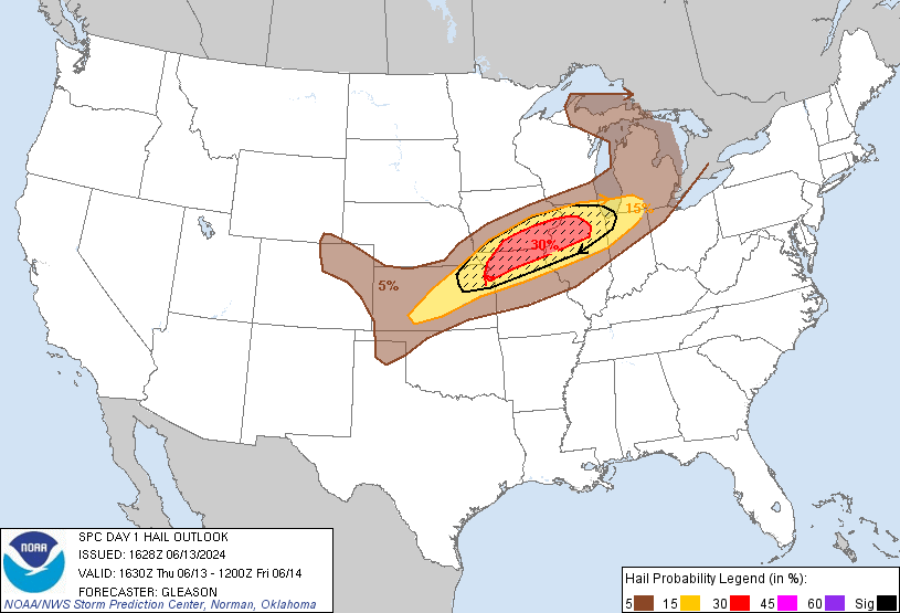
Severe Hail Risk Probabilities **Sig Severe Likely** |
Watches and Mesoscale Discussions
 |
 |
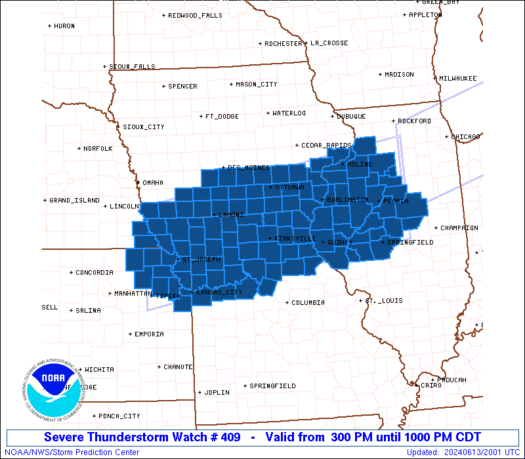 |
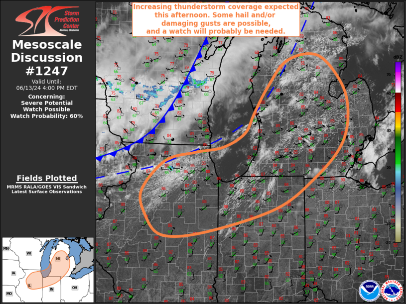
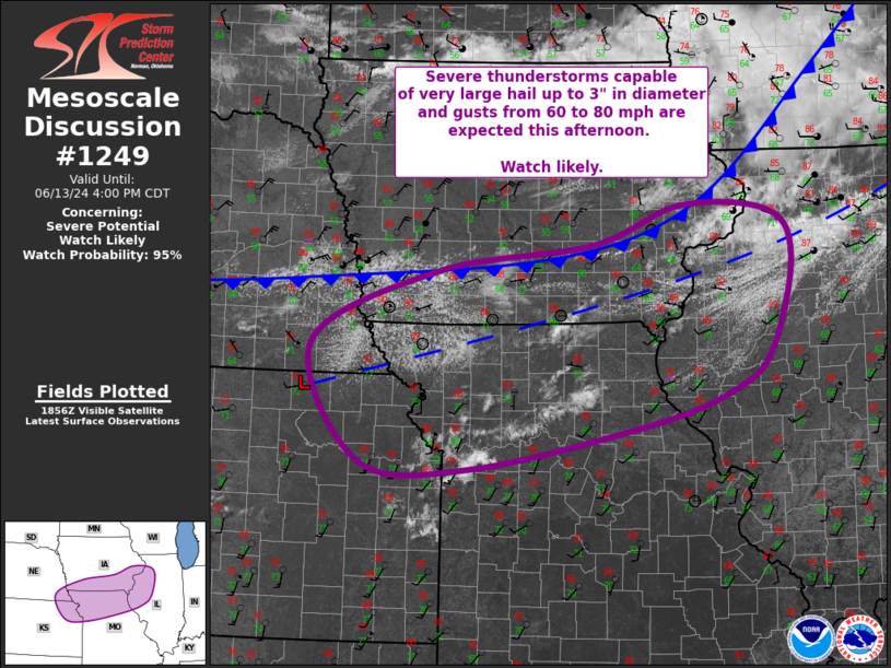
| Mesoscale Discussion #1247 | Mesoscale Discussion #1249 | Severe Thunderstorm Watch #409 |
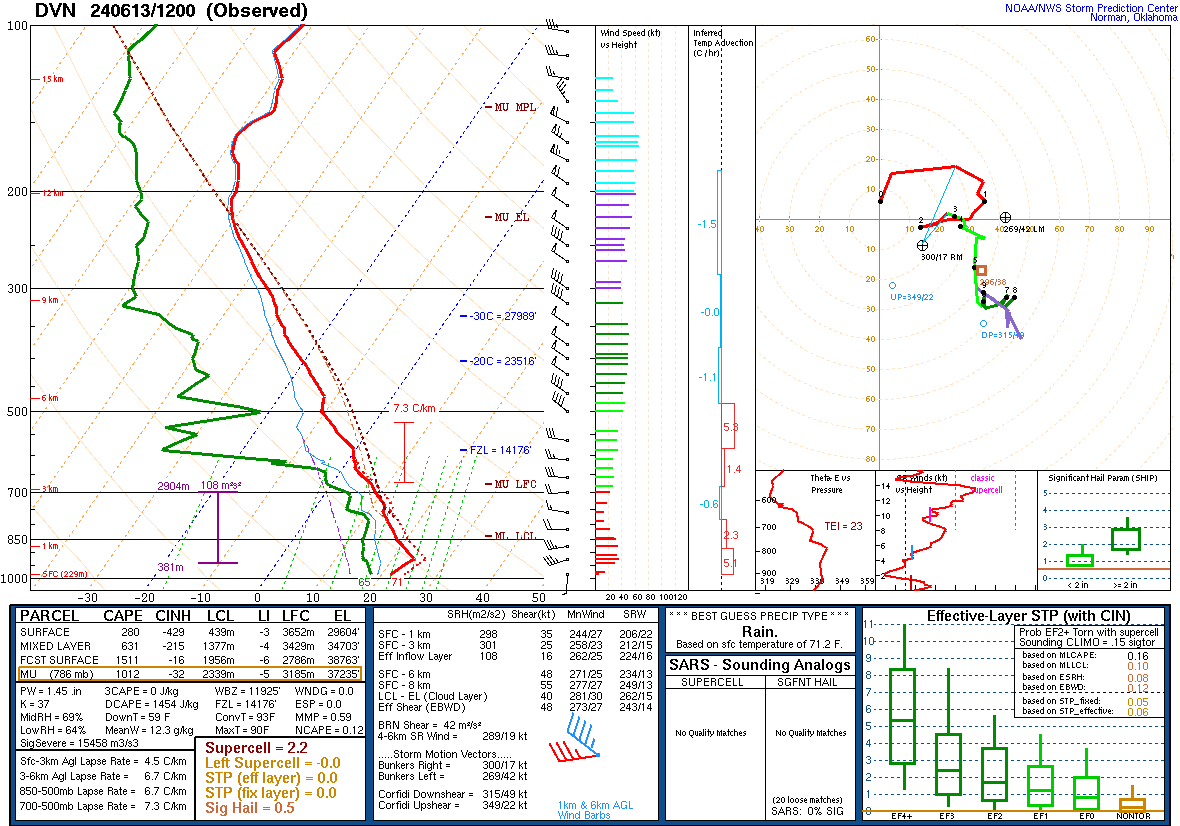
Local Soundings at DVN
 |
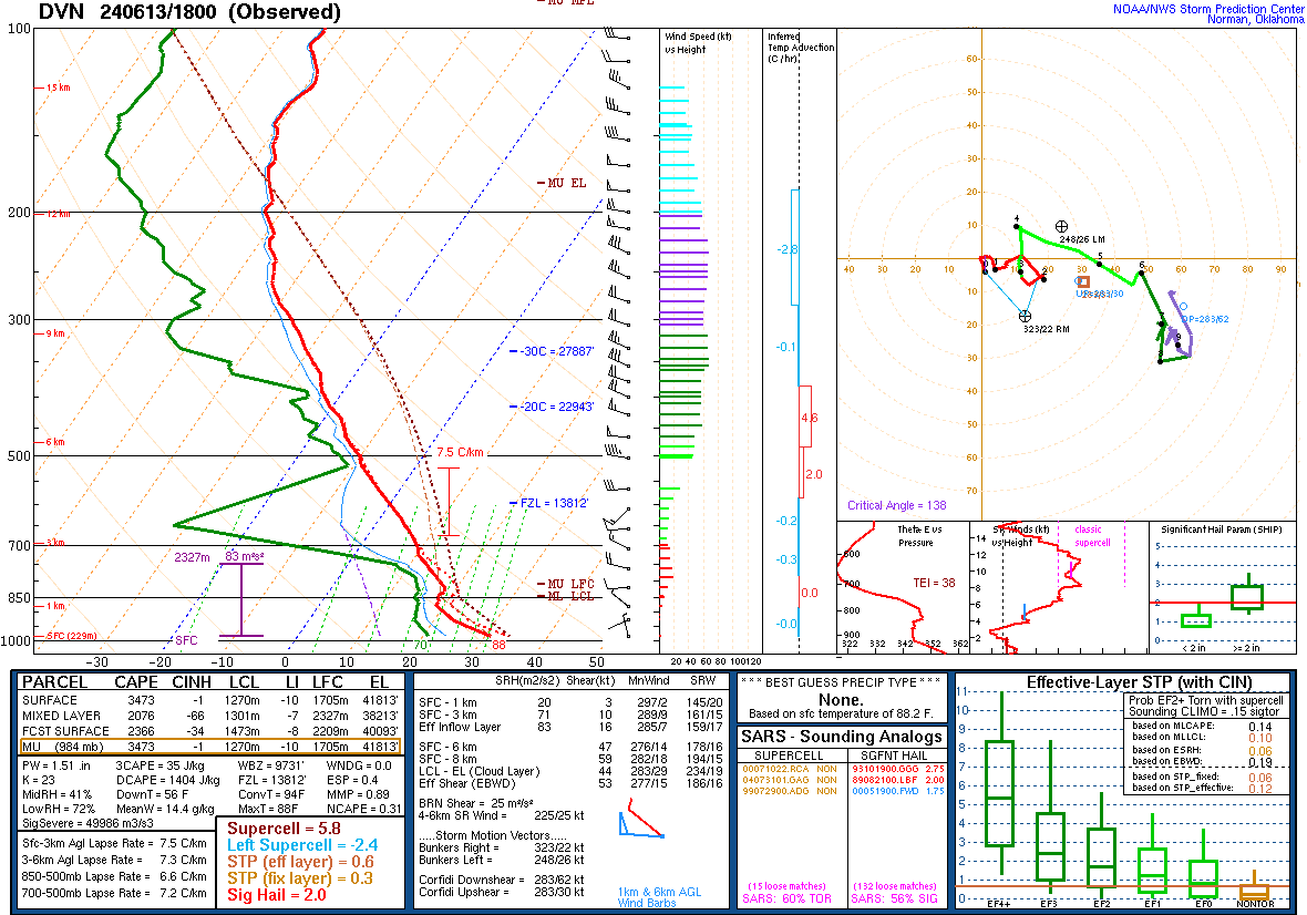 |
| 06/13/2024 - 7:00 am | 06/13/2024 - 1:00 pm |
Synoptic Environment
.gif) |
.gif) |
.gif) |
 |
| 500 mb Chart | 700 mb Chart | 850 mb Chart | Surface Chart |
Mesoscale Environment
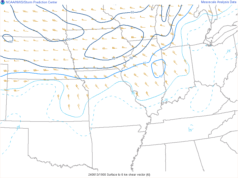 |
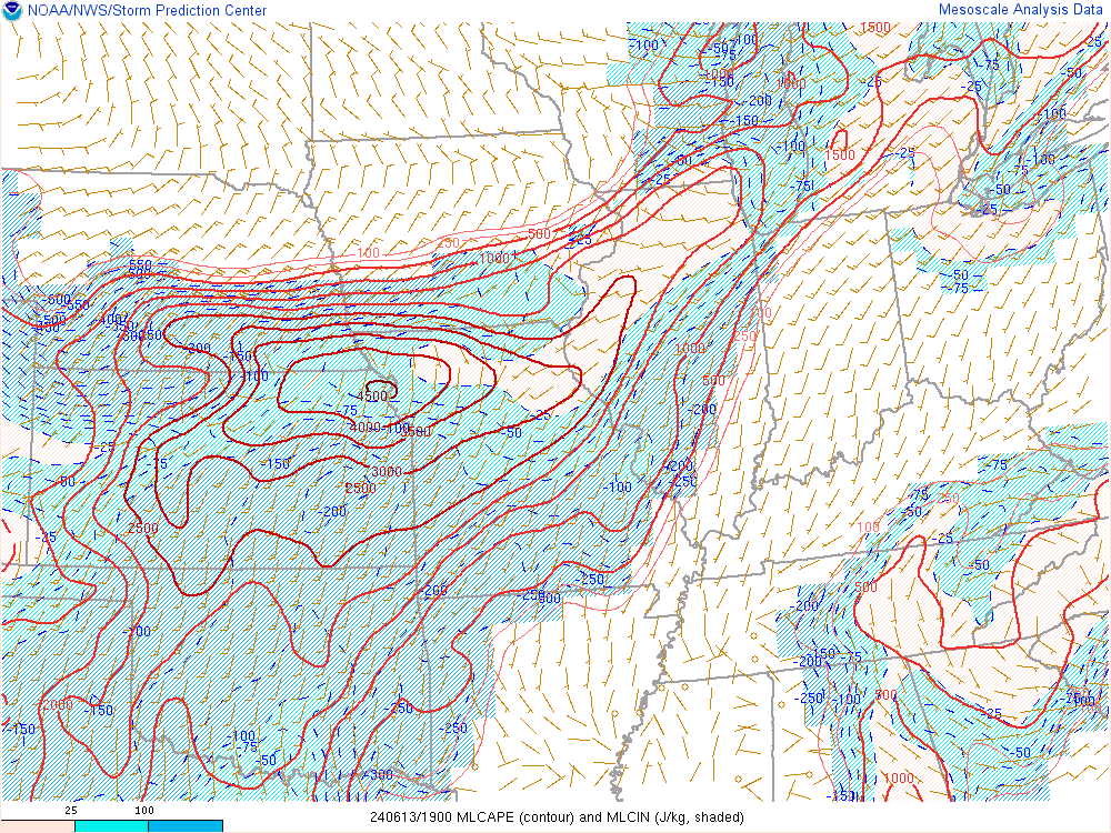 |
 |
 |
|
0-6 km Wind Shear Favorable for Organized Convection |
Instability Favorable for Organized Convection |
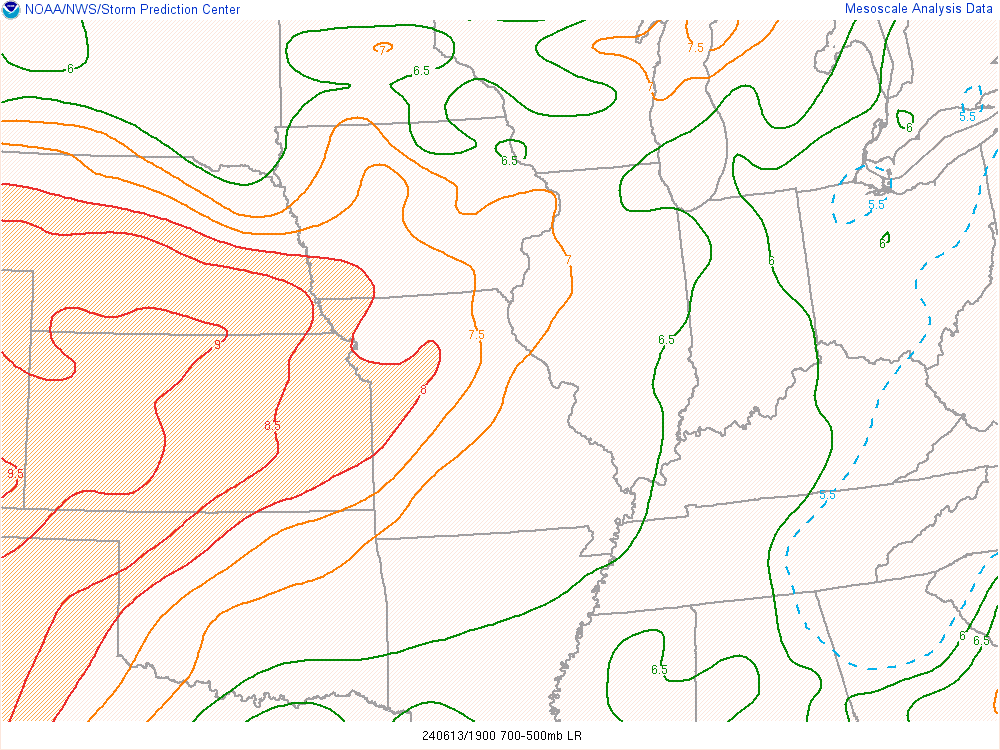
Midlevel Lapse Rates Favorable for Large Hail |
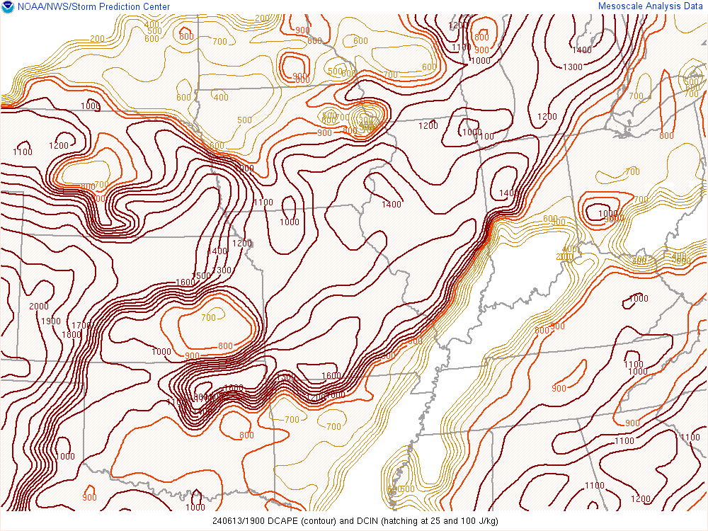
Downdraft CAPE Favorable for Strong Downdrafts |
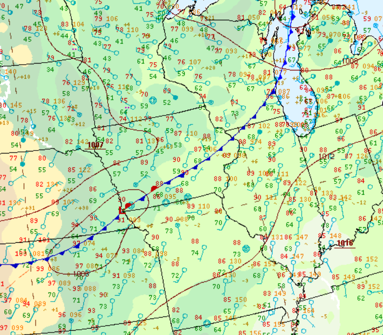
Surface Weather
 |
|
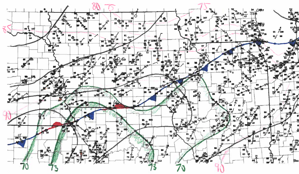
20Z / 3 PM CDTSurface Weather Map Slow moving frontal boundary moving into a warm, moist, and unstable air mass. |
 |
Media use of NWS Web News Stories is encouraged! |
|