Severe thunderstorms capable of damaging winds will be possible from the Ozark Plateau east into the Tennessee Valley Saturday. Rounds of heavy thunderstorms ahead of a slow moving front will continue locally heavy rainfall and scattered flash flooding potential from the Ozarks to the Ohio and Tennessee Valleys Saturday. Extreme heat will continue for the Intermountain West and Plains. Read More >
Overview
|
A strong storm system for mid-June brought two rounds of thunderstorms on Wednesday, June 17th. The most pronounced one was the morning storms that brought damaging winds (some significant), heavy rain, and three EF-1 tornadoes. The tornadoes were in / near:
Many trees fell and power lines were damaged, along with several reports of flash flooding. There were also 4-5 train cars that were pushed off the railroad just south of Monmouth, IL in Warren County due to significant straight-line winds (estimated near 100 mph). Additional train cars derailed as a result of these cars being blown off. From our local media partners, here is footage of the derailed train cars in Monmouth, IL: KWQC WQAD More on the NWS Central Illinois Tornadoes. |
 Recap of the Wednesday, June 17th, morning severe storms |
Tornadoes
Select a tornado from the table to zoom into the track and view more information. The default table view is limited to 8 tracks, but can be scrolled by a mouse wheel or dynamically expanded. Additionally, the table can fill the entire window by clicking the small circular expanding arrow icon at the very top right of the table and returned to its original size by clicking the button again. The side information panel that opens over the map can be closed using the "X" on the upper right corner of the pop-up. Zoom into the map and click damage points to see detailed information and pictures from the surveys.
Final Public Information Statement on June 17th Event Damage Surveys
NOTE: Tornadoes that crossed NWS Service Areas will not appear in the tornado dashboard (table) below, but will on the map.
|
NOTE: times shown below are local to your device's time zone. |

The Enhanced Fujita (EF) Scale classifies tornadoes into the following categories:
| EF0 Weak 65-85 mph |
EF1 Moderate 86-110 mph |
EF2 Significant 111-135 mph |
EF3 Severe 136-165 mph |
EF4 Extreme 166-200 mph |
EF5 Catastrophic 200+ mph |
 |
|||||
| Tornadoes that fail to impact any ratable damage indicators on the EF-Scale are rated EF-Unknown (EF-U) | |||||
Storm Reports
 |
Preliminary Local Storm Report...Summary
National Weather Service Quad Cities IA IL
559 PM CDT Thu Jun 18 2026
..TIME... ...EVENT... ...CITY LOCATION... ...LAT.LON...
..DATE... ....MAG.... ..COUNTY LOCATION..ST.. ...SOURCE....
..REMARKS..
0633 AM Tstm Wnd Gst 3 SW Koszta 41.80N 92.23W
06/17/2026 M63 MPH Iowa IA Mesonet
0638 AM Tstm Wnd Gst 2 SE Van Horne 41.99N 92.06W
06/17/2026 E74 MPH Benton IA Mesonet
0638 AM Tstm Wnd Gst Blairstown 41.91N 92.08W
06/17/2026 E65 MPH Benton IA Mesonet
0652 AM Tstm Wnd Gst 1 ESE Walford 41.88N 91.83W
06/17/2026 M75 MPH Linn IA Mesonet
0701 AM Tstm Wnd Gst Cedar Rapids Municipali 41.88N 91.71W
06/17/2026 M78 MPH Linn IA ASOS
0701 AM Tstm Wnd Dmg 2 SE Atkins 41.97N 91.83W
06/17/2026 Benton IA Emergency Mngr
tree snapped at location.
0704 AM Tstm Wnd Gst 2 NW North Liberty 41.76N 91.62W
06/17/2026 E60 MPH Johnson IA Trained Spotter
0704 AM Tstm Wnd Dmg 1 NNW North Liberty 41.75N 91.61W
06/17/2026 Johnson IA Broadcast Media
Tree fell and damaged fence on Washington
Ave.
0705 AM Tstm Wnd Dmg North Liberty 41.75N 91.61W
06/17/2026 Johnson IA Trained Spotter
Large tree down with limbs 6 to 8 inches in
diameter.
0711 AM Tstm Wnd Gst 2 NW North Liberty 41.76N 91.62W
06/17/2026 E70 MPH Johnson IA Public
0711 AM Tstm Wnd Dmg 1 SE Walford 41.88N 91.83W
06/17/2026 Linn IA Emergency Mngr
Firework sales tent collapsed.
0714 AM Tstm Wnd Gst 1 N North Liberty 41.75N 91.61W
06/17/2026 M64 MPH Johnson IA Mesonet
0715 AM Tstm Wnd Gst 3 E Cedar Rapids 41.97N 91.61W
06/17/2026 E70 MPH Linn IA Trained Spotter
Estimated wind gust. Torrential rainfall
also occurring at time of report.
0716 AM Rain 1 N Ely 41.89N 91.59W
06/17/2026 M1.70 Inch Linn IA Trained Spotter
0723 AM Tornado Pekin 41.16N 92.17W
06/17/2026 Jefferson IA NWS Storm Survey
A brief EF1 tornado, with peak winds of 90
mph, developed just south of Pekin, IA,
impacting areas from Pekin Community Schools
east-southeast towards Linby, IA. Damage was
noted to trees along the path, along with
some structural damage to outbuildings and
to the softball fields.
0729 AM Flash Flood 3 WSW Cedar Rapids 41.95N 91.73W
06/17/2026 Linn IA Trained Spotter
2 to 3 feet deep water with a car stuck at
location.
0740 AM Tstm Wnd Gst Lowden 41.86N 90.93W
06/17/2026 E60 MPH Cedar IA CO-OP Observer
0740 AM Flash Flood 1 E Ainsworth 41.29N 91.53W
06/17/2026 Washington IA Trained Spotter
Water flowing on the road eastbound off Hwy
218 near Aisnworth 2 to 3 inches deep from
fields.
0741 AM Flash Flood 2 NE Cedar Rapids 41.99N 91.64W
06/17/2026 Linn IA Trained Spotter
6 to 10 inches of water running across the
roads in the area including 19th St SE and
2nd Ave SE. Cars driving through are
stalling out. Delayed report.
0751 AM Rain 2 NE Muscatine 41.44N 91.05W
06/17/2026 M1.39 Inch Muscatine IA Trained Spotter
0800 AM Tstm Wnd Dmg 2 NNW Dodgeville 40.97N 91.19W
06/17/2026 Des Moines IA Trained Spotter
Utility poles and power lines down, time
estimated from radar.
0800 AM Tstm Wnd Dmg Mediapolis 41.01N 91.17W
06/17/2026 Des Moines IA Public
Multiple power lines down in town, tree down
on a house.
0801 AM Flash Flood 2 ENE Muscatine 41.43N 91.04W
06/17/2026 Muscatine IA Emergency Mngr
Mad Creek flooded over roadway. Vehicle
drove into flood waters and was swept away.
Also flooding at 10th and Sycamore.
0805 AM Tstm Wnd Dmg Mediapolis 41.01N 91.16W
06/17/2026 Des Moines IA Public
tree down on house along with many
powerlines down.
0807 AM Tstm Wnd Dmg 1 NNW Burlington 40.82N 91.13W
06/17/2026 Des Moines IA Public
Trees and power lines down, time estimated
from radar.
0808 AM Tstm Wnd Dmg 1 WNW Bettendorf 41.57N 90.50W
06/17/2026 Scott IA NWS Employee
4 inch diameter branch down. time estimated
on radar.
0810 AM Tstm Wnd Dmg 3 NNE Oquawka 40.99N 90.90W
06/17/2026 Henderson IL Public
Several large trees uprooted, some over 2 ft
in diameter. Likely 80 mph or higher wind
gusts based on degree of damage.
0814 AM Tstm Wnd Gst 1 S Moline 41.47N 90.49W
06/17/2026 E60 MPH Rock Island IL Trained Spotter
0814 AM Tstm Wnd Dmg 1 SSE Burlington 40.79N 91.11W
06/17/2026 Des Moines IA Public
Trees down with one on a home. Time
estimated from radar.
0815 AM Tstm Wnd Gst Moline Quad-City Airpor 41.45N 90.50W
06/17/2026 M69 MPH Rock Island IL ASOS
0815 AM Tstm Wnd Gst 1 SE Beaverdale 40.85N 91.21W
06/17/2026 M61 MPH Des Moines IA Trained Spotter
Awning blown off mobile home. Still had 45
to 50 mph winds 10 minutes later.
0819 AM Tstm Wnd Dmg Little York 41.01N 90.75W
06/17/2026 Warren IL NWS Storm Survey
Widespread winds of 80 to 100 mph occurred
across Warren County, starting near Little
York, where 14 utility poles on the south
side of Little York were downed and snapped.
Tree damage was also noted throughout town.
0821 AM Tstm Wnd Gst 1 SE Burlington Regiona 40.78N 91.12W
06/17/2026 M58 MPH Des Moines IA ASOS
0821 AM Tstm Wnd Gst 1 SSE Rozetta 40.94N 90.86W
06/17/2026 E58 MPH Henderson IL Mesonet
0822 AM Tstm Wnd Dmg 2 E Kirkwood 40.86N 90.71W
06/17/2026 Warren IL Trained Spotter
Tree tops snapped at the location.
0823 AM Tstm Wnd Gst Biggsville 40.85N 90.86W
06/17/2026 E60 MPH Henderson IL Trained Spotter
0825 AM Tornado Monmouth 40.91N 90.65W
06/17/2026 Warren IL NWS Storm Survey
A short-lived EF-1 tornado developed in
Monmouth Illinois and tracked southeast
through town for 1.3 miles, with estimated
maximum winds of 100 mph. Along the tornado
path, structural damage was observed in the
heart of Monmouth, along with widespread
damage to trees.
0828 AM Tstm Wnd Gst 1 NNE New Windsor 41.22N 90.44W
06/17/2026 E60 MPH Mercer IL Mesonet
0830 AM Tstm Wnd Dmg Ormonde 40.86N 90.60W
06/17/2026 Warren IL NWS Storm Survey
Widespread winds of 80 to 100 mph occurred
across Warren County, starting near Little
York and tracking southeast through Ormonde.
Through this stretch, widespread tree and
utility pole damage was noted, along with
the derailment of train cars in Ormonde.
0839 AM Tstm Wnd Gst 1 ESE Cambridge 41.30N 90.17W
06/17/2026 M73 MPH Henry IL Emergency Mngr
0843 AM Tstm Wnd Dmg 2 WSW Gerlaw 40.97N 90.64W
06/17/2026 Warren IL Trained Spotter
Spotter reports widespread tree damage
across northern Warren County with many
whole trees down and large branches down.
0900 AM Flash Flood Fairfield 41.01N 91.97W
06/17/2026 Jefferson IA Law Enforcement
Grimes Ave between the 600 block and 800
block was flooded and barricaded. Time
estimated.
0905 AM Tornado 3 SW Keokuk 40.38N 91.45W
06/17/2026 Lee IA NWS Storm Survey
A brief EF1 tornado uniquely tracked across
three states. This developed just in Lee
County, Iowa, with peak winds of 105 mph,
and tracked southeast through Clark County,
Missouri. It then continued across the
Mississippi River into Hancock County,
Illinois, impacting northern parts of
Warsaw. Much of the damage was noted to
trees, with some damage to canopies at two
nearby gas stations.
0917 AM Rain 2 NW North Liberty 41.76N 91.62W
06/17/2026 M1.31 Inch Johnson IA Trained Spotter
0921 AM Rain 2 NE New Windsor 41.23N 90.44W
06/17/2026 M1.56 Inch Henry IL Trained Spotter
Rainfall past 2 hrs.
0924 AM Rain 1 W Sigourney 41.34N 92.22W
06/17/2026 M1.63 Inch Keokuk IA Trained Spotter
since 7 am, 1.34 inches in 30 min.
0930 AM Rain 1 NE Hiawatha 42.05N 91.68W
06/17/2026 M2.00 Inch Linn IA Trained Spotter
Duration from 6am to 930am.
0941 AM Rain 1 SW Muscatine Municipa 41.36N 91.16W
06/17/2026 U1.50 Inch Muscatine IA Trained Spotter
Corrects previous rain report from 1 SW
Muscatine Municipality. Rainfall from the
morning storms.
0945 AM Flash Flood 3 W Cedar Rapids 41.97N 91.73W
06/17/2026 Linn IA Public
Wiley Blvd NW is closed north of Johnson Ave
NW due to flooding. Also, flooding reported
at 33rd Ave SW and 6th St. SW.
0957 AM Flash Flood Letts 41.33N 91.23W
06/17/2026 Louisa IA Public
Road closed due to flooding. Person reported
this is the worst flooding they have seen at
this location in a long time.
1000 AM Flash Flood 2 NNW Taylor Ridge 41.42N 90.68W
06/17/2026 Rock Island IL Law Enforcement
77th St W closed due to flooding. Delayed
report with time estimated.
1003 AM Rain Belle Plaine 41.90N 92.27W
06/17/2026 M2.00 Inch Benton IA Public
Rainfall so far.
1024 AM Rain 1 N Rubio 41.22N 91.93W
06/17/2026 E3.25 Inch Washington IA Trained Spotter
Since midnight.
1035 AM Rain 3 NNW Oakland Mills 40.97N 91.63W
06/17/2026 M2.41 Inch Henry IA Trained Spotter
1039 AM Rain 2 S Ladora 41.73N 92.18W
06/17/2026 M1.80 Inch Iowa IA Trained Spotter
1100 AM Rain 1 W Davenport 41.52N 90.60W
06/17/2026 M1.68 Inch Scott IA Trained Spotter
Fell in three hours.
1107 AM Rain 5 SE Sperry 40.89N 91.10W
06/17/2026 M2.02 Inch Des Moines IA Trained Spotter
1135 AM Rain 2 W Cedar Rapids 41.98N 91.71W
06/17/2026 M2.35 Inch Linn IA Trained Spotter
1138 AM Rain 1 NE Fairfax 41.93N 91.77W
06/17/2026 M2.11 Inch Linn IA Trained Spotter
Rainfall so far today.
1152 AM Flash Flood 1 SE Colchester 40.42N 90.79W
06/17/2026 McDonough IL Trained Spotter
Spotter reported ditches full, creeks out of
their banks between Colchester and Adair
across the south central portion of the
county with 3 to 5 inches of water on many
of the back roads.
1200 PM Rain 5 NW Industry 40.37N 90.67W
06/17/2026 M3.60 Inch McDonough IL Trained Spotter
Rainfall in past 4 hours.
1200 PM Rain Shellsburg 42.09N 91.87W
06/17/2026 M1.68 Inch Benton IA Trained Spotter
storm total.
1208 PM Rain 1 N Williamsburg 41.68N 92.01W
06/17/2026 M1.80 Inch Iowa IA Trained Spotter
1238 PM Rain Parnell 41.58N 92.01W
06/17/2026 M2.15 Inch Iowa IA Trained Spotter
12-hour rainfall accumulation.
1238 PM Flash Flood 3 NE Muscatine 41.45N 91.04W
06/17/2026 Muscatine IA Trained Spotter
Mad Creek out of banks near Hwy 38 to Lake
Park Blvd, and approaching bridge level at
5th St, 2nd St, and Coloraf St. Multiple
vehicles stranded in flood waters. 5.25
inches rain fell since 7am today.
1244 PM Rain Parnell 41.59N 92.01W
06/17/2026 M2.15 Inch Iowa IA Trained Spotter
1254 PM Flash Flood 3 SSE Ely 41.83N 91.56W
06/17/2026 Johnson IA Emergency Mngr
Roads closed due to high water - 140th St
between Ely Rd and Naples, Sandy Beach Rd at
the Beach, and Chambers Ave at posted low
water crossing. Time estimated.
0100 PM Rain 1 N Carbon Cliff 41.51N 90.39W
06/17/2026 M2.00 Inch Rock Island IL Trained Spotter
since 6am.
0100 PM Rain 2 W Bettendorf 41.57N 90.51W
06/17/2026 M1.74 Inch Scott IA Trained Spotter
began around 7 am.
0115 PM Rain 1 S Walcott 41.59N 90.77W
06/17/2026 M2.10 Inch Scott IA Trained Spotter
12-hour rainfall accumulation.
0120 PM Rain Bushnell 40.55N 90.51W
06/17/2026 M1.31 Inch McDonough IL Trained Spotter
12-hour rainfall accumulation.
0130 PM Rain Green River 41.47N 90.33W
06/17/2026 E1.68 Inch Henry IL Cocorahs
since 705 am.
0207 PM Rain 2 W Downey 41.61N 91.39W
06/17/2026 M1.60 Inch Johnson IA Trained Spotter
since 7 am.
0210 PM Rain 2 WSW Davenport 41.55N 90.64W
06/17/2026 M2.25 Inch Scott IA Trained Spotter
since midnight.
0216 PM Rain 2 NW Mc Nabb 41.19N 89.23W
06/17/2026 M1.37 Inch Putnam IL Cocorahs
rainfall since 840am.
0230 PM Rain 3 ESE Davenport 41.55N 90.54W
06/17/2026 M2.20 Inch Scott IA Trained Spotter
12-hour rainfall accumulation.
0235 PM Rain 1 ENE Green River 41.47N 90.32W
06/17/2026 M1.80 Inch Henry IL Trained Spotter
12-hour rainfall accumulation.
0240 PM Rain 1 ENE North English 41.52N 92.06W
06/17/2026 M2.82 Inch Iowa IA CO-OP Observer
12-hour rainfall accumulation.
0242 PM Rain 1 N Lombardville 41.24N 89.66W
06/17/2026 M1.27 Inch Bureau IL Trained Spotter
storm total.
0257 PM Rain 3 NNE Cedar Rapids 42.01N 91.66W
06/17/2026 M2.04 Inch Linn IA Trained Spotter
12-hour rainfall accumulation.
0340 PM Rain 1 SW Perlee 41.07N 91.92W
06/17/2026 E2.50 Inch Jefferson IA Trained Spotter
since 7 am.
0345 PM Hail 3 SE Wayland 40.36N 91.52W
06/17/2026 E1.75 Inch Clark MO Public
0348 PM Hail Warsaw 40.35N 91.43W
06/17/2026 M1.25 Inch Hancock IL Trained Spotter
Time estimated from radar.
0350 PM Rain 2 SW Williamstown 41.54N 91.75W
06/17/2026 M3.10 Inch Johnson IA Trained Spotter
storm total.
0406 PM Rain 2 NE Muscatine 41.44N 91.05W
06/17/2026 M3.56 Inch Muscatine IA Trained Spotter
storm total.
0412 PM Rain 3 SE Osborn 41.48N 90.23W
06/17/2026 M1.80 Inch Henry IL Trained Spotter
0419 PM Hail Adair 40.42N 90.50W
06/17/2026 E1.00 Inch McDonough IL Trained Spotter
0426 PM Rain 1 S Carthage 40.41N 91.14W
06/17/2026 M2.21 Inch Hancock IL Public
0436 PM Rain 1 SE Davenport 41.54N 90.60W
06/17/2026 M2.30 Inch Scott IA Trained Spotter
0448 PM Rain North English 41.51N 92.07W
06/17/2026 M2.30 Inch Iowa IA Trained Spotter
0537 PM Rain 2 NNW Muscatine 41.44N 91.08W
06/17/2026 M2.79 Inch Muscatine IA Trained Spotter
0600 PM Rain La Harpe 40.58N 90.97W
06/17/2026 M1.70 Inch Hancock IL Public
0717 PM Rain 2 S Colchester 40.40N 90.79W
06/17/2026 M2.50 Inch McDonough IL Trained Spotter
storm total rain.
0858 PM Rain Geneseo 41.45N 90.15W
06/17/2026 M1.64 Inch Henry IL Public
storm total rainfall.
Radar
|
|
 |
|
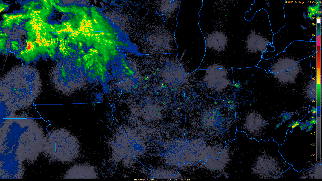
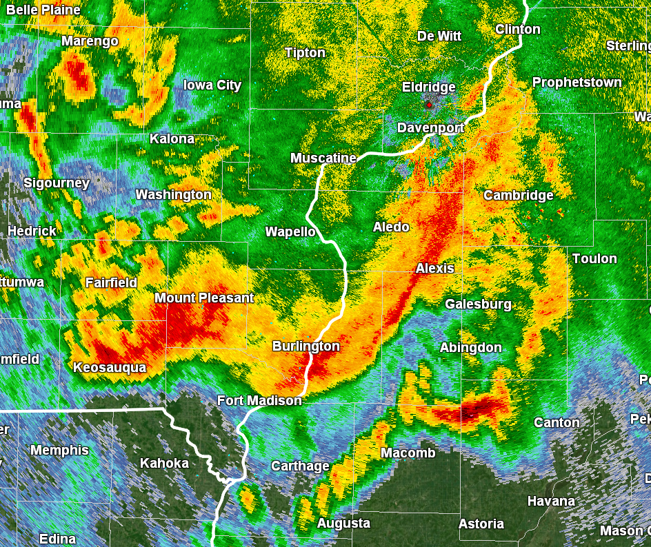
| Radar Loop from 3 AM - 6:30 PM June 17th. Click to expand loop. Also see IEM Radar Loop. | KDVN Radar Reflectivity during the peak intensity of the morning MCS. |
Photos
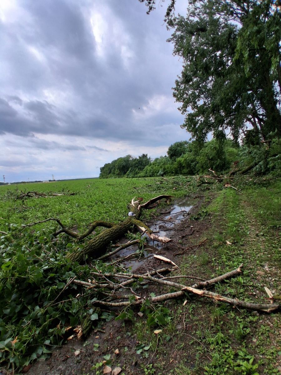 |
|
|
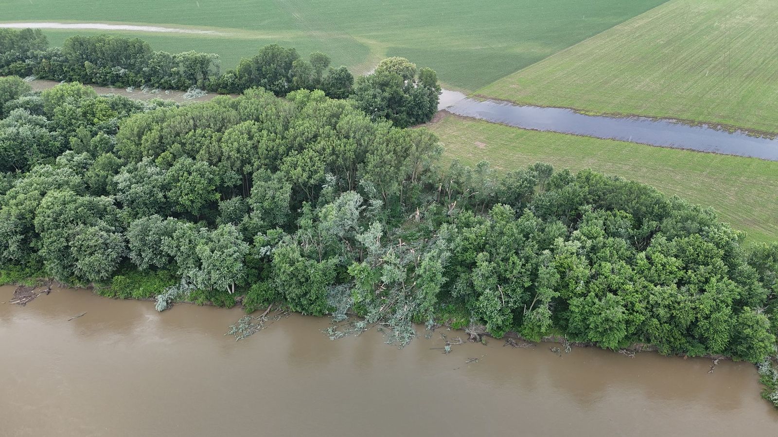
| Clark County, MO - part of Warsaw, IL Tornado (Tanner Harrison) |
Warsaw, IL Area (Hancock County, IL EMA) |
Warsaw, IL Area (Hancock County, IL EMA) |
 |
|
|
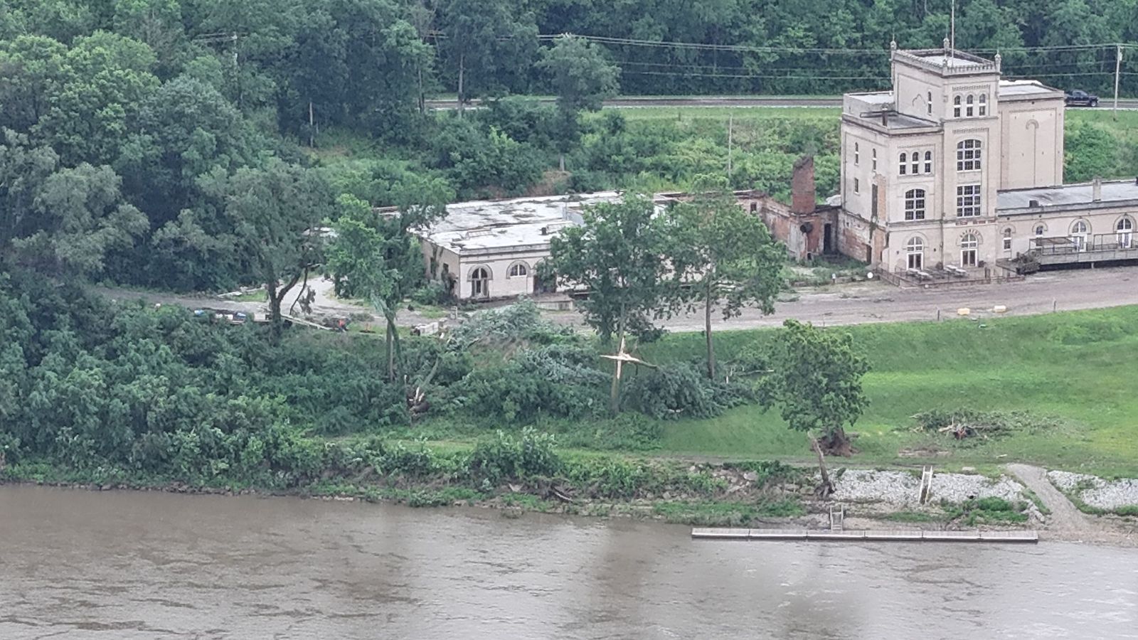
| Monmouth, IL (NWS Damage Survey) |
Monmouth, IL (NWS Damage Survey) |
Monmouth, IL (NWS Damage Survey) |
 |
| 3NNE Oquawka, IL (Jamie Storhoff) |
Rainfall
Two sites had record daily rainfall:
MLI; 1.90" old record was 1.65 in 1990
BRL; 2.03" old record was 1.78 in 1937
Public Information Statement
National Weather Service Quad Cities IA IL
617 PM CDT Thu Jun 18 2026

...RAINFALL REPORTS FROM JUNE 16-17...

The following are rainfall totals in excess of two inches received
during or after the heavy rain producing thunderstorms on June 17th.

Observations are collected from a variety of sources with varying
equipment and exposures. We thank all volunteer weather observers
for their dedication. Not all data listed are considered official.


Location                     Amount    Time/Date       Provider
---------------------------------------------------------------

...Illinois...

...Hancock County...
1 S Carthage                 2.21 in   0426 PM 06/17   Public

...Henderson County...
Stronghurst 0.4 SSW          2.09 in   0700 AM 06/18   COCORAHS

...Henry County...
New Windsor 2.0 N            2.23 in   0700 AM 06/18   COCORAHS

...McDonough County...
5 NW Industry                3.60 in   1200 PM 06/17   Trained Spotter
2 S Colchester               2.50 in   0717 PM 06/17   Trained Spotter
MACOMB                       2.30 in   0545 PM 06/18   CWOP

...Mercer County...
Aledo                        2.67 in   0610 AM 06/18   COOP

...Rock Island County...
Milan                        2.41 in   0548 PM 06/18   CWOP
Moline 0.7 NNE               2.11 in   0700 AM 06/18   COCORAHS
Moline 0.8 NNW               2.05 in   0730 AM 06/18   COCORAHS
SILVIS                       2.02 in   0546 PM 06/18   CWOP
1 N Carbon Cliff             2.00 in   0100 PM 06/17   Trained Spotter

...Iowa...

...Benton County...
1 NE Watkins                 2.80 in   0550 PM 06/18   AWS
Vinton                       2.11 in   0700 AM 06/18   COOP
Fairfax 4.0 NW               2.08 in   0700 AM 06/18   COCORAHS
Belle Plaine                 2.00 in   1003 AM 06/17   Public

...Des Moines County...
Burlington 6.5 SSW           2.18 in   0700 AM 06/18   COCORAHS
Burlington Arpt              2.03 in   0553 PM 06/18   ASOS
5 SSE Sperry                 2.02 in   1107 AM 06/17   Trained Spotter

...Henry County...
3 NNW Oakland Mills          2.41 in   1035 AM 06/17   Trained Spotter

...Iowa County...
1 ENE North English          2.82 in   0240 PM 06/17   CO-OP Observer
Amana                        2.34 in   0545 PM 06/18   CWOP
North English                2.30 in   0448 PM 06/17   Trained Spotter
Williamsburg 0.6 SW          2.19 in   0800 AM 06/18   COCORAHS
Parnell                      2.15 in   1244 PM 06/17   Trained Spotter
4.0 S Parnell                2.15 in   0500 PM 06/18   HADS
1 E Williamsburg             2.07 in   0700 AM 06/18   COOP

...Jefferson County...
1 SW Perlee                  2.50 in   0340 PM 06/17   Trained Spotter
Fairfield 5.7 NNE            2.15 in   0700 AM 06/18   COCORAHS
Fairfield                    2.05 in   0800 AM 06/18   COOP

...Johnson County...
Riverside                    4.01 in   0538 PM 06/18   CWOP
2 SSW Williamstown           3.10 in   0350 PM 06/17   Trained Spotter
Swisher                      2.40 in   0850 AM 06/18   COOP
Iowa City 1.5 NNE            2.10 in   0700 AM 06/18   COCORAHS
Iowa City Arpt               2.02 in   0552 PM 06/18   ASOS

...Linn County...
Ely 2.0 N                    2.55 in   0644 AM 06/18   COCORAHS
Cedar Rapids                 2.44 in   0548 PM 06/18   CWOP
2 W Cedar Rapids             2.35 in   1135 AM 06/17   Trained Spotter
Cedar Rapids 2.1 NW          2.16 in   0700 AM 06/18   COCORAHS
1 NE Fairfax                 2.11 in   1138 AM 06/17   Trained Spotter
3 NNE Cedar Rapids           2.04 in   0257 PM 06/17   Trained Spotter
1 NE Hiawatha                2.00 in   0930 AM 06/17   Trained Spotter

...Muscatine County...
Muscatine 1.7 N              4.33 in   0700 AM 06/18   COCORAHS
2 N Muscatine                3.63 in   0700 AM 06/18   COOP
2 NNE Muscatine              3.56 in   0406 PM 06/17   Trained Spotter
Muscatine 1.4 N              3.40 in   0700 AM 06/18   COCORAHS
Nichols 3.6 WSW              3.30 in   0700 AM 06/18   COCORAHS
Cedar River Tnc Swamp        3.19 in   0546 PM 06/18   RAWS
2 NNW Muscatine              2.79 in   0537 PM 06/17   Trained Spotter

...Scott County...
1 SSE Davenport              2.30 in   0436 PM 06/17   Trained Spotter
2 WSW Davenport              2.25 in   0210 PM 06/17   Trained Spotter
3 ESE Davenport              2.20 in   0230 PM 06/17   Trained Spotter
1 S Walcott                  2.10 in   0115 PM 06/17   Trained Spotter
Davenport                    2.04 in   0545 PM 06/18   CWOP
Davenport 0.9 WNW            2.02 in   0700 AM 06/18   COCORAHS
3 S Mount Joy                2.00 in   0550 PM 06/18   AWS

...Washington County...
Ainsworth 7.4 N              4.19 in   0700 AM 06/18   COCORAHS
1 N Rubio                    3.25 in   1024 AM 06/17   Trained Spotter
Wellman 4.0 E                2.86 in   0630 AM 06/18   COCORAHS
Environment
Please see this fantastic environmental summary of the June 17th event from NWS Central Illinois.
 |
| DVN 12Z sounding taken just prior to the morning severe thunderstorms' arrival. While not much apparent instability, the well-organized storm complex was already present over central Iowa and moving into a moist mid to upper atmosphere atop dry low-levels. In addition, there was strong wind shear. This all favored the storms to maintain organization, have precipitation-loading, and be aiding in rain-cooled downdrafts. |
 |
Media use of NWS Web News Stories is encouraged! Please acknowledge the NWS as the source of any news information accessed from this site. |
|