Overview
|
A few severe thunderstorms developed across eastern Iowa and far northeast Missouri on Tuesday, June 22, leading to several reports of severe hail and some wind damage. This was a day in which the instability was greater in our western counties, but the high shear throughout our forecast area allowed for these storms to become organized and thrive in an environment with just enough of instability. Storms entered our area around 3:00 PM CDT, producing up to golfball sized hail. A couple of these storms were long-lived, traveling through a few counties before dying. Some damaging wind gusts were also noted in Buchanan County, where large tree limbs were snapped and a power pole was blown down.
|
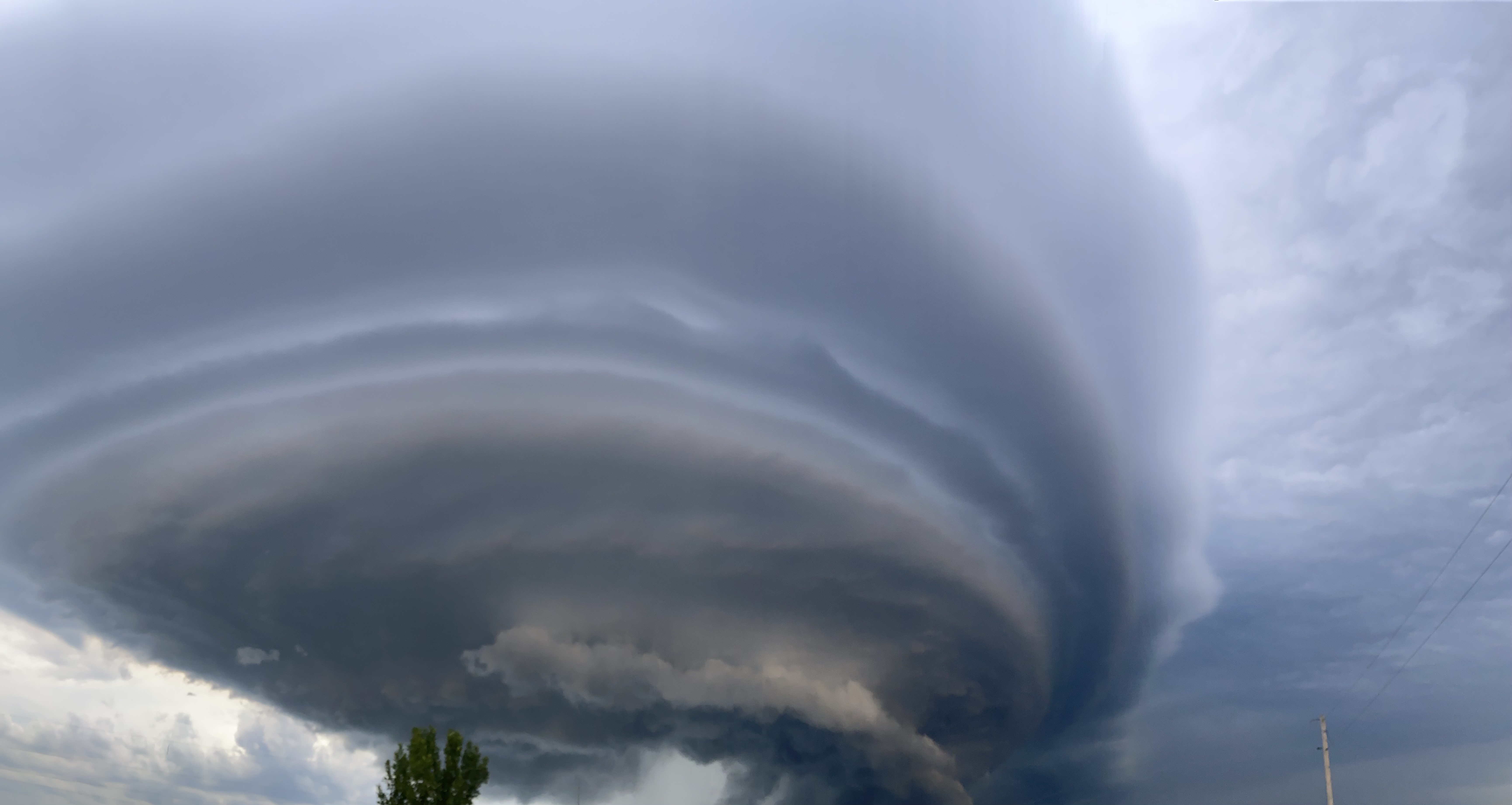
Supercell thunderstorm in Scotland County, Missouri (Courtesy Bryan Whitney) |
Storm Reports
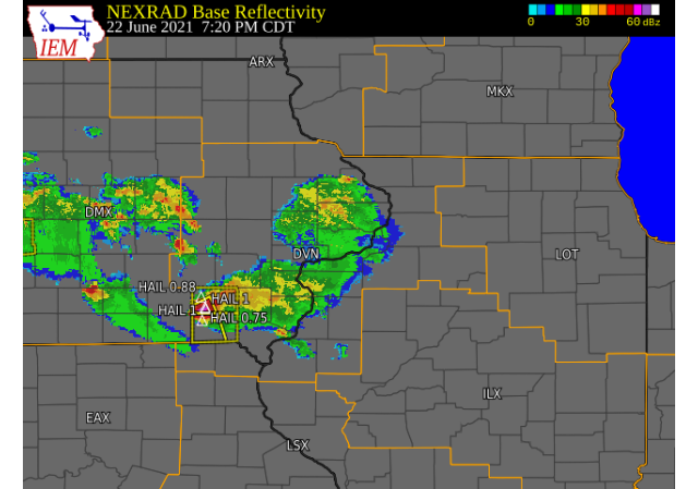
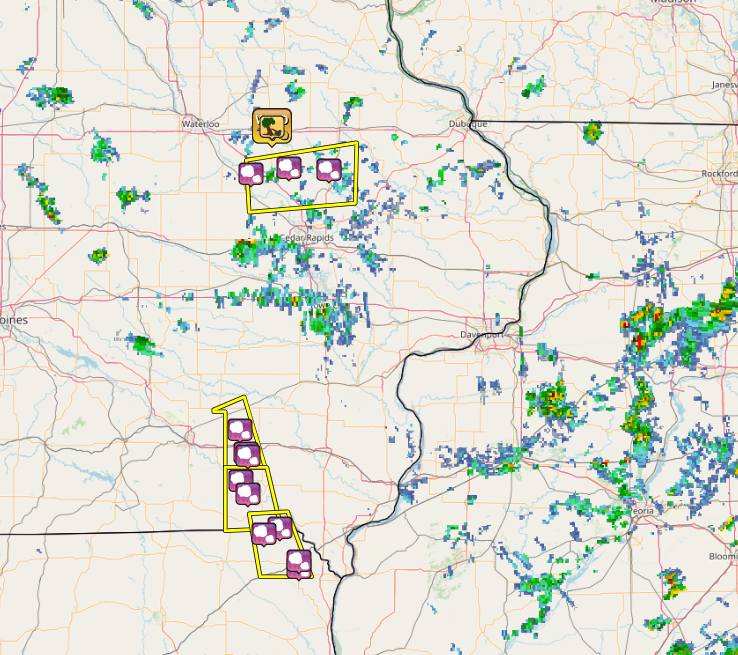
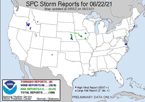
| Interactive Storm Report Map (IEM) | SPC Storm Reports |
 |
 |
 |
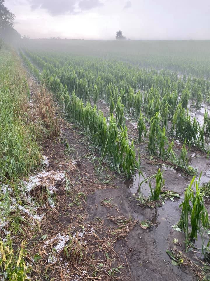 |
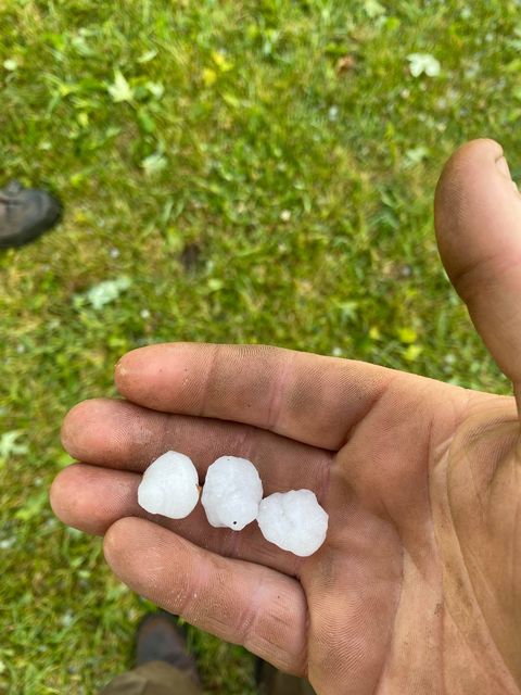
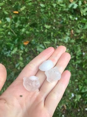
| Hail: Urbana, IA (Brad Ziesser) | Crop Damage By Hail: Urbana, IA (Brad Ziesser) |
 |
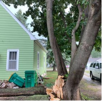 |
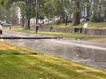
| Wind Damage: Independence, IA (Travis McBride) | Wind Damage: Independence, IA (Travis McBride) |
 |
 |
| Hail in Keosauqua, IA (Amanda Osborne) | Hail in Keosauqua, IA (Justin Boller) |
PRELIMINARY LOCAL STORM REPORT...SUMMARY
NATIONAL WEATHER SERVICE QUAD CITIES IA IL
1002 PM CDT TUE JUN 22 2021

..TIME...   ...EVENT...      ...CITY LOCATION...     ...LAT.LON...
..DATE...   ....MAG....      ..COUNTY LOCATION..ST.. ...SOURCE....
            ..REMARKS..

0808 PM     HAIL             3 ENE CHARLIE HEATH MEM 40.61N 91.84W
06/22/2021  M0.88 INCH       CLARK              MO   TRAINED SPOTTER

            HAIL STARTED AS PEA AND HAS INCREASED TO
            BETWEEN DIIME AND NICKEL SIZE.

0812 PM     HAIL             3 W CHARLIE HEATH MEMOR 40.58N 91.94W
06/22/2021  M1.00 INCH       CLARK              MO   TRAINED SPOTTER

            OCCURRING RIGHT NOW.

0837 PM     HAIL             KAHOKA                  40.42N 91.72W
06/22/2021  M0.25 INCH       CLARK              MO   EMERGENCY MNGR

            WIND STARTING TO PICK UP.

0839 PM     HAIL             2 N KAHOKA              40.45N 91.72W
06/22/2021  E0.25 INCH       CLARK              MO   TRAINED SPOTTER

            OCCURRING RIGHT NOW.

0725 PM     HAIL             DOUDS/LEANDO            40.83N 92.08W
06/22/2021  M1.00 INCH       VAN BUREN          IA   EMERGENCY MNGR

            ALSO HIGH WINDS.

0740 PM     HAIL             4 NE LEBANON            40.77N 92.04W
06/22/2021  M1.00 INCH       VAN BUREN          IA   TRAINED SPOTTER

            OCCURRING RIGHT NOW. 36 MPH WIND GUST.

0540 PM     HAIL             WALKER                  42.29N 91.78W
06/22/2021  E1.75 INCH       LINN               IA   BROADCAST MEDIA


0559 PM     HAIL             COGGON                  42.28N 91.53W
06/22/2021  E1.00 INCH       LINN               IA   TRAINED SPOTTER

            ALSO WINDS ESTIMATED AT 55 MPH.

0705 PM     HAIL             1 N BROOKVILLE          41.07N 92.09W
06/22/2021  E0.88 INCH       JEFFERSON          IA   TRAINED SPOTTER

            ALSO ESTIMATED 40-50 MPH WINDS. LASTED 5
            MINUTES.

0713 PM     HAIL             LIBERTYVILLE            40.96N 92.05W
06/22/2021  M0.75 INCH       JEFFERSON          IA   TRAINED SPOTTER

            HAIL COVERING THE GROUND.

0716 PM     HAIL             LIBERTYVILLE            40.95N 92.04W
06/22/2021  E1.00 INCH       JEFFERSON          IA   TRAINED SPOTTER

            PEA TO QUARTER SIZED HAIL; LASTED FOR 10 TO
            15 MINUTES.

0551 PM     TSTM WND GST     1 N INDEPENDENCE        42.48N 91.89W
06/22/2021  E50 MPH          BUCHANAN           IA   TRAINED SPOTTER


0555 PM     TSTM WND DMG     1 N INDEPENDENCE        42.48N 91.89W
06/22/2021                   BUCHANAN           IA   TRAINED SPOTTER

            LARGE TREE DOWN ALONG WITH A UTILITY POLE.

0523 PM     HAIL             4 E MOUNT AUBURN        42.26N 92.02W
06/22/2021  E0.75 INCH       BENTON             IA   TRAINED SPOTTER

            PEA TO PENNY SIZED HAIL.
 |
Media use of NWS Web News Stories is encouraged! Please acknowledge the NWS as the source of any news information accessed from this site. |
|