
Numerous severe storms with a potential for severe wind gusts, tornadoes (some potentially strong), and very large hail are expected in parts of the central and northern Plains. Heavy rainfall may bring a flooding threat to parts of the northern Plains and from the Ohio Valley to the Southeast. Fire weather concerns persist in the Four Corners Region. Hot and humid expected in the central U.S.. Read More >
Overview
|
An upper level low progressing across northeast Iowa produced scattered showers and thunderstorms across the upper and mid Mississippi River Valleys on the afternoon of June 26th. Over eastern Iowa, northwest Illinois, and northeast Missouri, thunderstorms produced mainly heavy rainfall and funnel clouds. However, one thunderstorm produced a brief tornado north of Memphis, MO, which lofted an empty grain bin around 200 yards.
|
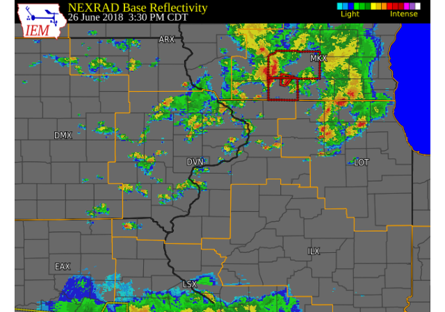 Radar Image (3:30 P.M.) (IEM) (Click to zoom) (Click here for Animation) |
Tornado:
|
Tornado - 1.3 N Memphis, MO
Track Map 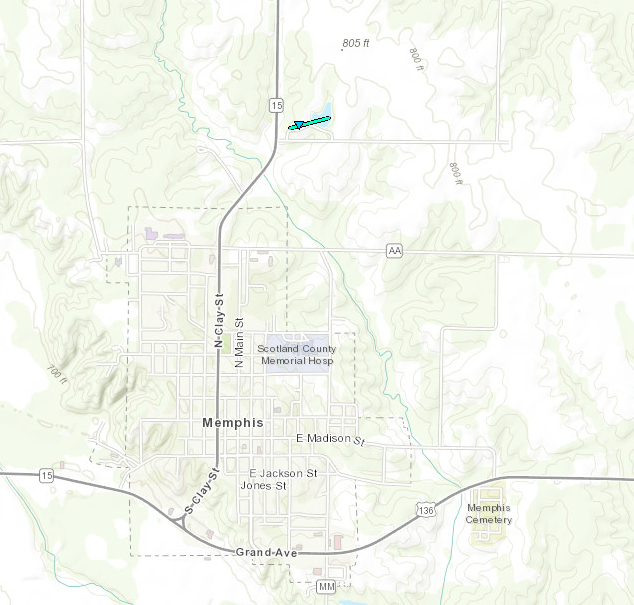 
Downloadable KMZ File |
||||||||||||||||
The Enhanced Fujita (EF) Scale classifies tornadoes into the following categories:
| EF0 Weak 65-85 mph |
EF1 Moderate 86-110 mph |
EF2 Significant 111-135 mph |
EF3 Severe 136-165 mph |
EF4 Extreme 166-200 mph |
EF5 Catastrophic 200+ mph |
 |
|||||
Environment
 |
 |
 |
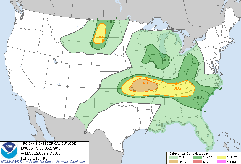
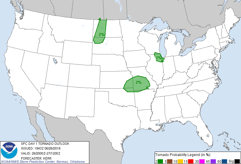
| Figure 1: SPC Day 1 Outlook (20:00 UTC) | Figure 2: SPC Day 1 Tornado Outlook (20:00 UTC) | Figure 3: SPC Day 1 Hail Outlook (20:00 UTC) |
 |
 |
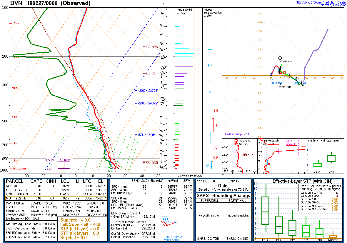 |
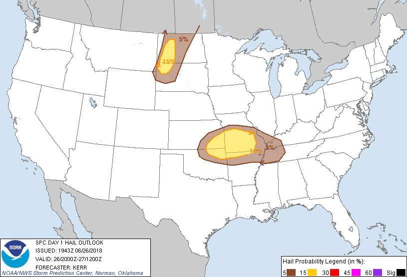
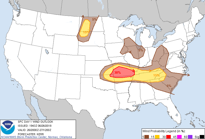
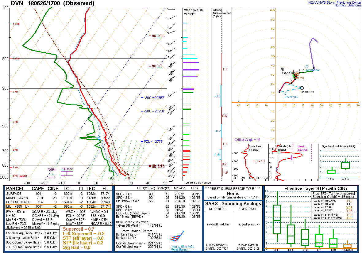
| Figure 4: SPC Day 1 Wind Outlook (20:00 UTC) | Figure 5: DVN Sounding: 6/26/18 17z | Figure 6: DVN Sounding: 6/27/18 00z |
 |
Media use of NWS Web News Stories is encouraged! Please acknowledge the NWS as the source of any news information accessed from this site. |
|

