Overview
|
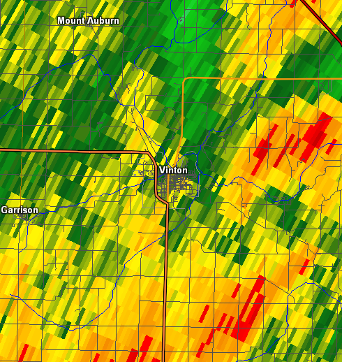
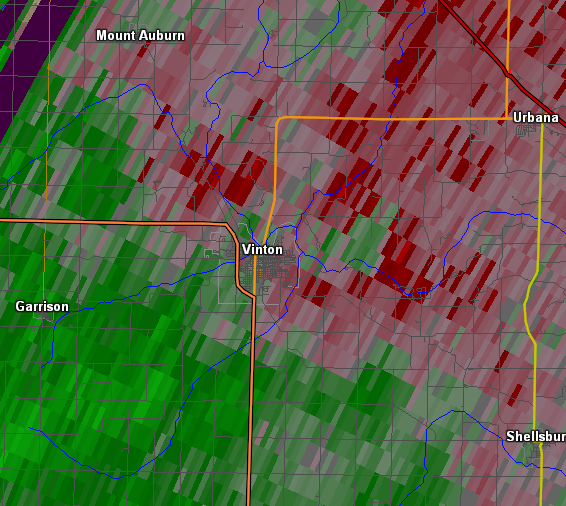
A line of showers and thunderstorms tracked southeast out of Minnesota into Iowa early Sunday, July 17, 2016. These storms brought damaging winds, heavy rains, frequent lightning, and a few brief tornadoes to the area. Winds between 50 and 70 mph were common with the line of storms, with the worst damage occurring in the Vinton and Walford areas. Widespread rainfall amounts between a quarter and a half inch were common, with higher amounts near 1 inch reported in Buchanan county. |
 Map of tornado tracks from July, 17, 2016 |
Tornadoes:
|
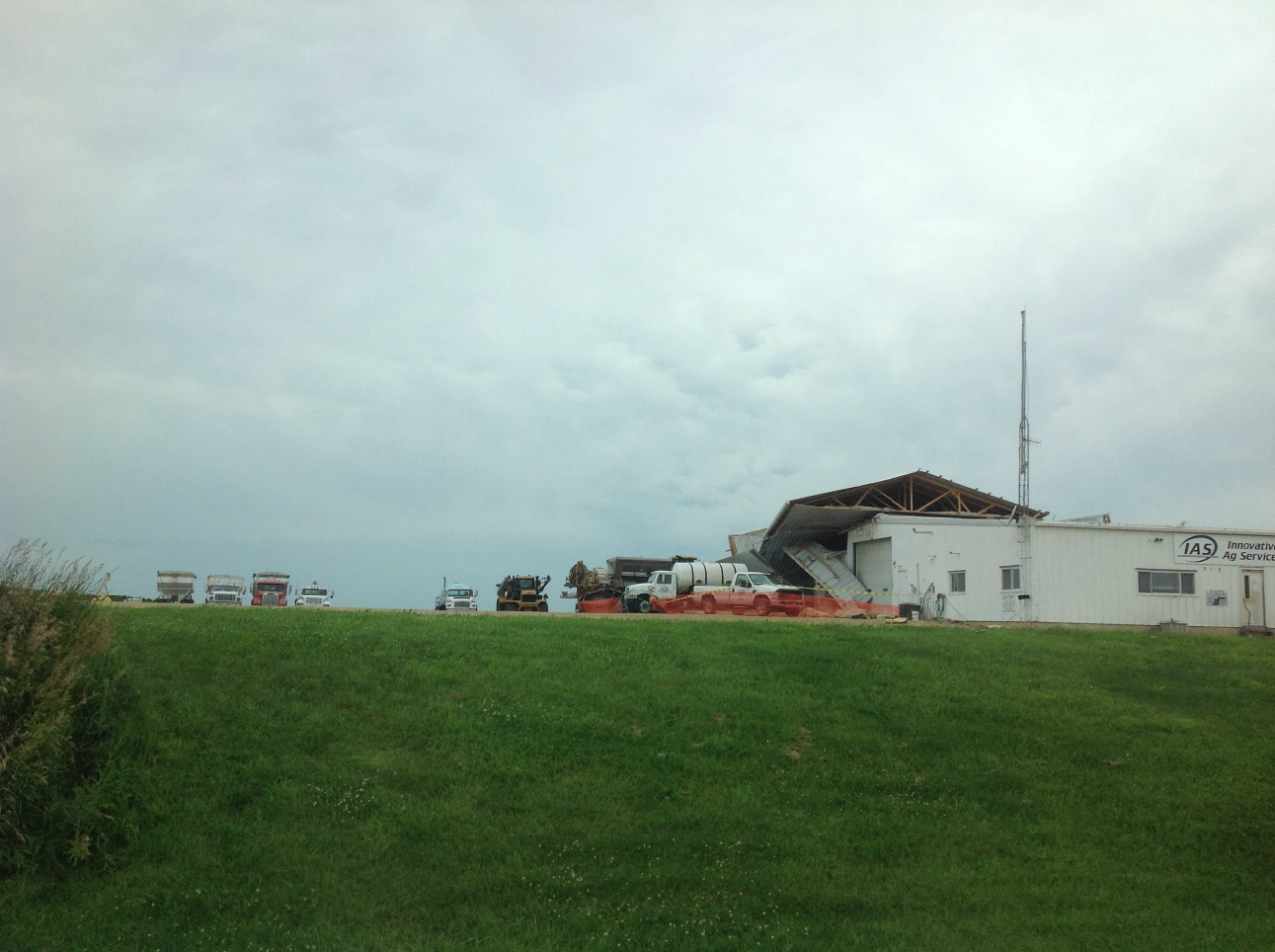
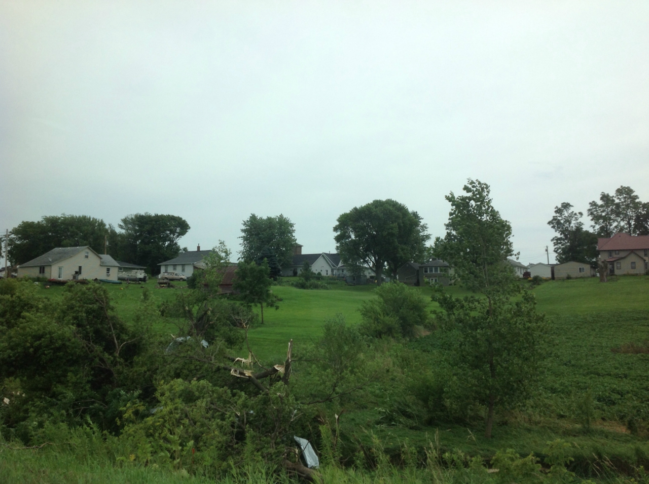
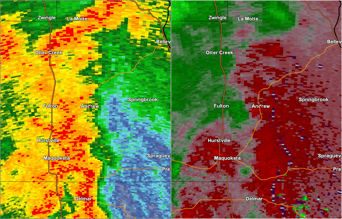
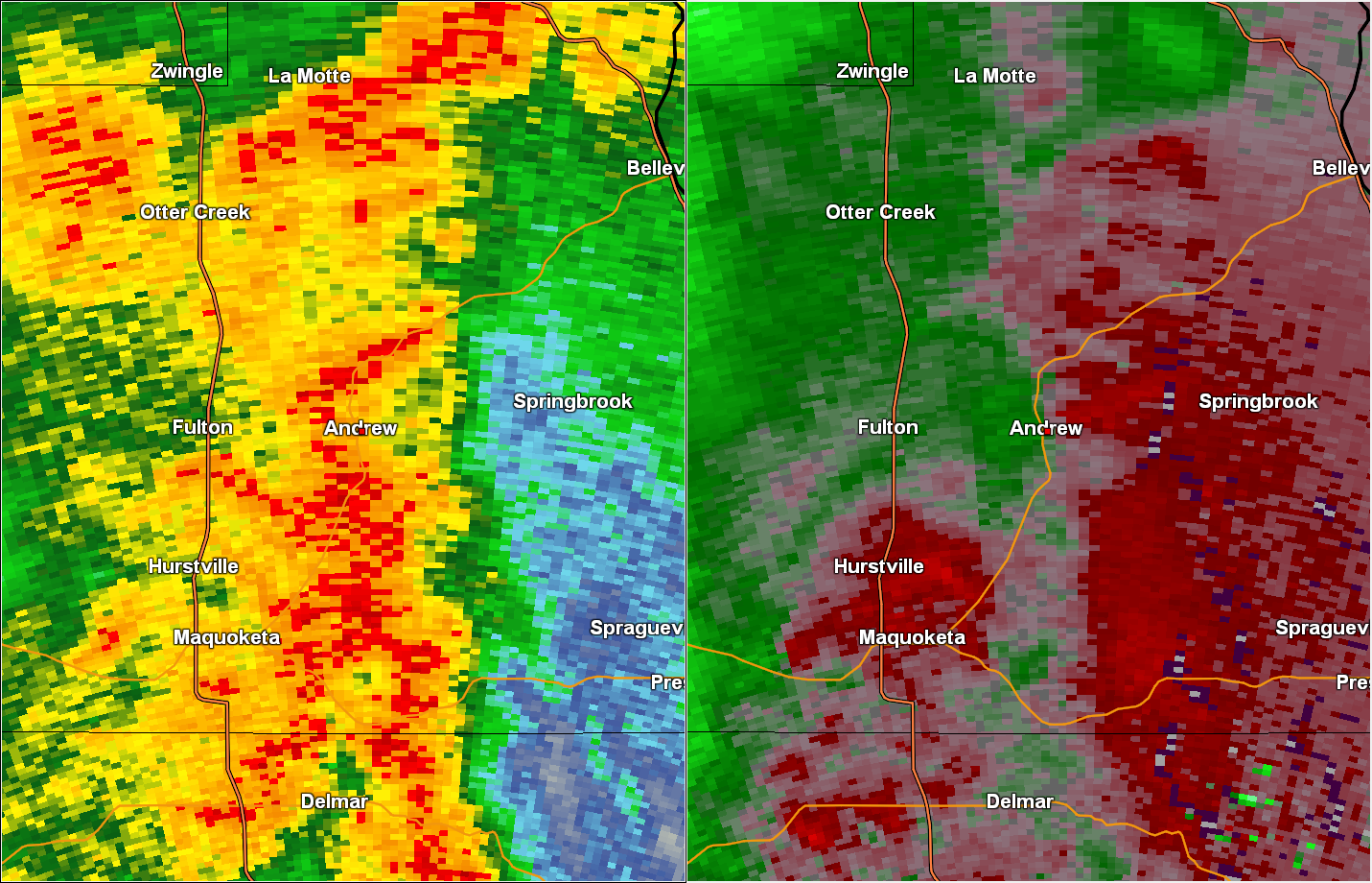
Tornado #1 - Andrew, IA
Track Map 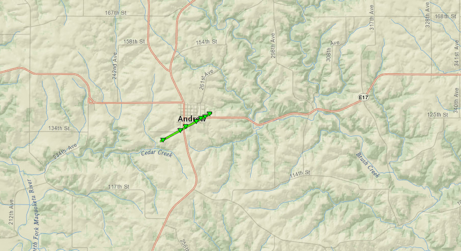 
|
||||||||||||||||
|
||||||||||||||||
|
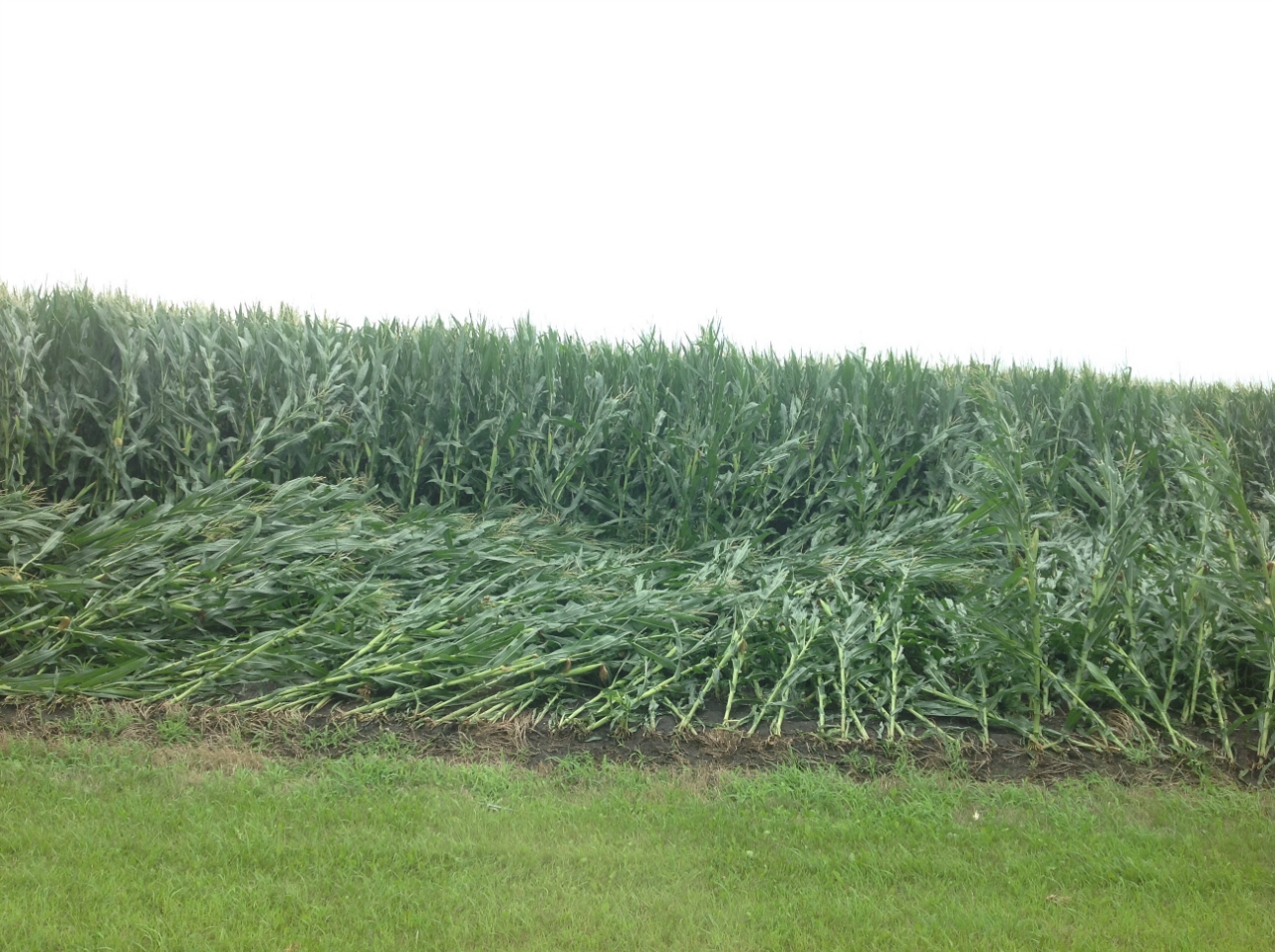
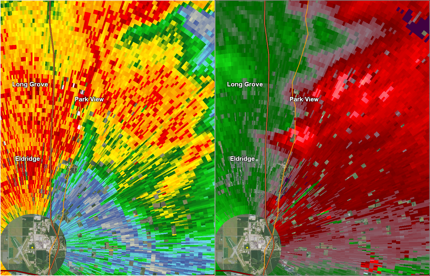
Tornado #2 - Park View, IA
Track Map 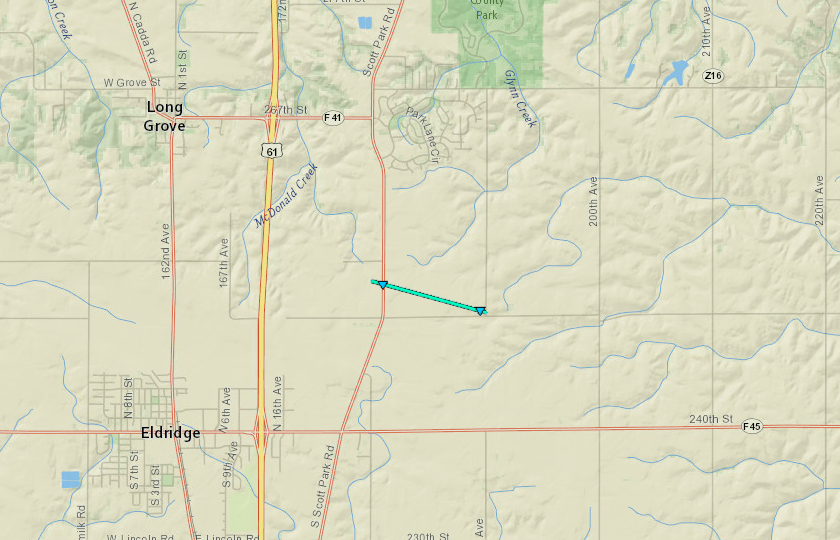
|
||||||||||||||||
|
||||||||||||||||
|
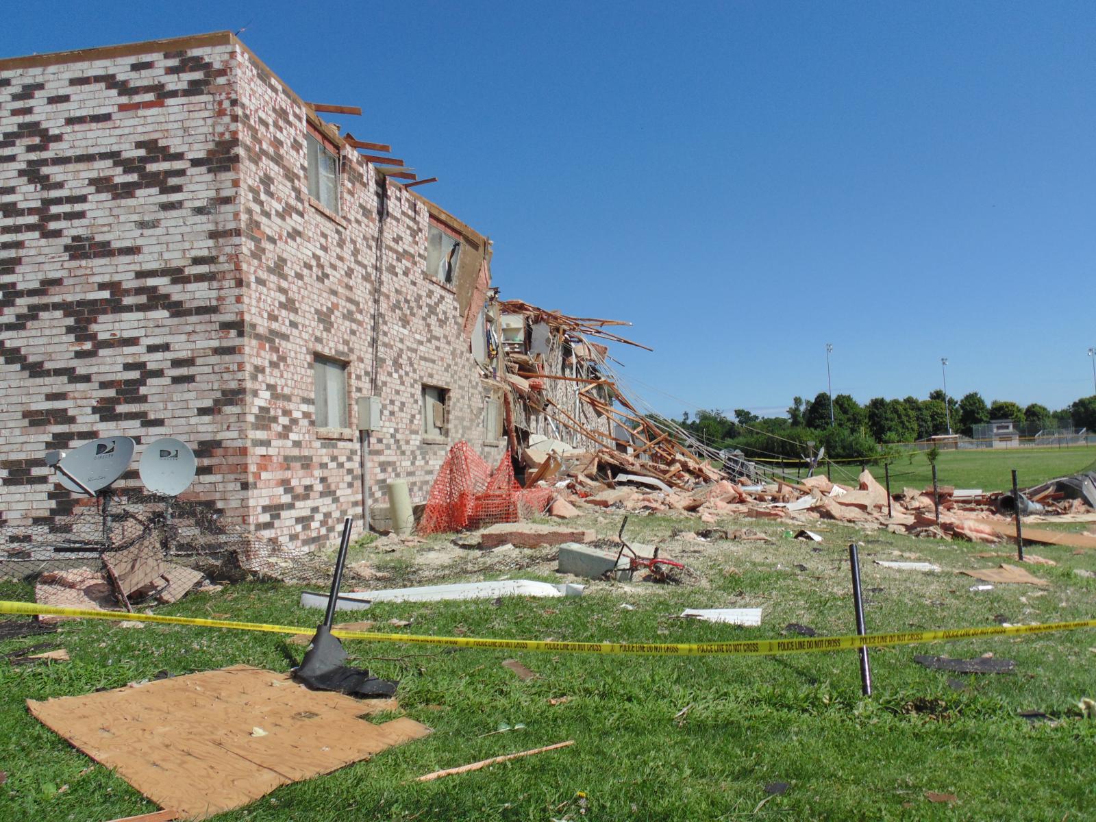
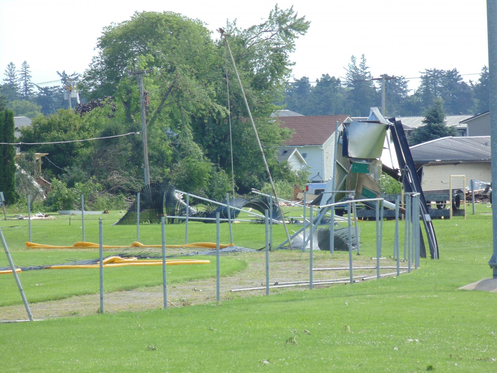
Tornado #3 - Vinton, IA
Track Map 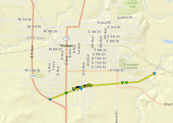
|
||||||||||||||||
| Photos | ||||||||||||||||
|
||||||||||||||||
|
Tornado #4 - Walford, IA
Track Map 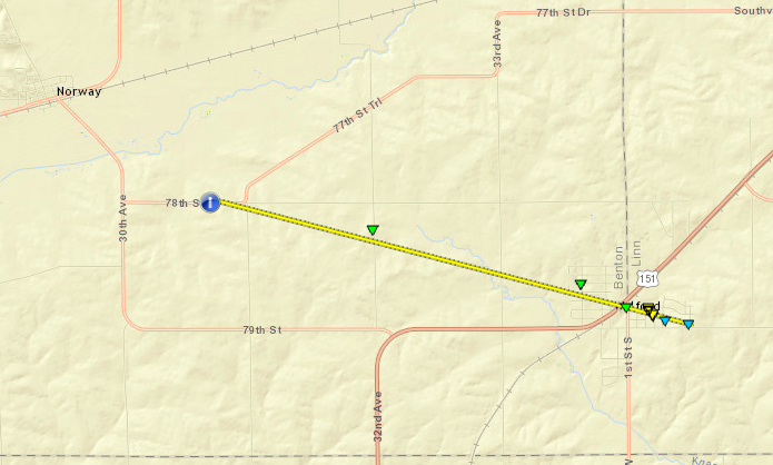
|
||||||||||||||||
|
Tornado #5 - Princeton, IA
Track Map 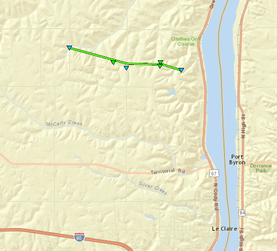
|
||||||||||||||||
The Enhanced Fujita (EF) Scale classifies tornadoes into the following categories:
| EF0 Weak 65-85 mph |
EF1 Moderate 86-110 mph |
EF2 Significant 111-135 mph |
EF3 Severe 136-165 mph |
EF4 Extreme 166-200 mph |
EF5 Catastrophic 200+ mph |
 |
|||||
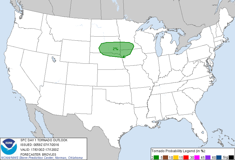
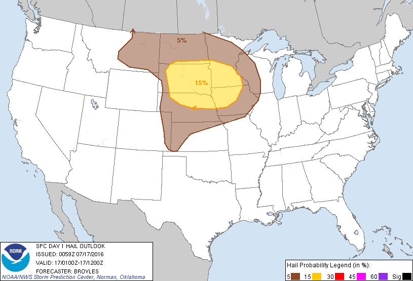
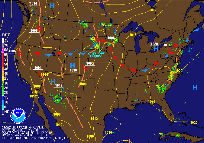
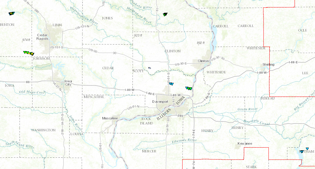
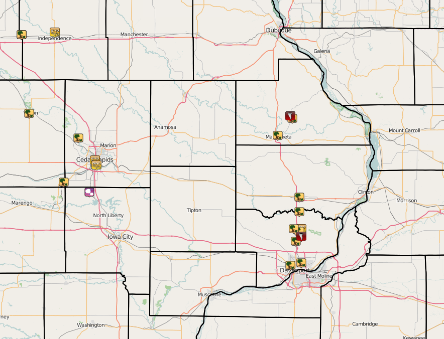
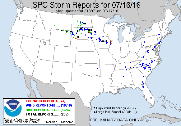
Storm Reports
| Interactive Map | SPC Storm Reports July 16, 2016 |
 |
 |
PRELIMINARY LOCAL STORM REPORT...SUMMARY
NATIONAL WEATHER SERVICE QUAD CITIES IA IL
324 PM CDT SUN JUL 17 2016
..TIME... ...EVENT... ...CITY LOCATION... ...LAT.LON...
..DATE... ....MAG.... ..COUNTY LOCATION..ST.. ...SOURCE....
..REMARKS..
0449 AM TSTM WND DMG NW JESUP 42.48N 92.07W
07/17/2016 BUCHANAN IA BROADCAST MEDIA
GRAIN BIN DESTROYED AND BLOWN INTO ANOTHER STRUCTURE. THE
GRAIN BIN WAS EMPTY
0454 AM TSTM WND DMG NE JESUP 42.48N 92.07W
07/17/2016 BUCHANAN IA FIRE DEPT/RESCUE
GRAIN BIN DESTROYED WITH ANOTHER WITH THE SIDE PUSHED IN
BY THE WIND.
0455 AM TSTM WND DMG S VINTON 42.16N 92.03W
07/17/2016 BENTON IA EMERGENCY MNGR
ROOF BLOWN OFF A LARGE APARTMENT BUILDING AND A HOUSE
DAMAGED. TIME ESTIMATED FROM RADAR.
0455 AM TSTM WND GST 1 N INDEPENDENCE 42.49N 91.89W
07/17/2016 E75.00 MPH BUCHANAN IA TRAINED SPOTTER
ESTIMATED WINDS OF 70 TO 75 MPH BASED ON THE MOVEMENT OF
THE TREES. NO DAMAGE WAS VISIBLE AT THE TIME OF THE
REPORT.
0510 AM TSTM WND DMG 2 E PALO 42.06N 91.76W
07/17/2016 LINN IA TRAINED SPOTTER
REPORT WAS DELAYED....SPOTTER OBSERVED POWER FLAHES
AROUND 510 AND THIS MORNING THERE WERE POWER LINES DOWN
IN THE AREA WITH THE POWER OUT.
0515 AM TSTM WND GST W CEDAR RAPIDS 41.97N 91.67W
07/17/2016 M61.00 MPH LINN IA BROADCAST MEDIA
KCRG EQUIPMENT MEASUREMENT AT XAVIER HIGH SCHOOL ON THE
WEST SIDE OF CEDAR RAPIDS. TIME OF THE EVENT IS ESTIMATED
SINCE EXACT TIME IS UNKNOWN.
0525 AM TSTM WND GST 1 SSE CEDAR RAPIDS 41.95N 91.66W
07/17/2016 E55.00 MPH LINN IA TRAINED SPOTTER
50 TO 55 MPH GUSTS.
0530 AM HAIL SWISHER 41.84N 91.70W
07/17/2016 M0.25 INCH JOHNSON IA TRAINED SPOTTER
0546 AM TSTM WND DMG WALFORD 41.88N 91.84W
07/17/2016 BENTON IA TRAINED SPOTTER
MULTIPLE HOMES DAMAGE IN WALFORD WITH ONE COLLAPSED.
0602 AM TSTM WND DMG MAQUOKETA 42.07N 90.67W
07/17/2016 JACKSON IA EMERGENCY MNGR
A COUPLE OF TREES WERE UPROOTED IN TOWN. TIME OF THE
EVENT ESTIMATED USING RADAR.
0603 AM TORNADO 1 SW ANDREW 42.15N 90.60W
07/17/2016 JACKSON IA NWS STORM SURVEY
EF-1 TORNADO CROSSED THE SOUTHERN PARTS OF THE TOWN OF
ANDREW. A BUILDING AT THE AG COOP WAS DESTROYED AND
NUMEROUS TREES WERE SNAPPED.
0622 AM TSTM WND GST PARK VIEW 41.69N 90.54W
07/17/2016 E60.00 MPH SCOTT IA NWS EMPLOYEE
0622 AM TSTM WND DMG 4 S DEWITT 41.76N 90.55W
07/17/2016 SCOTT IA CO-OP OBSERVER
MULBERRY TREE BLOWN OVER, NUMEROUS OTHER LIMBS DOWN
0622 AM TSTM WND DMG PARK VIEW 41.69N 90.54W
07/17/2016 SCOTT IA NWS EMPLOYEE
TREE BRANCHES DOWN...SOME 2 TO 6 INCHES IN DIAMETER. TIME
ESTIMATED FROM RADAR.
0623 AM TSTM WND DMG 1 S ANDREW 42.14N 90.59W
07/17/2016 JACKSON IA LAW ENFORCEMENT
LAW ENFORCEMENT REPORTED SIGNIFICANT DAMAGE TO A BUILDING
WITH NEARBY TREES TWISTED AND SOME FARM EQUIPMENT KNOCKED
OVER.
0623 AM TSTM WND DMG DEWITT 41.82N 90.55W
07/17/2016 CLINTON IA LAW ENFORCEMENT
LAW ENFORCEMENT REPORTED SEVERAL TREES DOWN IN DEWITT.
0625 AM TORNADO 2 S PARK VIEW 41.66N 90.54W
07/17/2016 SCOTT IA NWS STORM SURVEY
BRIEF EF-0 TORNADO DID DAMAGE TO TREES AND CORN CROPS.
0625 AM TSTM WND DMG 2 ESE LONG GROVE 41.68N 90.55W
07/17/2016 SCOTT IA PUBLIC
NEAR FARM ALONG OLD 61 BETWEEN PARKVIEW AND
ELDERIGE....TOPS OF TREES TWISTED OFF AND CORN LAYING
DOWN IN NEIGHBORING FIELD WITH SOME OF THE CORN RIPPED
OUT.
0625 AM TSTM WND DMG LONG GROVE 41.69N 90.58W
07/17/2016 SCOTT IA NWS EMPLOYEE
3 INCH LIMB DOWN IN A DRIVEWAY
0625 AM TSTM WND DMG 1 SSE DAVENPORT 41.54N 90.60W
07/17/2016 SCOTT IA TRAINED SPOTTER
TREE BRACNCHES DOWN ALONG THE 2200 BLOCK OF NORTH
WASHINGTON STREET IN DAVENPORT. BRANCHES SNAPPED OFF
TREES AND PARTIALLY IN THE STREET. NO DAMAGE TO
STRUCTURES. TIME ESTIMATED USING RADAR.
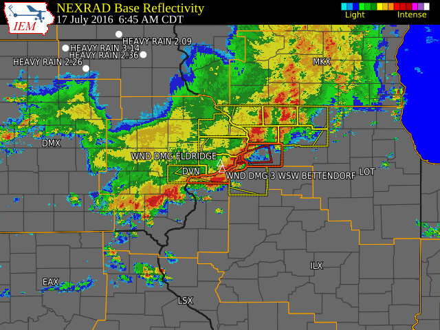
0630 AM TSTM WND DMG ELDRIDGE 41.64N 90.57W
07/17/2016 SCOTT IA NWS EMPLOYEE
4 TO 6 INCH DIAMETER BRANCHES BROKEN OFF AN BLOWN 100 TO
200 YARDS. TREE WAS ALONG U.S. 61 NORTH OF LE CLAIRE ROAD
EAST OF ELDRIDGE. TIME ESTIMATED FROM RADAR.
0635 AM TSTM WND DMG 3 WSW BETTENDORF 41.55N 90.54W
07/17/2016 SCOTT IA NWS EMPLOYEE
TREE UPROOTED AND CROWN SNAPPED ALONG WITH A 6 INCH
DIAMETER BRANCHES DOWN. TIME ESTIMATED USING RADAR.
 |
Media use of NWS Web News Stories is encouraged! Please acknowledge the NWS as the source of any news information accessed from this site. |
|