Event Overview
|
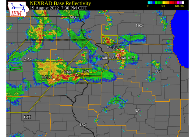
Cold core low moved over the area, dragging along a weak and slow moving surface low pressure. While weak, sufficient low level and upper forcing aided in developing strong to severe storms. While instability was more than sufficient, the shear was lacking, but was enough to help develop a few supercell thunderstorms. Due to the weak forcing overall and the slow moving nature of the storms, some storms anchored over locations for an extended period of time, resulting in Flash Flooding. Some repeated storms over the same area also led to similar results. Severe weather reports were mostly in the form of hail, as these storms produced hail very efficiently. Some hail reaching 1.5", with some isolated reports of damaging winds.
This event not only impacted the area on 8/19, but due to little movement of the system as a whole, repeated events were seen the following day, on 8/20. Storm action generally hovered over counties along and east of the Mississippi River on the second day. 8/20 was filled with many mini supercells, where many led to funnel clouds. Along with the funnel clouds, some reports of brief tornadoes were received.
|
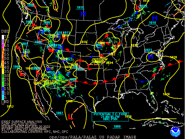 Surface Map on August 20th |
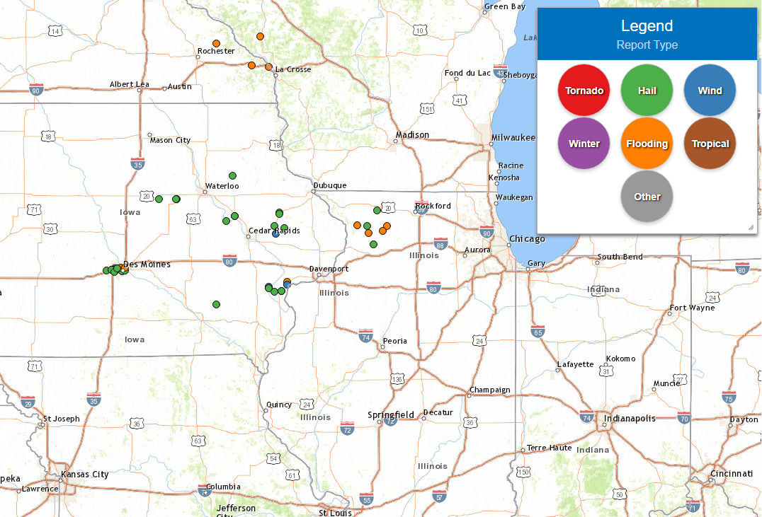
Tornado Information
|
1.0 NW Scotch Grove, IA
|
||||||||||||||||
|
|
||||||||||||||||
|
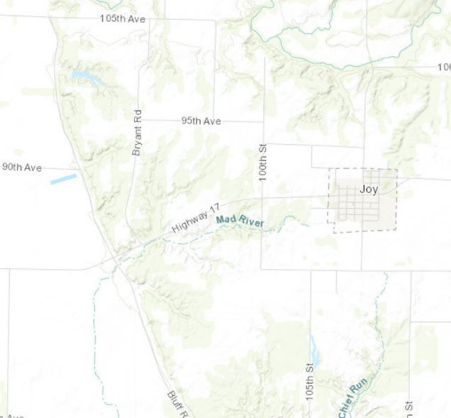
2.0 SSE Mannon, IL
|
||||||||||||||||
|
|
||||||||||||||||
|
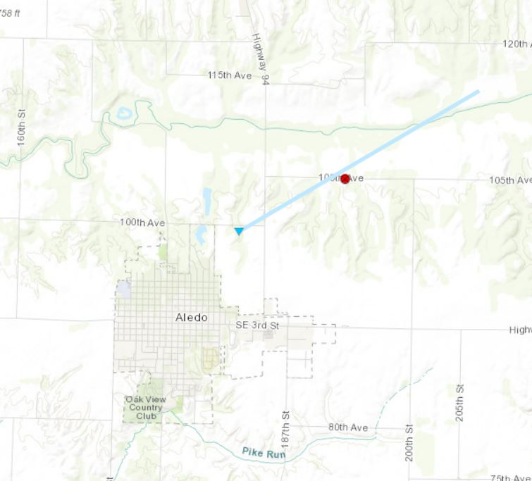
1.0 NNE Aledo, IL
|
||||||||||||||||
|
|
||||||||||||||||
Storm Reports
 |
PRELIMINARY LOCAL STORM REPORT...SUMMARY
NATIONAL WEATHER SERVICE QUAD CITIES IA IL
515 AM CDT SAT AUG 20 2022

..TIME...   ...EVENT...      ...CITY LOCATION...     ...LAT.LON...
..DATE...   ....MAG....      ..COUNTY LOCATION..ST.. ...SOURCE....
            ..REMARKS..

0746 PM     Heavy Rain       3 N Muscatine           41.46N 91.07W
08/19/2022  U0.00 inch       Muscatine          IA   Amateur Radio

            Delayed report. Water 3-4 inches deep across
            Tipton Road.

0518 PM     Hail             1 ESE Vinton            42.16N 92.01W
08/19/2022  E0.25 inch       Benton             IA   Public


0724 PM     Hail             Lanark                  42.10N 89.83W
08/19/2022  E0.25 inch       Carroll            IL   Trained Spotter

            Pea sized hail occurring for the past 5
            minutes.

0820 PM     Hail             1 SSW Muscatine Municip 41.35N 91.16W
08/19/2022  E0.25 inch       Muscatine          IA   Trained Spotter

            Delayed report. Lasted 10 minutes.

0902 PM     Hail             Monticello              42.24N 91.19W
08/19/2022  E0.25 inch       Jones              IA   Public

            Occurring right now with heavy winds.

0904 PM     Hail             3 SSW Center Junction   42.08N 91.11W
08/19/2022  E0.25 inch       Jones              IA   Trained Spotter

            Delayed report. Pea sized hail for a couple
            of minutes with heavy rain and estimated 40
            mph wind gusts.

0623 PM     Hail             2 WNW Letts             41.34N 91.27W
08/19/2022  E0.50 inch       Muscatine          IA   Public

            Report from mPING: Half-inch (0.50 in.).

0855 PM     Hail             2 N Monticello          42.26N 91.19W
08/19/2022  E0.50 inch       Jones              IA   Trained Spotter


0741 PM     Hail             2 WSW Freeport          42.28N 89.67W
08/19/2022  E0.70 inch       Stephenson         IL   Public

            Occurring right now.

0841 PM     Hail             1 ESE Anamosa           42.10N 91.27W
08/19/2022  E0.70 inch       Jones              IA   Public

            Delayed report via social media and time
            estimated from radar. Pea to dime sized
            hail.

0818 PM     Hail             3 W Penrose             41.89N 89.73W
08/19/2022  E0.75 inch       Whiteside          IL   Public

            Delayed report from social media and time
            estimated from radar. Pea to penny hail
            covered the ground.

0736 PM     Hail             Lanark                  42.10N 89.83W
08/19/2022  E0.88 inch       Carroll            IL   Public

            Occurring right now.

0503 PM     Hail             3W Vinton               42.22N 91.88W
08/19/2022  E1.00 inch       Benton             IA   Trained Spotter

            Corrects previous hail report from Urbana.
            Delayed report.

0707 PM     Hail             2 SSW Muscatine Municip 41.35N 91.16W
08/19/2022  E1.00 inch       Muscatine          IA   Public

            Report from mPING: Quarter (1.00 in.).

0724 PM     Hail             Conesville              41.38N 91.35W
08/19/2022  E1.00 inch       Muscatine          IA   Fire Dept/Rescue

            Via amatuer radio. Occurring right now.

0733 PM     Hail             2 N Pekin               41.19N 92.17W
08/19/2022  E1.00 inch       Keokuk             IA   Trained Spotter

            Hail falling the past 10 minutes with most
            stones pea to nickel size.

0703 PM     Hail             Conesville              41.38N 91.35W
08/19/2022  E1.50 inch       Muscatine          IA   Amateur Radio

            Reported relayed be ARES from fire chief.
            Time shortly after 7PM.

0922 PM     Heavy Rain       1 SSW Muscatine Municip 41.35N 91.16W
08/19/2022  M1.50 inch       Muscatine          IA   Trained Spotter

            Occurred over a 2 hour period.

1051 PM     Heavy Rain       1 NNW Mount Carroll     42.11N 89.98W
08/19/2022  M2.25 inch       Carroll            IL   Trained Spotter

            Occurred 1012 to 1045 PM.

0845 PM     Tstm Wnd Gst     Morley                  42.01N 91.24W
08/19/2022  E65 MPH          Jones              IA   Fire Dept/Rescue

            Wind gust estimated by Morley Fire Chief.

0700 PM     Tstm Wnd Dmg     2 N Conesville          41.40N 91.35W
08/19/2022                   Muscatine          IA   Law Enforcement

            Delayed report Via amateur radio. Trees down
            blocking the road on the north side of
            Conesville.

0846 PM     Tstm Wnd Dmg     Muscatine               41.42N 91.07W
08/19/2022                   Muscatine          IA   Law Enforcement

            Tree down on fletcher. Time estimated from
            radar.

0905 PM     Flash Flood      Conesville              41.38N 91.35W
08/19/2022                   Muscatine          IA   Public

            Several yards and alleyways with water up to
            a foot deep on the south side of Conesville.
0425 PM FUNNEL CLOUD LISBON 41.92N 91.39W
08/20/2022 LINN IA FIRE DEPT/RESCUE
FUNNEL CLOUD SIGHTED NEAR LISBON.
0315 PM FUNNEL CLOUD 4 S ANNAWAN 41.34N 89.90W
08/20/2022 HENRY IL TRAINED SPOTTER
BRIEF FUNNEL CLOUD OBSERVED OFF TO THE SOUTH
OF THIS LOCATION.
0250 PM FUNNEL CLOUD 2 W STANWOOD 41.89N 91.19W
08/20/2022 CEDAR IA LAW ENFORCEMENT
FUNNEL CLOUD THIRD OF WAY DOWN FROM CLOUD
BASE THEN RETREATED.
0245 PM HAIL 3 WSW MC NABB 41.16N 89.26W
08/20/2022 E1.00 INCH PUTNAM IL TRAINED SPOTTER
REPORT OF ESTIMATED PENNY TO QUARTER SIZE
HAIL.
0205 PM TORNADO 3 NW VIOLA 41.24N 90.69W
08/20/2022 MERCER IL TRAINED SPOTTER
TRAINED SPOTTER REPORTED MULTI VORTEX
TORNADO IN CORN FIELD KICKING UP SOME
DEBRIS. STARTED TO BECOME RAIN WRAPPED AGAIN
AT END OF REPORT.
0155 PM TORNADO 2 N ALEDO 41.22N 90.74W
08/20/2022 MERCER IL STORM CHASER
STORM CHASERS REPORTED A BRIEF TOUCHDOWN
NEAR ALEDO, BUT QUICKLY GOT RAIN WRAPPED. NO
DAMAGE REPORTED AT THIS TIME.
0117 PM FUNNEL CLOUD 3 SSE MANNON 41.20N 90.93W
08/20/2022 MERCER IL TRAINED SPOTTER
TRAINED SPOTTER REPORTS A FUNNEL CLOUD,
WHERE PHOTOS SHOW A POTENTIAL BRIEF
TOUCHDOWN. HAS SINCE LIFTED. NO DAMAGE
REPORTS AT THIS TIME.
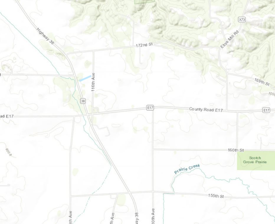
1220 PM TSTM WND DMG 1 NNW SCOTCH GROVE 42.19N 91.11W
08/20/2022 JONES IA EMERGENCY MNGR
EM RELAYED POSSIBLE TORNADO TOUCHDOWN,
DAMAGE TO CROPS. WILL INVESTIGATE FURTHER.
1205 PM FUNNEL CLOUD 2 NE CENTER JUNCTION 42.14N 91.06W
08/20/2022 JONES IA EMERGENCY MNGR
FUNNEL CLOUD REPORTED VERY CLOSE TO THE
GROUND. RELAYED BY LOCAL EM.
Photos & Video
Header
Discussions / Environmental Information
 |
 |
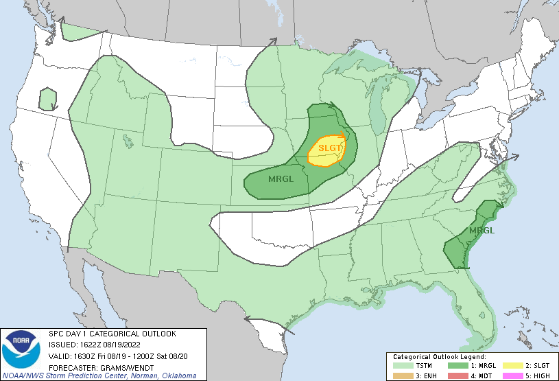 |
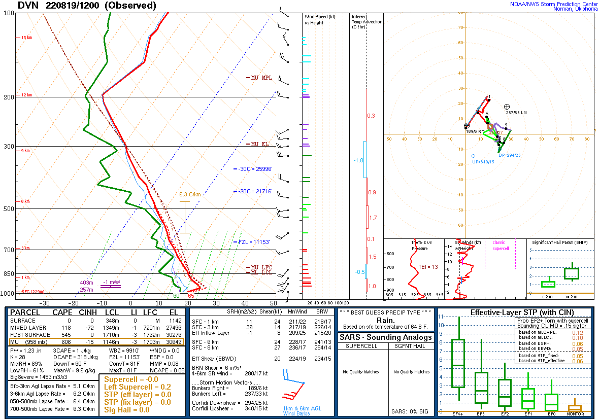
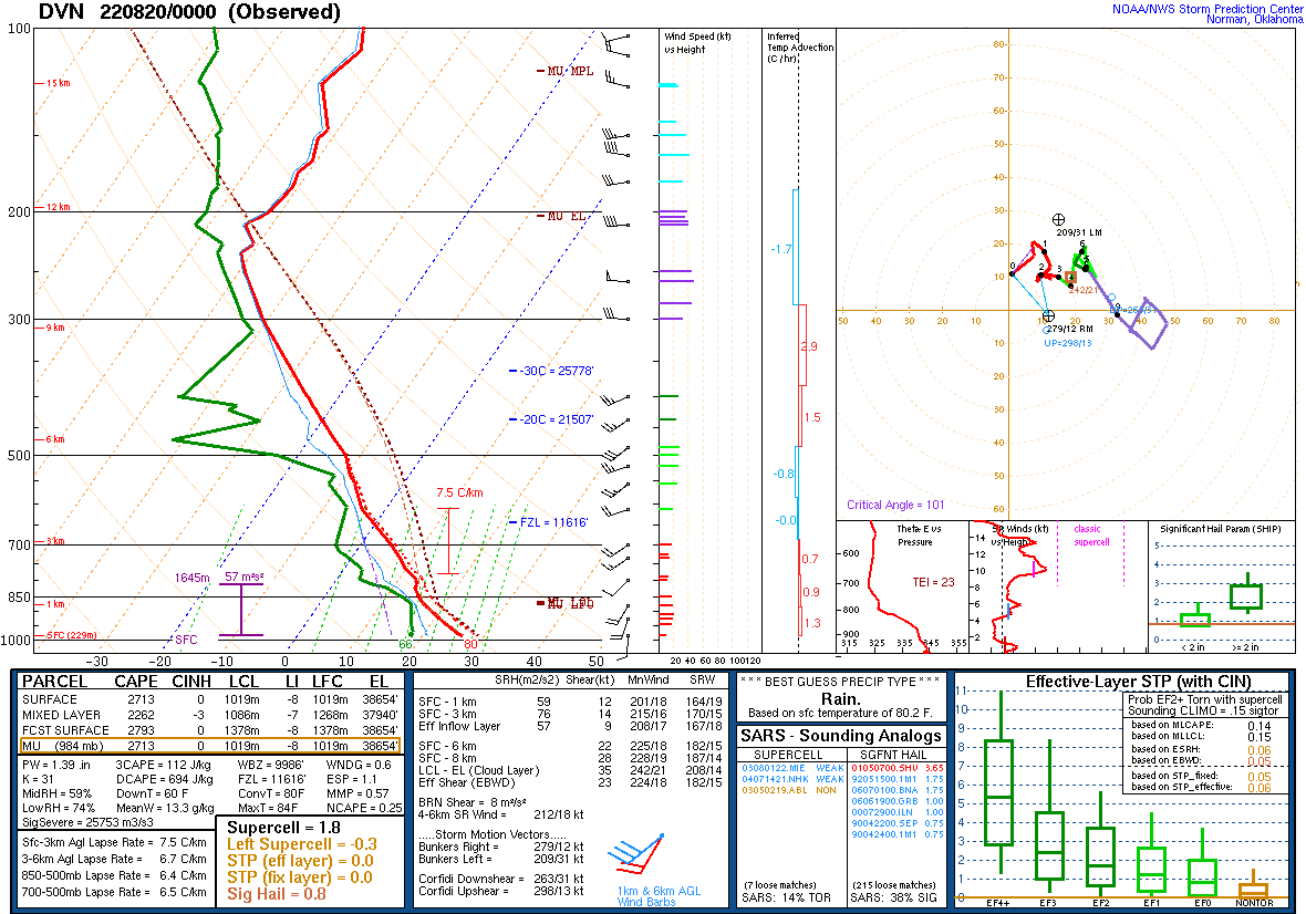
| Figure 1: 12z 08/19 DVN Sounding | Figure 2: 00z 08/20 DVN Sounding | Figure 3: SPC Outlook 8/19 |
 |
 |
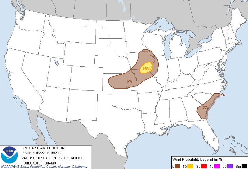 |
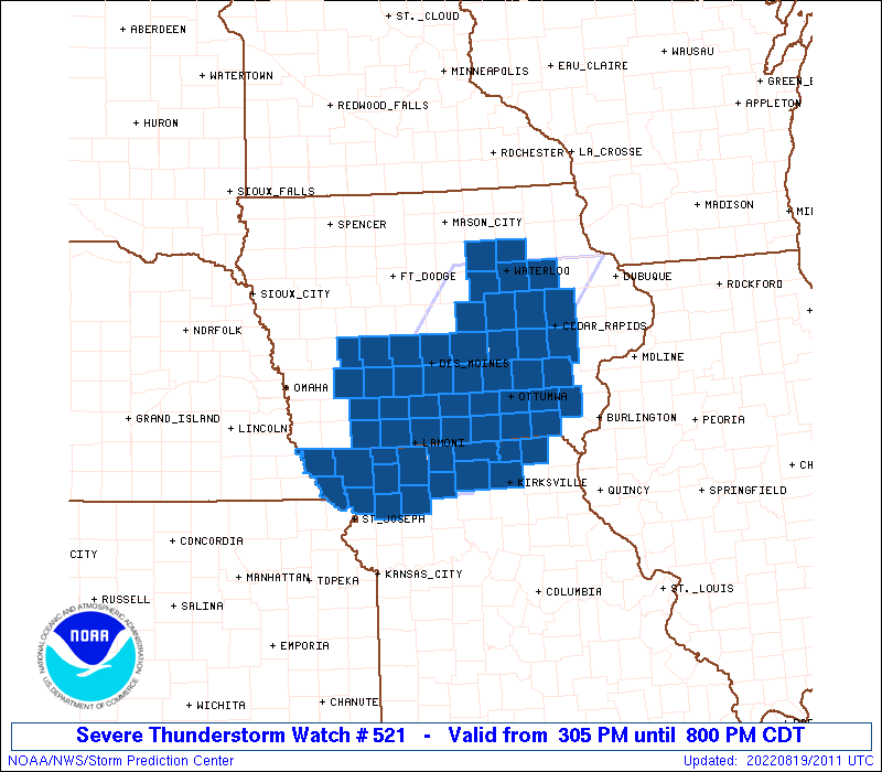
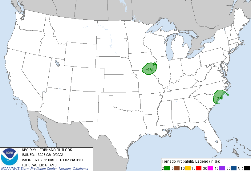
| Figure 4: SPC Severe Thunderstorm Watch - 8/19 | Figure 5: SPC Tornado Threat - 8/19 | Figure 6: SPC Damaging Wind Threat - 8/19 |
 |
 |
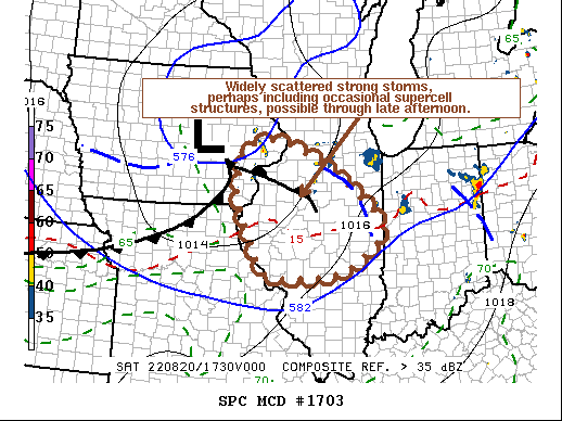 |
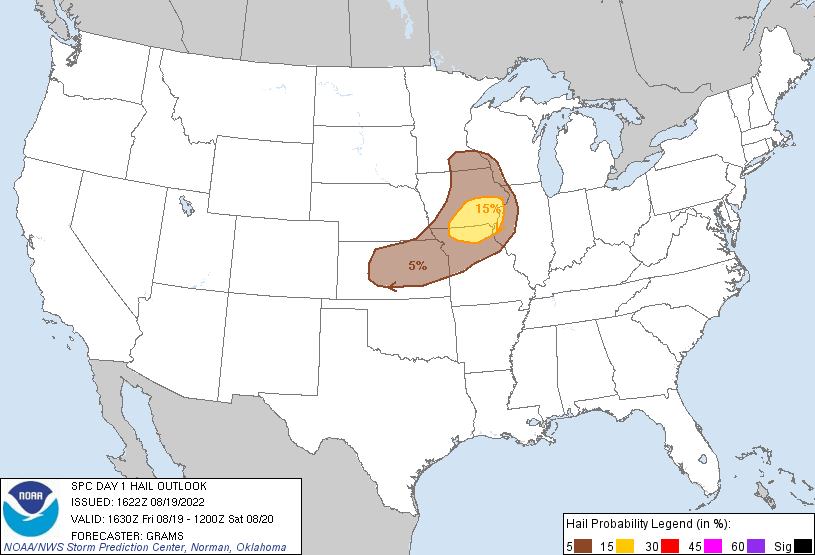
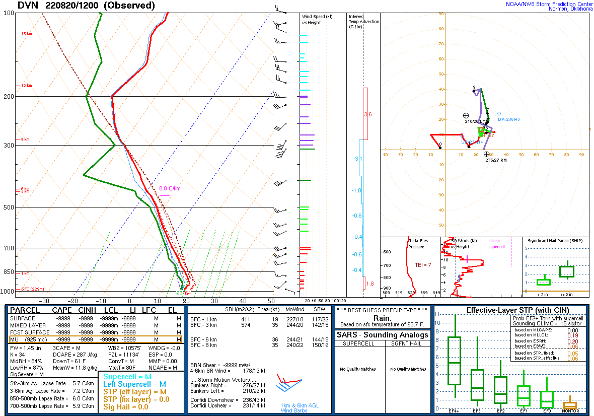
| Figure 7: SPC Hail Threat - 8/19 | Figure 8: 12z 08/20 DVN Sounding | Figure 9: 8/20 Mesoscale Discussion |
 |
 |
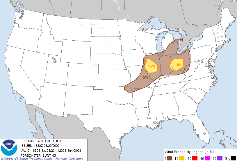 |
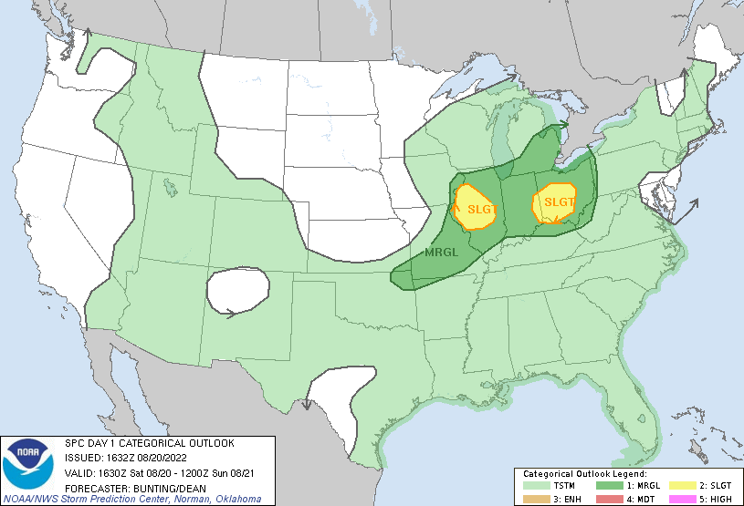
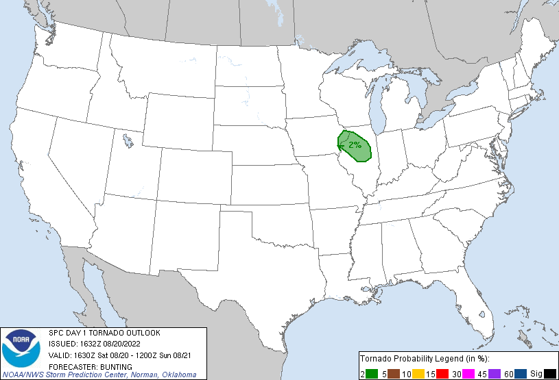
| Figure 10: SPC Outlook - 8/20 | Figure 11: SPC Tornado Threat - 8/20 | Figure 12: SPC Damaging Wind Threat - 8/20 |
 |
Media use of NWS Web News Stories is encouraged! Please acknowledge the NWS as the source of any news information accessed from this site. |
|