Overview
|
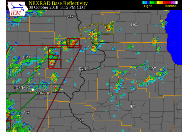
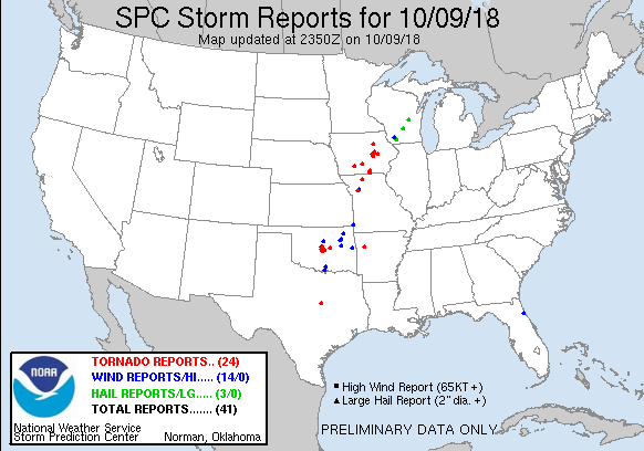
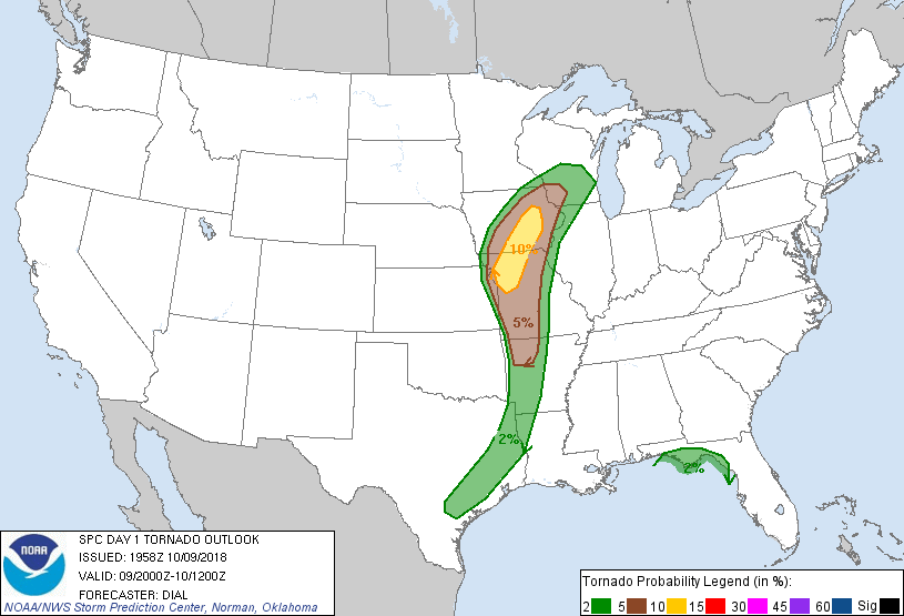
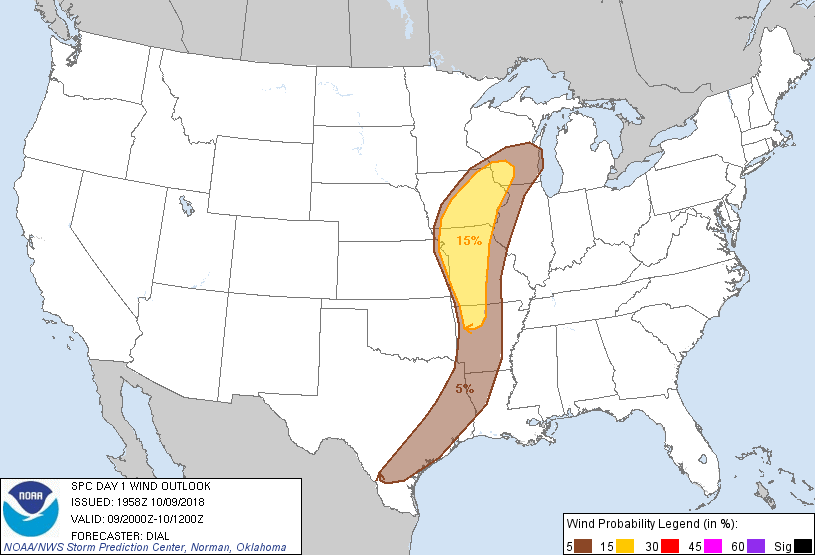
Scattered showers and thunderstorms developed across much of eastern IA, northwest IL and northeast MO on the afternoon and evening of October 9th. This was due to a strong cold front and associated low pressure system advancing eastward across west central IA. Several supercells developed, with one producing a confirmed tornado near Blairstown, IA in Benton county. Other storms produced hail up to penny size, locally heavy rainfall, and brief funnel clouds.
|
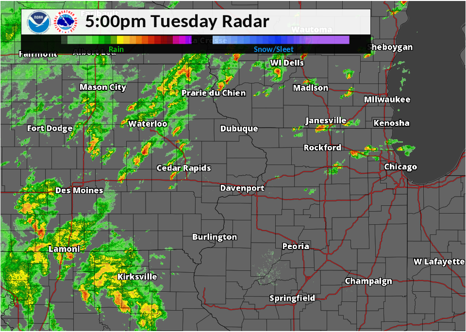 Radar Image: Tuesday 10/9 5:00 pm |
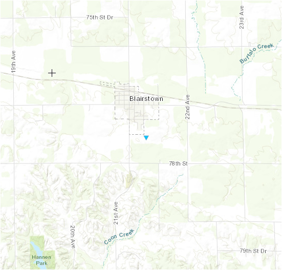
Tornado:
|
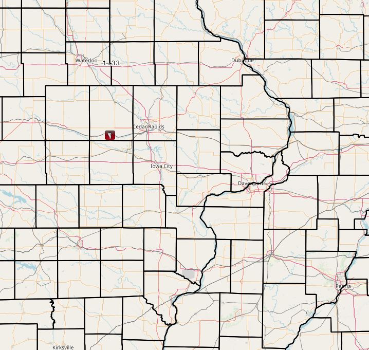
1 SE Blairstown, Iowa
Track Map
|
||||||||||||||||
The Enhanced Fujita (EF) Scale classifies tornadoes into the following categories:
| EF0 Weak 65-85 mph |
EF1 Moderate 86-110 mph |
EF2 Significant 111-135 mph |
EF3 Severe 136-165 mph |
EF4 Extreme 166-200 mph |
EF5 Catastrophic 200+ mph |
 |
|||||
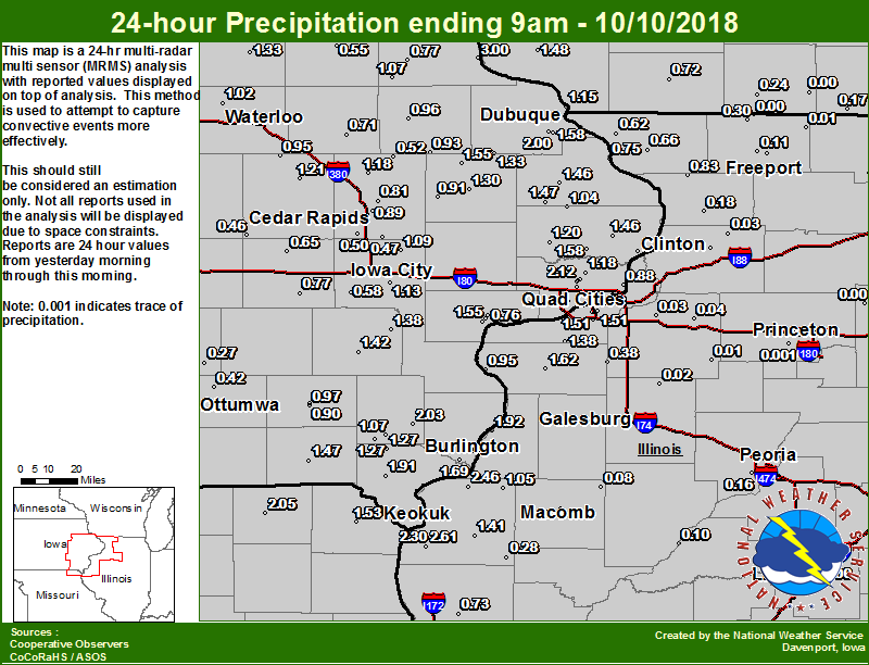
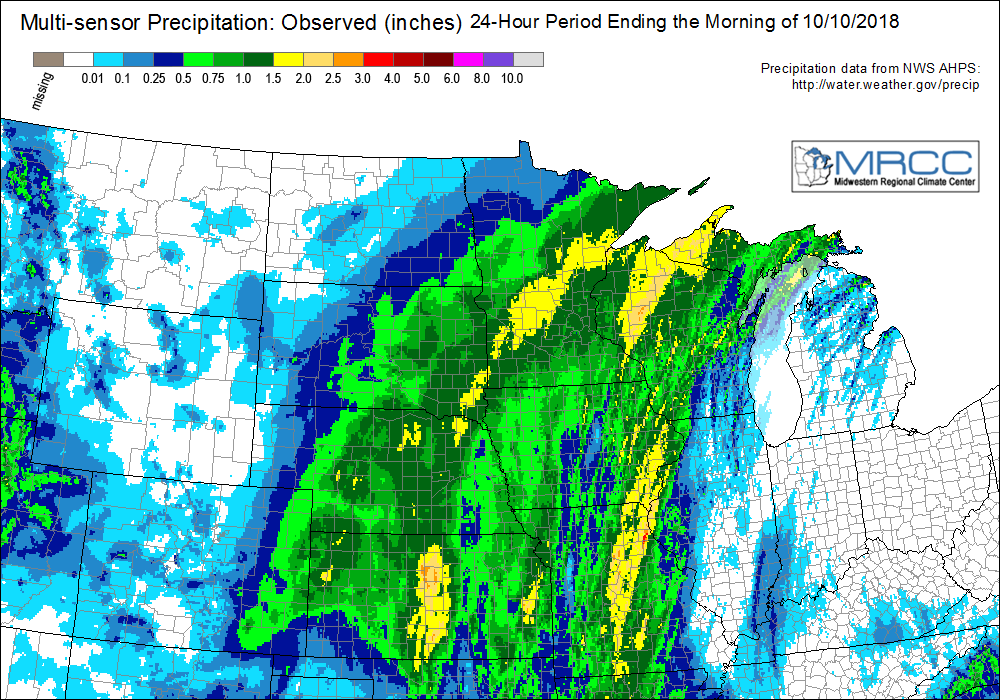
Rain Reports
|
Local Rainfall Map
|
Regional Estimated Rainfall
|
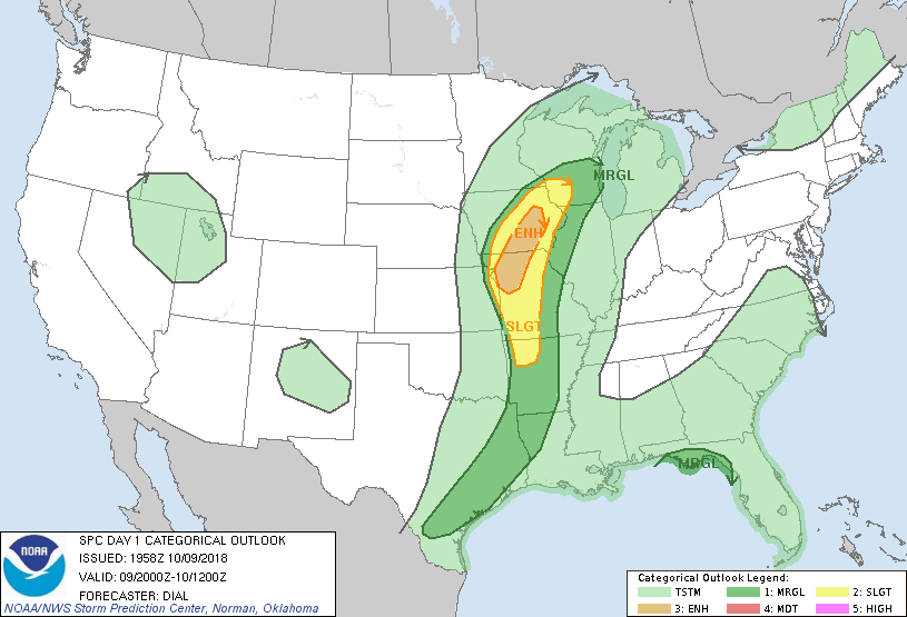
Environment
 |
 |
 |
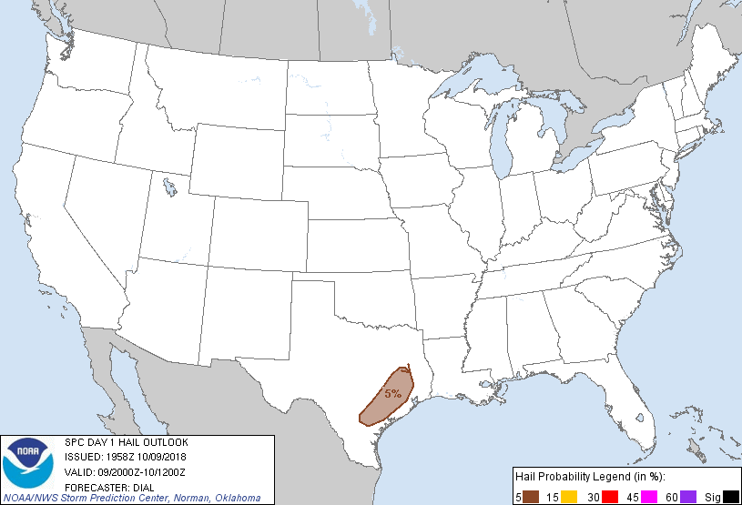 |
| Figure 1: SPC Day 1 Outlook (200z) | Figure 2: SPC Day 1 Tornado Outlook (200z) | Figure 3: SPC Day 1 Wind Outlook (2000z) | Figure 4: SPC Day 1 Hail Outlook (2000z) |
 |
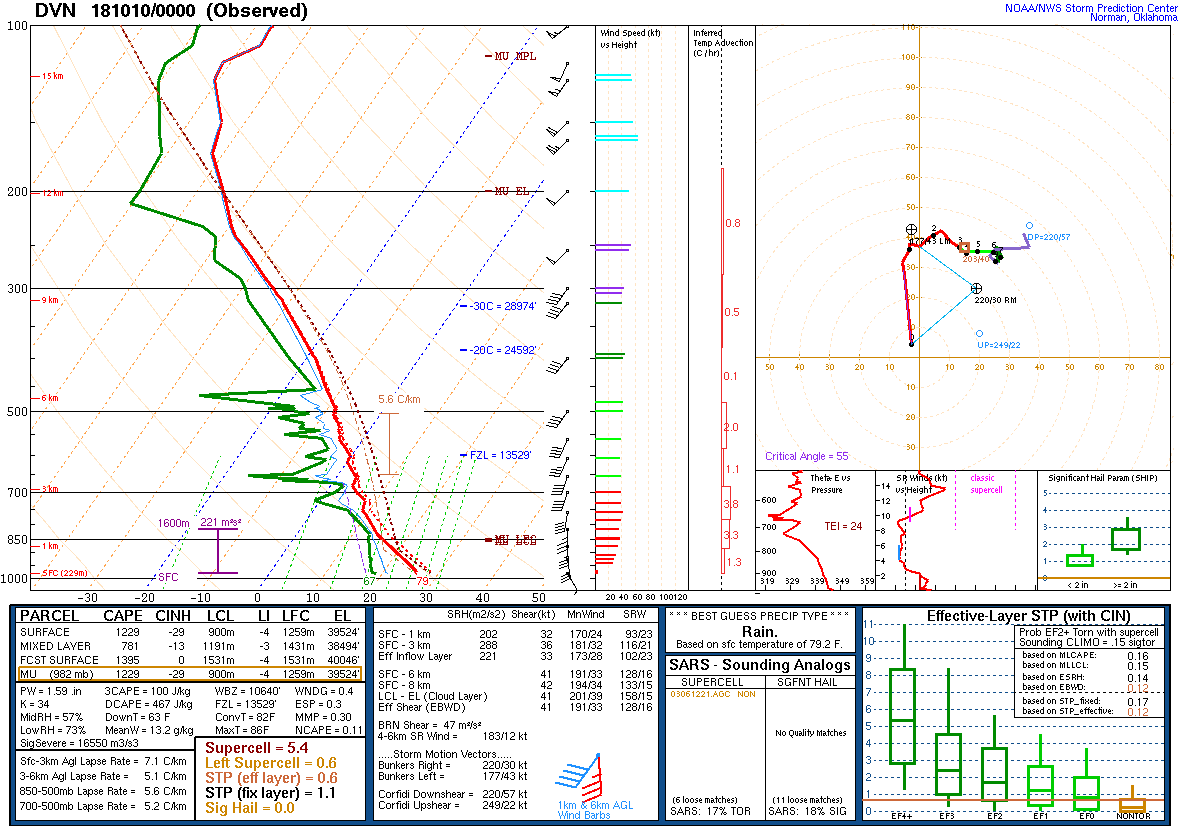 |
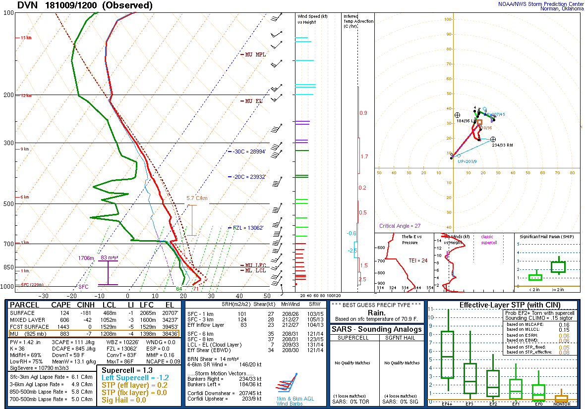
| Figure 5: DVN Sounding 10/9/18 12z | Figure 6: DVN Sounding 10/10/18 00z |
 |
 |
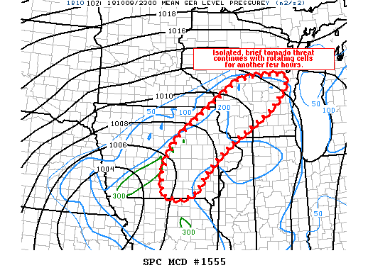 |
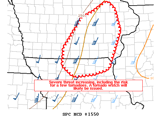
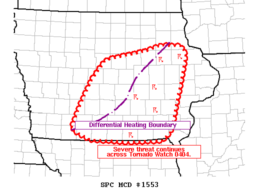
| Figure 7: SPC Mesoscale Discussion #1550 (see link for details) | Figure 8: SPC Mesoscale Discussion #1553 (see link for details) | Figure 9: SPC Mesoscale Discussion #1555 (see link for details) |
 |
Media use of NWS Web News Stories is encouraged! Please acknowledge the NWS as the source of any news information accessed from this site. |
|